Cirque du Troumouse, Lac des Gloriettes & Col des Tentes

Pyrenees Peaks – Day Five, Lourdes (7th September 2017).

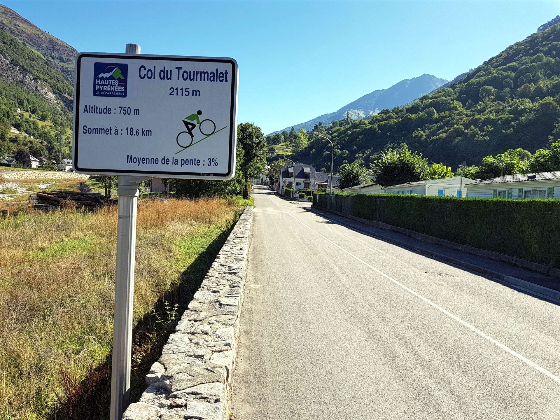
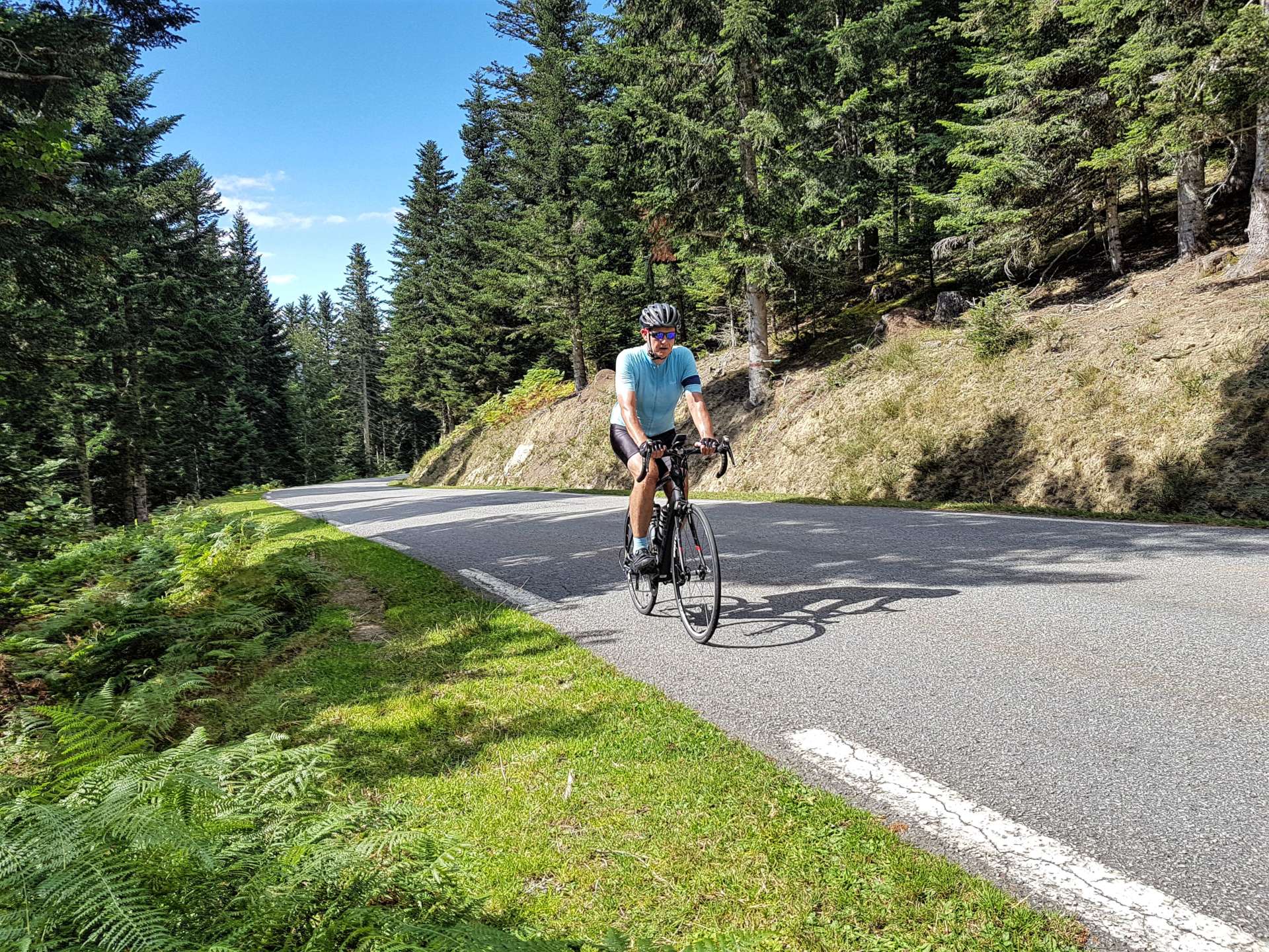
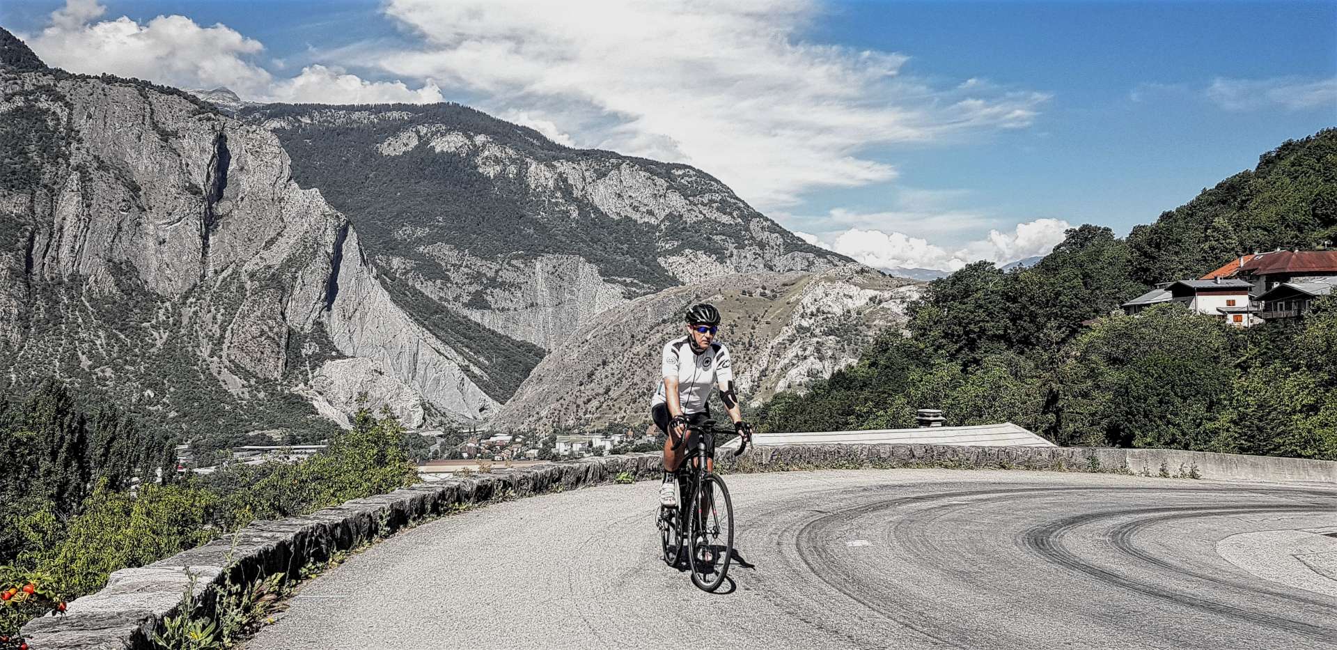
Today we took the third & final commute of the week. It was a 30 minute drive to Luz Saint Sauveur which is a mecca for road biking climbs – within 10 miles are Col de Tourmalet, Hautacam, Luz Ardiden, Col de Soulor which have all hosted Tour de France stages.

The original plan was to cycle out to Cirque de Troumouse, take a short, but steep detour up to Lac des Gloriettes, then if the legs were feeling good, also climb Luz Ardiden. We started riding in very, very light rain & under slate grey skies. It seems like the days here are very much like my climbing legs, they take a while to brighten up in the morning!

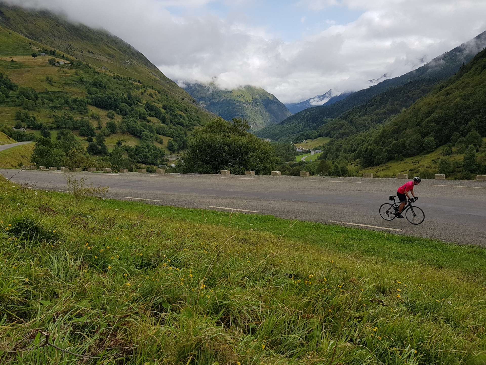
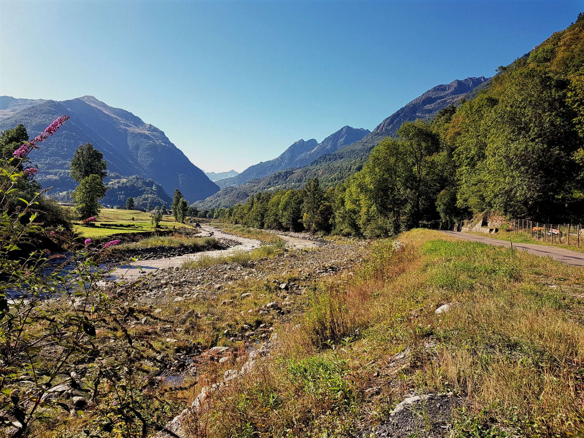
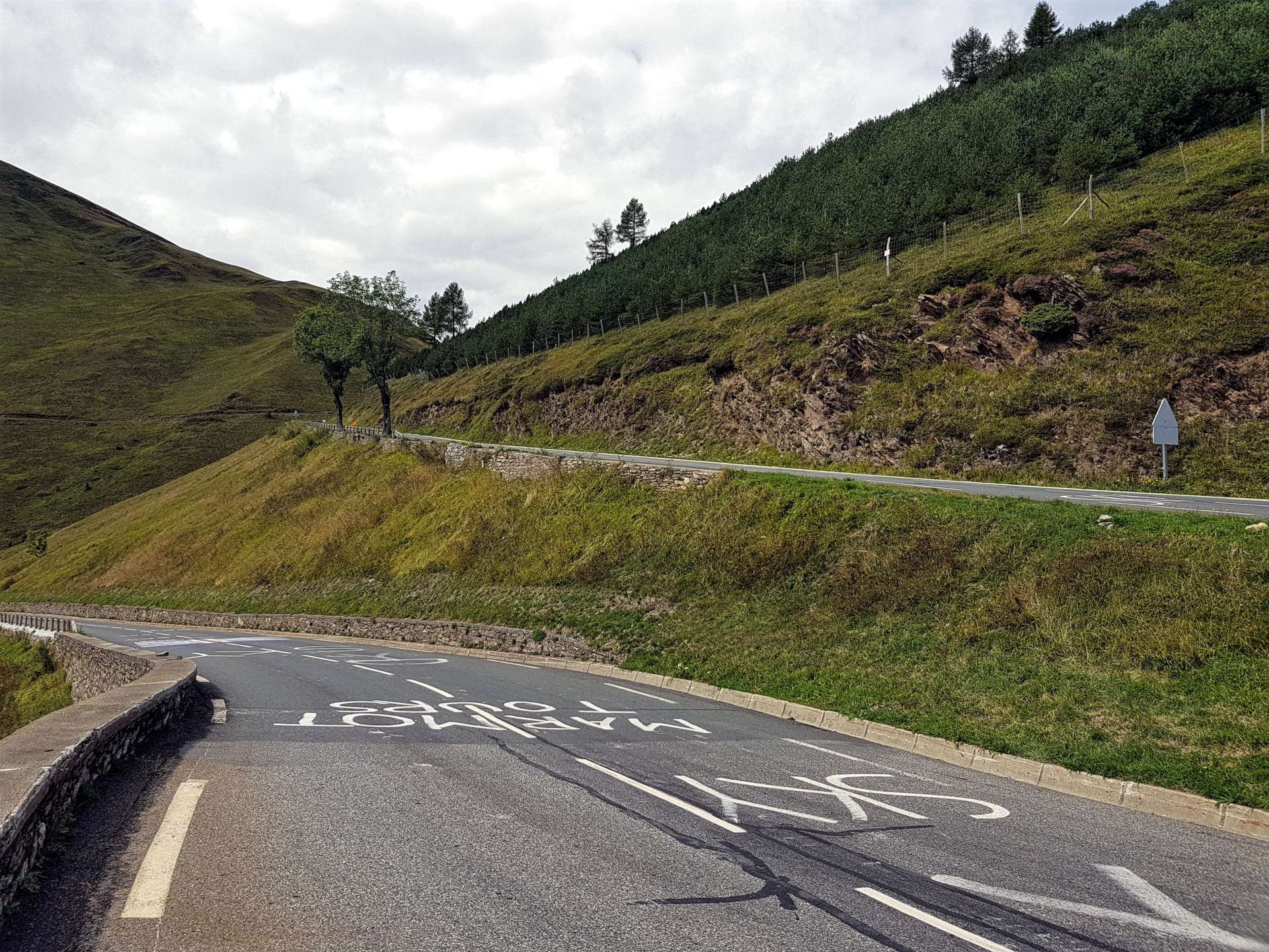
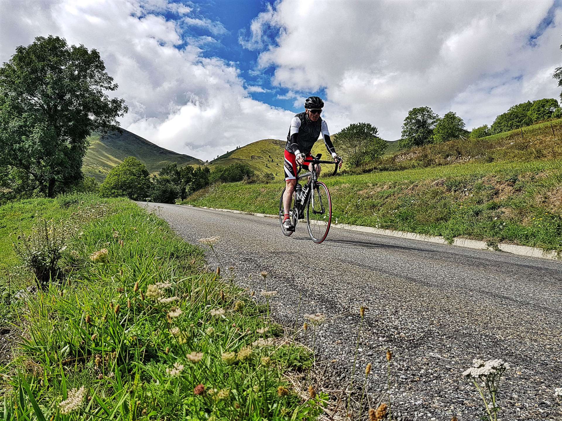
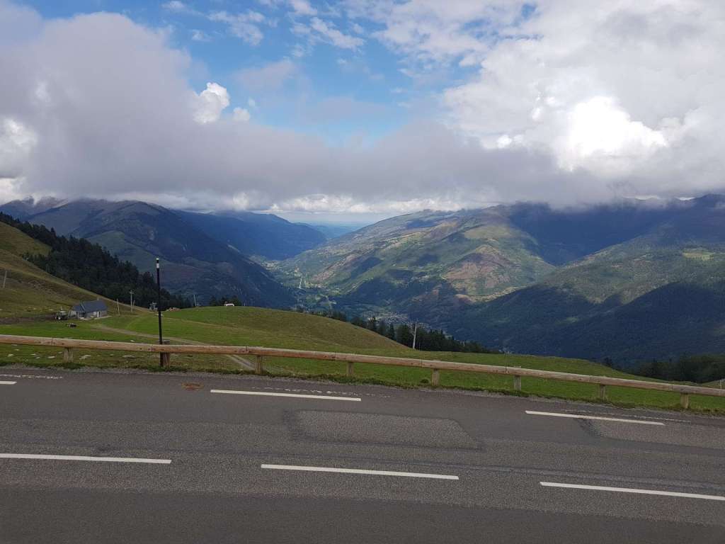
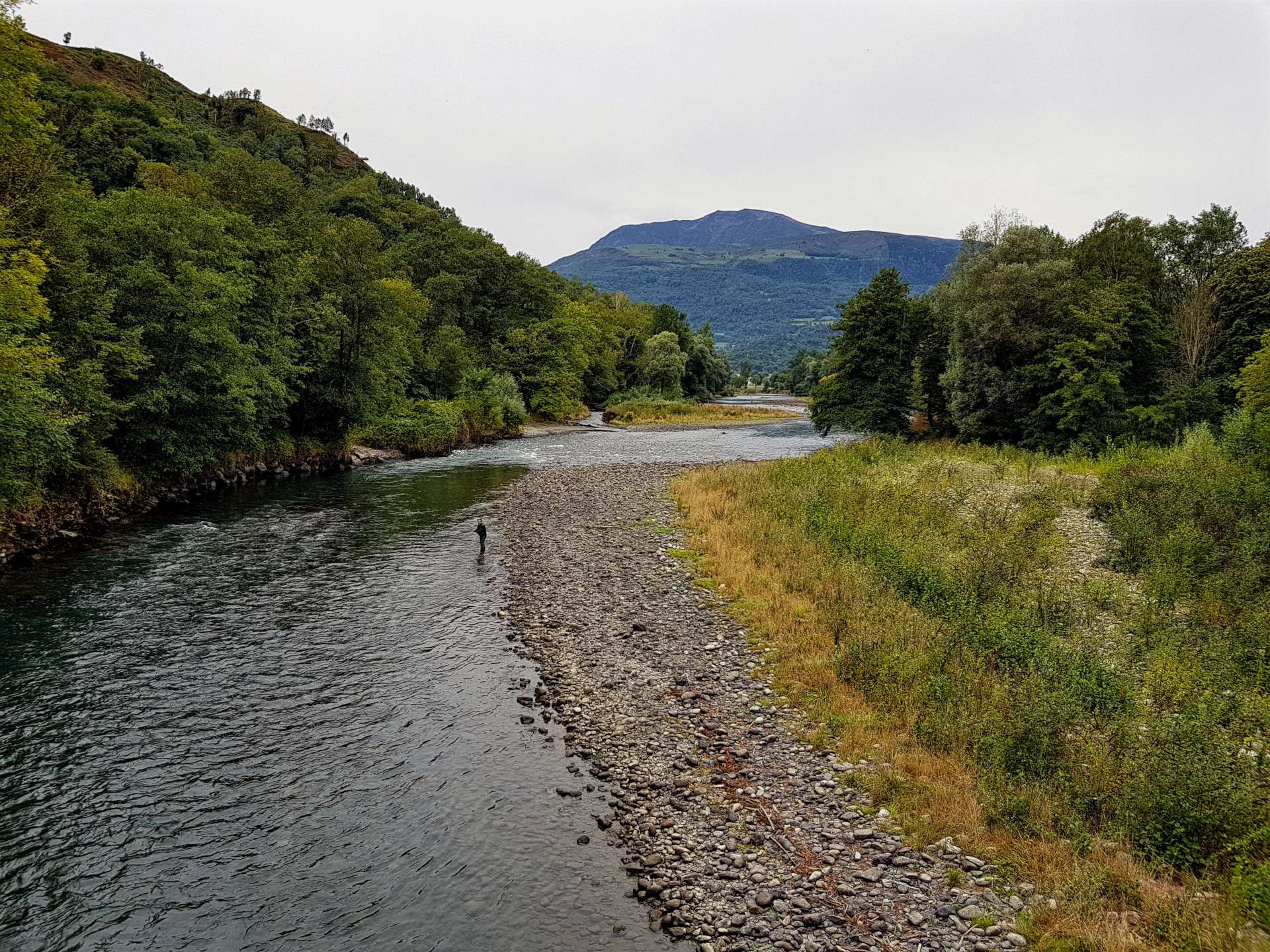
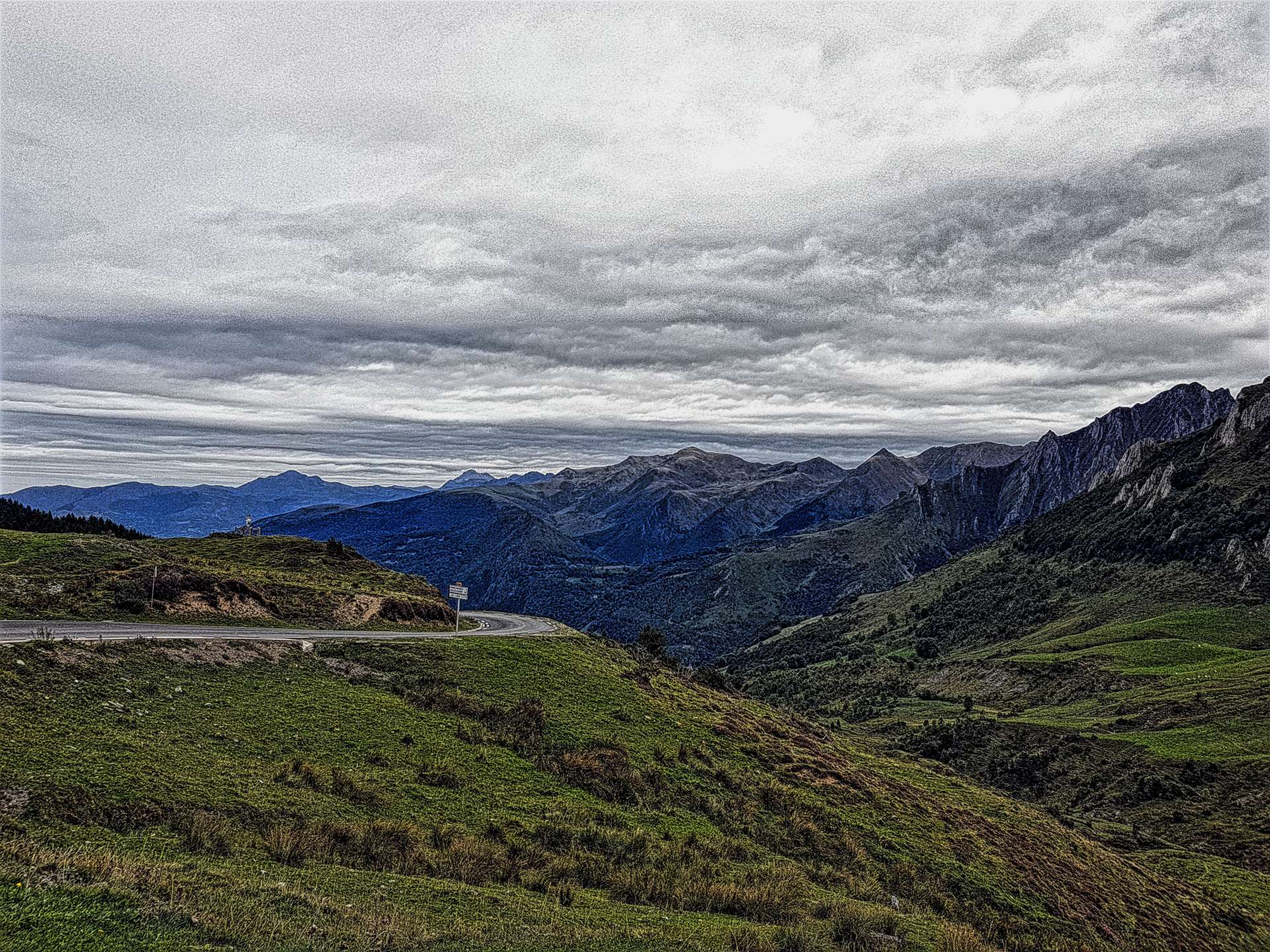
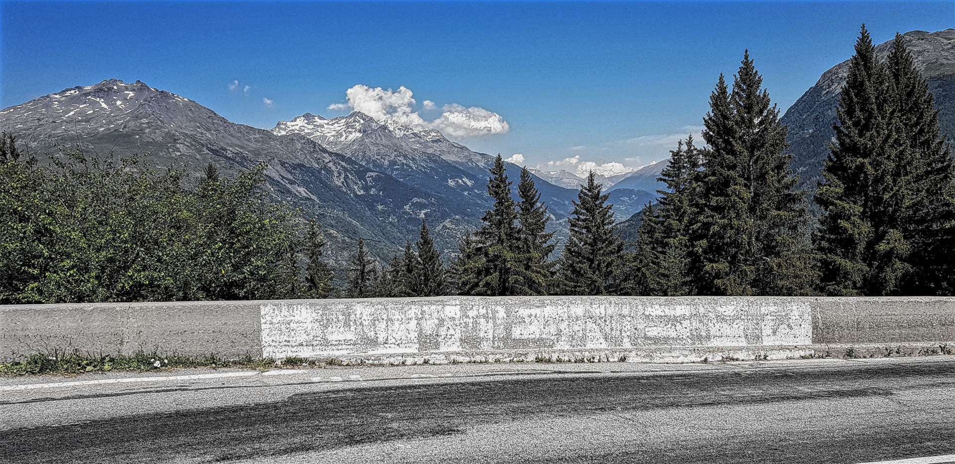
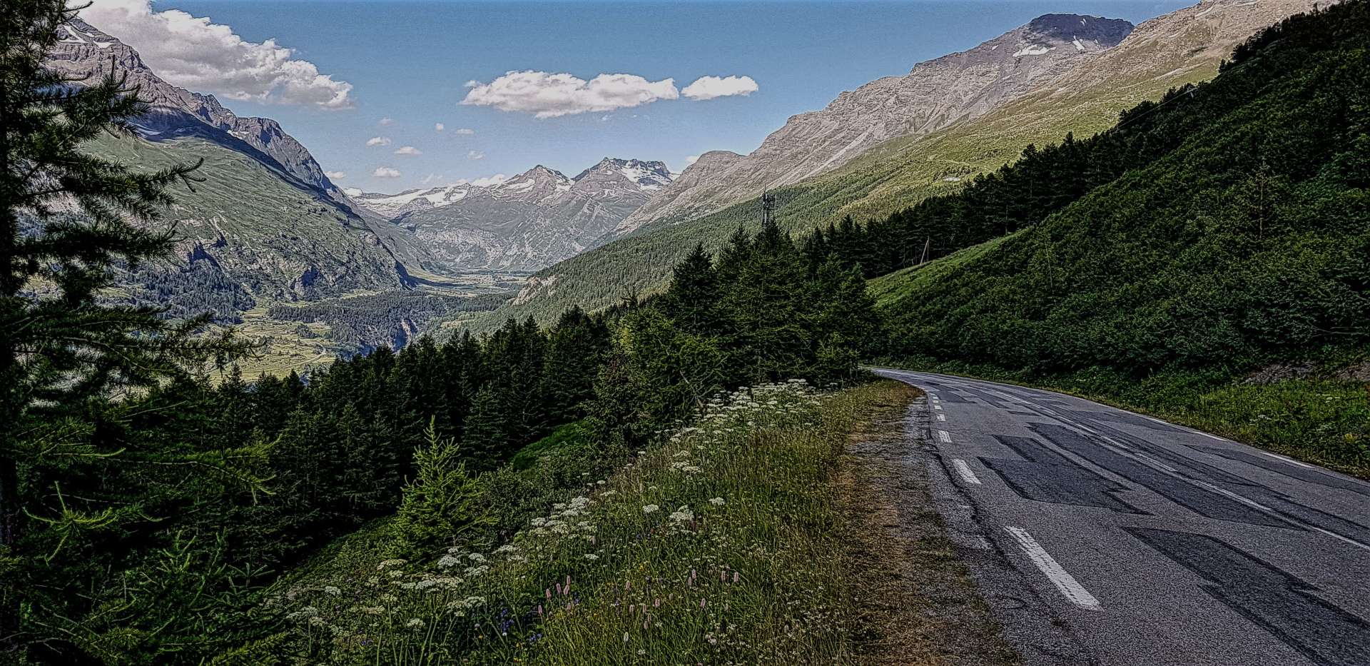
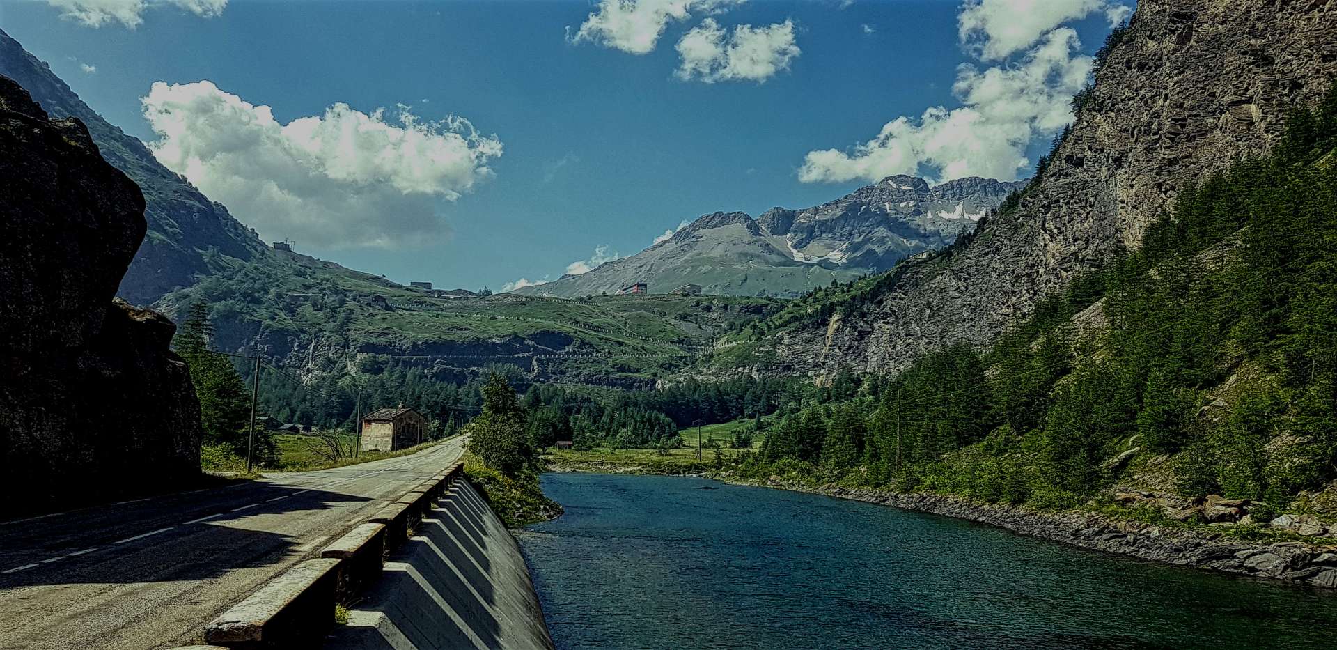
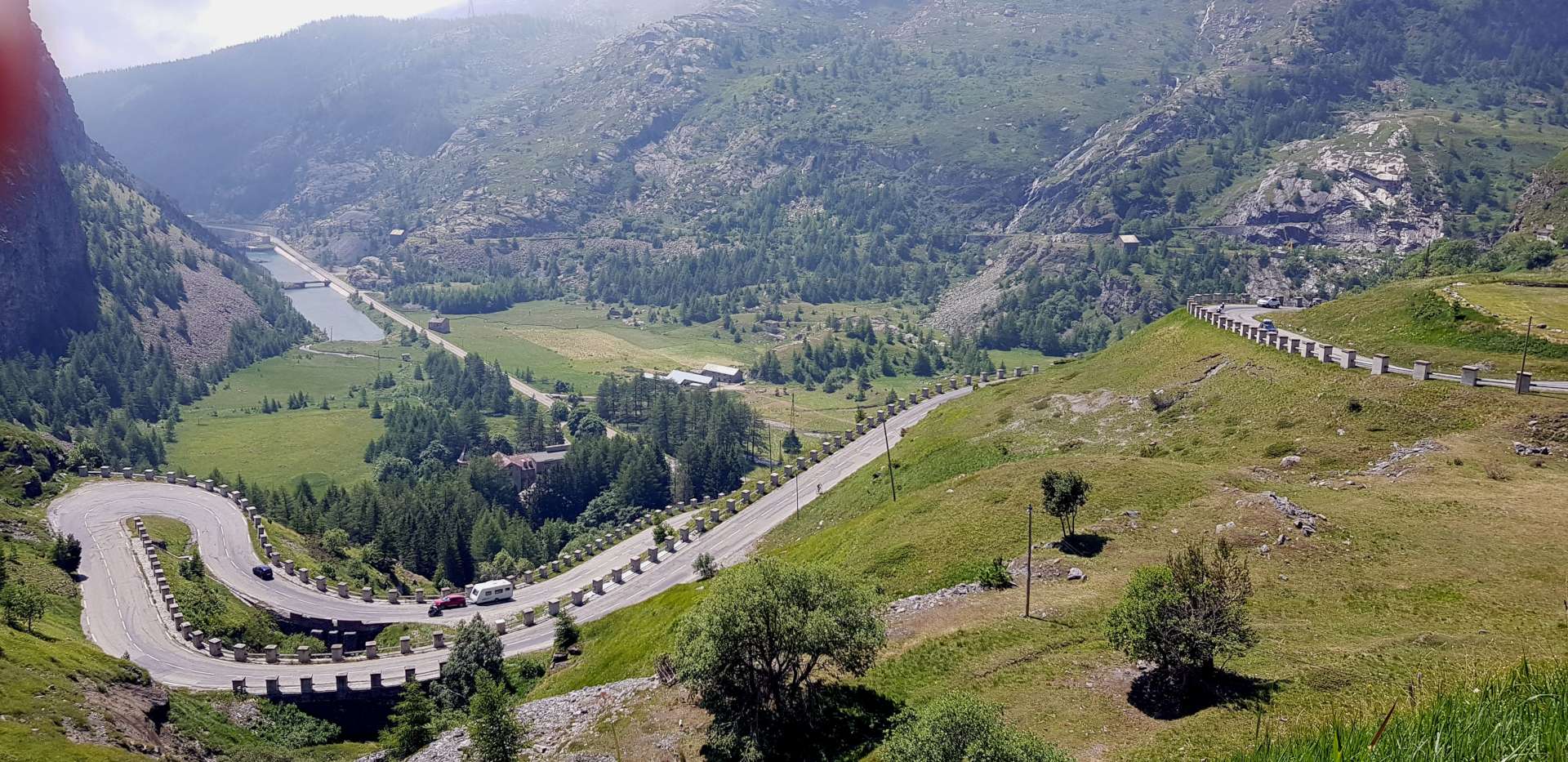
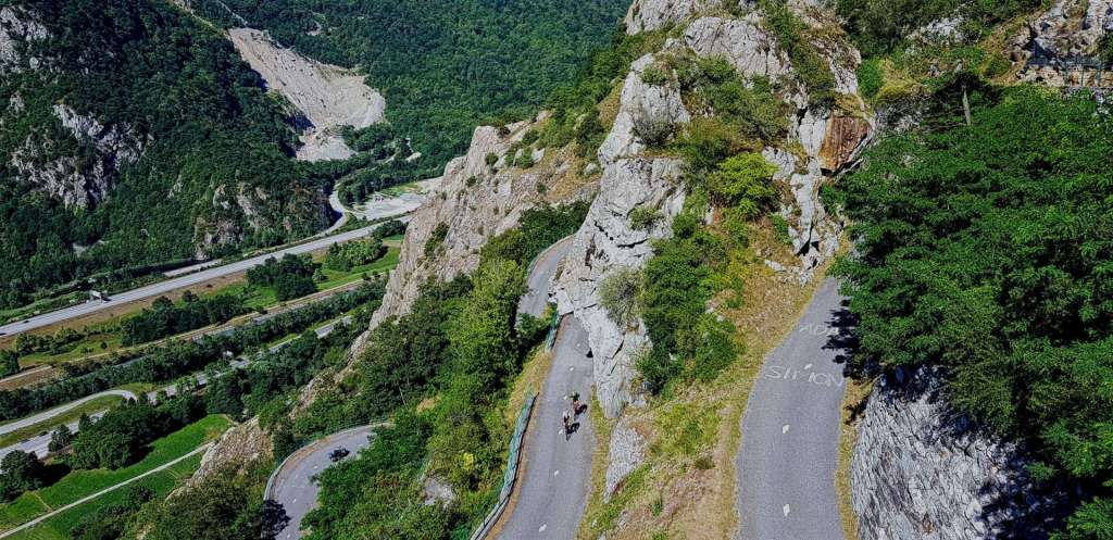
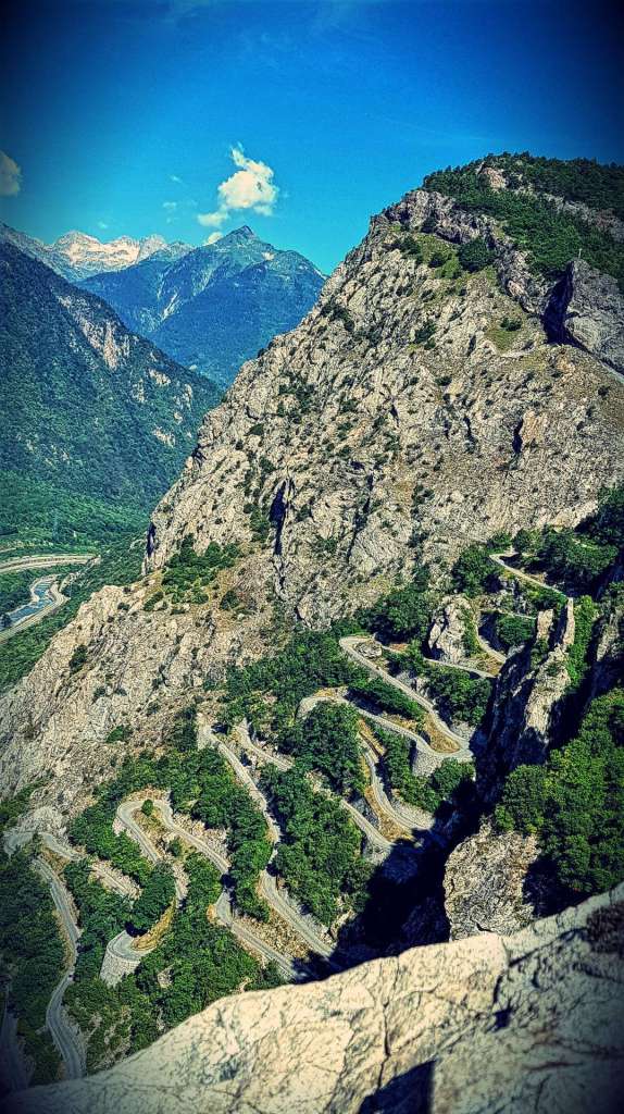
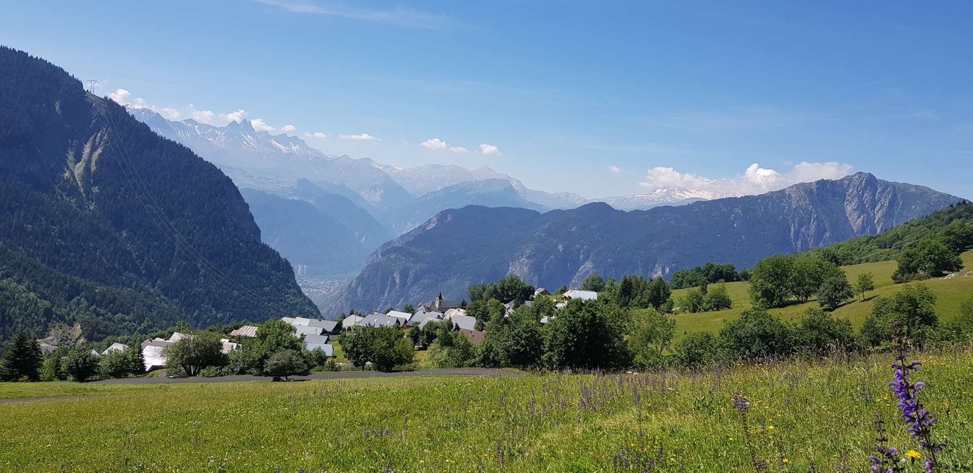
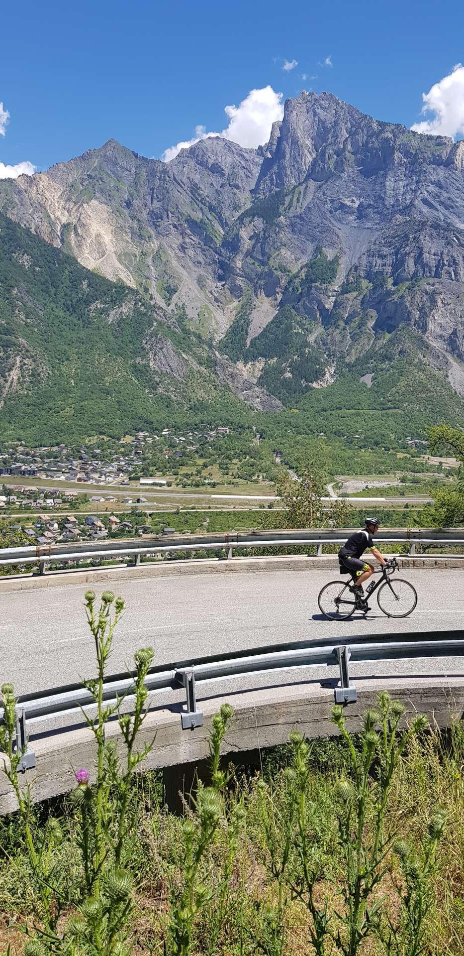
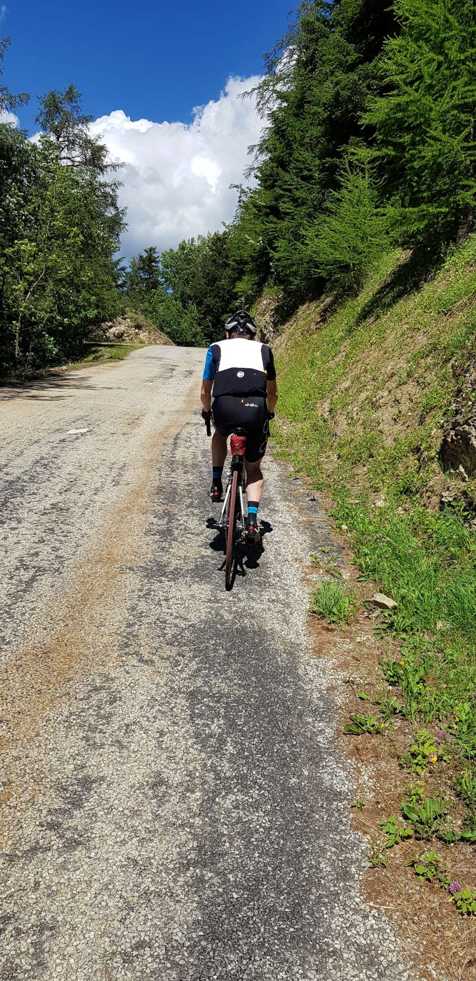
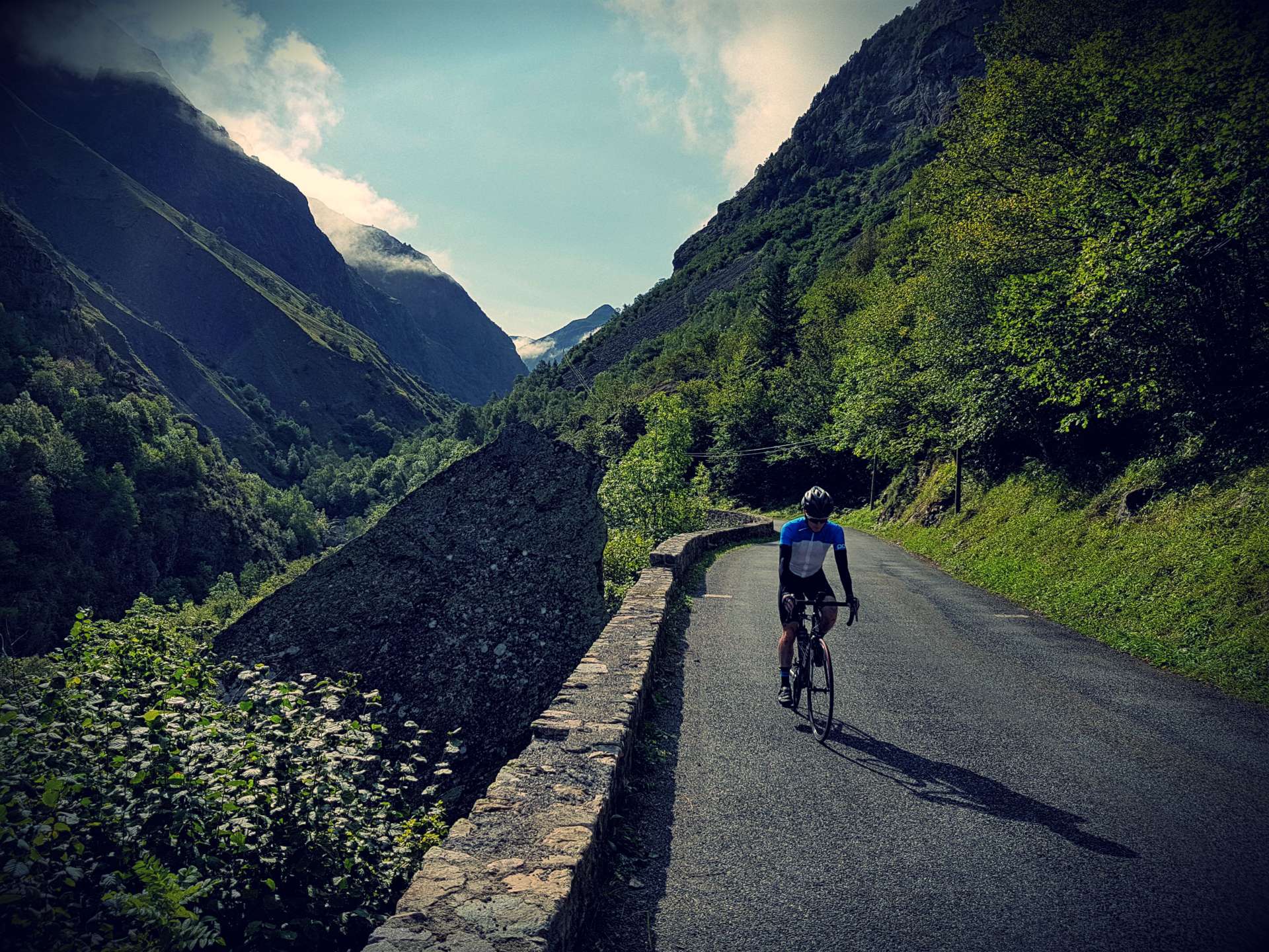
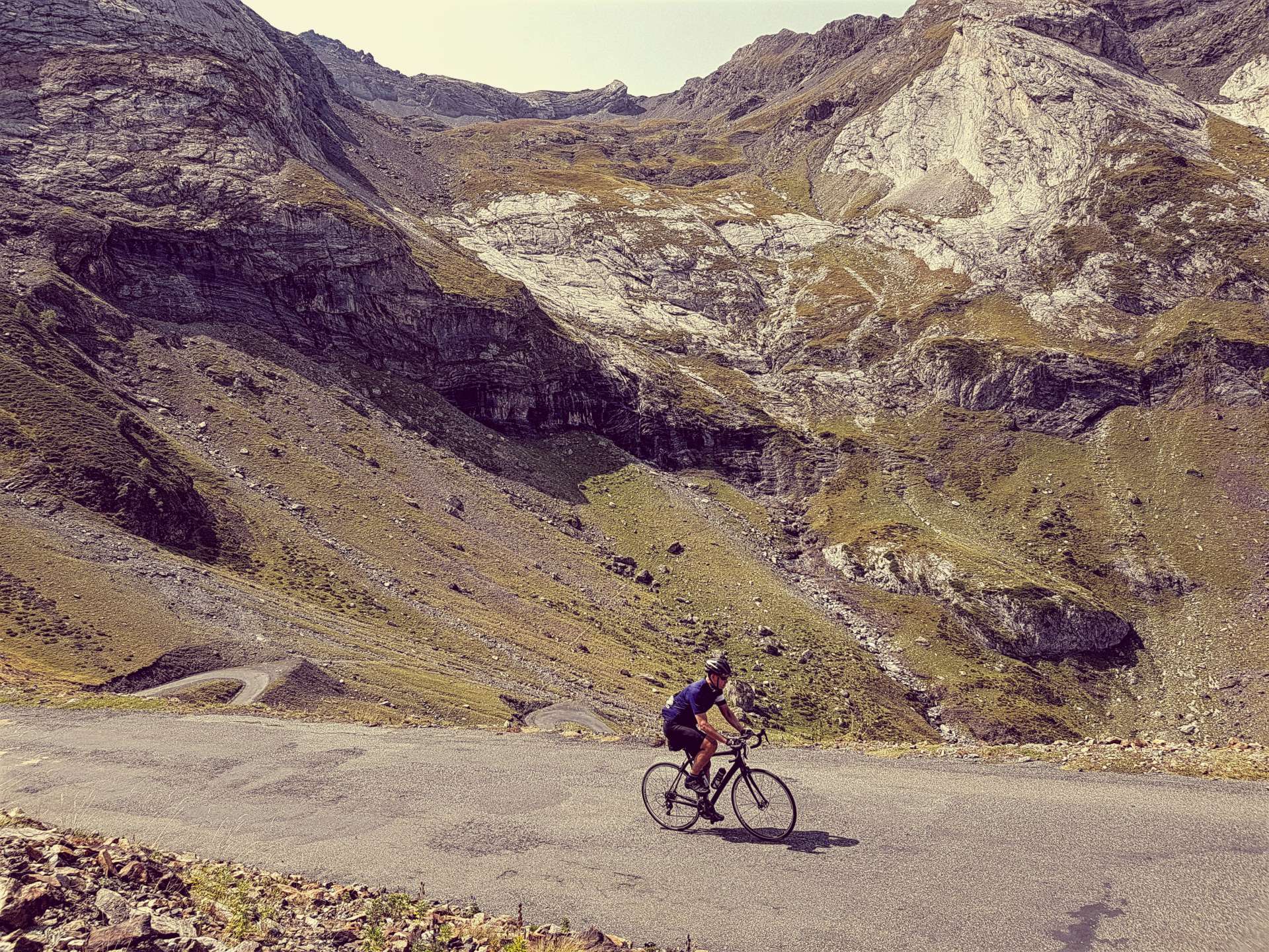
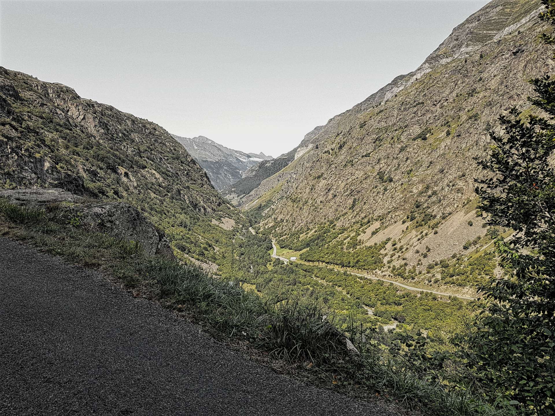
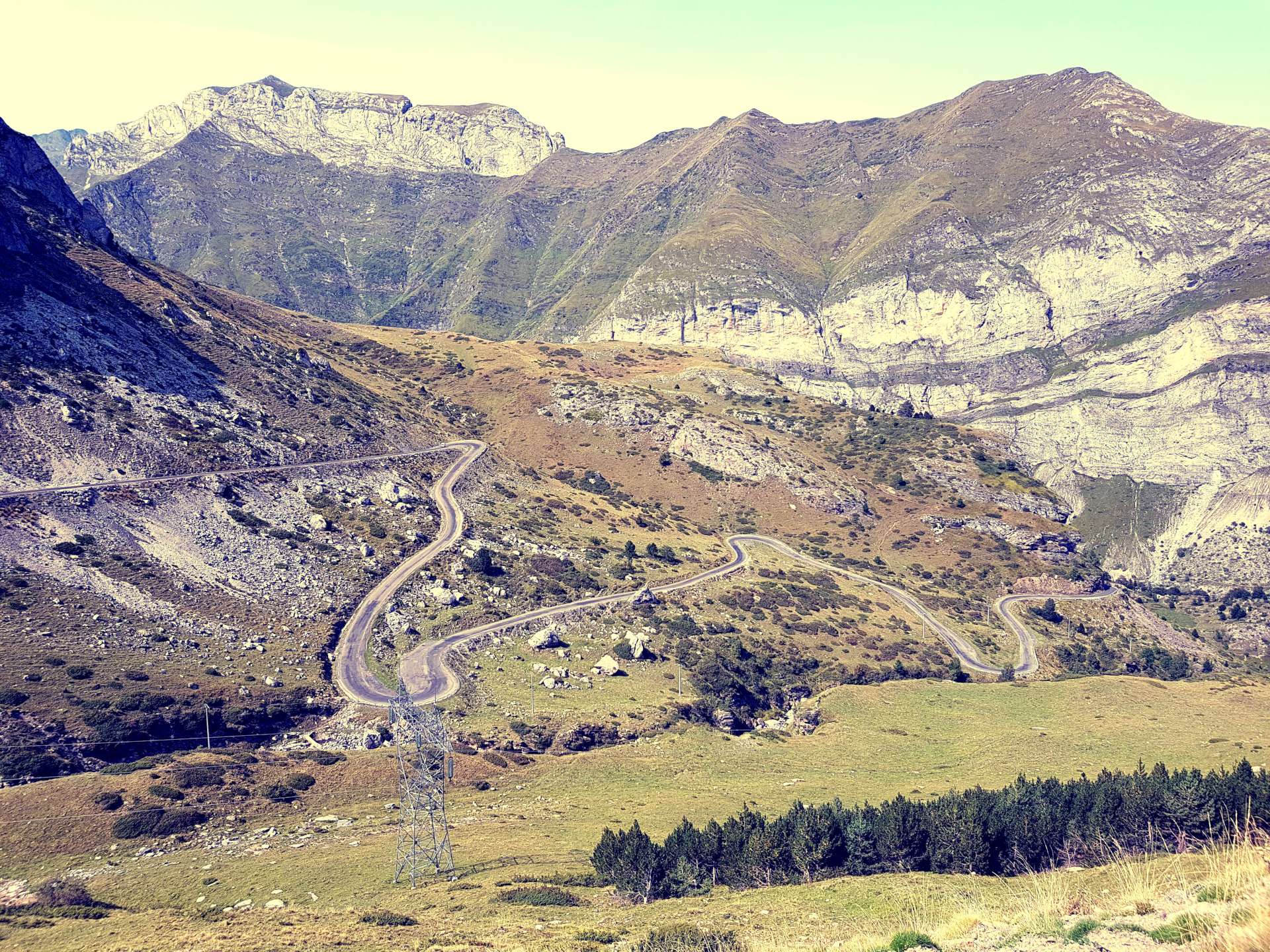
As the road leaves Luz St Sauveur, the road climbs a valley & regularly criss-crosses the river far below. Low cloud & the threat of rain meant the road was far quieter than expected, as normally loads of tourists would use this road to get to Cirque de Gavarnie – a UNESCO site. It also meant that the views of the high mountains were also hidden. After 6 miles there’s a turnoff signposted to Cirque de Troumouse on a small single track road & it’s here that the ride started to get fun. As we turned into a new valley, the sun popped its head out & it was time to get rid of the arm warmers & rain jacket.

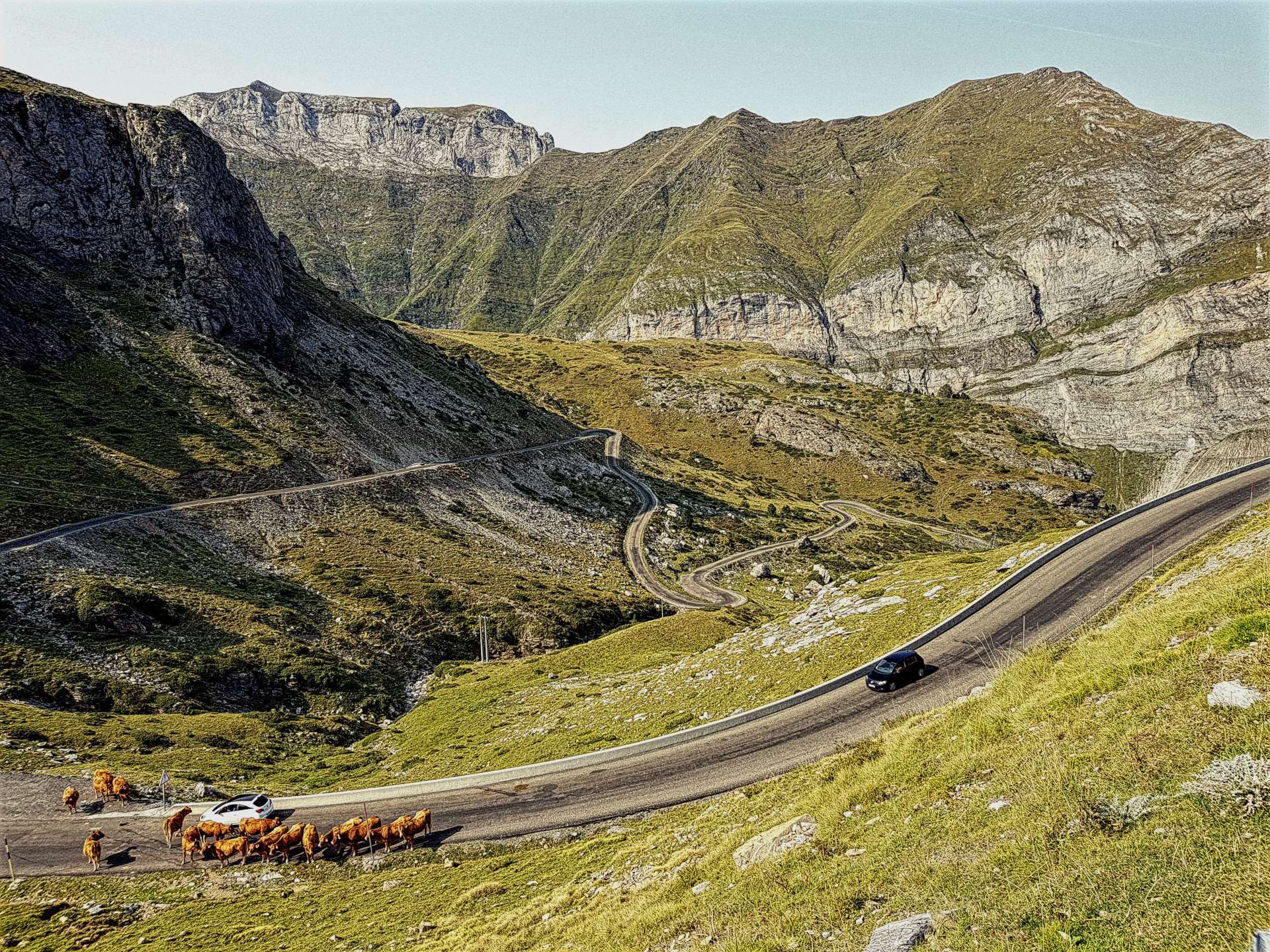
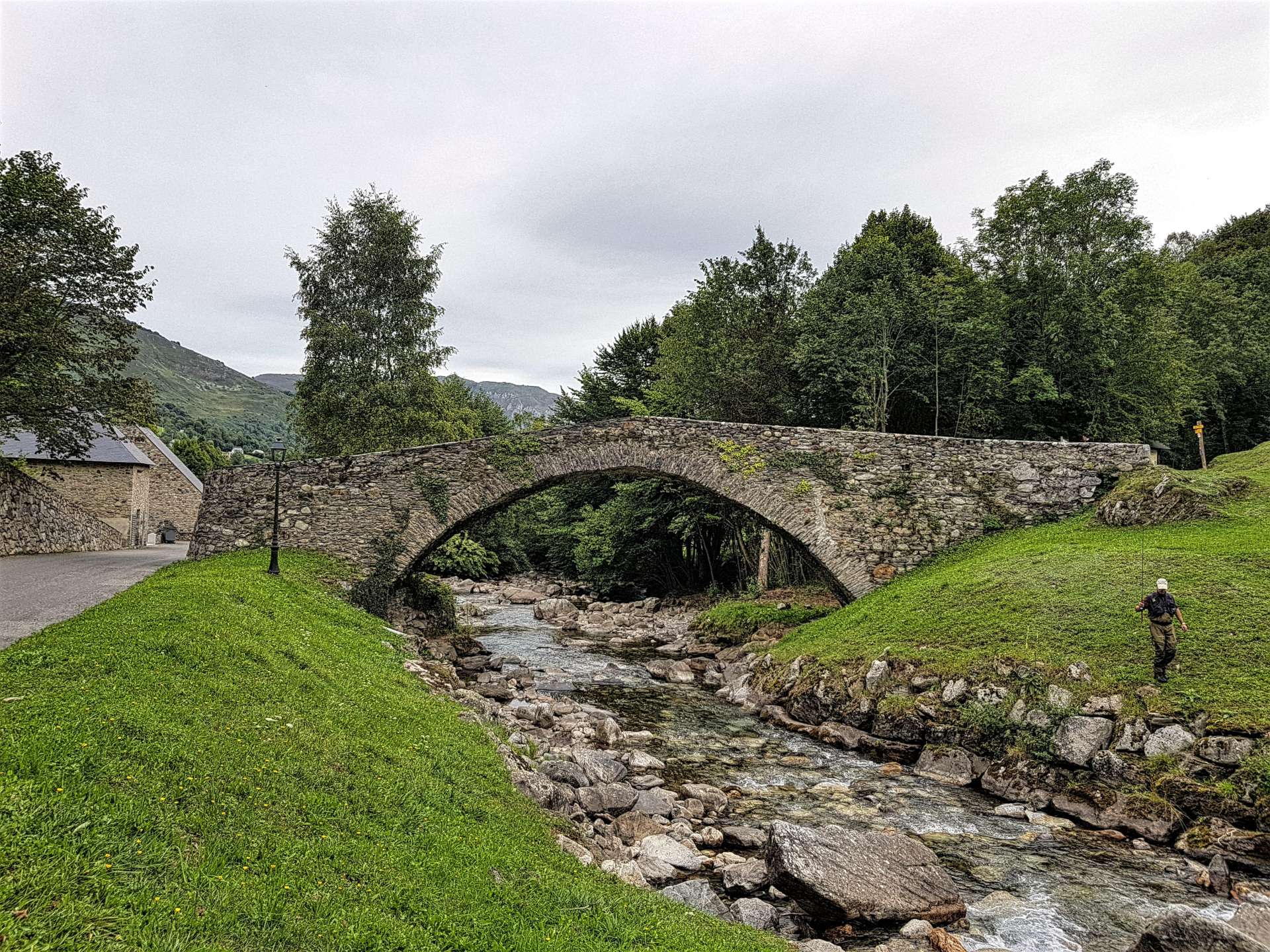
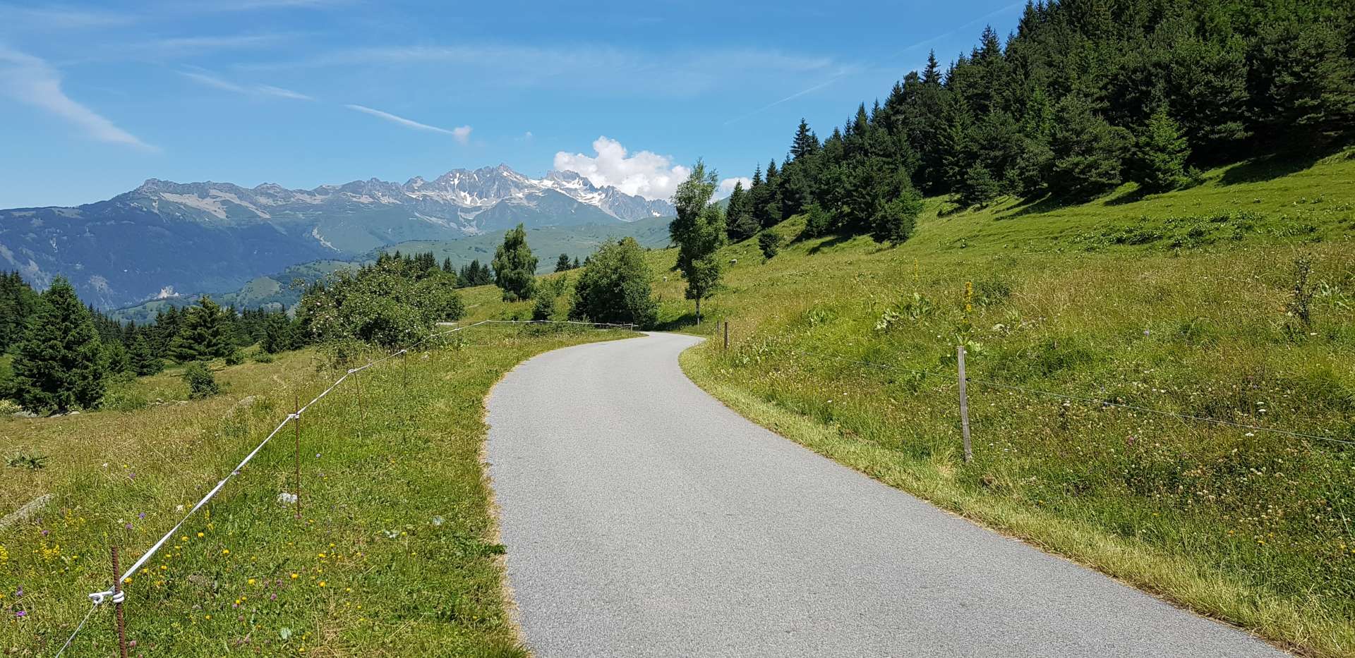
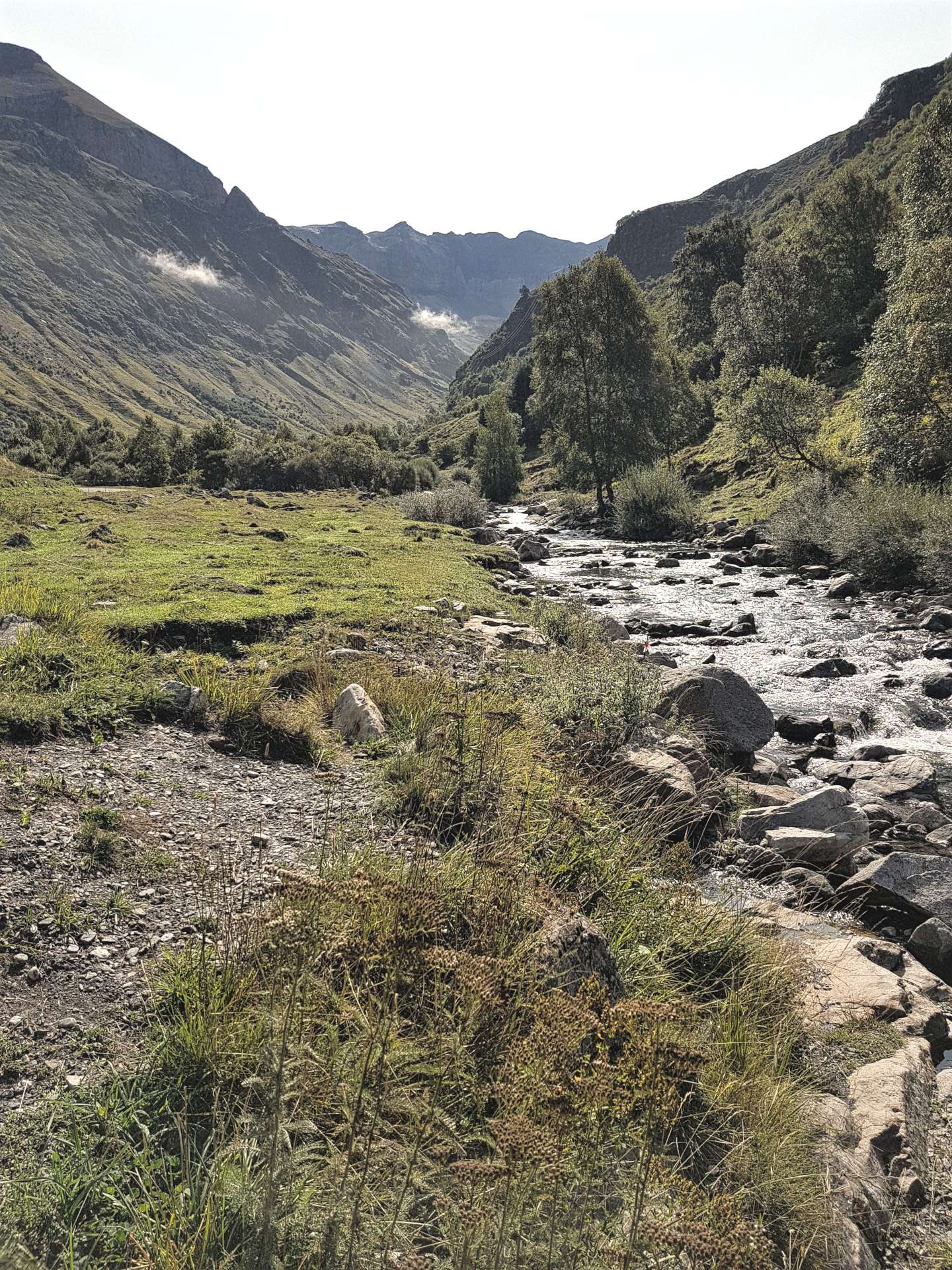
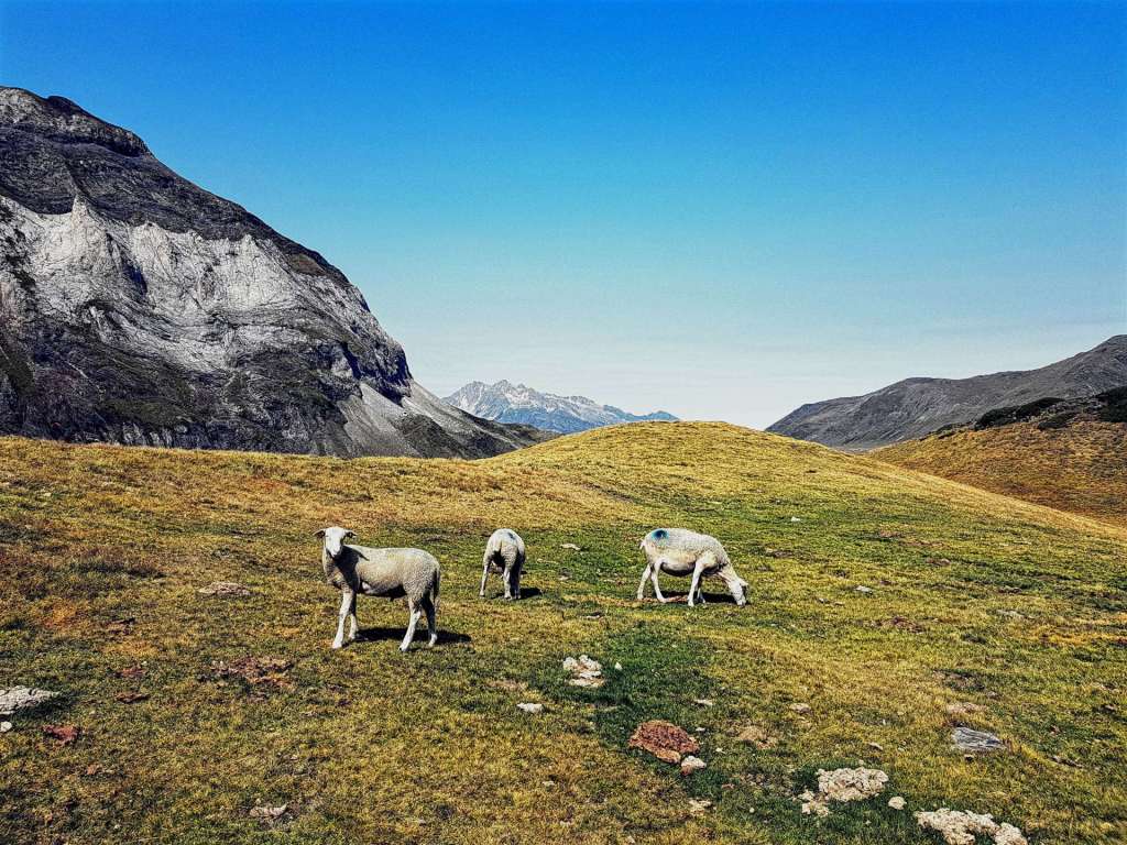
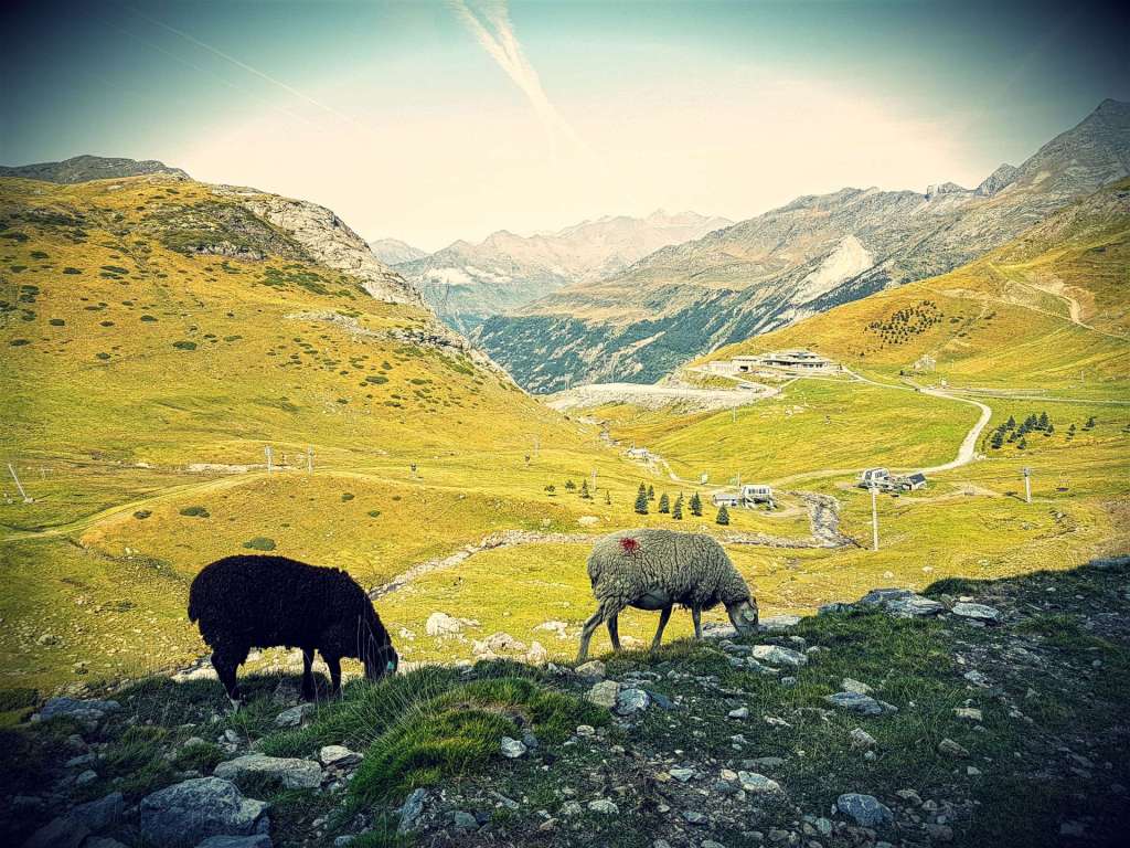
The road climbs at a fairly consistent 6-8% as it twists & turns by the side of a gurgling stream & after a couple of miles, the valley widens out & the track is in the middle of meadow land. This continued for another 3 or 4 miles, before we reached a toll booth, where cars had to pay to climb the remaining 5 miles to Cirque de Troumouse. Cyclists & pedestrians are free to continue free of charge! The road began to rise steeply up the side of the valley & soon we were in sheep & cow grazing territory & we could hear marmots calling to each other.

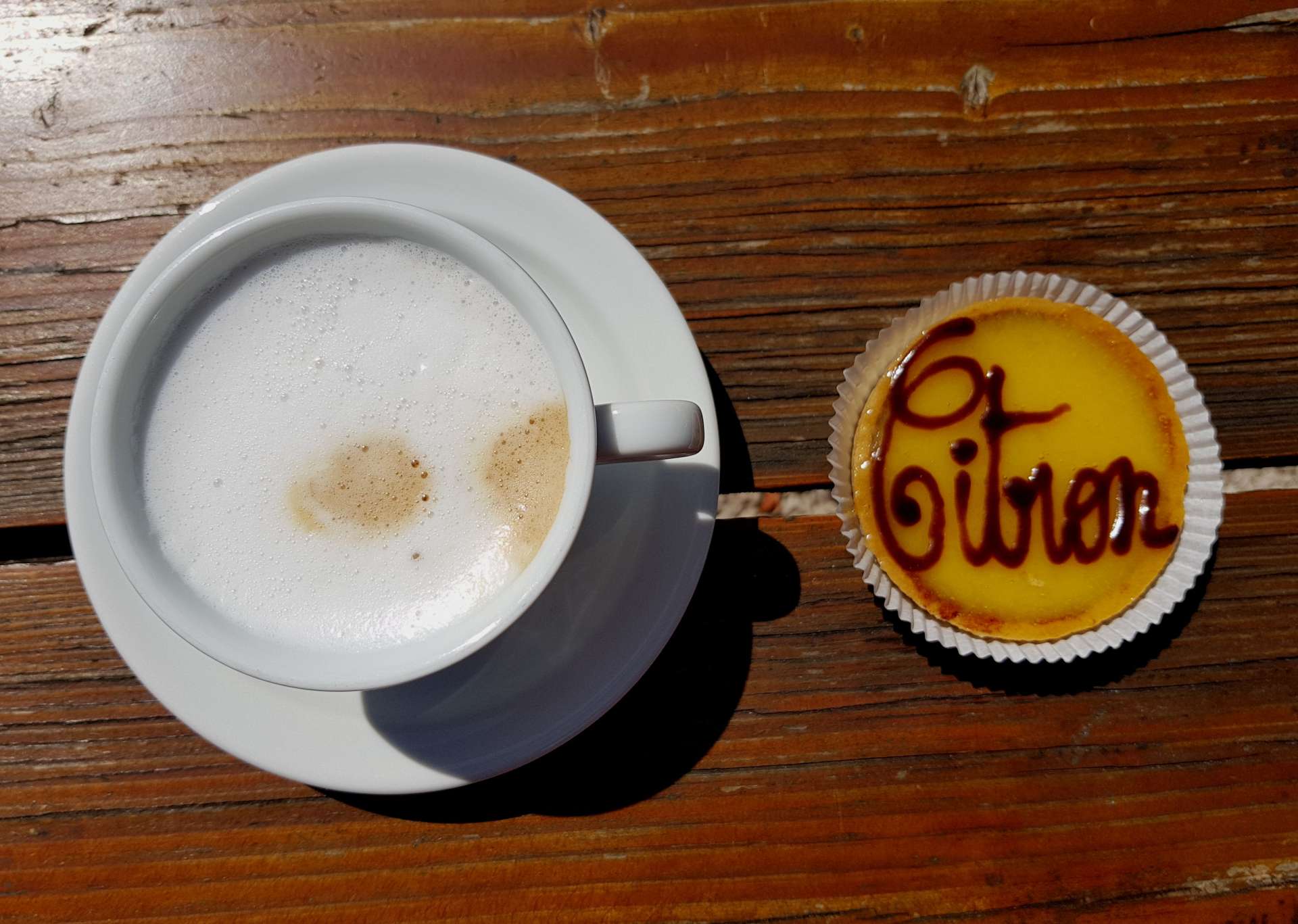
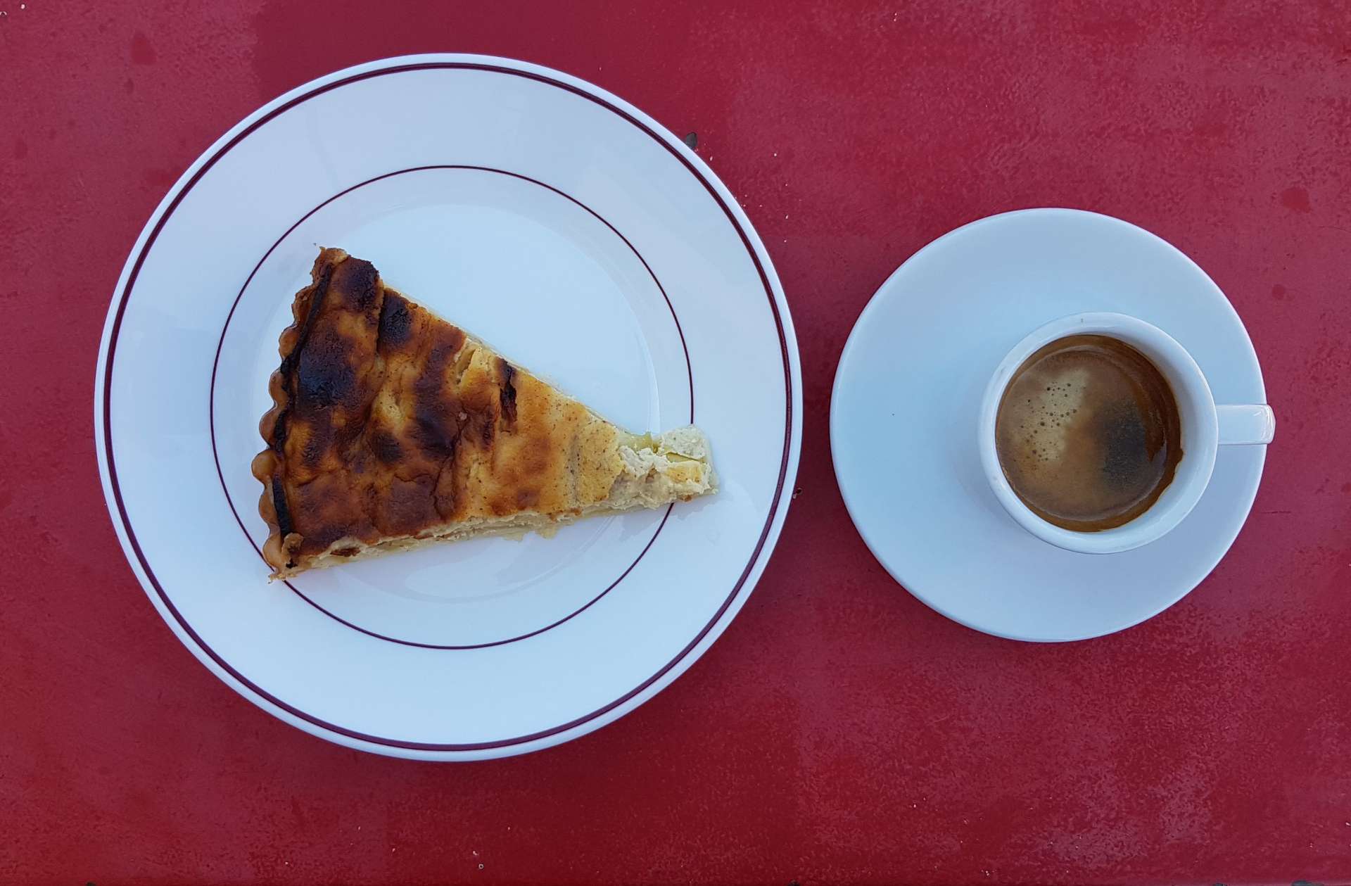
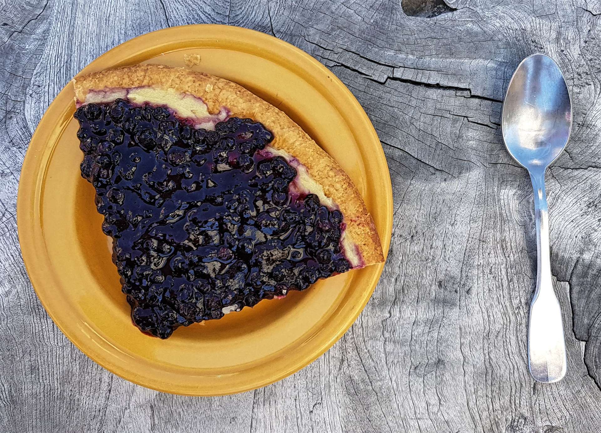
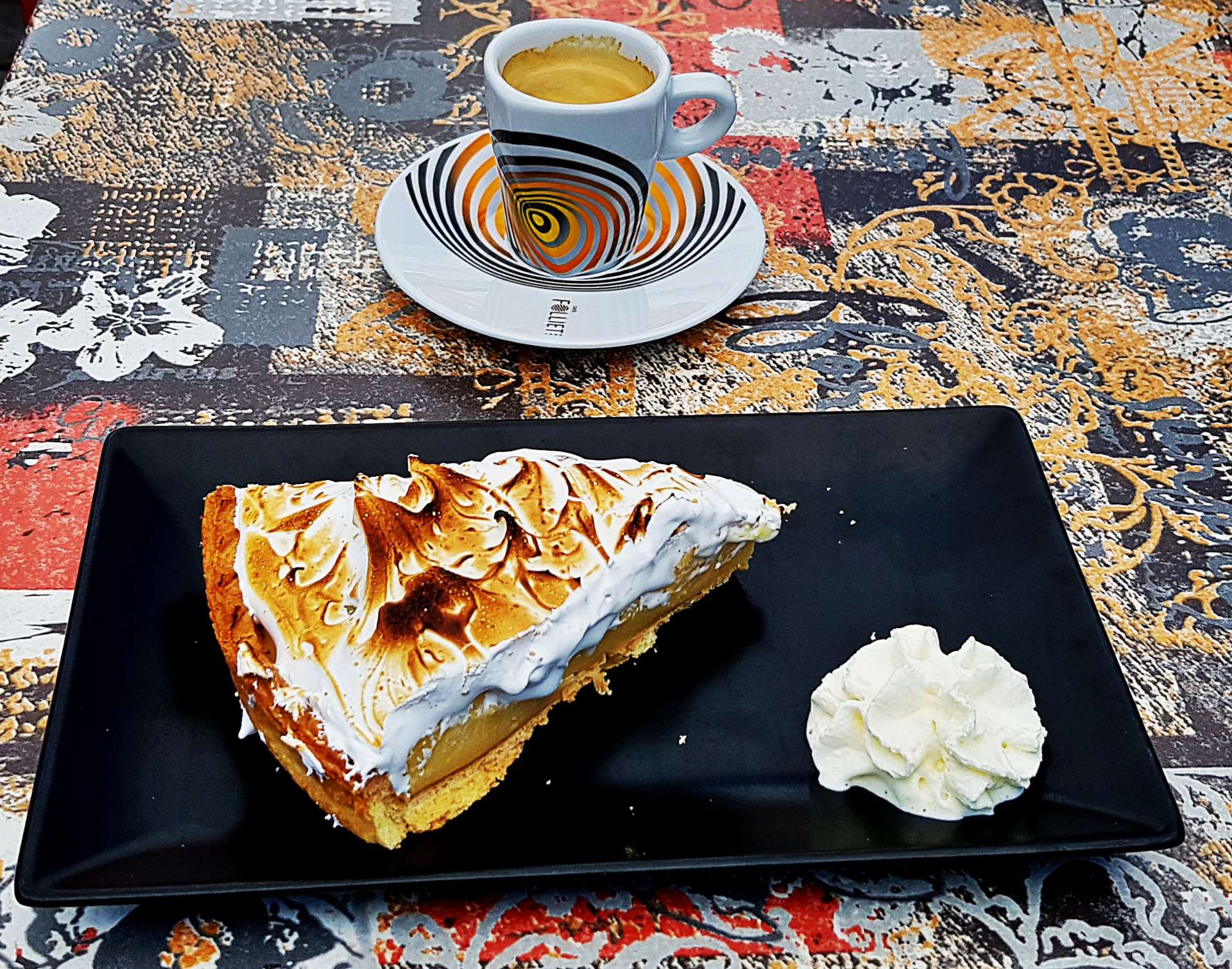
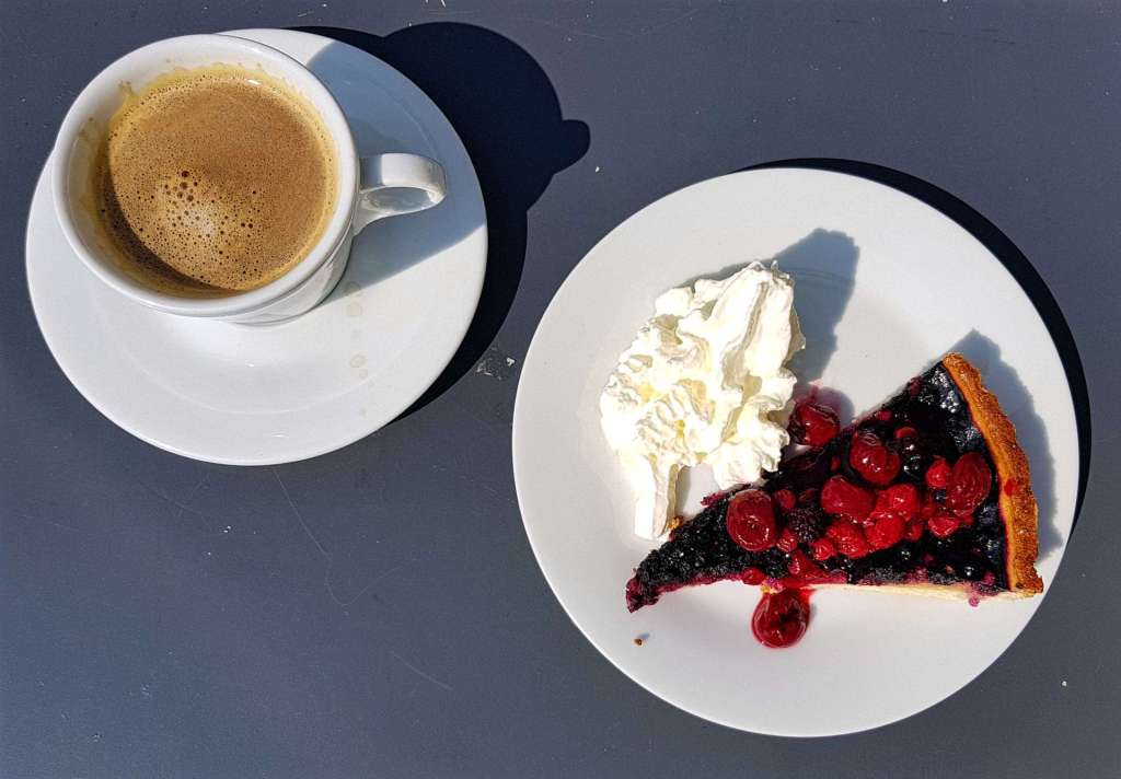
There’s a café half way up this section, so we stopped for a slice of fruits of the mountain tart & a coffee.

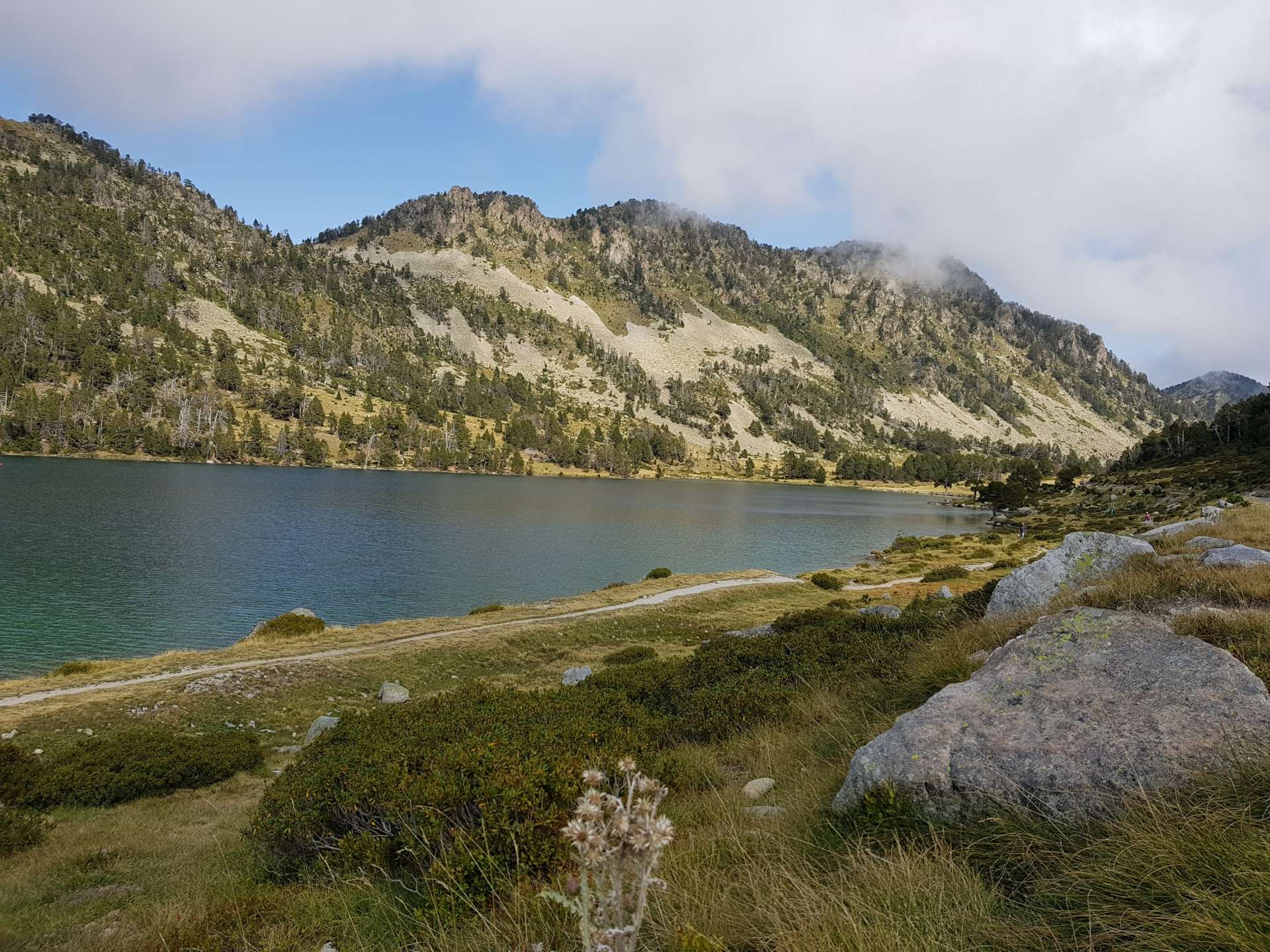
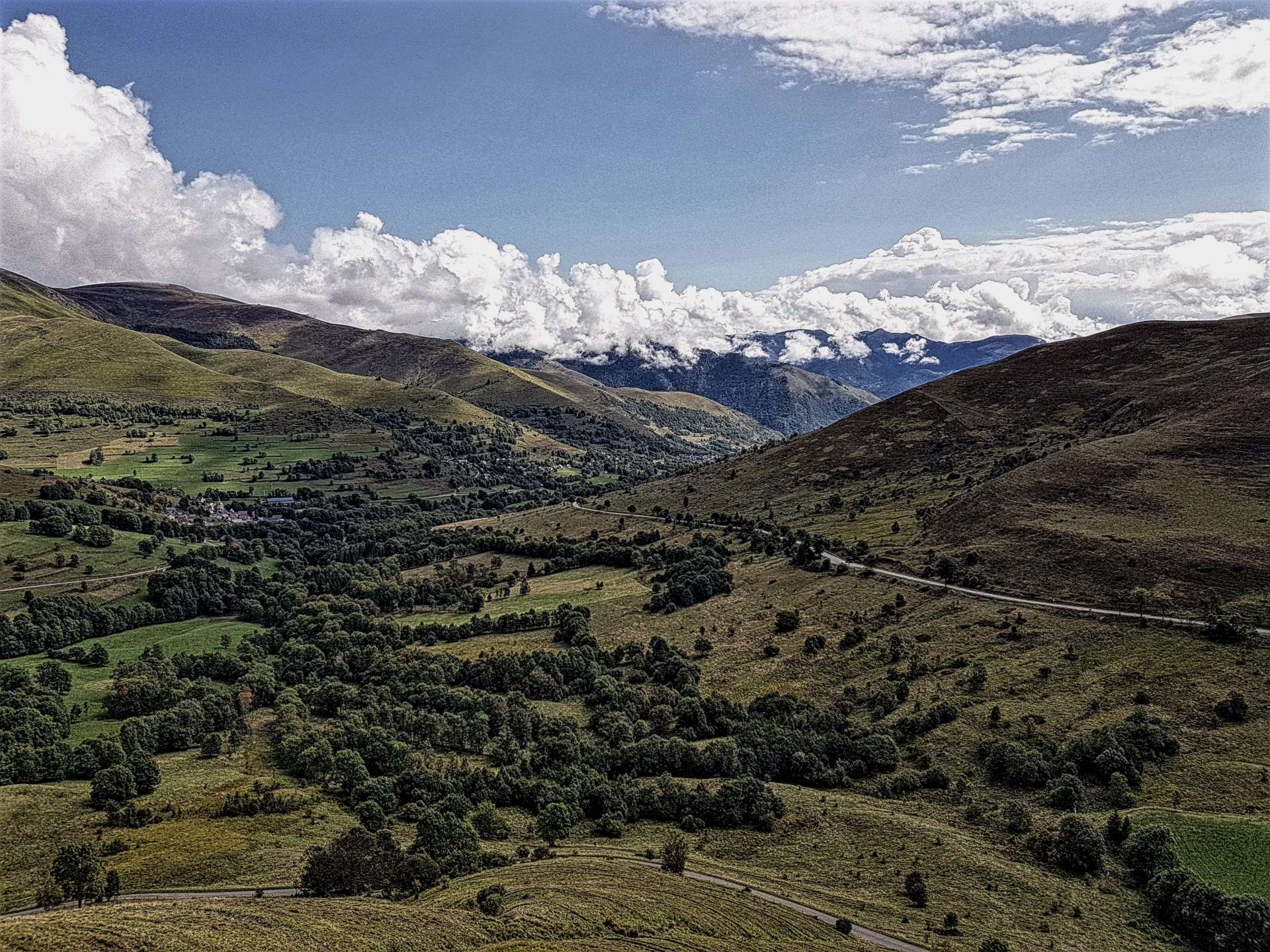
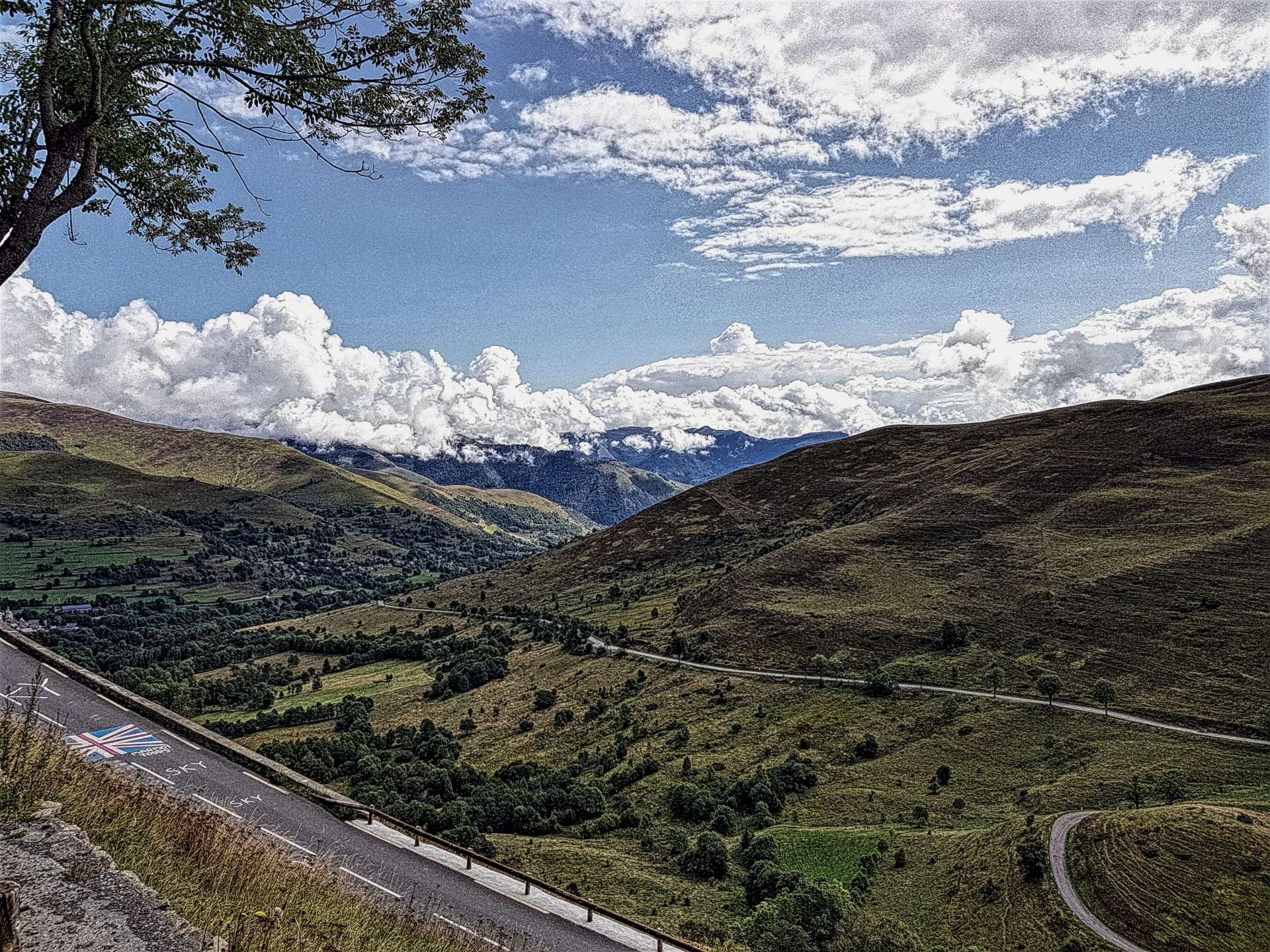
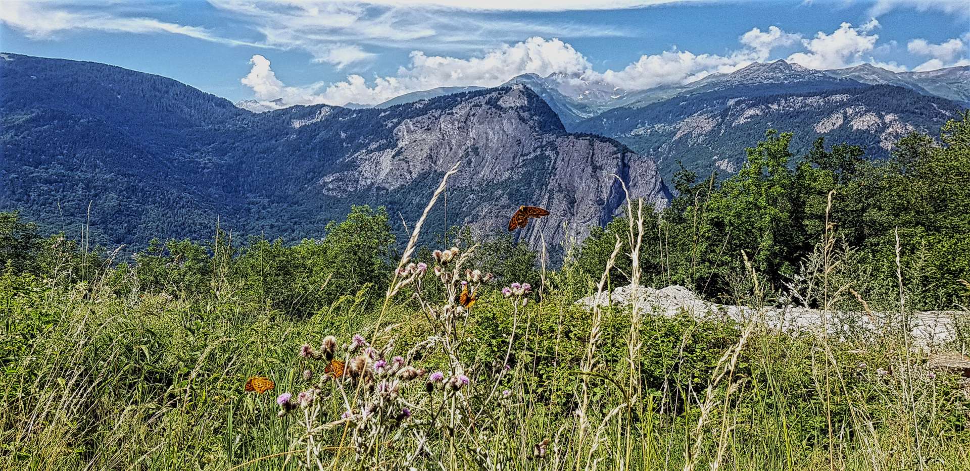
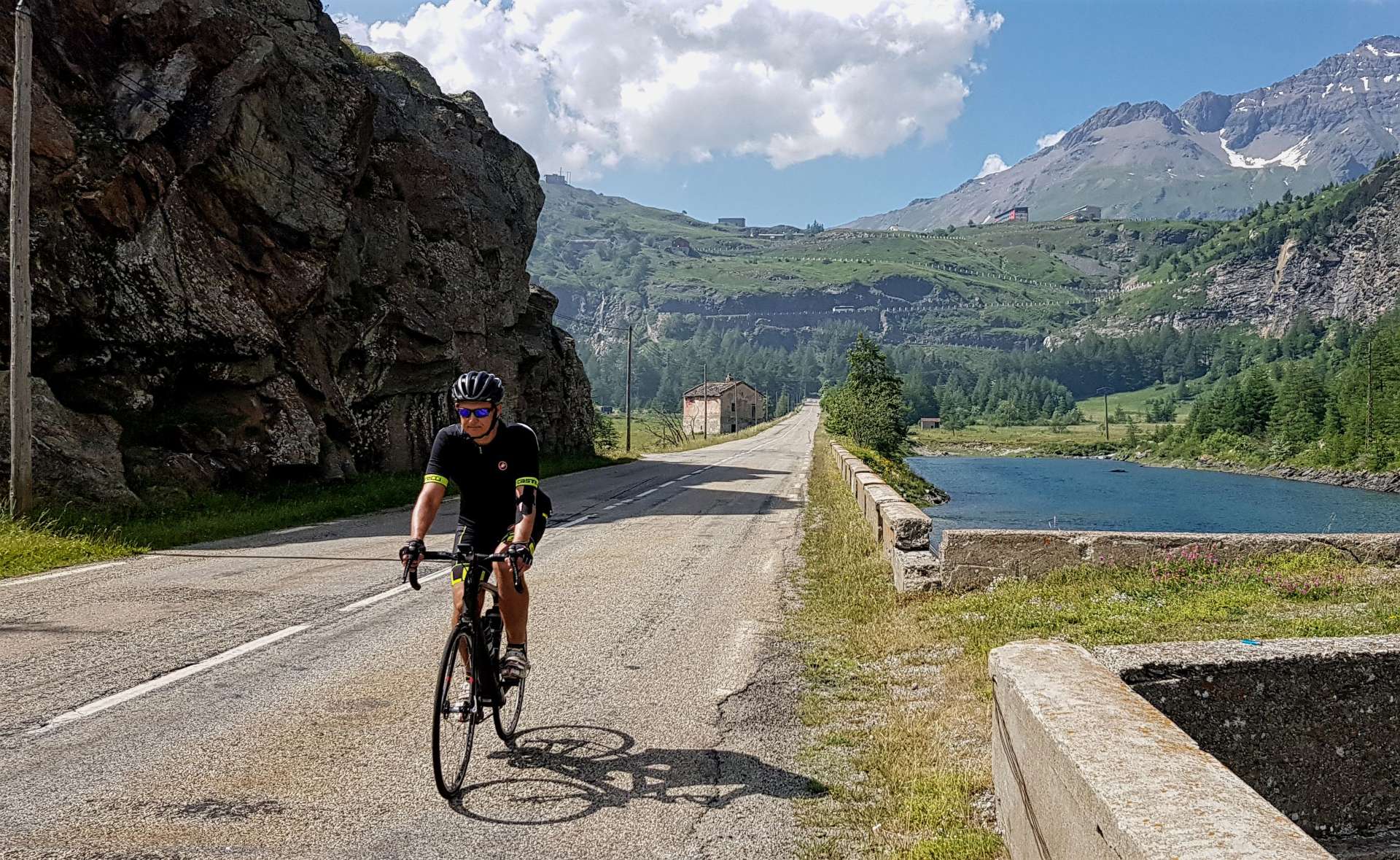
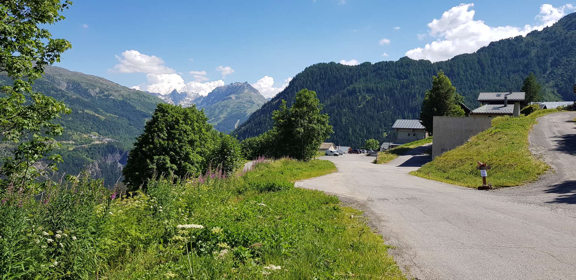
There were now only 2.5 miles of switchbacks between us & the car park at the summit – stunning views awaited us, including our first sight of snow on this trip, way up above.

I took a few minutes to enjoy the peaceful surroundings (there were more sheep than people).

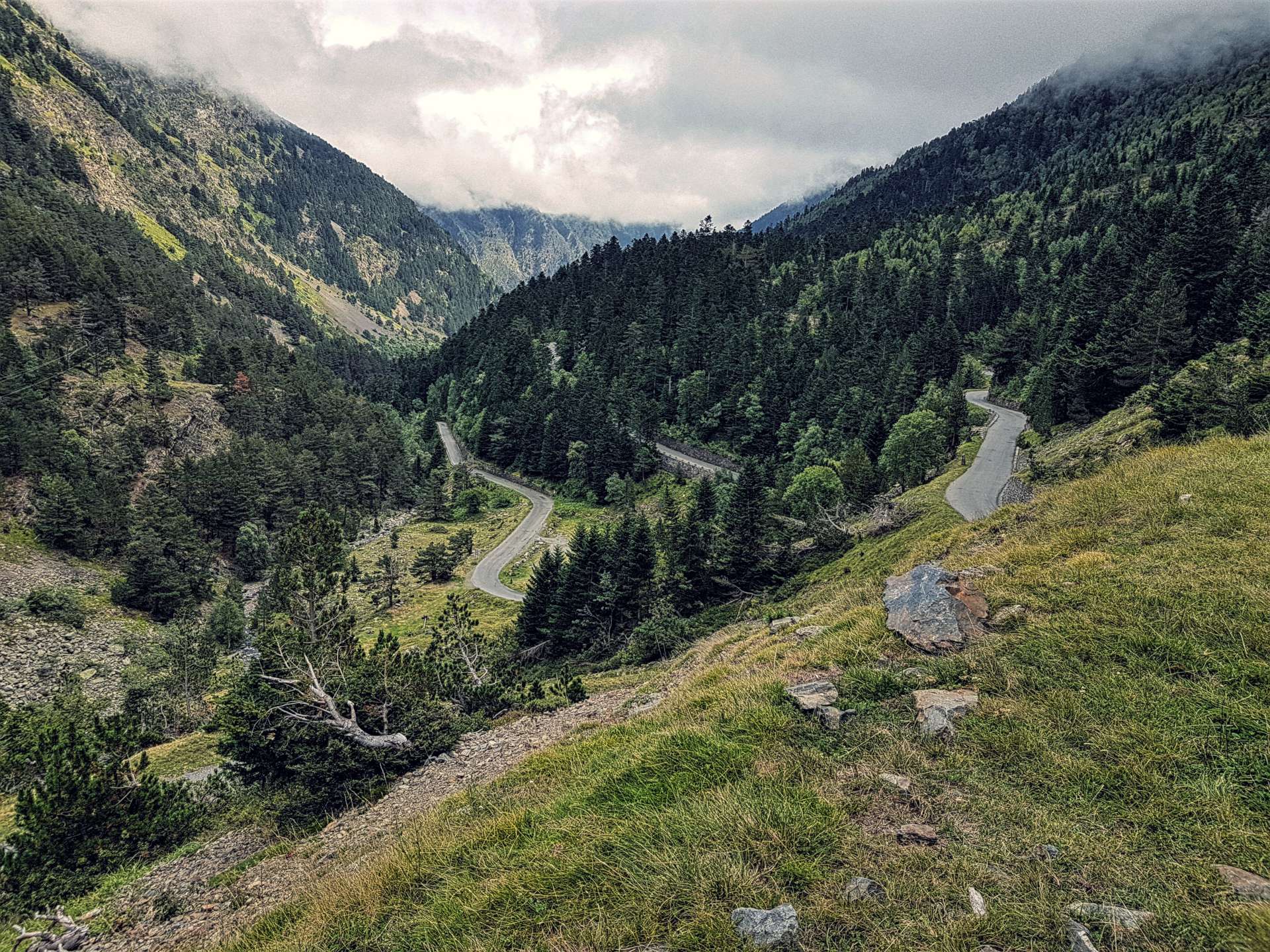
The descent was on a rutted & bumpy track, so there was no danger of going fast, as the surface was covered in loose grit & gravel, plus there was always the chance of meeting a car on a blind corner. This was still a really enjoyable descent, it simply required full concentration!

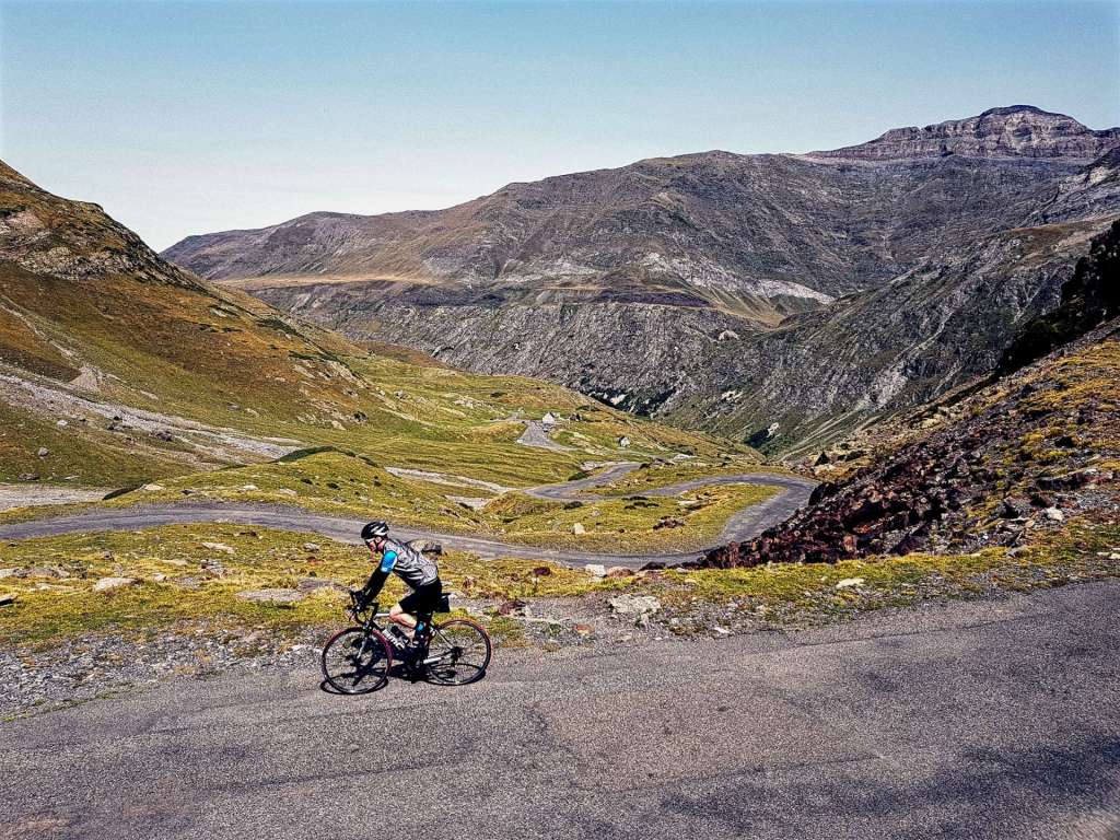
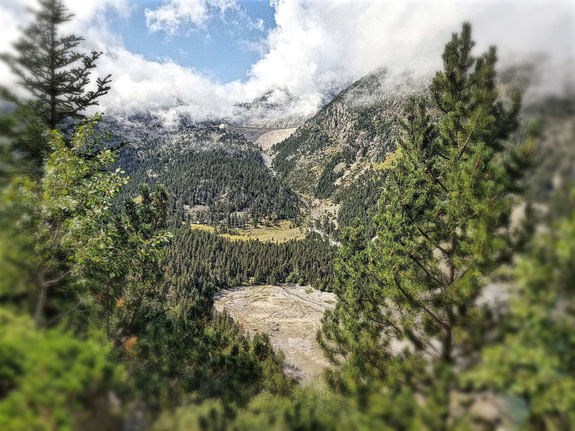
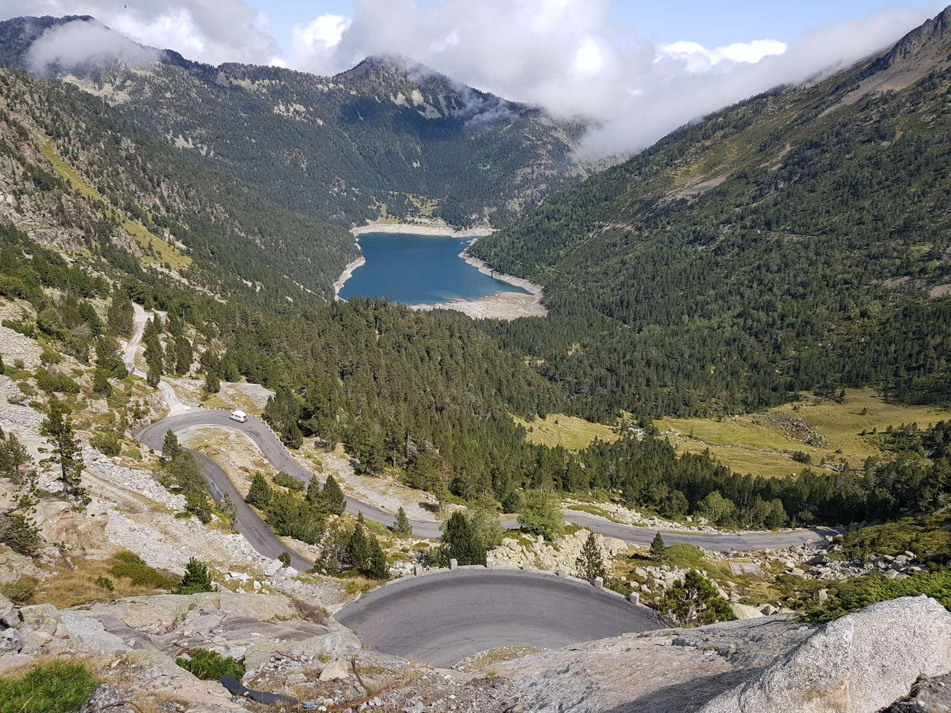
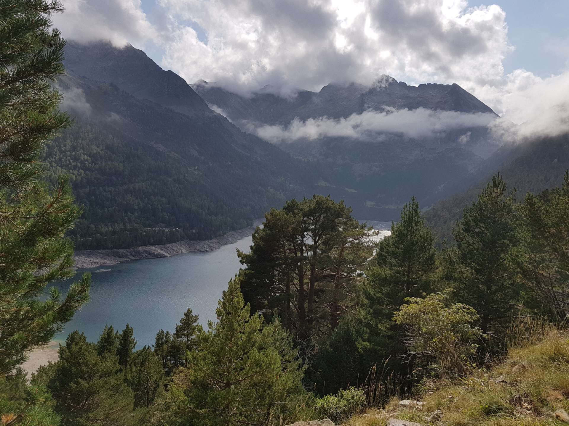
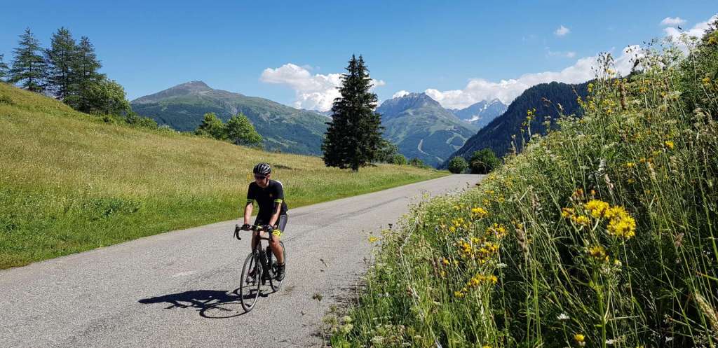
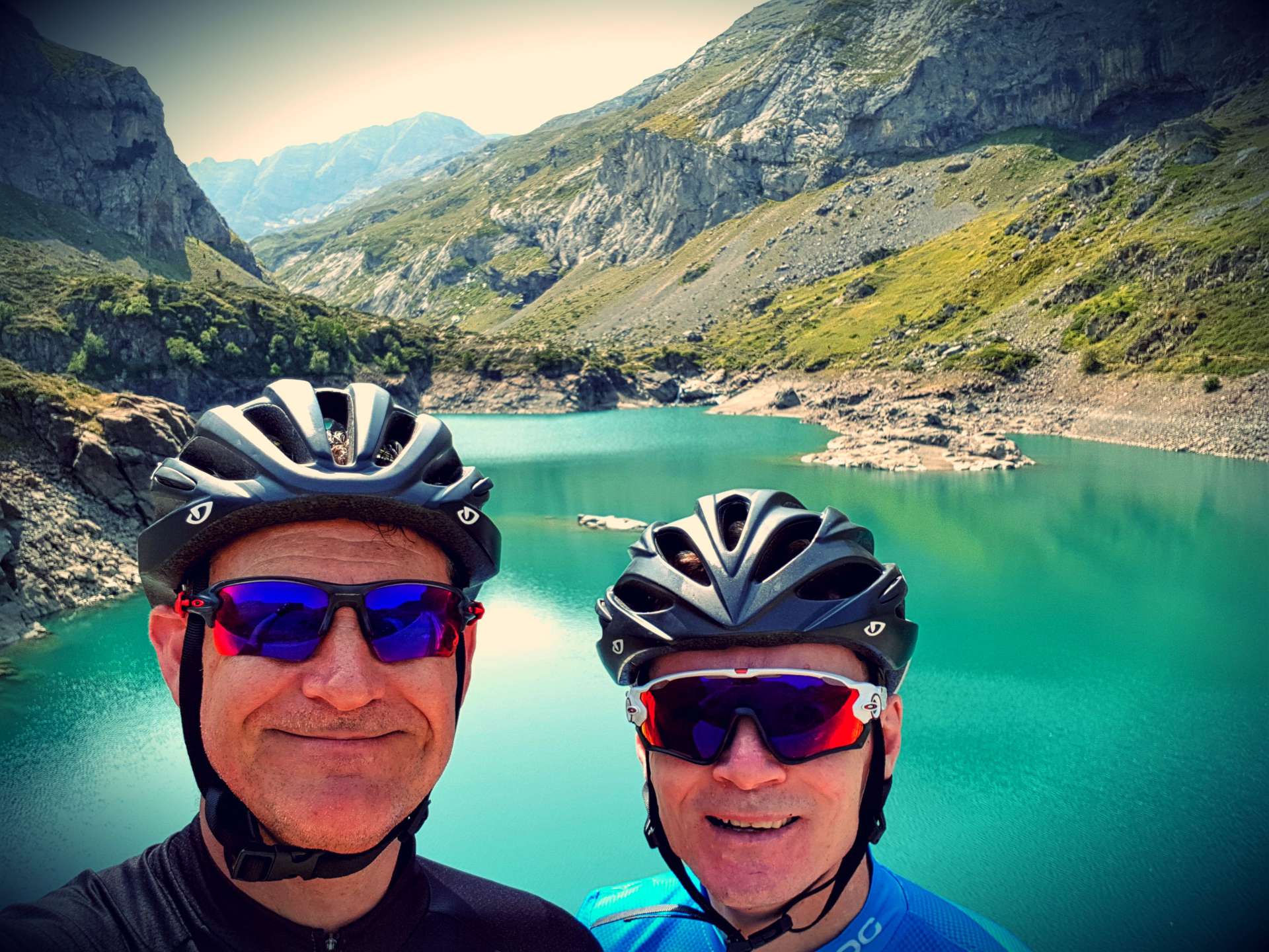
I’d read on one of Will’s blogs that on the way back there was a great detour up to Lac des Gloriettes, a hydro-electric dam. This was too good an opportunity to miss, although it required significant effort, as the 2 mile climb never dropped below 10%.

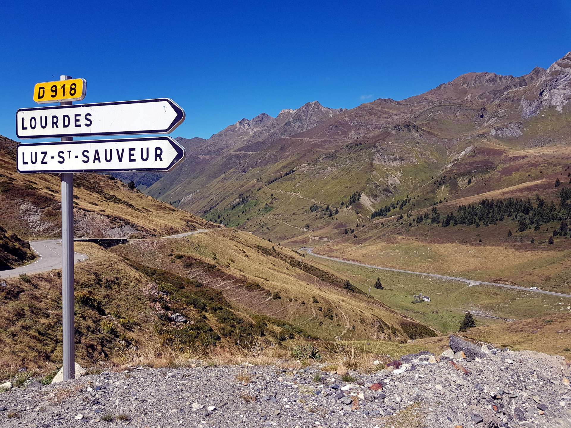
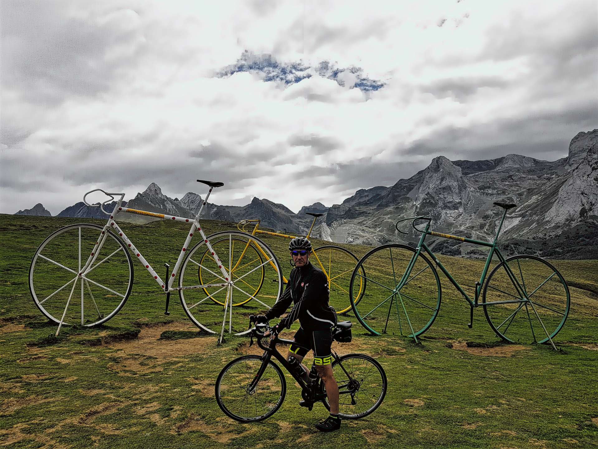
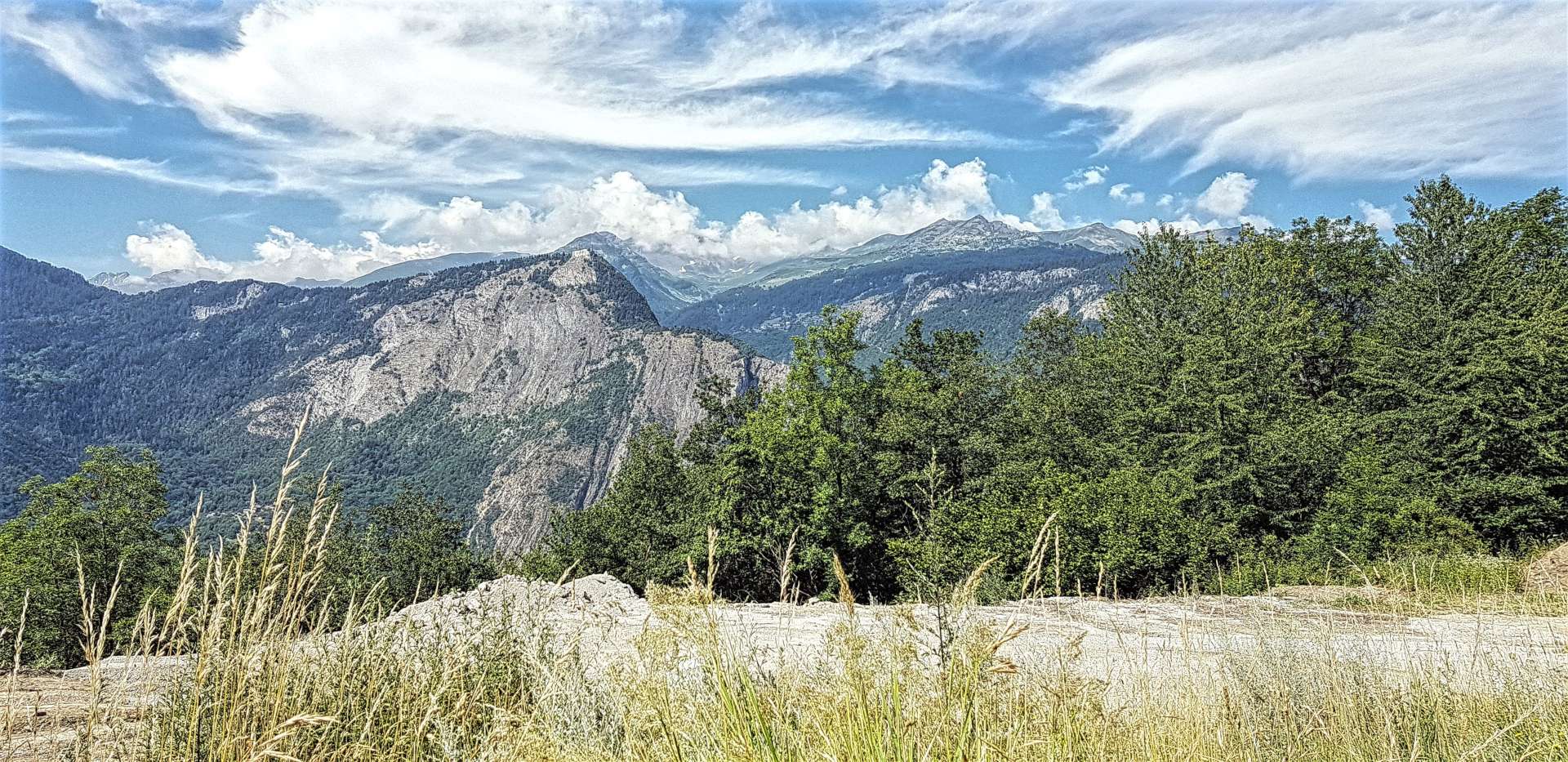
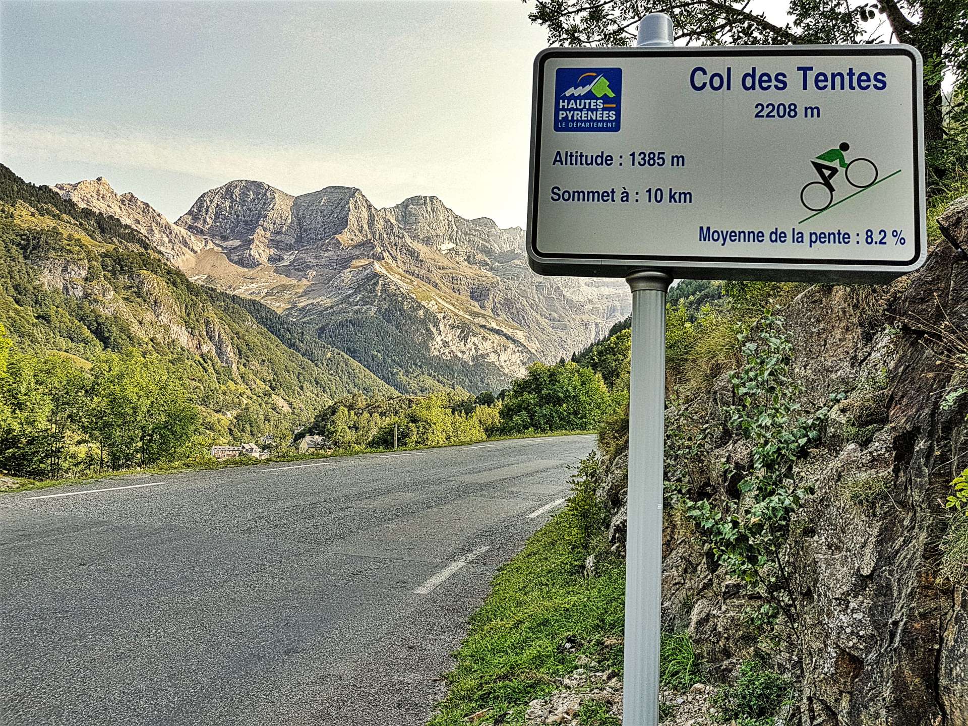
The views were well worth the effort of reaching the dam! At this point I floated the idea of changing our plan for the day & extending our trip up the valley to Port de Boucharo, via the Col des Tentes, rather than riding to the ski resort of Luz Ardiden.

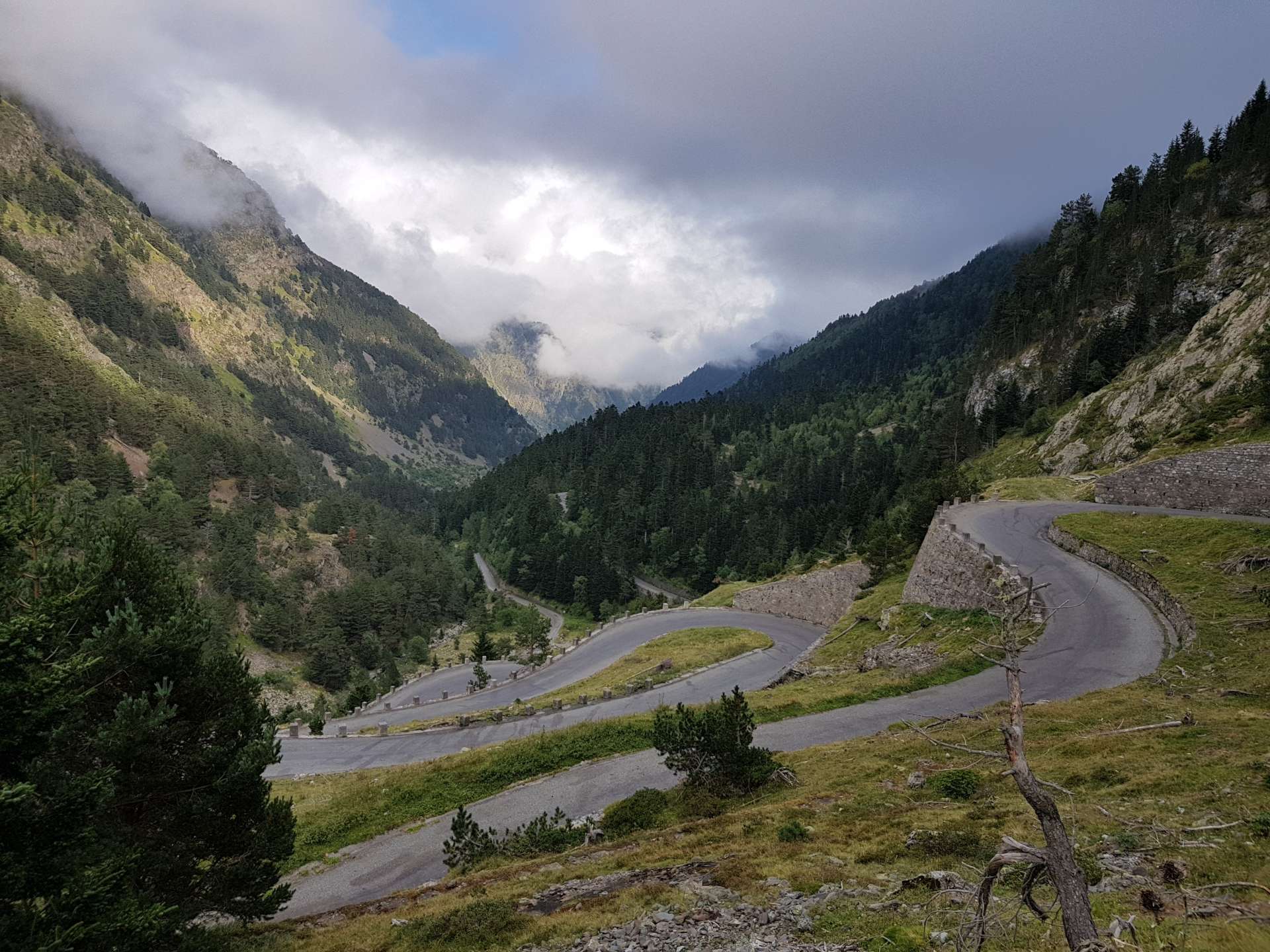
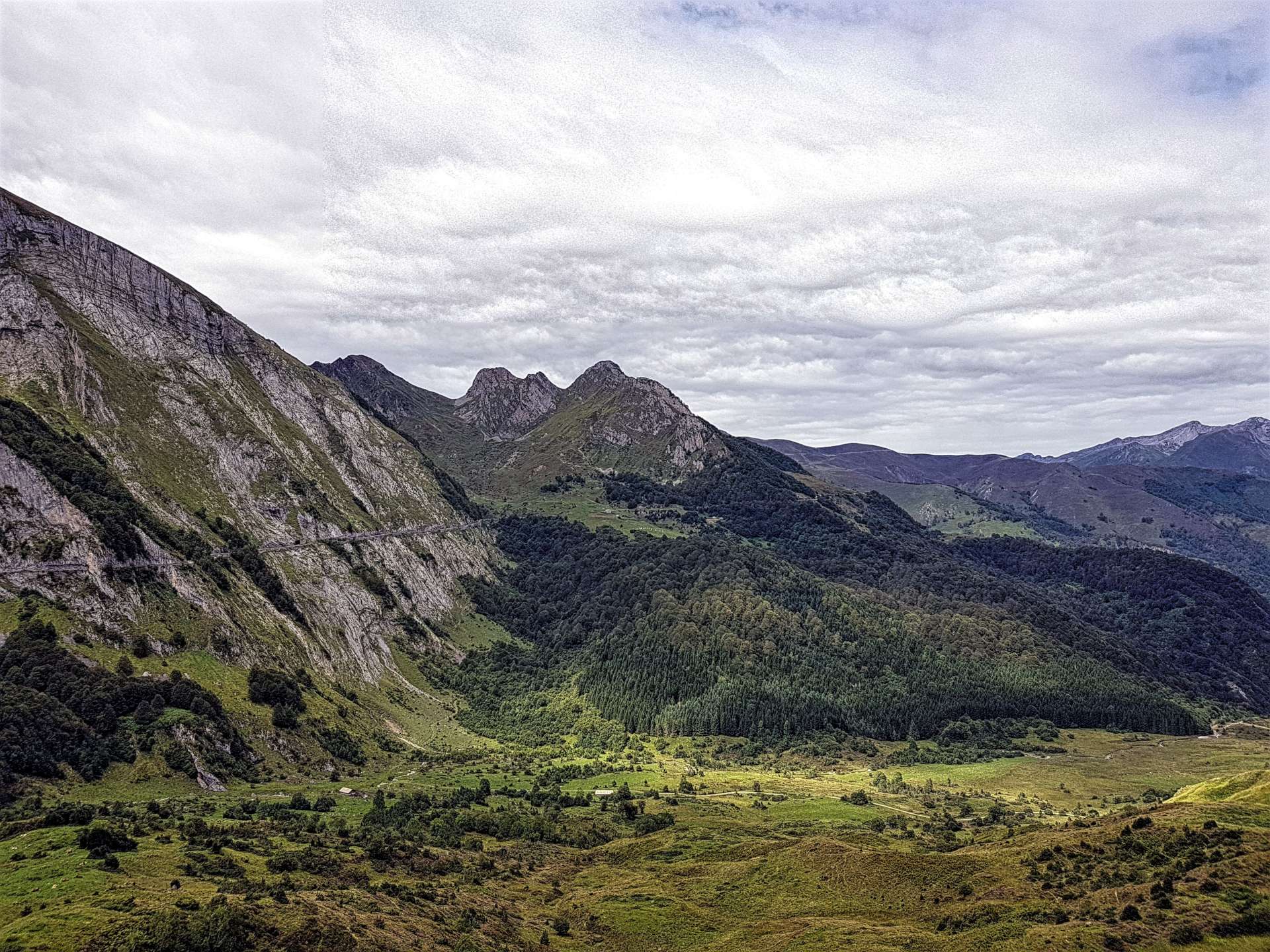
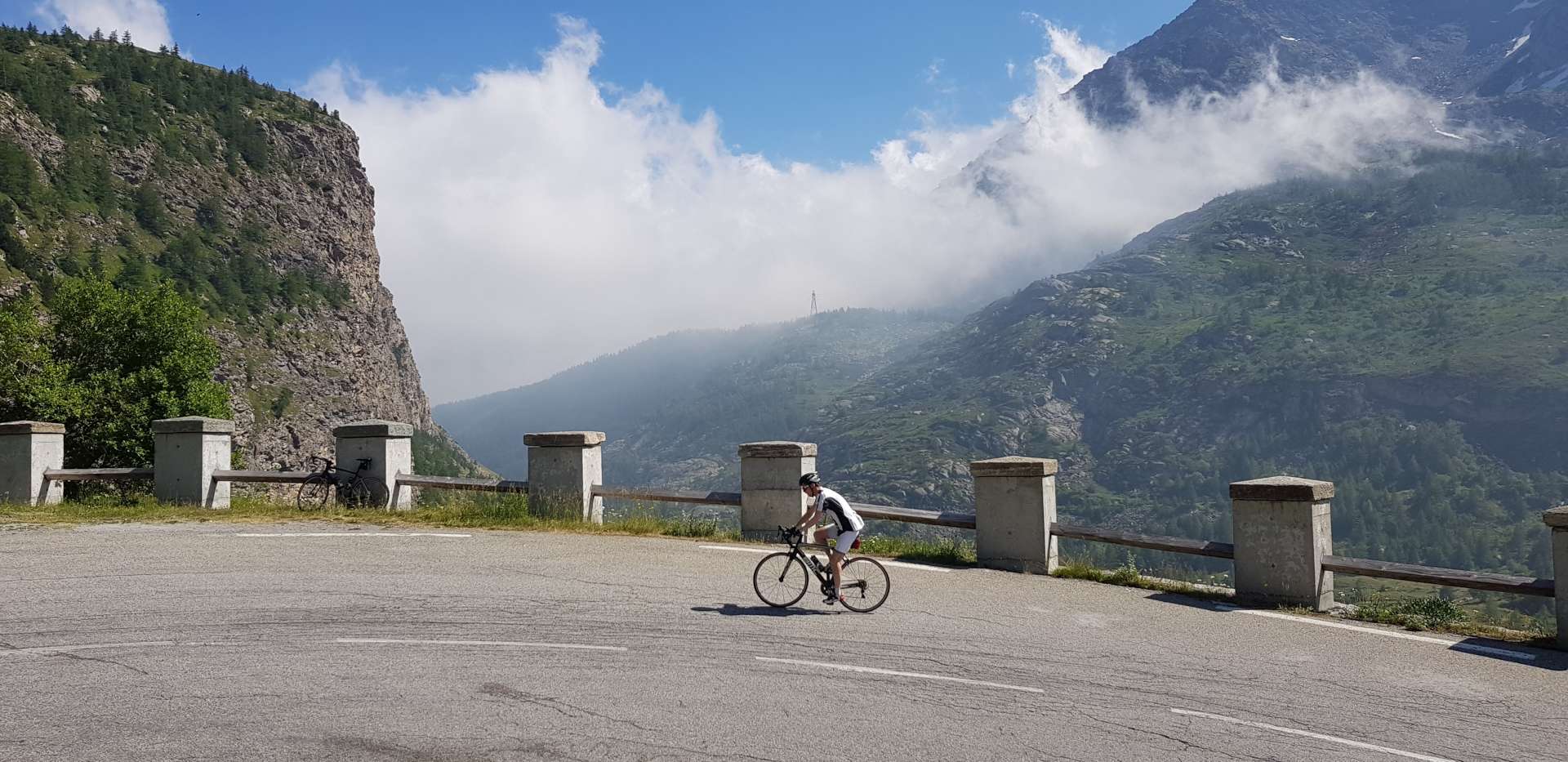
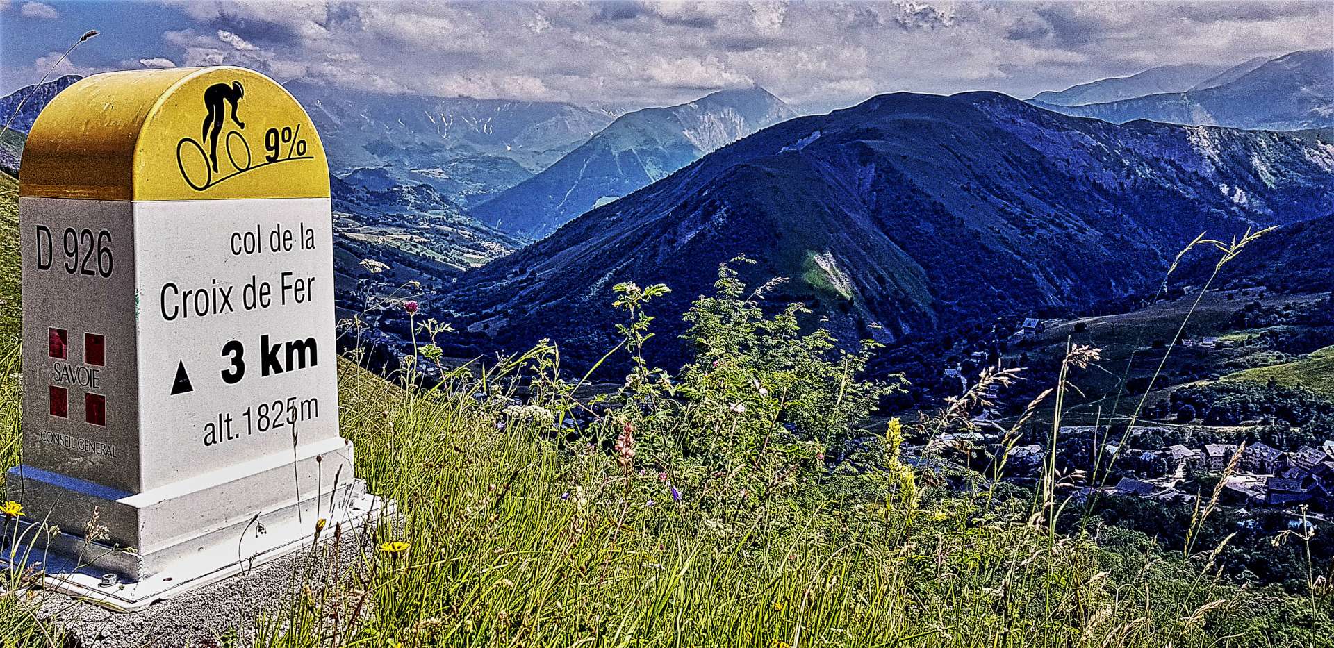
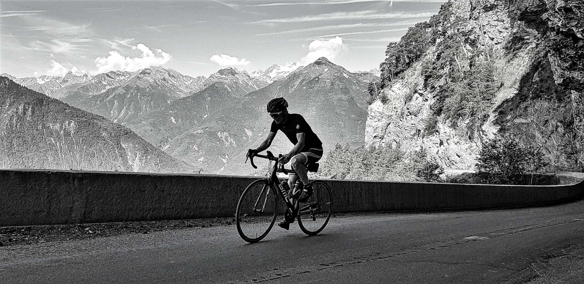
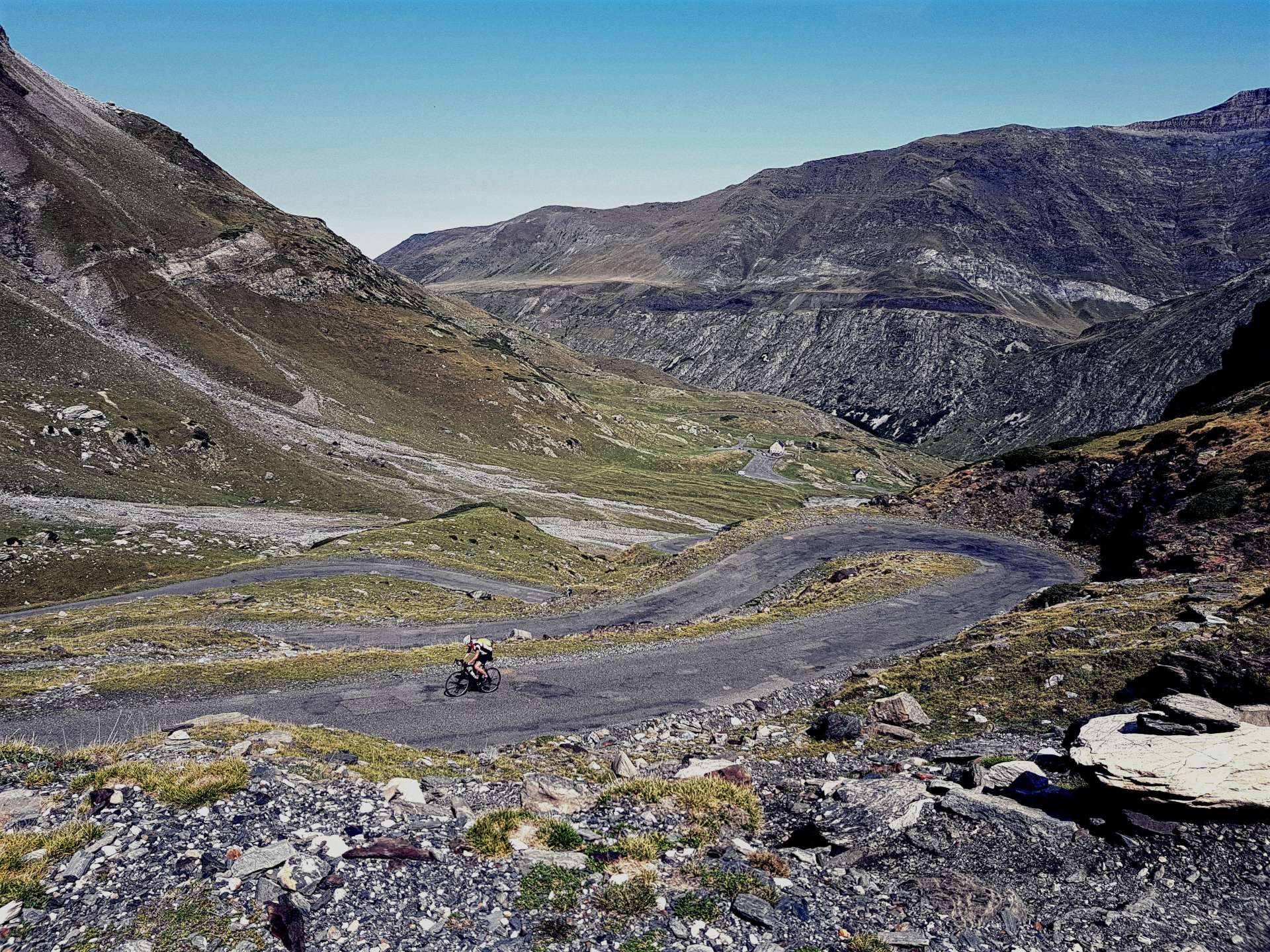
Col des Tentes is a 6 mile climb that rises to 2,208 metres, making it the highest paved road in the French Pyrenees (even higher than the mighty Tourmalet!). It’s set in stunning scenery & had hardly any traffic on it – the wildlife far outnumbered the cars. The climb has markers every kilometre, so you know how far is left to go & what the average gradient is for that section (this is common in The Alps & Pyrenees), but someone had fun when they made the signs, as every single gradient counter was wrong – this had to be somebody’s idea of a joke, as the steepest sections were marked as 1.2% average, while the shallower sections were marked as 10.2%!!

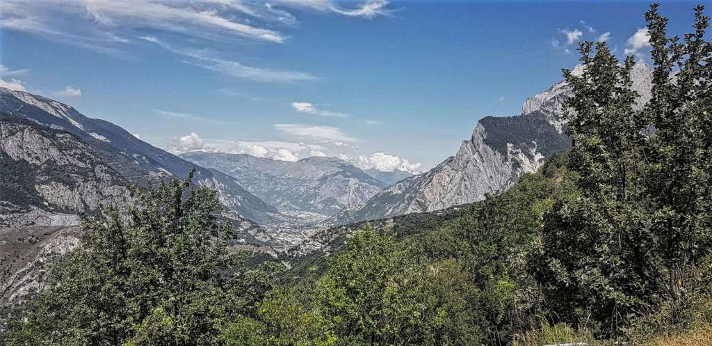
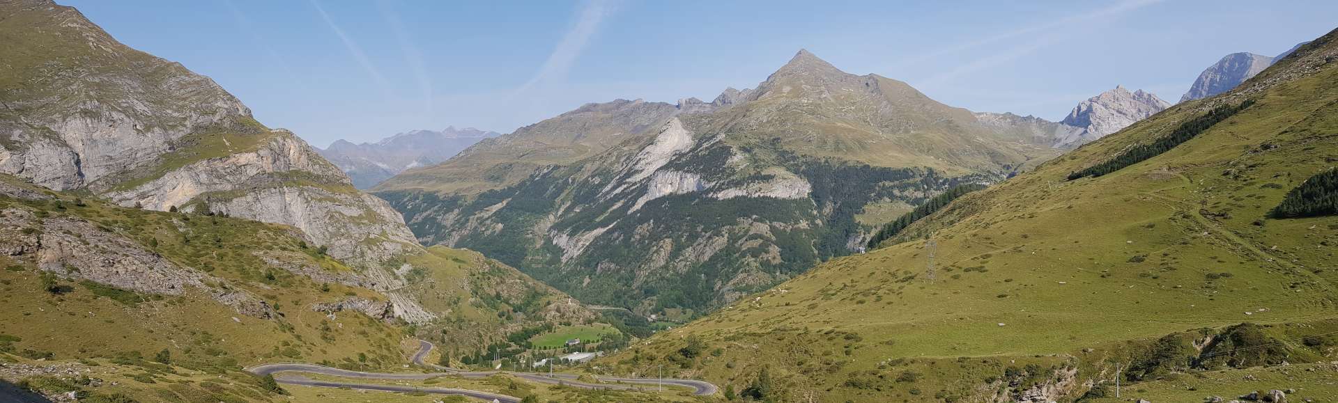
The early slopes of the climb were through woods, then meadows & as the road wound its way ever higher, this changed again & it resembled a moonscape. Along the way, we had to dodge our way through herds of sheep & cows, as they clearly own the roads around here! After about 75 minutes of effort, we finally made the summit – this was the first time in many years that a single 5 mile segment took more than 60 minutes to complete, which shows how tough the climb really was. I forgot to refill my water bottles when we left our coffee stop, so had also run out of water about two thirds of the way up the climb – schoolboy error!

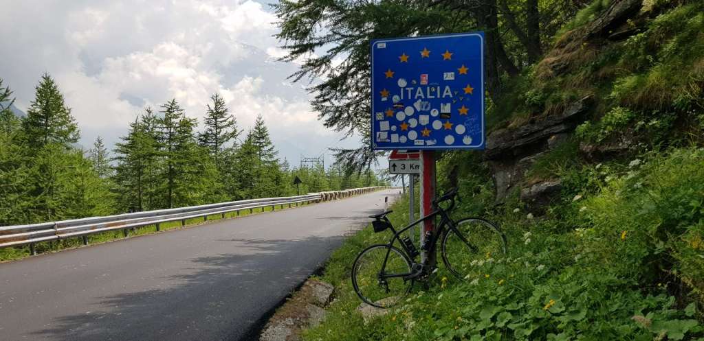
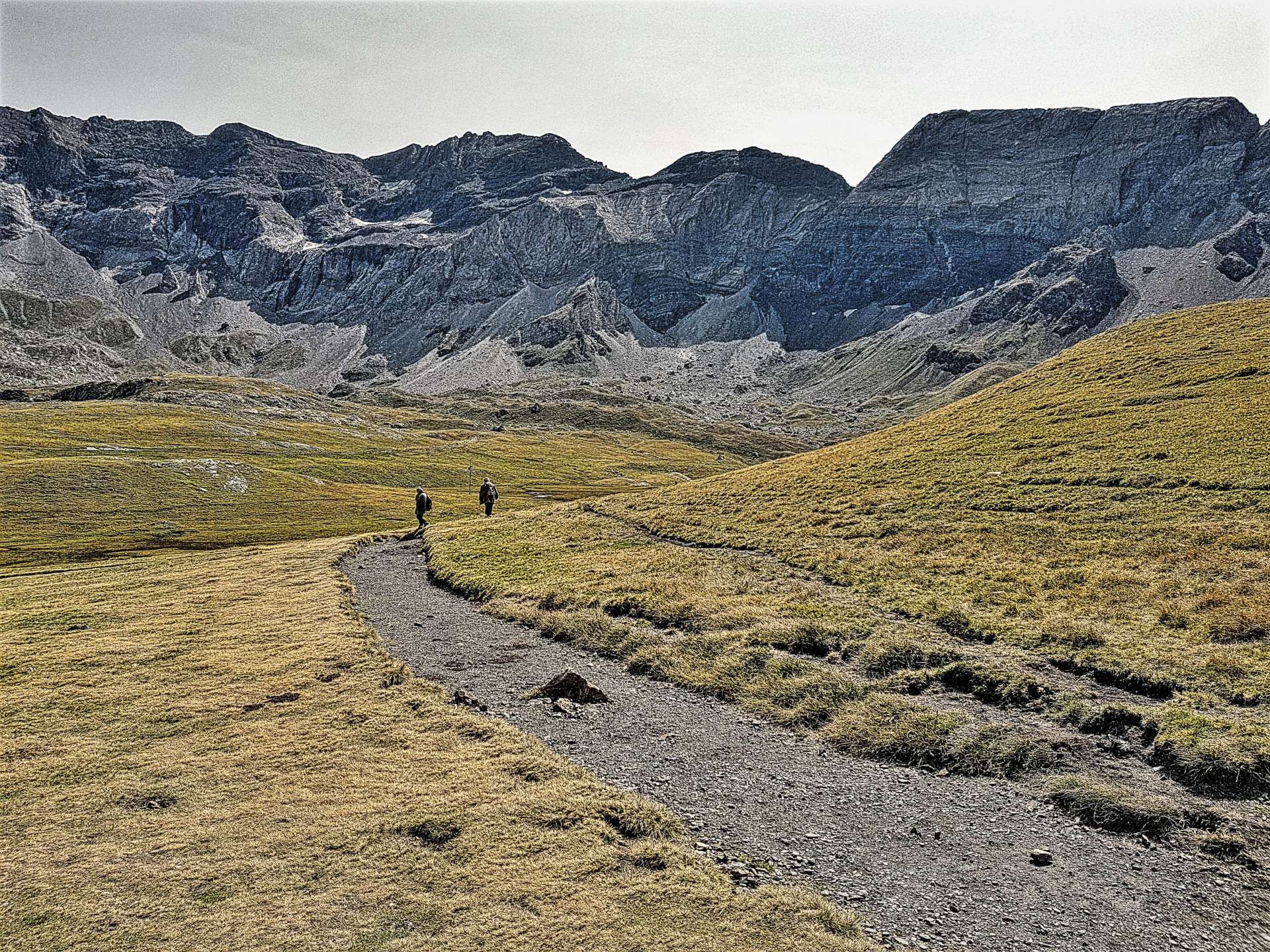
At the summit, the car park was pretty much full & there were hundreds of ramblers, hikers & families out enjoying the walk out to Port Boucharo – this is the French/Spanish border & although I fancied crossing it, I didn’t want to fight my way through rush hour, so in the end we gave it a miss.

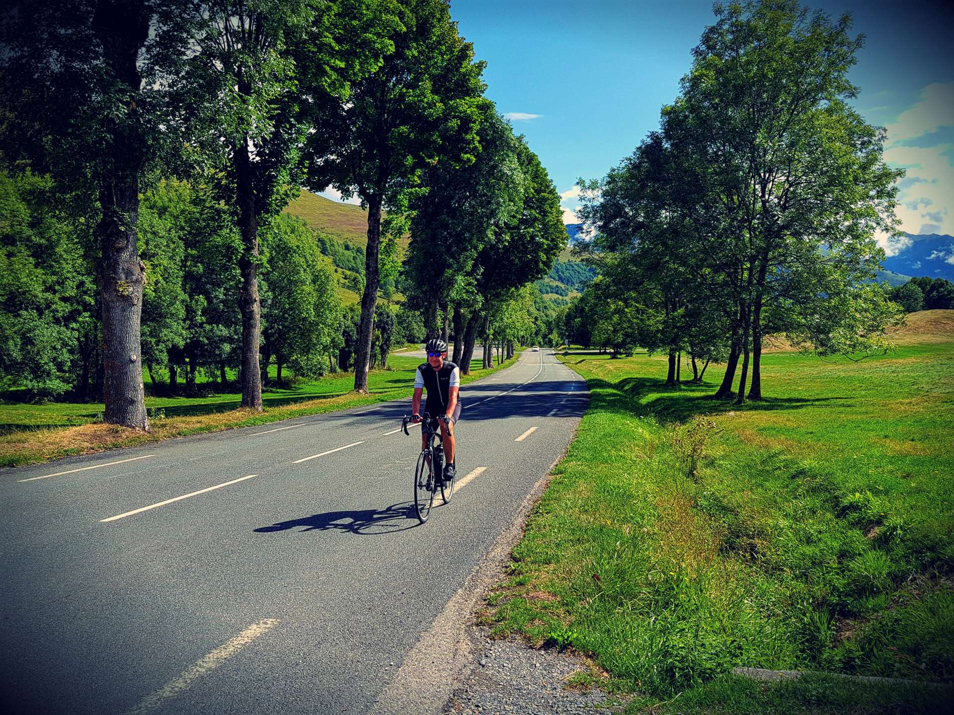
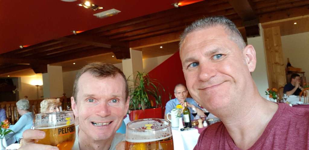
We had to negotiate the cows & sheep on the descent back to Gavarnie, where we stopped for a quick coffee to warm up from the fast & cold descent from Col des Tentes. From there we were back on a wider & smoother road all the way back to Luz St Sauveur. This ended up being our largest climbing day of the trip & was another real adventure in the wilderness of The Pyrenees!

Piau Engaly, Lac de Cap de Long & La Route des Lacs

Pyrenees Peaks – Day Four, Lourdes (6th September 2017).

I make no secret of the fact that I use a website called http://www.cycling-challenge.com for the majority of my research into where to ride on my Alpine Adventures (& now my Pyrenees Peaks too). Today’s ride is one that Will has called ‘the best road-bike climb that I have done in The Pyrenees’ – as soon as I read that, I wanted to do this ride!!!

St Lary Soulan is just under an 80 minute drive in the car, so it was another early start to the day. When we arrived the skies were leaden & the big mountain peaks were hidden from view, but we’re on a cycling holiday & will make the best of any conditions – it was dry & the winds were light, so it was a great day to be riding!

The early slopes out of Saint Lary Soulan are on a steadily rising main road (never that busy in spite of being an artery into Spain via a tunnel) that after 9 miles took us to La Plan, which is the start of the climb proper to Piau Engaly (the first of today’s 3 ascents), although by then we’d already clocked up about 1,600 feet of ascent. The clouds were low in the sky & even as I started the climb it was obvious that views would be restricted higher up, so we decided to simply enjoy the climb for what it was – a very consistent 7-8% gradient over almost 4 miles with plenty of switchbacks to make it fun.

As expected, the ski station was closed (we’d experienced the same at Superbagneres on Monday) & we were above the base of the clouds, however, we did see some eagles soaring on the thermals. We stopped just long enough to get a photo or two, ride around the resort & wolf down a banana, then we descended back to the main road & retraced out pedals towards St Lary. When we reached Fabian, we took a left up what looked to be little more than a single track road – in fact it was exactly that! This was the start of a truly awesome day in the saddle & whatever I write simply won’t do the ride justice, but here goes anyway!

Straight from the get go, the road kicked up to about 9% & it was a real effort to keep climbing – in truth, this is probably more to do with fatigue after 4 days of riding. We made our way up a narrow valley, with the constant babbling of the river helping to take my mind off the pain of pushing the pedals. After about 3 miles, we hit a stunning stretch of switchbacks, which meant that the slope eased slightly & also provided great views back down the valley.

As we reached a fork in the road we were met by the sight of a huge dam (Lac de Cap de Long) high up in the far distance & Lac d’Oredon directly in front of us where the Route des Lacs continued up to Lac d’Aumar & Lac d’Aubert . We chose to tackle Cap de Long first – approximately 3 miles in length it climbed around the lake below until eventually we were looking back towards the fork in the road some 1,500 feet below us!!!

By now it was gone 2.30pm, so we had a quick snack of Blueberry Tart & coffee, took some photos to help me remember this cycling paradise, then headed back to the fork in the road.

The final climb took us around the back of Lac d’Oredon & ever higher on a vehicle free road – cycling heaven! As we climbed, we passed goats that were either laid in the road or grazing on grass in the shadows of the pine trees.

As we ascended, we got views across the lake to where were we riding only 30 minutes previously. After a few final switchbacks, we reached a plateau with a couple of smallish lakes below us & the much larger & prettier Lac d’Aumar in front of us.

As we cycled along the edge of the lake, we passed ramblers on their way to Lac d’Aubert which marked the end of the metaphorical & physical road – in total the climb was only about 4 miles.

I took the opportunity to dip my feet in the pristine water & cool off as I took in the beauty of the surrounding scenery.

From here it was all downhill – we stopped briefly at the café on Lac d’Oredon for a quick espresso, then we retraced our way down the single track – the descent was very technical with lots of blind corners & steep stretches, so it required full concentration the whole way back to the main road – from there it was an easy 5 miles back to the car.

This has been by far my favourite day in The Pyrenees this week – what an amazing ride! I can’t sign off without saying a huge ‘Thank You’ to Will for sharing his epic cycling adventures.

Col du Tourmalet & Col d’Aspin

Pyrenees Peaks – Day Three, Lourdes (5th September 2017).

I was super excited (to quote pro cyclists the world over) this morning, as today’s ride was a loop straight from the hotel & we were taking in two more Tour de France climbs. The first climb needs no introduction, the Col du Tourmalet (The Distant Mountain) has featured in the Tour de France on more occasions than any other mountain since 1910 – a total of 85 times. There was the opportunity to also add a bonus ascent of the Col d’Aspin, which has featured a on a mere 73 occasions!

The route started on quiet country roads, as we twisted & turned between fields, with big views of the Pyrenees in the background. The first 10 miles took us in a similar direction to our Sunday ride, but as we reached Argeles-Gazost we took a left turn & started gradually gaining altitude as we followed Route de Luz up a small river valley. By the time we reached Luz Saint Sauveur, we were 20 miles into the ride & had clocked up 1,600 feet of climbing & the serious stuff hadn’t even begun. We decided to stop & have a quick pain au chocolat & espresso while we gathered our thoughts for the big challenge ahead – from Luz St Saveur, Col du Tourmalet is 11.8 miles long, gains an altitude of 4,606 feet & has an average gradient of 7.4%.

The early slopes are very gentle & provide an opportunity to take in your surroundings (big mountains on all sides!) & get into a rhythm for the climb ahead. I know from many previous experiences the key to long climbs is slow & steady at the start, as you can’t recover if you expend too much energy early on. There are a few pretty villages lower down, but as soon as we passed through Bareges, we left civilization behind.

By now the gradient has reached a fairly consistent 7-9% – I far prefer this to a constantly changing gradient, which seems to deaden my legs in no time! The views by this point were spectacular, as it was possible to make out the summit café way off in the far distance & also look back towards the parapenters who were riding the thermals. Once again, the cows & sheep have complete freedom of movement & it’s the responsibility of drivers & cyclists to get out of their way.

All that remained was to tackle the final 4 miles, as I started climbing the ‘back wall’ of the mountain – effectively riding switchback after switchback up what would have been a sheer drop if the road wasn’t there. The engineers had built one final hurdle for me to overcome, as the final ½ mile or so ramps up to 10%. Having researched the climb in advance, I knew this in advance, so had a bit of energy saved up (not much, but enough!). After 2 hours & 20 minutes of effort I was at the summit & it was time to celebrate with a fanta citron et tartelette du myrtille (lemon fanta & blueberry tart) as I took in the massive views in all directions & got a couple of souvenir photos.

As we continued over the summit & commenced our descent, we bumped in to a herd of llamas! I had to get a photo, as I knew no-one would believe me without the evidence! We also stopped briefly in La Mongie Ski Station for a quick lunch of chicken salad baguette. Although I was going downhill, this looked the more difficult side to climb, as we fairly flew down the mountain through long, sweeping bends. At Campan we decided the legs were feeling good & we should also climb Col d’Aspin – it’s 8 miles long, gains 2,106 feet & has an average gradient of 5%. This is all a little misleading, as all the serious climbing is done in the final 4 miles, where it averages 8%. Most of the climb is through pine forest & the smell was amazing, although the views were somewhat limited as a result. The other remarkable feature of the climb was how peaceful & quiet it was – traffic was light & it was great to hear nothing but the sound of the bikes changing gear as we climbed.

Once again, the views from the summit were beautiful & it made the decision to ride the climb so worthwhile. I enjoyed a few more moments of quiet contemplation before getting a photo of the summit sign as a memento.

We fairly flew down the descent again (back the way we came this time) & I stopped briefly on the lower slopes to get my photo taken between two dolls/models – they were everywhere in Campan, although I haven’t yet found out why there were so many of them! This really wraps up the interesting part of the ride – at this point we were 60 miles into the ride & all that remained was the final 20 miles of the loop back to Lourdes & to be honest there wasn’t anything memorable about it – there was also nothing wrong with it either, we’ve simply been spoiled for stunning scenery today!

Col du Tourmalet & Col d’Aspin has been one of my favourite days of riding in the high mountains of Europe. It lived up to its billing as the Queen Stage of the Pyrenees Peaks adventure & I still have three more days of riding to look forward to!

Col du Peyresourde, Superbagneres & Col du Portillon

Pyrenees Peaks – Day Two, Lourdes (4th September 2017).

The plan is to explore all the major Tour de France climbs within a reasonable distance of our base in Lourdes – the weather forecast was changeable, so we decided to commute to Bagneres-du-Luchon, some 80 miles away & hope for the best. By the time we’d parked & got ourselves sorted out it was about 10.45am, so we knew we were in for a late finish too, as we had big plans for the day. The great news was that our gamble had paid off, as the sun was shining when we arrived in the town that’s twinned with Harrogate.

Bagneres-du-Luchon is an outdoor adventurer’s paradise – during the course of the day we saw parapenters, gliders, mountain bikers, hikers & rafters in addition to road cyclists. We were aiming to ascend 3 different mountains, all of which have featured in the Tour de France. First up was Col du Peyresourde (used in the Tour on 64 occasions since its debut in 1910), at 9.5 miles in length & a height gain of 3,081 feet, the gradient averages 6.1%. The climb is fairly constant, with views of the huge Pyrenean peaks all around. Although the road is a main road, traffic was minimal, so there were plenty of opportunities to stop & admire the architecture as we rode through small villages. We found a public water fountain at the halfway point, where I needed to fill my empty bottles – it was a humid day & I pretty much leaked sweat all day!!! Sorry, too much detail….

As we neared the summit, the famous Peyresourde hairpins came into sight – there was still graffiti on the road from 2016, which is when Chris Froome attacked over the summit in 2016 & won the stage as he pedalled whilst sat on his top-tube.

We stopped briefly at the summit to enjoy the views & take a few photos – sadly the Crepe stall didn’t open on a Monday, so we were soon descending back to B-d-L for a quick lunch of baguette & patisserie. The café owners kindly filled our bottles for the afternoon’s first challenge.

Our next challenge was Superbagneres, which is a ski station high up above Bagneres-du-Luchon. The climb is 12 miles in length, with a height gain of 4,000 feet, so the gradient averages 6.3%. It doesn’t sound much, but there are some flatter stretches, so this also means there are stretches of +10% to test the legs! It’s been used in the Tour de France on 6 occasions, most recently in 1989, when Scotland’s Robert Millar (now known as Philippa York) won the stage.

The first 4 miles were next to a river & there was the constant babble of water, which was a real distraction from the hard work of climbing! The next 4 miles were through thick forest, so there were only sporadic views down to the valley floor below. As it’s a ski resort & it’s September, we hardly saw any traffic – bikes definitely outnumbers cars! All of a sudden the forest ended & we had huge views across the valley – we were even able to look all the way down to B-d-L, thousands of feet below! By now we were also exposed to a blustering headwind as we continued to wend our way ever higher towards a massive hotel in the resort of Superbagneres itself. As we reached the summit, my fears were realised – a ski resort in September doesn’t get many visitors, so the café’s were all shut!!!

The upside of a really long, steep climb, is a lightning quick descent on a near deserted road. At one point I saw my speedo top 45 mph, before I had to start braking for the next hairpin – it was a fast, fun, but straightforward blast back to B-d-L. Having taken 1 hour 45 to climb to the summit, it took less than 25 minutes to descend!

After a quick espresso (& another recharging of my water bottles – I drank x8 bottles of 0.75 litres on today’s ride) we set off for the day’s final challenge. The Col du Portillon has featured in the Tour de France on 18 occasions, most recently in 2014, The Col marks the geographic boundary between France & Spain, so I took the opportunity to snap a photo of a Spanish summit as well as French one!

The climb itself is 6.3 miles long, climbs 2,178 feet & has an average gradient of 6.5% – it sounds easy, but again the lower slopes are very shallow, resulting in the final 5 miles averaging 8.4% (& a nasty stretch of 13%!). As we looked up & across the valley, we could just make out Superbagneres, in the distance. We were in forest for the entire climb, so it was almost impossible to get a scenic photo, although I managed to get a few album fillers. I’d love to come back here again & explore the Spanish side of the mountain, as the climb is supposed to be amazing. The descent was another non-technical one on quiet roads (fast in other words!) & we were back in town before we knew it.

This was a special day in the saddle, we rode for 5½ hours & climbed 8,800 feet in 57 miles – 3 epic Tour de France mountain summits in a road cyclist’s paradise. The original plan was to have a meal in B-d-L, then drive back to Lourdes & head straight to bed. We finished riding about 6pm & nowhere was serving food until 7pm, so in the end we jumped in the car & drove the 90 minutes back to Lourdes & have just returned from devouring a cracking pizza.

Col des Borderes, Col du Soulor & Col d’Aubisque

Pyrenees Peaks – Day One, Lourdes (3rd September 2017).

Before I start my review, let me introduce my new heartthrob – Domino. She’s a brand new Trek Domane SL 2018 model & what a beauty she is! The short story is my original bike had a crack in the carbon fibre frame & it was replaced under Trek’s Lifetime Warranty. I want to say a huge THANK YOU to Ryan from Mud Dock Cycleworks & Cafe for working incredibly hard to ensure was Domino ready for the trip & to Dan at Trek Bicycle UK for sorting out the warranty claim quickly. Without their help, I wouldn’t have had a bike to ride.

The first task of the day was to check out the breakfast facilities, so we turned up at 7.30am & were impressed to find that everyone has designated tables & that coffee, croissants, fresh French sticks & OJ were delivered directly to us!! All we had to do was choose our own cereals & jam / honey / marmalade! I’m delighted to report that our hotel is everything I’d hoped for & more – in addition to the excellent breakfast facilities, I have an enormous ‘single’ room, luxury shower, room to store everything & decent wifi.

We arrived in Lourdes at 10pm last night, so we needed to build our bikes before we could start today’s adventure. As a result, we set off at about 9.15am under bruised grey skies – it was still cool enough to need arm warmers & a gilet as we took the cycle path out of town & followed the river upstream towards Argeles-Gazost. We stayed on the path a bit too long, but as a result we were able to see a time trial race at very close quarters, as proper athletes on expensive machines whooshed past us as we pootled along the road!

The detour only added a couple of flat miles & we were soon on the right road up the early slopes of Col du Soulor, as we got our first view of the Midi-Pyrenees. We took a left turn onto a quiet back road, to take in an additional ascent of Col des Borderes to warm up the legs. By the time we were 5 miles into the climb, we were ready for a coffee stop & although we were on a fairly deserted road, we stumbled across a camp site with a café that was open – although there was no cake, the coffee was very welcome after 20 miles of riding. The final part of the climb went up in ramps, ranging from a very enjoyable 5%, up to a lactic acid building 16% in one instance – certainly not expected! My introductory photo of Domino was taken at the summit of the first climb.

After a brief descent, we made our way back onto the Col du Soulor, for the final 11km of the climb – this was first used in the 1910 Tour de France, at the end of a 300+ km stage! It’s a steady gradient all the way to the summit & with pretty views in every direction, the miles quickly passed. At the summit, we had our first experience of animals in the road, as a herd of cows strolled across the road without a care in the world – we also learned that they have right of way, as they had no intention of stopping!

After a quick ham & cheese baguette, we were on our way to Col d’Aubisque (all day I had Chris Rea’s Auberge in my head – not the best ear-worm to have!). The first couple of miles were downhill, before the road gradually started climbing again towards the heavens. There were huge drops down to the valley floor on the right hand side, so with a howling crosswind, we rode on the English side of the road where possible!

Before we knew it, we’d made it to the summit of our third Col of the day. Being a regular Tour de France route, there was a display of massive yellow, green & polka dot bikes, to represent the Tours major jerseys.

At this point, the hard riding was over for the day, we just had to negotiate the wild horses on the road during the descent (& brief climb) to Soulor, before a fun 12 mile swoop back to Argeles-Gazost for a quick refreshment stop. We then jumped on the cycle path for a gentle 10 mile ride back to Lourdes.

We were back in Lourdes before 4pm, so took the opportunity to explore a bit of the town on bike – we found the incredible Sanctuary, where pilgrims were queuing to up to enter the church. All in we were in the saddle for just over 5 hours & we clocked up 64 miles, with 7,000 feet of climbing. The perfect start to our Peaky Pyrenees adventure.

Col de Beau Plan & Col du Telegraphe

Amazing Alpine Adventures – Day Ten, St Jean de Maurienne.

Our final day of this year’s Alpine Adventure, so we decided to mix another secret climb with a real Tour de France legend. This morning we took a short drive to St Michel de Maurienne & parked up – from here we would be enjoying two separate rides.

The Col de Beau Plan loop isn’t one of the well-known climbs in Maurienne valley, but it’s a treat of a 16 mile loop. As we reached the right turn for the Telegraphe & Galibier, we turned left & almost immediately the road started rising. The first ½ mile or so is through residential housing, but in almost no time the buildings are replaced by fields & open grassland.

Going upwards & out of town, it became obvious we were heading to some fairly remote countryside & it was unlikely that we’d see much in the way of traffic – cycling heaven in other words! As we continued to climb, we could make out Les Karellis & L’Albanne ski resorts from our day out on Saturday. To begin with, they were up above us on the opposite side of the valley, but as we continued climbing the difference in height steadily reduced. In addition, we also had amazing views of the Fort du Telegraph & beyond, towards the mythical Col du Galibier.

We took a slight detour on the recommendation of someone staying at the hotel – it was with the disclaimer that the views would be amazing, but the road had been recently resurfaced. As we were climbing, the loose chippings were a mere inconvenience & didn’t detract from the detour in any way.

Having left town, it took more than an hour for us to see our first car, the roads really are remote & wild! The detour took us to over 2,500 feet above the valley floor below & also opened up views to the Orelle mountains some 3,000 feet above us. We were well & truly above the tree line, with the main crop appearing to be hay – the perfect opportunity to do some hay bale surfing (of sorts!).

As we reached the Col de Beau Plan, there was a side road off to the right & it would have been rude not to explore – it was a wide two lane, which wouldn’t have looked out of place as an access road to a ski resort, but after about 2 miles, the road simply stopped – we hadn’t passed a single building, so it’s a mystery as to why the road was built!

We descended back to the Col & continued over the summit & had a fairly sketchy descent for a mile or so, as there was gravel on pretty much every corner. We were still in the back country, although every now & then we rode through tiny hamlets as we continued losing altitude. Somehow we managed to bag our 2nd Col of the day as we descended towards St Martin La Porte, the Col de Beaune.

By now, the single track had become a proper road & for the last 3 miles we zig-zagged our way to the outer edges of town & back into the main street.

It was almost 1pm, so time for lunch – we found a great place where the Plat du Jour was roast chicken, chips & salad. Needless to say we filled our boots & inside 30 minutes were ready to start our final climb of the trip.

All that remained was to visit the Col du Telegraphe, as we’d seen it during Saturday & Wednesday morning’s rides. This is the first part of the legendary Tour de France double act of Col du Telegraphe & Col du Galibier which, when combined together is the biggest ‘bottom to top’ climb in France.

We headed back to the traffic lights in the centre of town & this time headed right & immediately crossed the River Arc, which marks the start of the climb. From here we would ascend 3,200 feet in a little under 7.5 miles. The first 1.5 miles are through quiet villages until the forest takes over – for the next 6 miles the road would twist & turn through the birch & pine forest, however as the sun was directly overhead, there wasn’t much in the way of protection available.

The climb is a consistent 7% to 8% & is a favourite training climb for the professional teams – today we saw the Fortuneo-Samsic team going through their paces – their star riders (including last year’s Polka Dot Jersey winner, Warren Barguil) are currently taking part in the Tour de France. The guys we saw training absolutely powered up the climb in their ‘Big Rings’ while chatting & laughing!

Every now & then the Telegraphe allows you views to the opposite side of the valley & we could clearly make out where we’d been riding only a few hours earlier! One of the neat things about Col du Telegraphe & the nearby town of Valloire, is that they make a different straw man every year – when I last visited he had a wood cutters axe, however this year the theme is skiing, so I stopped at the summit of the col to get a photo. We also made time to enjoy a final espresso & fruit tart stop – I chose apple, Sean appears addicted to Myrtille (blueberry)!

All that remained was to turn around & then descend the 7.5 miles of twists & turns back to the valley floor below. I feel so very fortunate to have enjoyed 10 consecutive days of cycling, as I’d accepted that my injuries & lack of fitness would likely limit me to shortish rides every other day. I hope you’ve enjoyed reading about my adventures as much as I’ve enjoyed having them, Salut!!

Col du Mont Cenis (Both Sides)

Amazing Alpine Adventures – Day Nine, St Jean de Maurienne.

Today was our first (& possibly only) commute, so we had a 1 hour drive up the Maurienne valley to Lanslebourg for the start of our adventure. Most of the Mountains we’ve ridden on this trip are famous for the cycle races that use them. Today was different, as Mont Cenis is a famous passage in its own right that occasionally has cycle races on its slopes.

At 2,081 metres, Col du Mont Cenis separates Lanslebourg, France from Susa, Italy – it also marks the border between the Cottian & Graian alps. From Lanslebourg, it’s a 6.25 mile ascent with 2,100 feet of climbing as the road winds through fir forests at a fairly consistent 8% gradient. There are a couple of lookouts where there are huge views to the Iseran at the end of the valley – although it’s almost mid-July, there is still plenty of snow in sight! As we climbed higher, the scenery changed to meadows with goats & cows roaming freely.

After 65 minutes, we’d reached the summit & were ready for elevenses – blueberry tart & a quick espresso. We were expecting a long day in the saddle, with plenty of photo ops, so we decided to speed up our traditional lazy coffee stops!

Col du Mont Cenis is steeped in history, as historians believe this may be where Hannibal & his Elephants crossed the Alps from France into Italy in 218 BC & from the 1860’s the summit was considered as the border between France & Italy. However, after World War 2, the plateau & lake were ceded to France, so the border is now several kilometres down the Italian side, below the dam & lake.

This is one of my favourite alpine lakes, as the colour of the water is incredible & it’s normally quite full – today was no exception, the only difference to normal being that the enormous mountains were shrouded in clouds & there was a haziness to the sky.

While the climb of the French side of the mountain is short & sharp, the Italian side of the mountain is a complete contrast. We descended 19 miles into Susa in a little over 40 minutes, as the road is wide & the corners are sweeping, allowing us to ride through the bends, rather than having to brake before them.

By the time we arrived in Susa, it was time for lunch, so we went all in on a pasta dish of gnocchi with mushroom sauce, penne with tomato sauce & spaghetti bolognese. The food was out of this world & was so filling that I didn’t need dinner this evening. All was going well until Sean ordered a Cappuccino at 1.30pm – as all coffee aficionados know, this is a criminal offence, especially in Italy!

We set off from Susa at about 1.45pm on what we knew would be a long haul back to the summit, although the good news is that the 19 miles ascends at an average gradient of 6%. Based on my climbing over the last 8 days, we knew this was likely to be a 3.5 hour ascent, with the temperature hitting 90 degrees fahrenheit for most of the afternoon. During today’s ride I drank 7.5 litres of water, which equates to over 10 pints – it was scorching all day!!

The early stages of the Susa climb were through deciduous forest, which became pine as the altitude increased. The Col du Mont Cenis used to be a main trade route between France & Italy, however in 1980 the Frejus Tunnel was opened & much of the heavy truck traffic was diverted away, which is great news for cyclists. However, there was a price to pay for the locals, as many of the restaurants & cafes that catered for the passing haulage trade closed down – we passed numerous deserted bars, cafes & restaurants on the ascent.

As we continued our ascent, we could see a huge bank of cloud forming above us at the lake (although we were still in the sun) – it appeared that the clouds were rising from the Susa side today, but the warm air from the plateau was then pushing back the colder mountain air – there was an invisible wall that prevented the clouds reaching the lake.

After about 2.5 hours of riding & a quick stop for espresso & an ice cream lolly, we had our first glimpse of the switchbacks – at this point we both knew we only had an hour or so left of the ascent. The hairpins climb a wall of a cliff & the views back down the valley are superb, as the trees are replaced by grassland & a man-made lake/pond provides colour to proceedings.

The final push saw us reach the summit & stop for some more snaps of the lake, as the sky was now much clearer. It was just after 5.30pm, so it had been a very long day in the saddle & we still had the final descent to Lanslebourg to negotiate. After the first couple of blind corners the road opens out & there’s clear line of sight on where the corner ends, so I was able to let the brakes go & simply enjoy the ride.

I can’t believe that this is the end of Day Nine already, where has the time gone? Today was another awesome day of cycling in the big mountains & I’m hoping for one final day of fun tomorrow!

Col du Mollard, Col de la Croix de Fer & Col du Glandon Loop

Amazing Alpine Adventures – Day Eight, St Jean de Maurienne.

After yesterday’s epic day in the saddle, the intention was to take on a slightly more straightforward challenge. At points it was clear this wasn’t that easy ride! For the third day running, we rode straight out the hotel car park & rolled slightly downhill for 3 miles to the small village of Villargondran, for the start of our first climb of the day. The Col du Mollard can be tackled from 3 different directions & today we chose the route with 40 hairpins (yes, 40!) through a shaded, deciduous forest.

Throughout our stay in France, the temperatures have been in the high 80’s / low 90’s & today was no exception, so we were mighty relieved that the trees kept some of the sun off our backs for the first 45 minutes or so. This meant that we weren’t always aware of how high we’d climbed – we had an opening over St Jean de Maurienne after about 15 minutes of climbing & the valley floor was already more than 500 feet below us.

After 45 minutes of climbing the forest opened out onto alpine meadows & there were big views in all directions, although the haze limited the quality of the photos. In addition, the higher mountain peaks were hidden by cotton wool style clouds. We could just make out the classic route up the Col de le Croix de Fer on the opposite side of the valley, as it wound its way around the bluffs & promontories or cut through the rock via the 4 small tunnels.

At this point, we still had another 5 or 6 miles of climbing to reach the summit of Col du Mollard, in the skiing village of Albiez-Le-Vieux & the perennial problem of sourcing water reared it head – this is a daily challenge on the bike in high temperatures, as we only carry 1.5 litres split between 2 bidons. Sometimes the villages will have a communal tap/spring where cyclists can fill their water bottles. The tricky bit is finding where they are, as not all free flowing water is drinkable. Luckily Albiez-Le-Jeune came to our aid & I was able to top off my two empty bottles.

We eventually reached the summit & the village had entered into the Tour de France spirit by decorating an old racing bike in the red polka dots of the King Of The Mountains. Once I’d taken my customary photos, we found a neat place for lunch, with views towards the our next climb, which gave us something else to chew over, as well as our rather tasty burger!

The descent from the Mollard to join the main Croix de Fer route had roadworks, gravel & was in generally poor condition, but we both made it down safely, which is the measure of any descent. We joined the climb 10 miles from the start in St Jean de Maurienne, but there were still another 9.5 miles to go – this is a Hors Categorie in the Tour for a reason!

The first 4 miles are gentle, with gradients averaging between 5% & 7%, but then it gets tough – as we arrived at Saint-Sorlin-d’Arves the road ramped up to 11% for about 1.5 miles. As if this wasn’t a big enough challenge for me (it was, in case you’re wondering!), there was yet more roadworks & all the tar had been removed from the road, so we were riding on the metalworks, which made for a jarring experience in many ways!!!

Once we were through town, the magic of the climb began. The final 4 miles of the route are up a sheer wall at the end of the valley & this is achieved by a series of amazing switchbacks that rise ever higher above the ski village below.

It’s a consistent 8% to 9% throughout, until eventually we passed through a gap in the rock & there was the Col de la Croix de Fer signpost! This is one of my favourite places, as it is named Croix de Fer for a reason – it has an Iron Cross at the summit, which always makes for a great photo! A few years ago some vandals knocked the cross down & stole part of the base, but I’m delighted to report it’s now back in pristine condition again.

After a quick espresso, we set off to bag our 3rd & final Col of the day & less than 4 minutes later we’d also climbed the Col du Glandon! This is a huge climb from either St-Etienne-des-Cuines (12.5 miles at 7.1%) or Allemont (20 miles at 4.75%), but it’s only a 2 mile descent from the Croix de Fer, with a small 100 foot climb to get to the summit.  Beware anyone who claims to have climbed both the Croix de Fer & Glandon in a single day!!

The first 2 miles of the descent from the Col du Glandon are crazy, as the road hairpins down 12% gradients – I could hear my brakes squealing every time I applied them! We zig-zagged through grassland as we plummeted down the first 4 miles, with cows & sheep kept in their ‘fields’ with electric fencing….you wouldn’t want to meet one of them on the road!

All of a sudden the grassland stopped & was replaced by woodland, which makes spotting the exit of corners that much trickier, so concentration was fully engaged. We had huge views across the valley to the lower slopes of the Col de Madeleine, although the haze meant I couldn’t get any ‘Top 5’ photos today.

The final 5 miles of the descent were on a wide two lane road, with fast, sweeping corners & at last I could feel some of my confidence returning, as I wasn’t having to continually second guess the corners, I could actually ride through them. Once we reached St Etienne, we had a relatively flat return to the hotel by quiet back roads & we were back in time to enjoy a pint as the final few teams in the Tour Team Time Trial came in. What an incredible day of cycling in the huge Maurienne Mountains!

Col de Chaussy (via Les Lacets de Montvernier) & Col de la Madeleine

Amazing Alpine Adventures – Day Seven, St Jean de Maurienne.

Today was all about exploring the wild back country of the Maurienne valley, while taking in some epic climbs. We started by heading to what was once the best kept secret climb in the region, Les Lacets de Montvernier (which translates as ‘the shoe laces of Montvernier’).

There are 17 hairpins in the space of 1.5 miles & the single track road (it looks more like a cycle path) rises just over 650 feet. I managed to get one action shot, where there was a motorcyclist on one set of hairpins, while I captured two cyclists further up the ascent. There was still some graffiti from the 2016 Tour de France, which is just visible on the  photo below – Adam & Simon refers to the Yates brothers who competed for Mitchelton Scott that year.

Once we reached the summit of the hairpins, I jumped off the bike & headed down a farm track for about 400 yards & then cut through some woodland. I was now stood on the edge of a 1,000 foot vertical drop to the valley floor below (not good for my vertigo), with a stunning view of Les Lacets laid out below & across from me – my photo doesn’t really do the climb justice, but it’s a great reminder of a stunning piece of tarmac. The Tour de France is visiting again this year, so look out for Les Lacets de Montvernier on Stage 12.

After another mile or so, the single track joins the main route up to Col du Chaussy, which is a 9 mile brute of a climb with stretches hitting 13% in gradient for 400 yards or more – plenty long enough to cause me significant difficulty (& pain!). The scenery was awesome at this point, with huge views across to the snow-capped mountains that surround the Cols de Glandon & Croix de Fer. We were heading ever higher & the trees were getting thinner (hence the views) & then we saw a tiny balcony road, threading its way across what appeared to be a sheer faced cliff. As we got closer, we realised that’s exactly what it was & that the only thing protecting us from the 2,000 foot drop would be a concrete barrier!

The road was so quiet, at least we didn’t have to worry about traffic – other than the odd motor bike, the only people we saw until we reached the summit were other cyclists, as they motored past us! Once we’d made our way past the cliff road, it was a steep few miles of climbing through forest, before another change of scenery as we left one valley & joined another. The final 2 miles of the ascent took us through alpine meadow & then finally we could make out the Col du Chaussy sign in the distance – it’s not the greatest of signs!

We stopped at the summit café for a coke followed by coffee & watched in amazement as above us about 25 eagles soared on the thermals looking for their Sunday Lunch – we hoped we weren’t on the menu!! As we headed over the summit we knew we were in for a helter skelter descent of some 6½ miles on narrow farm tracks – we were effectively transitioning over to the lower slopes of the Col de la Madeleine, before our next 9 mile ascent to the summit some 4,000 feet above us.

I’d always known I would be fine climbing the Chaussy, as it was only about 3,500 of climbing although some was steep, however, backing this up with an ascent of a Tour de France legend (it’s referred to in the climbing guides as Mythique because of its difficulty) was going to be completely unknown territory & I genuinely didn’t know if I would be capable of completing the climb – but that’s what challenges are about.

The first of a few acid tests came after less than a mile of climbing, when the roadside marker showed that the gradient for the next kilometre averaged 11% – I couldn’t hang on to Sean’s wheel as my speed plummeted to 3.5 miles an hour! My lack of climbing training was exposed right there & the next 45 minutes were the most painful I can remember on a bike, as the gradient hovered between 8% & 10% while horseflies mocked me by taking bites out of my oversized arse – I couldn’t go fast enough to escape them!! The views were beautiful up towards the snow peaked mountains, but I experienced a very rare crisis of confidence about whether I would see the new summit sign on the Col, some 7 miles further on.

At that moment I stopped to take the photo below & made a conscious decision to ride to the summit, but to do it at my pace & to enjoy every minute of the experience. All of a sudden I was ok – I’d had the opportunity to stop & had made the choice to continue, so I knew I’d complete the climb. It was still an incredibly difficult few miles up to Saint-Francois-Longchamp, the last sign of civilisation before the summit. From here the road twists & turns over cattle grazing land, with huge views all the way down to La Chambre, some 13 miles & 3,500 feet away on the valley floor.

Finally, after 1 hour 50 minutes we’d reached the summit – again Sean rode at my pace all day & never complained about me slowing him down. That made it all the more enjoyable to get a photo together in front of the new Col sign, then head to the café for a massive slice of blueberry tart & coke!!

The first 4 miles of the descent were on twisty & wide roads, but at that point the road was being repaired ahead of Le Tour & there was gravel on almost every corner for about 2 miles. I’d been warned about this yesterday by a group of Oz riders who are staying at our hotel, so at least we were both prepared for it. After that, the road took long sweeping corners ever downwards towards La Chambre & some 25 minutes after leaving the summit, we were back on the valley floor.

All that remained was to cycle the final 6 miles beside the river as we headed back to St Jean de Maurienne. Today was yet another stunningly beautiful day in the saddle, here’s hoping tomorrow brings more of the same!

Les Karellis & Col d’Albanne

Amazing Alpine Adventures – Day Six, St Jean de Maurienne.

Having enjoyed every minute of our stay in Hotel Les Grillons in Talloires, today was time to say ‘Au Revoir’ to our hosts Aurelie & Sebastien & head to our new base in St Jean de Maurienne, the Hotel St Georges, which is run by Martine – we’ve stayed here twice before & it was great to wander into Reception at 11am, be recognised immediately & offered un tasse de café on the terrace!

Our rooms were ready for us within 20 minutes of arriving, so we were unpacked, bikes built & ready to roll out for a leg loosener by 12.30. The Maurienne Valley is home to 5 of the top 10 cycling climbs in France & we plan to climb some of the Tour de France classics, as well as explore a few lesser known climbs, as we did today. Slightly west of Col du Telegraphe & Col du Galibier is a purpose built road up to Les Karellis ski station & the Col d’Albanne. I’m an avid follower of Will Davies (no relation), who’s set up the Cycling Challenge website & I found this ride on there. In fact many of my Alpine Adventures owe an enormous debt of gratitude to Will for sharing his exploits.

The first 4 ½ miles took us from St Jean de Maurienne, to the foot of the climb at Le Bochet – the fun began here! For the next 8 miles, we cycled switchback after switchback as we climbed at gradients of between 8 & 10%. As we rose ever higher, the views along & across the Maurienne valley became ever more impressive.

After 5 miles, the road splits, with Les Karellis heading right & Col d’Albanne heading left (both continue to climb, so no easy options here!). We carried on towards Les Karellis, a purpose built ski station, some 3,000 feet above the valley floor below. We didn’t see anywhere open for lunch, so we were pretty desperate for something to eat & drink by the time we reached town. We found a café where we stopped long enough to enjoy an espresso & lemon meringue tart – the food of champions!!!

We descended 2 ½ miles to the turning for Albanne & then started climbing a single track lane through a pine & silver birch forest, which provided some welcome shade from the heat of the sun. After a couple of miles of twisting & turning past small streams, we exited the forest & found ourselves in an alpine meadow with views of the high mountains in every direction! Across the valley we could make out the cliff road up to Mont Denis (a challenge for another day), while directly in front of us was the Fort du Telegraphe & the descent from Col du Telegraphe into Valloire. So much incredible scenery on our first day in the Maurienne valley!!

All that remained was to drink in the views, capture some photos for posterity & then descend the single track to the Karellis junction, before diving back to the valley below. Once we arrived back in Le Bochet, we took a short but scenic diversion past the beginning of the Col du Mollard – hopefully I’ll share more about it later in the week.

What a great first day in the Maurienne Valley – here’s to four more action packed adventures!!