Amazing Alpine Adventures – Day Eight, St Jean de Maurienne.
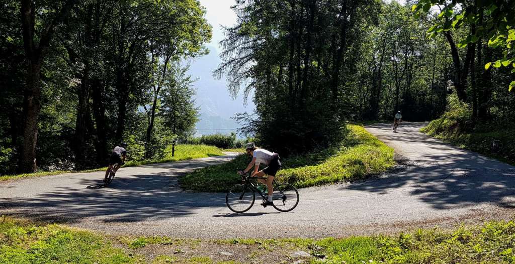
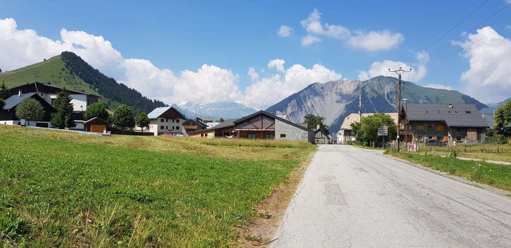
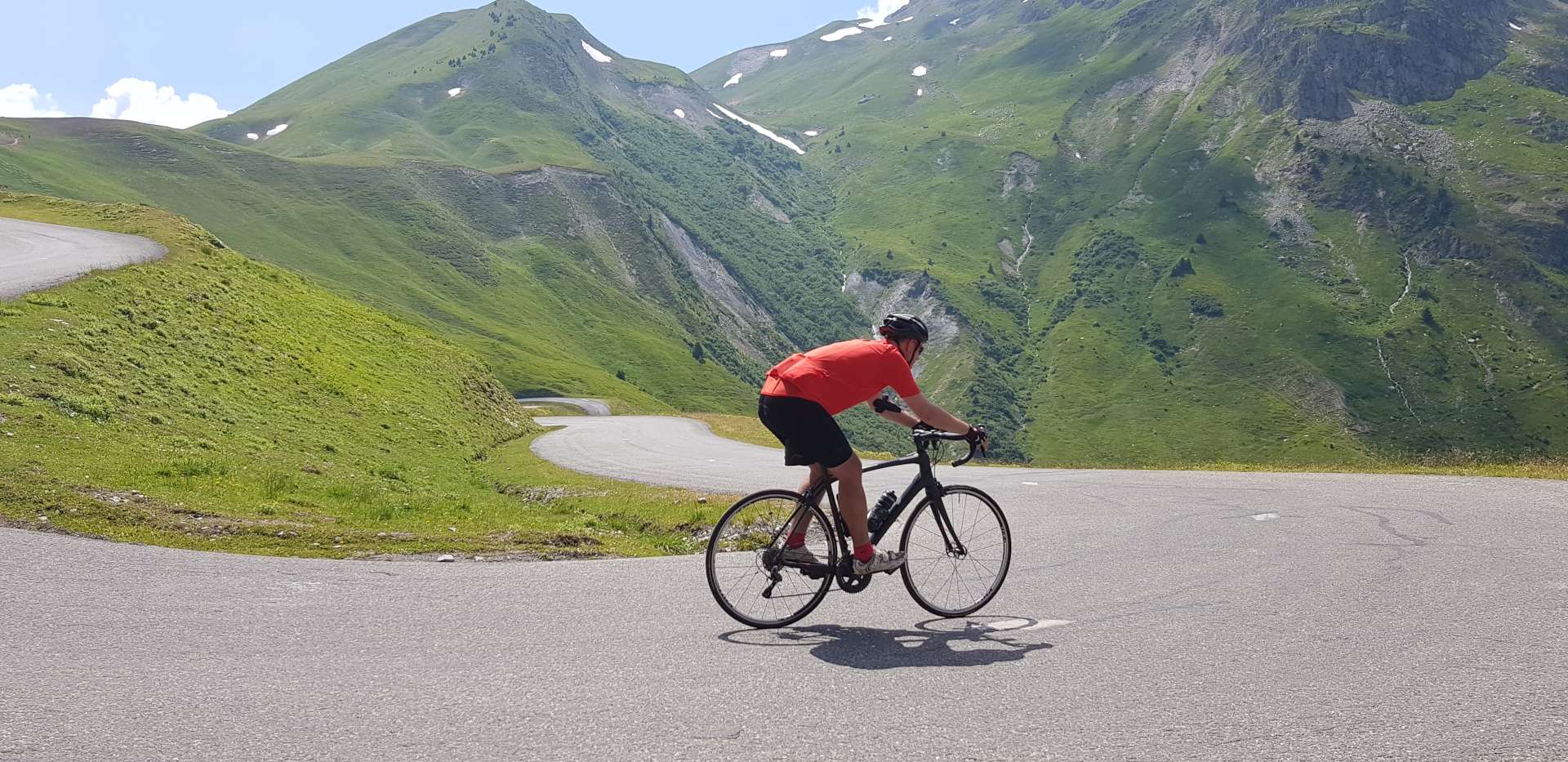
After yesterday’s epic day in the saddle, the intention was to take on a slightly more straightforward challenge. At points it was clear this wasn’t that easy ride! For the third day running, we rode straight out the hotel car park & rolled slightly downhill for 3 miles to the small village of Villargondran, for the start of our first climb of the day. The Col du Mollard can be tackled from 3 different directions & today we chose the route with 40 hairpins (yes, 40!) through a shaded, deciduous forest.
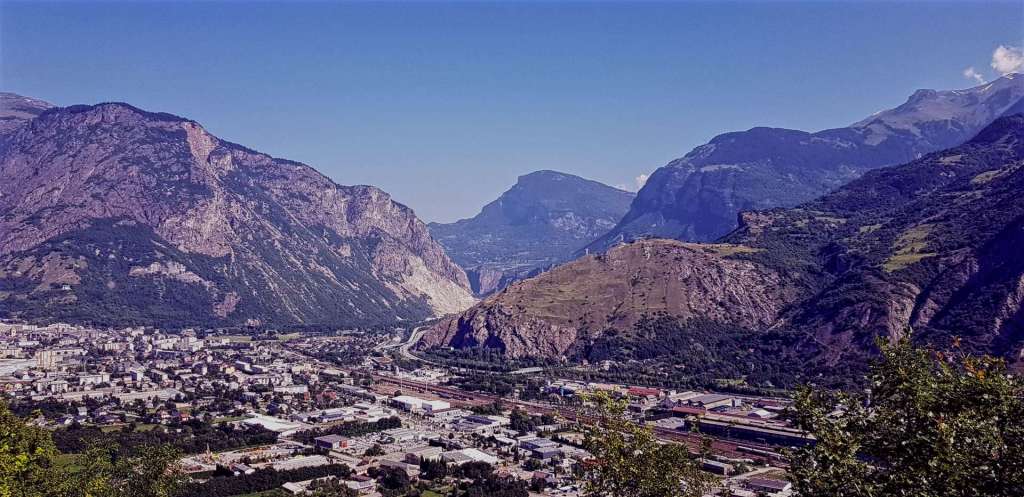
Throughout our stay in France, the temperatures have been in the high 80’s / low 90’s & today was no exception, so we were mighty relieved that the trees kept some of the sun off our backs for the first 45 minutes or so. This meant that we weren’t always aware of how high we’d climbed – we had an opening over St Jean de Maurienne after about 15 minutes of climbing & the valley floor was already more than 500 feet below us.
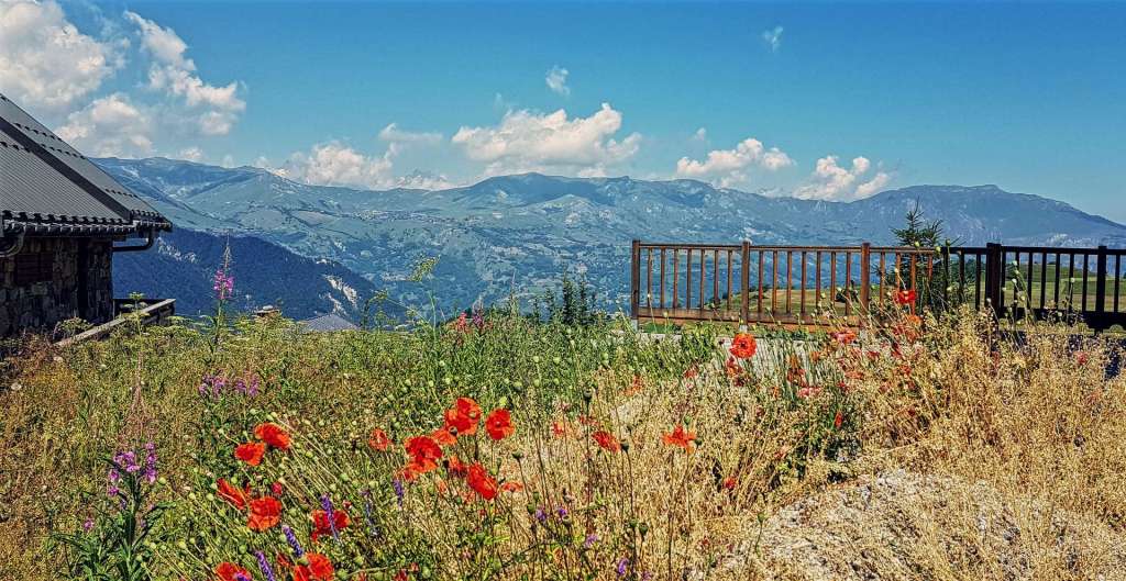
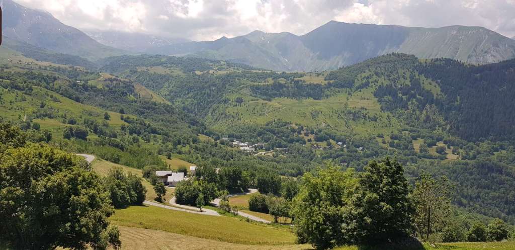
After 45 minutes of climbing the forest opened out onto alpine meadows & there were big views in all directions, although the haze limited the quality of the photos. In addition, the higher mountain peaks were hidden by cotton wool style clouds. We could just make out the classic route up the Col de le Croix de Fer on the opposite side of the valley, as it wound its way around the bluffs & promontories or cut through the rock via the 4 small tunnels.
At this point, we still had another 5 or 6 miles of climbing to reach the summit of Col du Mollard, in the skiing village of Albiez-Le-Vieux & the perennial problem of sourcing water reared it head – this is a daily challenge on the bike in high temperatures, as we only carry 1.5 litres split between 2 bidons. Sometimes the villages will have a communal tap/spring where cyclists can fill their water bottles. The tricky bit is finding where they are, as not all free flowing water is drinkable. Luckily Albiez-Le-Jeune came to our aid & I was able to top off my two empty bottles.
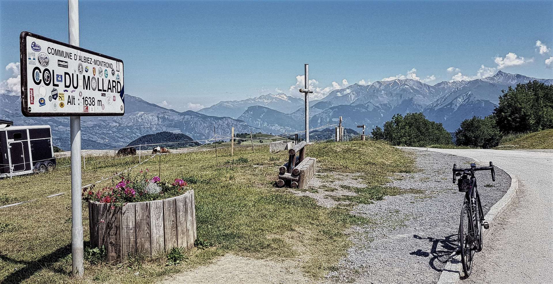
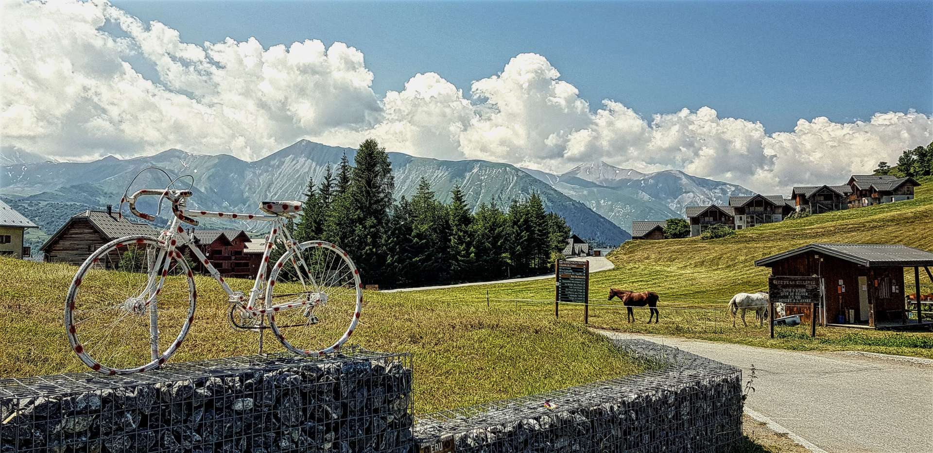
We eventually reached the summit & the village had entered into the Tour de France spirit by decorating an old racing bike in the red polka dots of the King Of The Mountains. Once I’d taken my customary photos, we found a neat place for lunch, with views towards the our next climb, which gave us something else to chew over, as well as our rather tasty burger!
The descent from the Mollard to join the main Croix de Fer route had roadworks, gravel & was in generally poor condition, but we both made it down safely, which is the measure of any descent. We joined the climb 10 miles from the start in St Jean de Maurienne, but there were still another 9.5 miles to go – this is a Hors Categorie in the Tour for a reason!
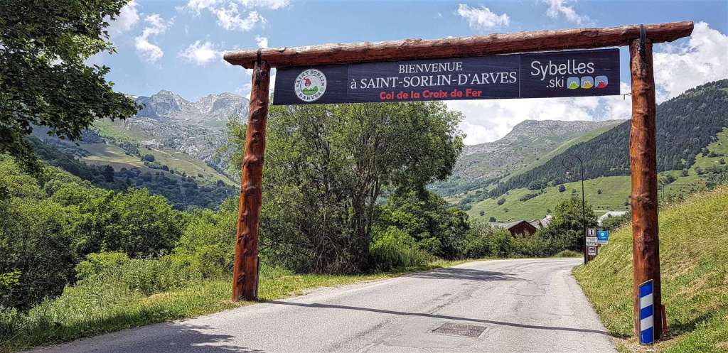
The first 4 miles are gentle, with gradients averaging between 5% & 7%, but then it gets tough – as we arrived at Saint-Sorlin-d’Arves the road ramped up to 11% for about 1.5 miles. As if this wasn’t a big enough challenge for me (it was, in case you’re wondering!), there was yet more roadworks & all the tar had been removed from the road, so we were riding on the metalworks, which made for a jarring experience in many ways!!!
Once we were through town, the magic of the climb began. The final 4 miles of the route are up a sheer wall at the end of the valley & this is achieved by a series of amazing switchbacks that rise ever higher above the ski village below.
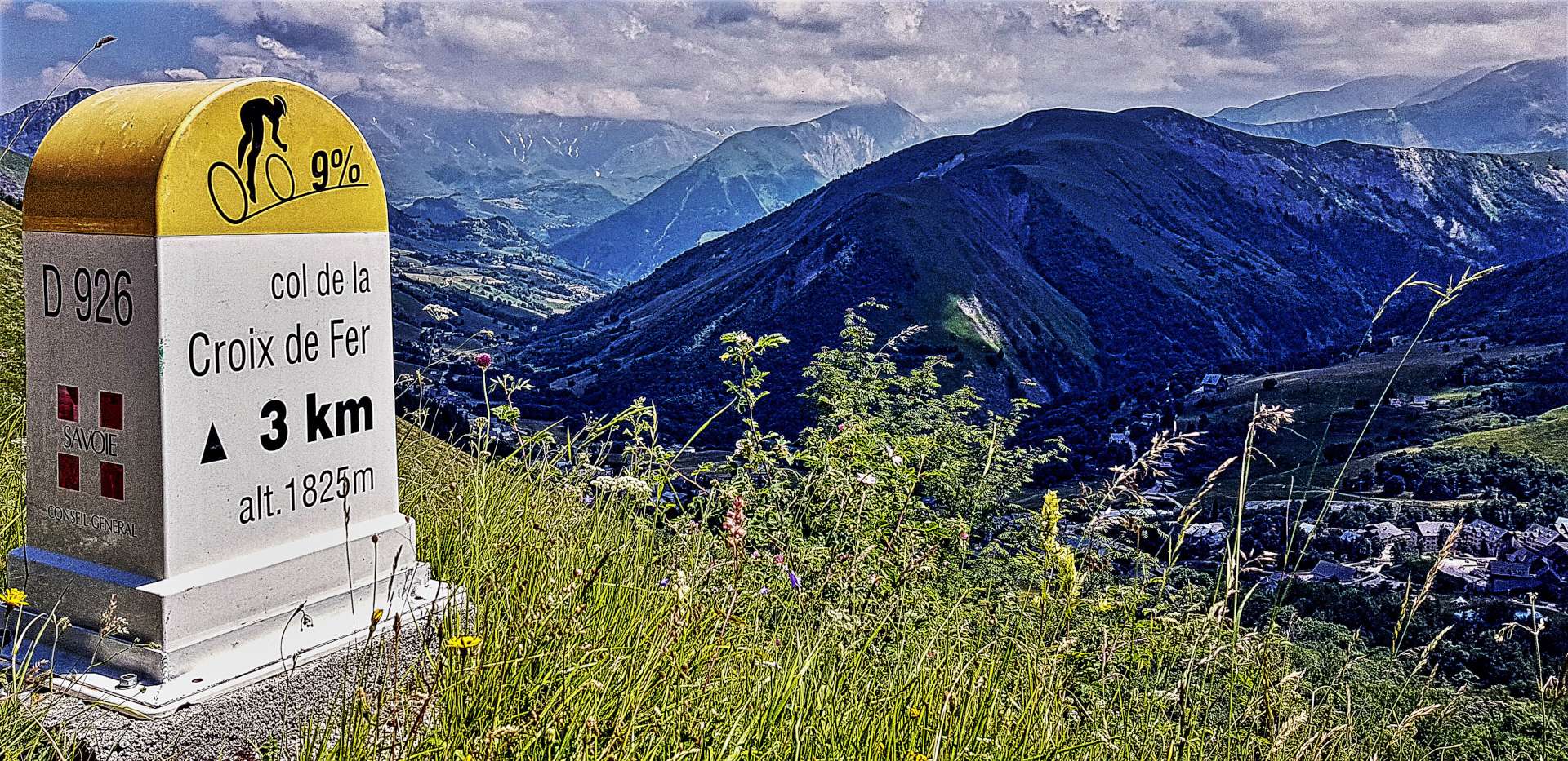

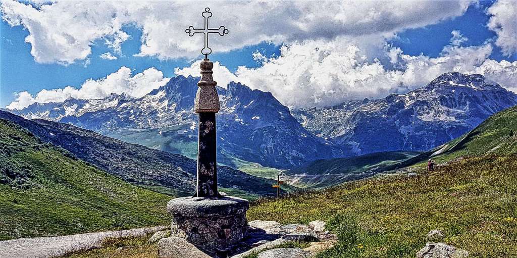
It’s a consistent 8% to 9% throughout, until eventually we passed through a gap in the rock & there was the Col de la Croix de Fer signpost! This is one of my favourite places, as it is named Croix de Fer for a reason – it has an Iron Cross at the summit, which always makes for a great photo! A few years ago some vandals knocked the cross down & stole part of the base, but I’m delighted to report it’s now back in pristine condition again.
After a quick espresso, we set off to bag our 3rd & final Col of the day & less than 4 minutes later we’d also climbed the Col du Glandon! This is a huge climb from either St-Etienne-des-Cuines (12.5 miles at 7.1%) or Allemont (20 miles at 4.75%), but it’s only a 2 mile descent from the Croix de Fer, with a small 100 foot climb to get to the summit. Beware anyone who claims to have climbed both the Croix de Fer & Glandon in a single day!!


The first 2 miles of the descent from the Col du Glandon are crazy, as the road hairpins down 12% gradients – I could hear my brakes squealing every time I applied them! We zig-zagged through grassland as we plummeted down the first 4 miles, with cows & sheep kept in their ‘fields’ with electric fencing….you wouldn’t want to meet one of them on the road!

All of a sudden the grassland stopped & was replaced by woodland, which makes spotting the exit of corners that much trickier, so concentration was fully engaged. We had huge views across the valley to the lower slopes of the Col de Madeleine, although the haze meant I couldn’t get any ‘Top 5’ photos today.
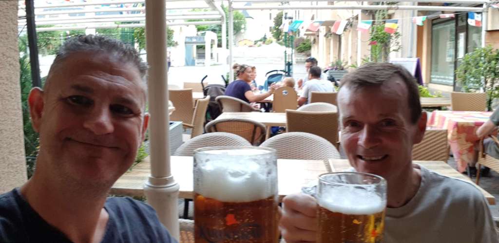
The final 5 miles of the descent were on a wide two lane road, with fast, sweeping corners & at last I could feel some of my confidence returning, as I wasn’t having to continually second guess the corners, I could actually ride through them. Once we reached St Etienne, we had a relatively flat return to the hotel by quiet back roads & we were back in time to enjoy a pint as the final few teams in the Tour Team Time Trial came in. What an incredible day of cycling in the huge Maurienne Mountains!