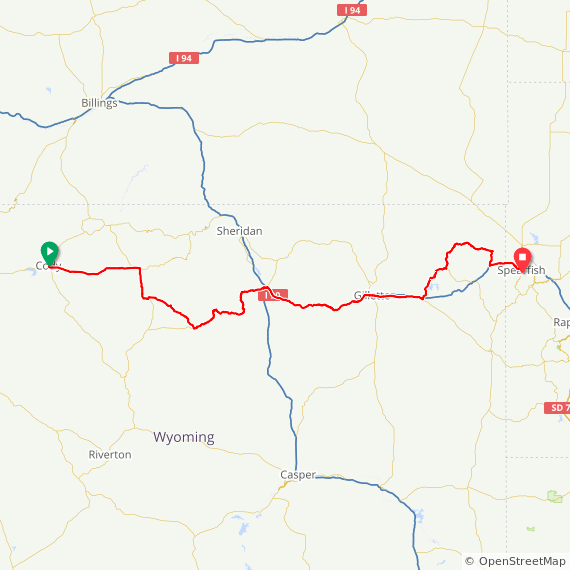
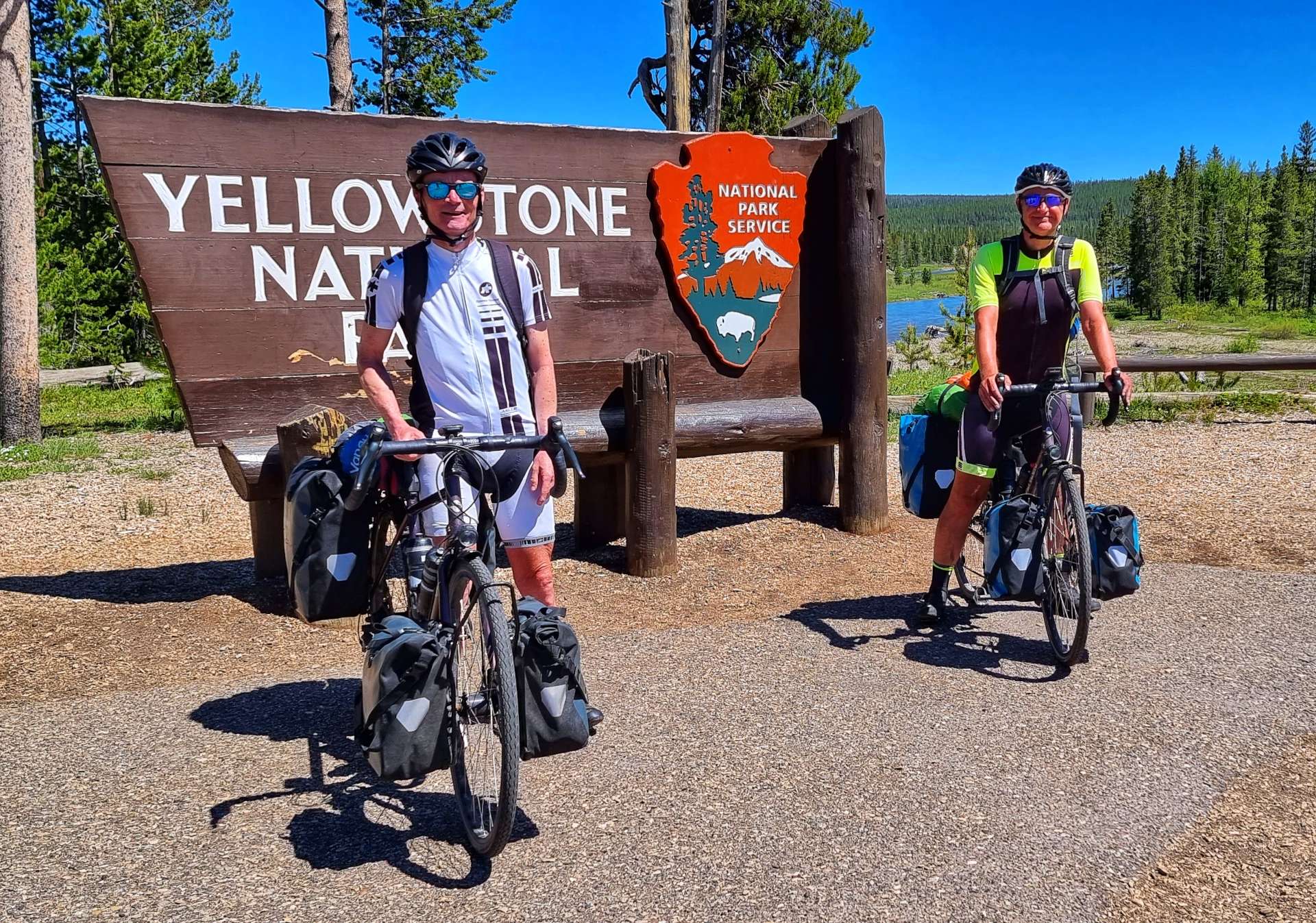
Well, How Did We Get Here? Miles, Feet Climbed, Maps & Profiles.
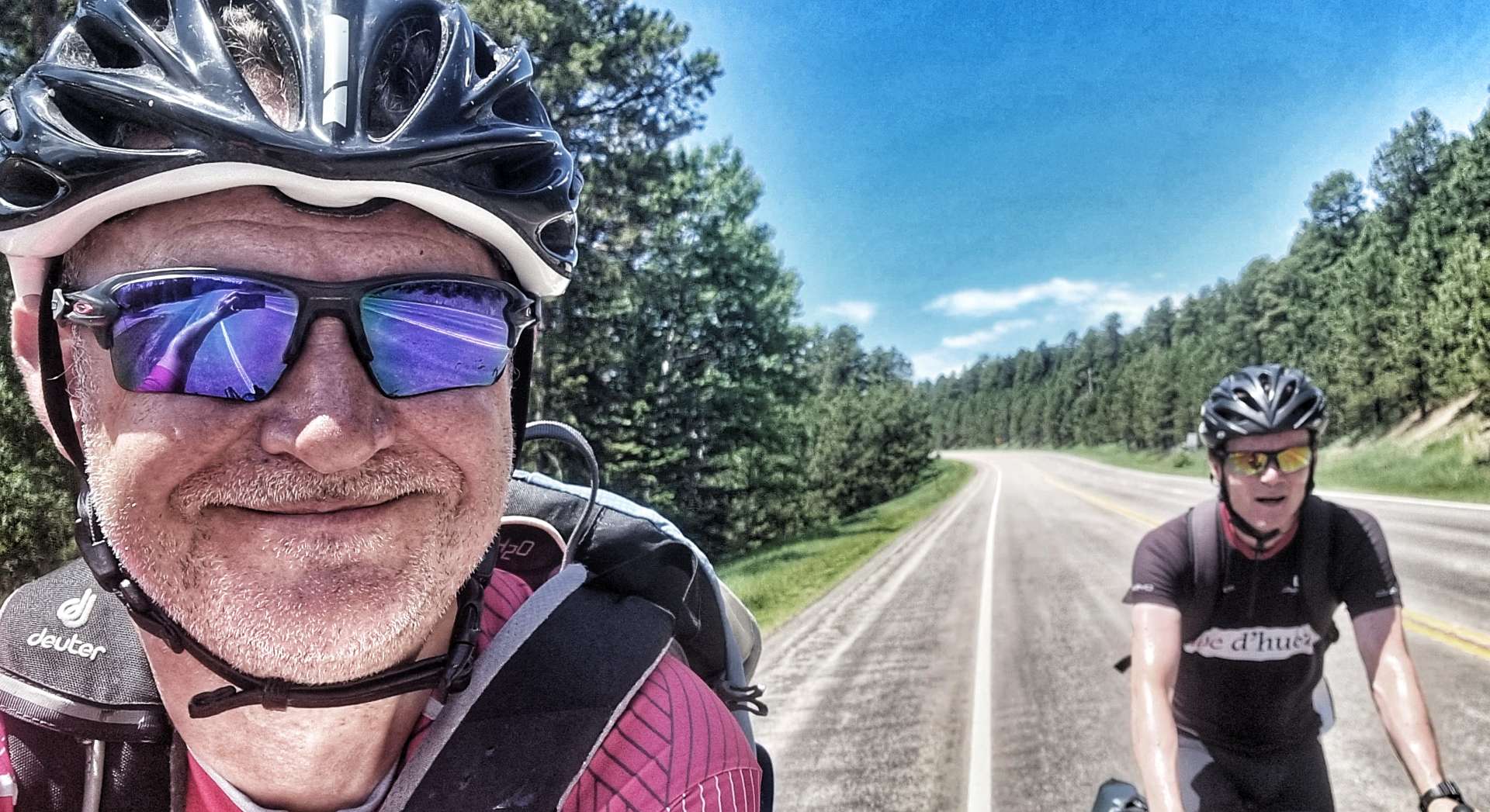
Previous updates described how we travelled from Seattle to Spearfish in the first 9 weeks of our adventure. Now find out where we went & what we did in Week 10! Hopefully picking a single photo to represent each day will refresh my mind when it comes to looking back on my adventure!
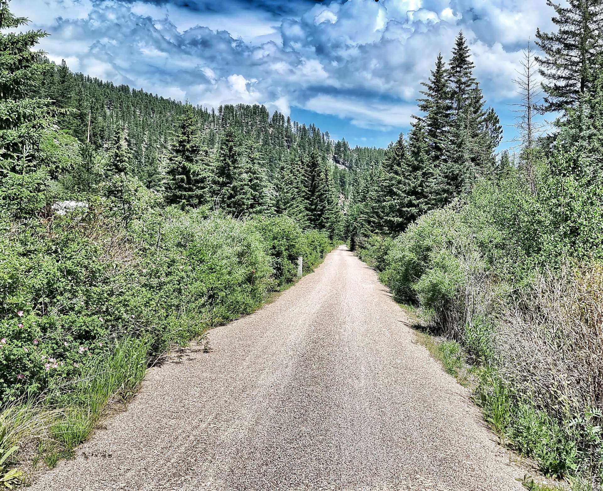
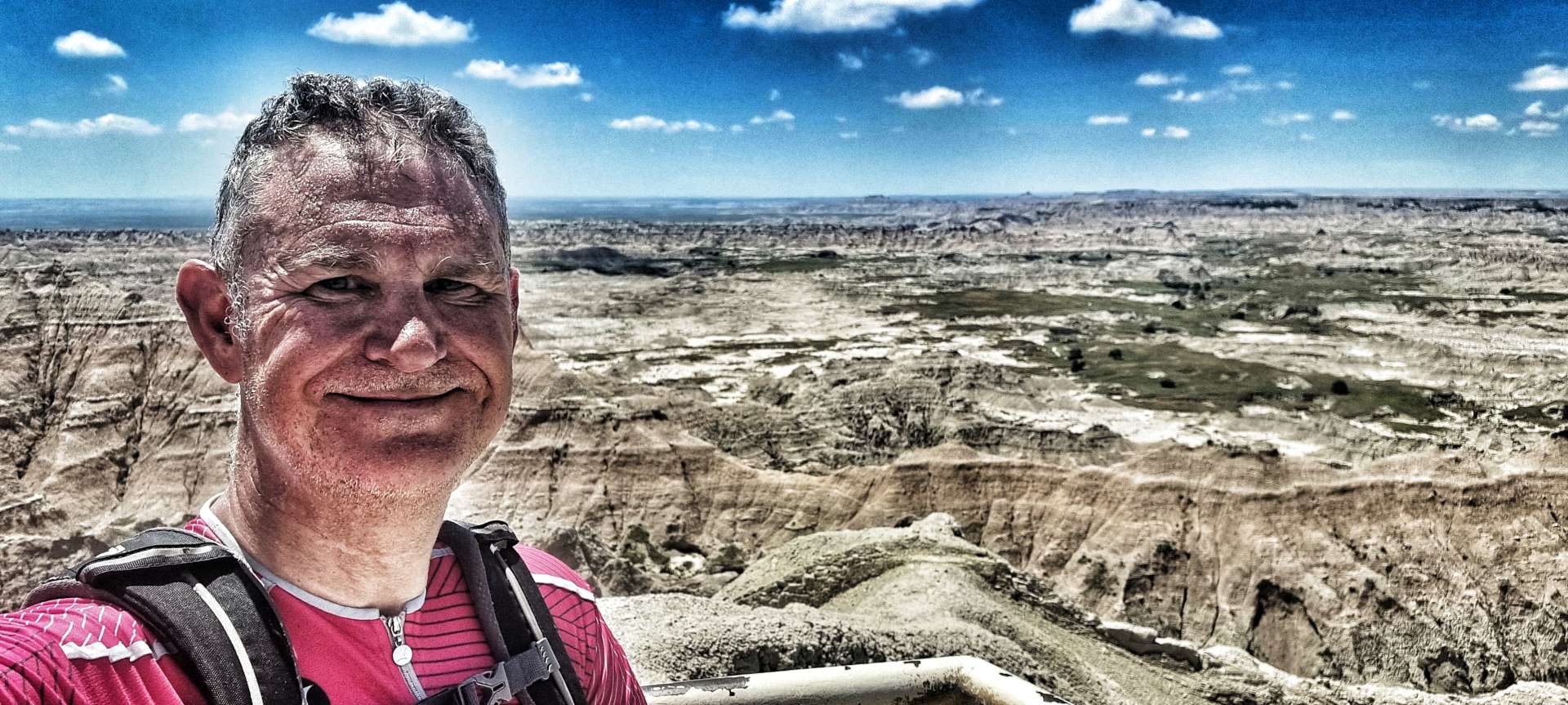
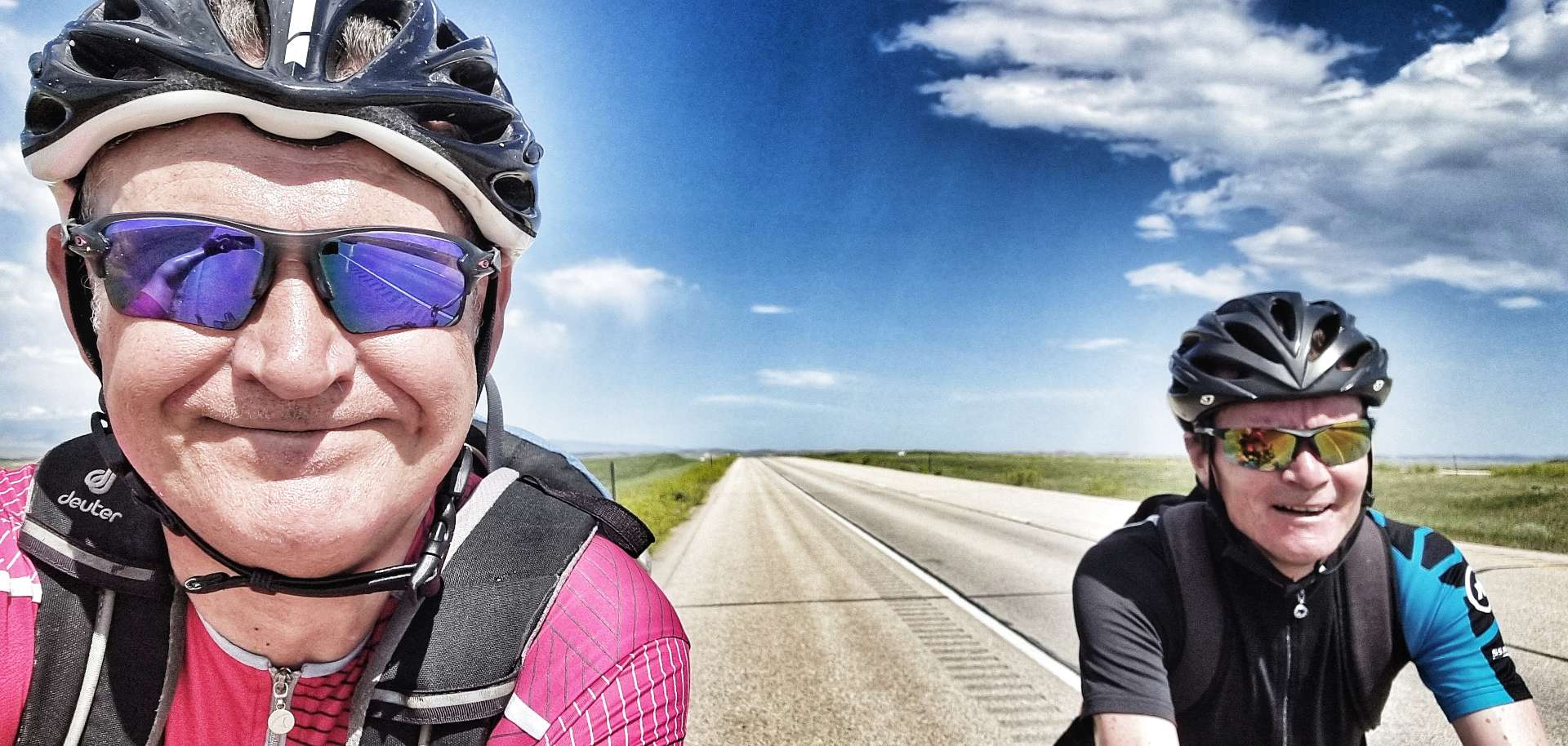
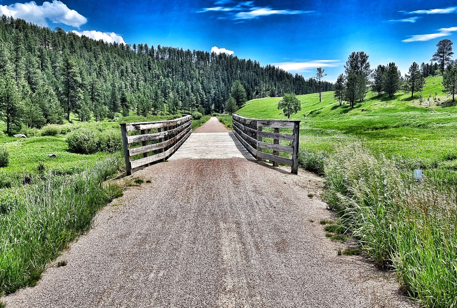
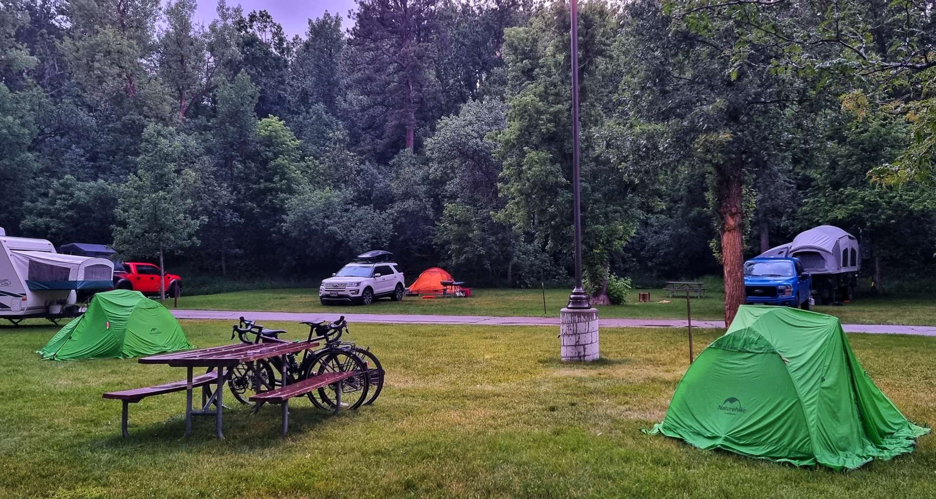
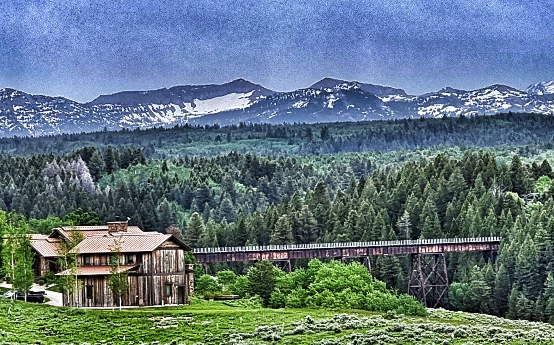
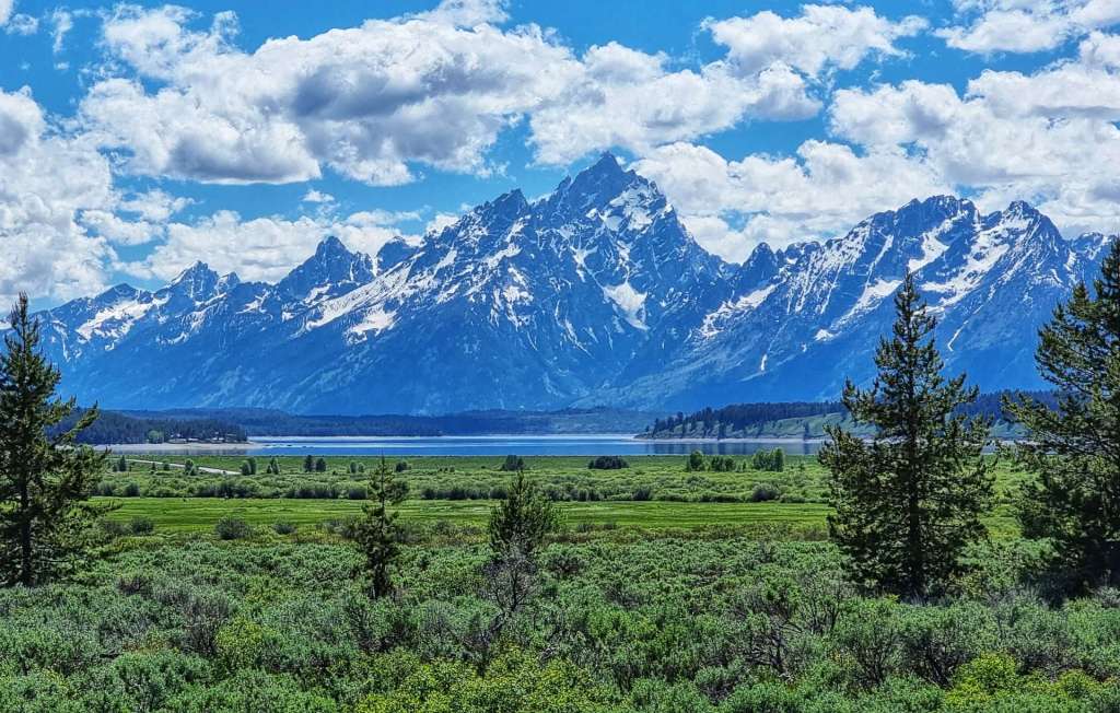
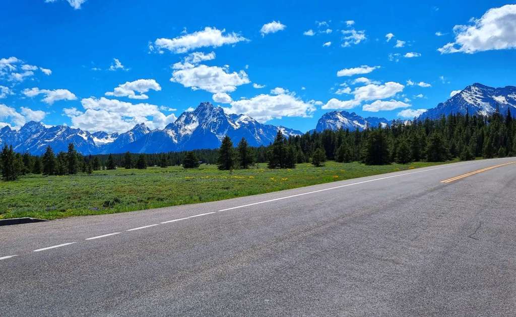
Alex & Mary welcomed us with beer & great conversation on Saturday. Sunday was a real adventure on the crushed limestone & gravel of The George S. Mickelson Trail. Monday was Independence Day & we spent it exploring Crazy Horse, Custer State Park & had our first views of Mount Rushmore. On Tuesday we experienced Mount Rushmore up close & learned about its history, before heading to Rapid City. We had a rare Rest Day on Wednesday & enjoyed some recovery & relaxation. Thursday gave us a brief glimpse of Badlands National Park & a night in a Camping Cabin. Finally, on Friday we had the full Badlands experience – absolutely breath-taking!!!
Another incredible week of making new friends, getting off the beaten track & exploring some of America’s best scenery on our Coast to Coast adventure.
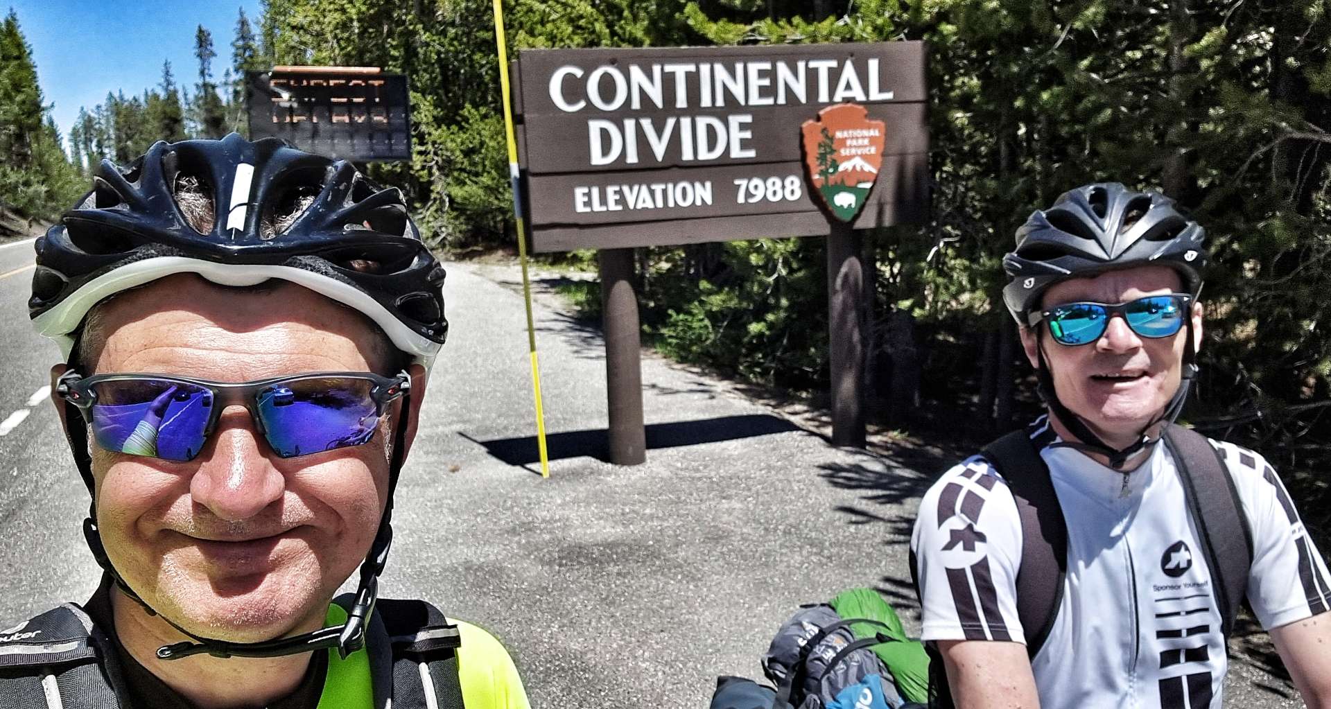
Thursday 7th July to Sunday 10th July – Stages 53 to 55.
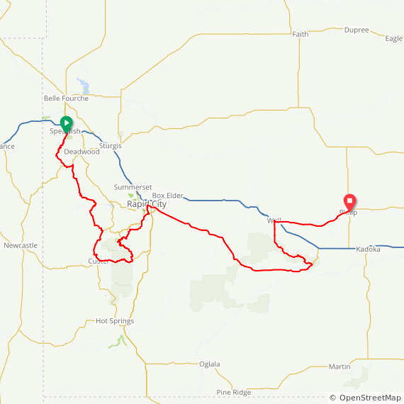
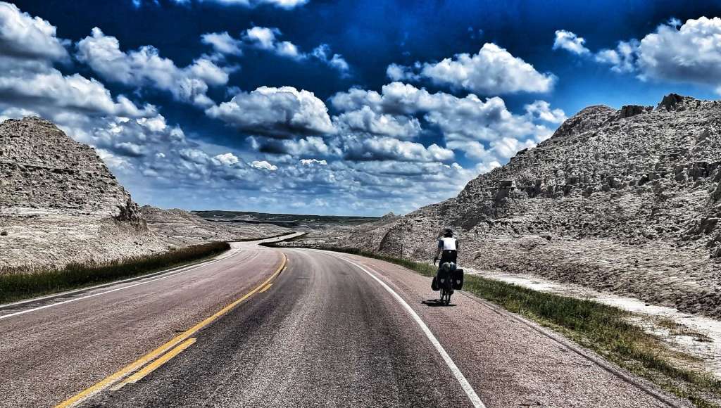
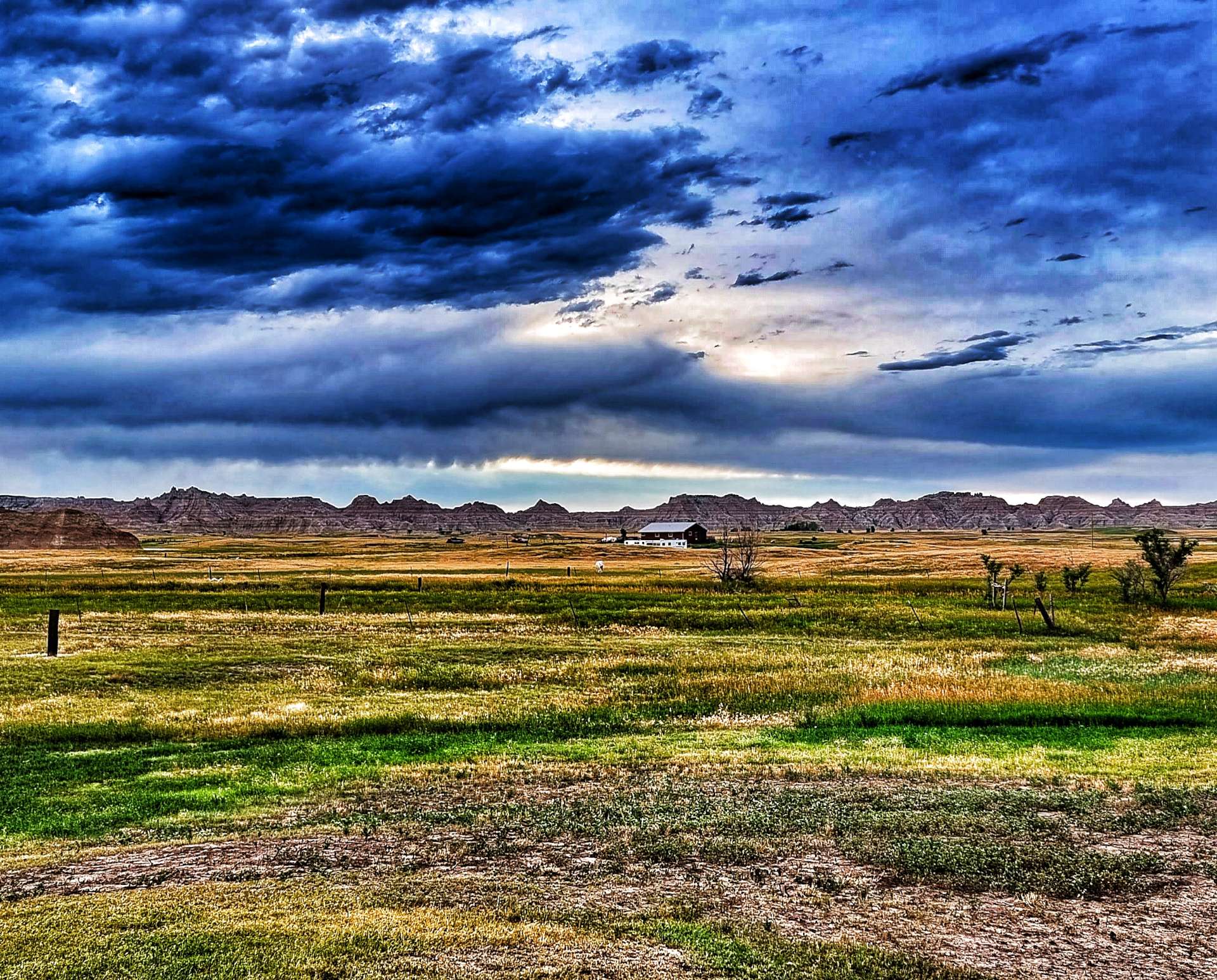
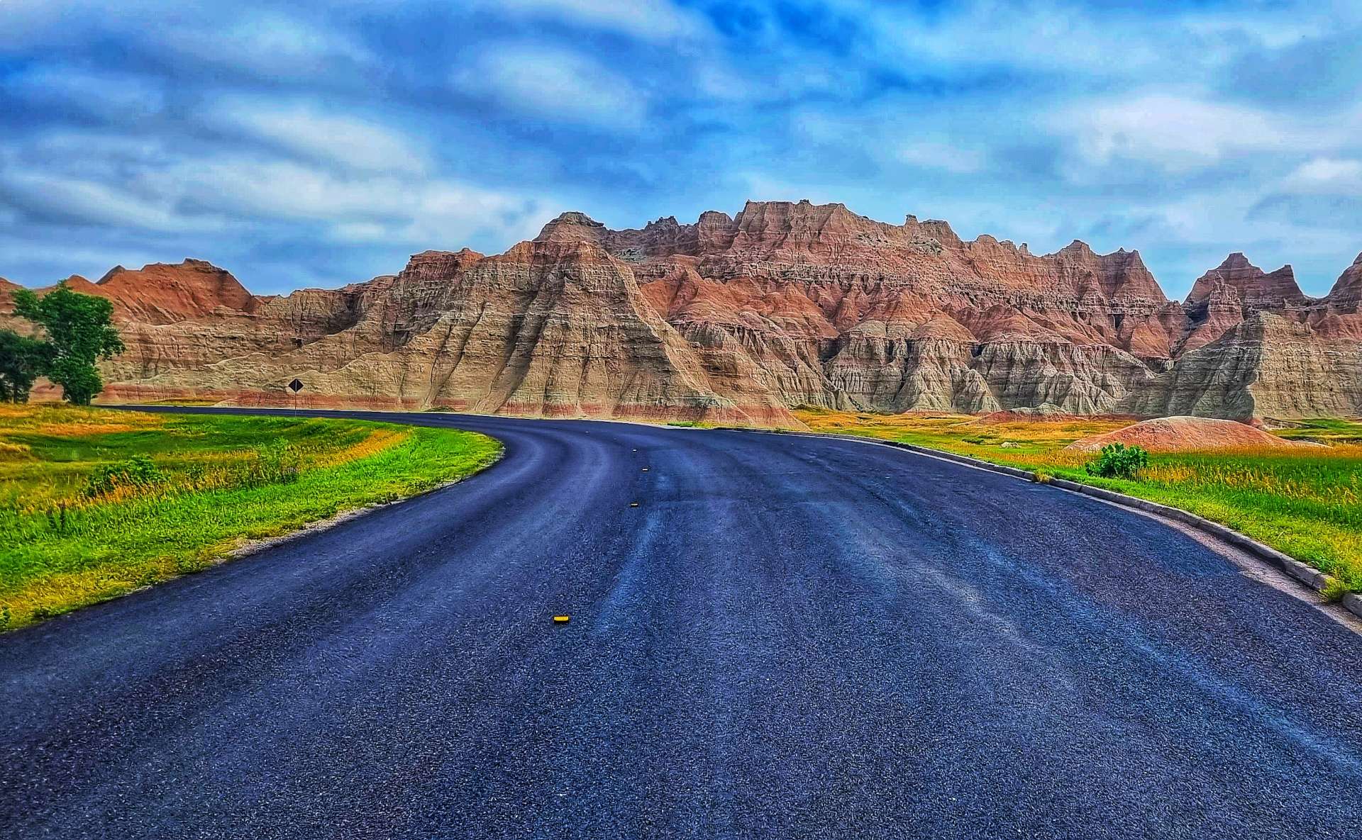
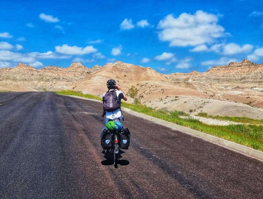
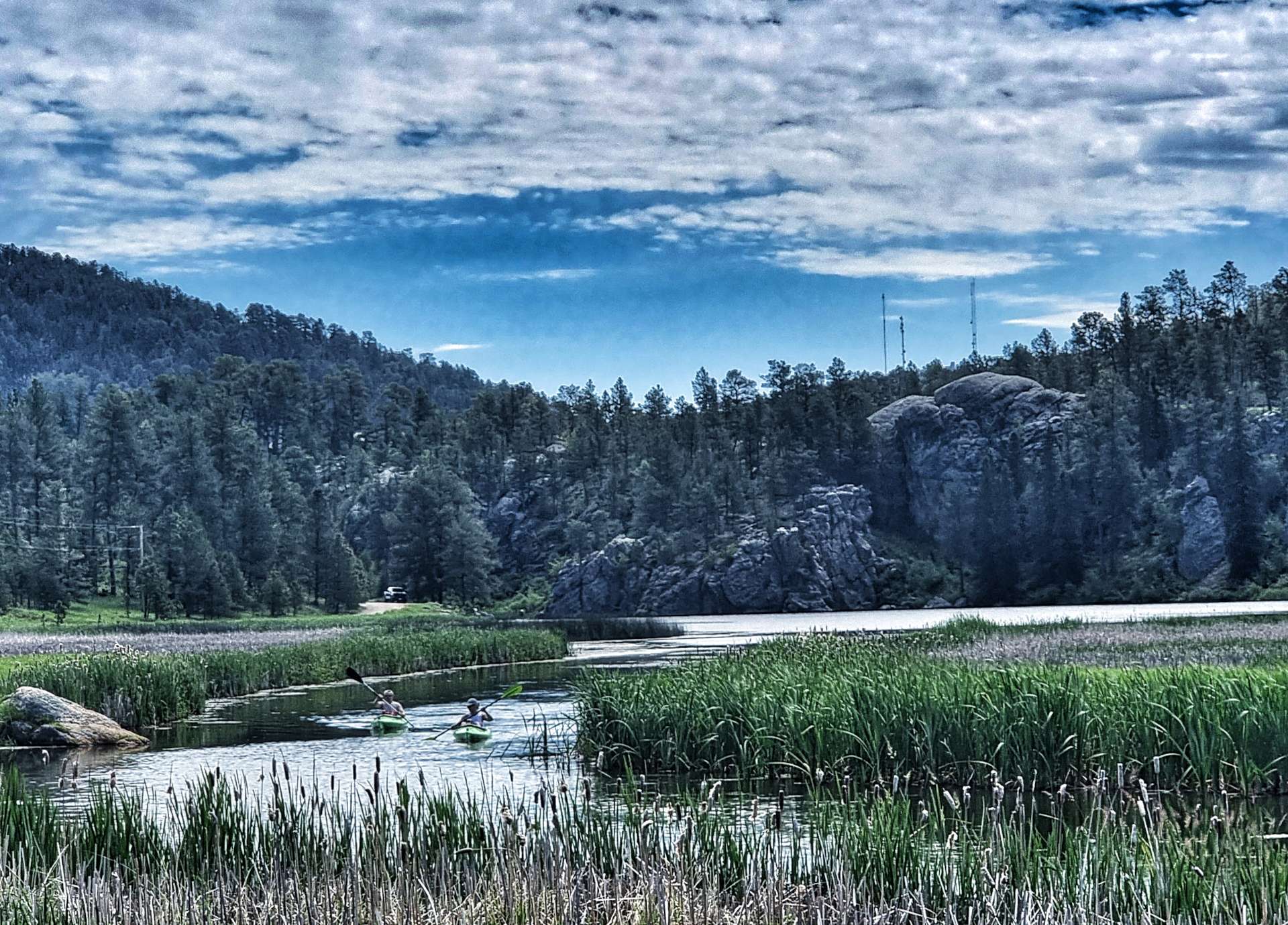
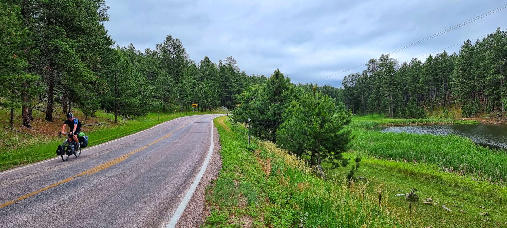
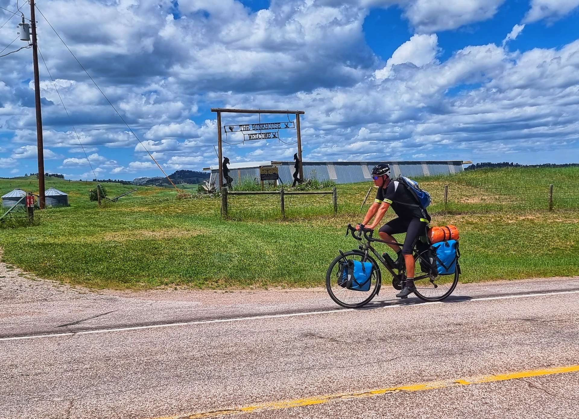
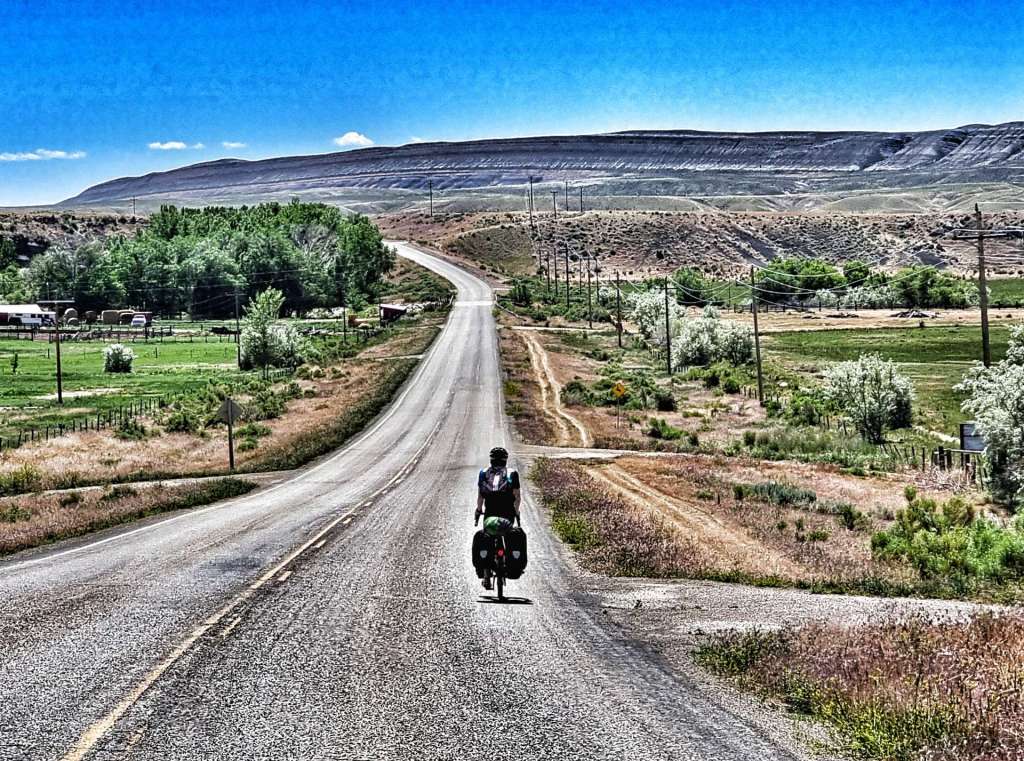
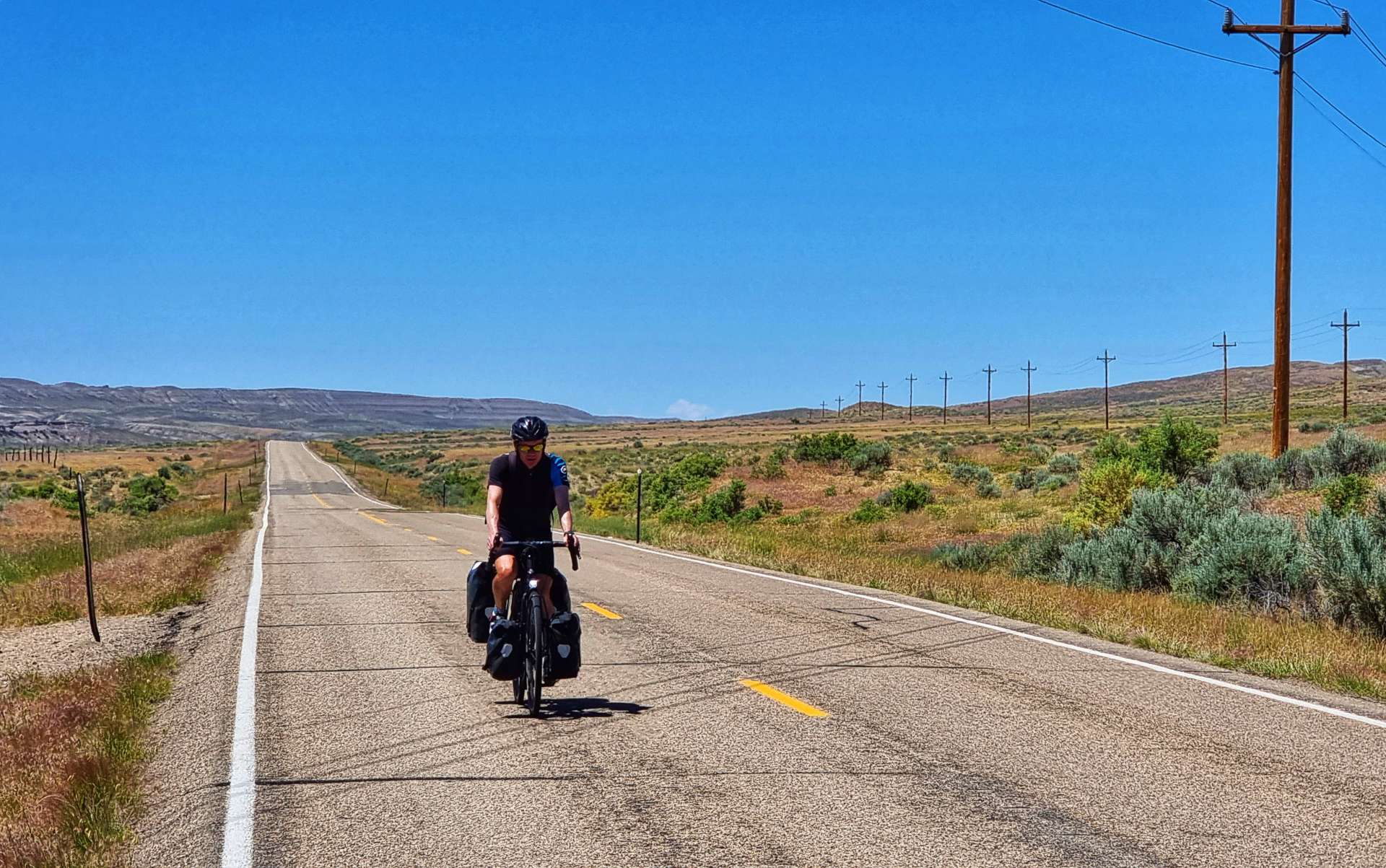
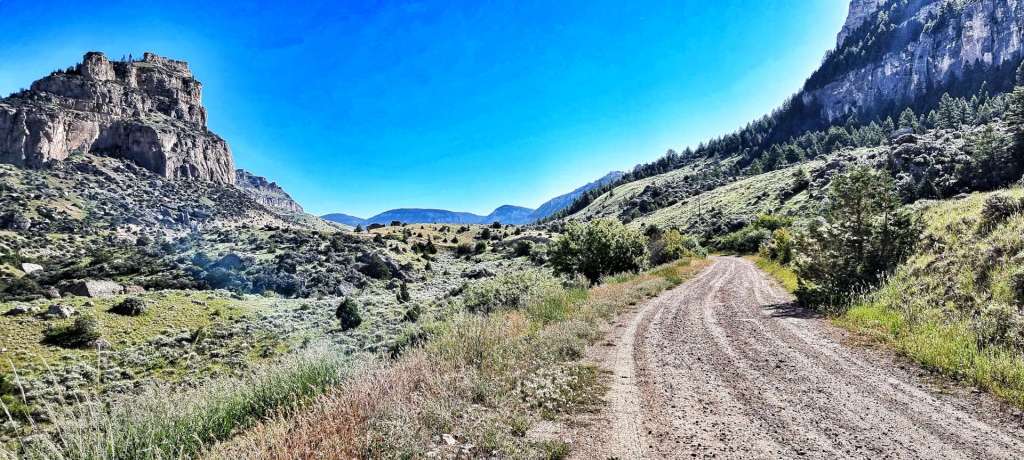
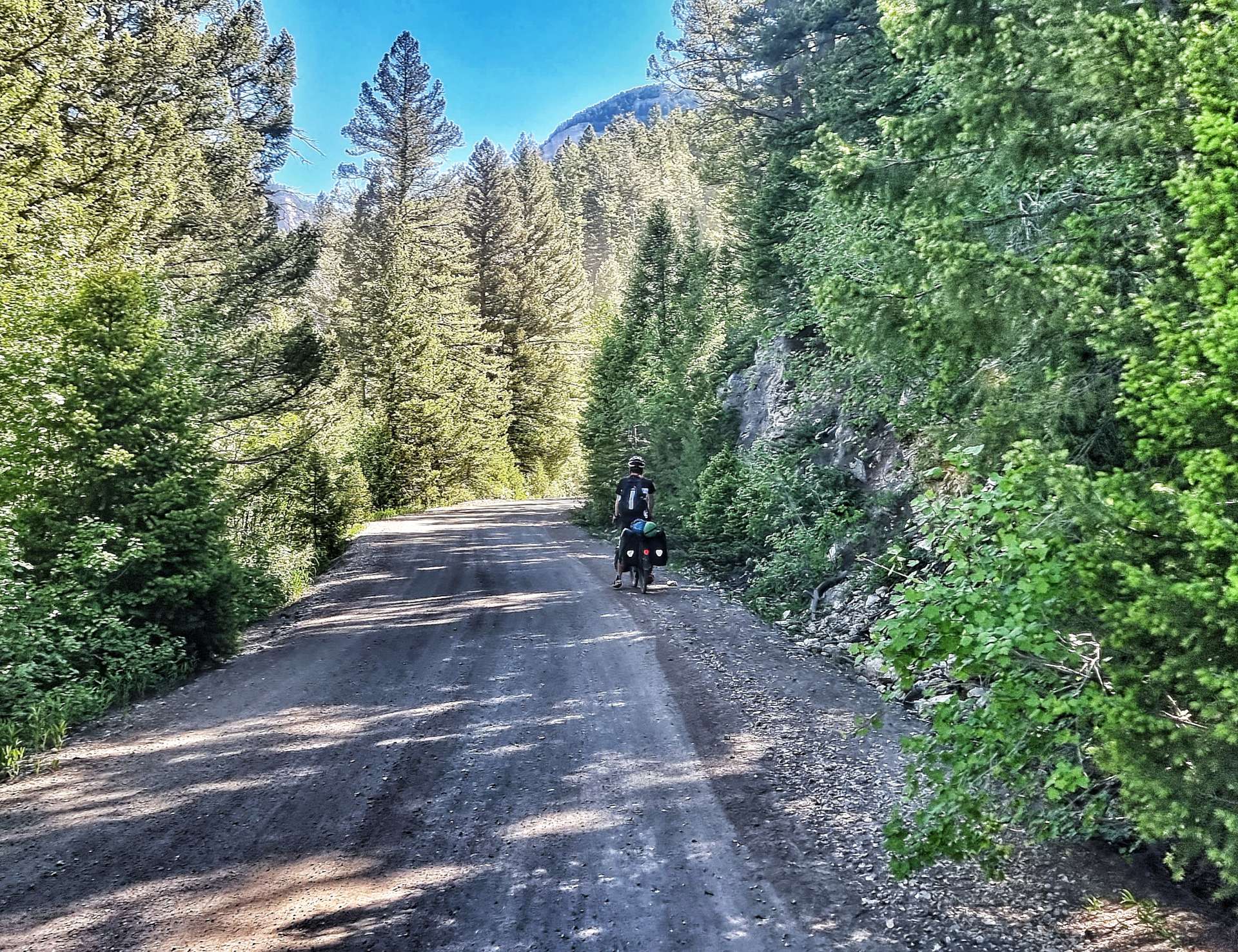
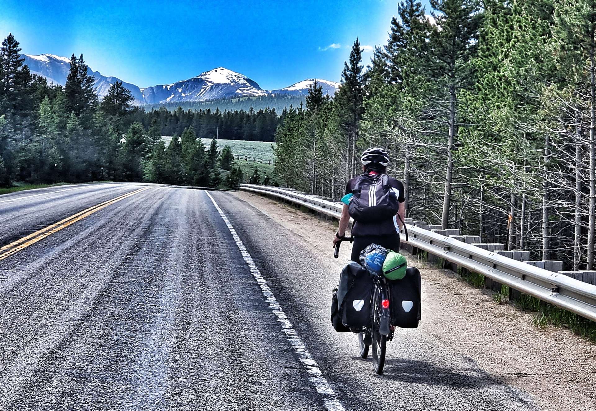
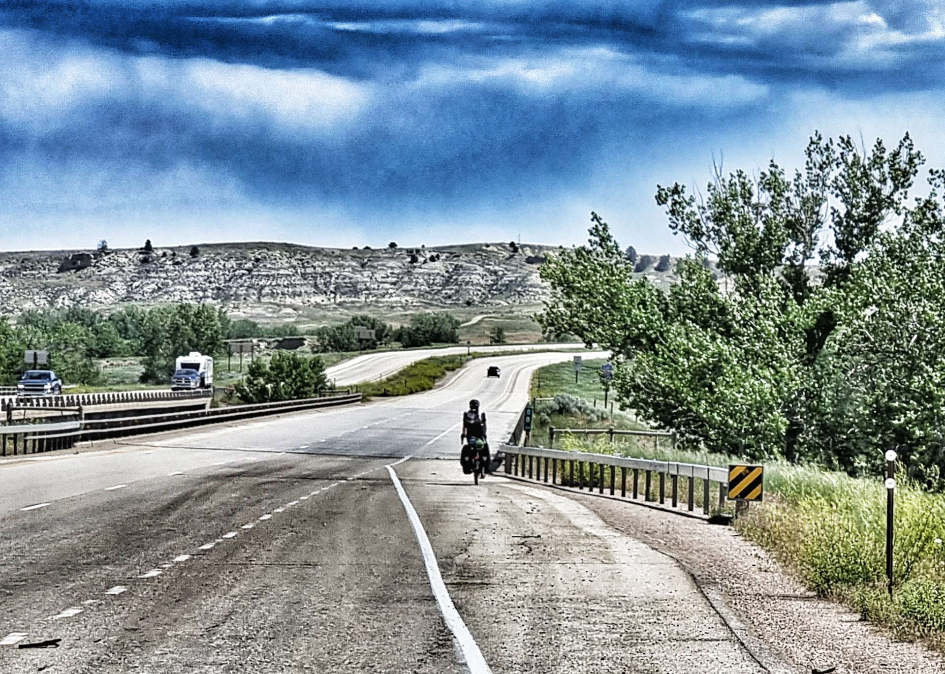
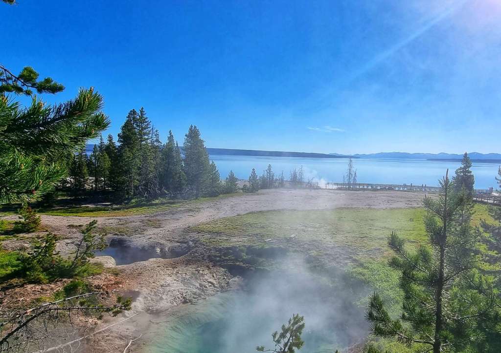
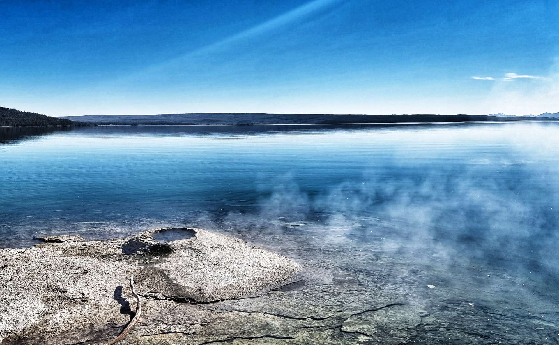
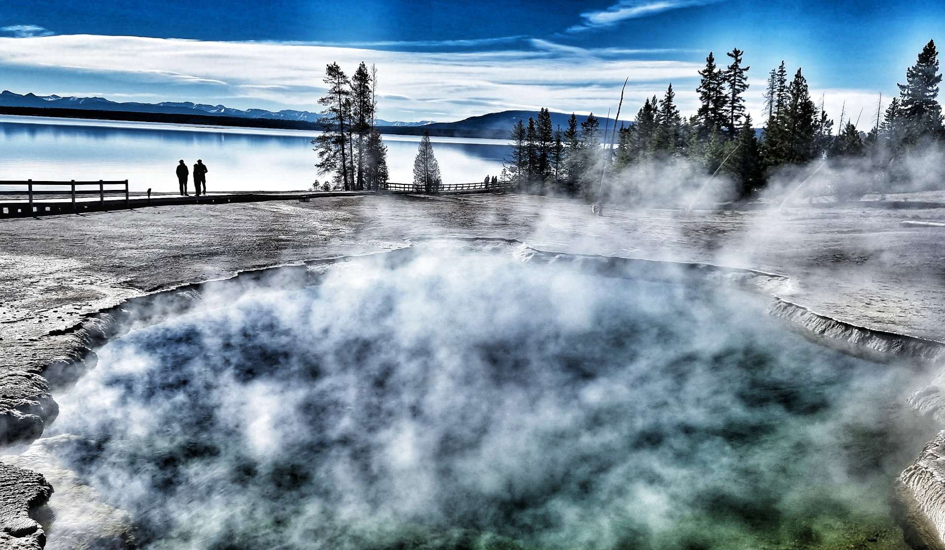
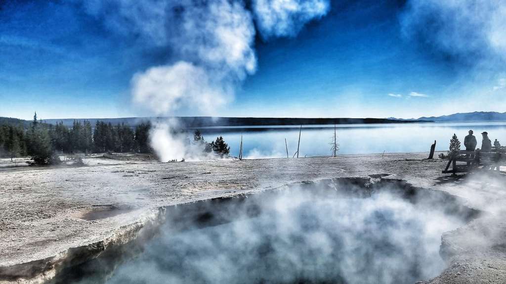
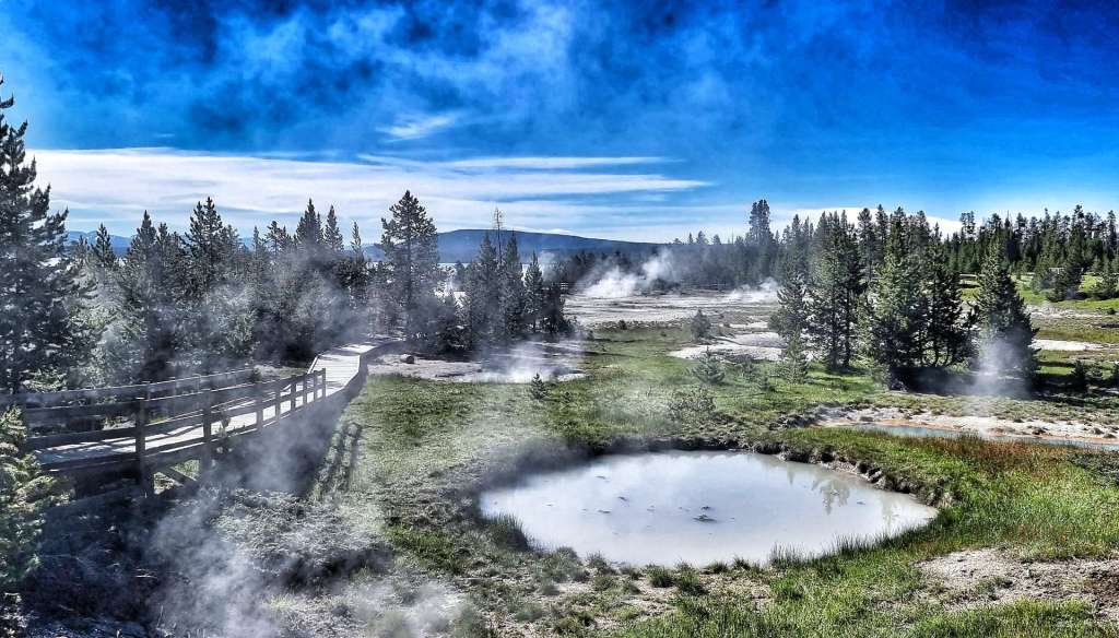
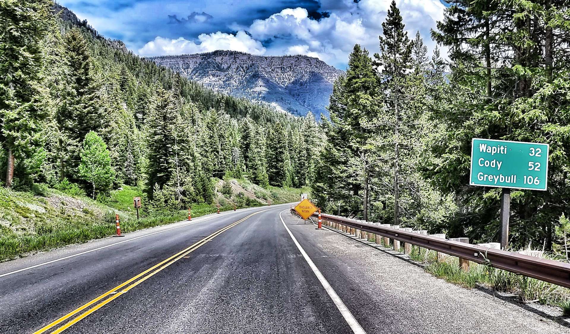
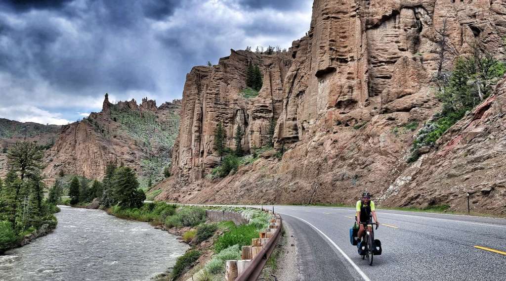
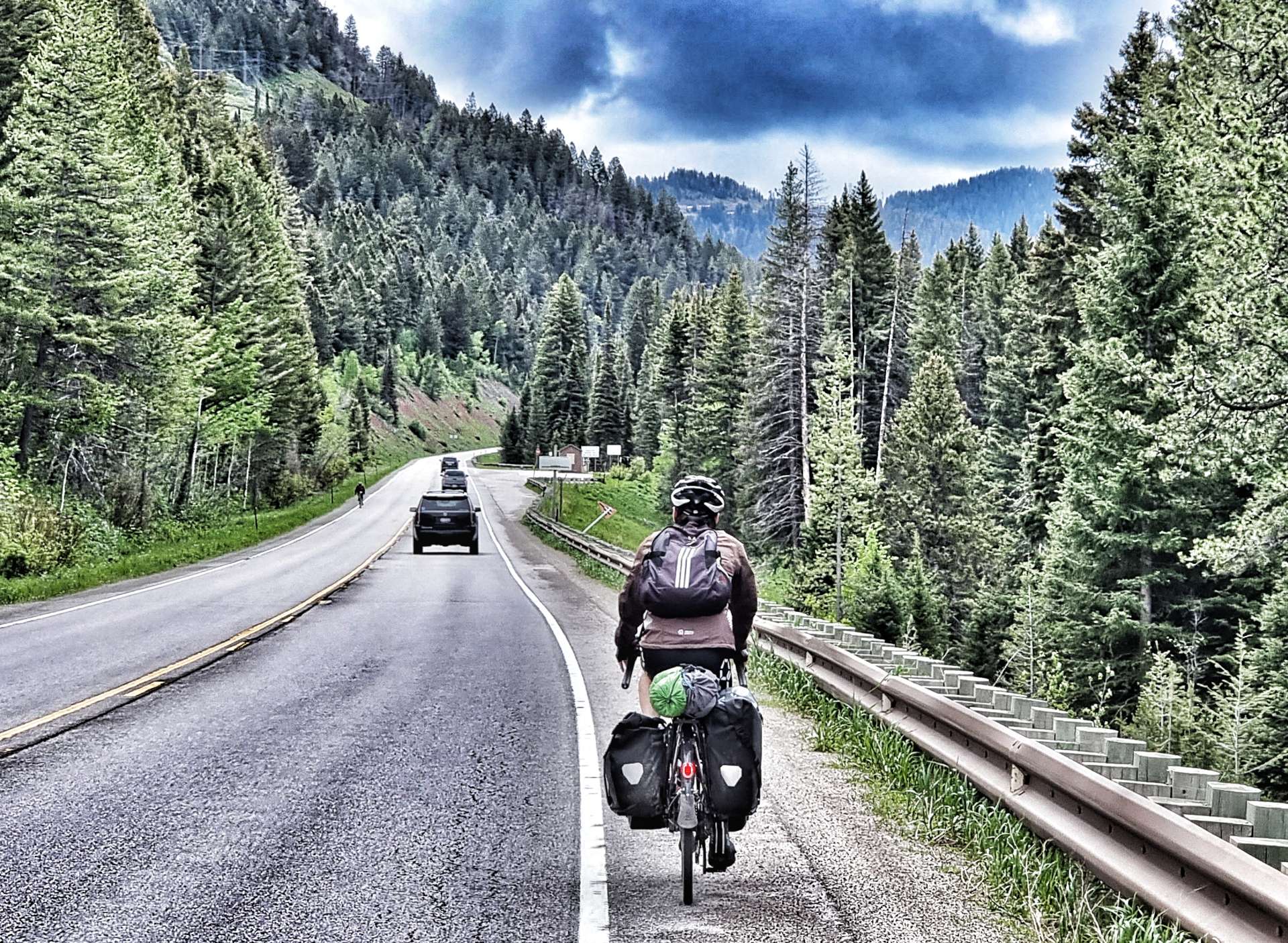
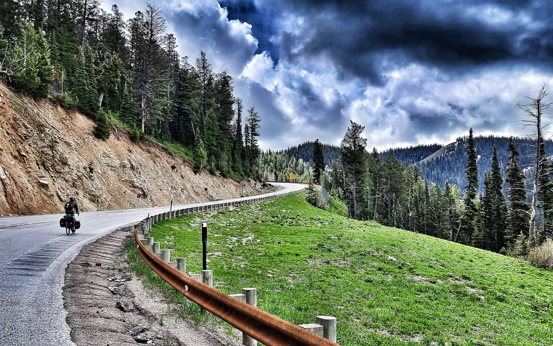
Thursday 7th July – Rapid City to Interior (Stage 53).
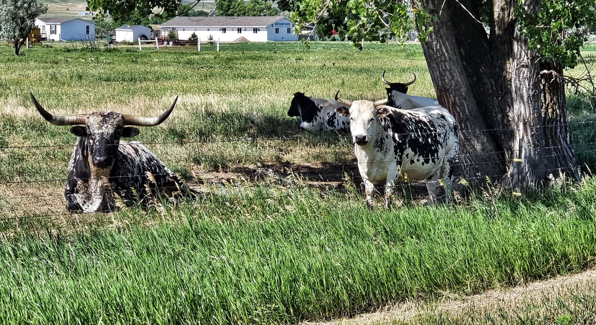
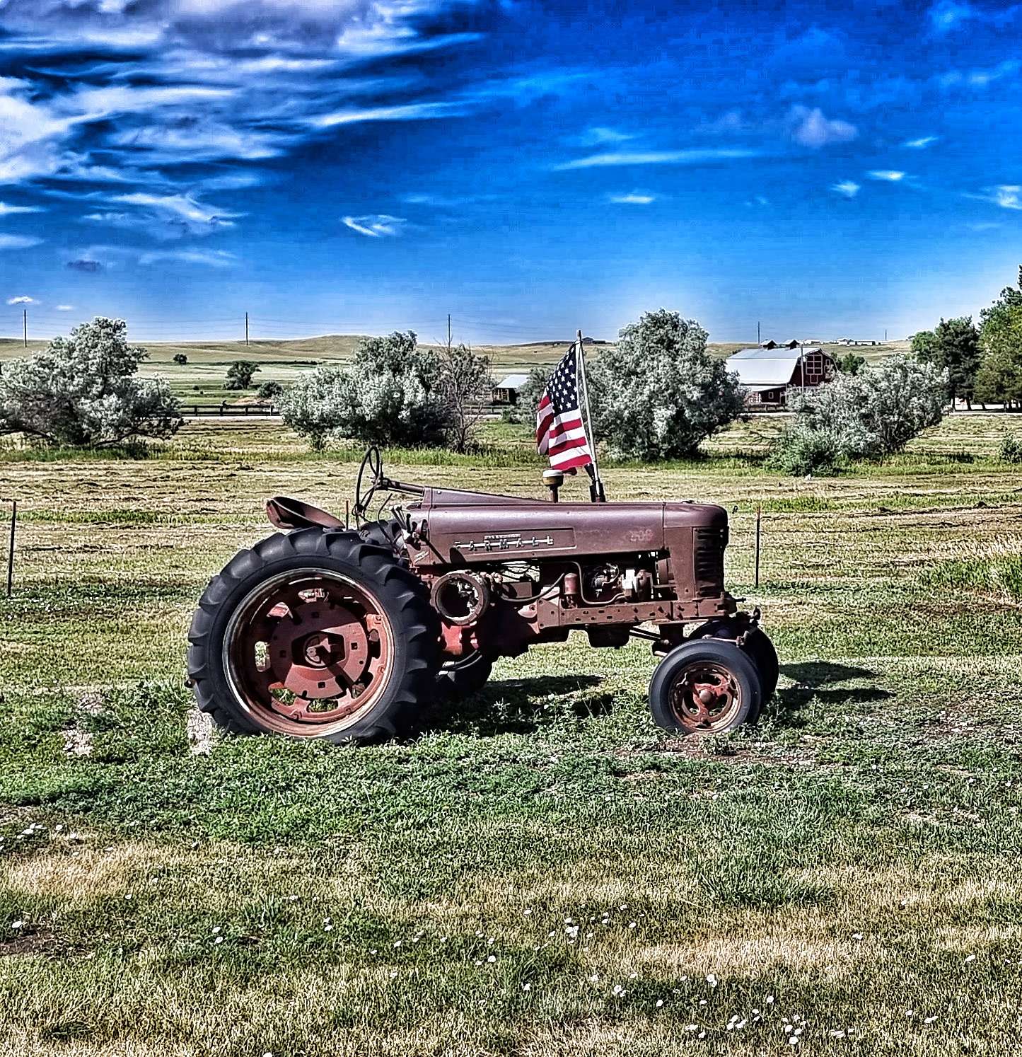
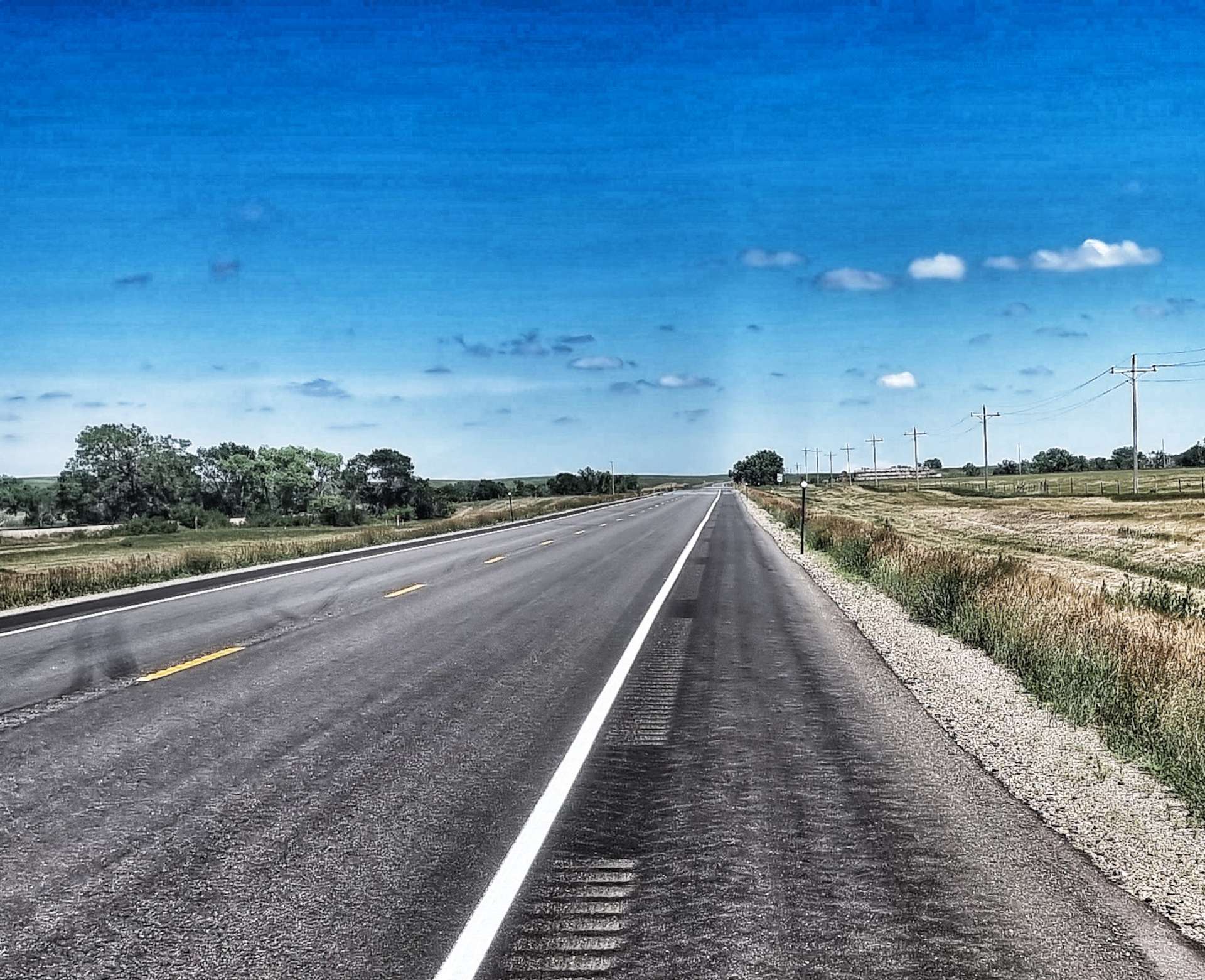
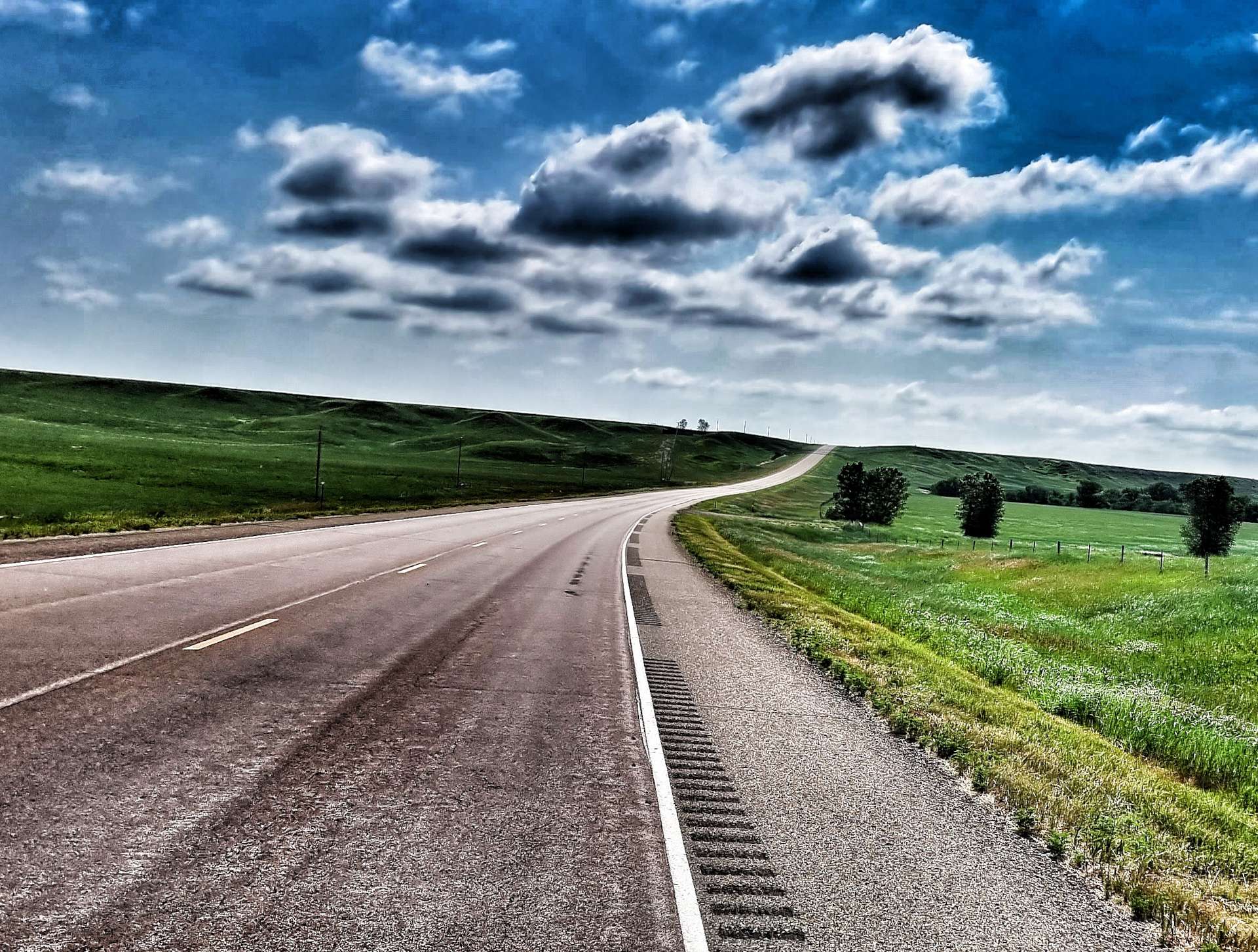
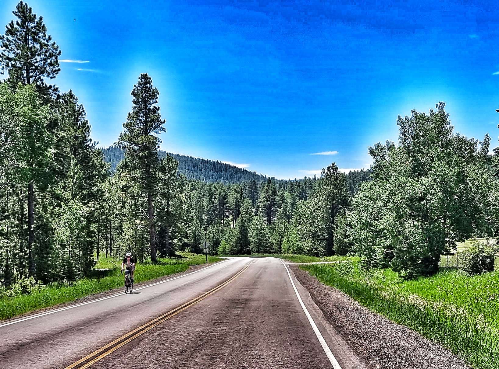
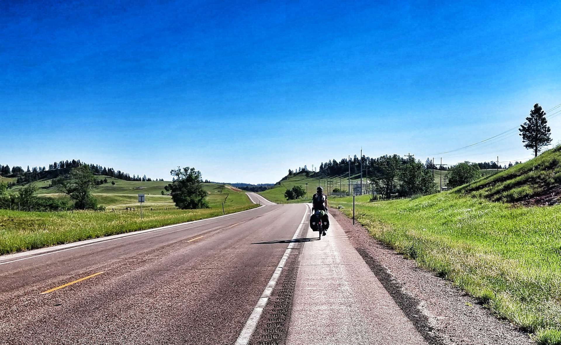
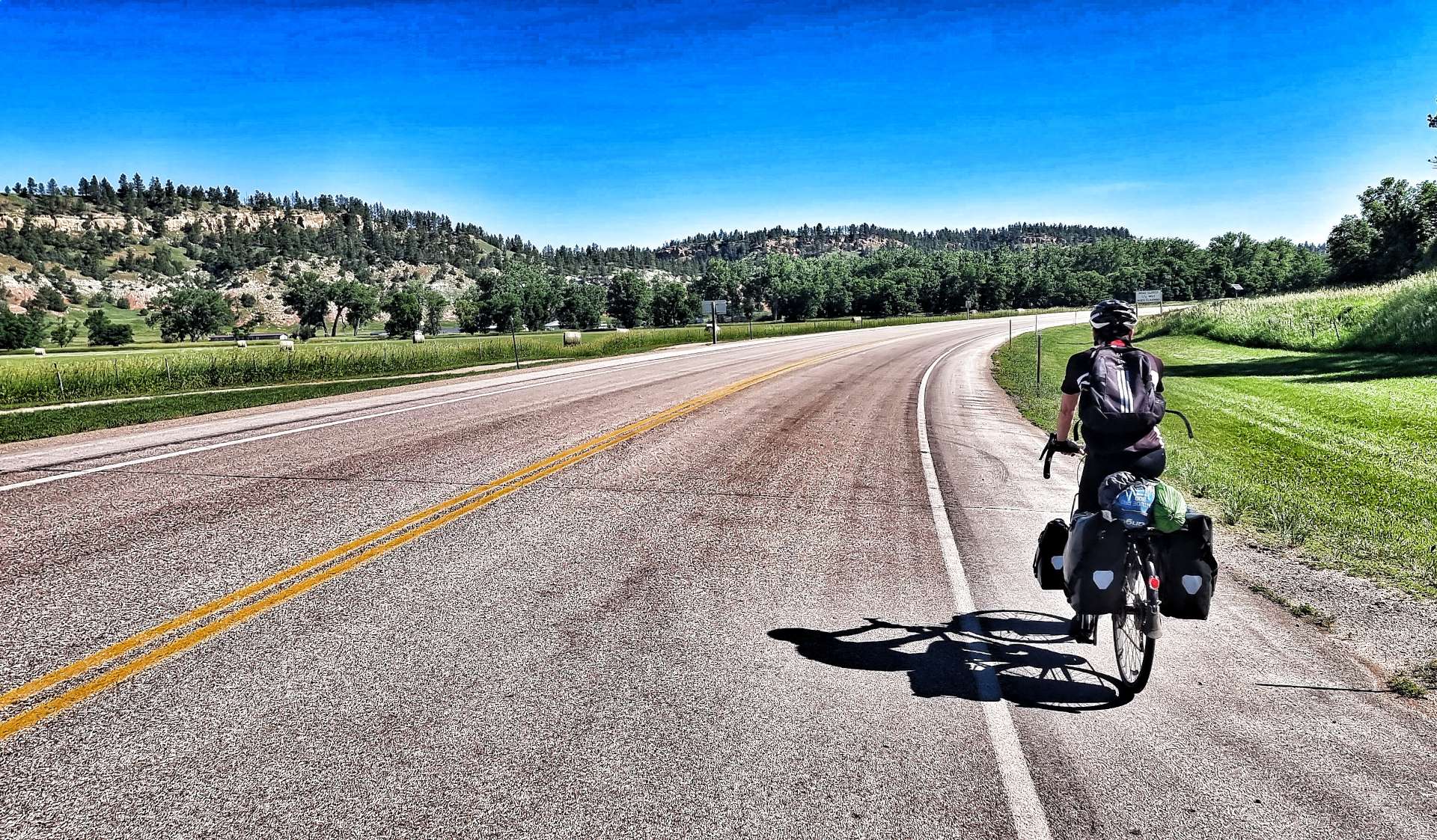
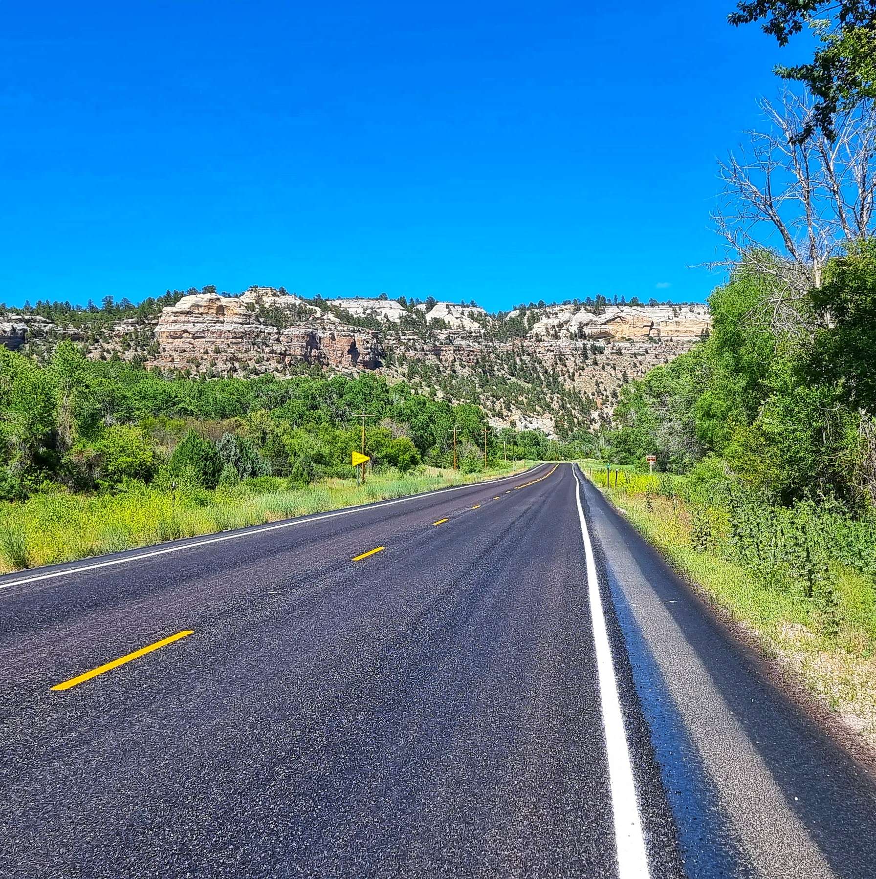
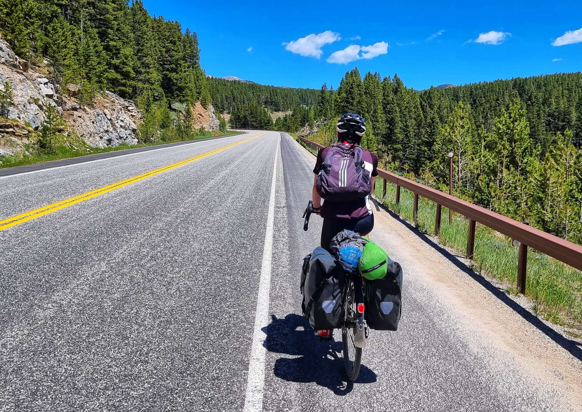
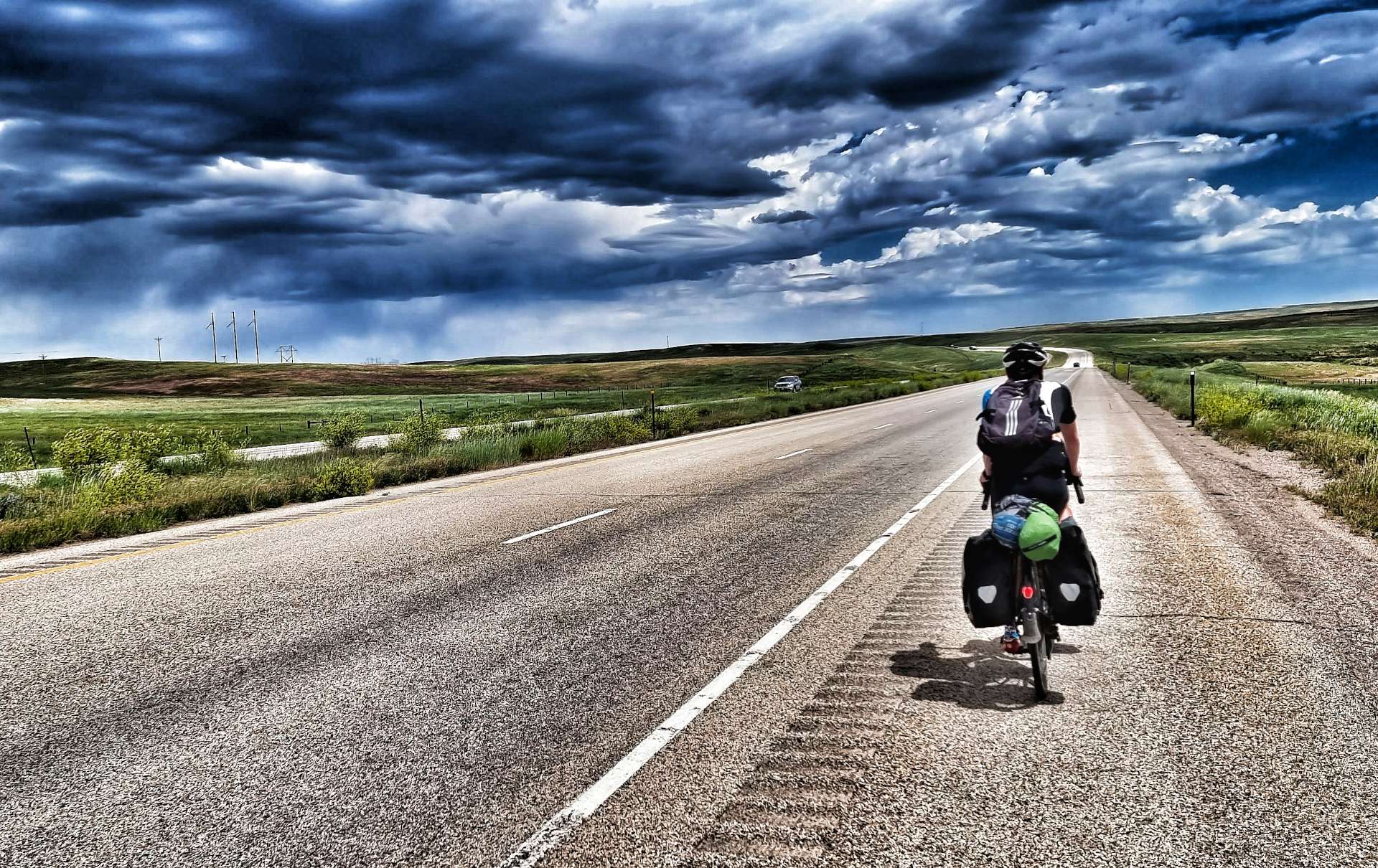
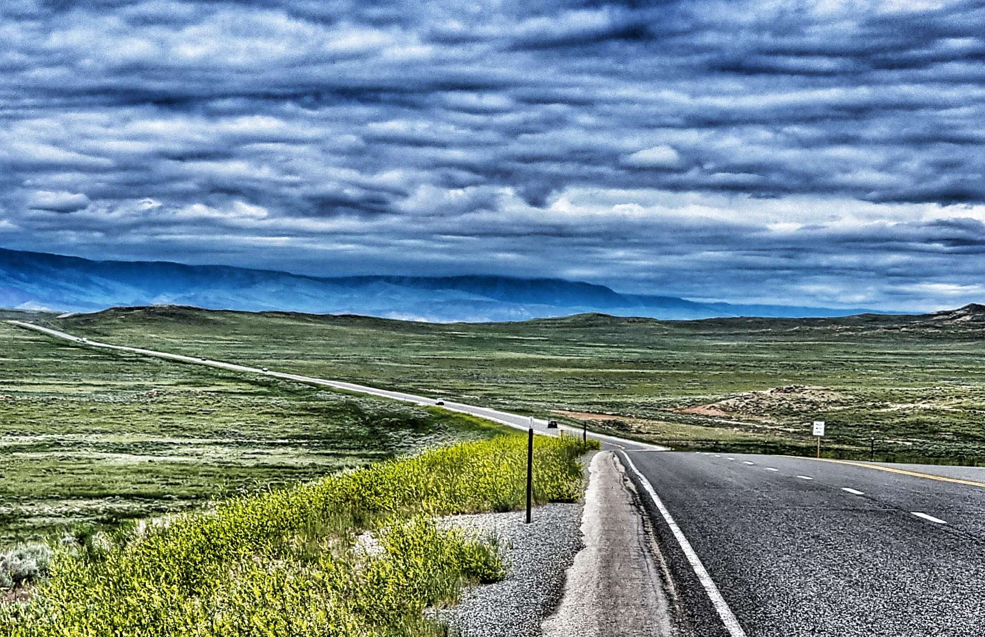
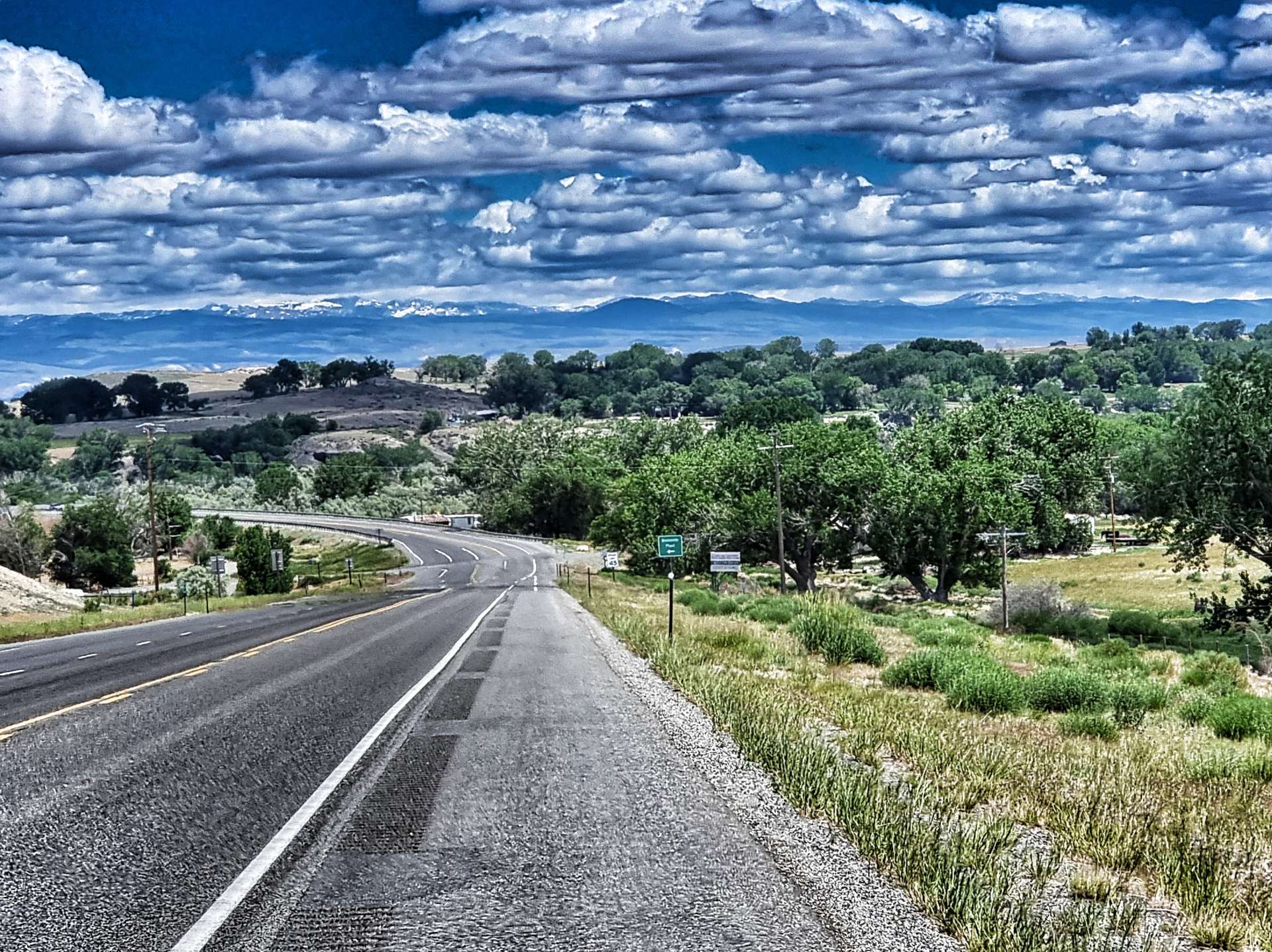
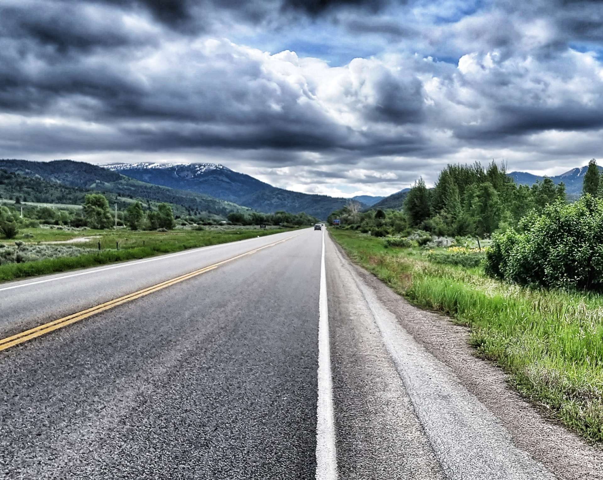
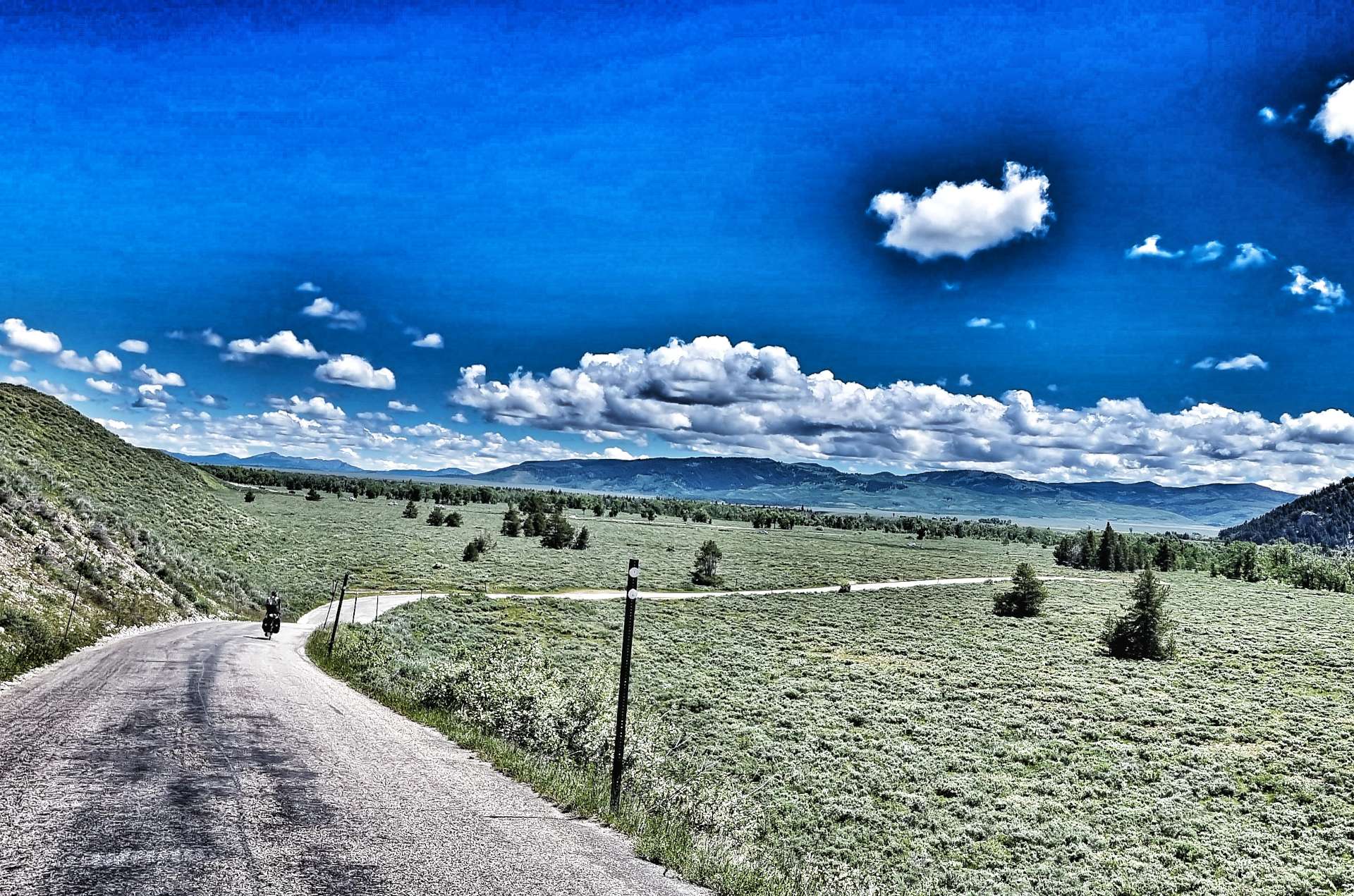
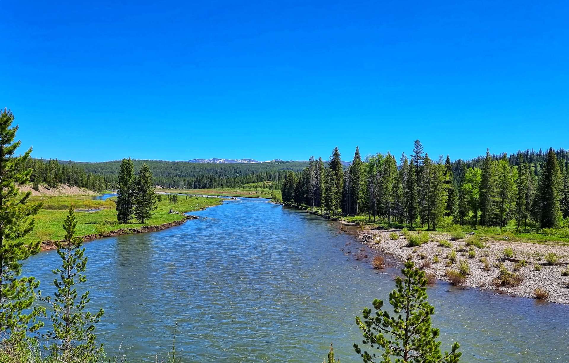
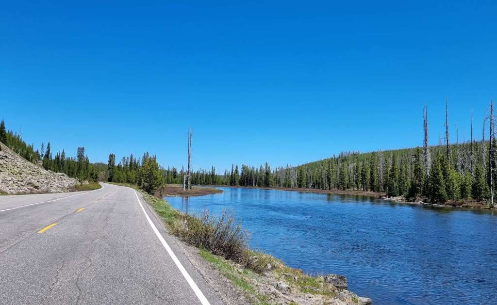
After a rest & recovery day in Rapid City, we were back on the road just after 9am. We headed across town & picked up Highway 44, which we would be riding for the rest of the day. We passed a few herds of longhorn cattle (they always stop grazing & watch us as we pass them) & old farm equipment near farm entrances, still with Stars & Stripes on display from 4th July.
We stopped briefly at a gas station after about 20 miles to top up on cold water & enjoy a coke & cookie. At this point we’d covered 17 miles in the first hour & were both looking forward to the tailwind blowing us all the way to Interior. The temperature was in the high 80’s fahrenheit & staying hydrated was a challenge, as there were only 2 places to replenish our bottles on today’s route.
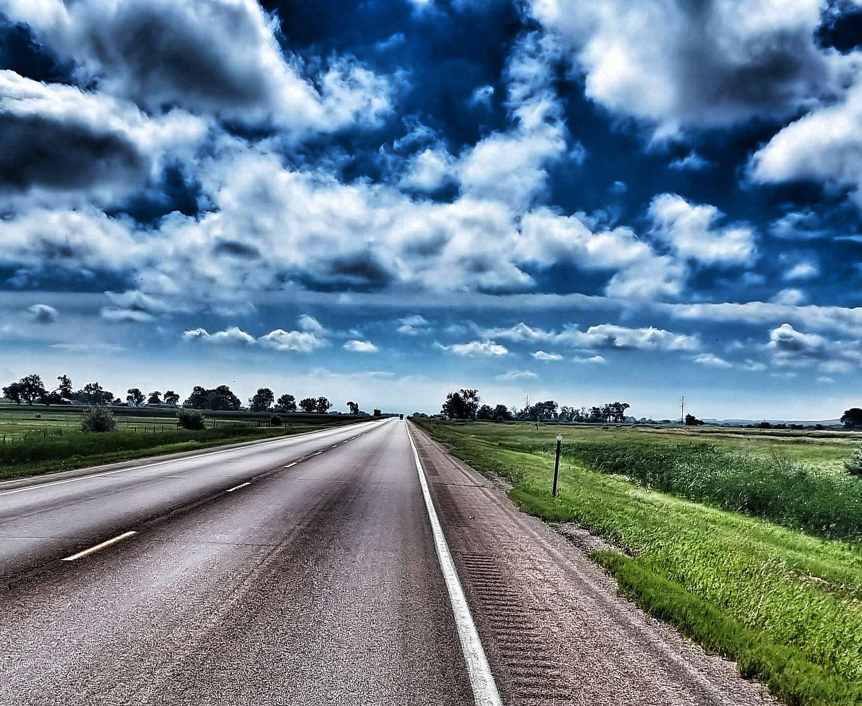
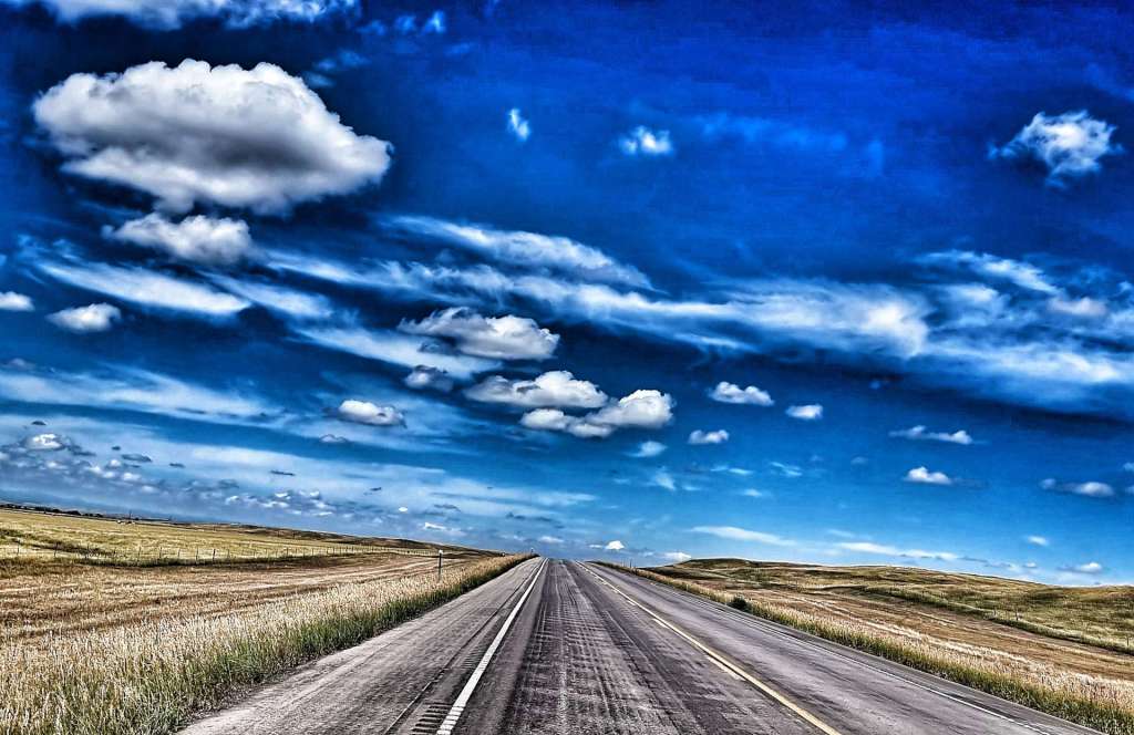
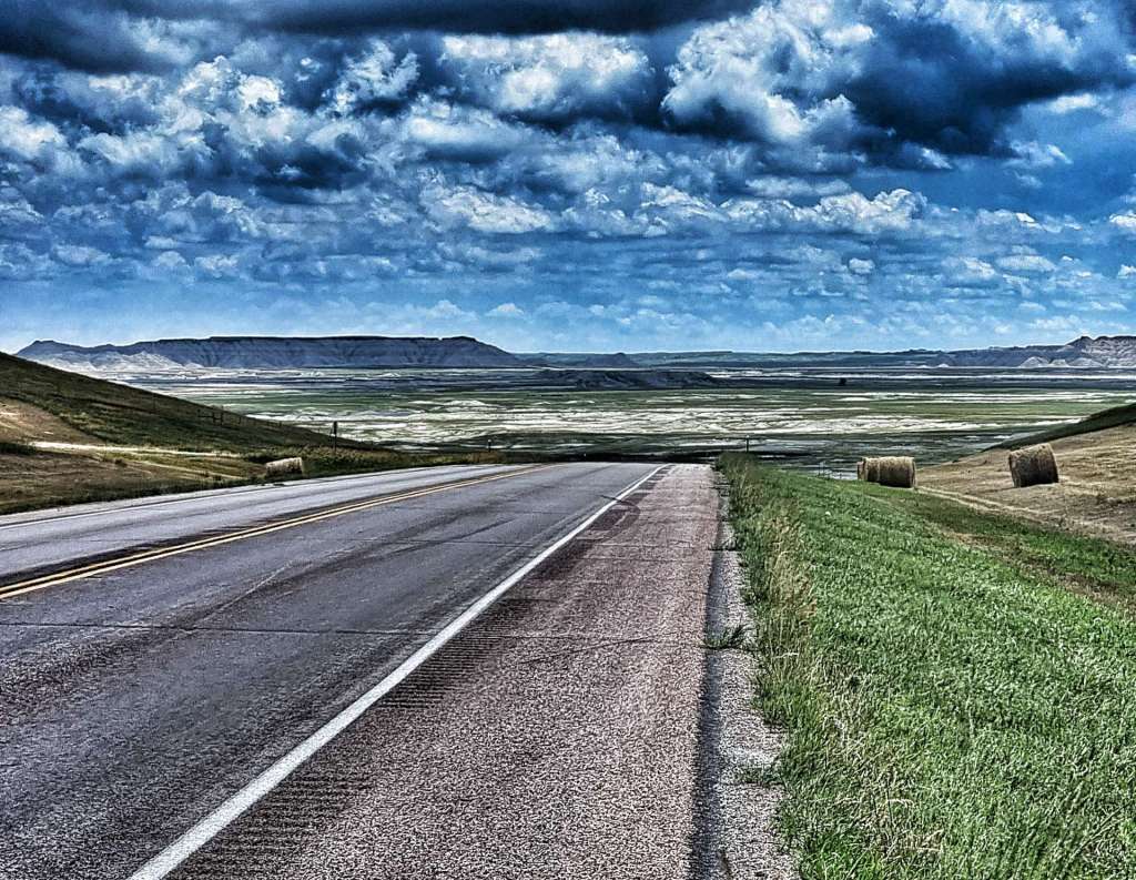
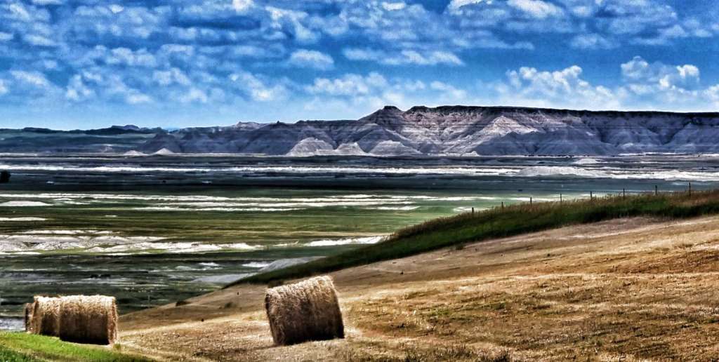
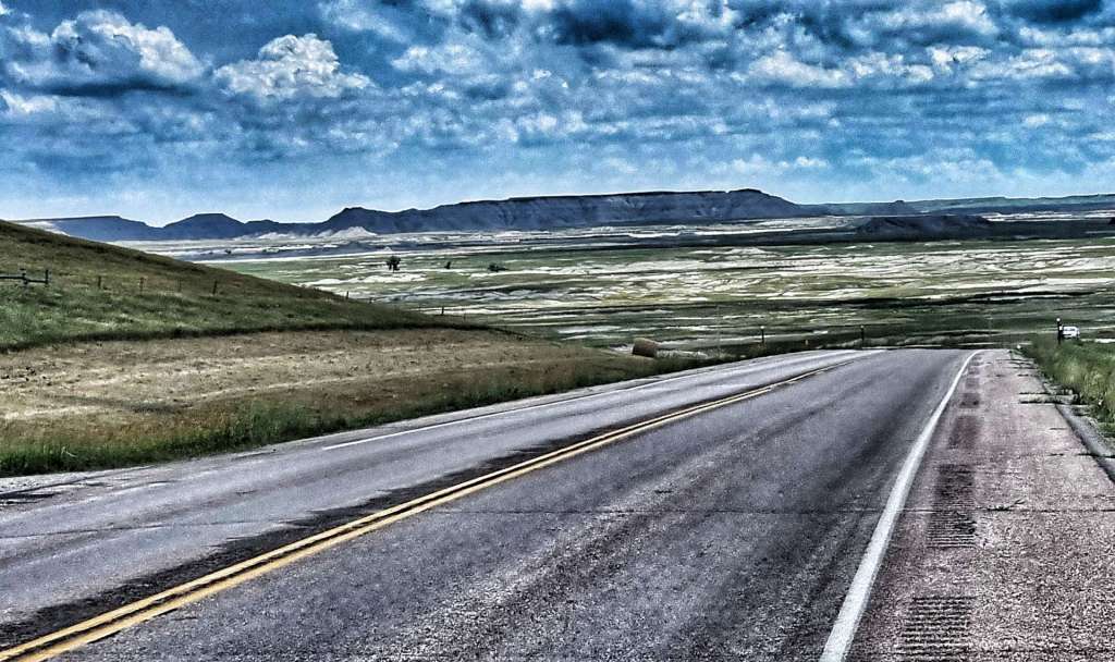
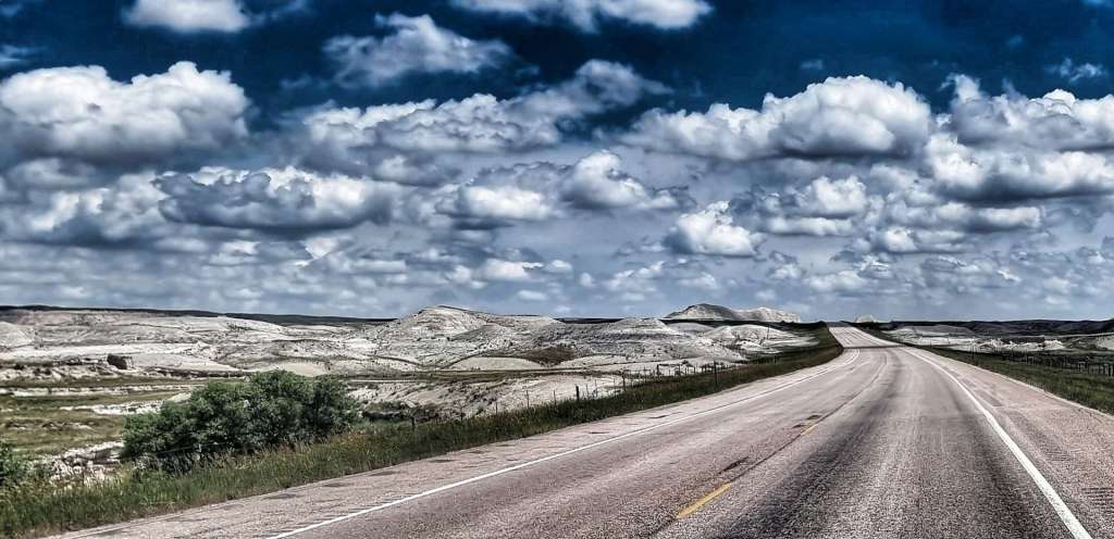
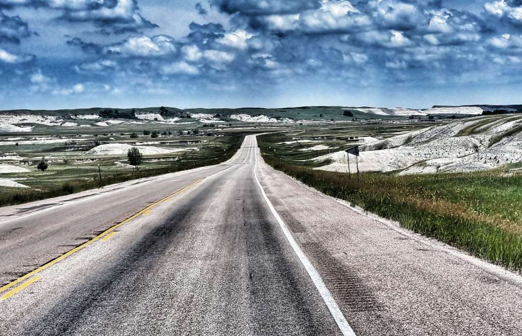
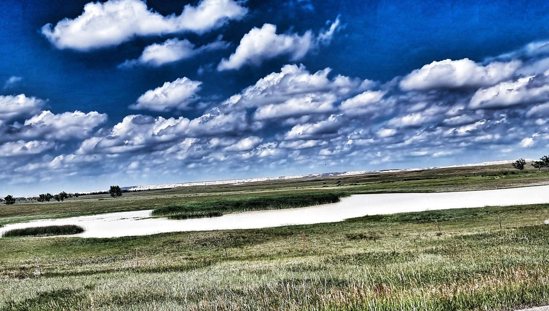
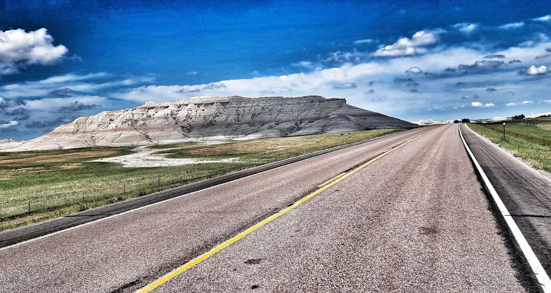
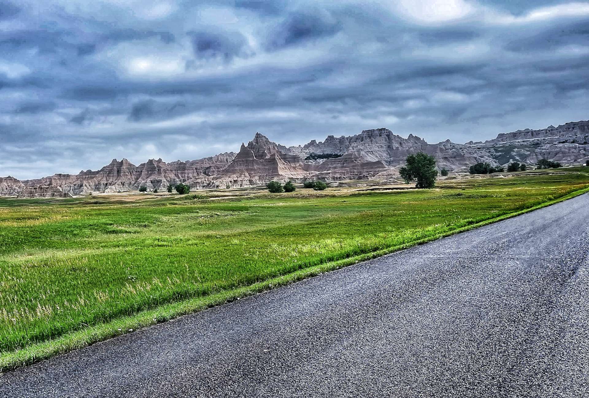
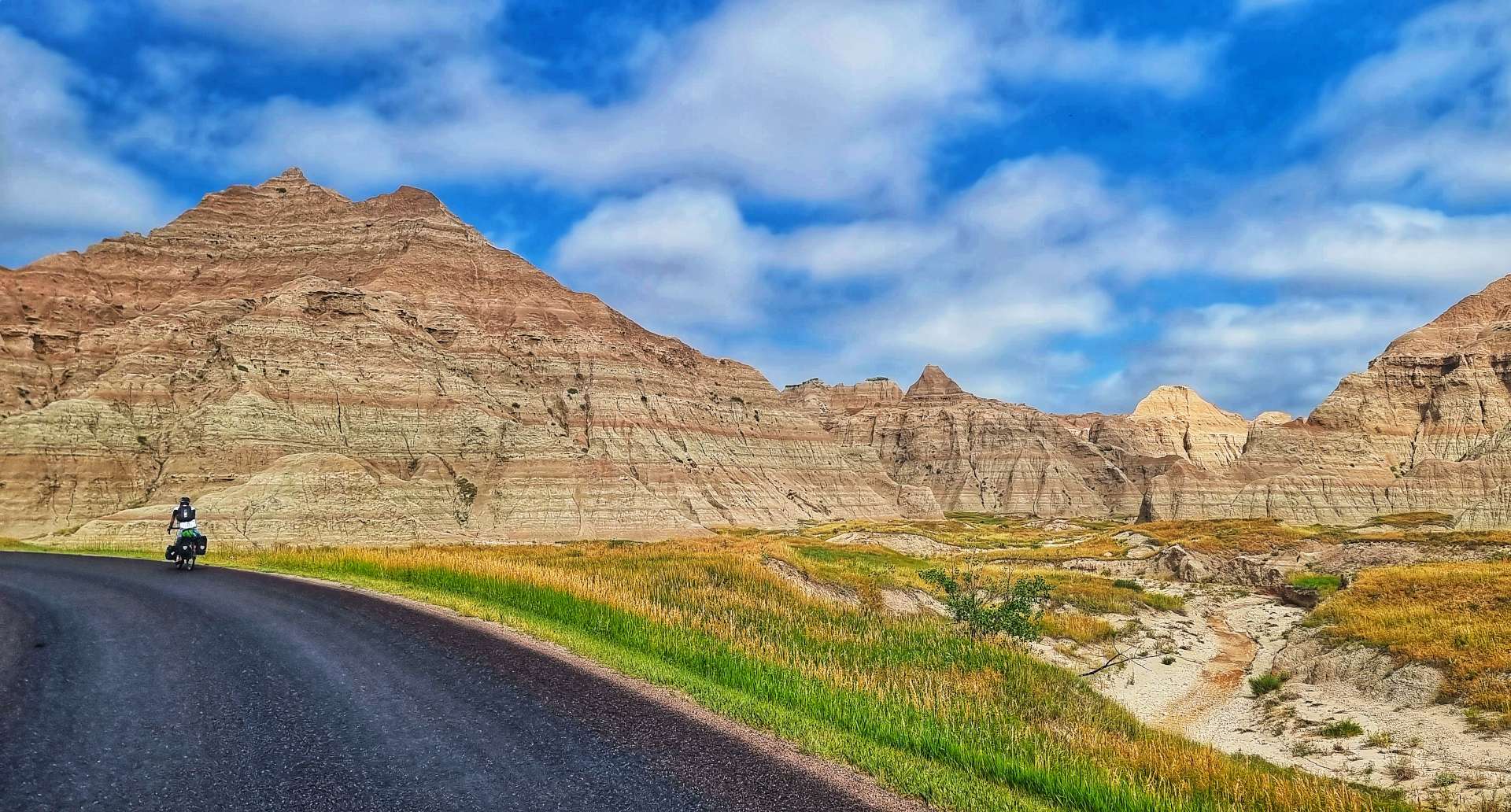
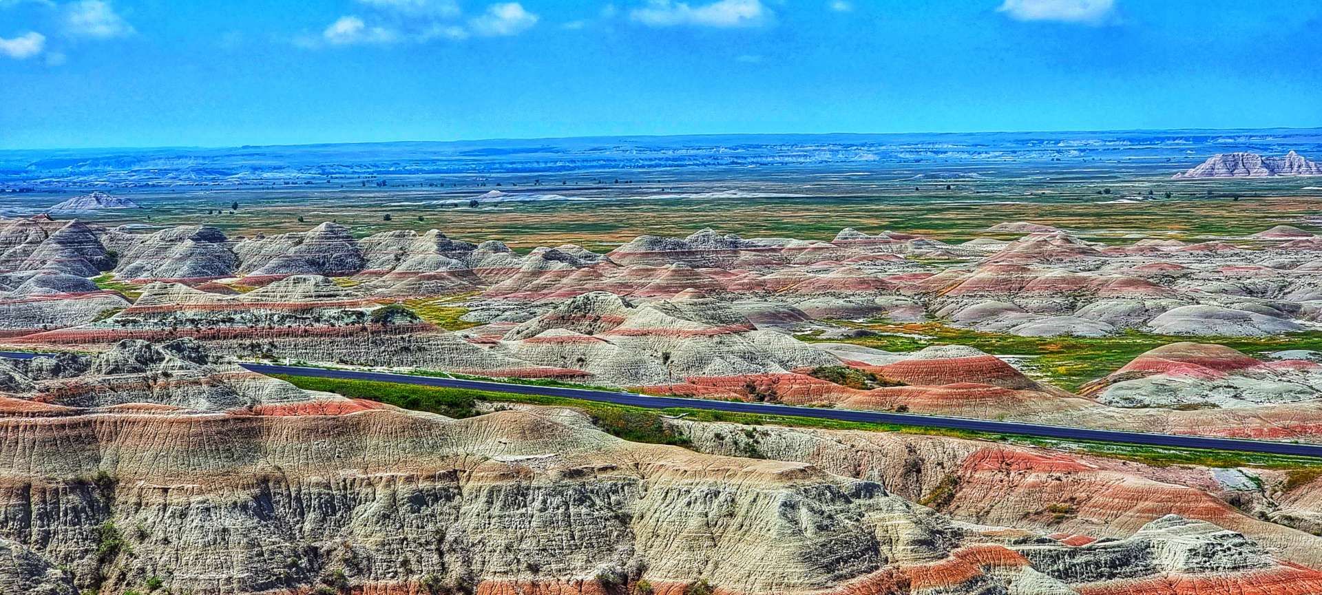
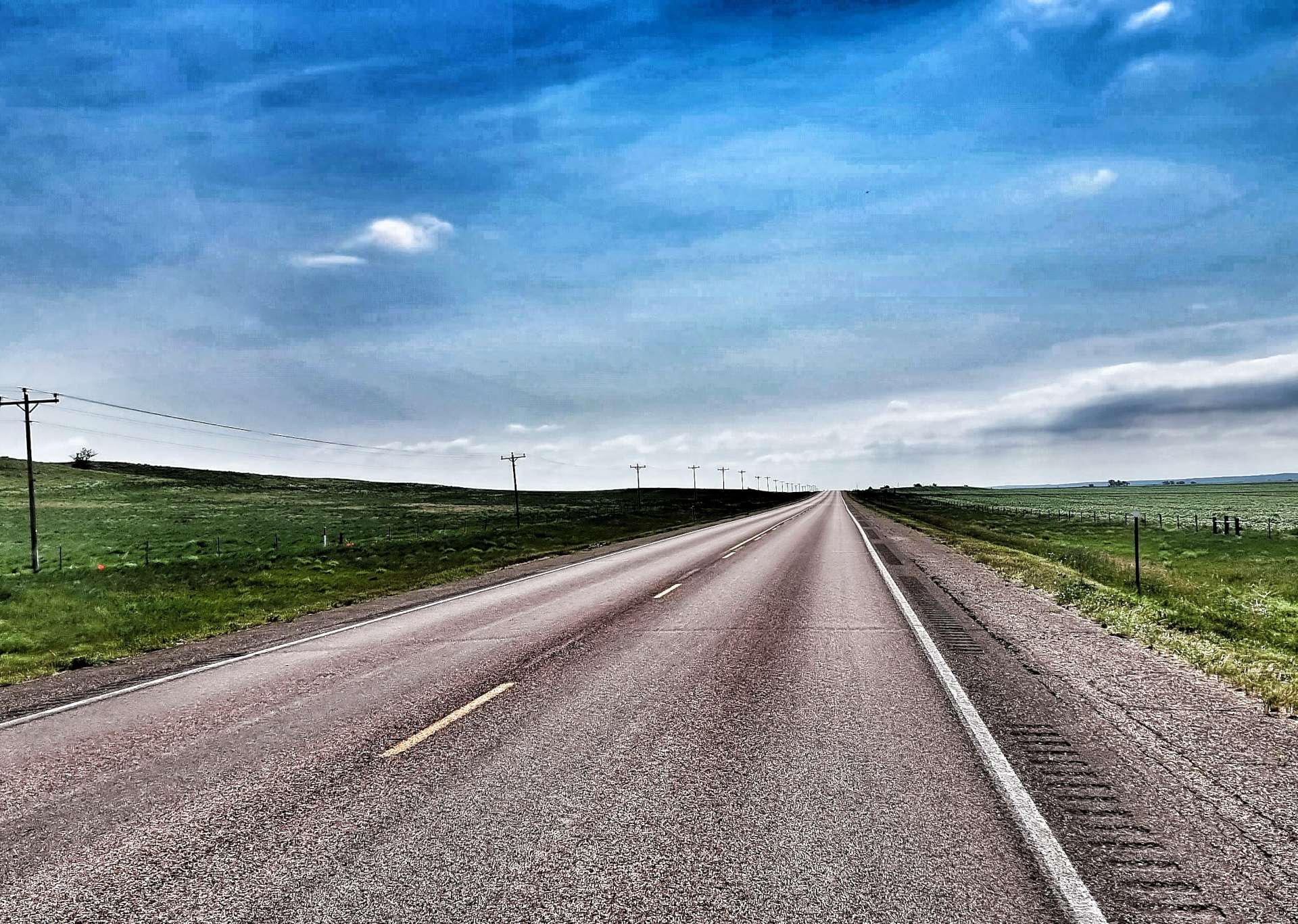
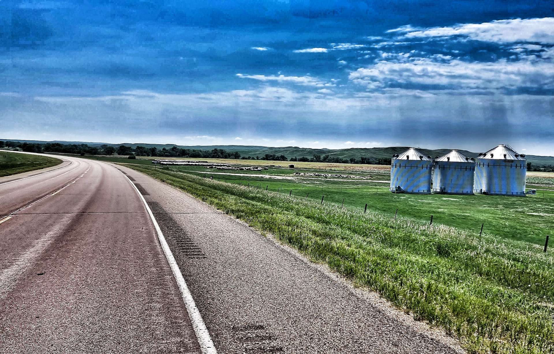
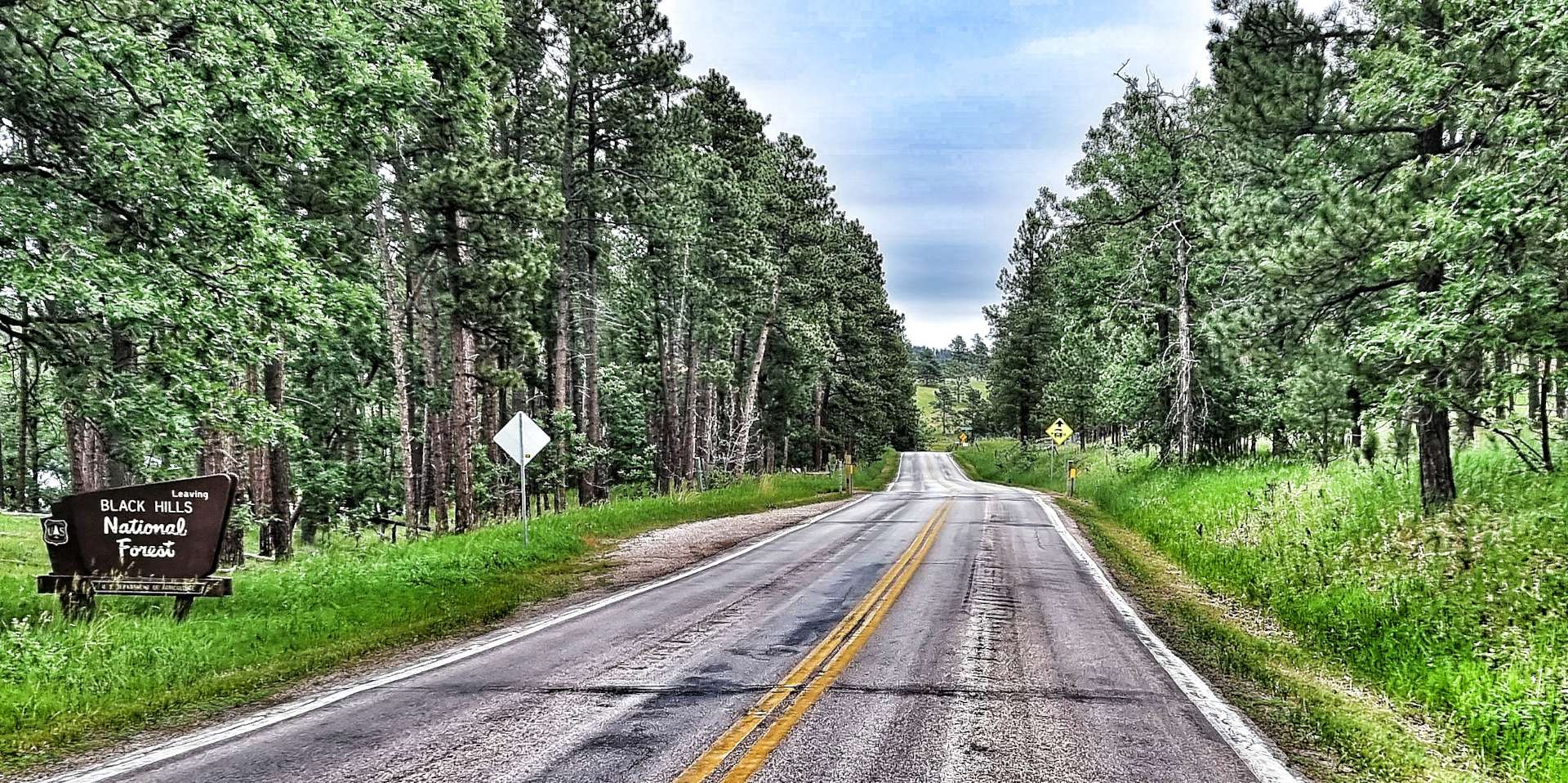
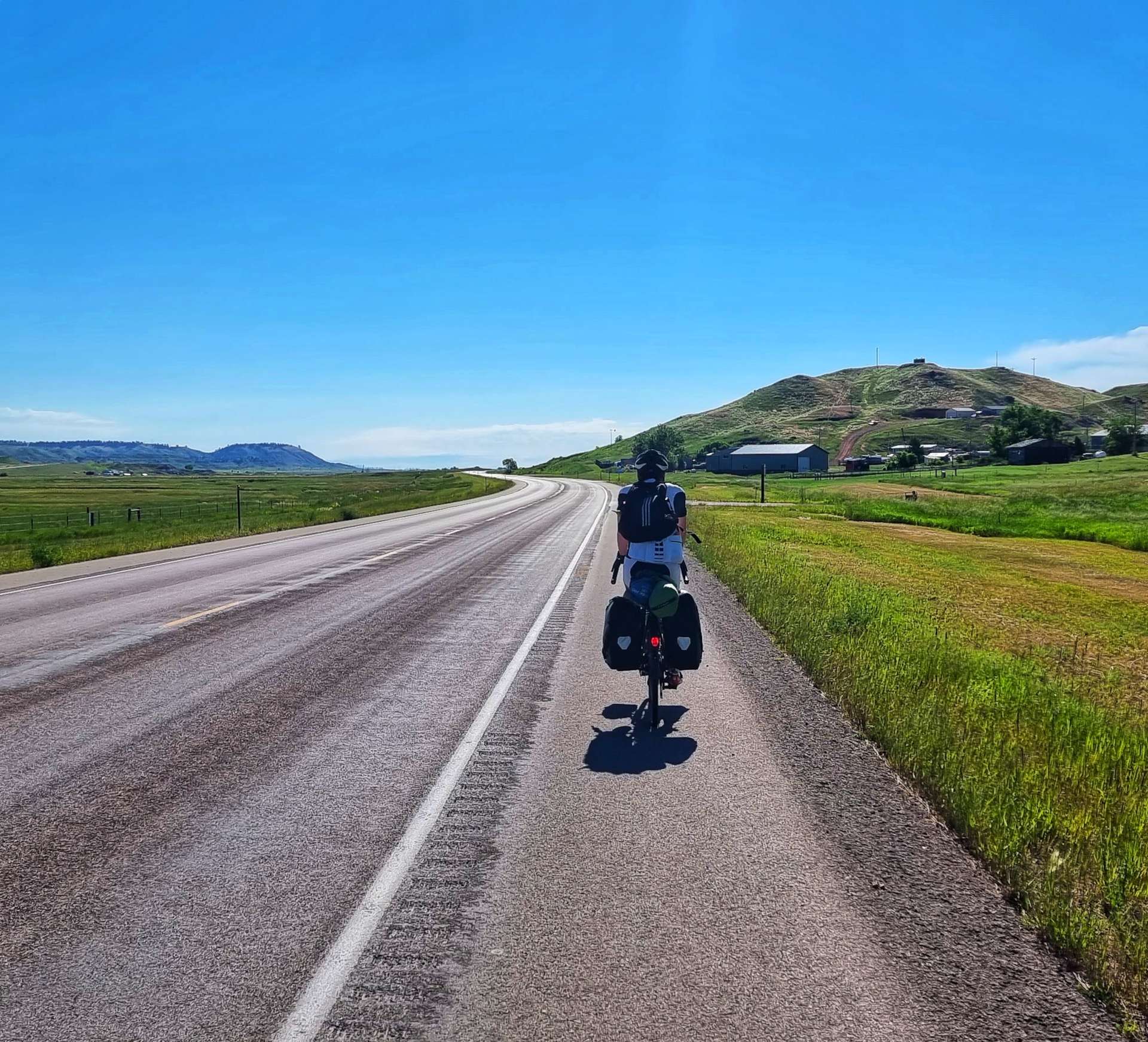
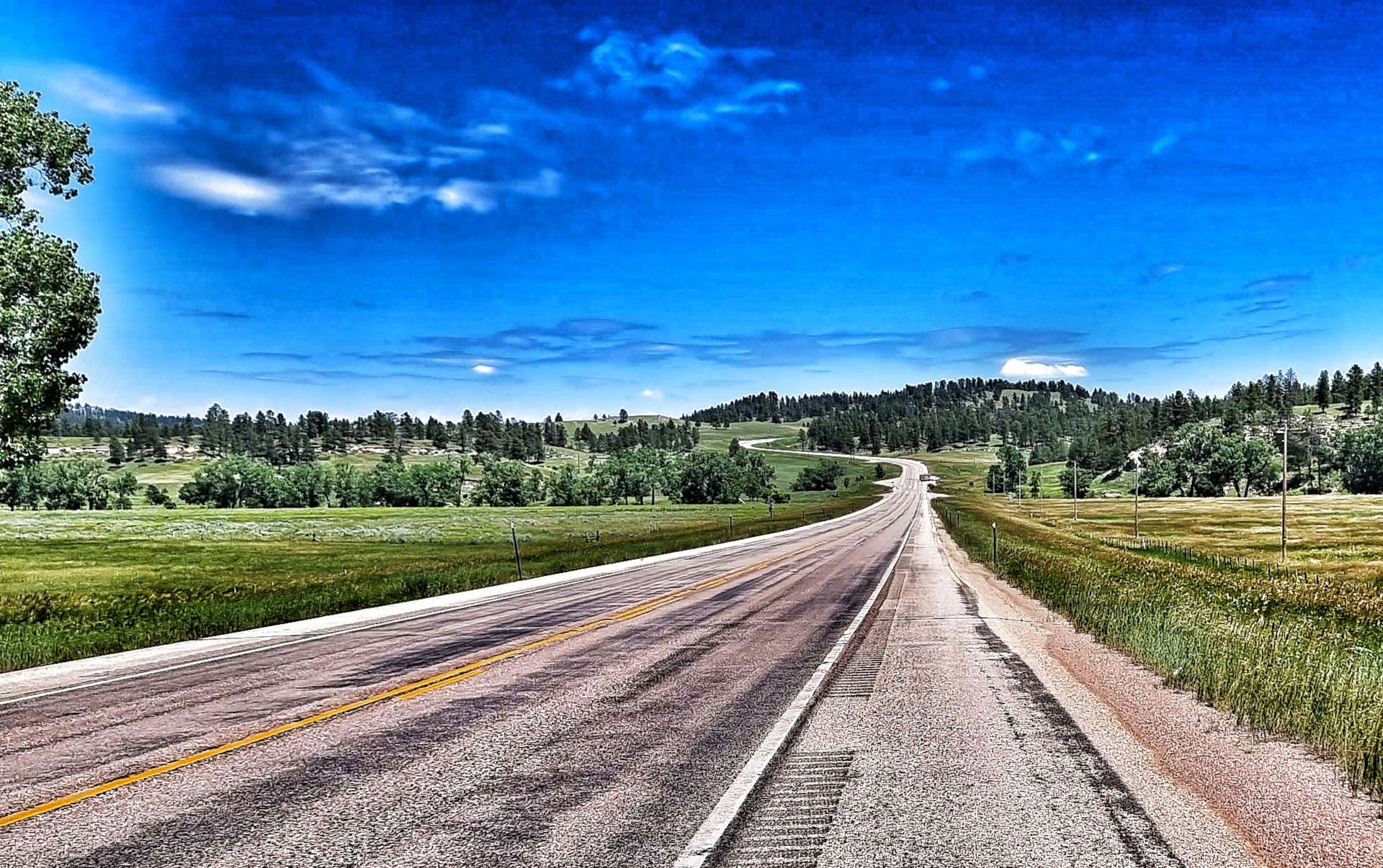
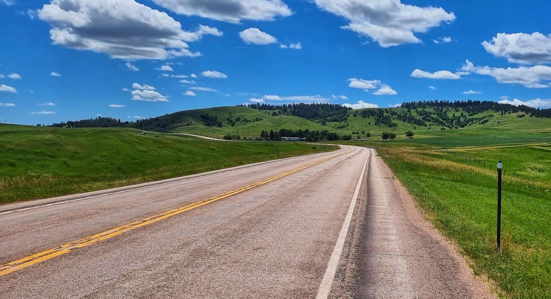
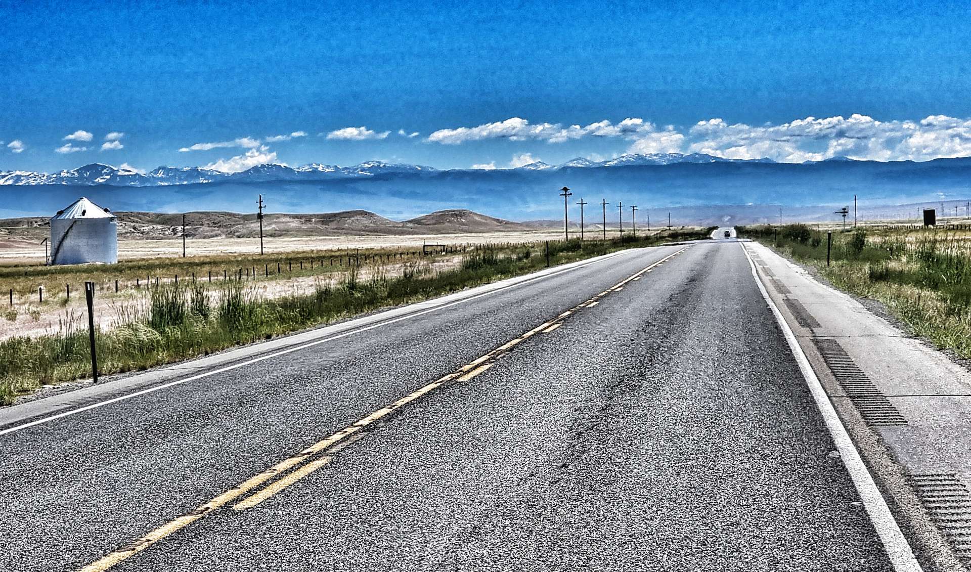
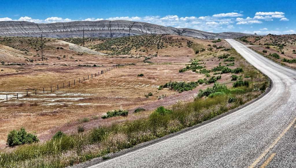
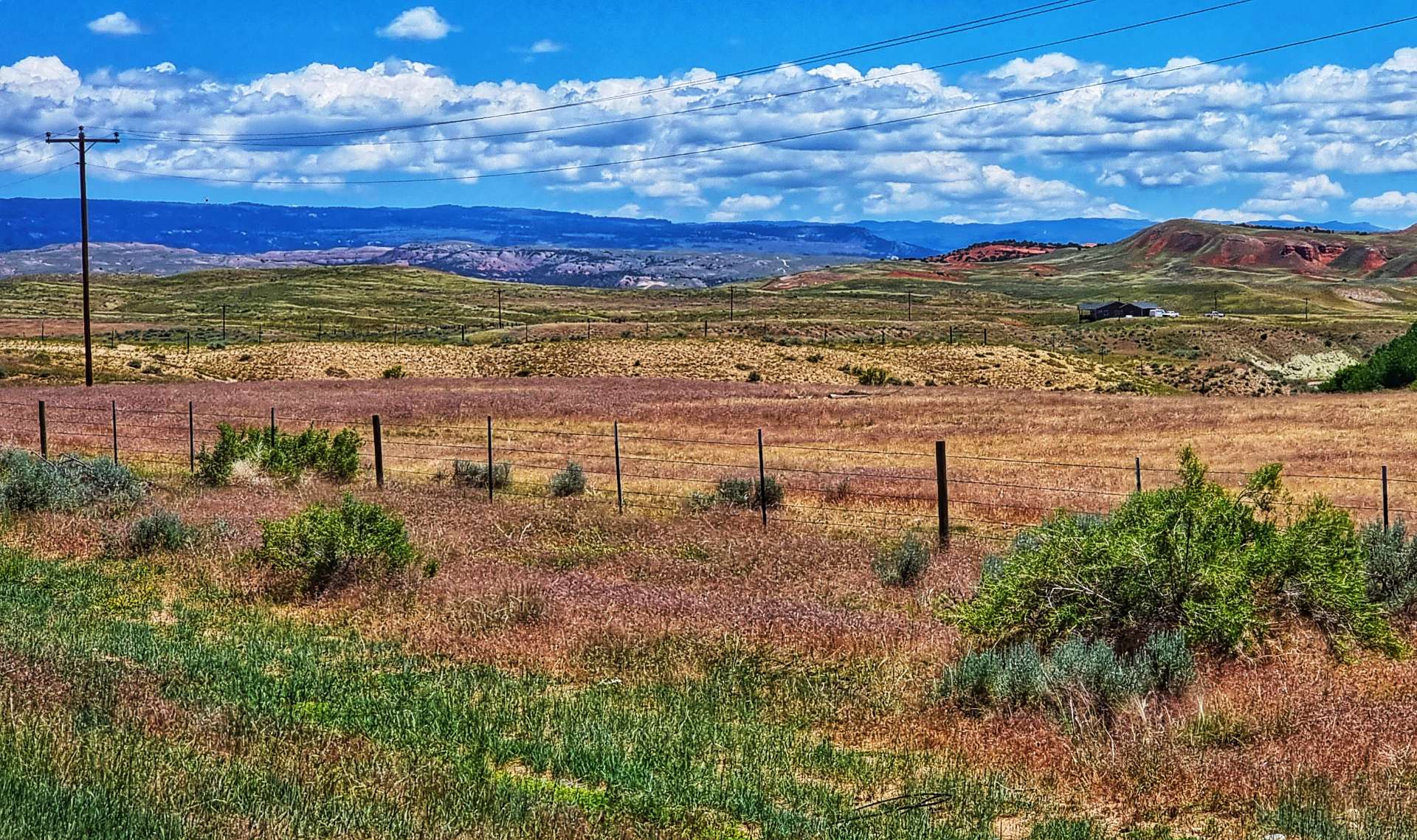
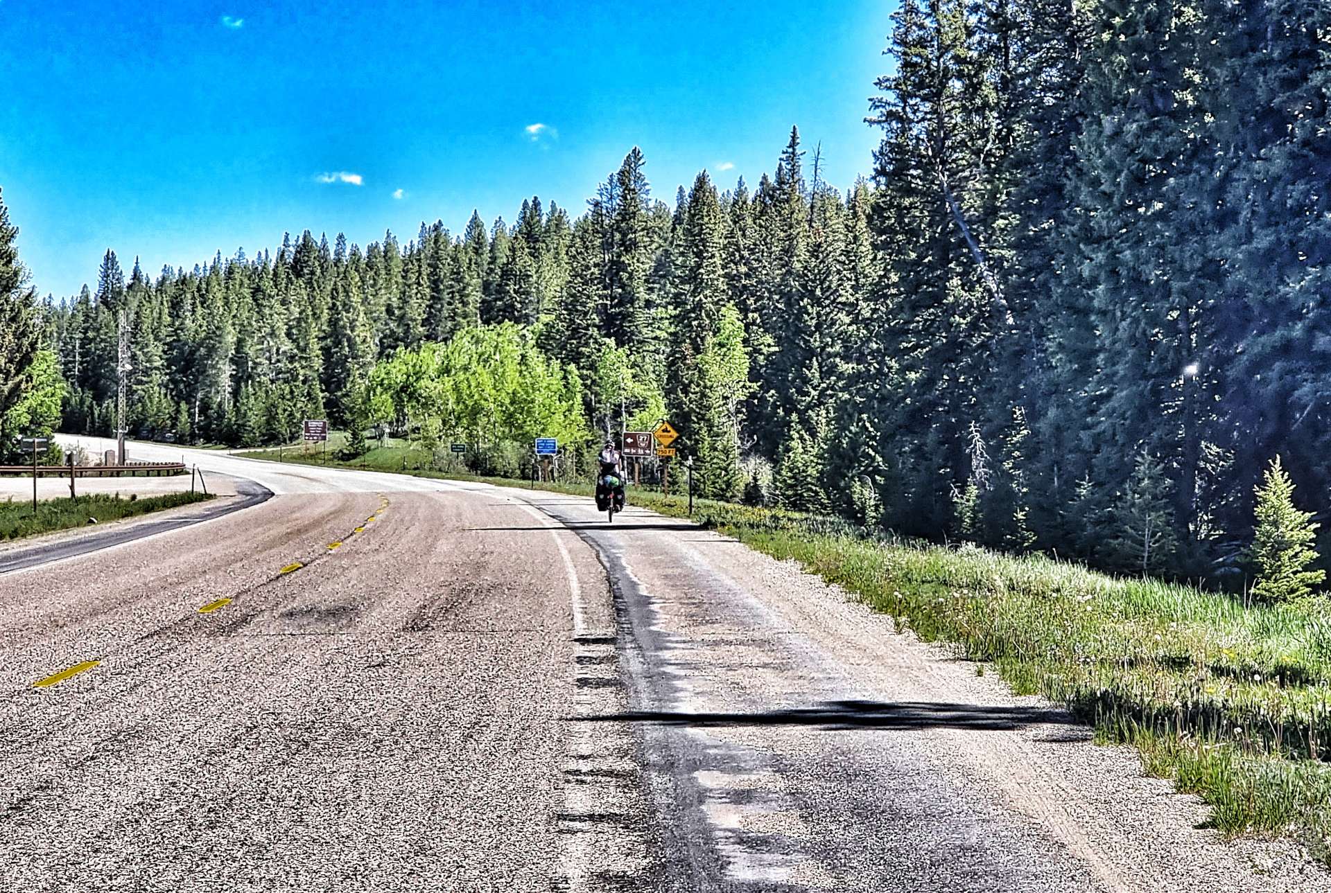
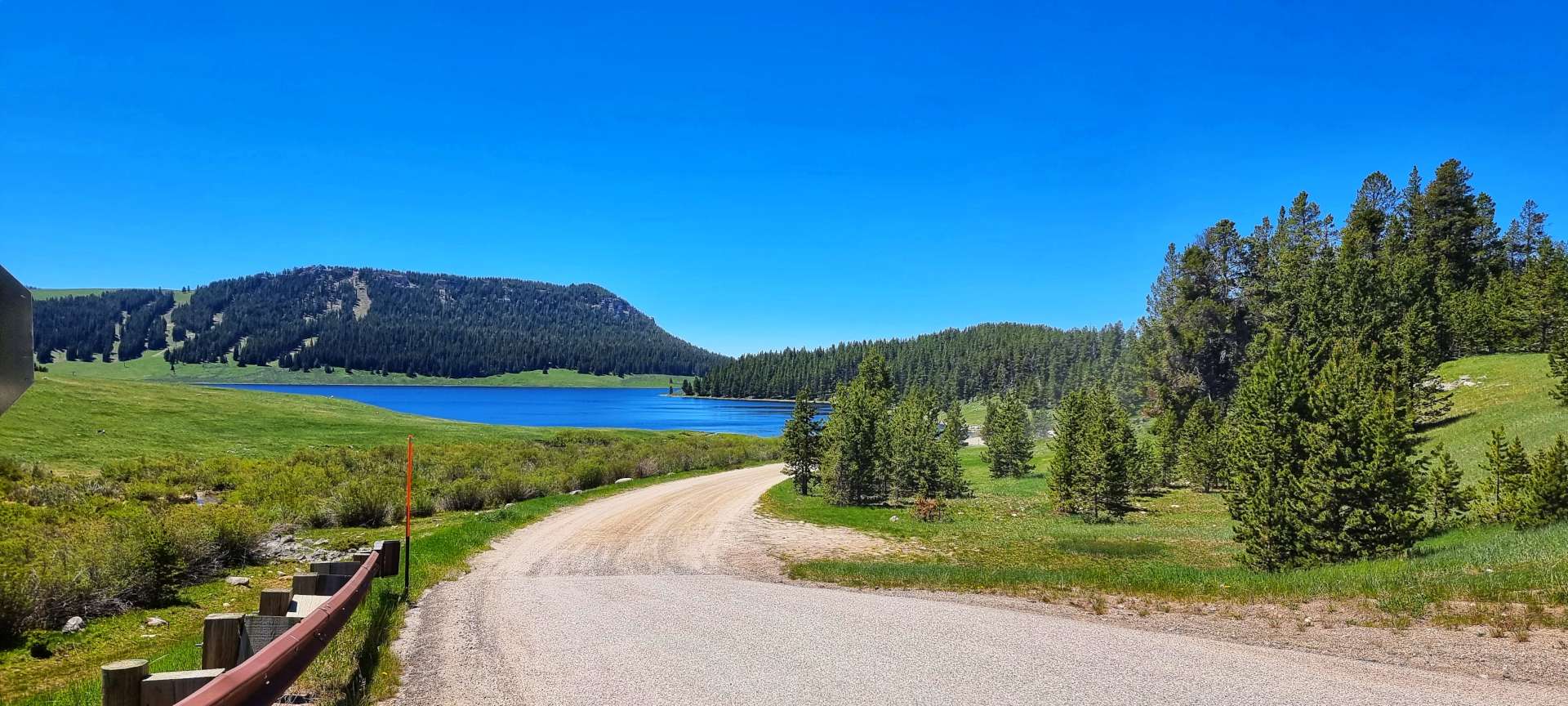
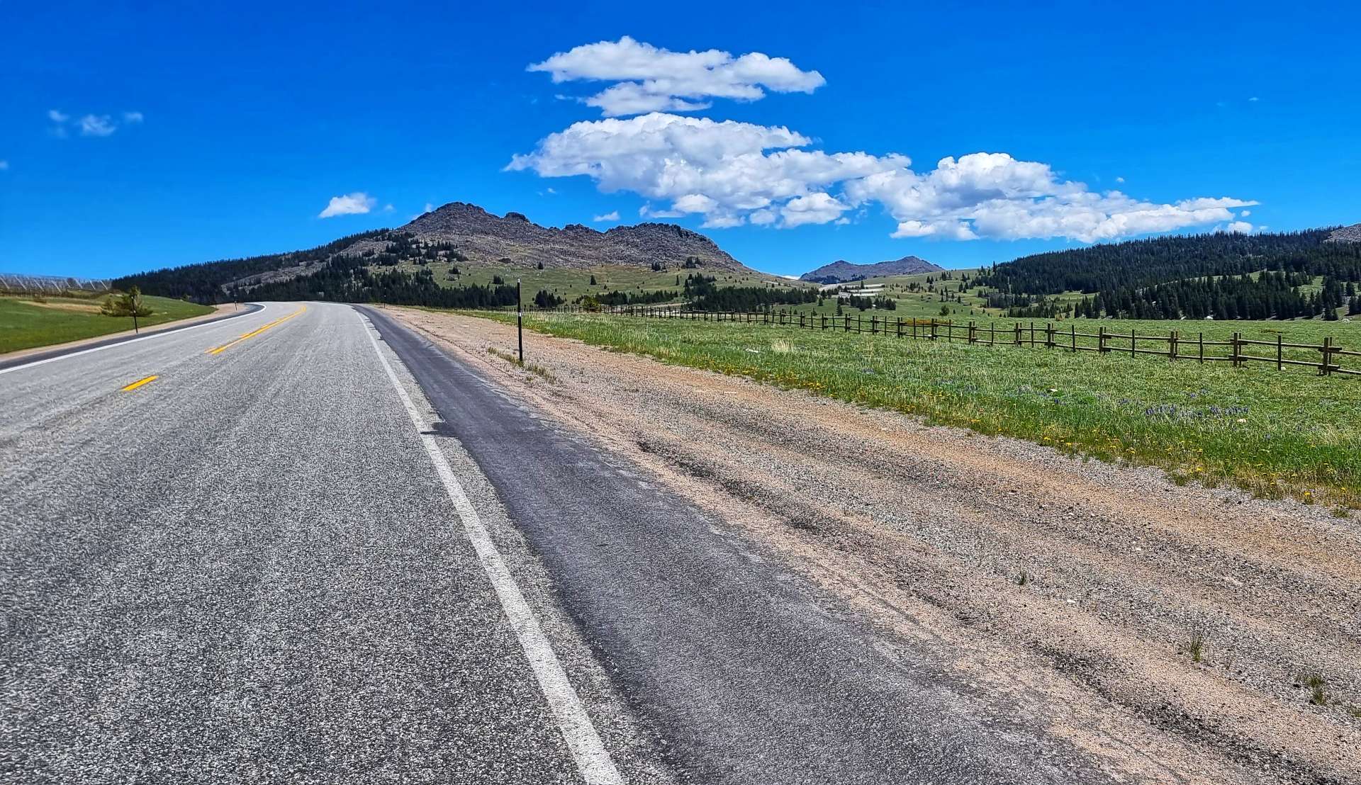
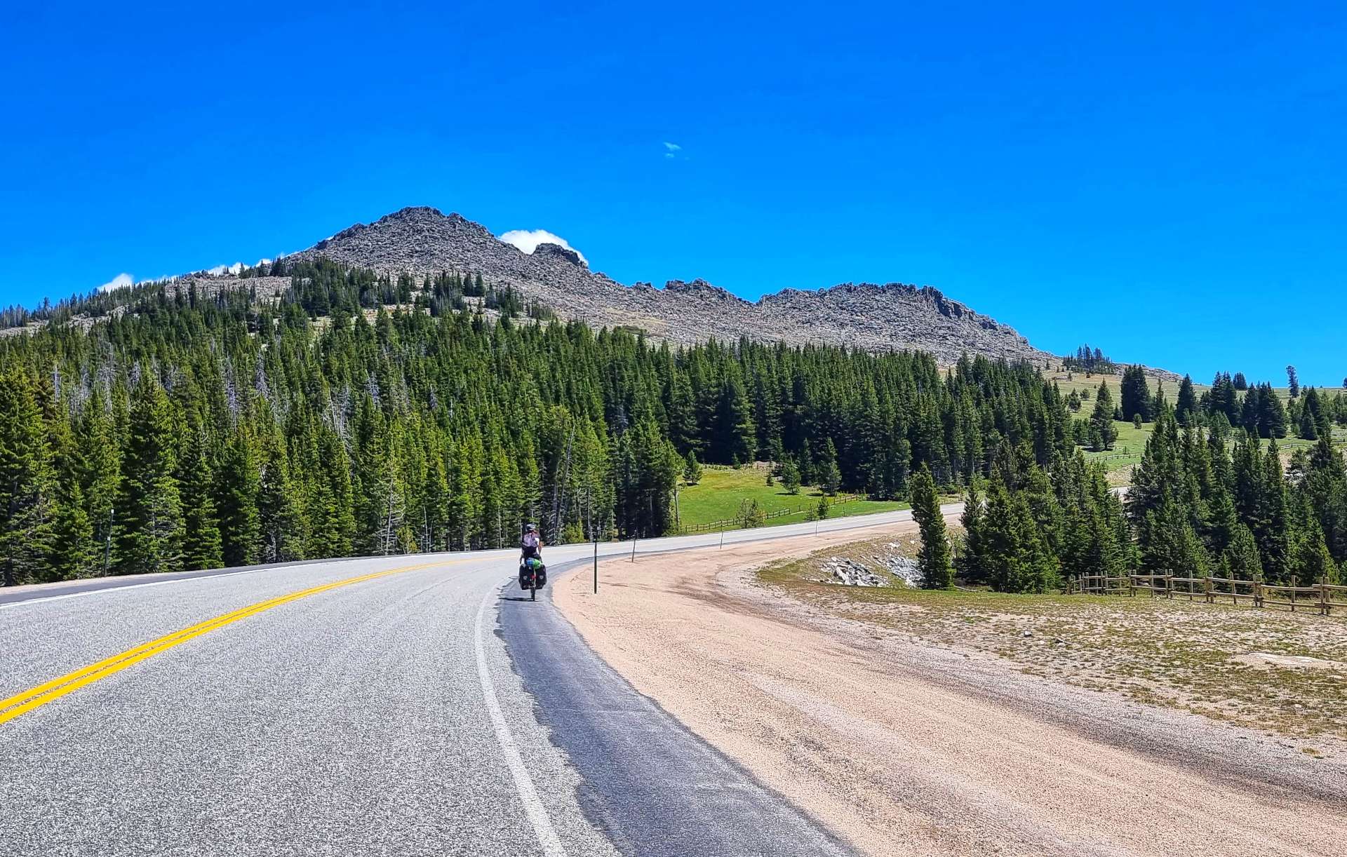
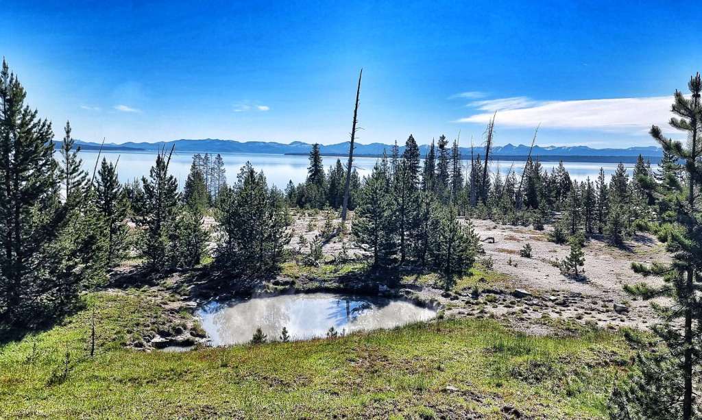
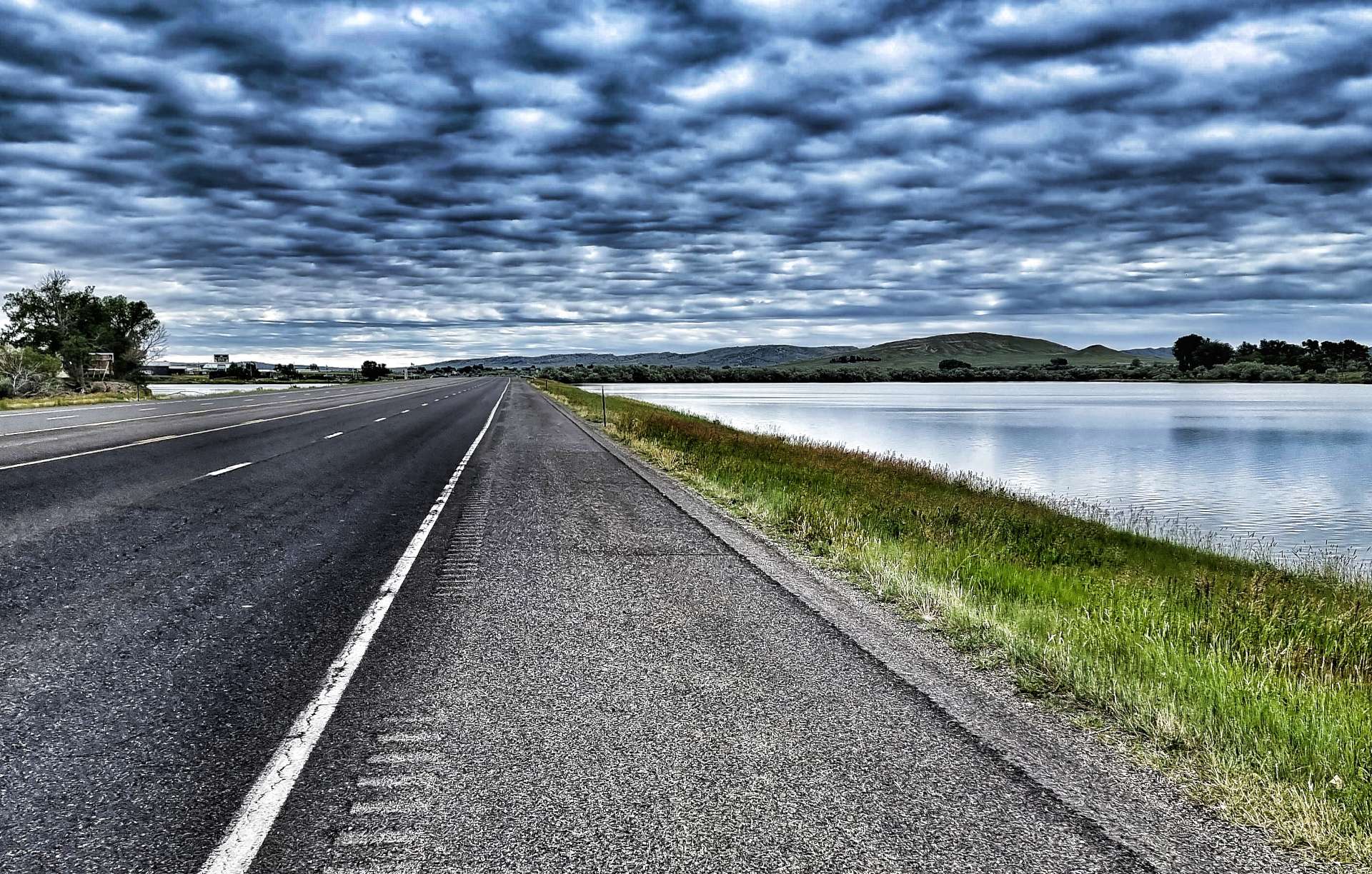
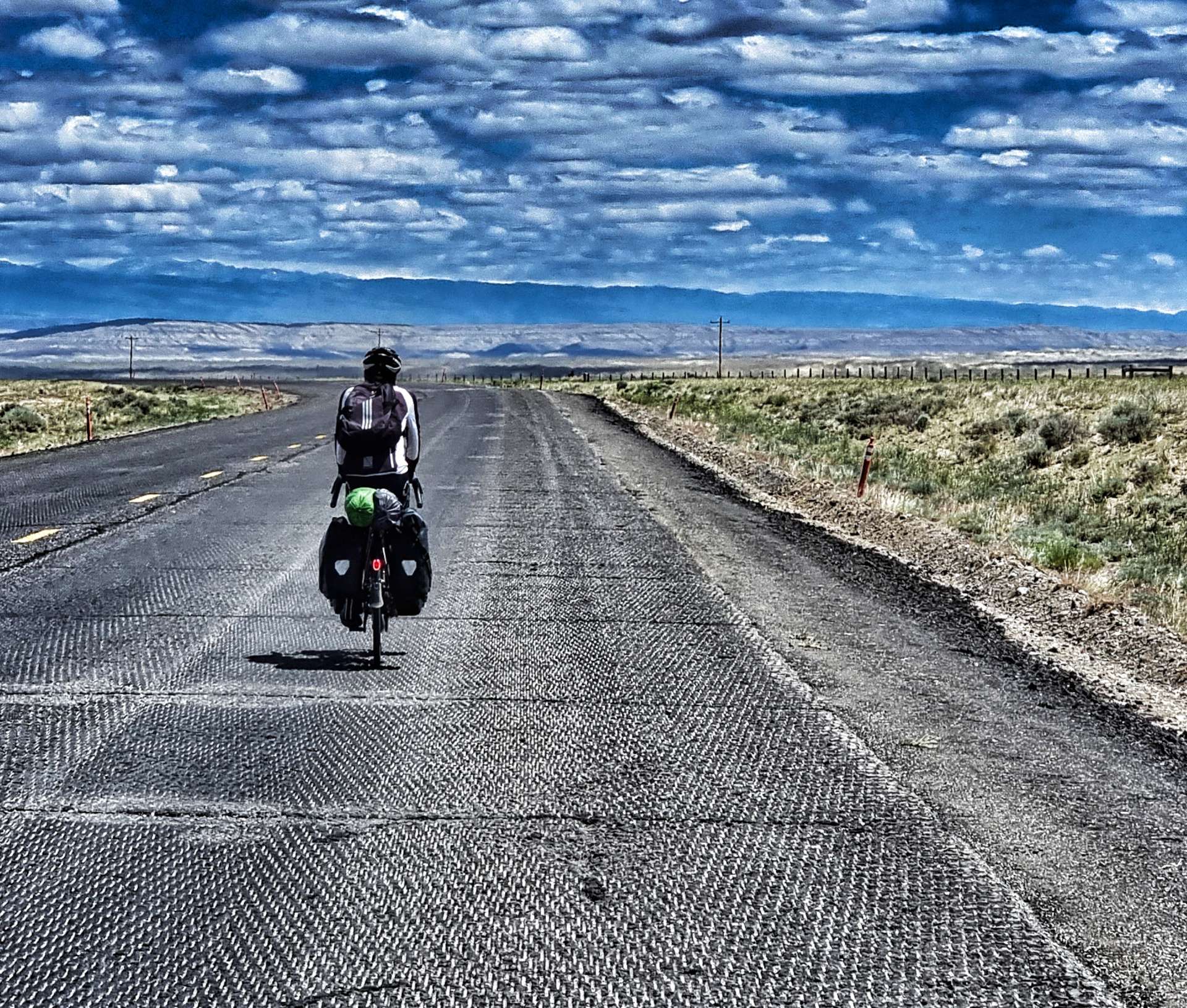
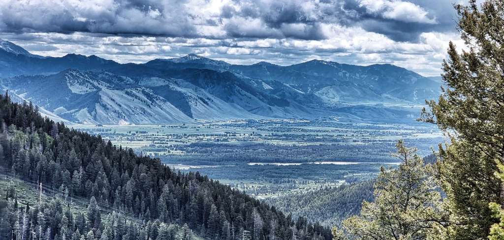
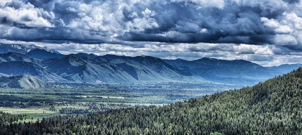
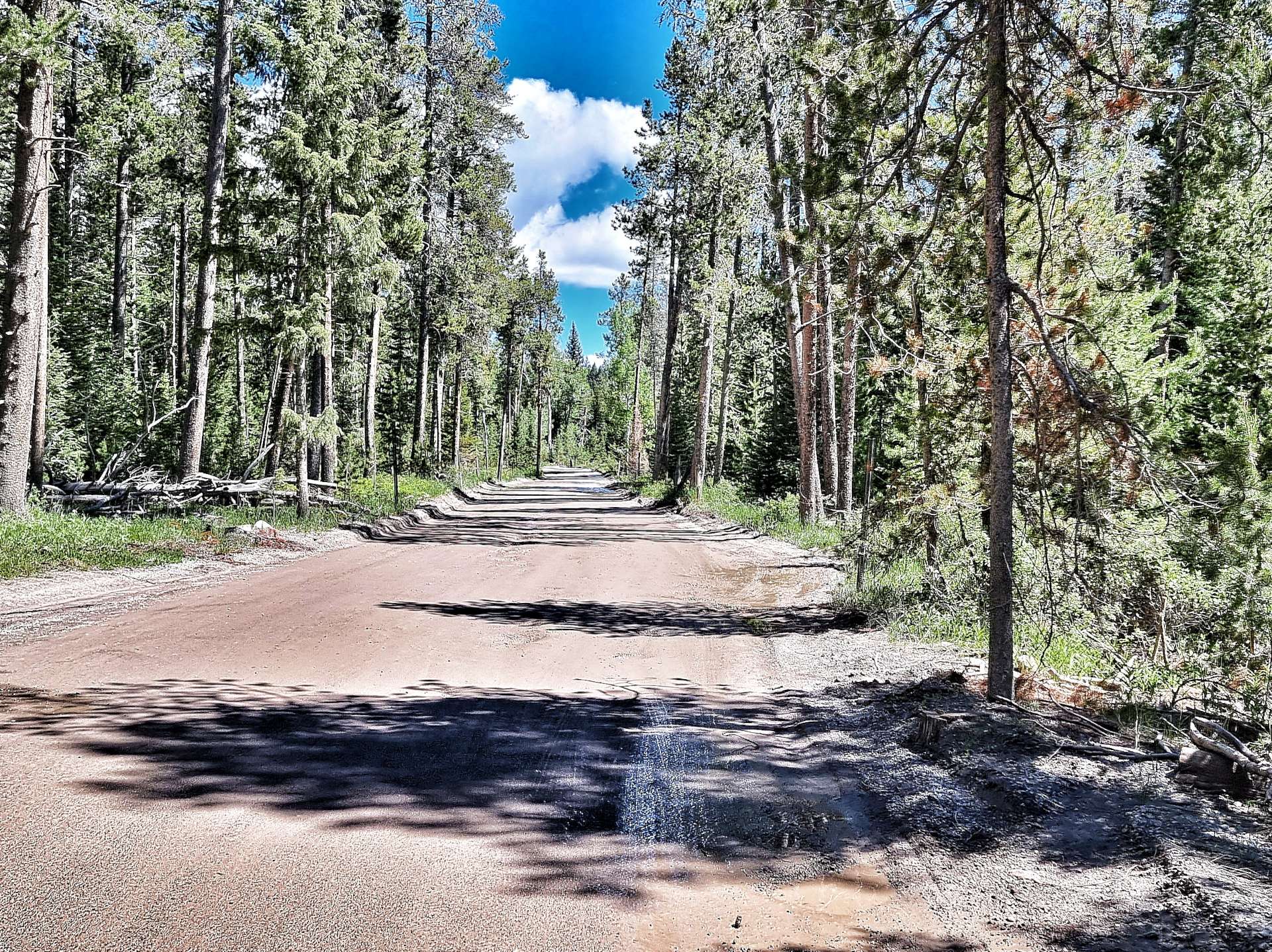
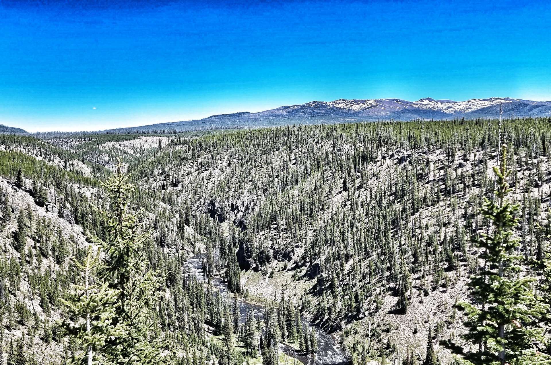
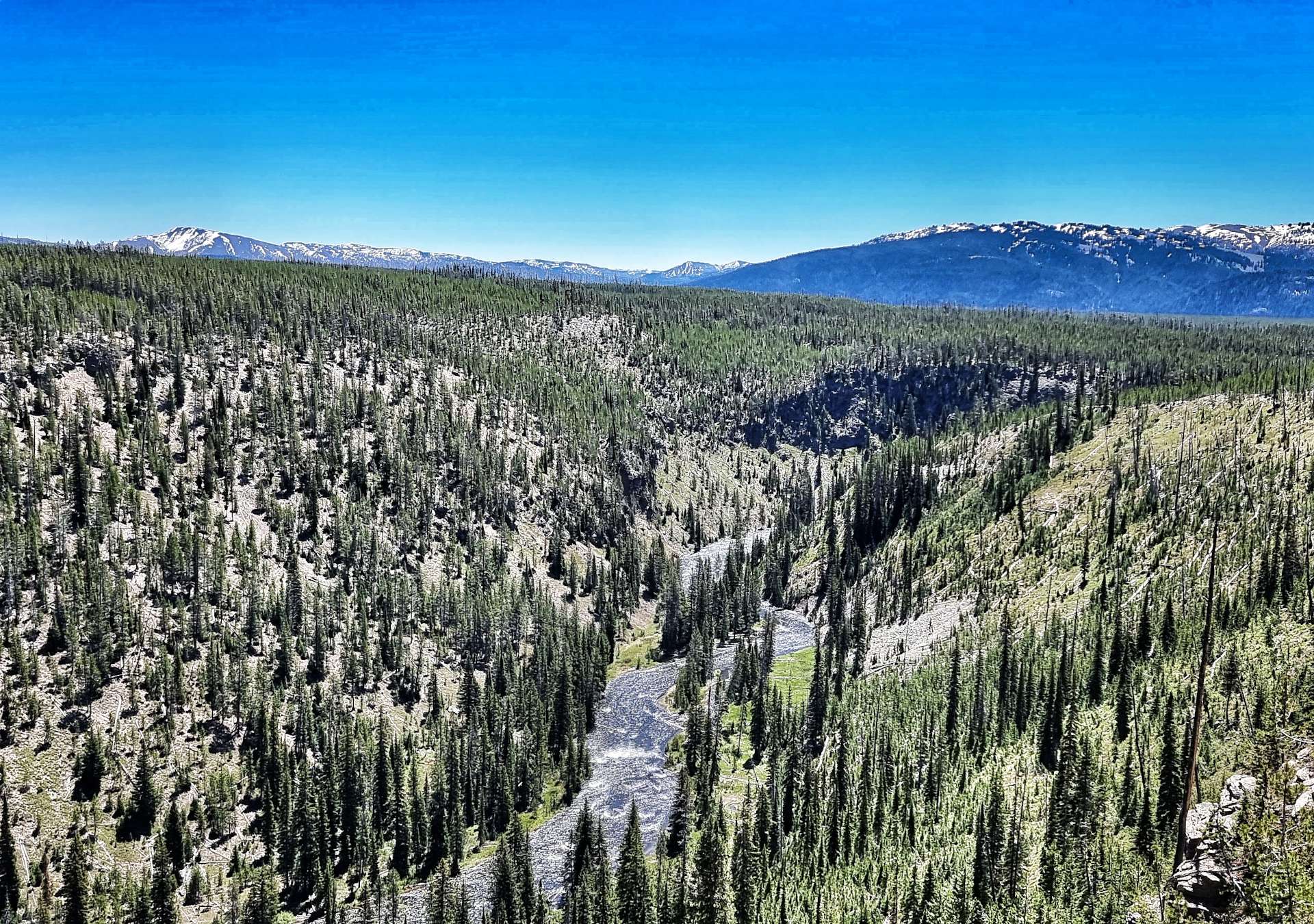
The road stretched far into the distance as the fields slowly switched from pasture to grassland, as we were nearing the Buffalo Gap National Grasslands – the second largest of 20 National Grasslands sites, it’s encompasses about 600,000 acres in various tracts across South Dakota. The characteristics of Buffalo Gap are mixed prairie & chalky badlands. The Buffalo Gap also results in localised winds & unfortunately for us, today’s localised wind was into our faces – from mile 30 until we finished we battled a 10 to 15 mph headwind the whole way.
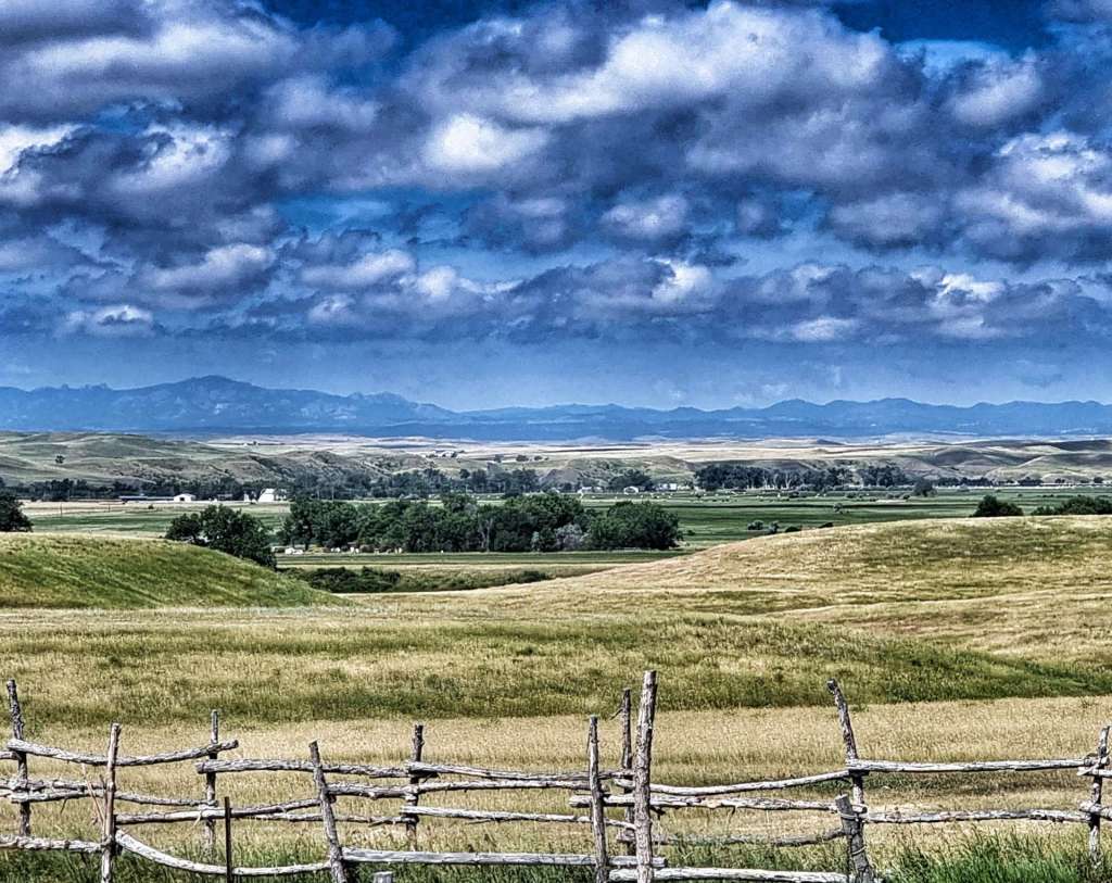
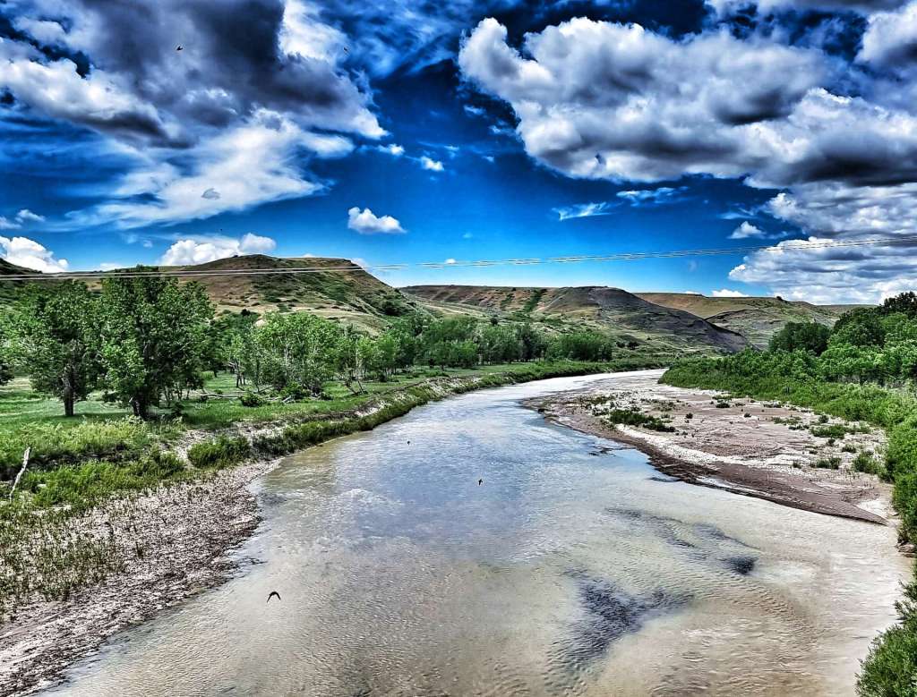
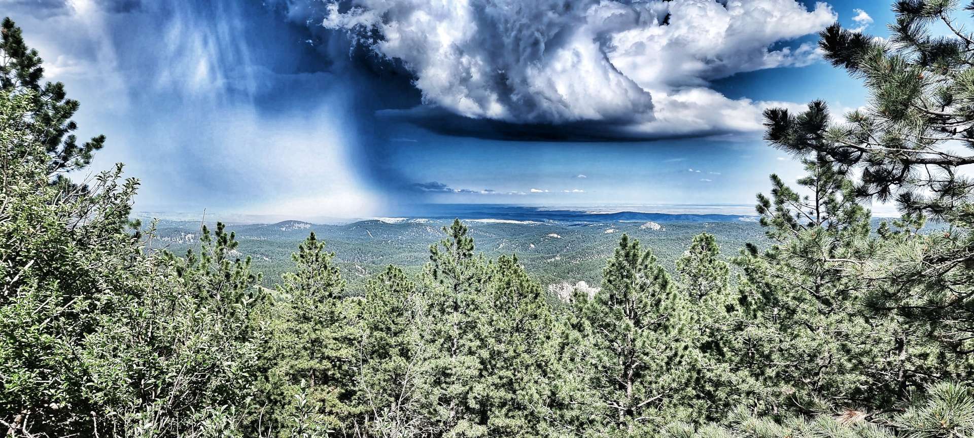
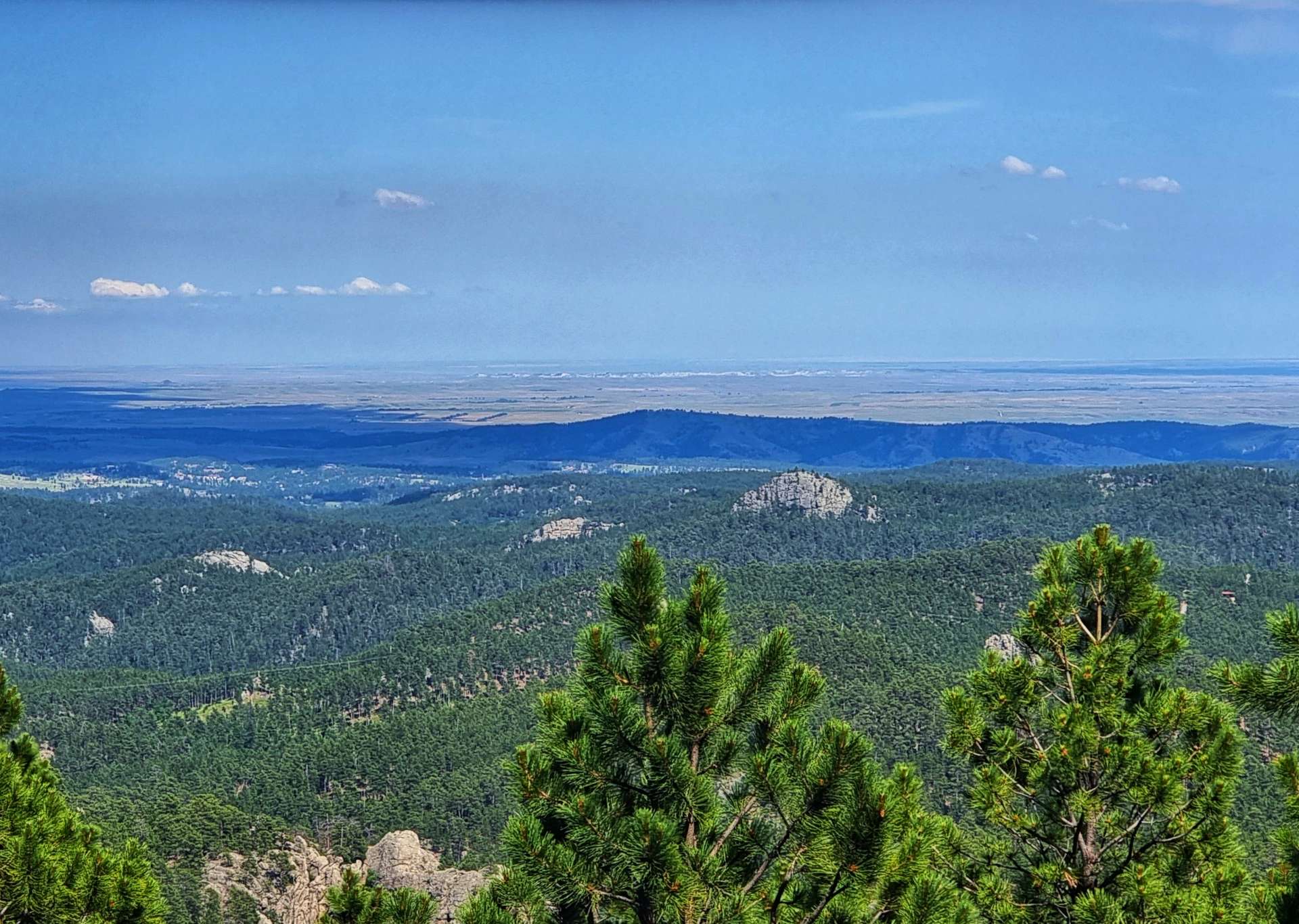
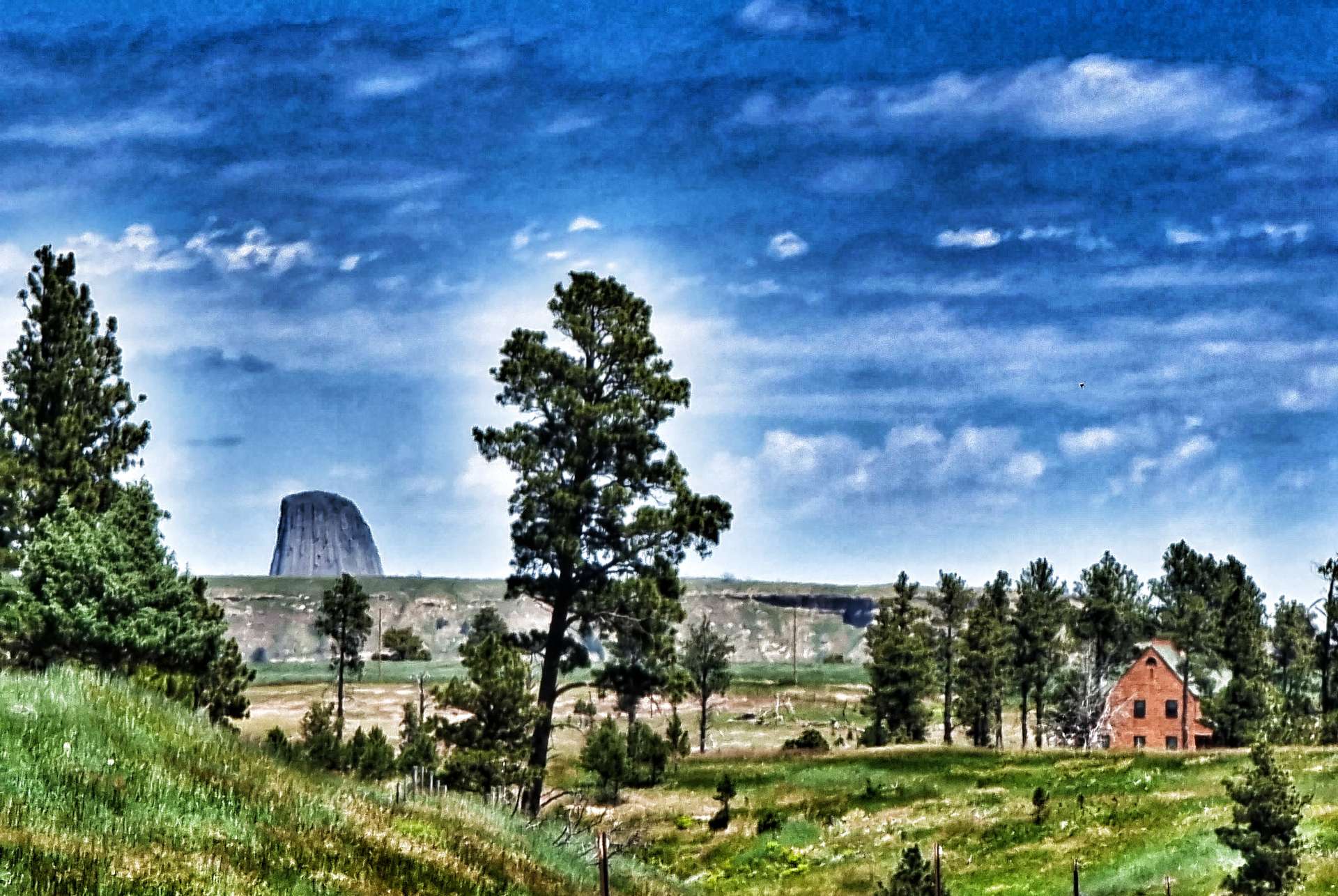
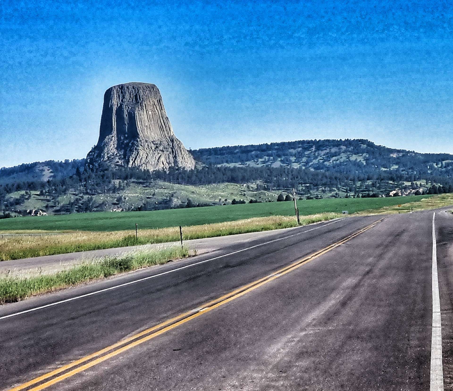
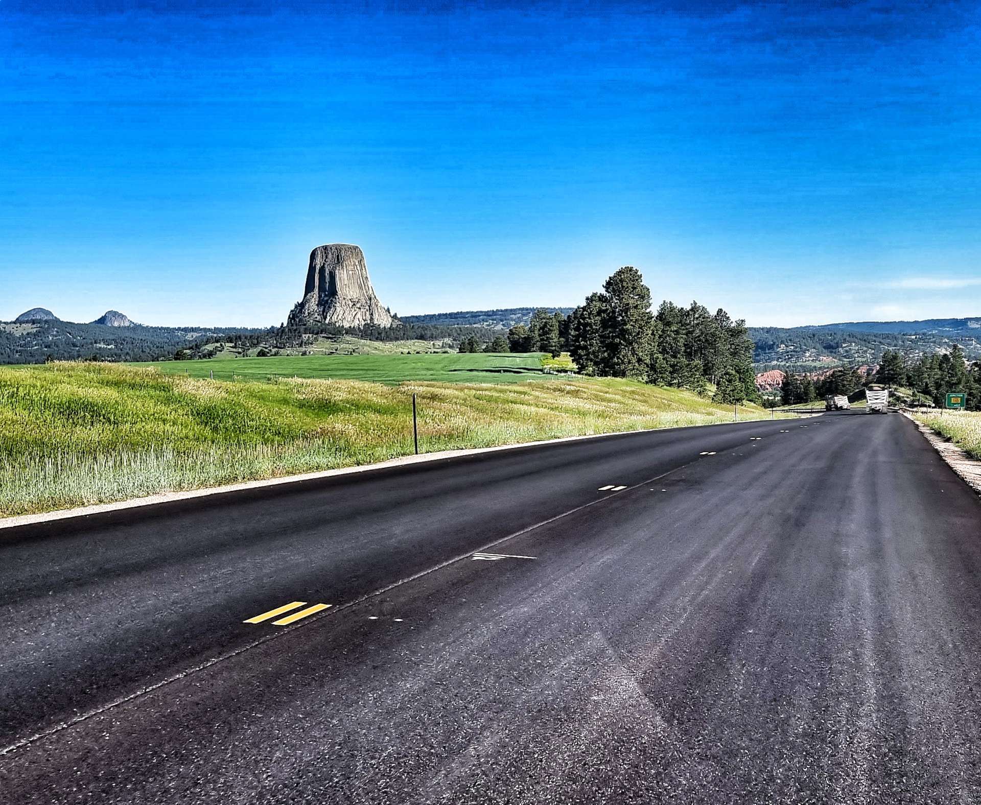
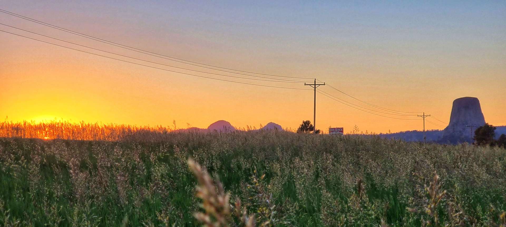
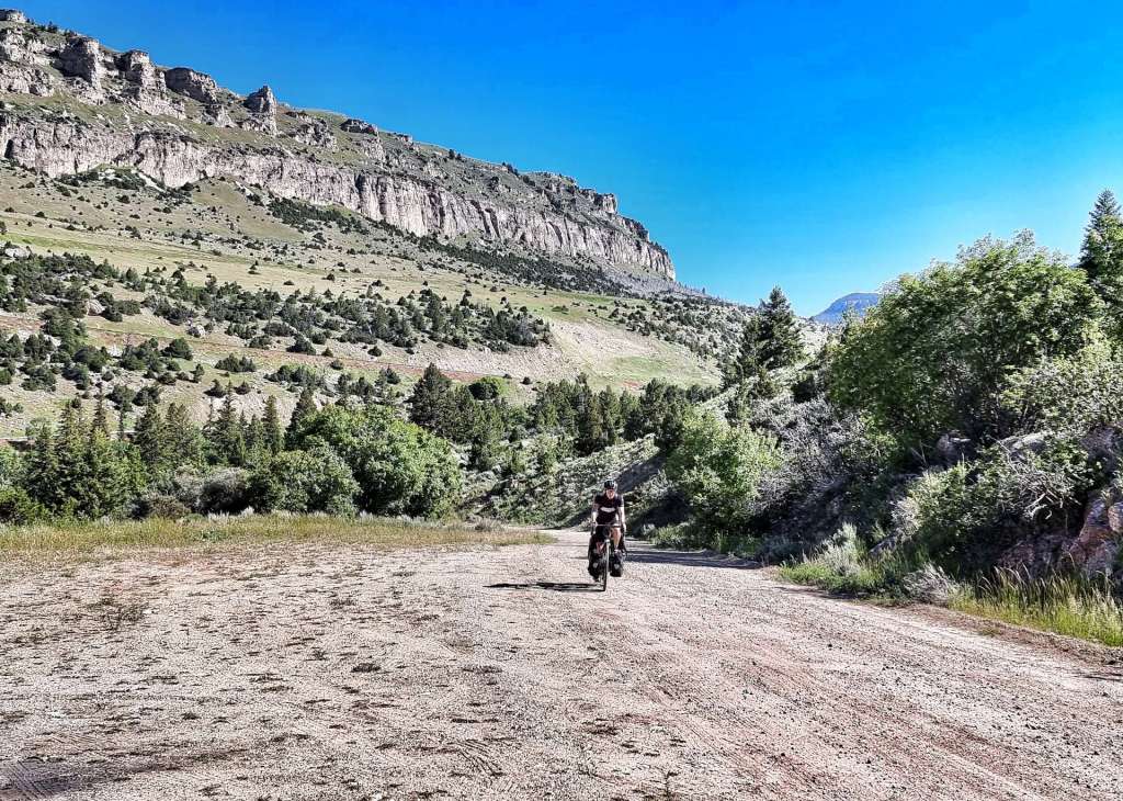
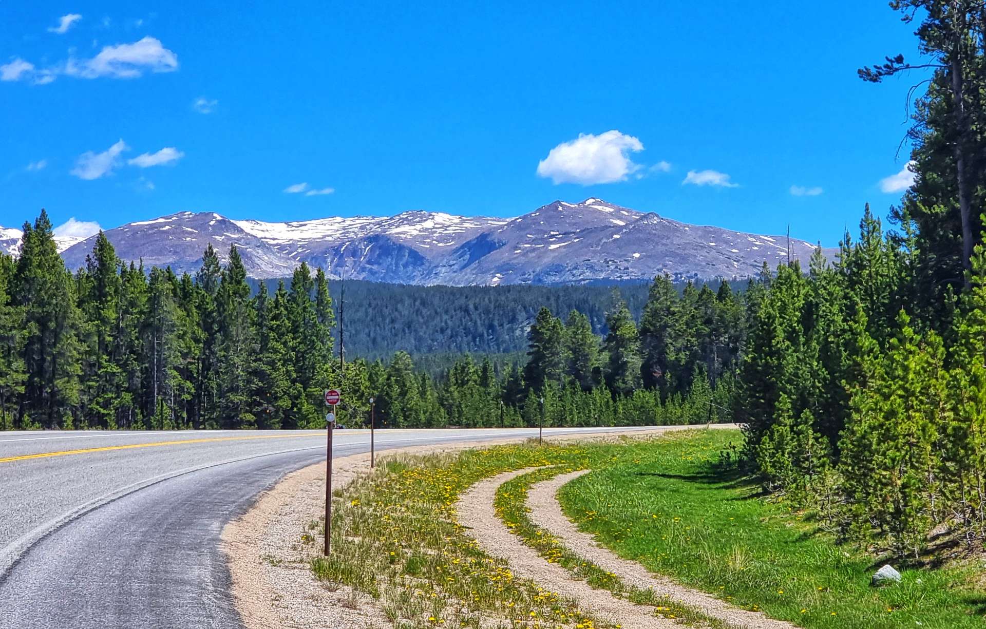
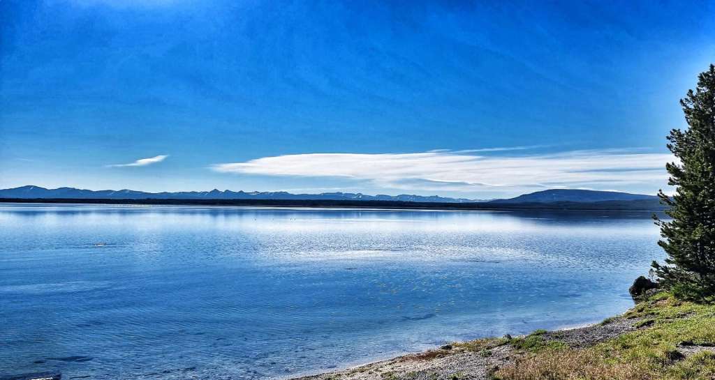
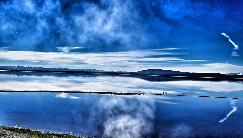
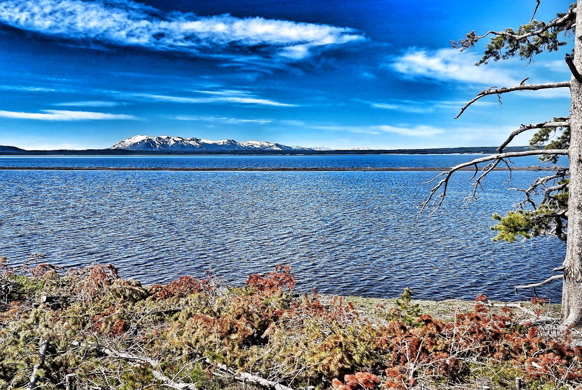
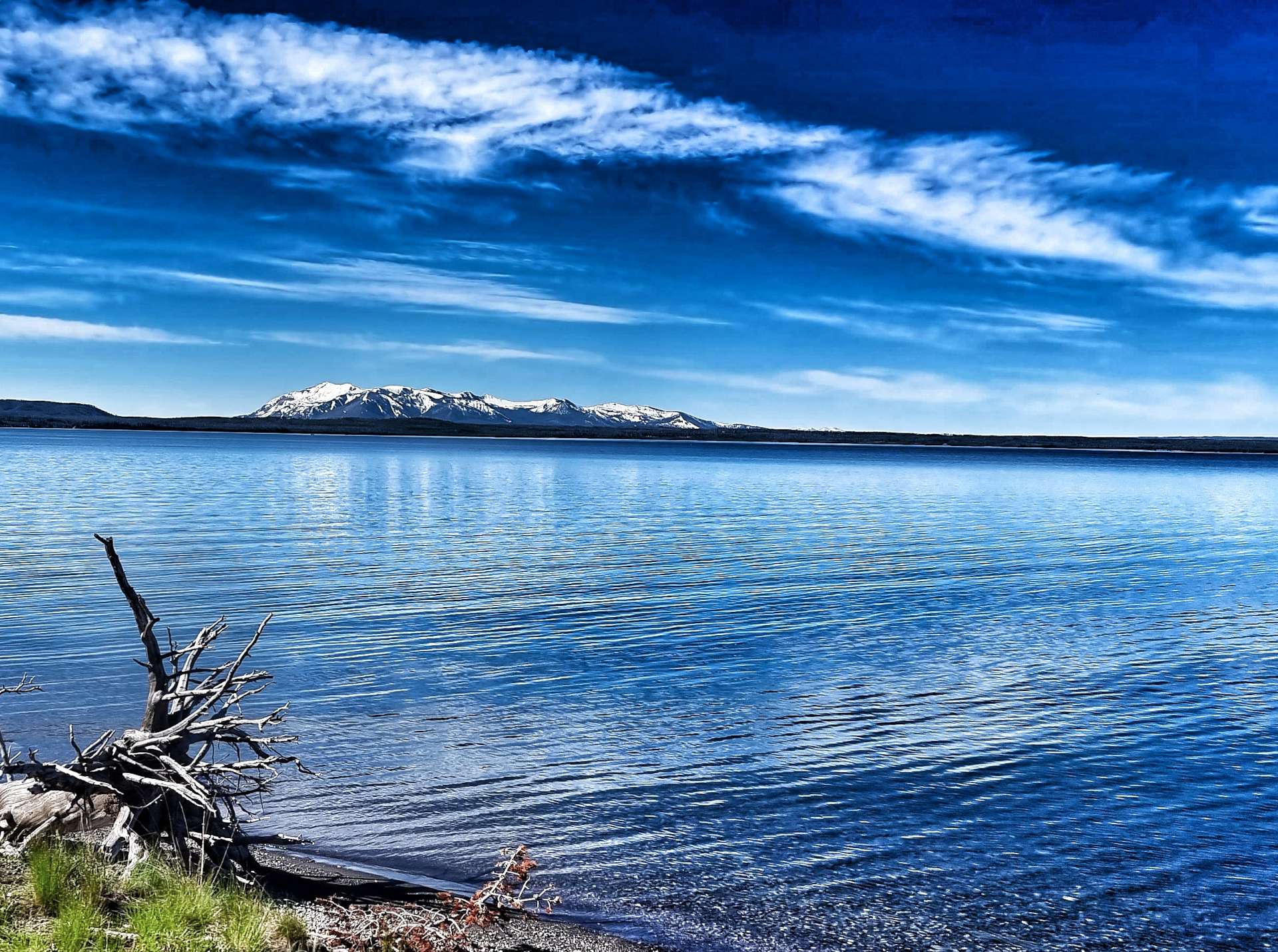
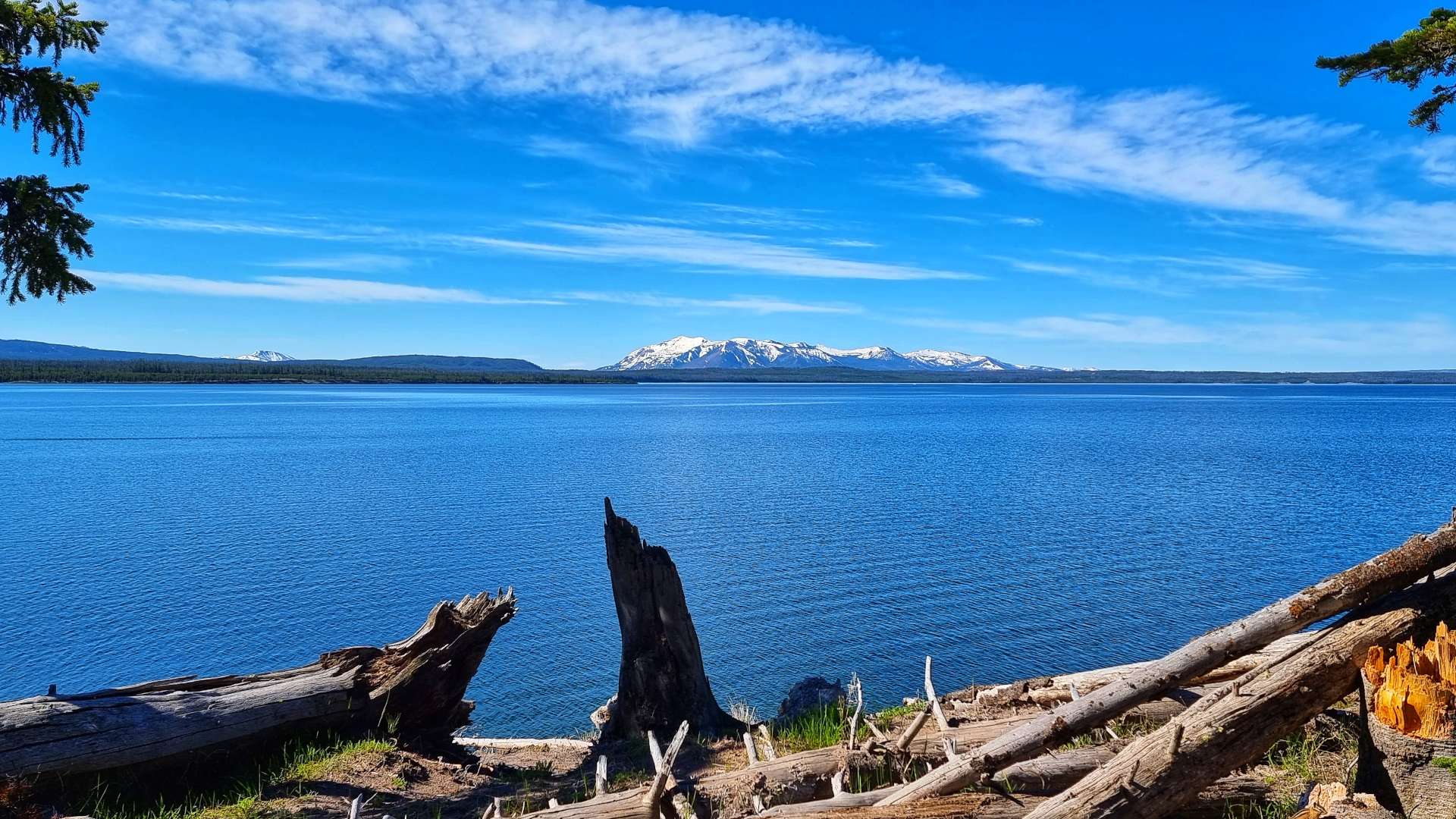
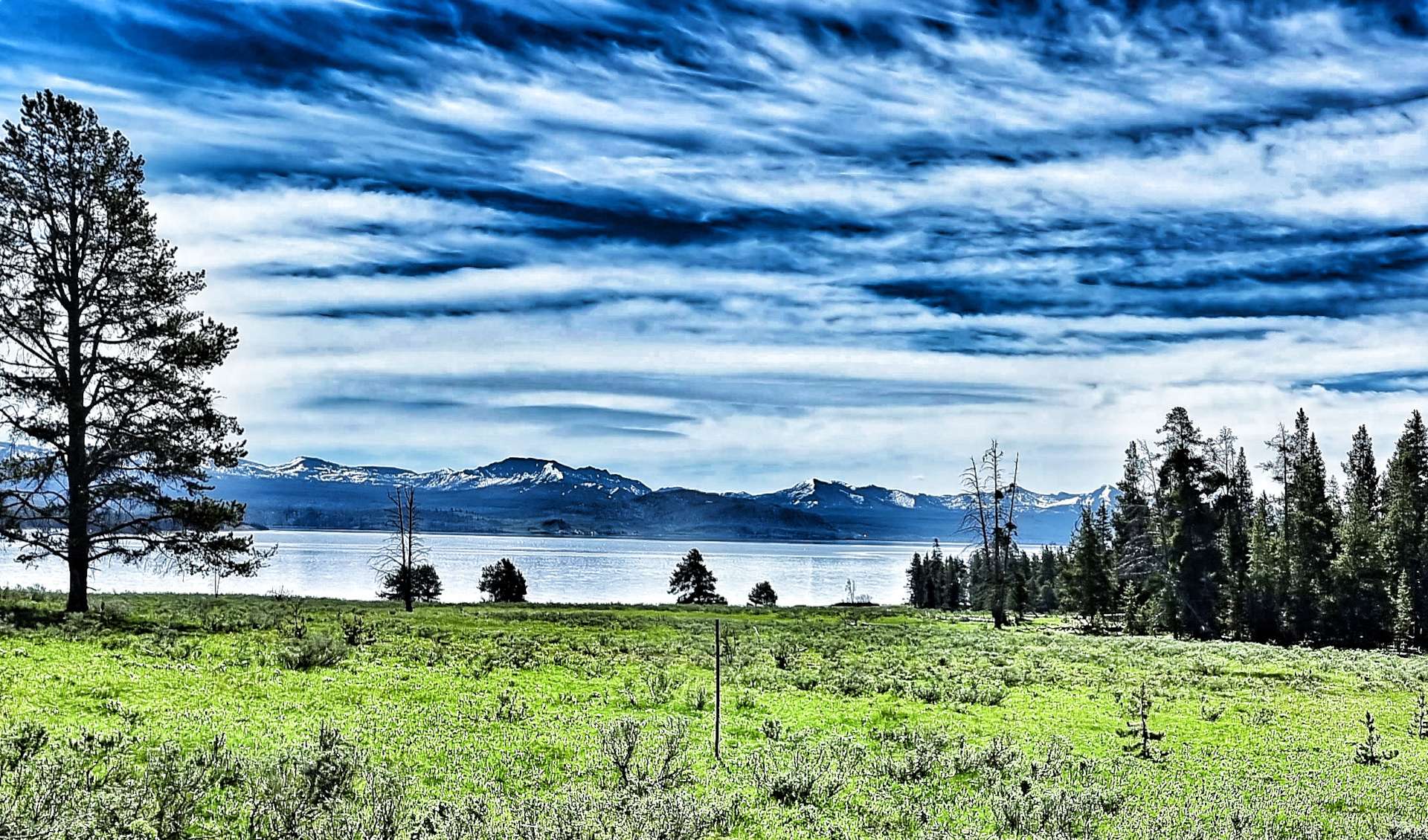
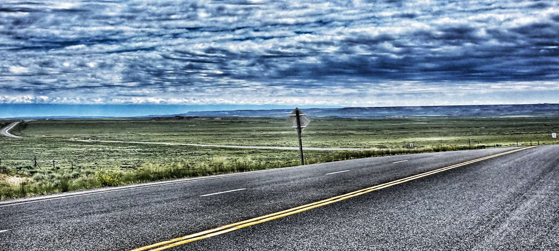
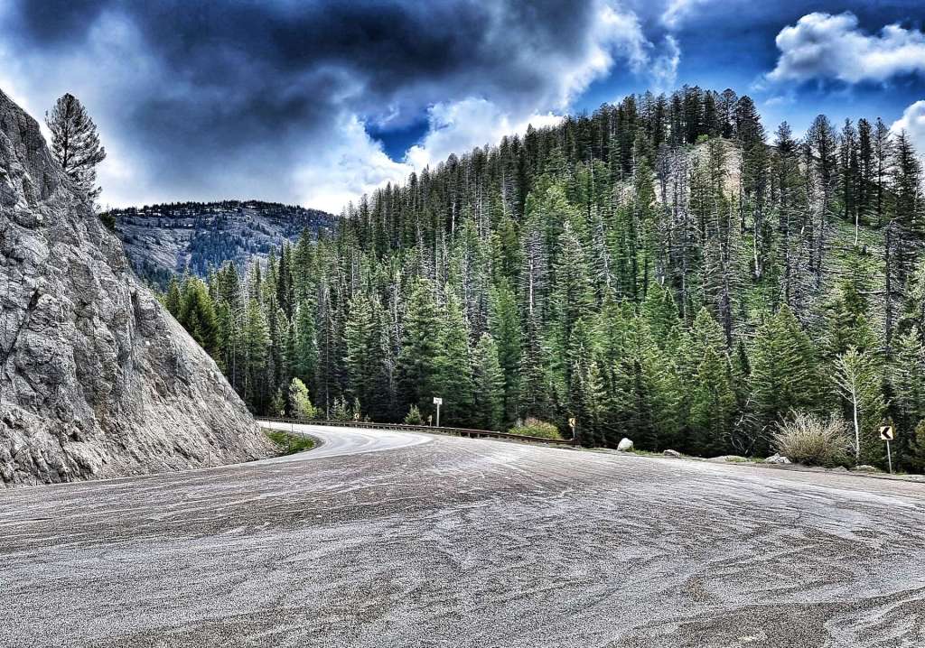
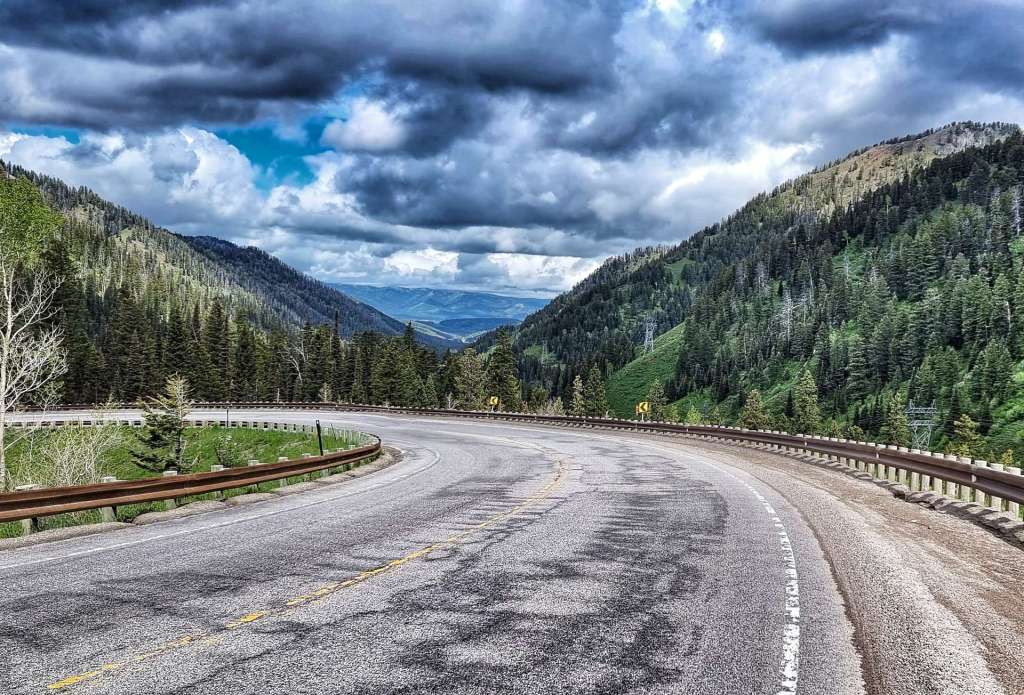
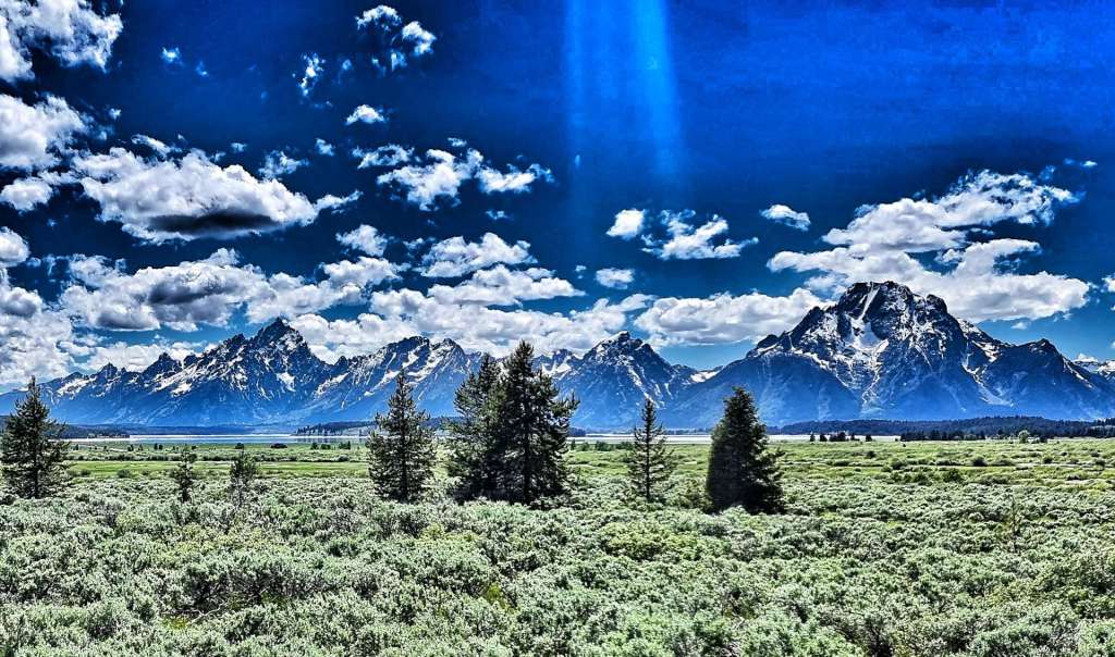
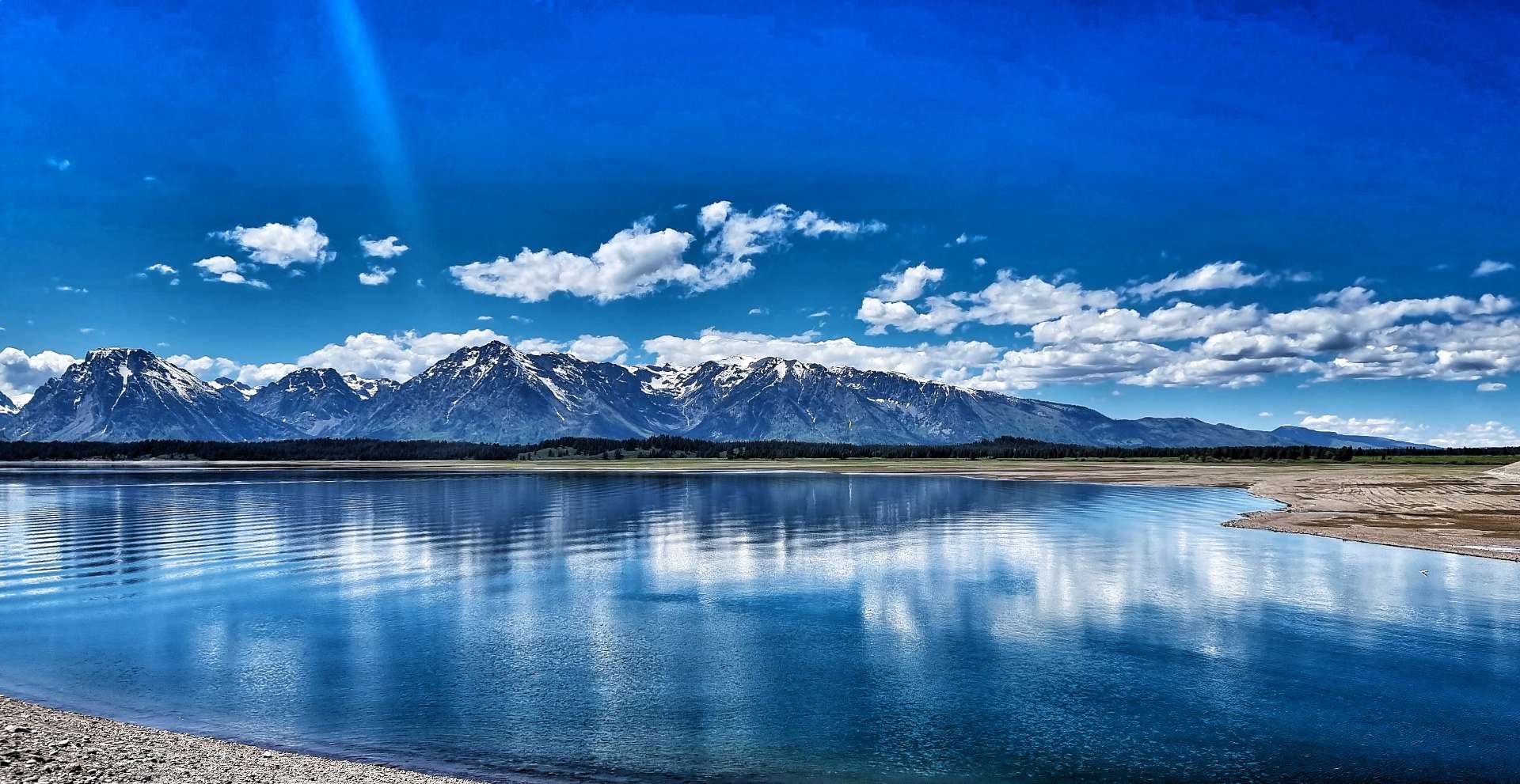
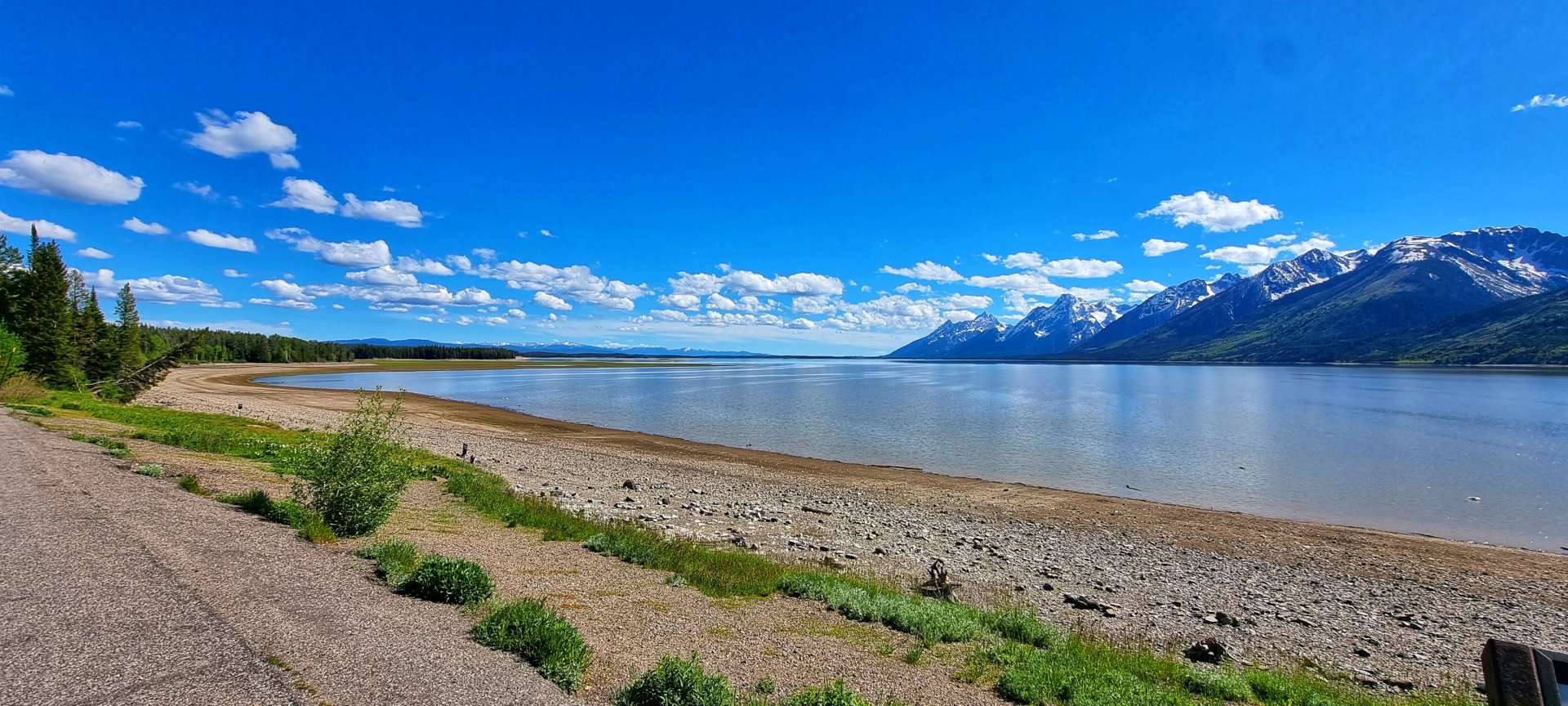
I stopped for one last look back to the Black Hills – we’ll be slowly descending for the next 2,500 miles until we hit some small hills in New York State & Vermont. That also means there aren’t any more big descents either, which is a bit more of a disappointment!!! Meanwhile, on today’s stage, the road stretched ahead into the distance, taking us ever closer to Scenic, gateway to our next iconic landmark.
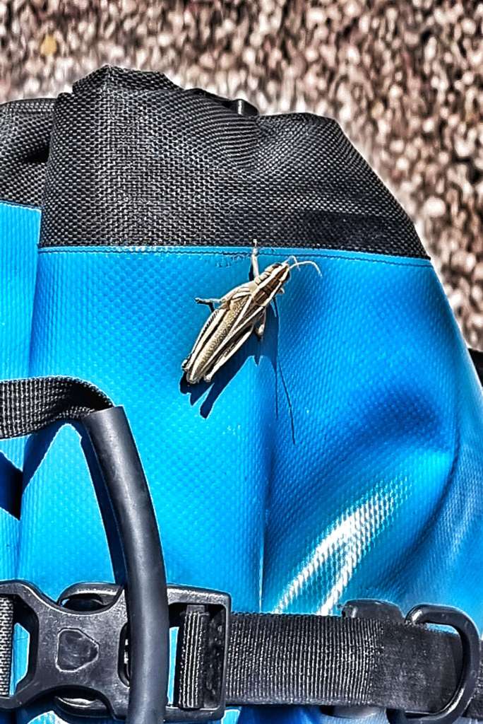
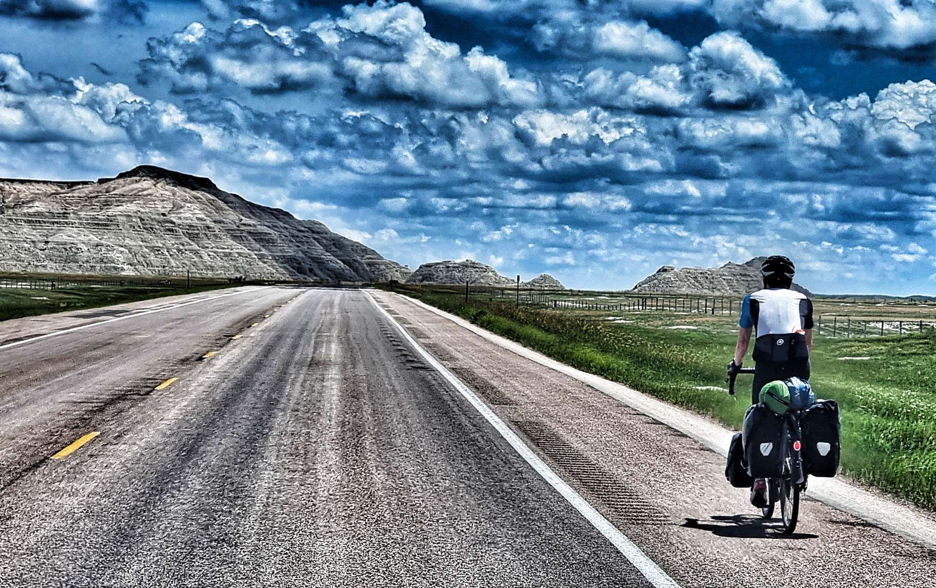
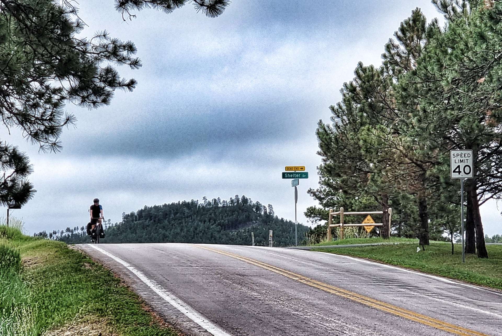
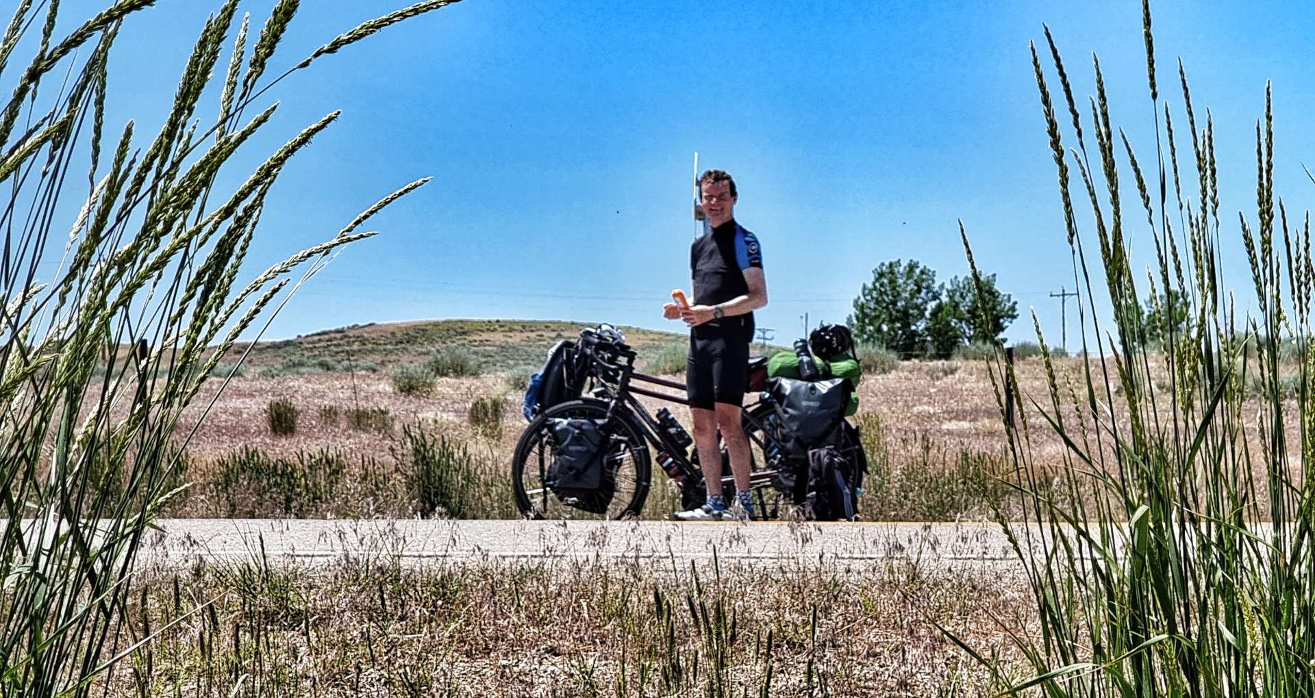
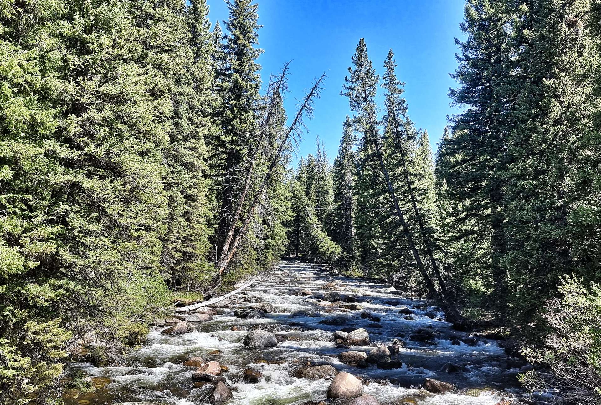
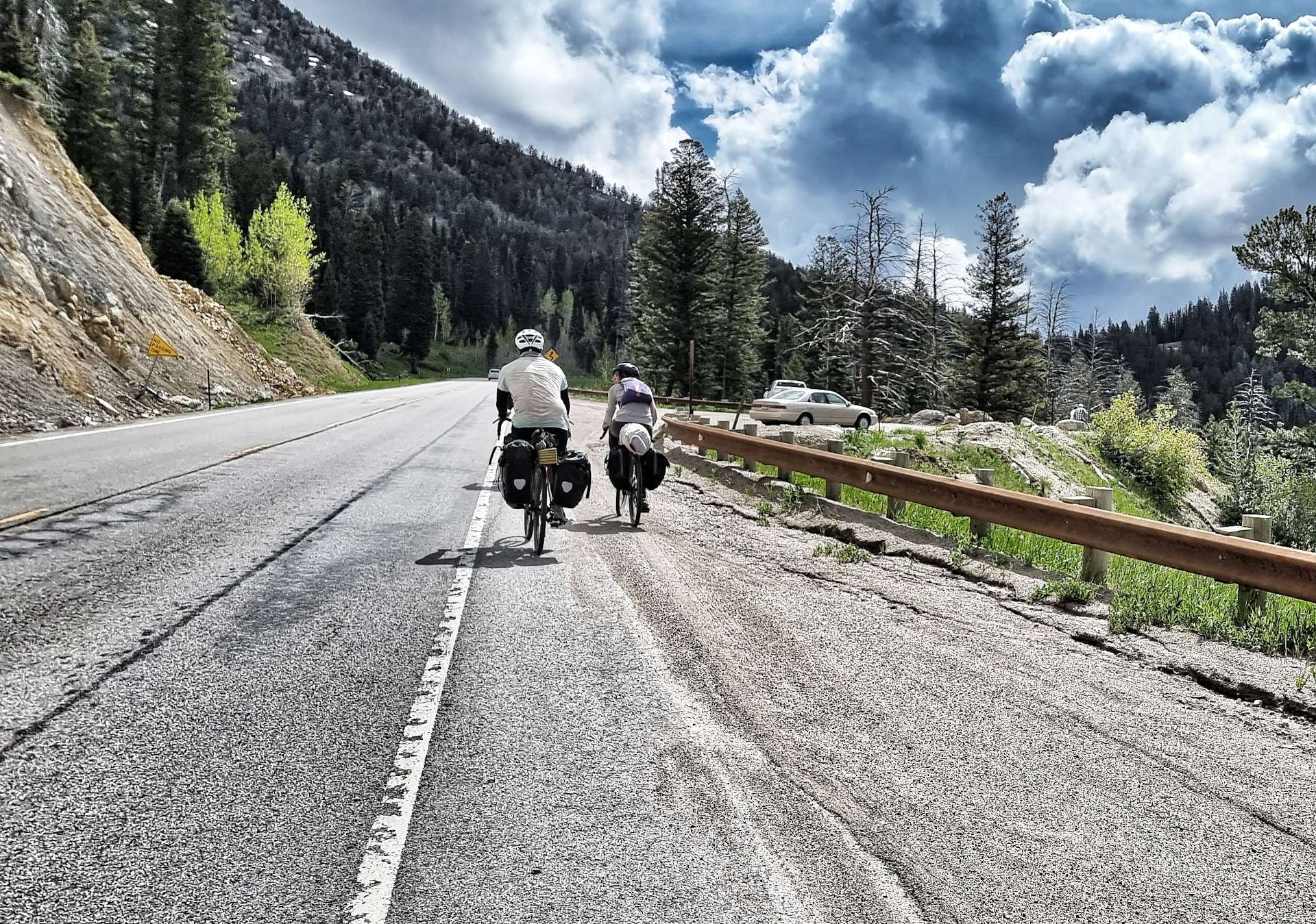
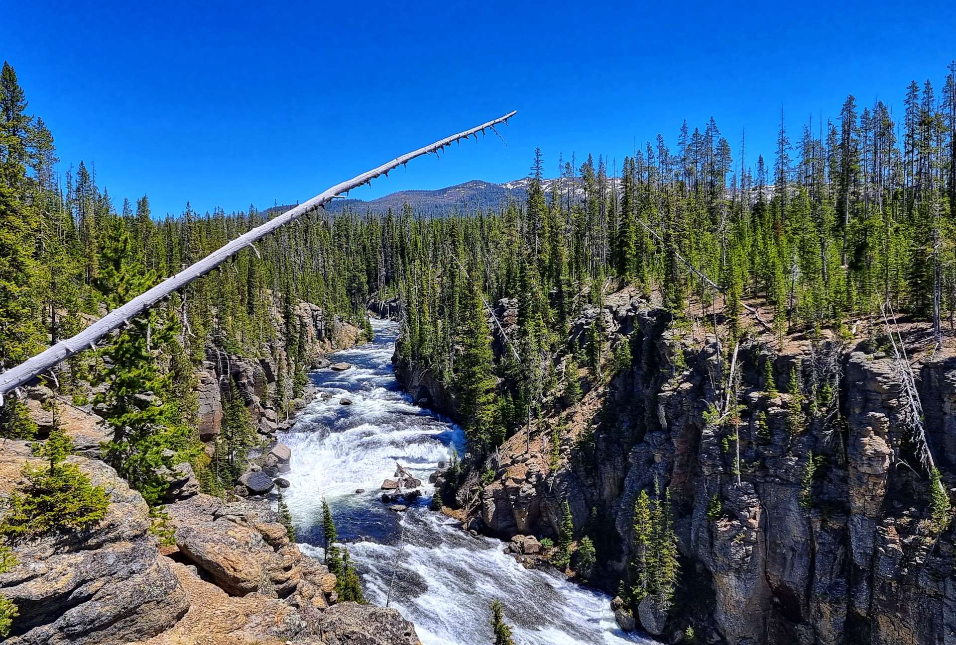
Before that we crossed Rapid Creek & took on one final drag up to the plateau – on the way up, I picked up a passenger. I originally thought it was Jiminy The Cricket, but it’s since been suggested that I may have introduced the first of a plague of locusts into Scenic!
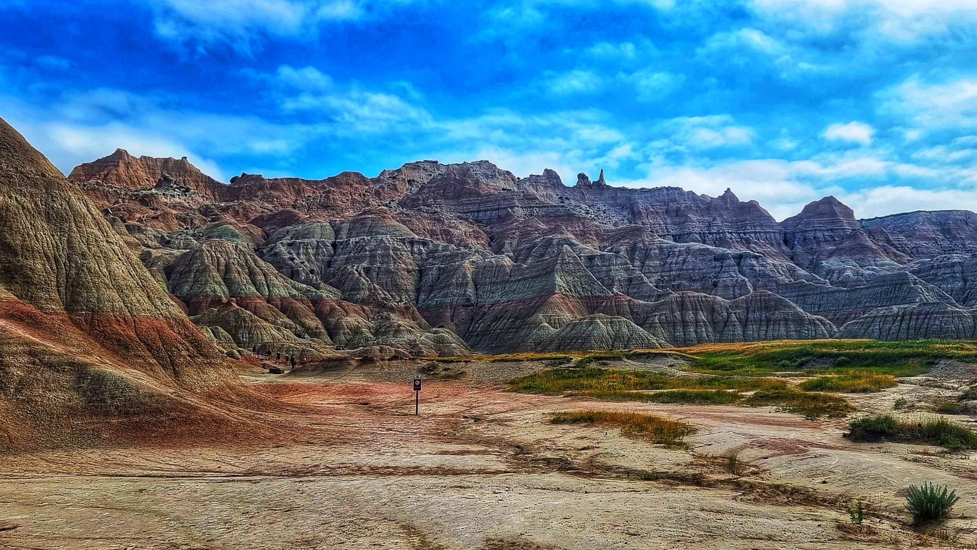
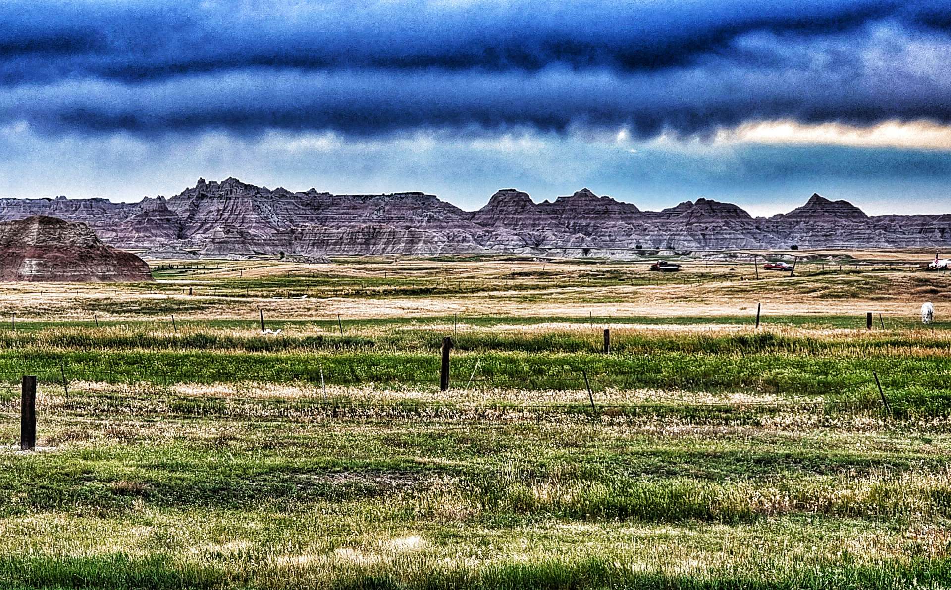
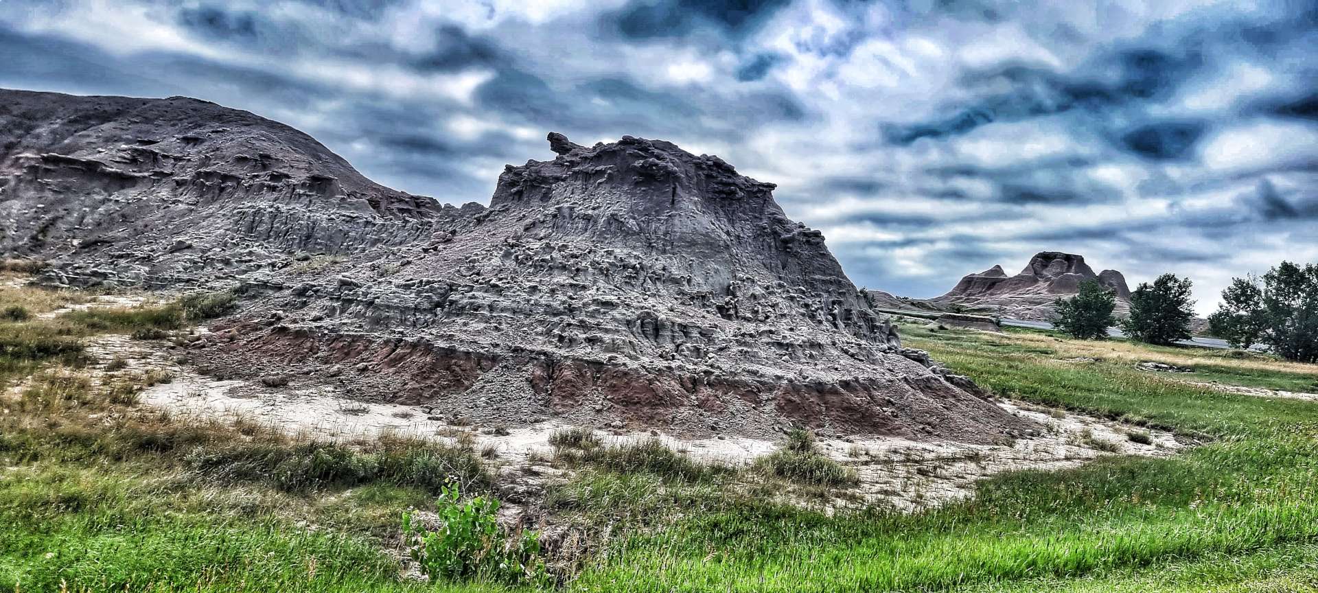
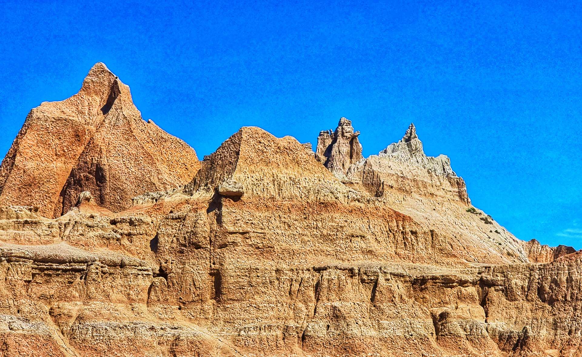
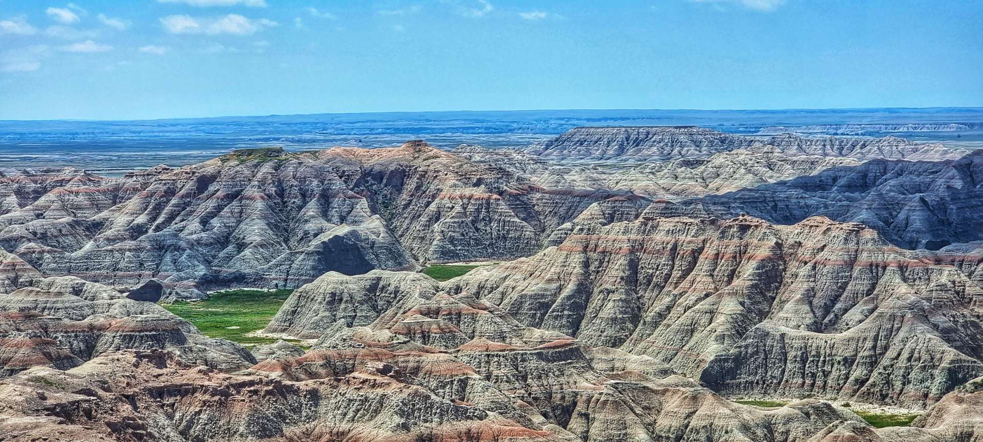
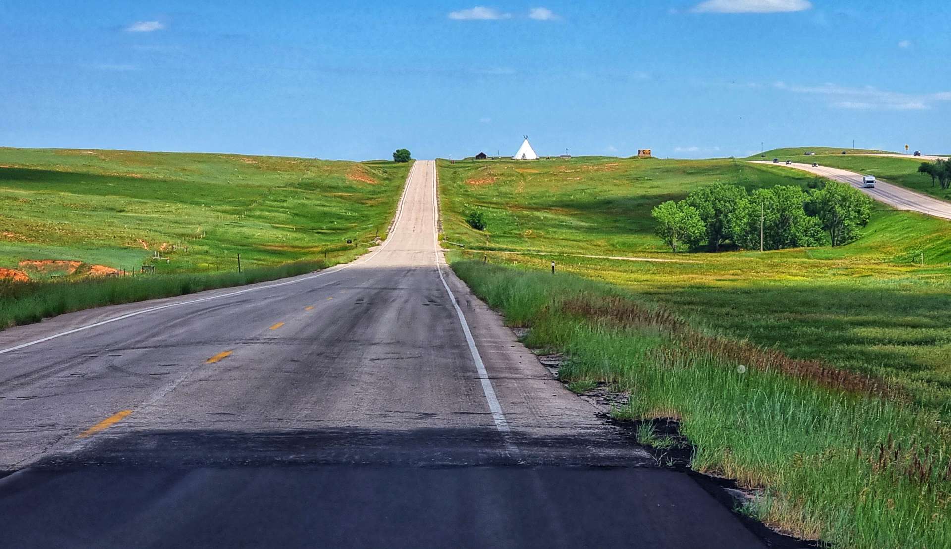
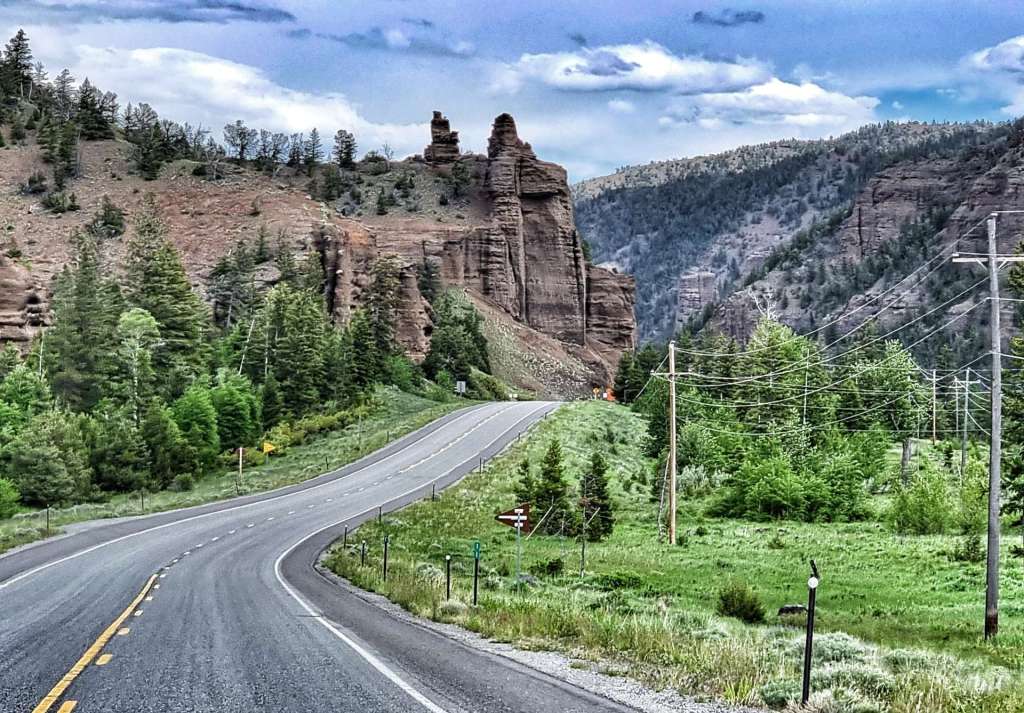
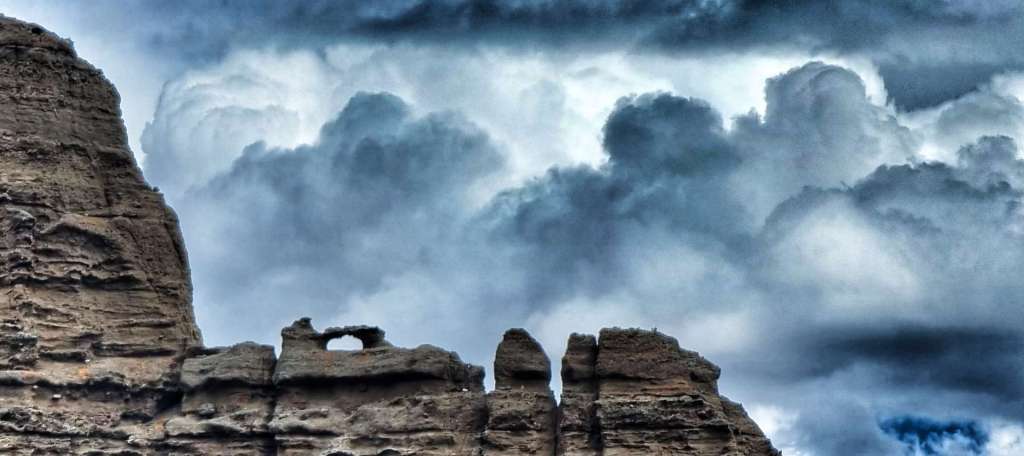
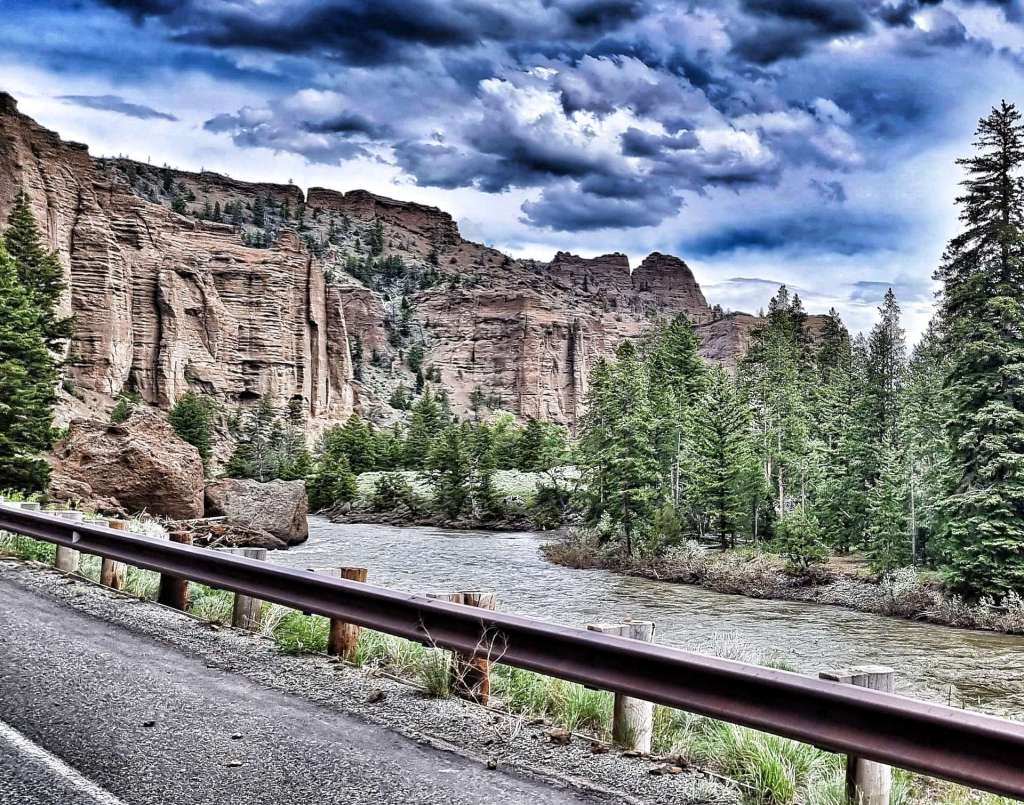
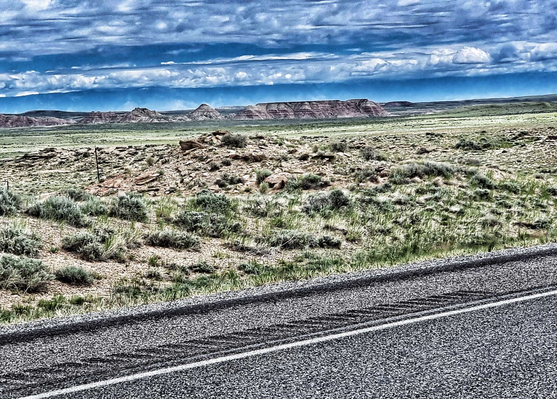
The little fellow stayed on my front pannier for more than 45 minutes, until eventually he got blown off on a small descent when we saw The Badlands for the first time. After seeing fields for the last 3 hours, the outcrops of red, white, yellow & black rock laid out before us seemed even more grand & impressive.
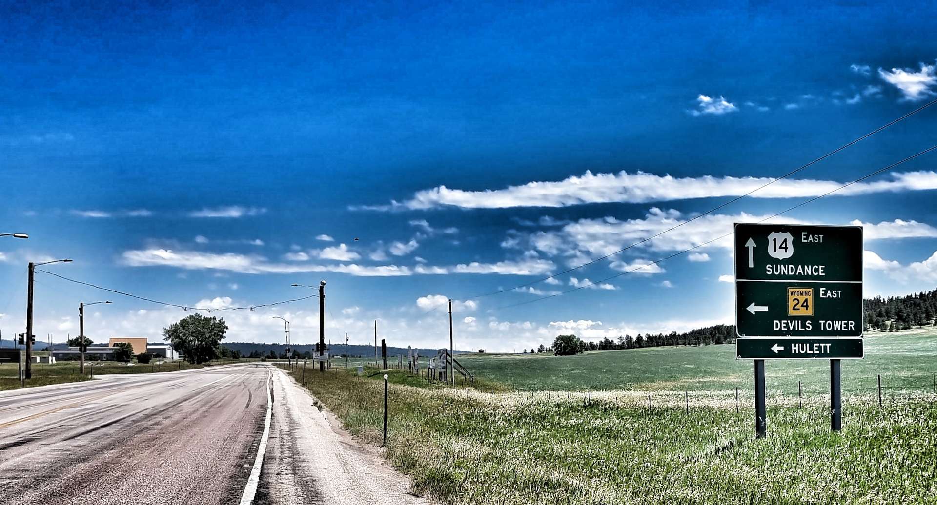
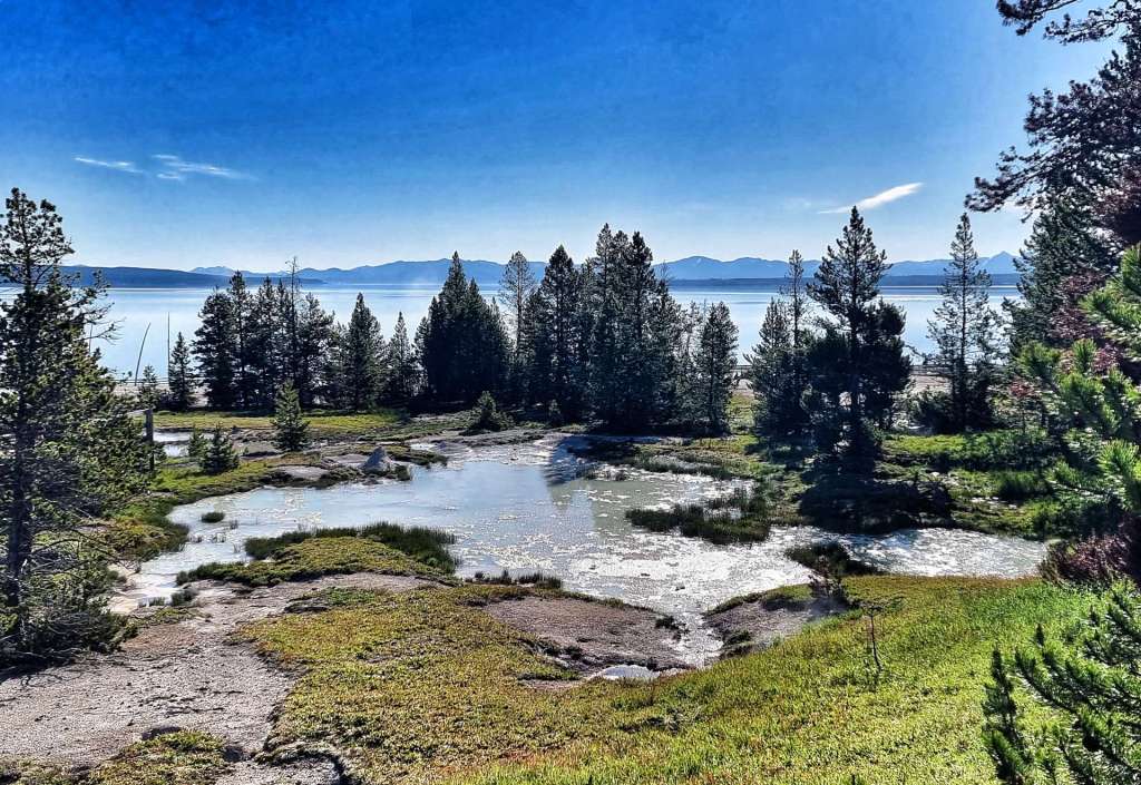
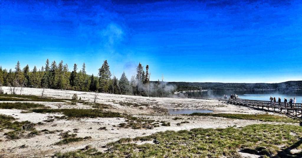
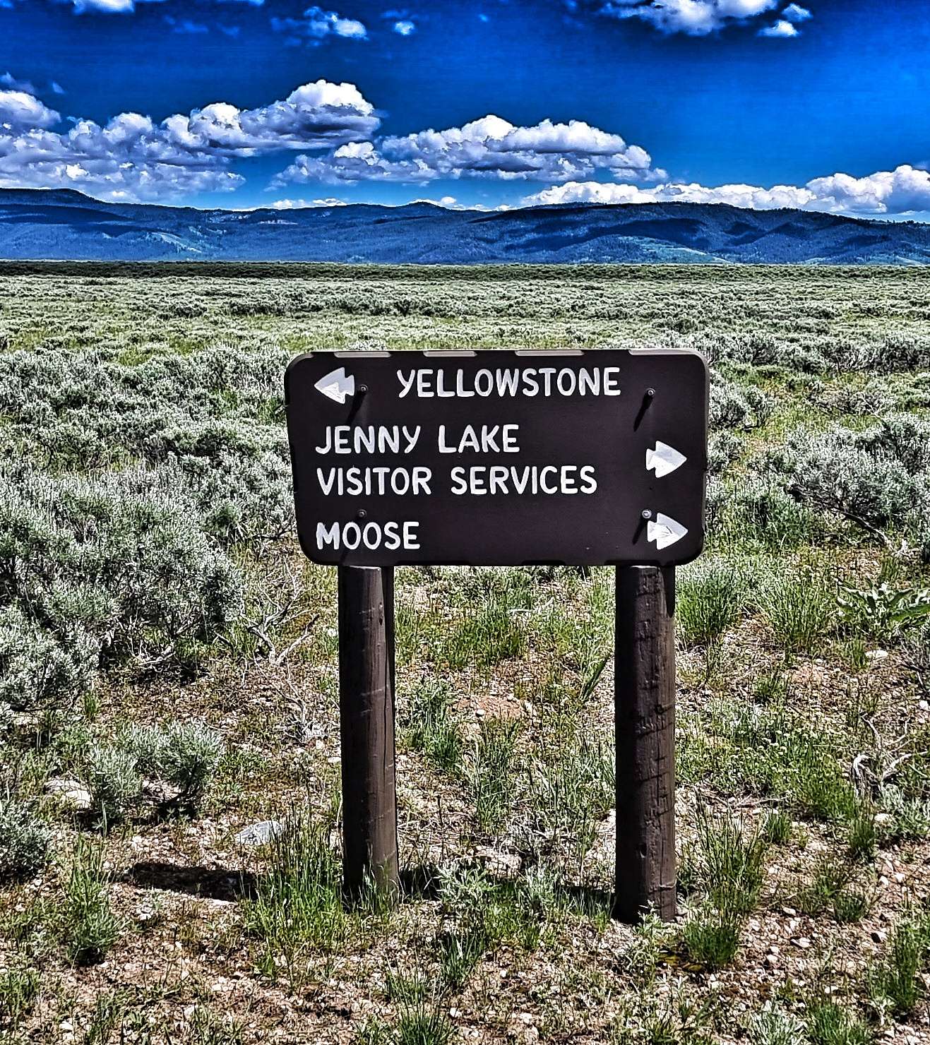
As we reached Scenic, one of 3 ways into Badlands National Park (the others being Wall & Interior), we found what was once a thriving community to be no more than a ghost town with Tatanka (Lakota for Buffalo) Trading Post the only building still in use – we were able to top up our bottles & relax in the shade for 10 minutes with a can of sprite.
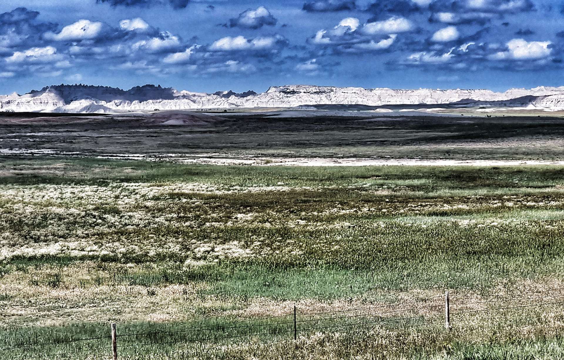
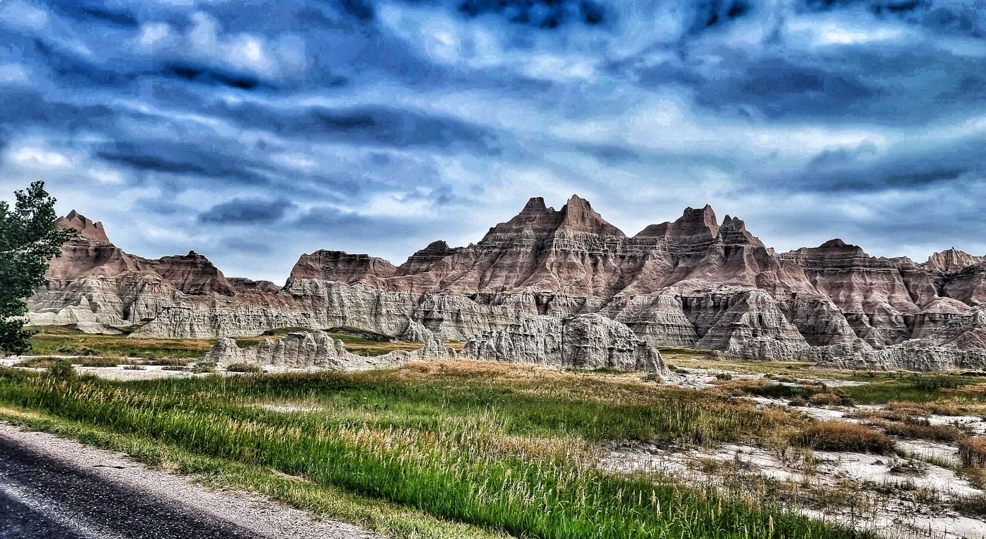
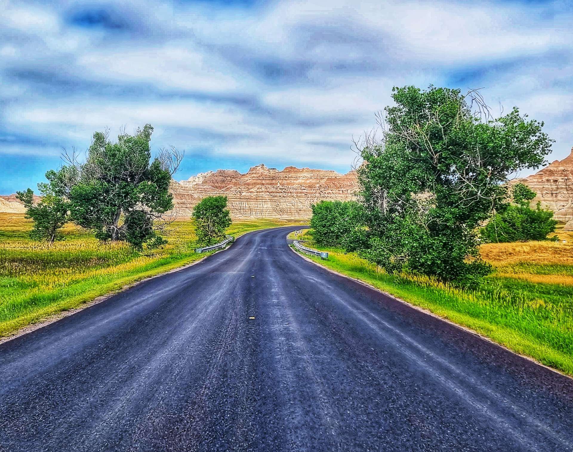
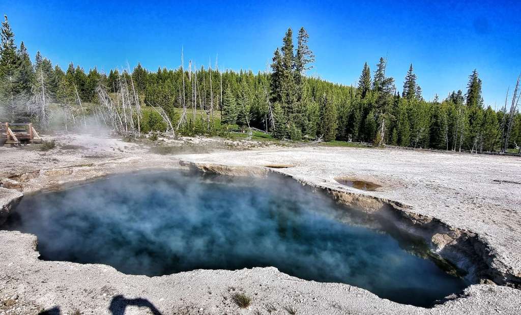
We could now see the rugged beauty of Badlands up close. Although we entered Badlands National Park today, it was only a fleeting visit.
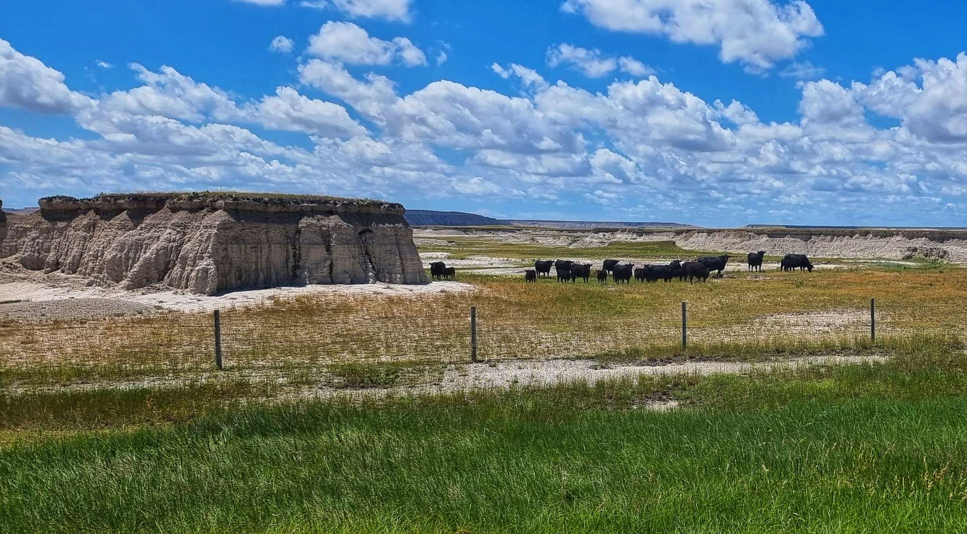
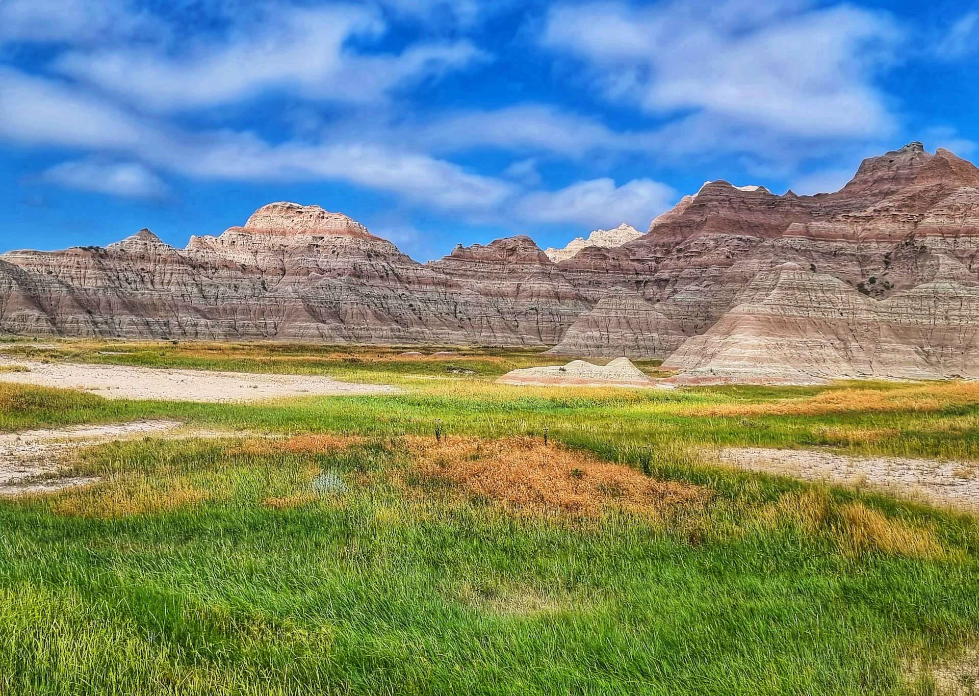
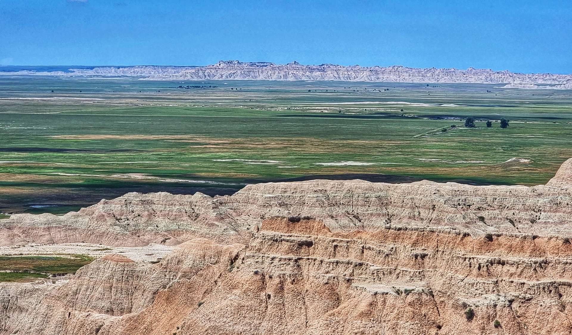
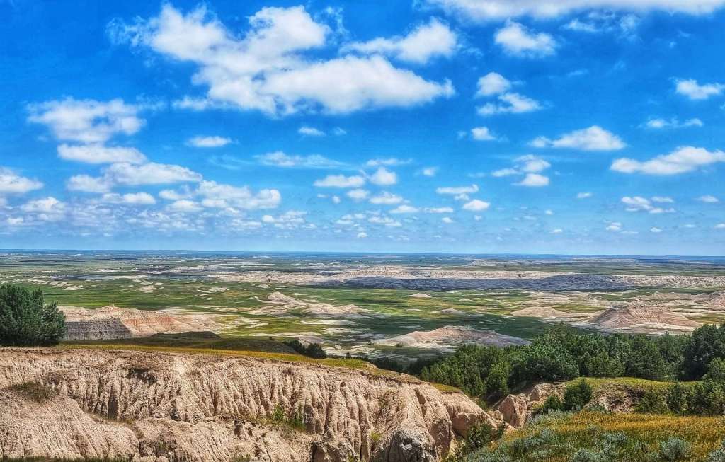
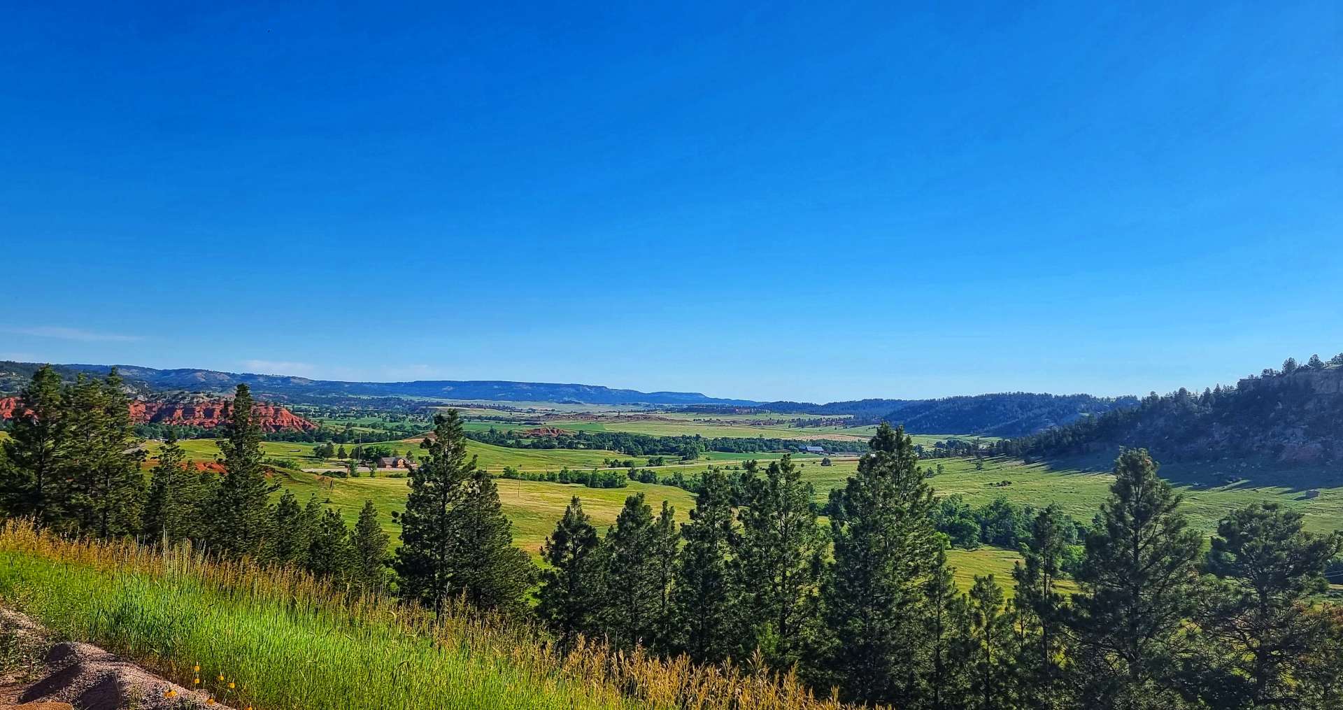
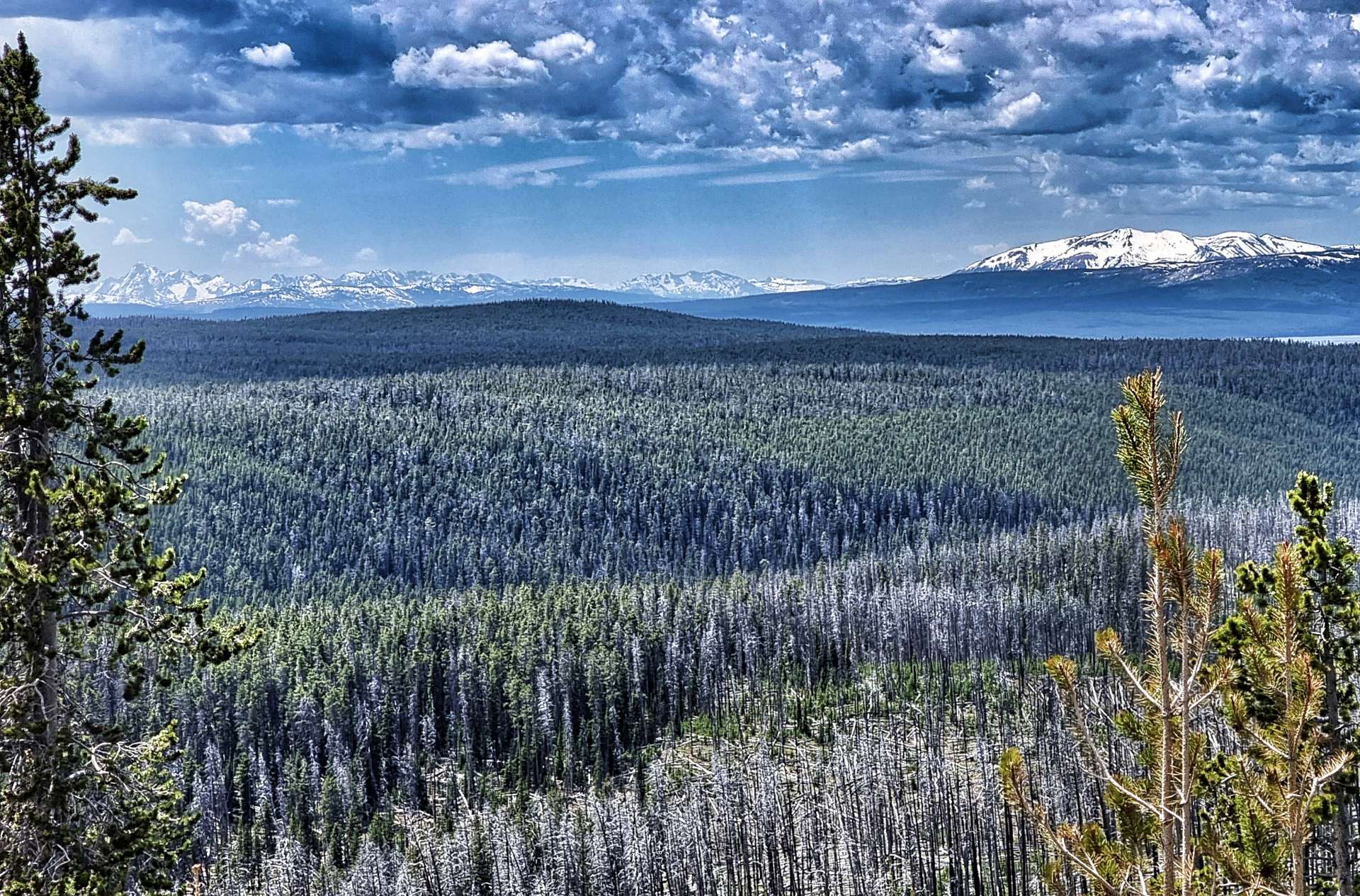
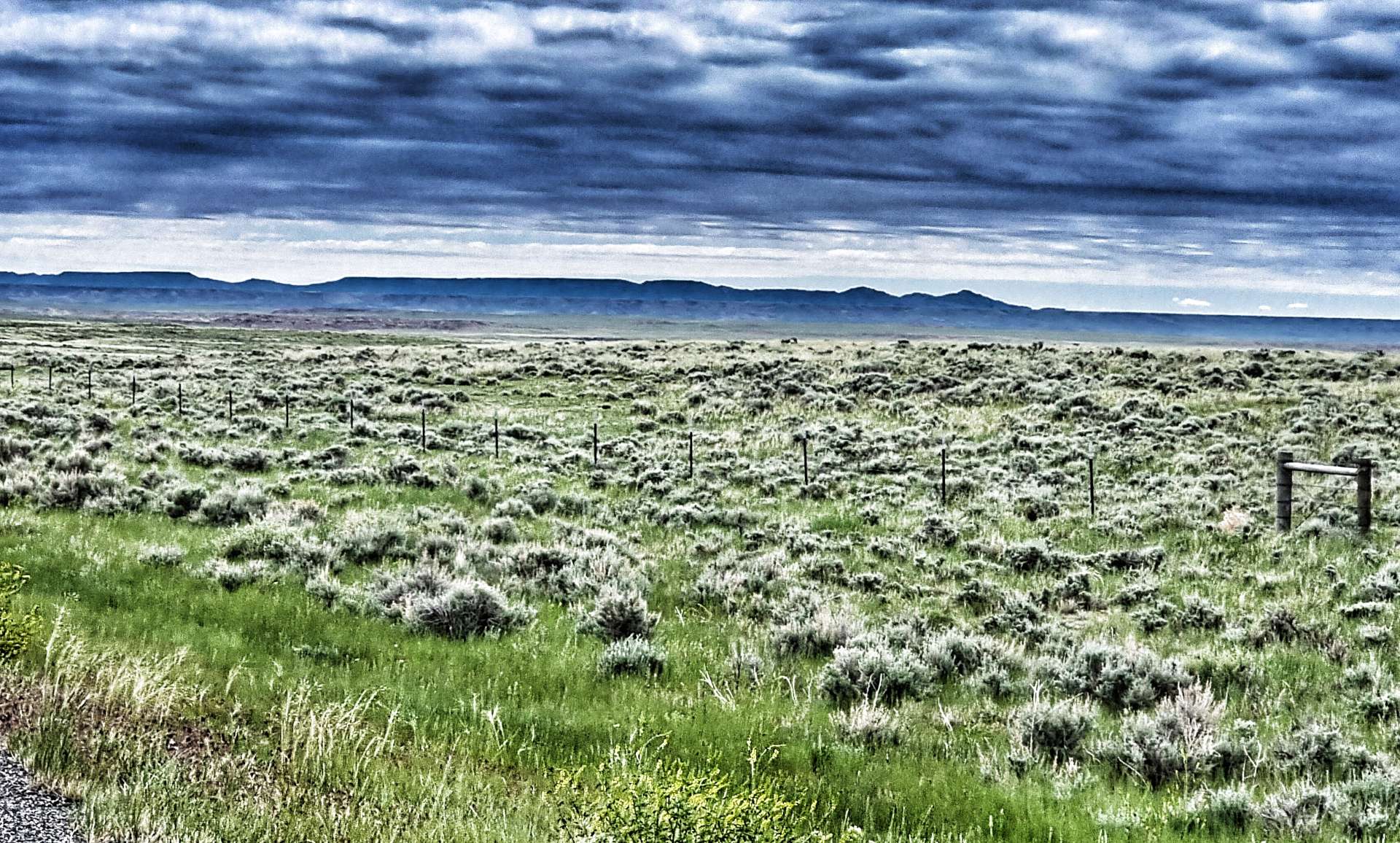
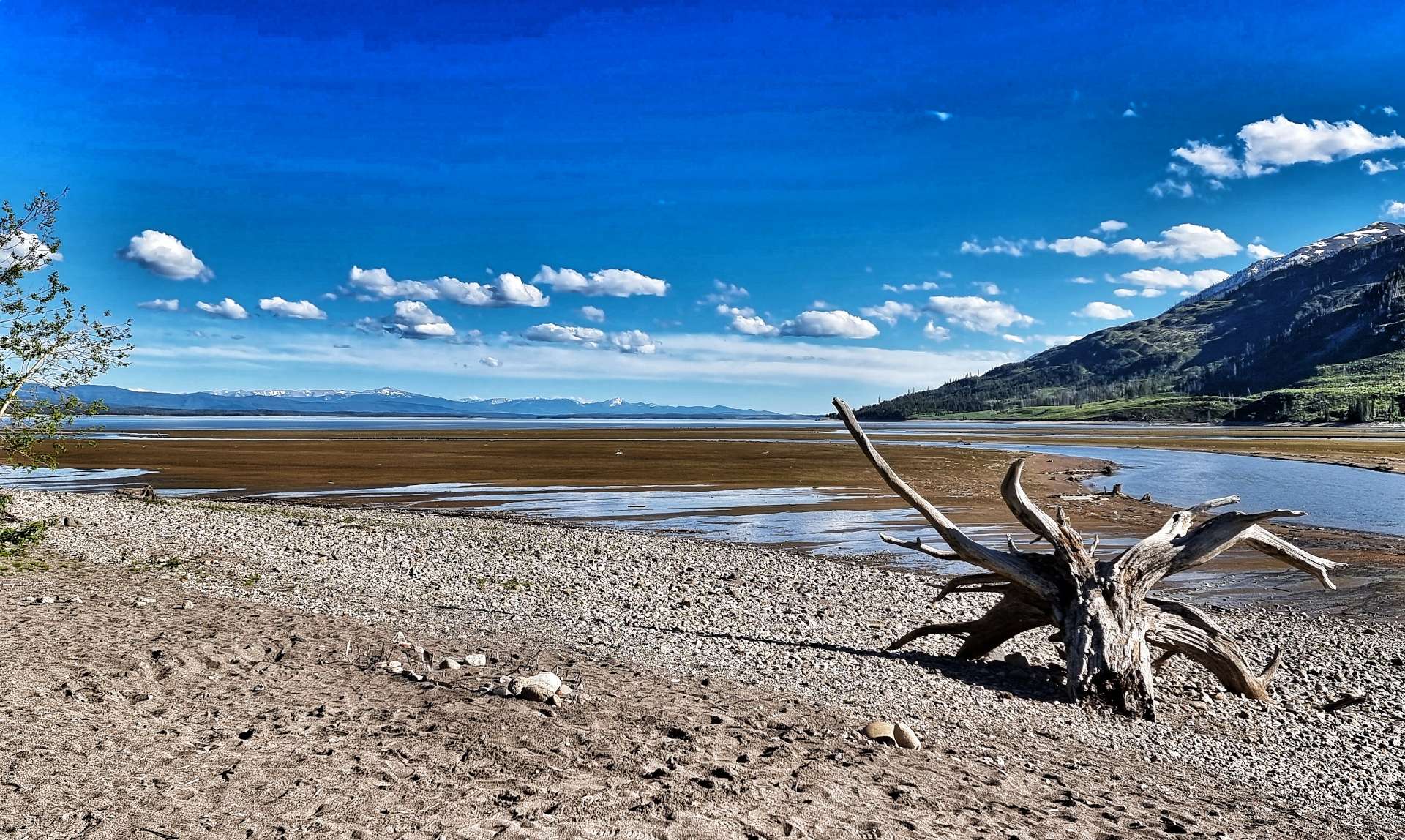
Although we were only cycling through Badlands National Park for about 3 or 4 miles, the scenery was stunning & gave us an idea of what tomorrow might offer up. As we left Badlands, we returned to Buffalo Gap Grasslands – a simple way to tell the difference is whether the photo has a fence (Buffalo Gap Grasslands) or not (Badlands).
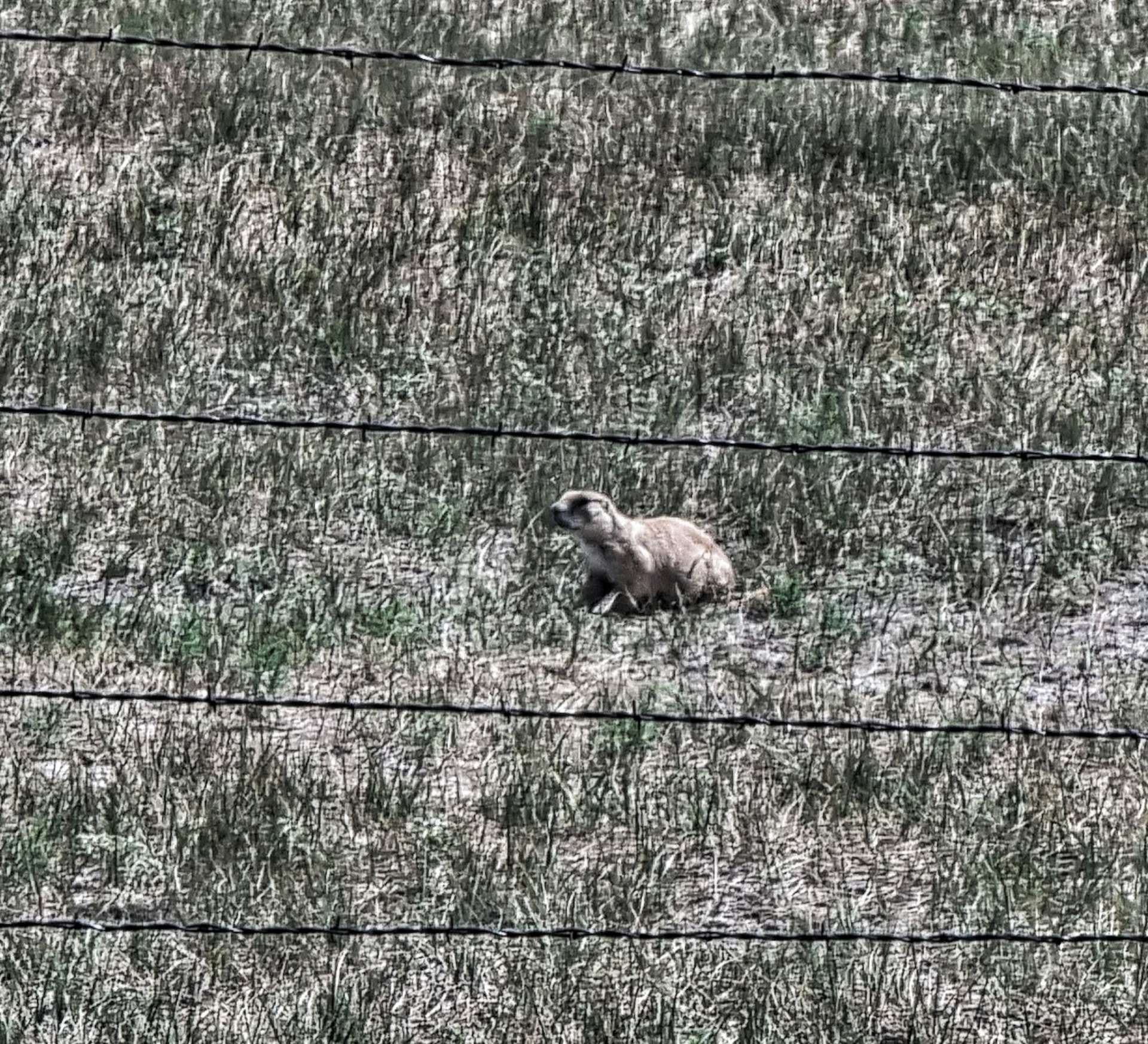
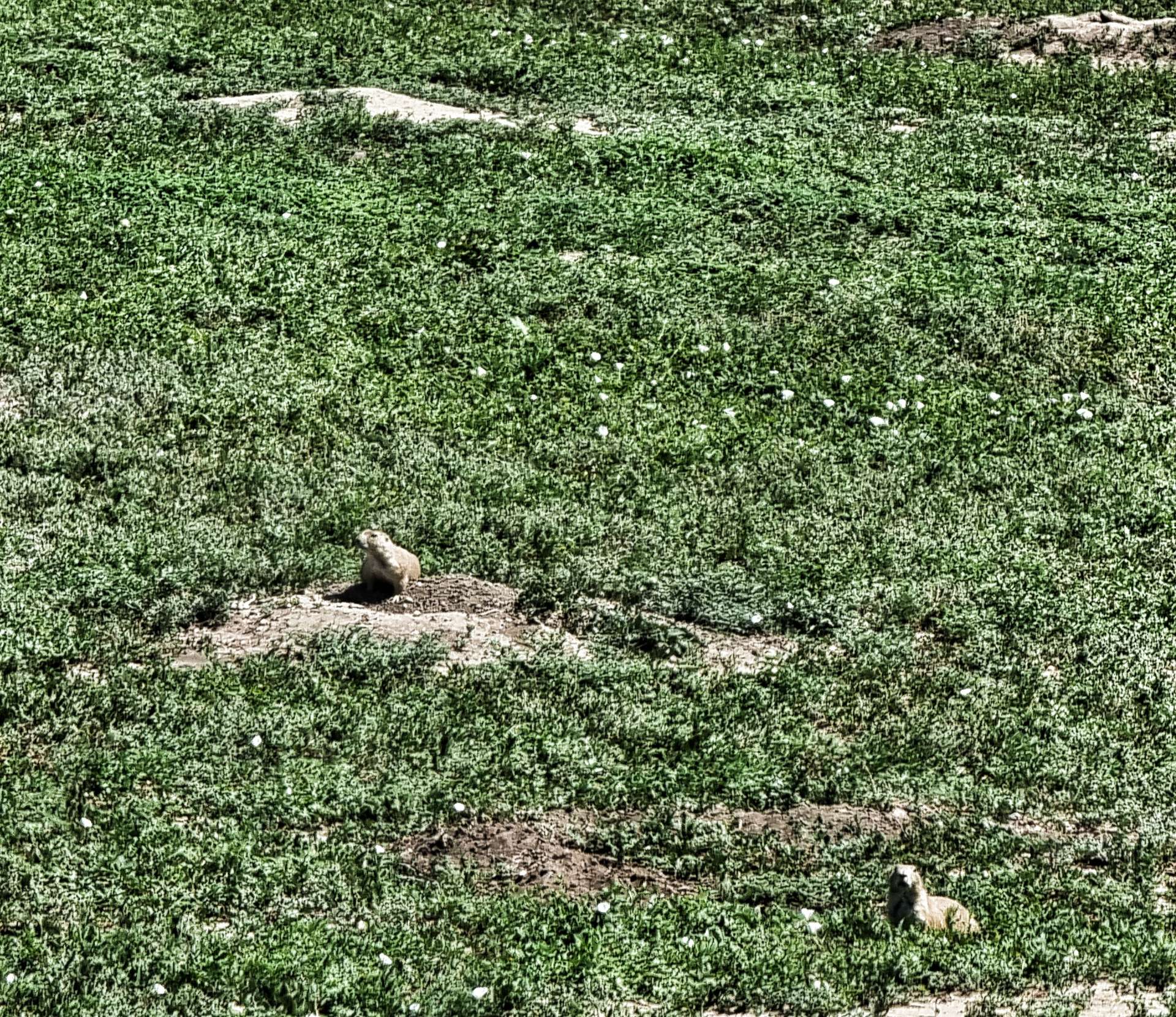
Returning to the carefully managed National Grasslands, we saw the only wildlife of the day (other than cattle) – prairie dogs thrive in Buffalo Gap National Grasslands & Badlands National Park, with very few natural predators. Every now & then the Badlands drew closer to us, giving us a tantalising view.
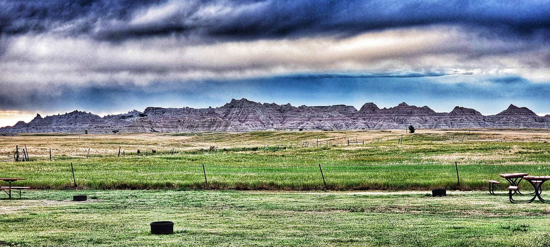
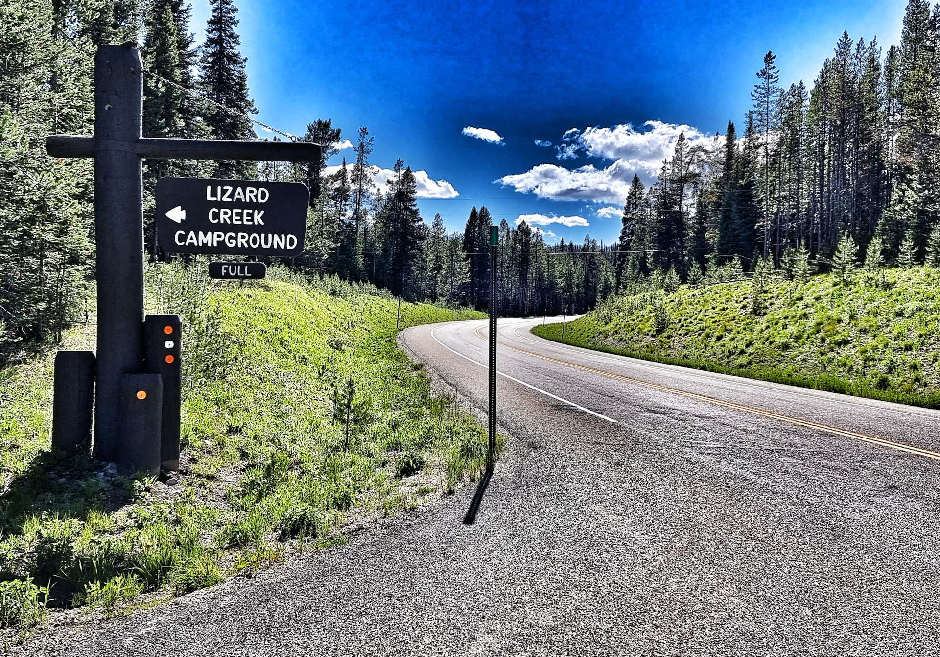
After over 5 1/2 hours in the saddle we were beginning to feel the heat & our water although plentiful (we still had a bottle each), was tepid like warm bath water – hardly appetising! We could see Interior in the distance & our camping cabins, but our first priority was to raid the town’s gas station for a 28 ounce bottle of gatorade & a 35 ounce bottle of water – we sat in the air conditioned seating area for 10 minutes & demolished the lot!!! It had been a challenging day cycling into a headwind in temperatures of 85 degrees plus.
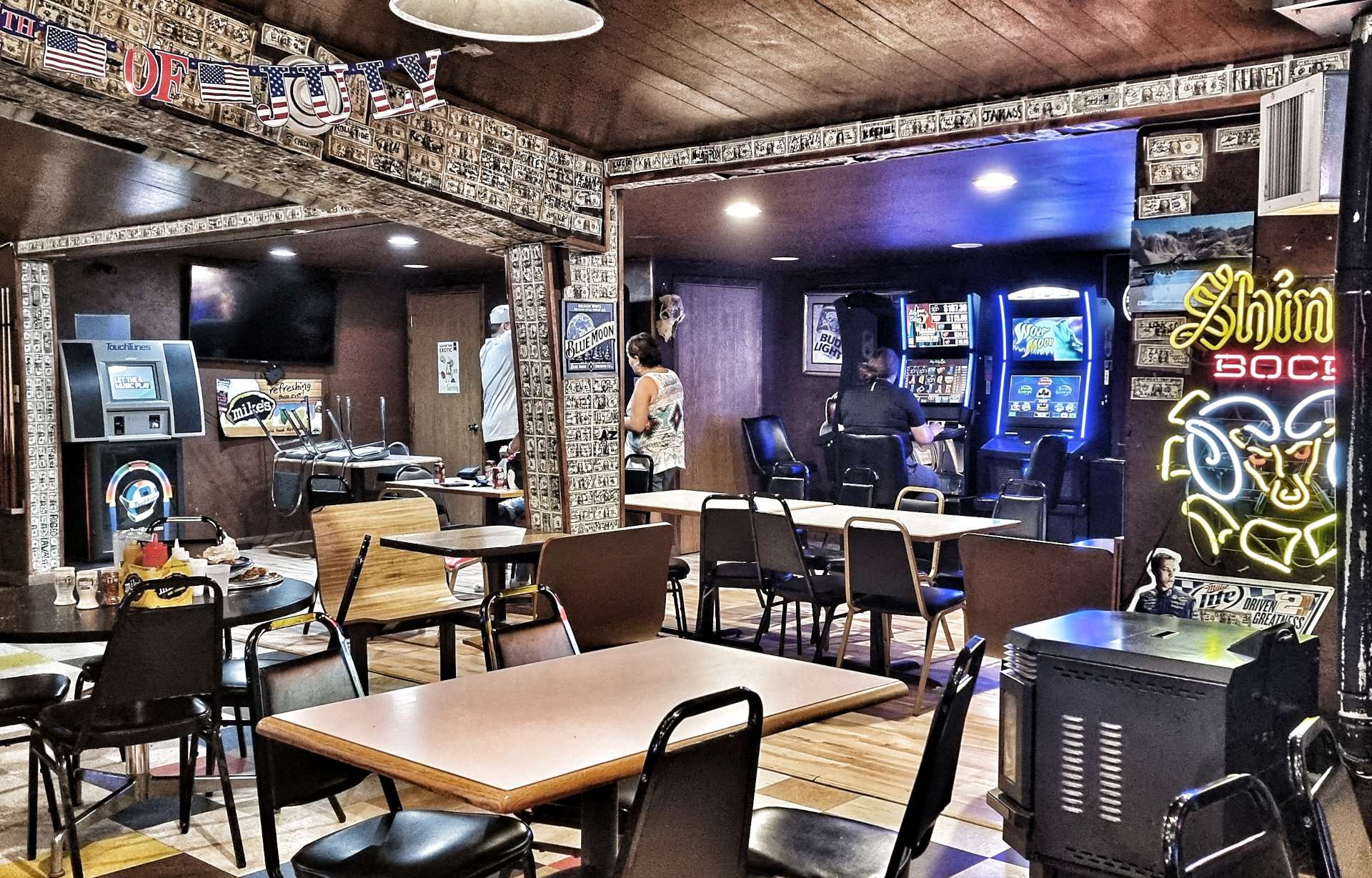
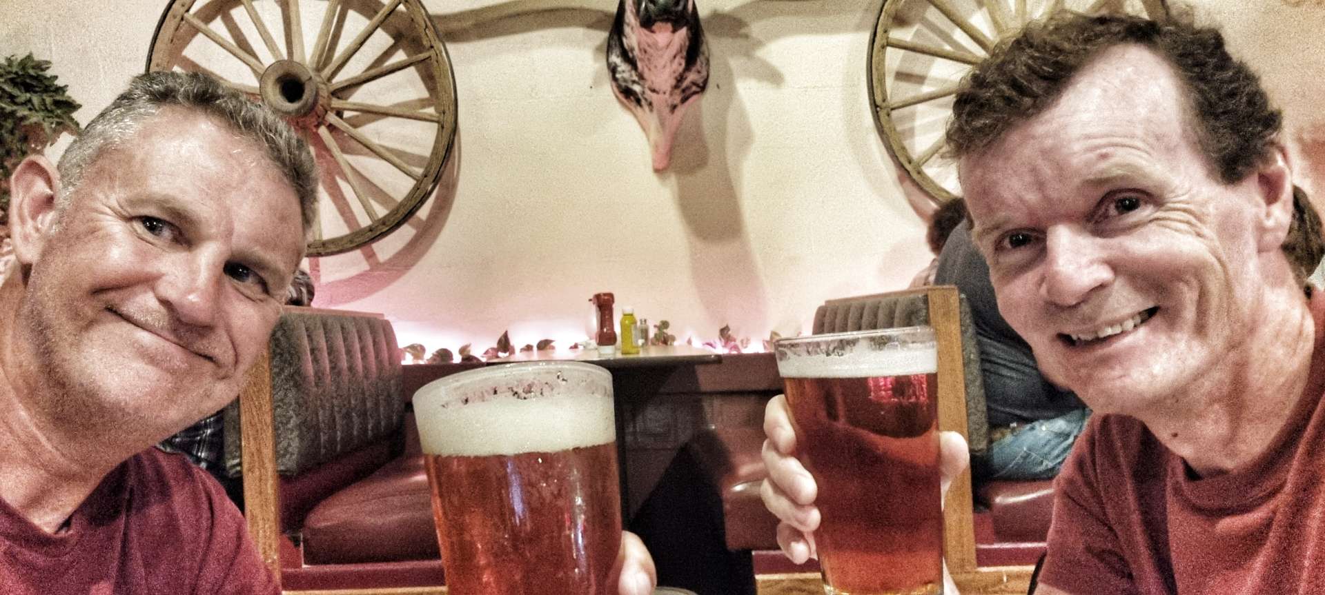
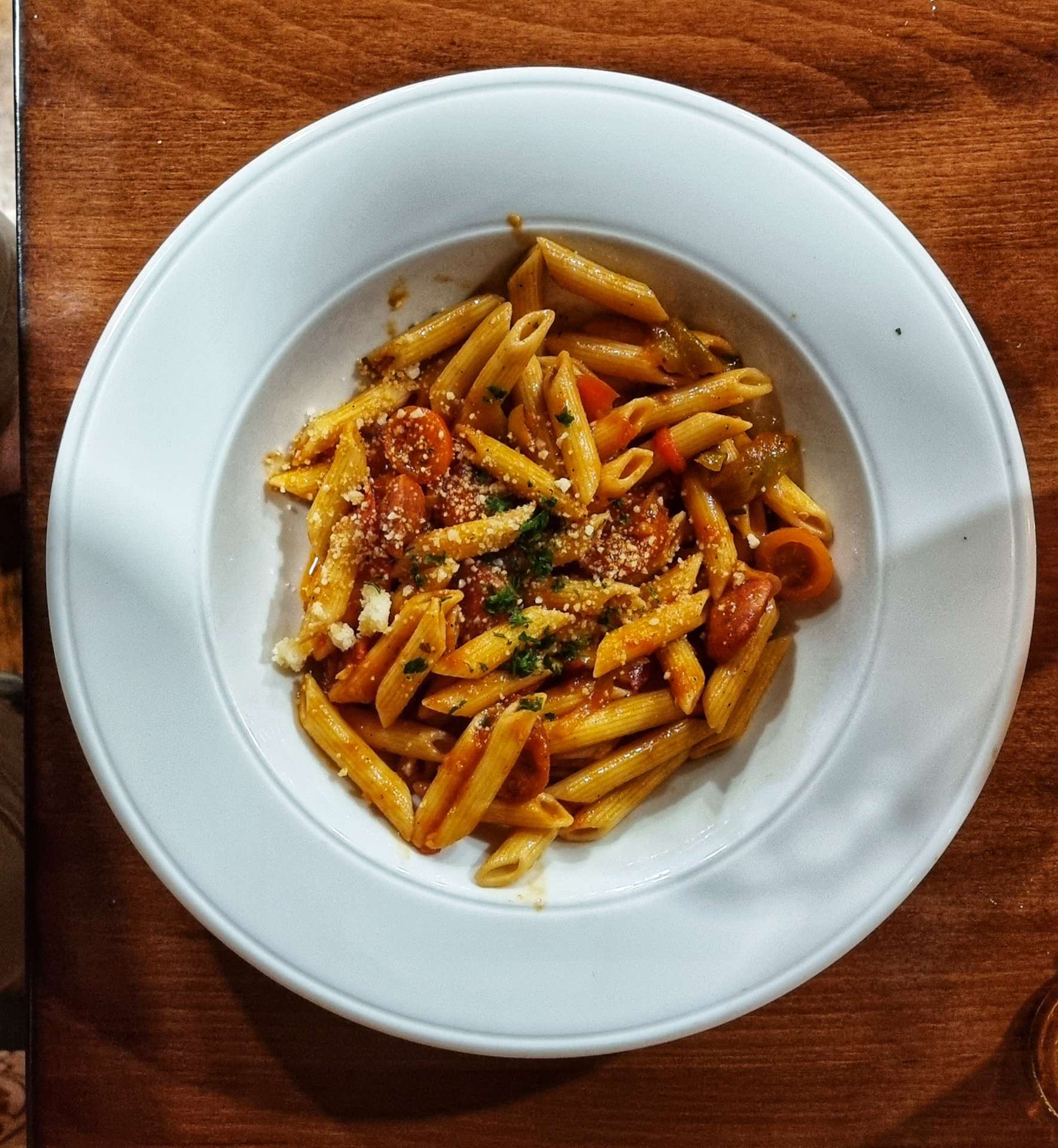
Sean decided he was going to grab dinner from the shop on the campground, while I fancied some hot food. I visited the Wagon Wheel Bar, where I tucked into a buffalo burger & a bottle of Goose Island IPA as I reflected on a great day in the saddle.
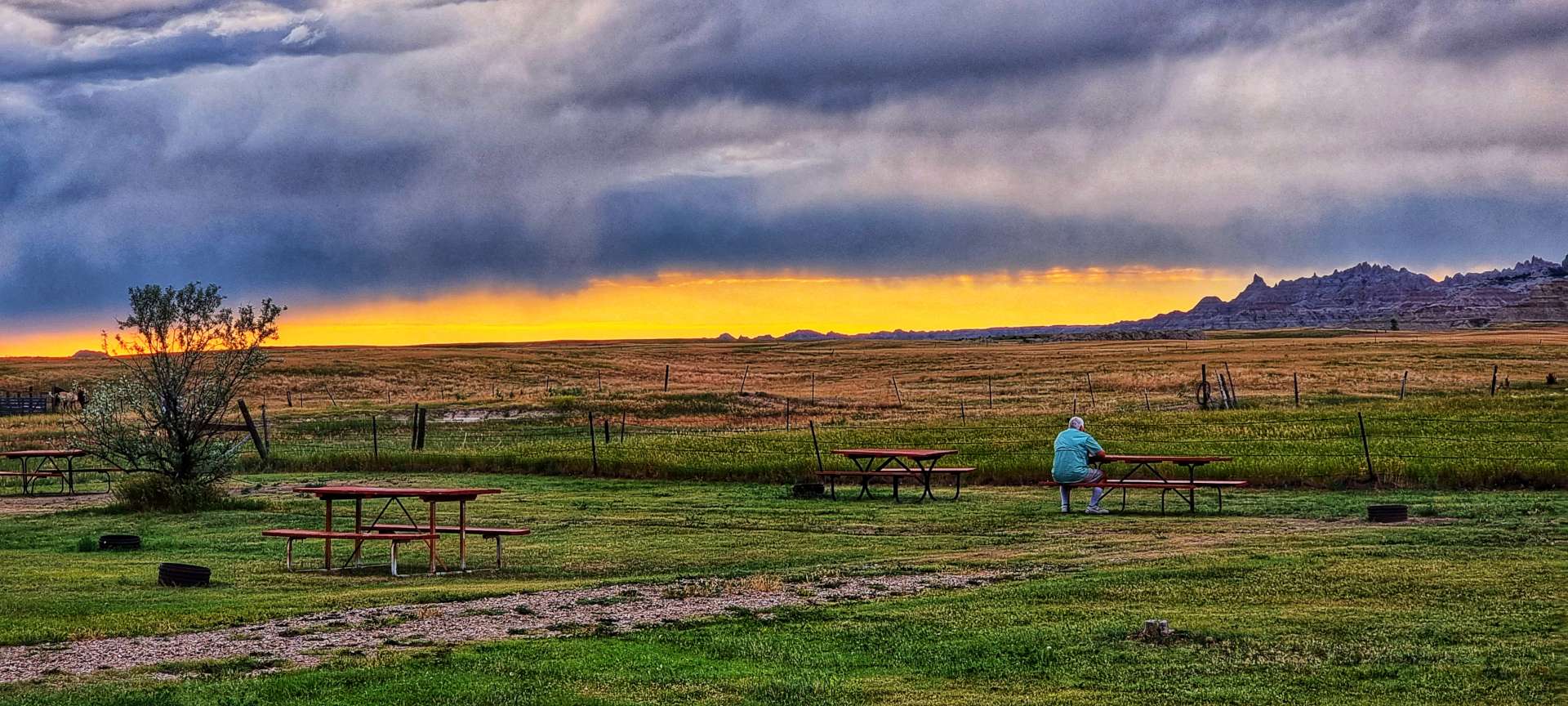
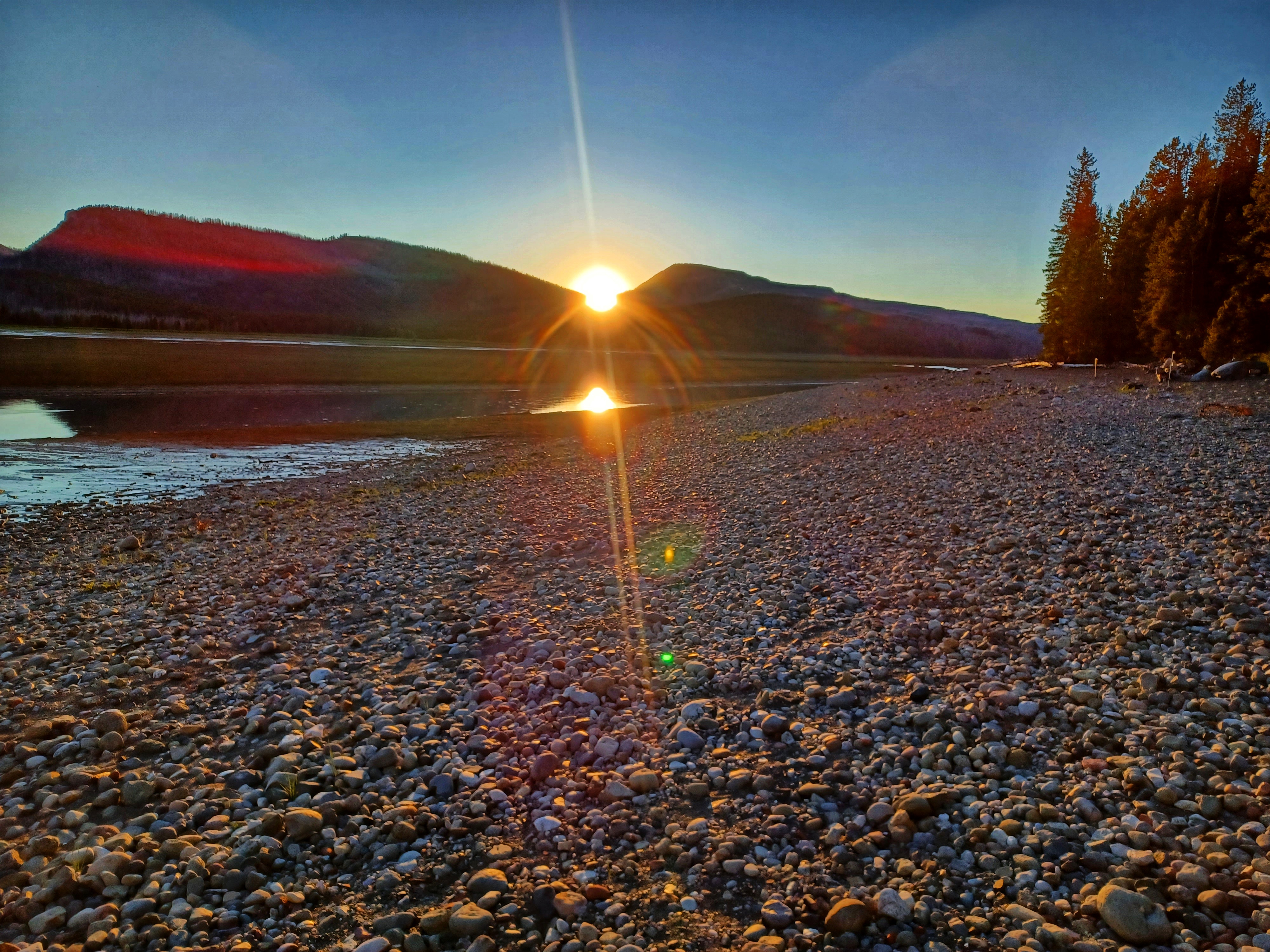
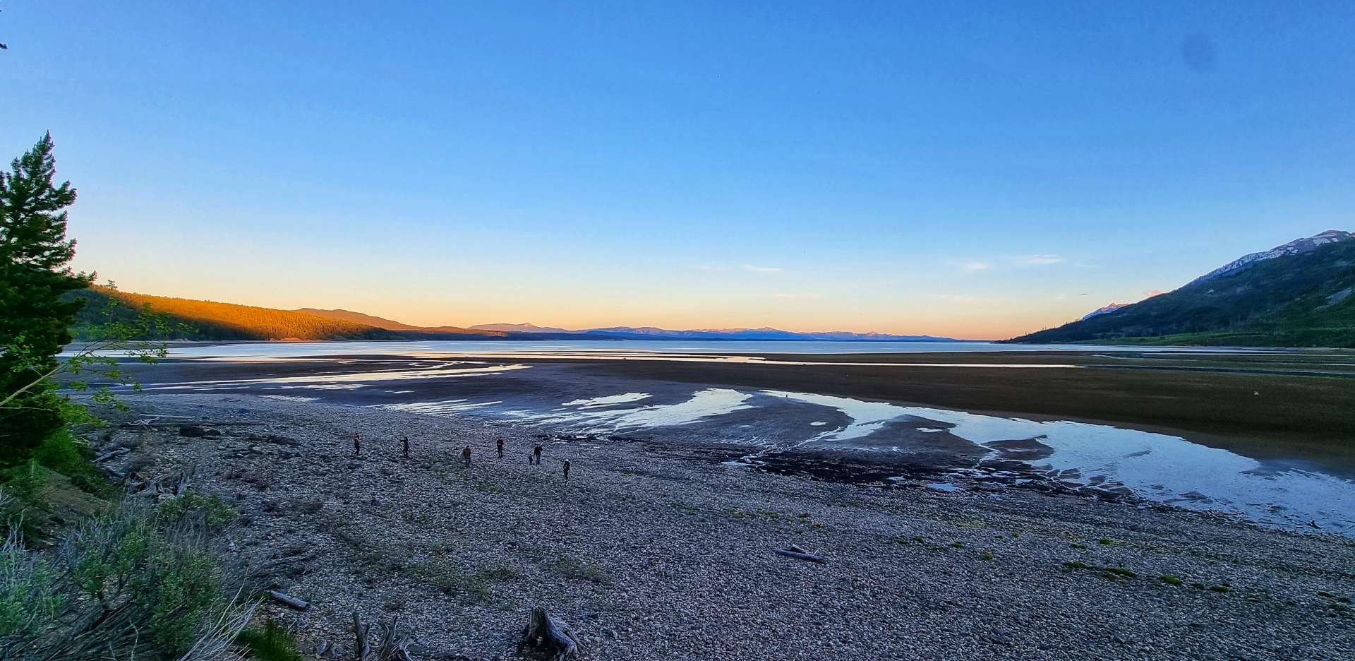
On my way back to the campground I stopped to take a few photos as the sun set over Badlands in the distance – enjoy, I did!
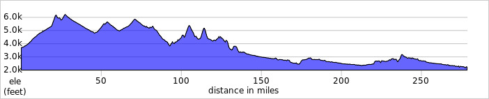
Stage Stats – 74 miles, 1,421 feet of climbing. A fast first hour, followed by 4 1/2 hours battling a headwind. A tantalising taster of what Badlands may offer us tomorrow.
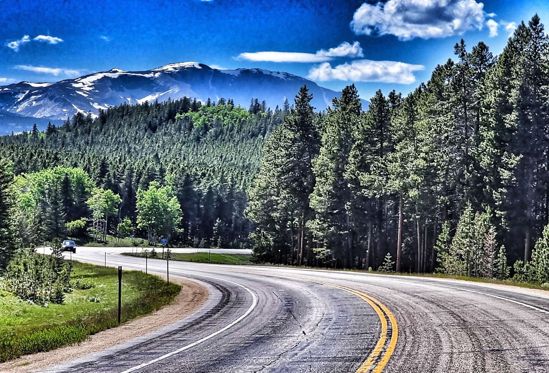
Friday 8th July – Interior to Philip (Stage 54).
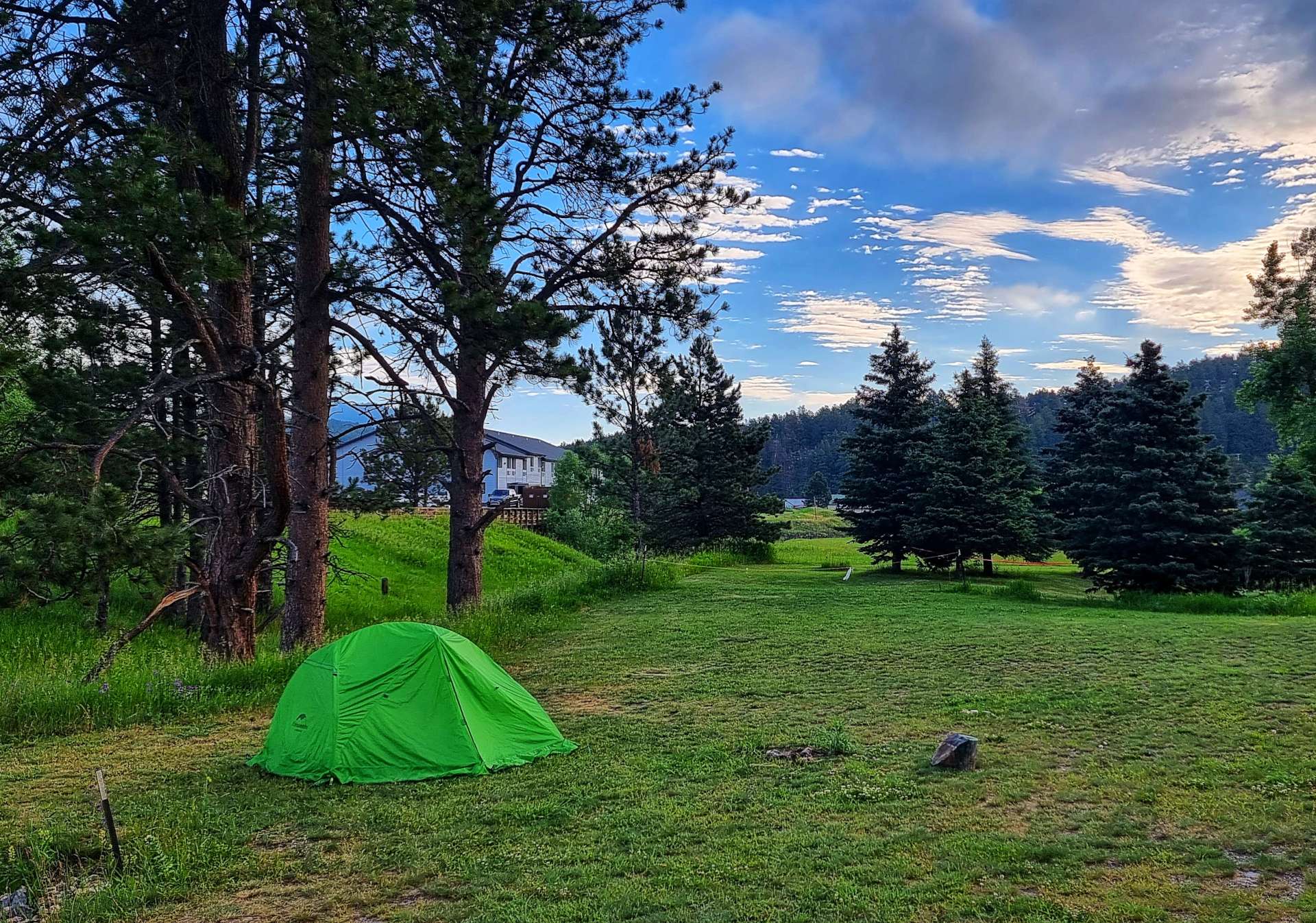
The camping cabin was fairly basic (we had a bed, a light, air conditioning & patchy Wifi) – the toilet & showers were in a separate block about 50 yards away & we had to supply our own sleeping bag & pillow. We decided on reflection it was just better than camping, as we didn’t have to put up & take down the tent, but a poor 2nd to a motel!
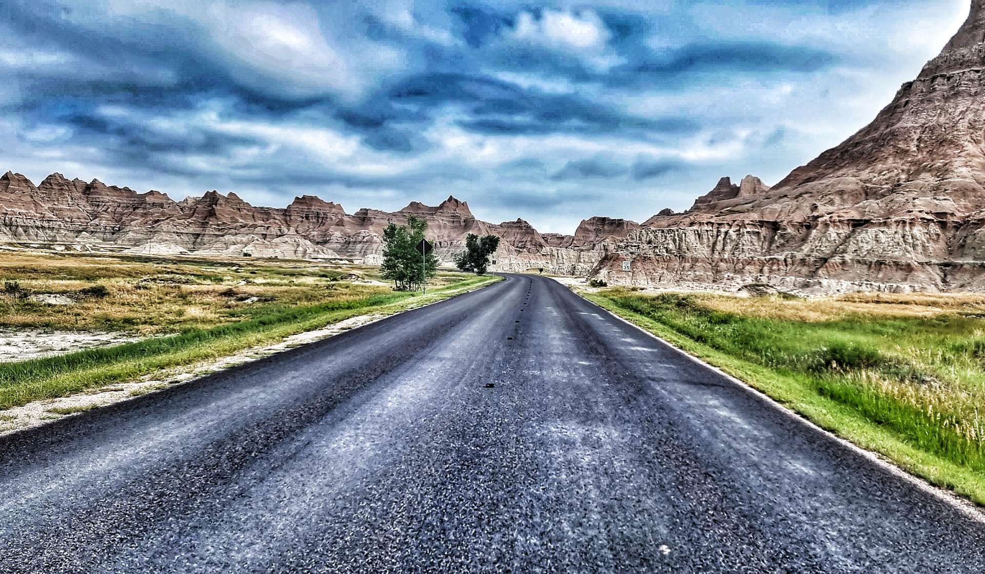
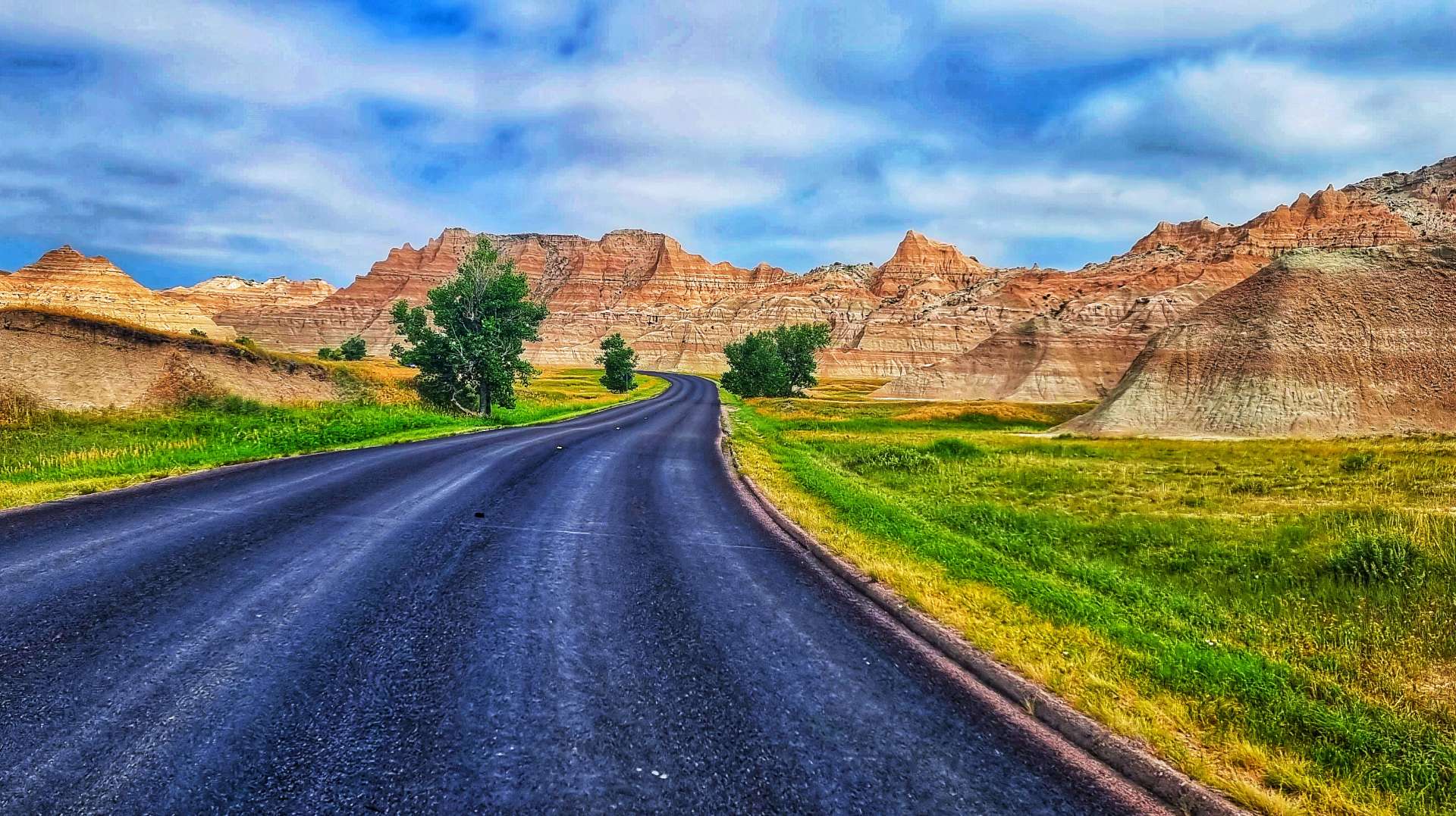
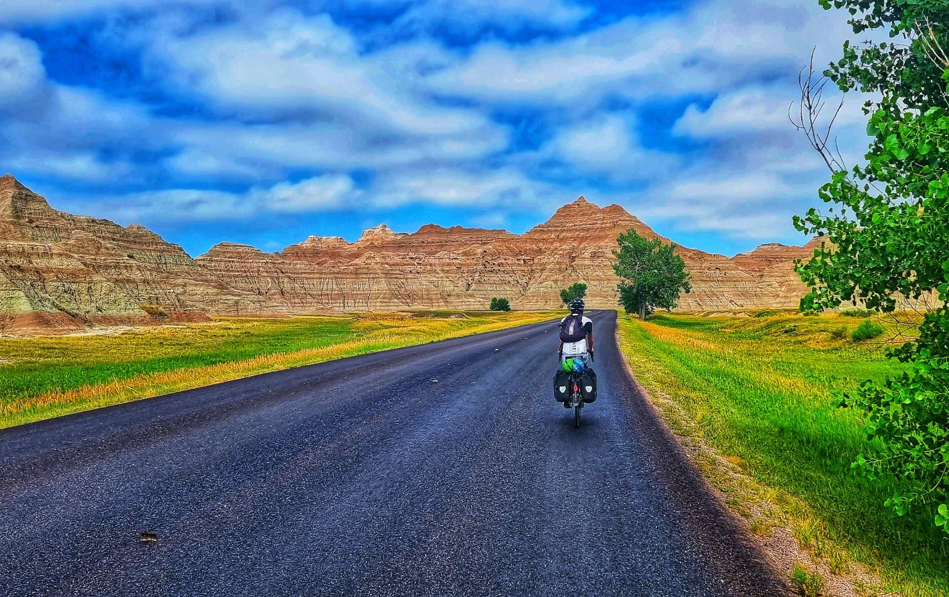
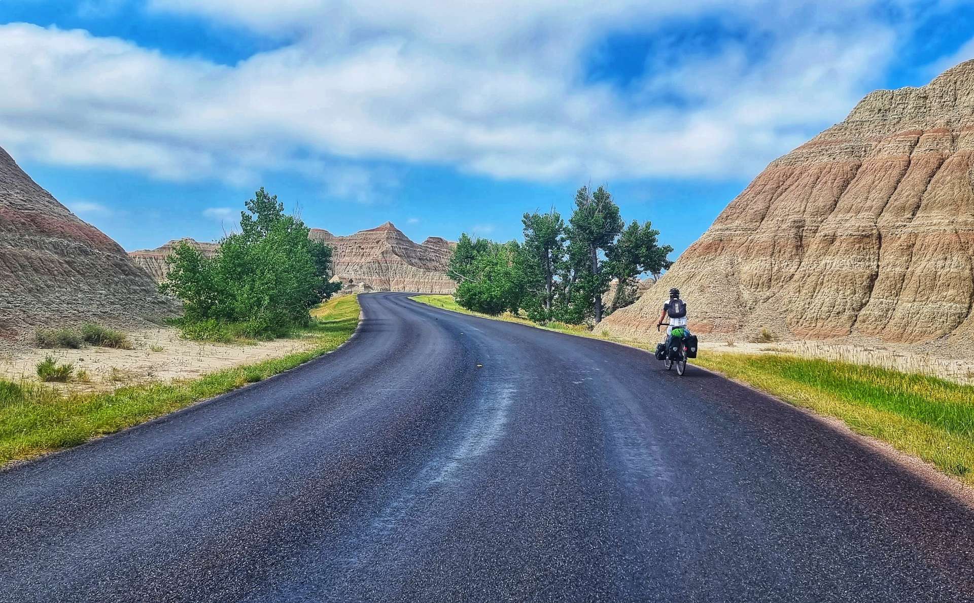
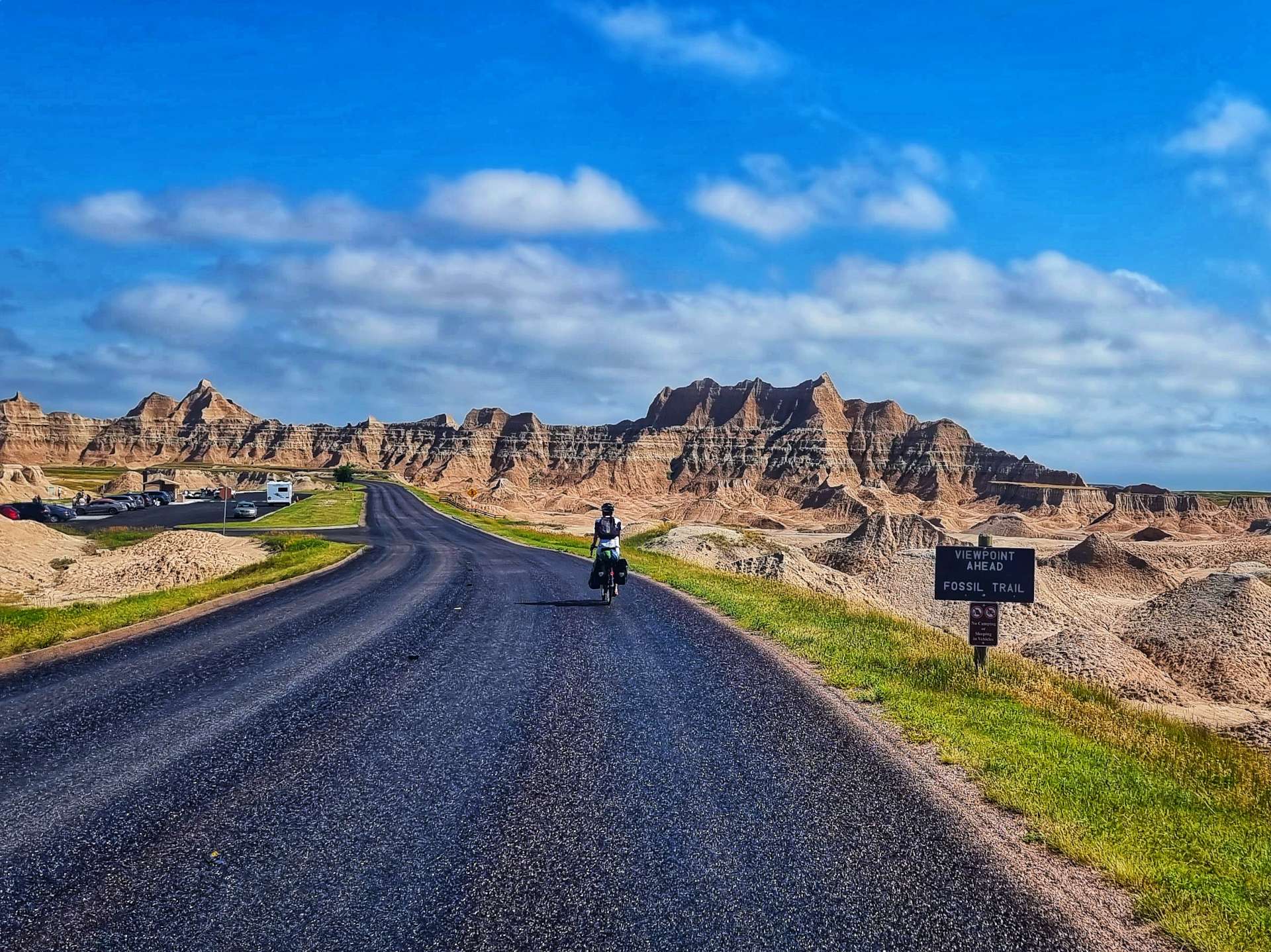
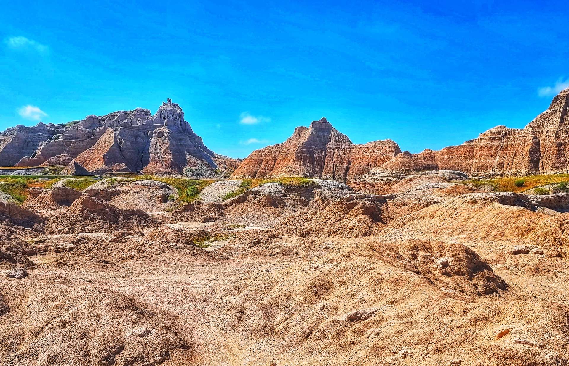
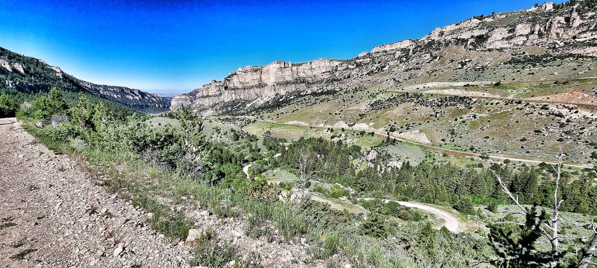
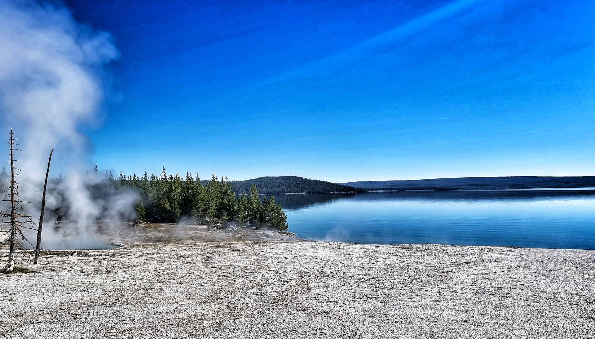
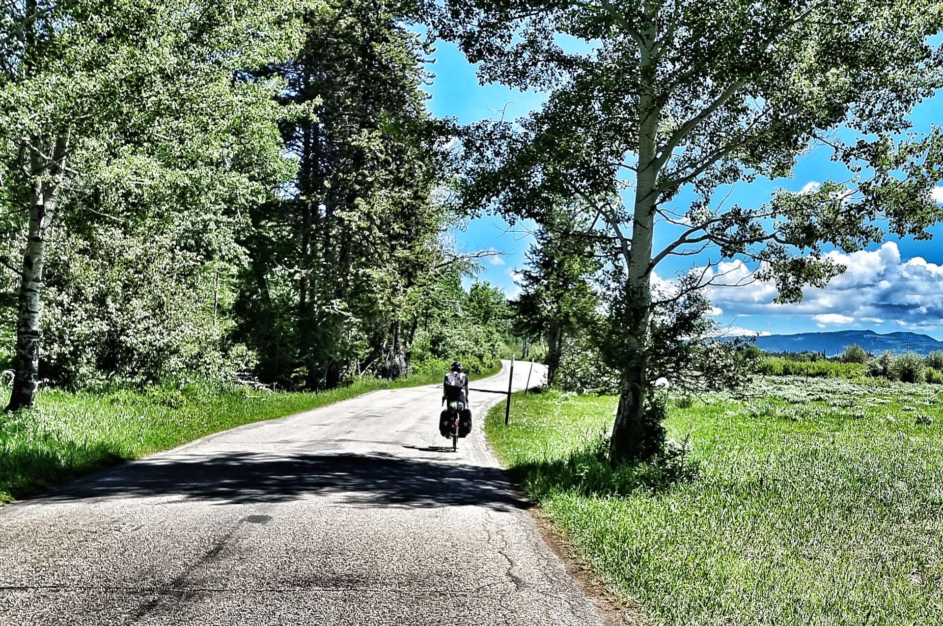
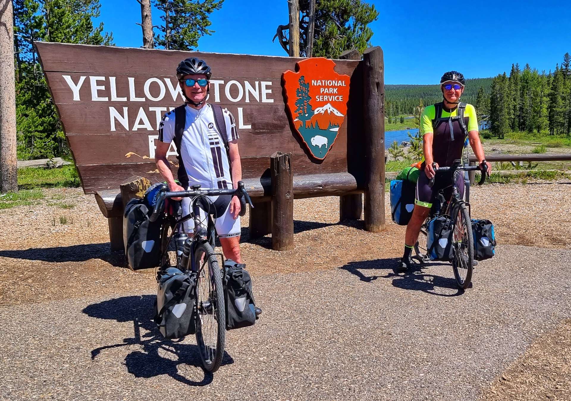
We were both looking forward to cycling through Badlands National Park, so we were on our way by 9am again. I’ve enhanced the colours in the photos in this post, but the views were stunning enough I probably didn’t need to bother, however, old habits die hard! The video later is exactly as we saw the scenery – yes, it does look like a ride through a film set!!!
Badlands National Park has one of the richest fossil beds in the world & is spread out over 244,000 acres, which bison, longhorn sheep, prairie dogs & black footed ferrets all call home. The first set of photos were taken just after we’d passed through the entrance gate to the National Park.
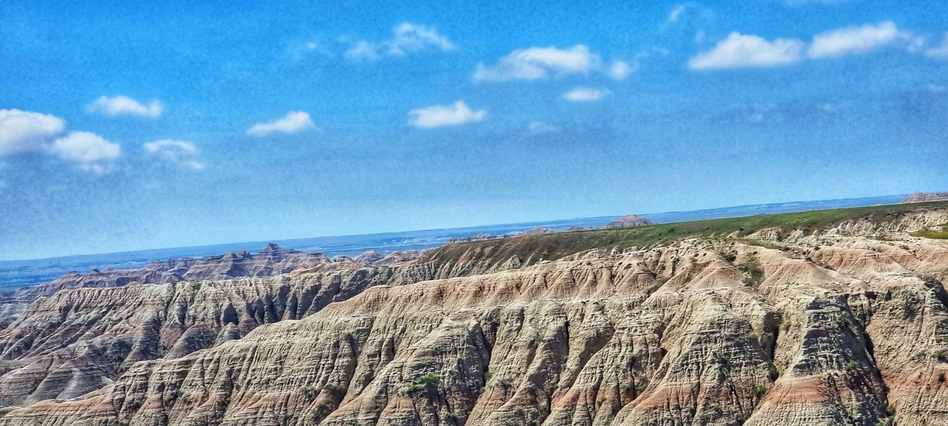
We took a left onto Highway 240 by the Cedar Pass Lodge & the stunning views opened up before us – 5 minutes before, we had been riding through grassland & here we were in scenery that looked like it belonged on Mars.
Badlands National Park pays homage to the people who inhabited the area before it became a National Park. For hundreds of years the Lakota people have called the area mako sica which literally translates as “bad lands”. This refers to the challenges of travelling across the land, as when it rains the wet clay becomes slick & sticky, making it difficult to traverse. The jagged canyons & buttes that cover the landscape also make it hard to navigate. The winters are cold & windy, the summers are hot & dry, while the few water sources that exist are normally muddy & unsafe.
A fun fact for you – when Badlands was first proposed as a National Park in 1922, the suggested name was Wonderland National Park!
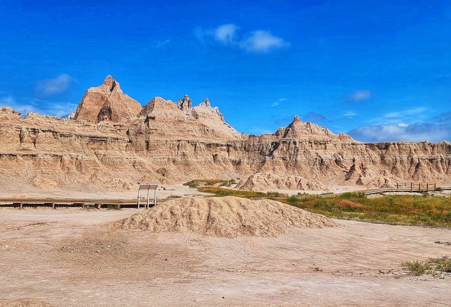
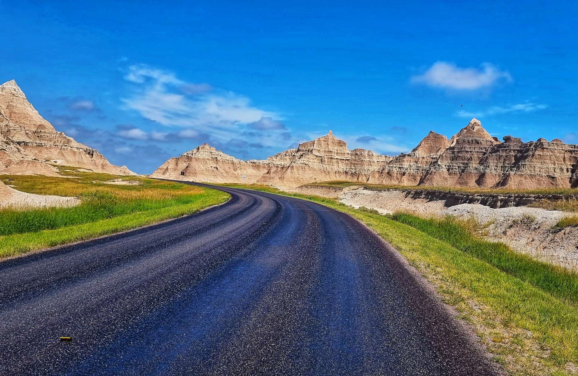
The stunning views continued after a brief stop at Cedar Pass trailhead. We turned up just too late to see a snake, but we saw the photos some other visitors took – we can’t complain, we saw our snake at Devils Tower!
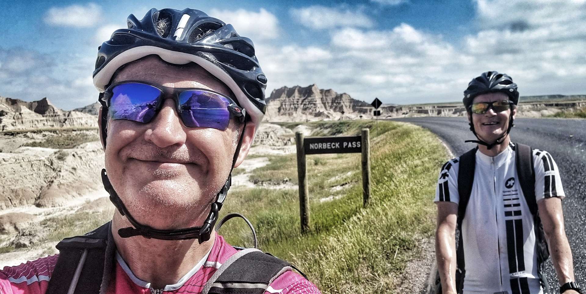
The road starting climbing as we rode between the various rock formations & within 10 minutes we’d crested Norbeck Pass & we were now on a plateau.
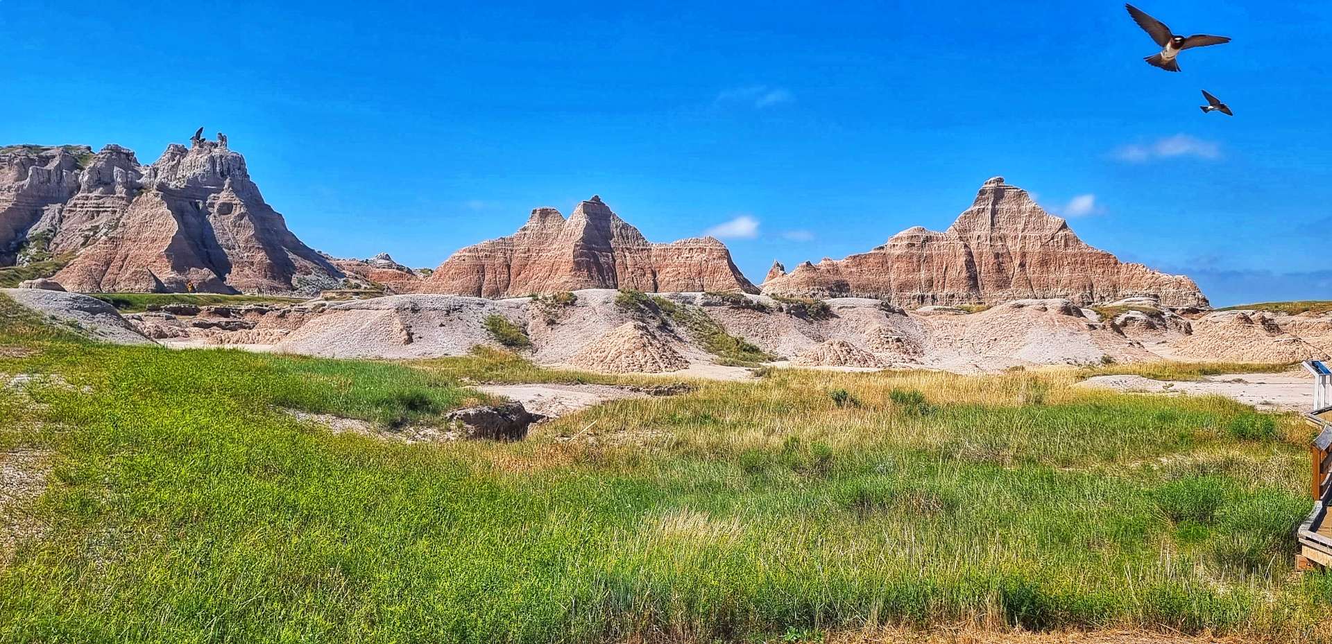
We stopped at Fossil Exhibit trailhead where birds had made small houses under the eaves of the picnic shelter – they took it in turns to occupy the nests. The trailhead featured fossil replicas & exhibits of creatures that once lived in the area.
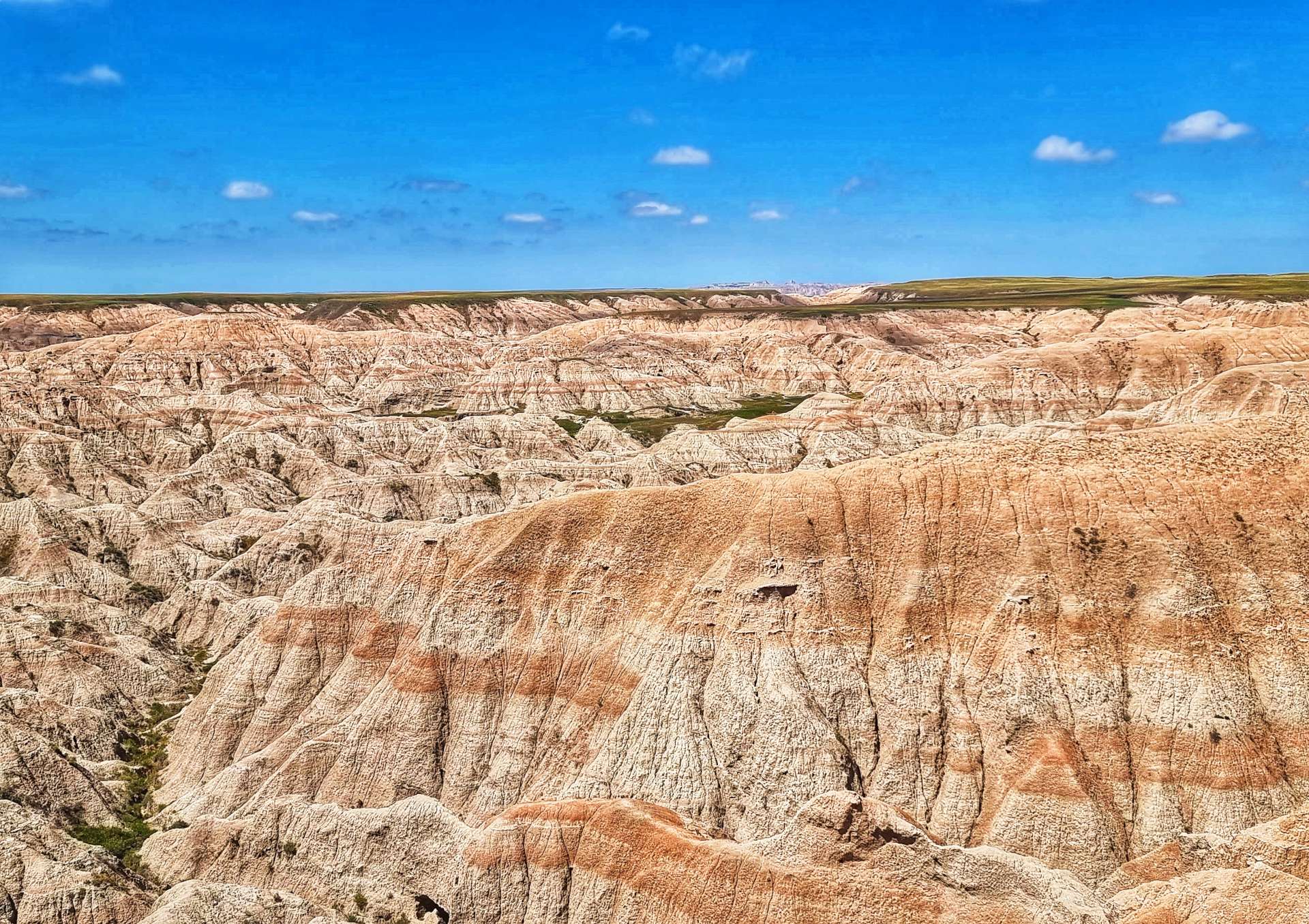
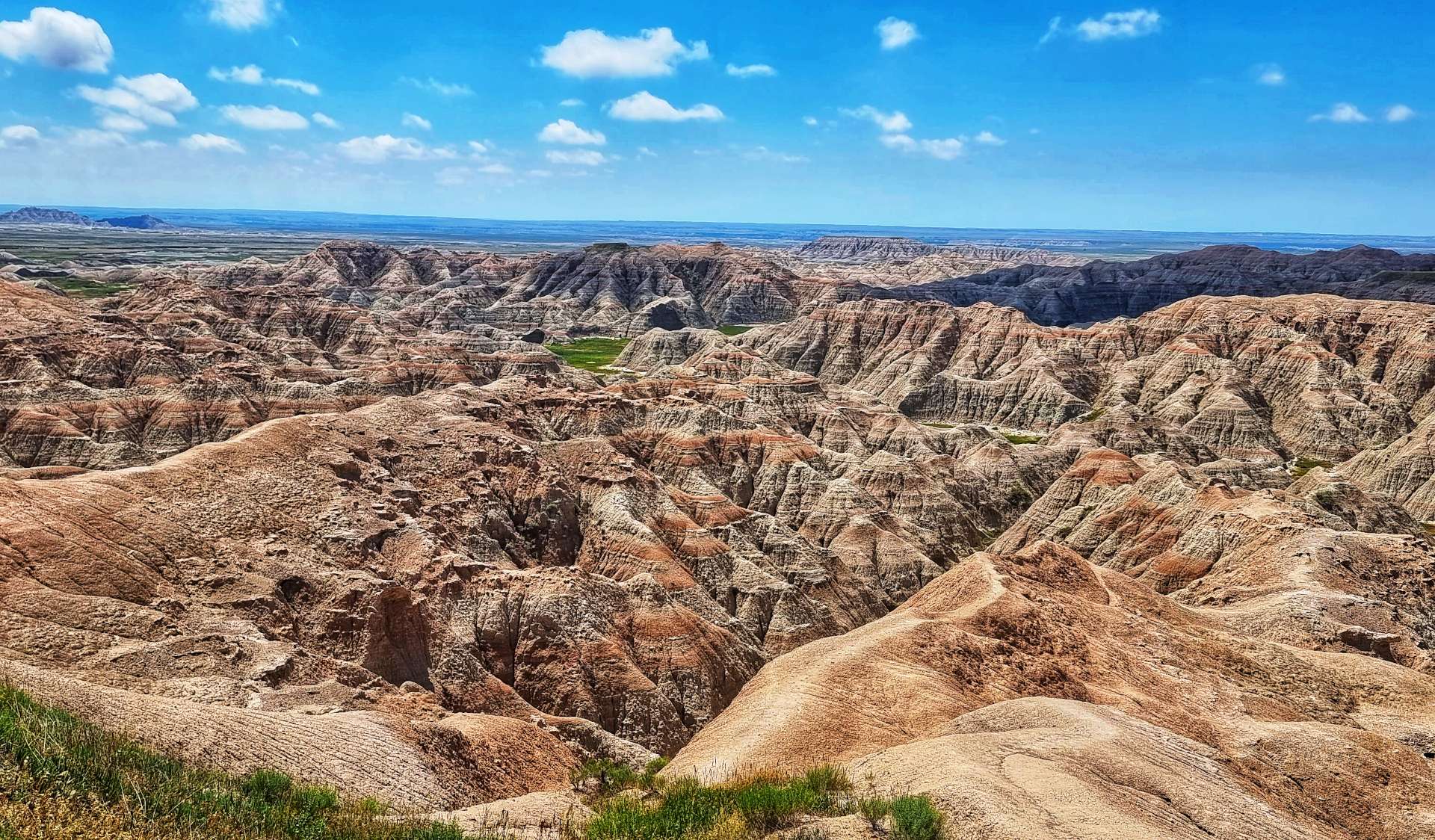
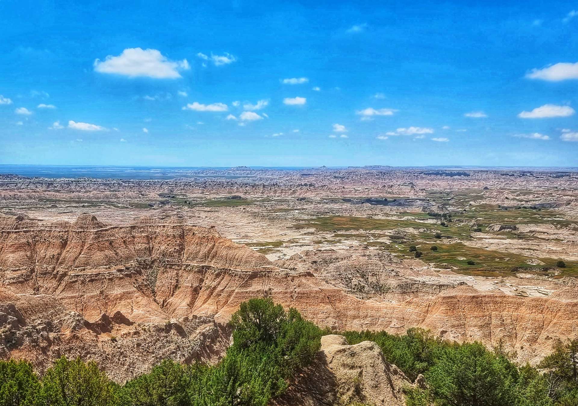
The White River Overlook provided big views across to the dark rocky outcrops on the far side of the plateau. Then we were delivered to Bigfoot Pass Overlook where the valley was laid out in all its glory – the views were immense.
We descended one side of the valley, then climbed the opposite side as we made our way up to the next plateau & passed the Big Foote gravel road – we would pass the opposite end of the road later in the afternoon!
Prairie Wind (first 2 photos) & Burns Basin (final photo) Overlooks offer totally different vistas of the surrounding rock formations & lowlands – the colours, geological structures & panoramic views don’t look anything like the same, yet the viewpoints are less than 800 yards apart.
On the way to Homestead Overlook we passed a prairie dog city – there must have been 50 or more prairie dogs on the lookout for potential predators. There was a constant high pitched squeaking as they communicated with each other.
Homestead Overlook offers views over Badlands & the surrounding prairie. In 1862 Abraham Lincoln signed the first Homesteading Act into Law – a US citizen could claim a 160 acre plot of land in the West by filling in an application, living on & improving the land for a minimum of 5 years & filing for a deed within 7 years.
It was said that back in the 1860’s you could look out from Homestead Overlook & all the surrounding prairie was neatly quartered off into 160 acre plots where people had migrated West to claim their homestead. While the Homesteading Acts offered free land to settlers, this “free” land came at great cost to Native Americans. Much of the land offered as homesteading plots was seized from the Native Americans who previously inhabited the Great Plains.
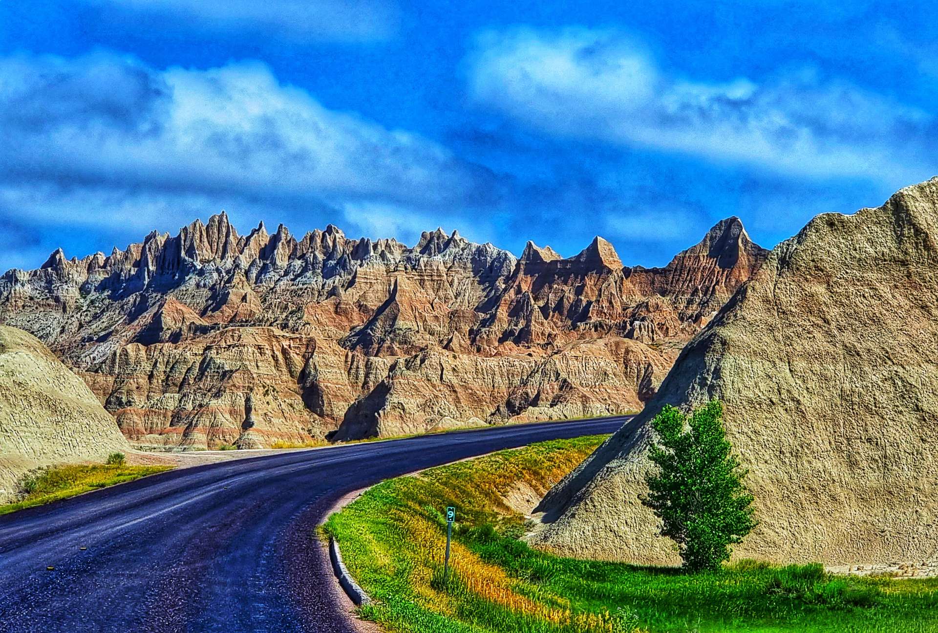
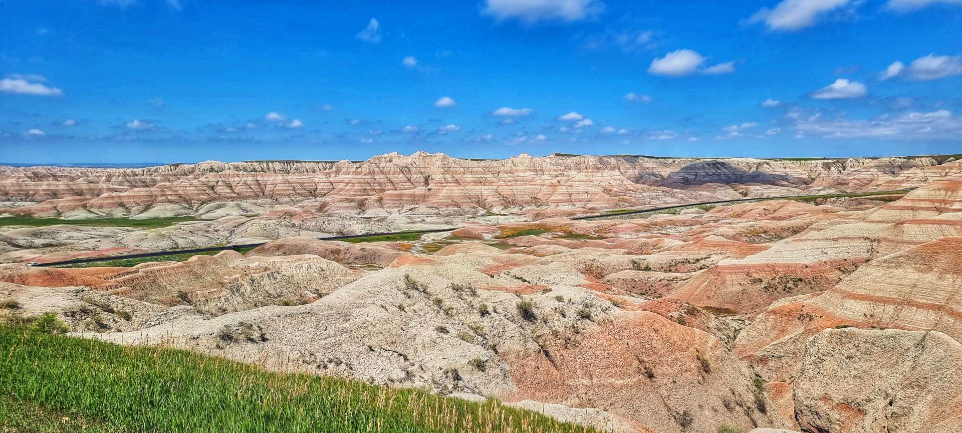
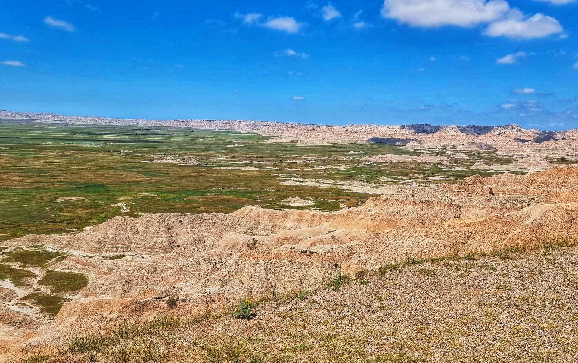
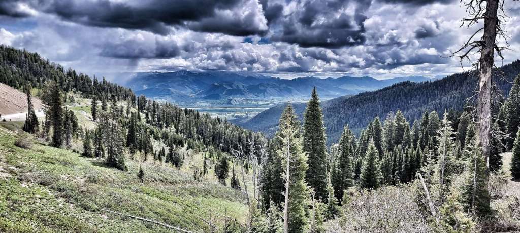
Yellow Mounds Overlook was the final viewing point before we had to descend & quickly tackle a steep ascent up to the final plateau. We were rewarded at Ancient Hunters Overlook with huge views East. This is one of the few spots where it’s wet enough for trees to grow in Badlands. Bison bones & arrowheads have been found in the vicinity & its believed this may be an ancient butchering site.
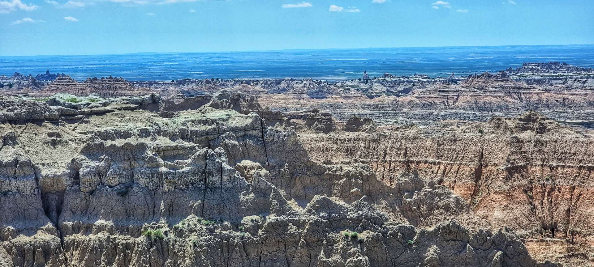
The final stop on my tour of Badlands National Park was at Pinnacles Overlook. These views reminded me of Bryce Canyon in Utah – the hoodoos, formations & rock colours are all similar. It was the perfect way to end a 3 hour cycling tour of another of the great natural wonders of the USA.
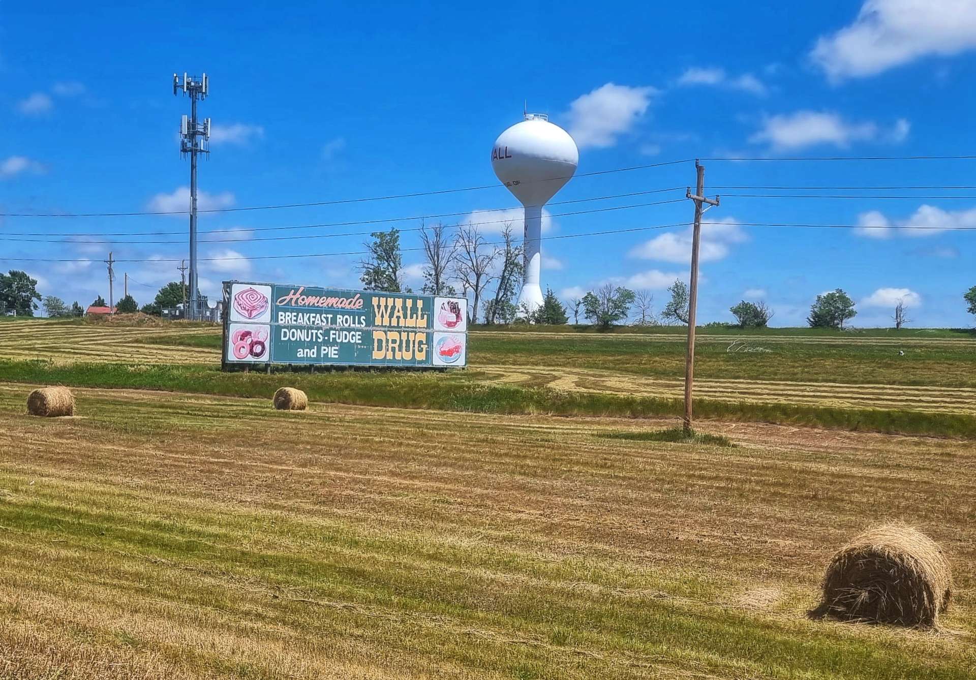
We stopped briefly to get a photo at the exit gate to Badlands National Park, then cycled the 10 miles or so to Wall.
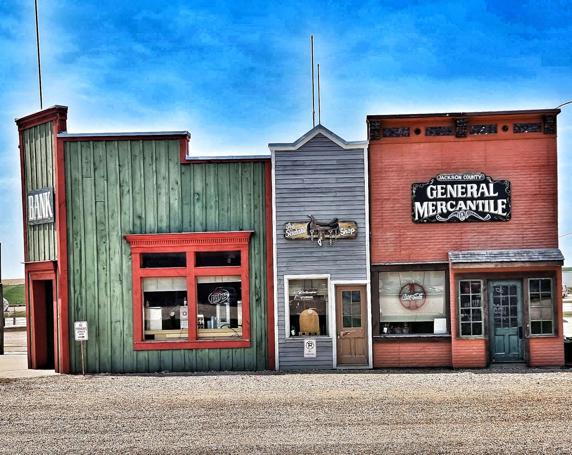
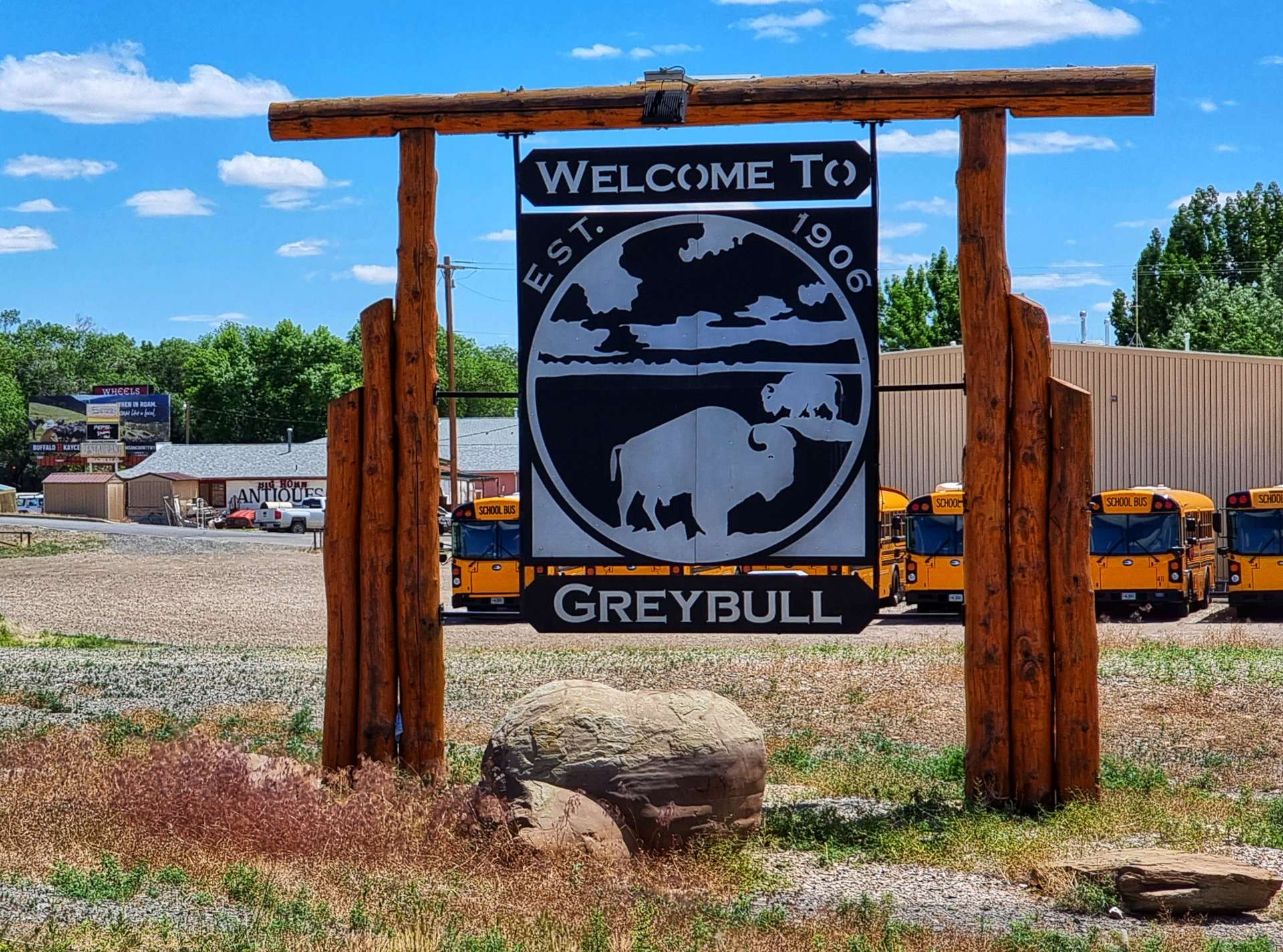
I first visited Wall in 1990 & next to nothing has changed in the intervening 32 years. It’s a place that is famous for being famous – when you approach Wall on the I-90 from the West, there are roadside billboards advertising “Wall Drug – 5 cent coffee since 1930” or “Free iced water at Wall Drug” from 394 miles away – that particular billboard is in Greybull, Wyoming & we stopped there for a night 2 weeks ago!
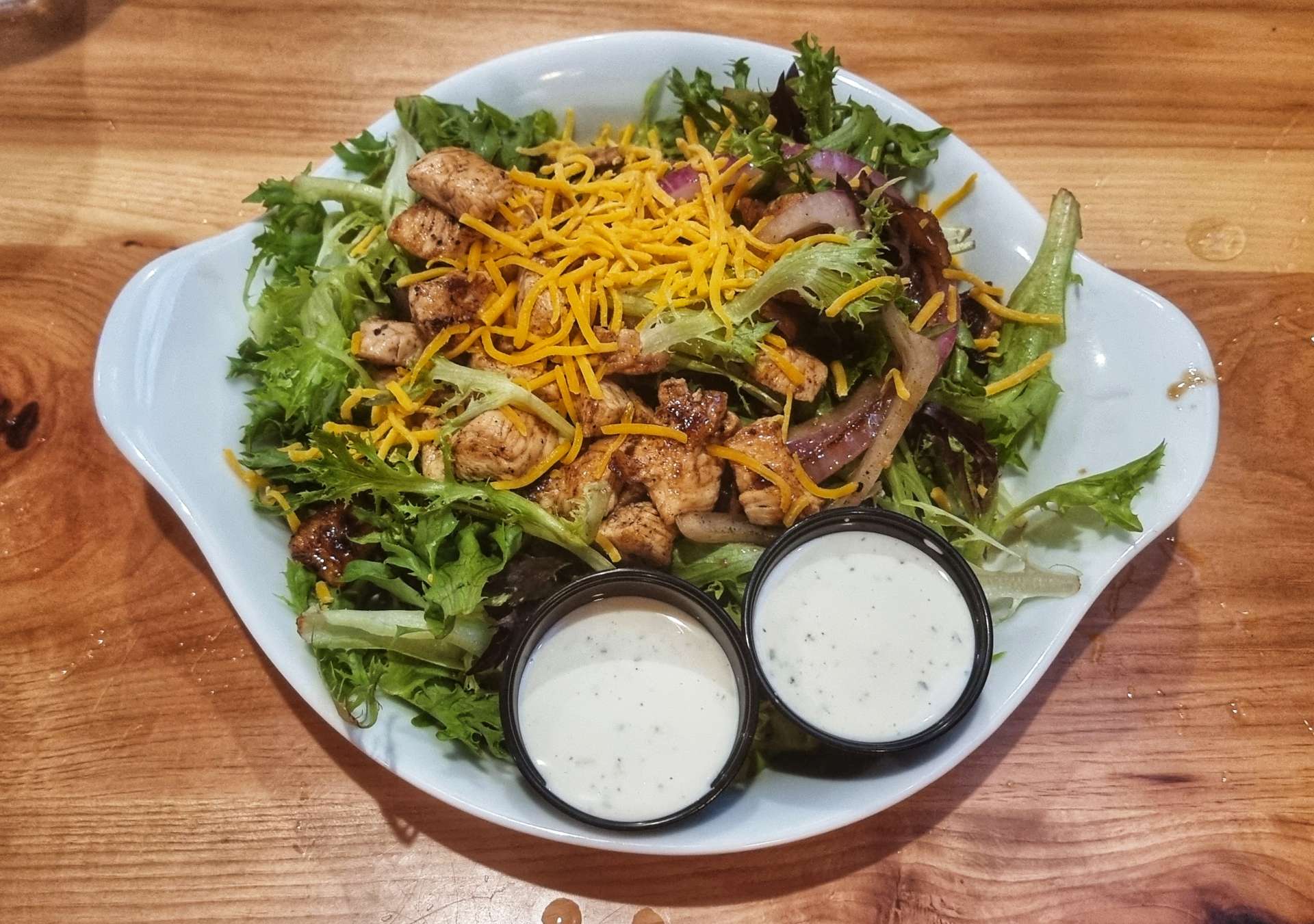
We stopped at the Badlands Saloon & Grill in Wall (Wall Drug’s advertising didn’t work on me!!) for a lunch of chicken salad & x3 refills of Dr Peppers, while also topping up our water bottles. We still had another 32 miles before we could stop for the day!
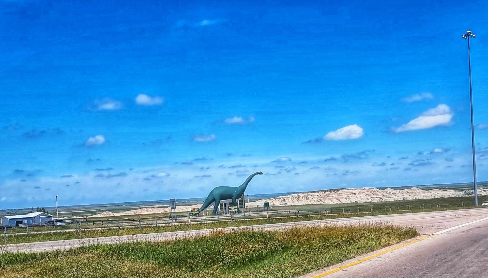
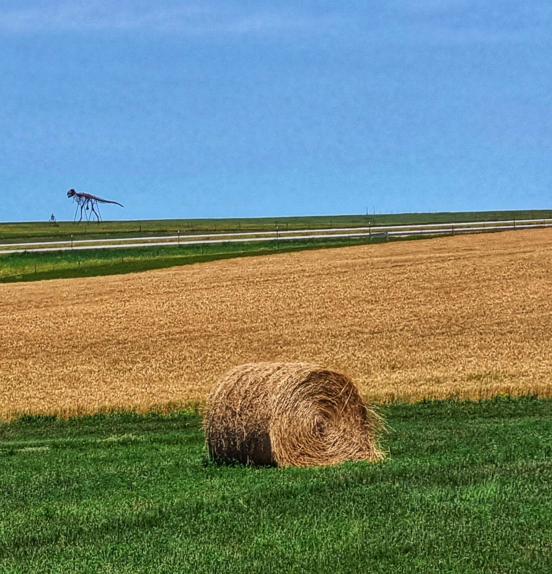
Wall is also famous (at least locally) for having an 80 foot dinosaur on display by the I-90 freeway. I know if I don’t share the photos you’ll think I’m joking!
South Dakota was the home for many of the USA’s Minuteman Nuclear Missiles & there is a silo & Visitor Centre a few miles from Wall. Sadly it was in the wrong direction for us to visit, but I did read about it anyway.
The peaceful prairie of South Dakota around Badlands once had the power to destroy the world. There were 3 strands to the US nuclear policy – Land, Sea & Air. Land & Air were both based out of nearby Ellsworth Air Force Base. An art installation based on a Domino’s Pizza Box design declares “Worldwide Delivery In 30 Minutes Or Less“. In 1945 there were 6 nuclear bombs, all owned by the USA, in 1986 at the peak of the nuclear arms race there were 65,000 bombs mostly split between USA & Russia & in 2009 the number had reduced to 20,000.
After the majestic scenery of this morning, the afternoon ride was tame in comparison. The road to Philip was long, straight, slightly uphill & into a headwind, so was slightly more effort that we were expecting. I also started to experience some issues with my rear gears in the last 10 miles of the ride. As my friends know only too well, I have a very limited ability to do bicycle repairs, but I have at least learned to recognise a terminal problem when I see one!! I was 90% sure the cable was fraying & if so, I would need to get it fixed sooner rather than later.
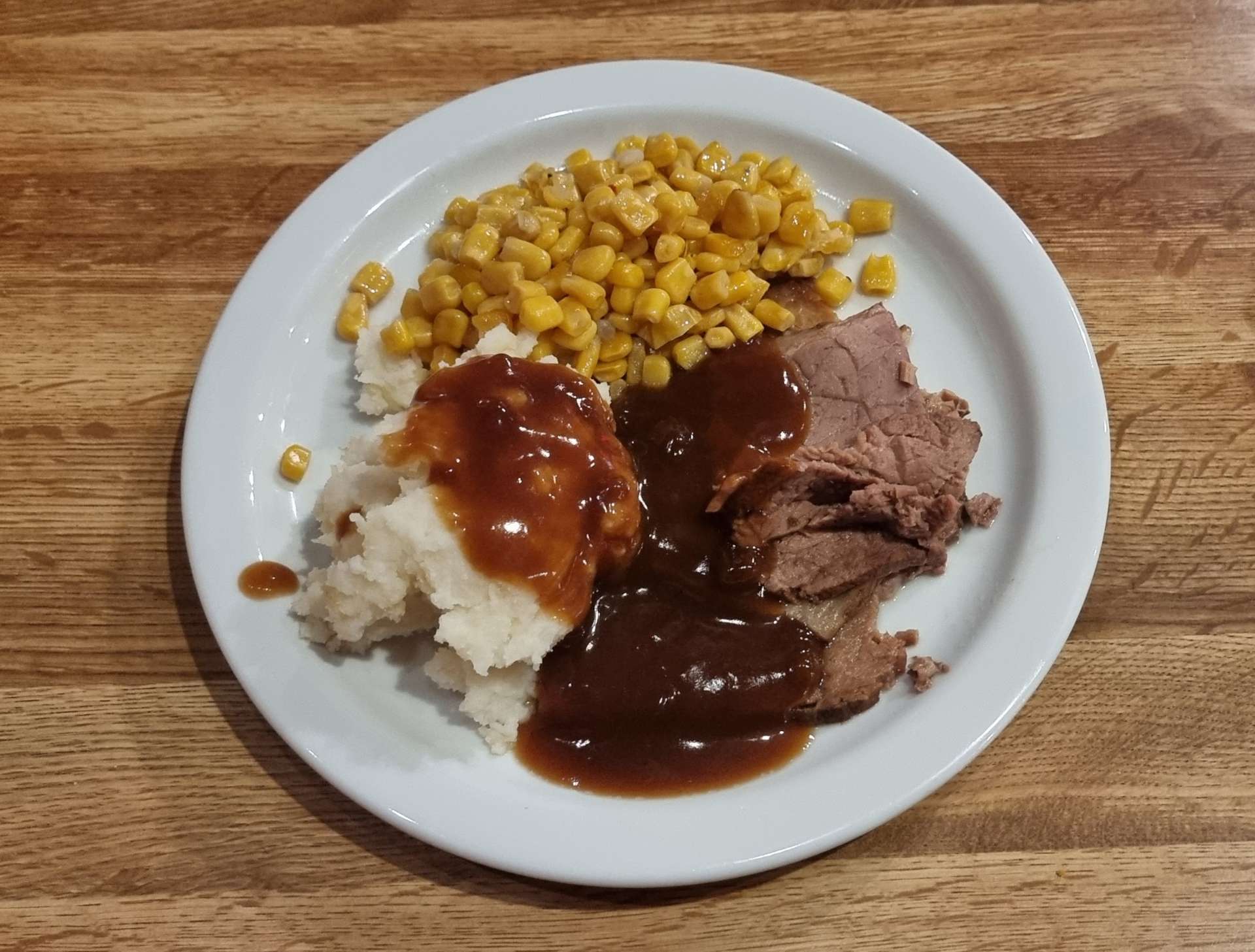
While I considered my options (there were very few in truth) we went out for dinner & enjoyed a pint as we toasted a special day exploring Badlands National Park. We found an all you can eat buffet for $15 & quite literally ate them out of salad before starting on the prime rib, mashed potato & corn – I was so hungry I went up for a 2nd plate!!
My options tomorrow are to find a way of either getting to Rapid City (89 miles away) or Pierre (89 miles away) – it’s likely to be a long & expensive day as I’ll need to hire transport. I think my best bet is to return to Rapid City, but I’ll sleep on it & speak to Doug, the owner of the motel, in the morning.
Stage Stats – 65 miles, 2,165 feet of climbing. Marvelling at the stunning scenery in Badlands National Park. Battling a headwind into Philip & the first indications of rear gear cable issues.
Saturday 9th July – Unplanned Rest Day.
I spoke to Joanne & Doug (the hotel owners) this morning at 8.35am & told them all about my bike woes – I’m more sure than ever that it’s a cable problem. Doug agreed my best chance of getting Gene Genie fixed is in Rapid City. Although Pierre (pronounced Pier) is the State capital, it’s more of a hunting, shooting & fishing place.
This is where Doug stepped up to the plate. He said Prairie Transport may be able to pick me up & shuttle me to Rapid City & back today. He phoned them up for me at 8.45am & by 9.05am Tom was outside the motel door with his van, ready to take me to Rapid City. I was so grateful I could have cried & that was before I heard the price – it would be $40 for the round trip! Rapid City is 90 miles in each direction & the driving on its own would be almost 3 hours. It appears this is the standard fare to Rapid City, as the service receives State or Federal support.
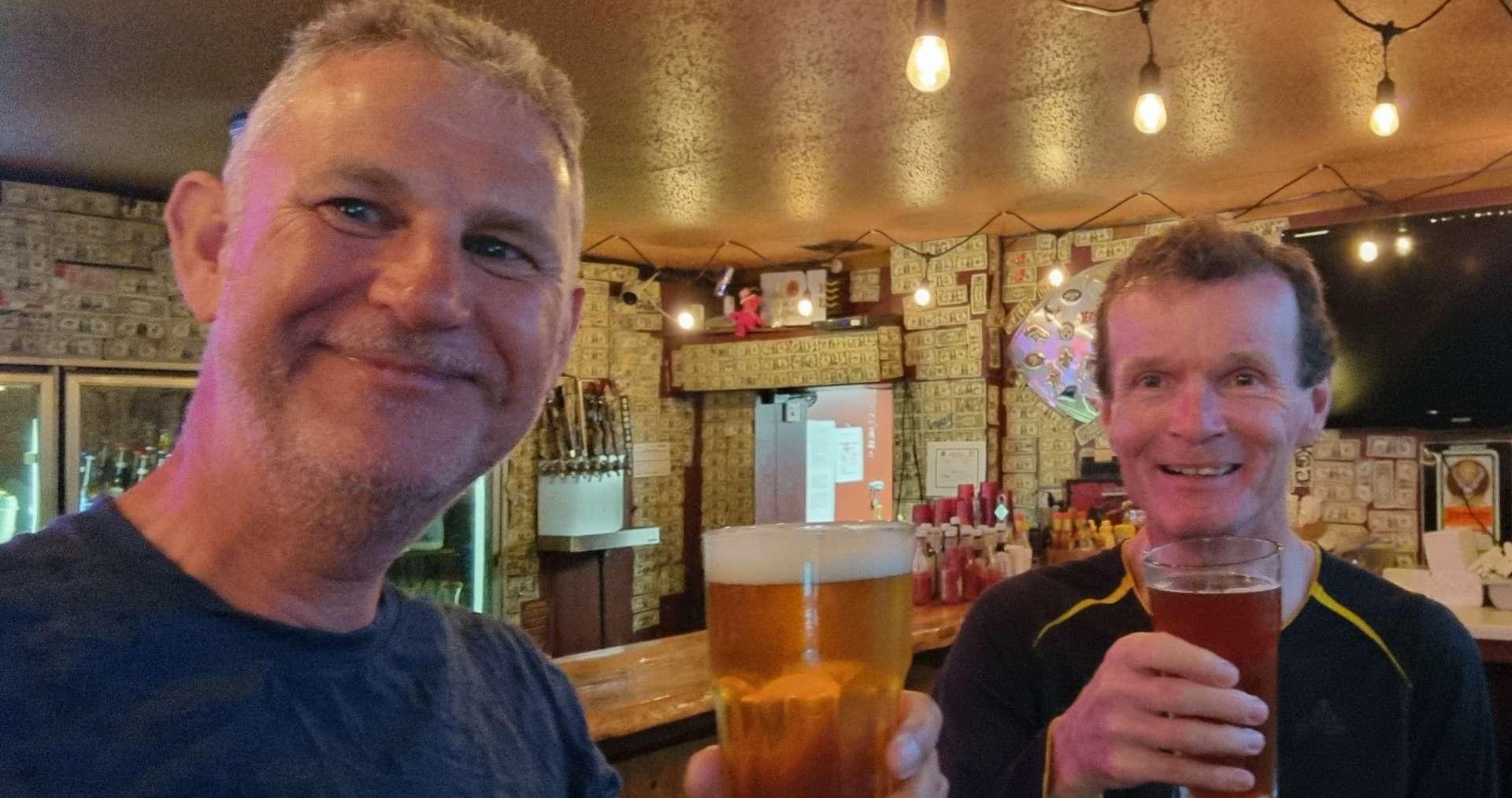
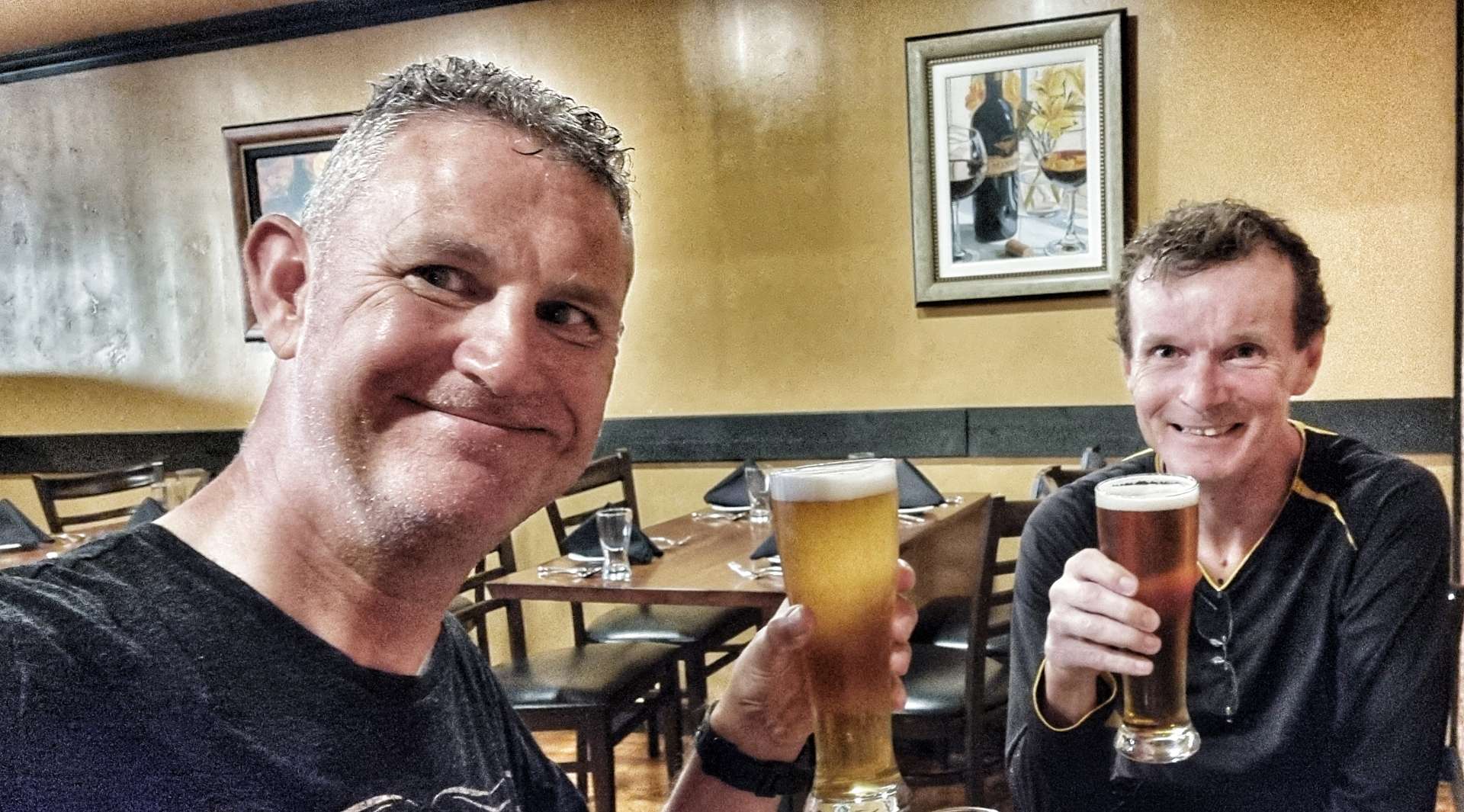
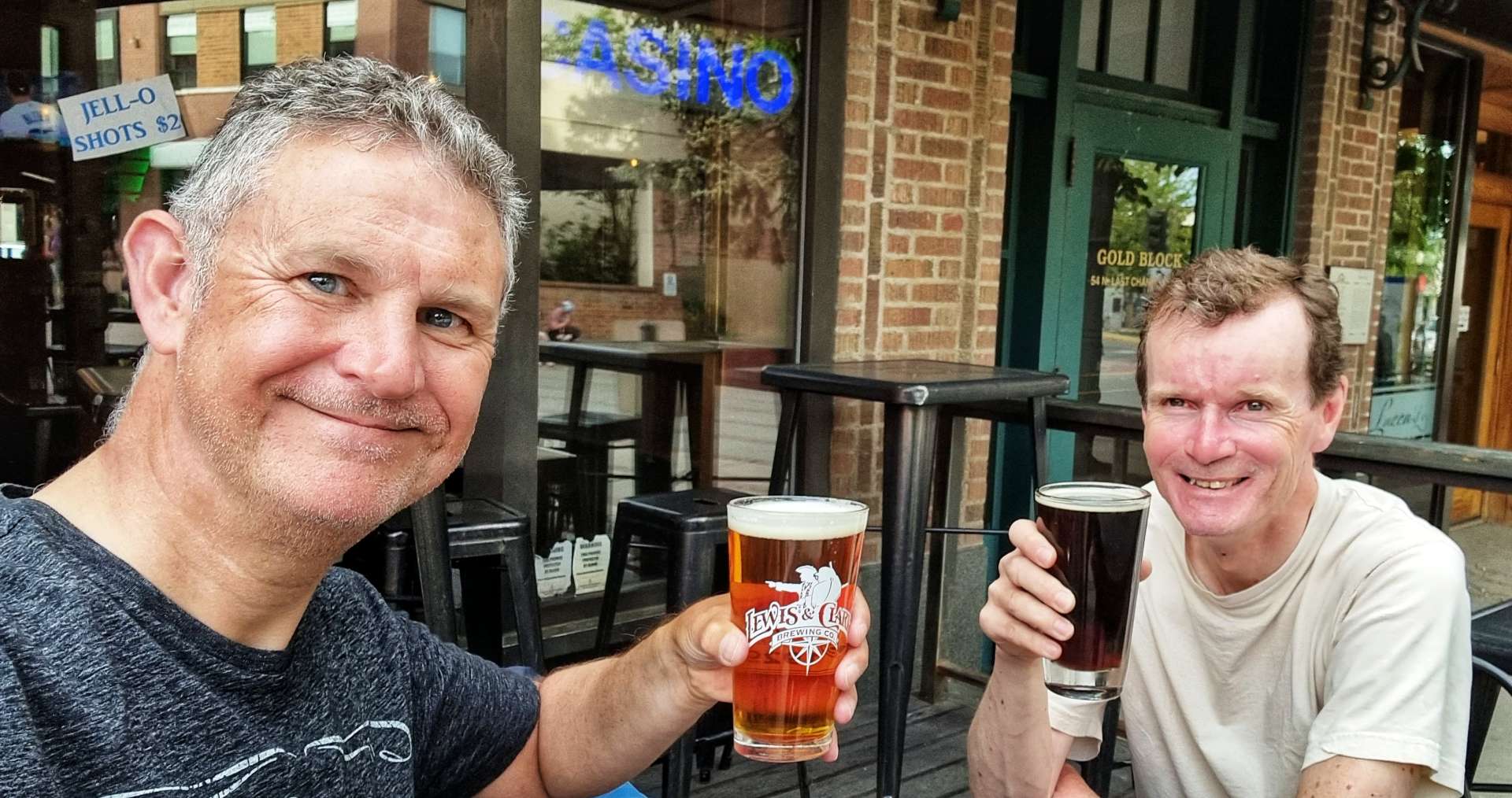
Tom & I chatted all the way to Rapid City about anything & everything – so much so that the time flew by. I had identified a couple of bike shops that might be able to help me, so I called Black Hills Bicycles & spoke to Dan. I told him we were 20 minutes away from Rapid City & I was a hopeless Brit who needed his help, as my Coast to Coast adventure across the USA was about to unravel – I think I may have worded it differently, but that was how I was feeling!!
Dan agreed to look at the bike if we brought it in – I said we were on our way! 15 minutes later, I was talking to Dan & with a big smile, he said “you must have been speeding, I thought you were 20 minutes away”. We hit it off instantly & I explained what the problem was. He immediately put Gene Genie up on a stand & started work.
Within 30 minutes he’d stripped the old cable, confirmed it was frayed, identified a couple of other very small issues with the cable set up, fitted a new cable & checked the front cable as well. In the same 30 minutes I’d identified a Black Hills Bicycles tee shirt I liked & tried it on! Whatever my final bill was, it was going to increase by $20 for the tee shirt.
We spent 5 or 10 minutes talking about my adventure so far, then Dan was ready to work out the bill – 30 minutes (minimum) labour, a new cable, a couple of other small tweaks & a $20 tee shirt. Somehow the total bill was $34.05! I was totally gobsmacked as I’d been fearing upwards of $100 for the repairs (including labour). I asked if he was sure, to which he said definitely. In the end I made a donation to the boys club that the bike shop supported – the Coast to Coast adventure could continue after all.
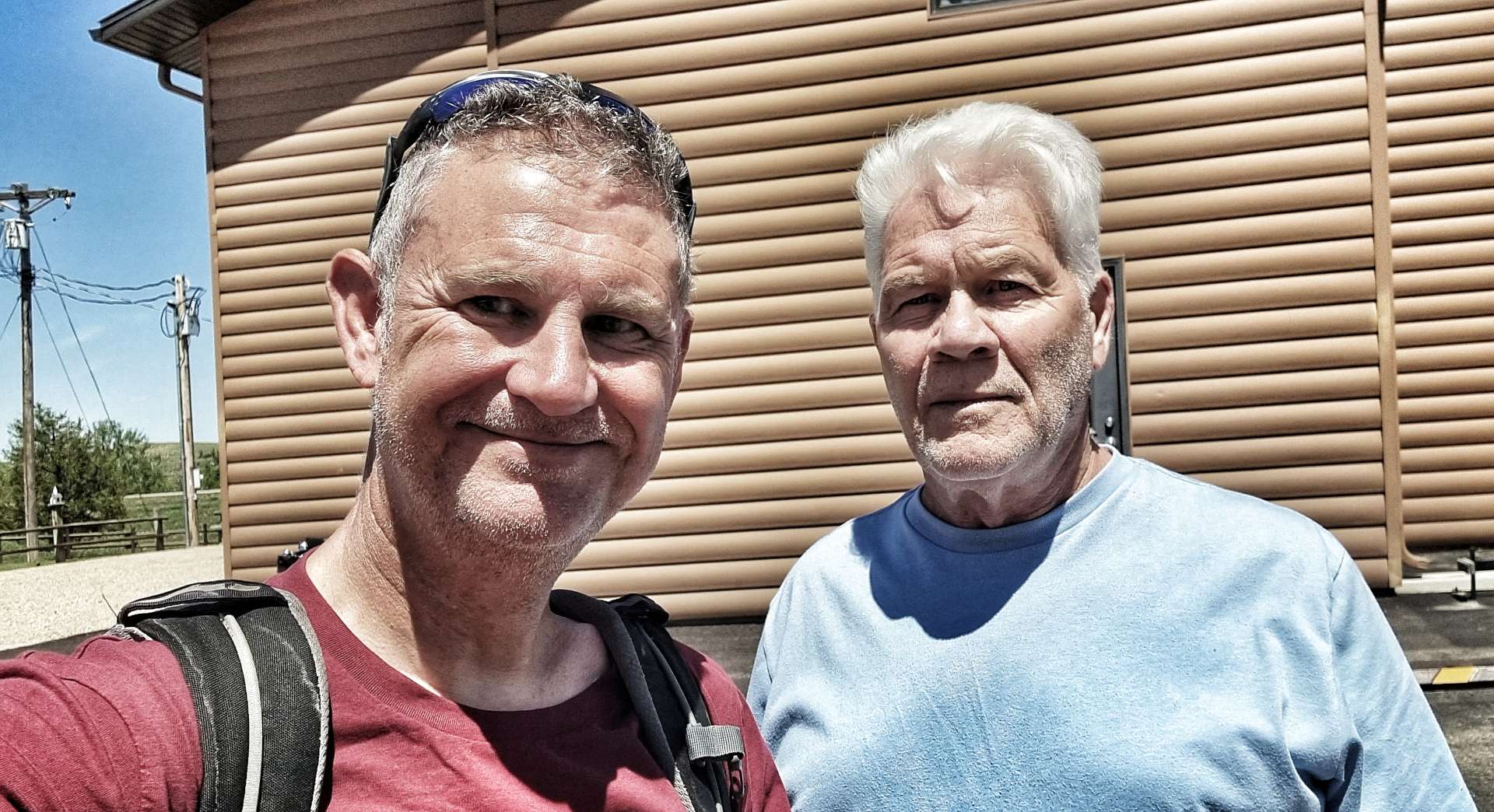
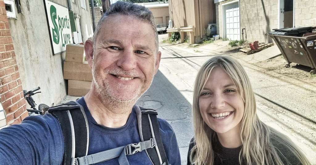
I’ll be forever grateful to Doug (for sorting out transport in the first place), Tom (for driving me to Rapid City & back, as well as being great company) & Dan (for getting me back on the road). They each demonstrated a level of kindness & generosity of spirit that significantly exceeded anything I could have hoped for. I hope you get to read this & see what an impact you had. Thank you guys!
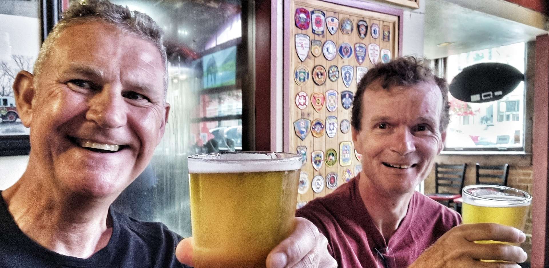
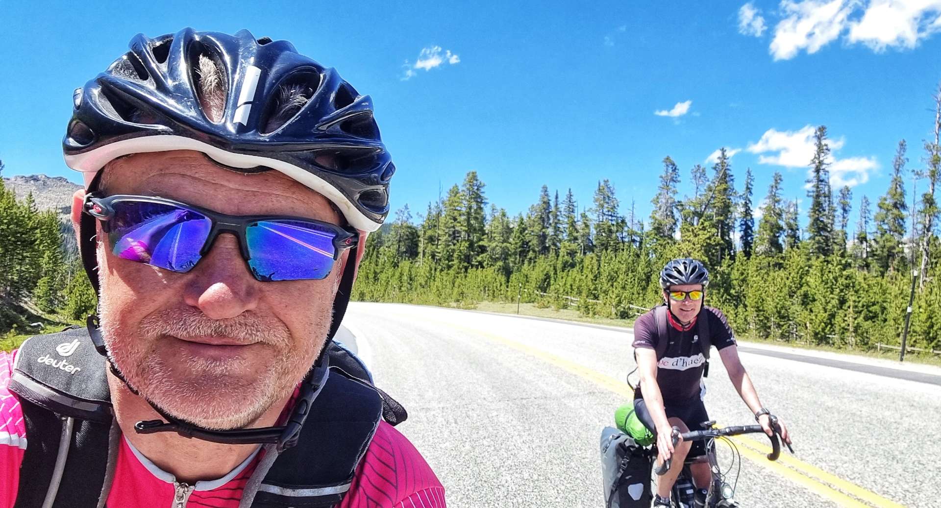
Tom is in the first photo & Dan is in the second photo – you’re both heroes, thank you so much!!!
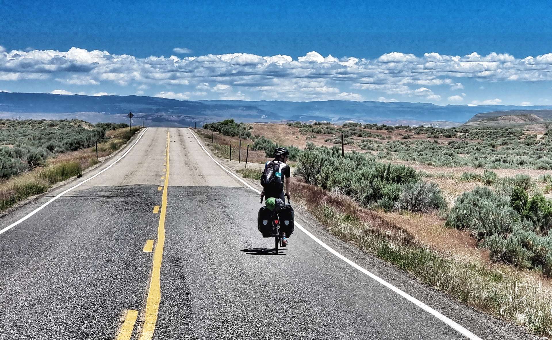
Sunday 10th July – Philip to Murdo (Stage 55).
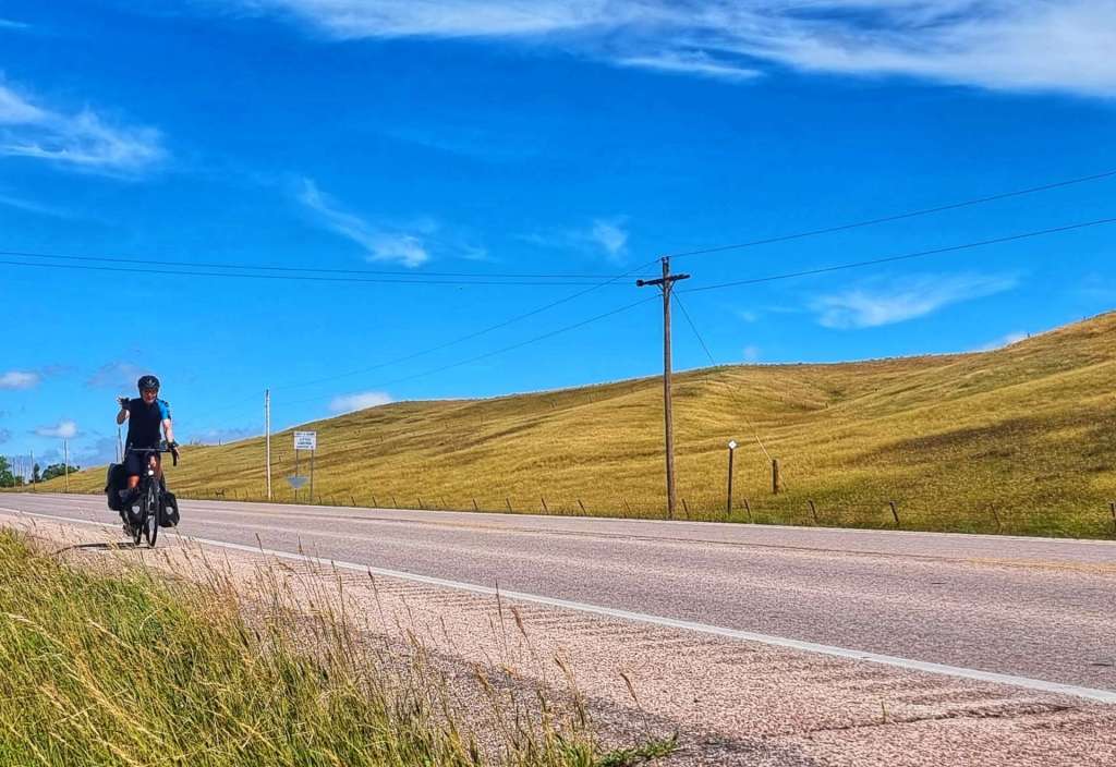
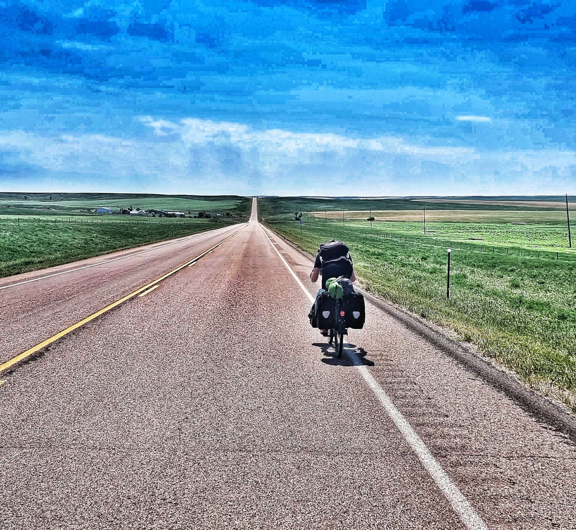
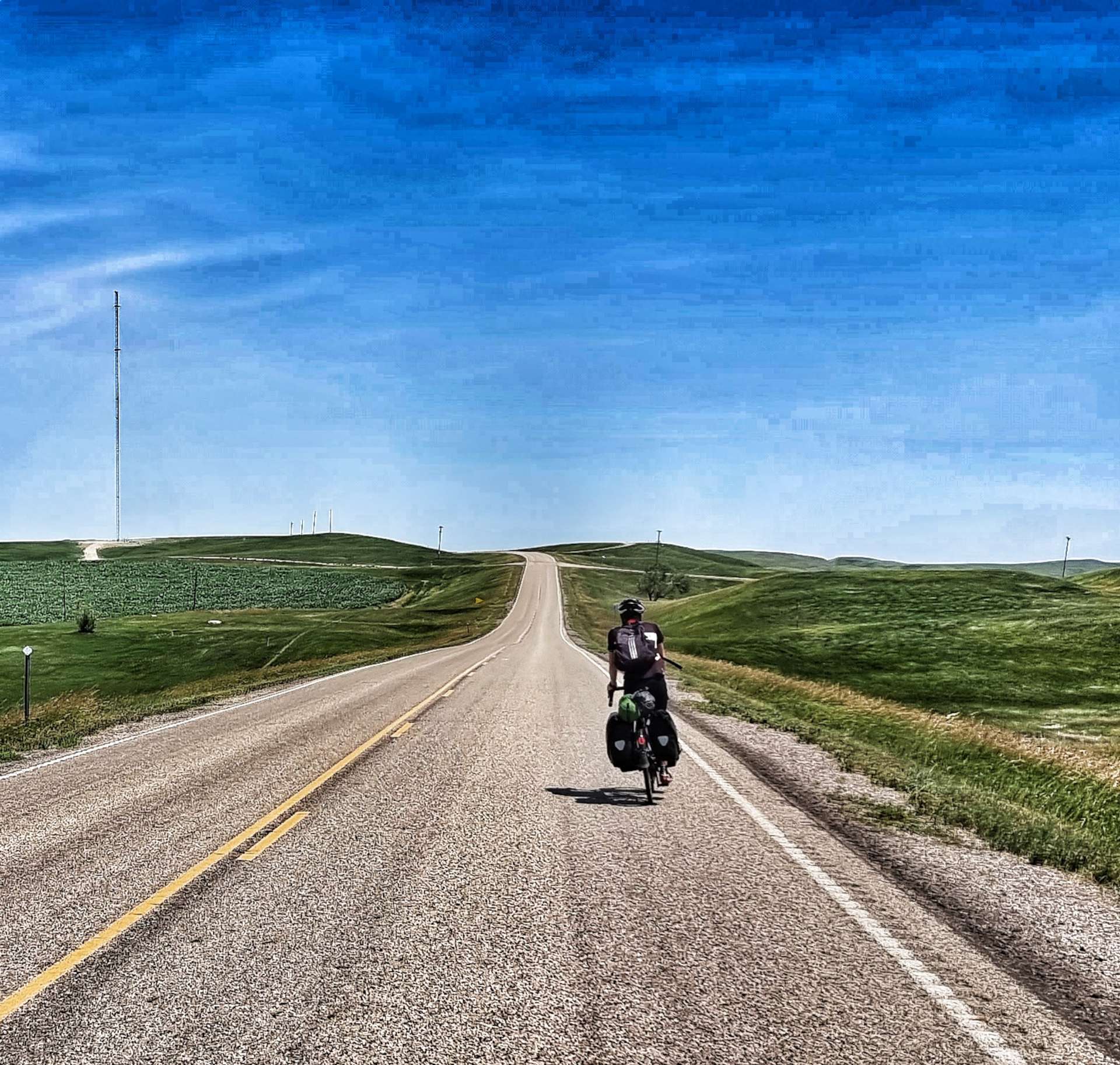
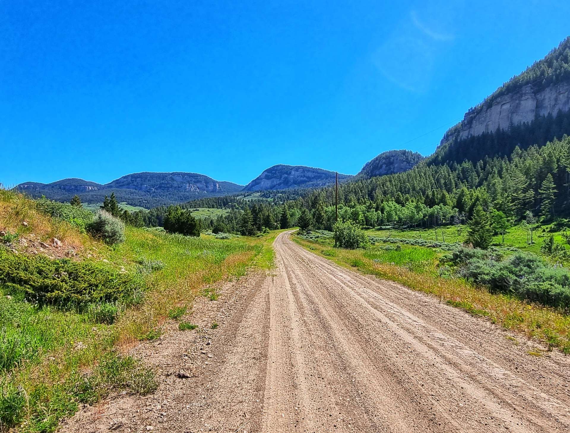
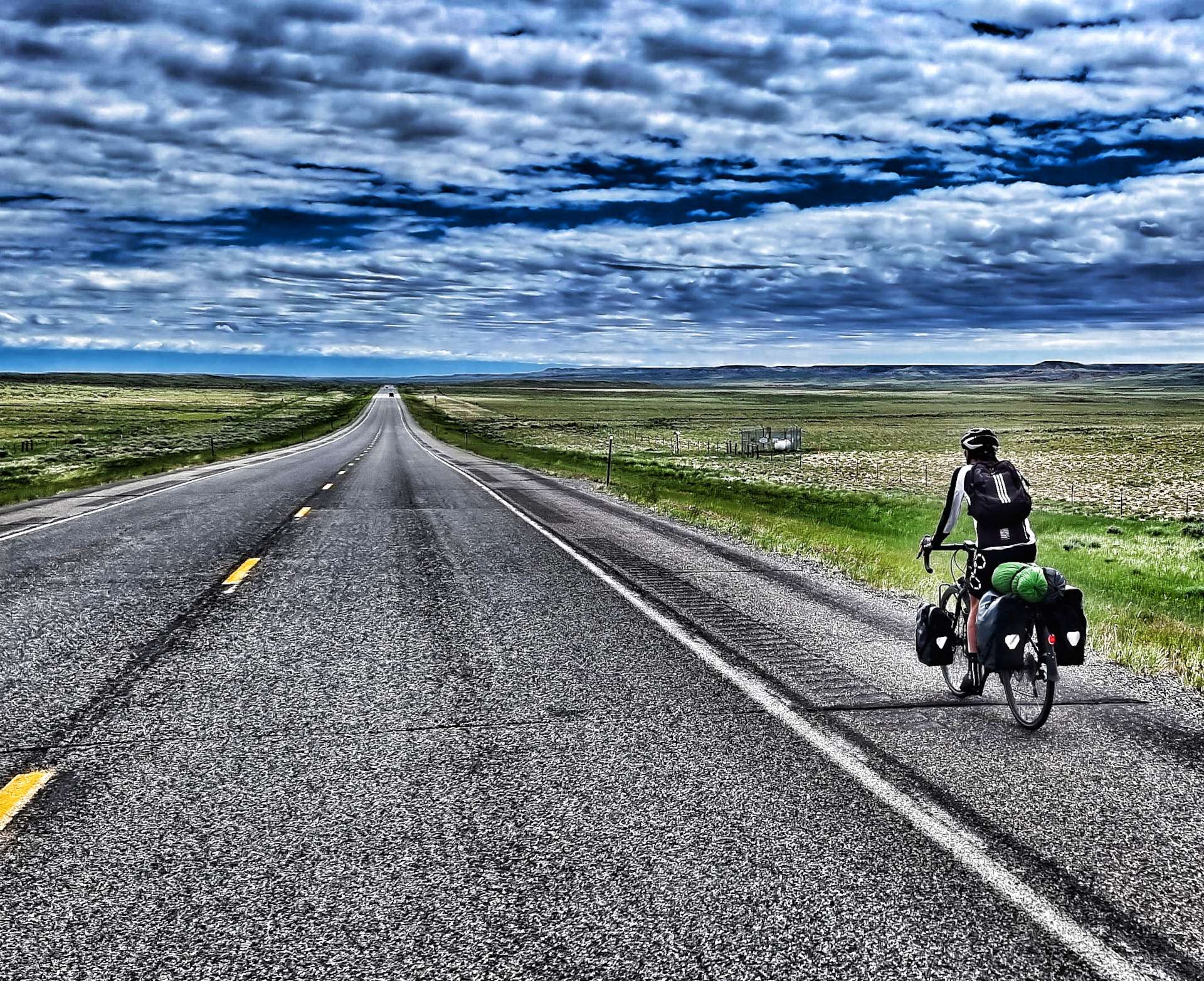
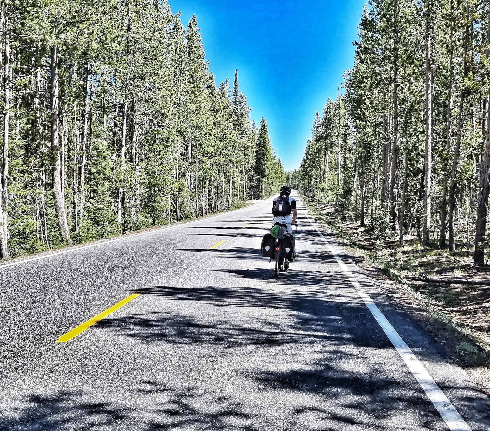
When I arrived back at the motel yesterday at 12.30 & it was 105 degrees outside, so we were fortunate not to be riding in the end! Doug was able to extend our stay for another night, so Sean & I decided to ride today on what should have been a rest day. We were up & on our way by 9am, picking up a tailwind as we continued along Highway 14.
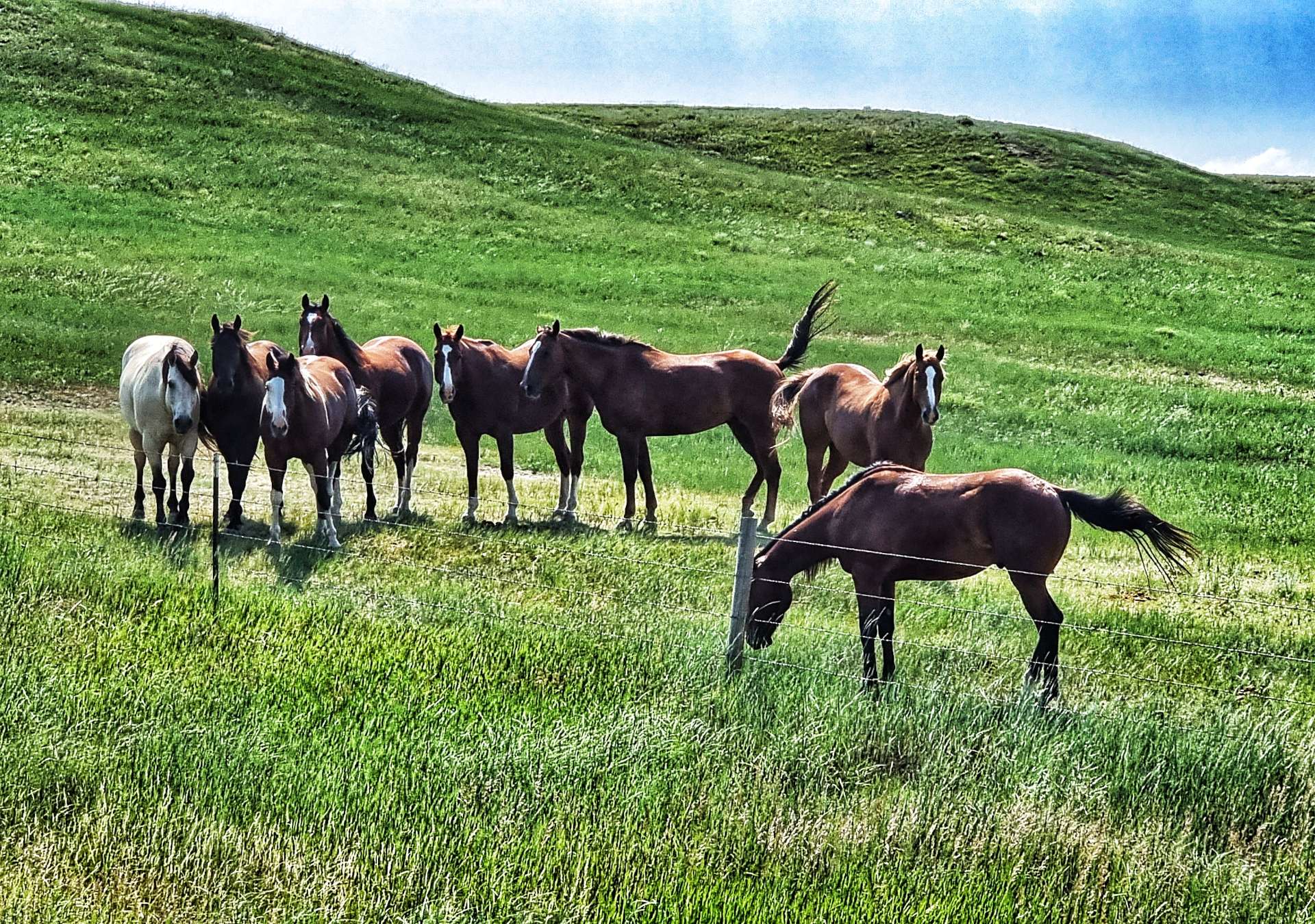
The early miles were a series of ongoing rollers, but we had a tailwind to we made good progress. Whenever the road gets close to horses, they stop whatever they were doing & come over to the fence to have a look at us. It’s as if they know we’re crazy! Following on from Thursday, I picked up another passenger today, this time he had a free ride for about 15 minutes.
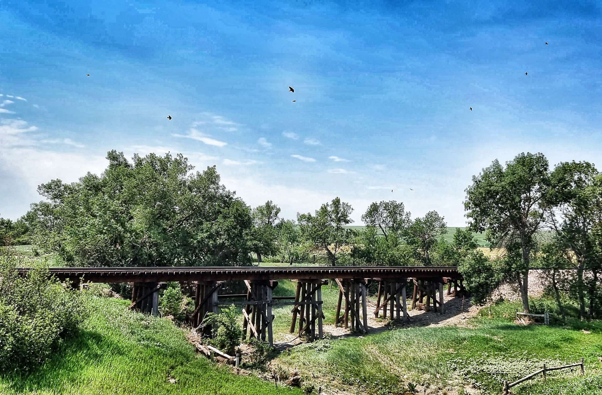
We’re beginning to recognise themes emerging in South Dakota (just as we prepare to move States again!) – residents take great pride in the entrances to their property, there are lots of pepper pots & the railroad still uses classic trestle bridges to cross creeks & water.
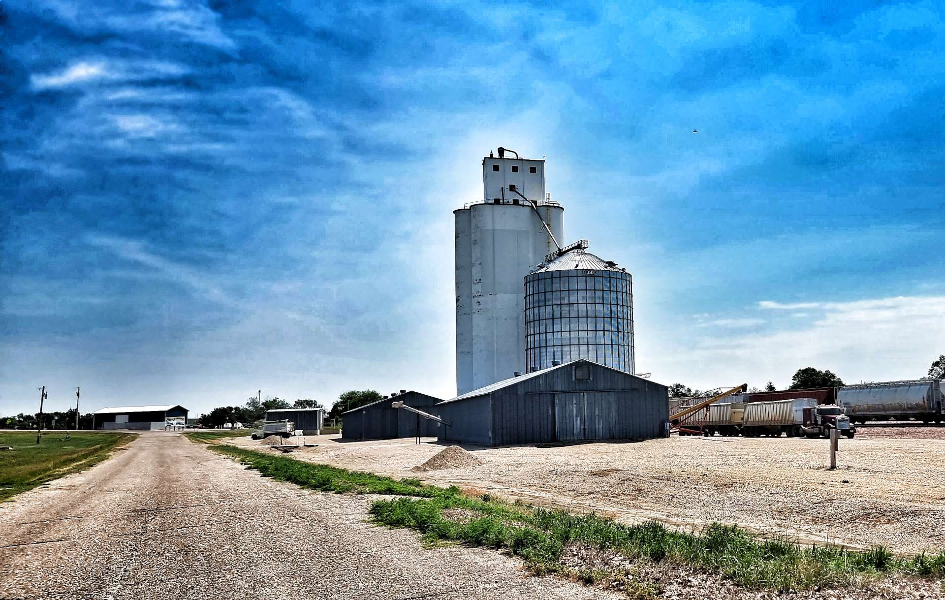
We stopped briefly in Midland for a cold drink & cookie, as well as to fill our water bottles. As we rode through the small town we passed a Grain Elevator Building & a customised Welcome To Midland sign. After the stunning scenery of the first 10 weeks, today feels like it’s a more run-of-the-mill day.
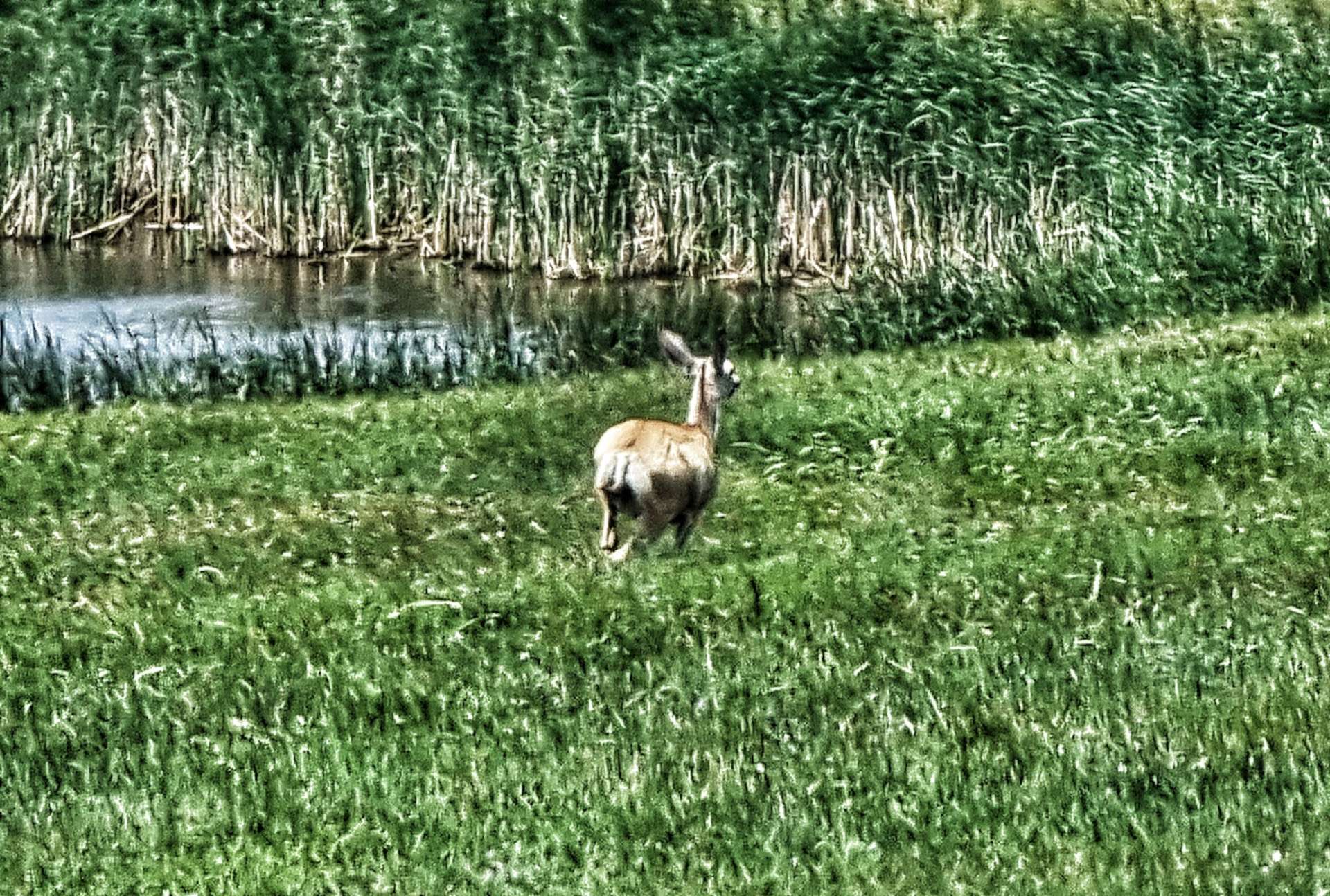
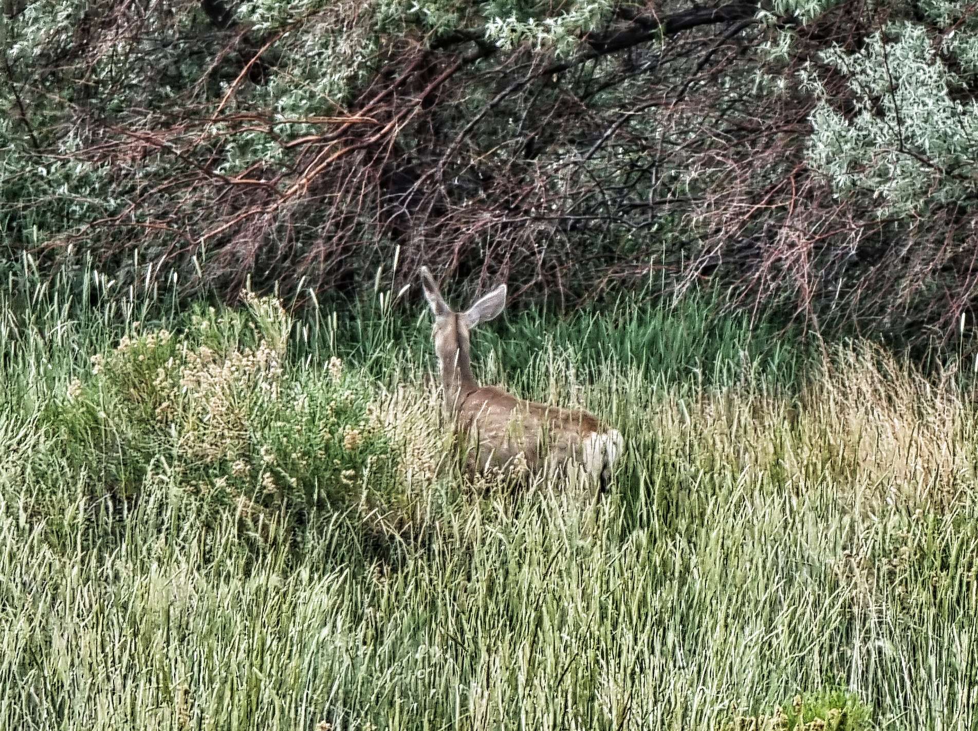
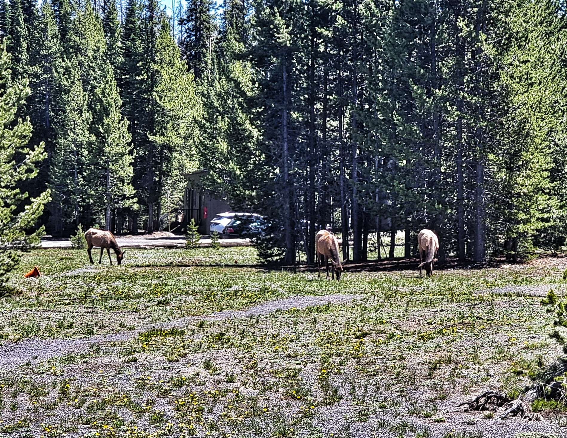
At Midland we turned right onto the 63 & we were immediately hit by a cross / headwind, just as the road started rising. The next 10 miles were a series of rollers as we bounced along the top of a ridge. We also saw our only real wildlife of the day in the form of a deer.
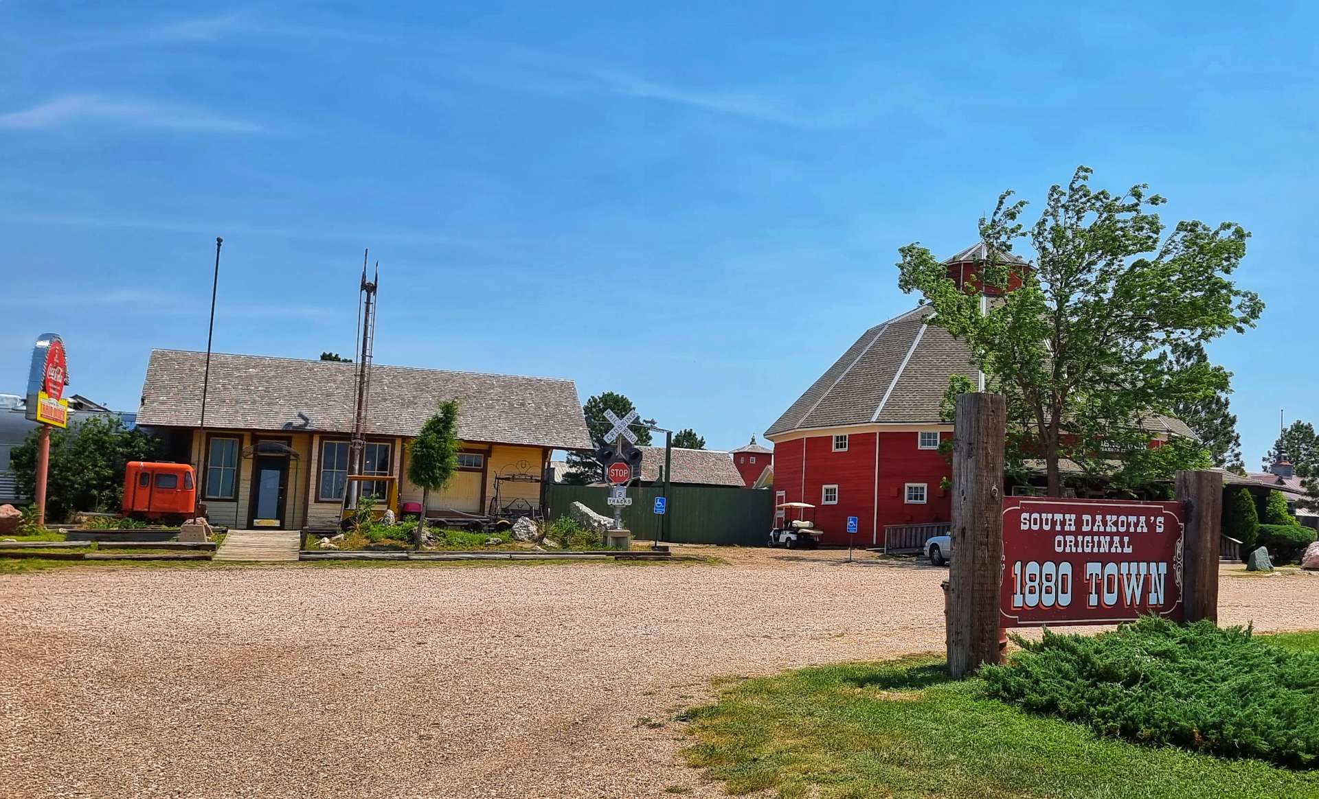
As we closed in on the I-90 junction, we realised that the services were also a historic stopping off point. It was advertised as Original 1880 Town & the shop had been decorated in an 1880’s style. Oddly, there were also other items from the past, like the diesel locomotive, that clearly weren’t from the 1880’s. We had a quick stroll around, then did the important business of throwing away the warm water from our bottles & replacing it with some fresh, ice cold water from the fridge!
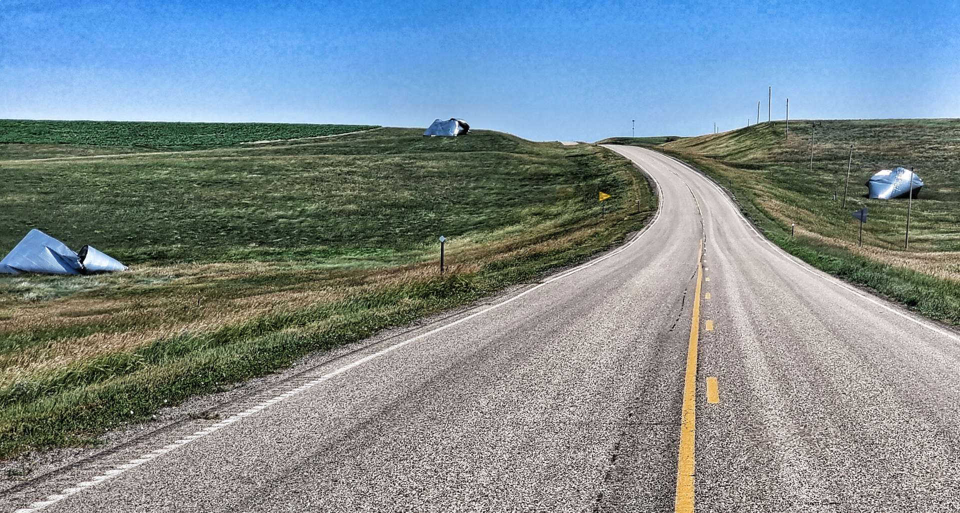
The remainder of the ride was on rolling hills, as we took the frontage road that shadowed the I-90. Along the way we saw a huge skeleton of a dinosaur, as well as recent damage to one of the many pepper pots that were destroyed by a recent storm. In Philip (where we stayed last night), they had been without power for 4 days after the storm passed through. Seeing a large radio tower gave me hope that I might have a phone signal – today is Mum’s Birthday & I planned to call her. Alas, no signal today, so I made a short video & used the hotel Wifi to send it later in the afternoon.
The final few miles were gently downhill until a nasty, steep drag up to the town – all the cows in a nearby field came over to watch us as we battled our way to the top!!!
Stage Stats – 63 miles, 2,500 feet of climbing. Hot & riding into a headwind for large parts of the ride.
Well, How Did We Get Here? Miles, Feet Climbed, Maps & Profiles.
I’ve previously described how we travelled from Seattle to Cody in the first 8 weeks of our adventure. Now find out where we went & what we did in Week 9! Hopefully picking a single photo (2 for Powder River Pass & Devils Tower!) to represent each day will refresh my mind when it comes to looking back on my adventure!
Sunday 3rd July to Wednesday 6th July – Stages 50 to 52.
Sunday 3rd July – Spearfish to Hill City (Stage 50)
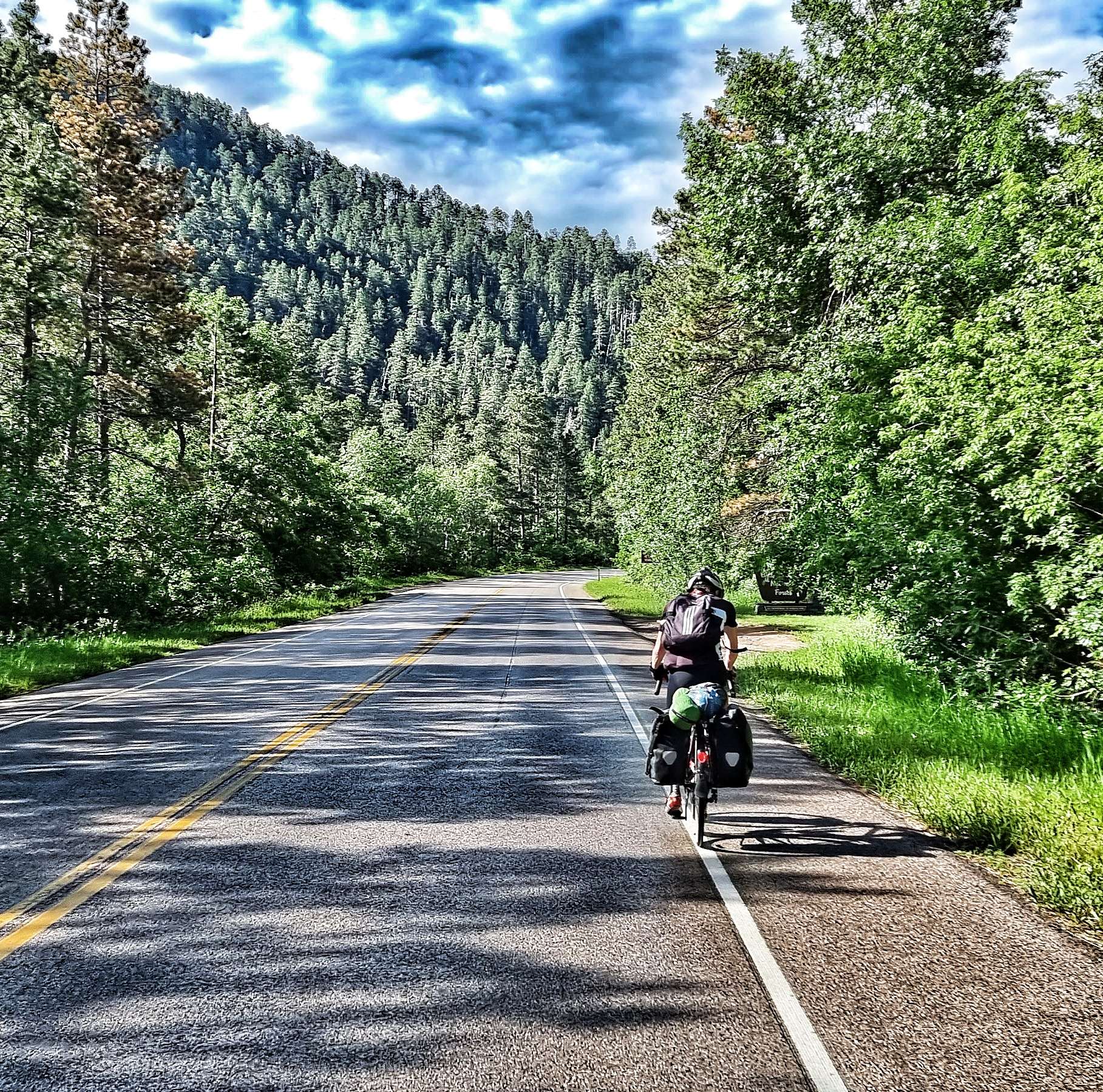
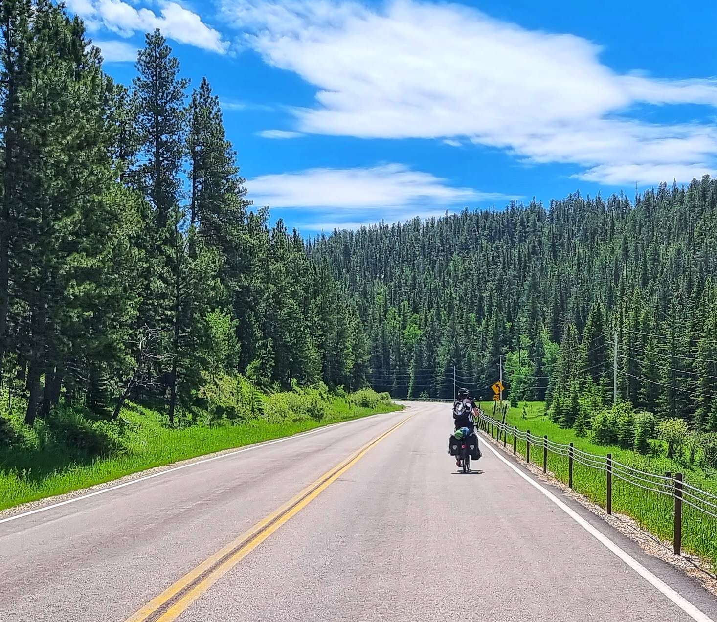
We packed our camping equipment & were on the road by 8.45am for the first of 3 days of adventures in the Black Hills. Spearfish Canyon Scenic Byway is an area of outstanding natural beauty, but isn’t that well known – luckily we were aware of it from our Adventure Cycling Association maps. The road follows an old railroad route, so although it climbs for the best part of 22 miles, the gradient rarely exceeds 4% & is one of the top 50 scenic cycle paths in the USA.
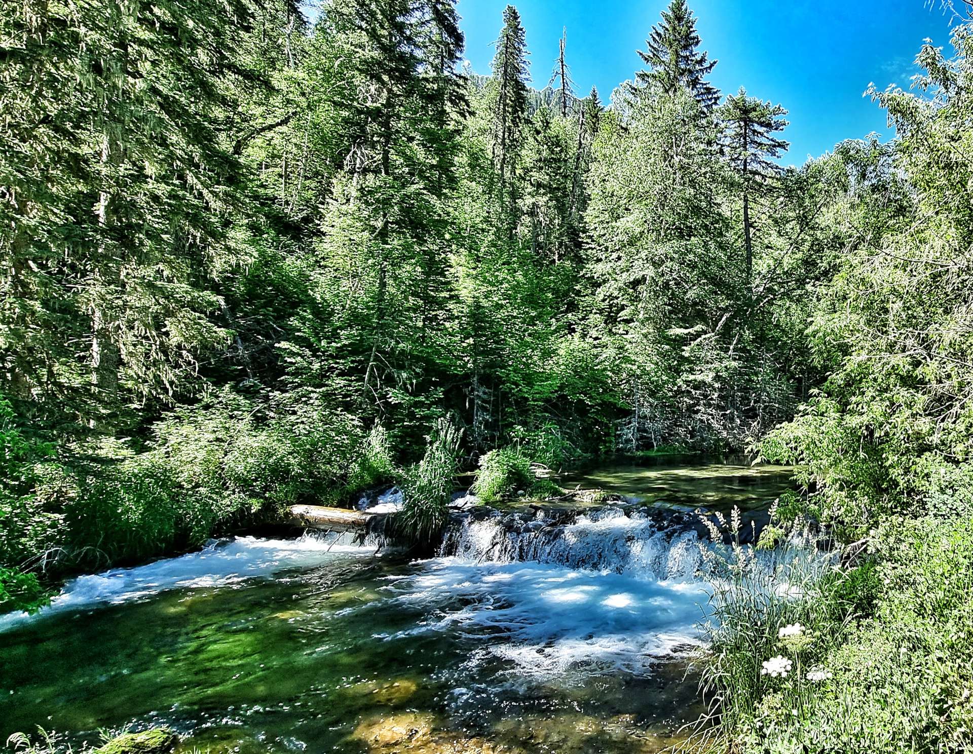
The cliffs rise over 1,000 feet on either side of the canyon & are covered by trees as the scenic 14a road follows the path of Spearfish Creek. Along the way are Bridal Falls (photo 3 below) & the Devils Bathtub (photo 4).
As we continued up the canyon, we were passed by a few small groups of cyclists – we were no match for their carbon bikes! The red, yellow & white cliffs occasionally peaked out from the forest as we reached the Latchstring restaurant where we pulled in for a coffee & to top up our water bottles.
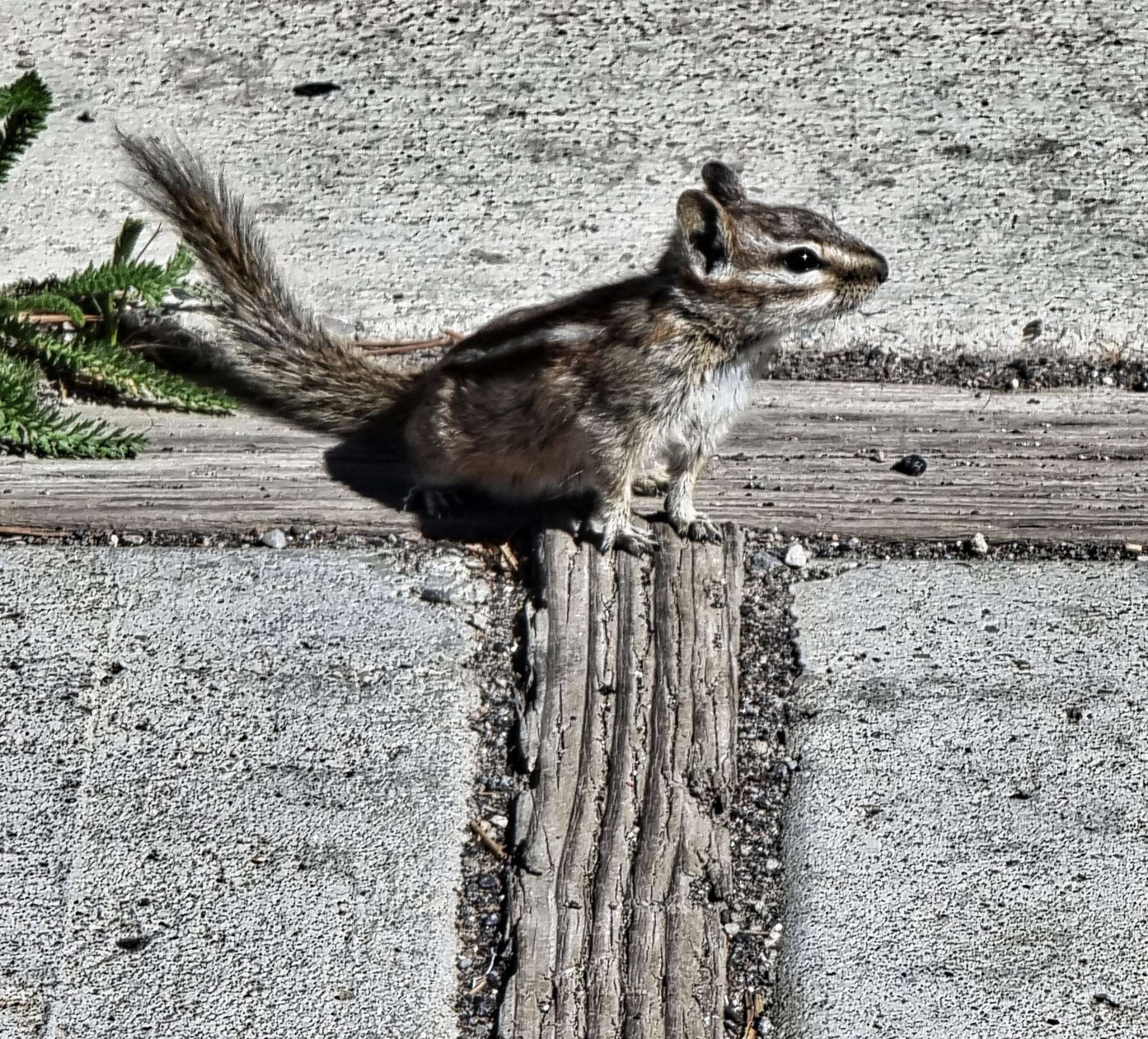
We stopped briefly in one of the picnic spots, so we could cool down when enjoying a handful of trail mix – while I sat there, a chipmonk came over to investigate if there were any scraps for him! Spearfish Canyon was used as a location for some of the scenes from Dances with Wolves & there was a signpost to direct film buffs up Forest Road 222.
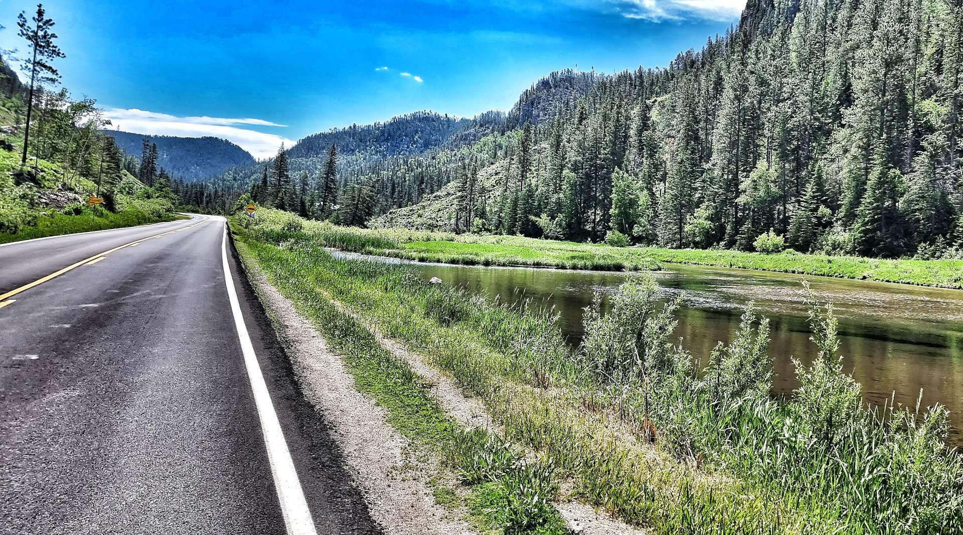
The canyon widened out as we neared Cheyenne Crossing, with small lakes appearing where manmade weirs had been installed. At Cheyenne Crossing we followed the 14a as the gradient suddenly increased in severity – this part of the climb was about 3 miles in length & took us past where Don had planned to stay last night. We then enjoyed a couple of miles of downhill before taking a right turn onto a smaller backroad.
We saw a long distance cyclist heading in the opposite direction & I actually had time to take a photo as we passed each other, shouting “Safe Travels” to each other. We had one final road climb before today’s adventure began in earnest.
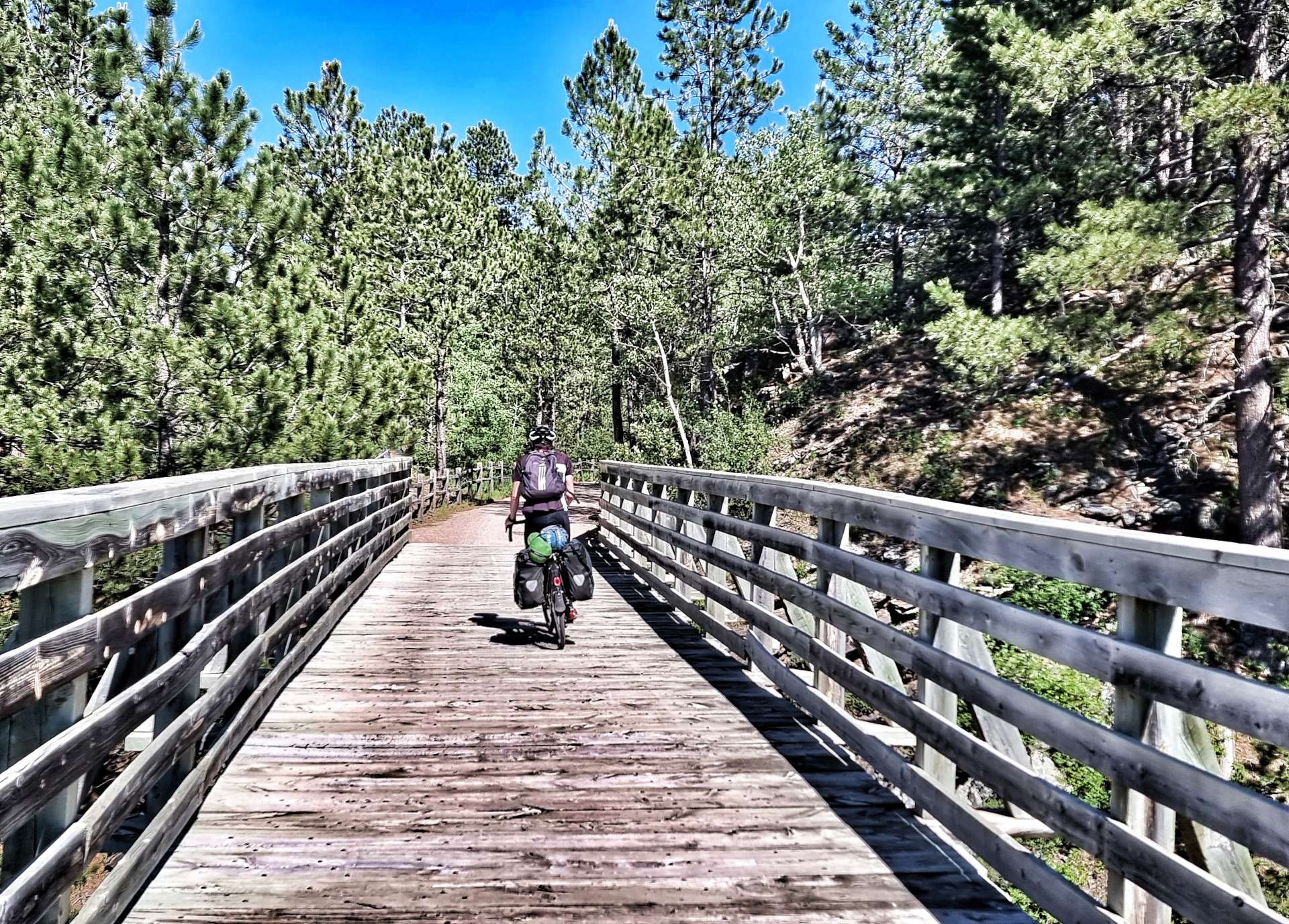
The George S. Mickelson Trail is 109 miles in length, is shared by cyclists, hikers & horse riders & was completed in September 1998. Much of the trail passes through National Forest Land as the 100 converted bridges & 4 rock tunnels enable users to travel from Deadwood to Edgemont – its surface is primarily crushed limestone, with stretches of gravel. The trail follows the old Chicago, Burlington & Quincy railroad branch line.
We joined at the Englewood Trailhead on a gentle downhill section (milepost 98.5), perfect for getting used to the different surface! We were both a bit wary to begin with, as we haven’t done too much off-road riding with the panniers, however, we soon felt more confident. At times the trail followed the road, but there were also sections that took us into the wilderness, so it really felt like an adventure!
The trail continued to descend for the next 23 miles. Along the way we passed through 2 of the rock tunnels, followed the course of Rapid Creek, cut through forest & stopped in the town of Rochford for an ice cream & to top up our water bottles again. The local tap water was high in iron content, so the owner of the Rochford Mall kindly shared her daily water supply with us. Another of many generous acts we’ve experienced on our adventure to date.
Passing through Mystic, we encountered Pony & then Bobcat Gulch – there was a beautiful river beneath us & this marked the point where our descending ended.
We now had to climb the Mickelson Trail!!! Up to this point we thought we had a bailout option of riding the road – we could now see that was gravel too, so time to accept our lot in life & get on with it. The views were breath-taking as we steadily gained altitude, the trail was a constant gradient & although it was hard work, I enjoyed myself – being that bit heavier than Sean meant the bike handled better & I was able to get more traction.
On the early part of the climb 2 horse riders were heading down the trail & we exchanges pleasantries, but other than that, we had the trail to ourselves for the next 8 miles as we continued climbing. We would occasionally cross a creek on one of the wooden trestle bridges. As the trail topped out at Red Fern we stopped again to fill our water bottles, this time at a handily placed picnic site with a hand pump to draw water.
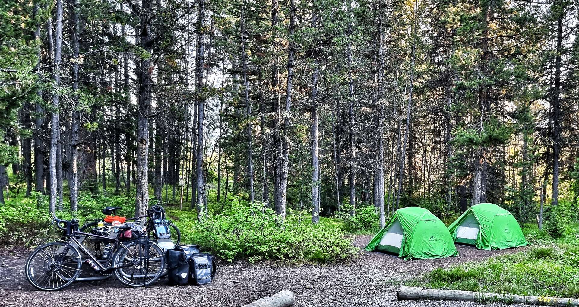
From Red Fern we had a gradual 8 mile descent into Hill City (mile point 60.1), where we were staying at the Trailside Campground – yes, the campground straddles the Mickelson Trail. We’d travelled 38.5 miles on the trail & it lived up to its billing as an adventurous day out. We also understood why Don had decided to take a couple of days to make the journey!
We set up our tents & then set about trying to recover in the shade – we’d drunk 9 bottles of water (just over 5.5 litres / 10 pints) on our day out, yet still we were thirsty! The temperature had been 85 degrees, so had taken its toll over our 6 hour ride.
In the last update, I promised you a photo of Don (aka Gus to us for a couple of days!!) – here he is at Trailside Campground! We chatted while Don prepared his dinner & shared plans for the coming days, Don & ourselves planned to stop at Keystone tomorrow, but were taking different routes. I hope we bump into Don again, as we really enjoyed his company & it’s great to meet up with someone who ‘gets’ what you’re doing & can provide experience & insights to make the adventure even better. Along with a few other people we met in Spearfish, Don recommended cycling in Wisconsin if we get the chance.
Stage Stats – 63 miles, 4,091 feet of climbing. 38.5 miles of off road riding on crushed limestone, with a long climb thrown in for good measure.
Monday 4th July – Hill City to Keystone (Stage 51)
Happy Fourth of July!!!
Hill City to Keystone is 10.9 miles point to point on Highway 323 – obviously that wasn’t the way we would do it!! We were on our way by 8.45am once more, picking up the Mickelson Trail again. Almost immediately we spotted a sign for Quails Crossing – initially I thought it meant the birds, I later worked out it was an instruction, telling everyone to keep out, except customers of Quails Crossing. I prefer to think of it as a crossing specifically for quails!
The trail was gradually climbing for the first 5 miles, at which point we had a decision to make – continue on the trail for another 10 miles (5 up & 5 down), or take the road into Custer. I chose the trail & Sean chose the road – this was the first time that we’d be riding on our own, but it was important that we were able to make our own decisions. We agreed to meet up for coffee in Custer & then continue the rest of our ride together.
The trail continued climbing past the eclectic Boyds Antiques, they looked to have everything no-one ever needed! Every now & then the trail & road would converge, but not surprisingly I didn’t see Sean, he’s strong going uphill on the road, whereas the trail is slower going.
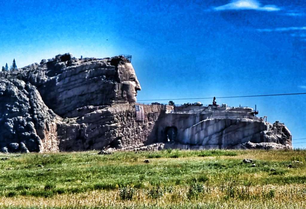
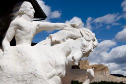
At the summit of the trail climb I could see across to Crazy Horse Mountain – home of the world’s largest mountain carving in progress. The memorial was started in June 1948 & when finished will depict Crazy Horse riding a horse & pointing to his tribal land. Korczak Ziolkowski was commissioned to sculpt the memorial. If completed as designed, it will become the 2nd tallest sculpture in the world at 563 feet high & 641 feet long. The Statue of Unity in India is the tallest.
Chief Henry Standing Bear, when talking about his maternal cousin Crazy Horse said “My fellow chiefs & I would like the white man to know that the red man has great heroes also”. When reading about the memorial, it became clear that not all Lakota Tribespeople agree with the Crazy Horse memorial. Some members of the Tribe believe that carving his image in the mountain pollutes the Lakota lands. There are two sides to every story.
The photo on the left was taken by me, but the second photo is lifted off the internet to show what the memorial will look like when finished.
The trail then started a 5 mile descent, twisting & turning through the rocks & forest at a constant 4% gradient. With all the kit on board, Gene Genie actually feels well balanced, even on gravel. As I reached Custer, I exited the Mickelson Trail at the 44.5 mile post – in total I’d ridden 54 miles on the gravel & thoroughly enjoyed every minute of it!!!
Sean was waiting for me by the side of the trail & had been there a bit over 5 minutes, which wasn’t too bad for either of us. We found a small coffee hut, with seating in the shade & enjoyed a coffee & muffin each. We also met Seanna, her daughter Hayley & young son, Max. She had previously served in the military & is now an air traffic controller with the FAA in Denver. Her husband is a personal trainer & at one time was looking after a baseball player on the New York Yankees roster! It was a really enjoyable 20 minutes chatting with Seanna & Hayley – I hope they enjoyed it as much as we did.
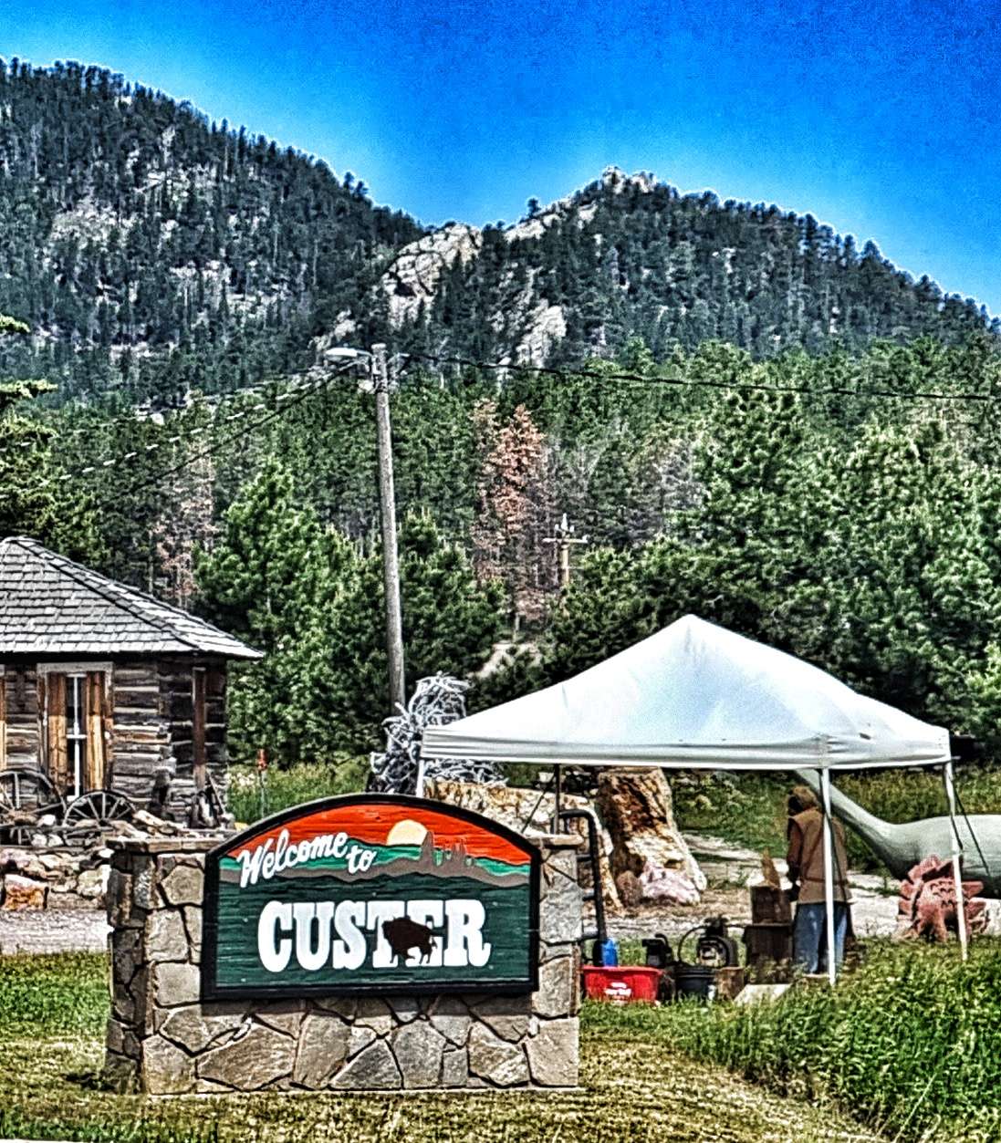
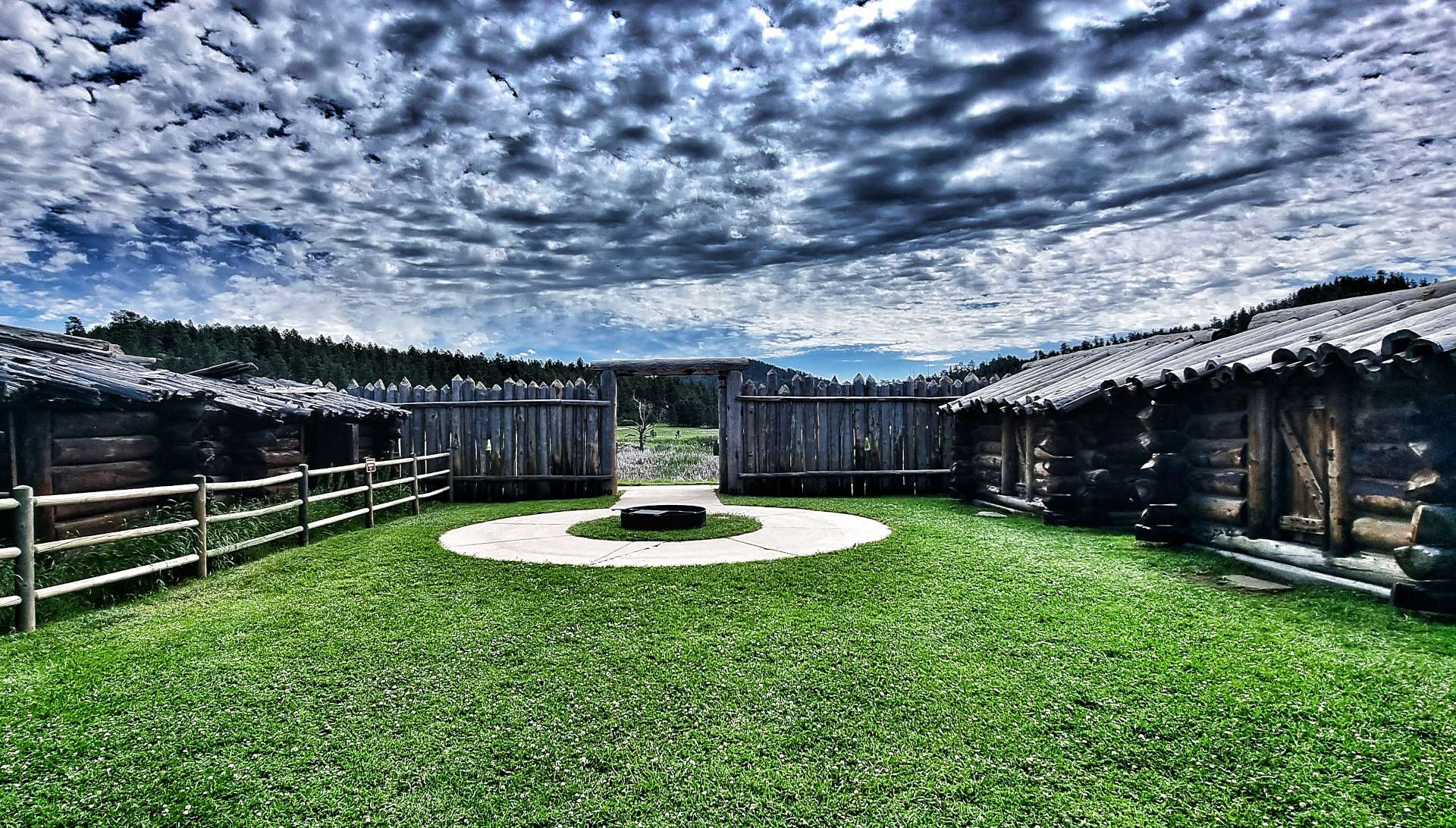
From Custer, we set off towards Custer State Park & along the way we learned a bit more about General Custer’s Expedition (in addition to the sign needing some repairs!!), as well as stopping at Gordon Stockade Historic Landmark. This is an exact replica of the Stockade that was built in December 1874, to keep the first “gold seekers” relatively safe from the Indians.
At the time, there was a standing order forbidding any white gold seekers from entering the Black Hills, however, 26 men, 1 woman & 1 boy carried on & built a stockade anyway. The fort was abandoned when the army forced the gold seekers to return to Fort Laramie in Wyoming, but that wasn’t the end of the story, as the military moved into the Gordon Stockade & used it as a temporary home.
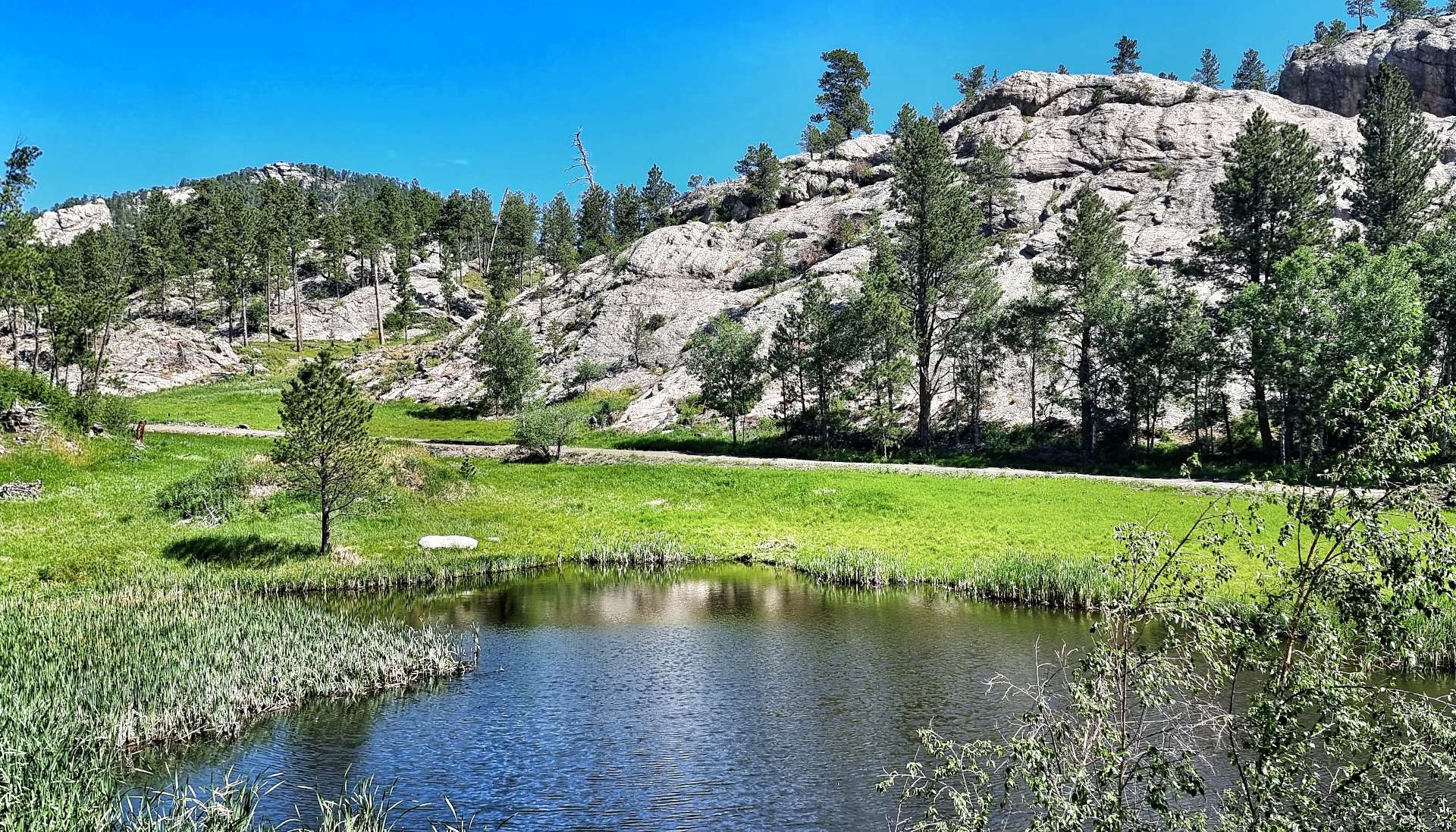
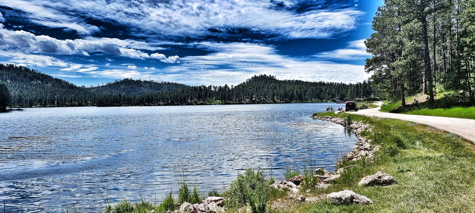
Custer State Park is less than 1/2 mile from Gordon Stockade, so in no time at all we were exploring Gordon Lake & then descending through the forest. We were both pleasantly surprised that the State Park was so quiet on a public holiday.
We stopped for a coke & cake at Legion Lake, while we watched canoes, kayaks & rowing boats making their way around & across the lake – a very relaxing 30 minutes! The road continued descending, until 13 miles after entering the State Park we reached the Visitor Centre, where we spent 20 minutes wandering around the exhibits & learning how nature, wildlife & man survive in the same space.
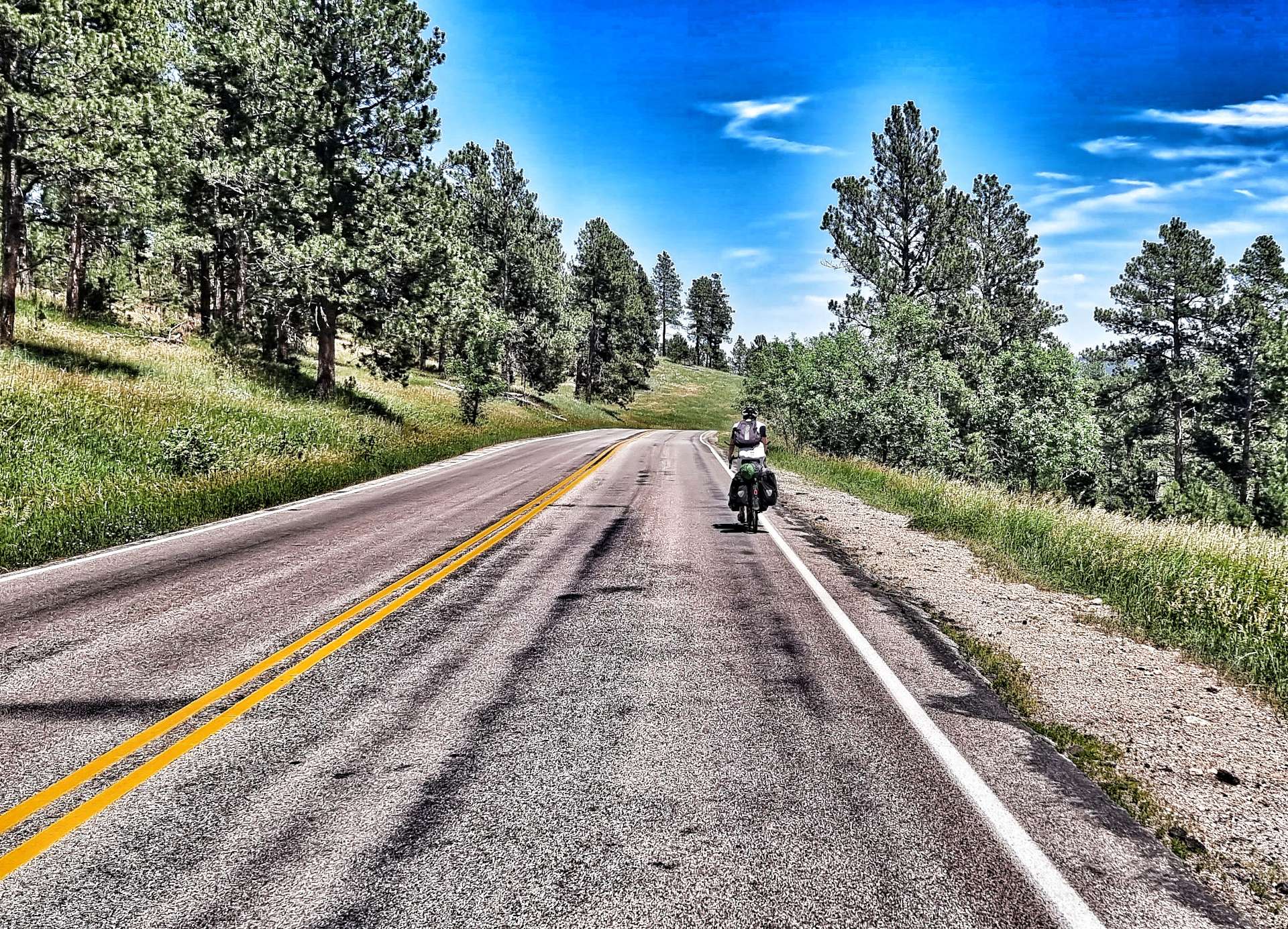
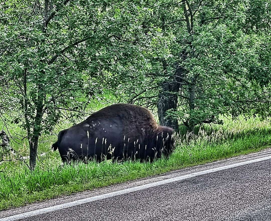
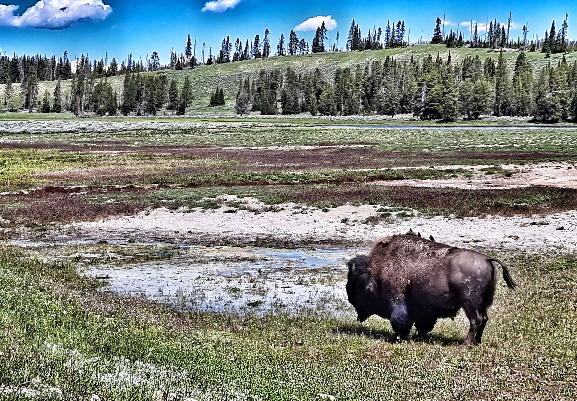
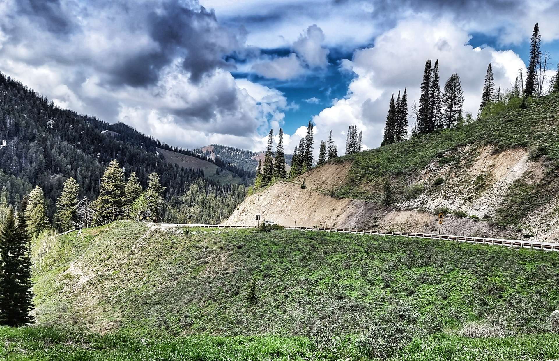
The road continued descending for another 2 miles until we left Custer State Park & took a left turn for the 12 mile climb up Iron Mountain Road. We were on the lookout for wildlife & couldn’t believe our luck, when there on the verge was a bison grazing on the grass. I made sure I was a safe distance away, then took a quick snap, before leaving the bison in peace.
The climb twisted & turned through grassland & then forest, giving us a first fleeting view of Mount Rushmore, some 15 miles away. The climb took us about 1 hour 45 minutes to complete, with plenty of 7% – 8% sections & we both said it was a tough climb, with similarities to the alpine landscapes of Europe.
As we neared the summit of the climb, we had huge views across the plains below – we could see a localised rain storm in full flow, while we basked in the sun!
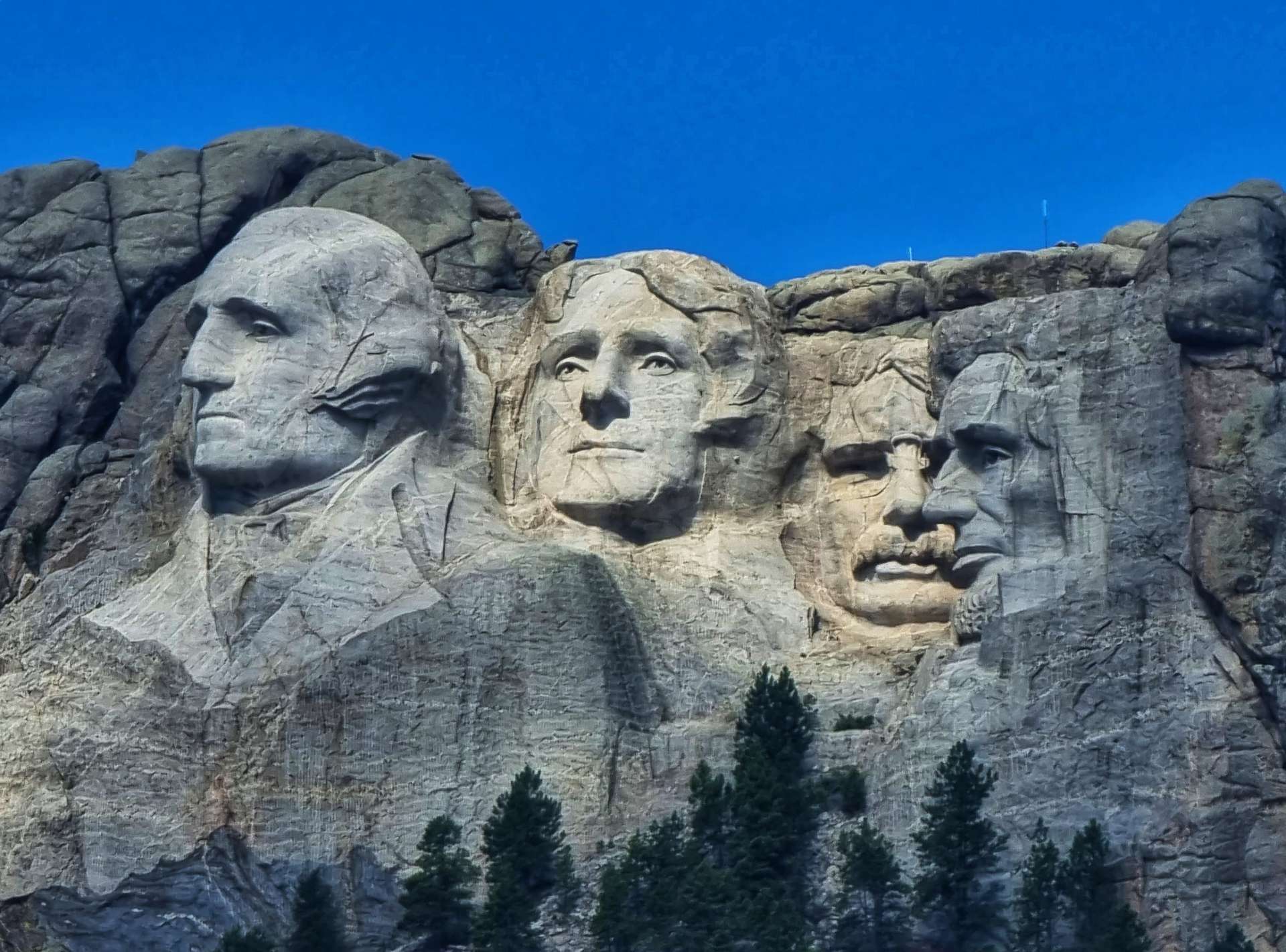
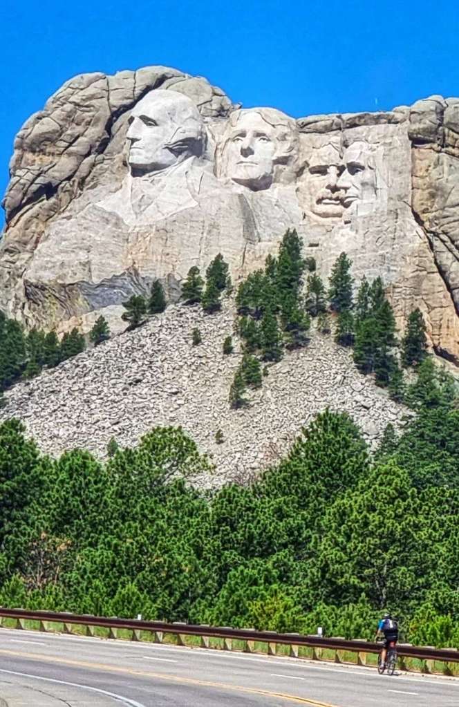
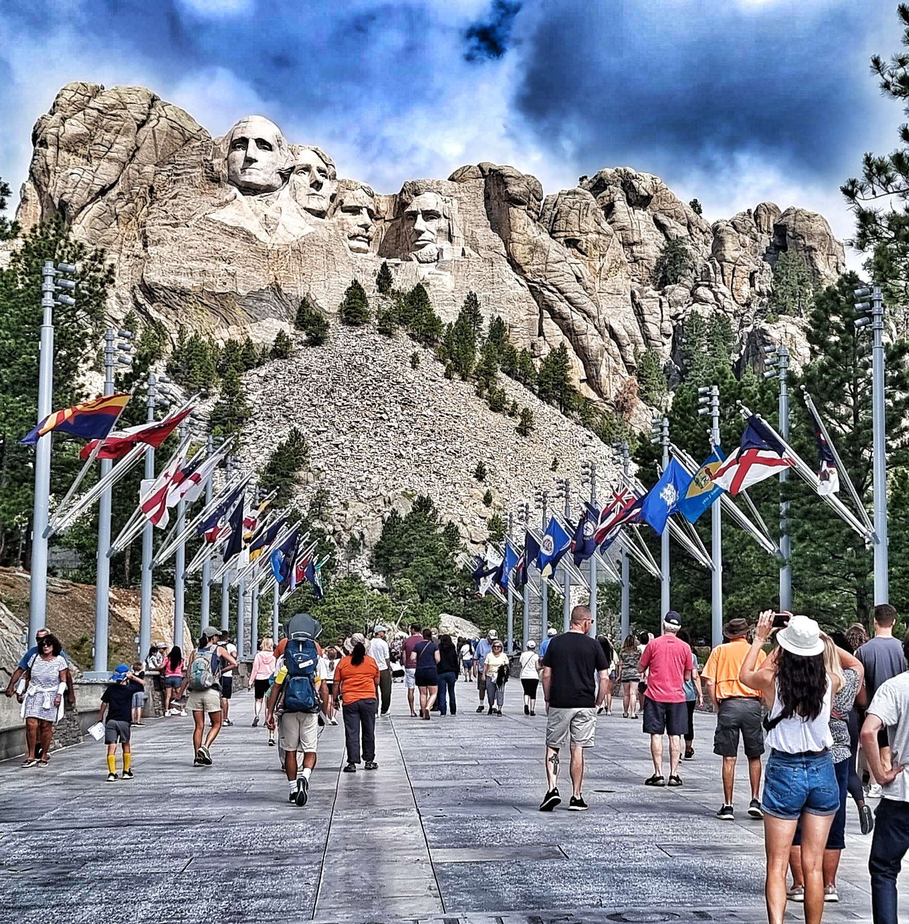
As we reached the overlook, we finally got our reward for our 1 hour 45 minutes of full-on effort – the Four Presidents of Mount Rushmore were in front of us! I had to use a x10 zoom to get the first two close-up photos – you get a better idea of perspective in the 3rd photo, the Four Presidents are on the rockface behind us. We were still 7 or 8 miles away at this point. As we’re planning to visit Mount Rushmore tomorrow, I’ll save all the facts & figures for then!
The descent from Iron Mountain is full of sharp corners, single track, 3 tunnels & a couple of 720 degree “pig tails” where the road twists round underneath itself much as a pig tail loops around itself. While we needed to concentrate, it was also a fun descent!
Within 15 minutes we were at the junction with the road to Mount Rushmore & today’s epic adventure was drawing to a close. All the remained was to check in to our hotel, then head out for dinner & a couple of pints to celebrate another amazing day in the saddle.
Stage Stats – 51 miles, 3,832 feet of climbing. An additional 15.5 miles of off road riding on crushed limestone, exploring Custer State Park, a long climb of Iron Mountain Road & our first views of Mount Rushmore.
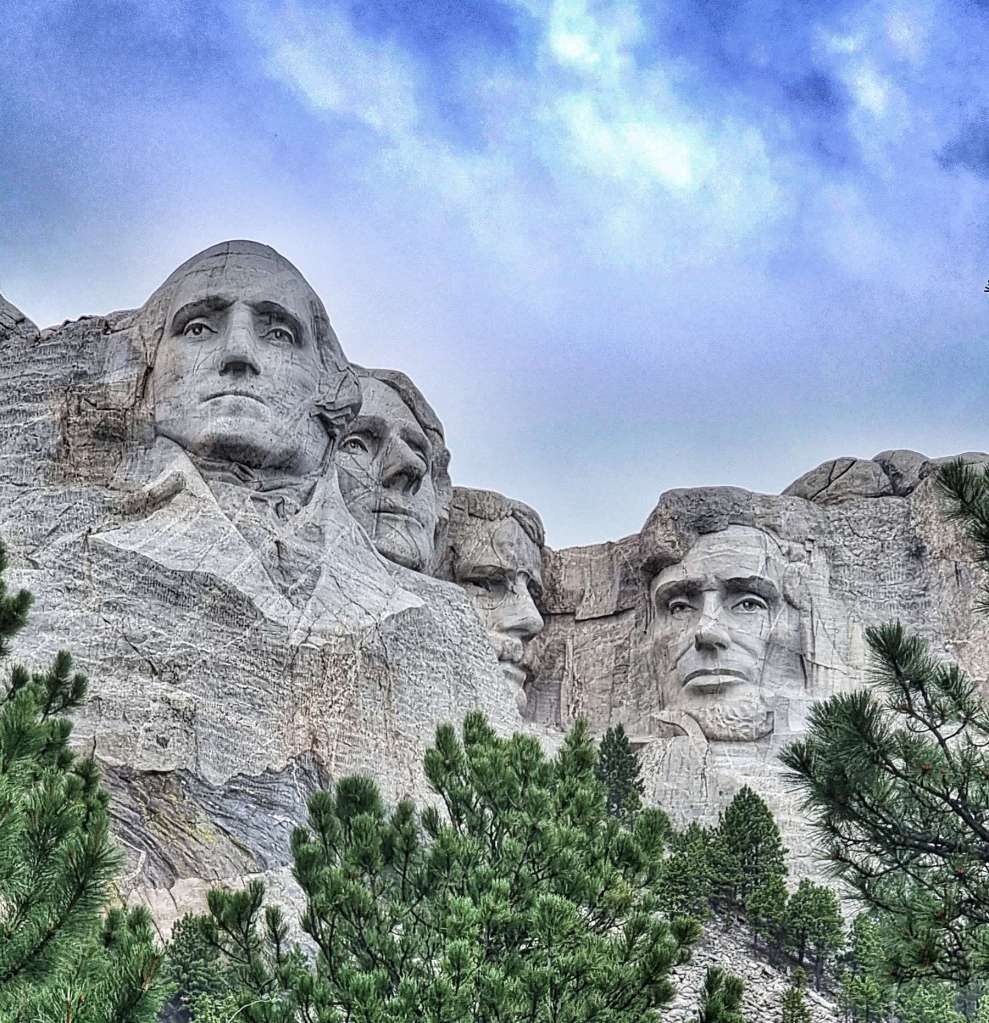
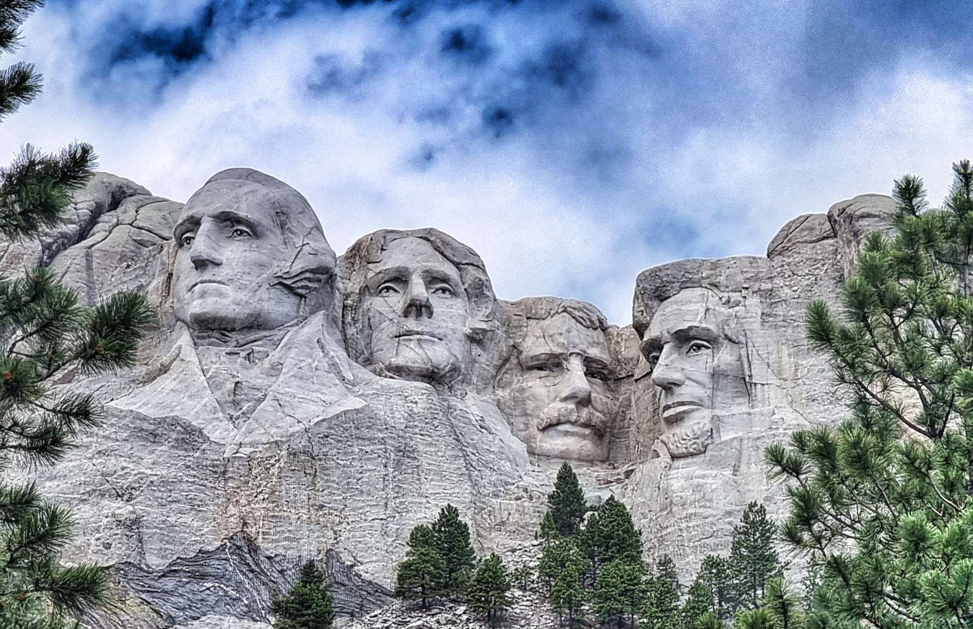
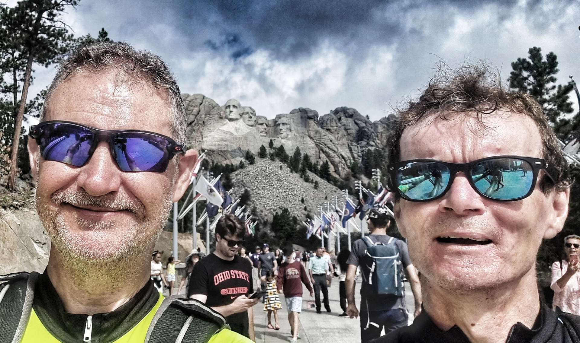
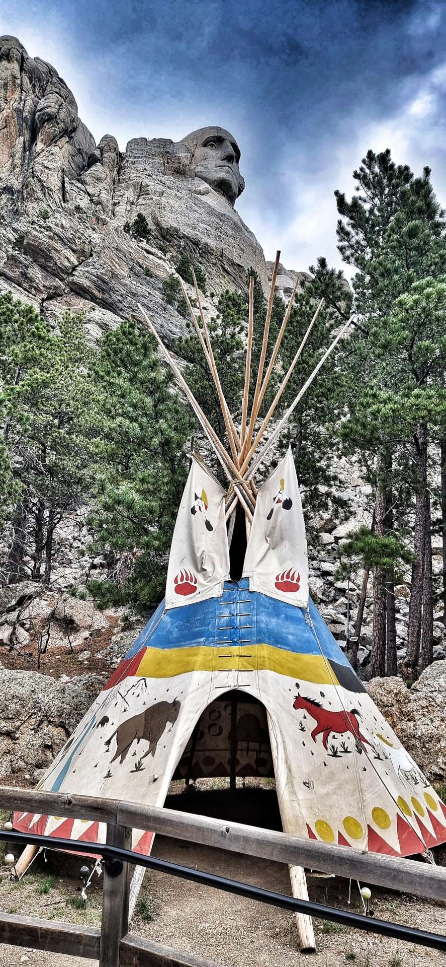
Tuesday 5th July – Keystone to Rapid City via Mount Rushmore (Stage 52)
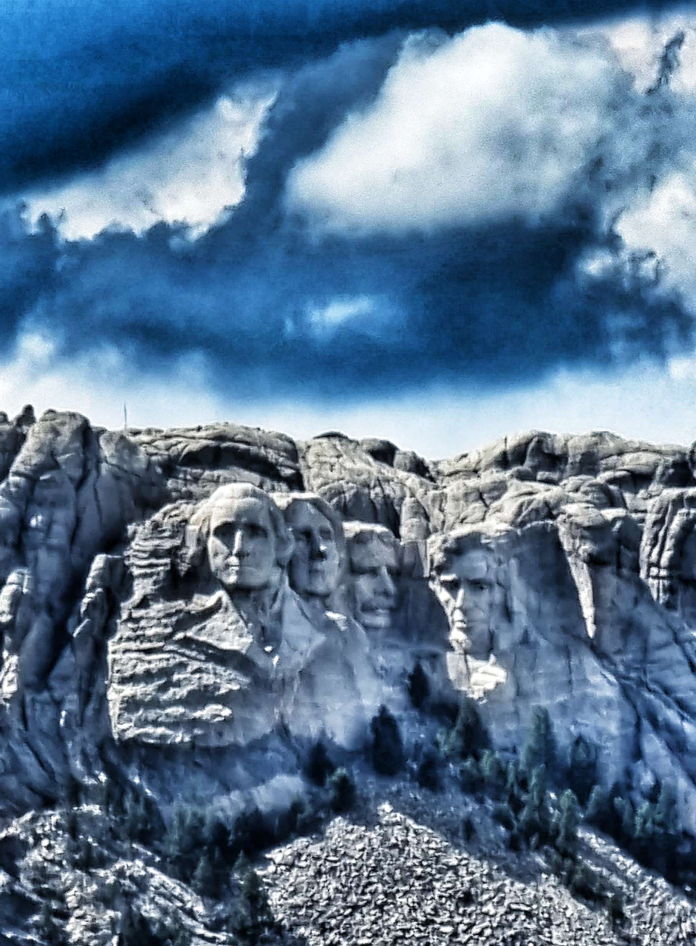
We were up bright & early for breakfast, so we could spend a couple of hours exploring Mount Rushmore. Our motel owners very kindly agreed to look after our panniers, sleeping bags & tents, so we could ride up to Mount Rushmore without any unnecessary weight – although the climb is only a couple of miles in length, most of it is 10% plus in gradient! You may be able to make out Sean at the bottom of the 4th photo.
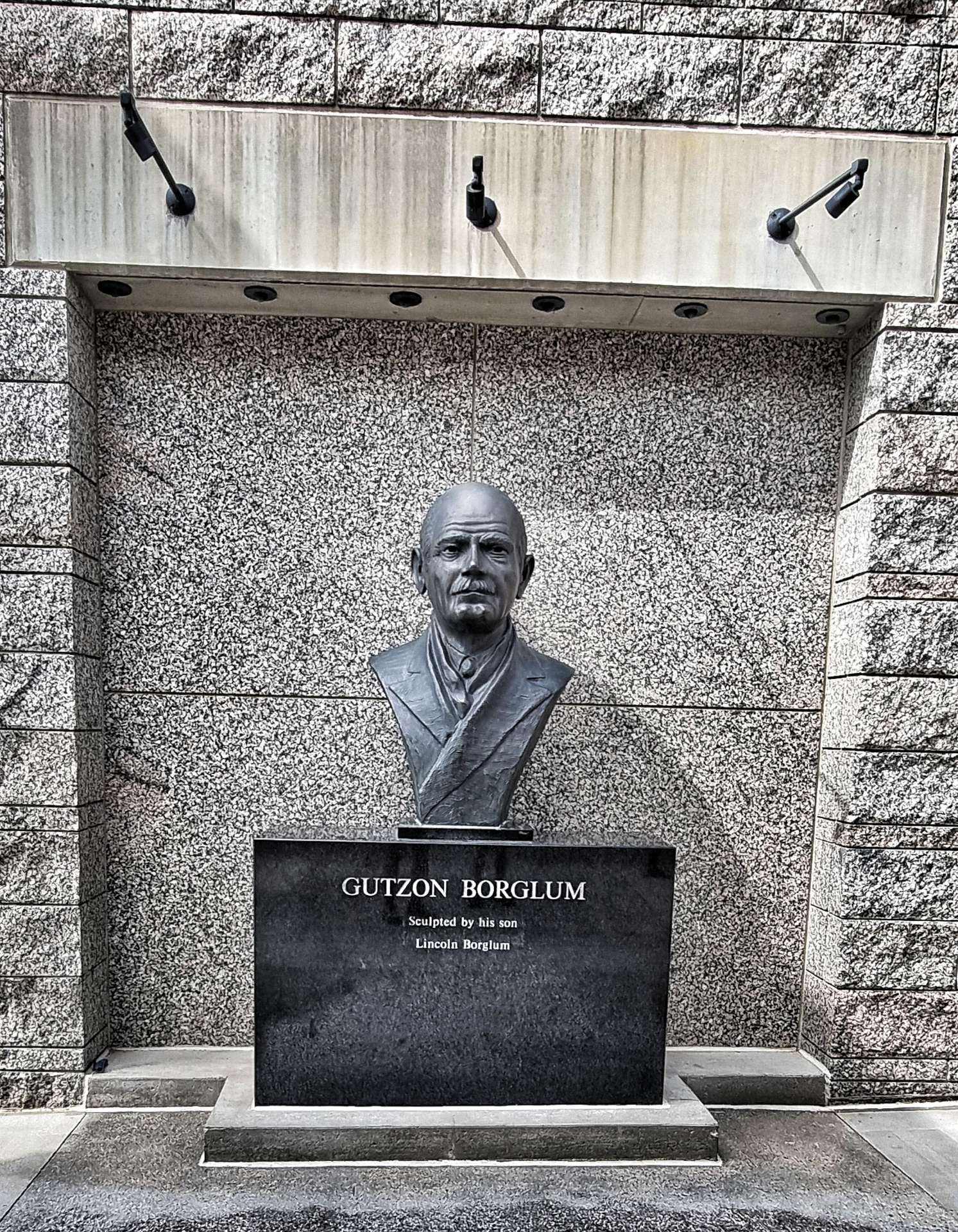
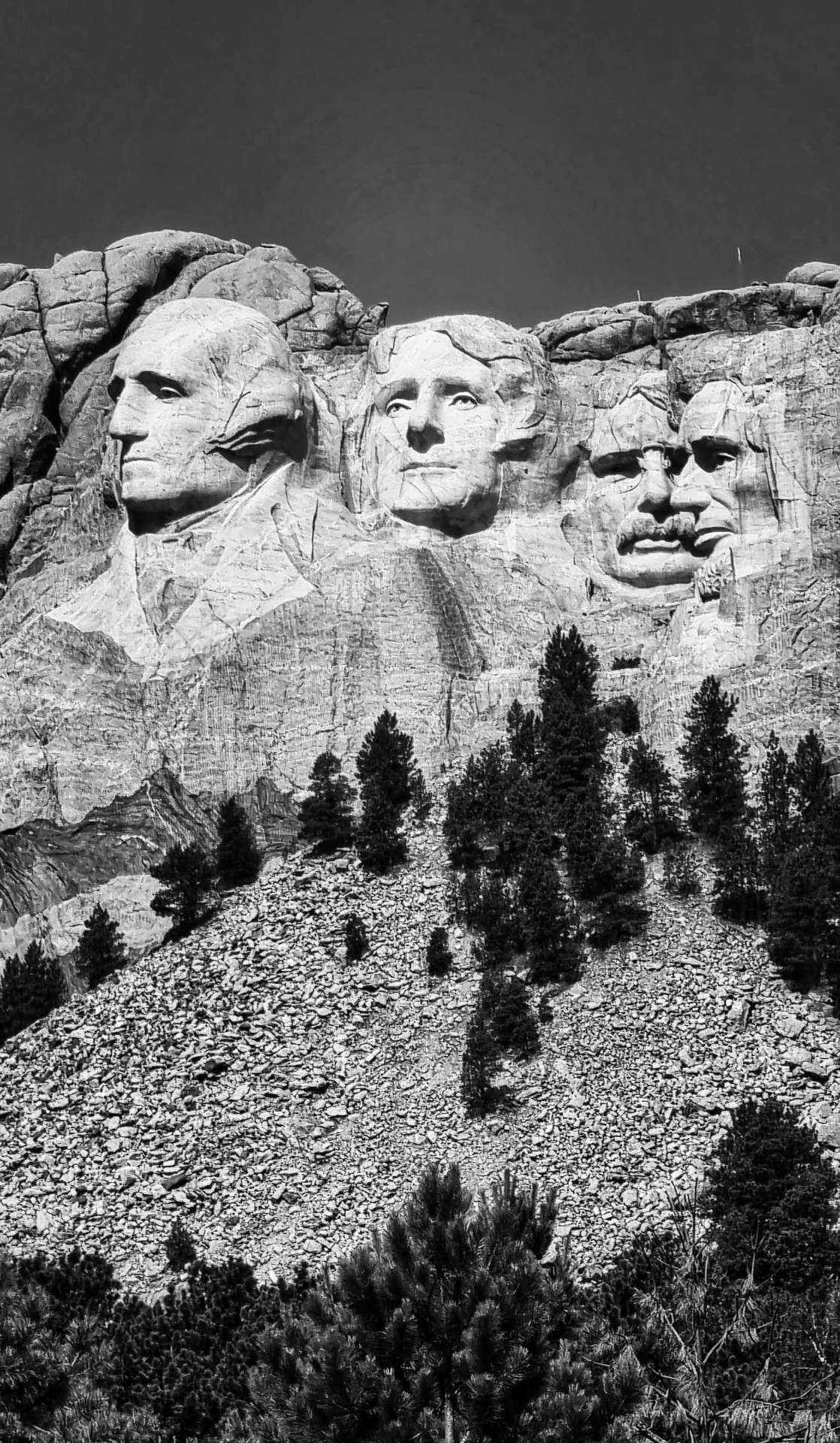
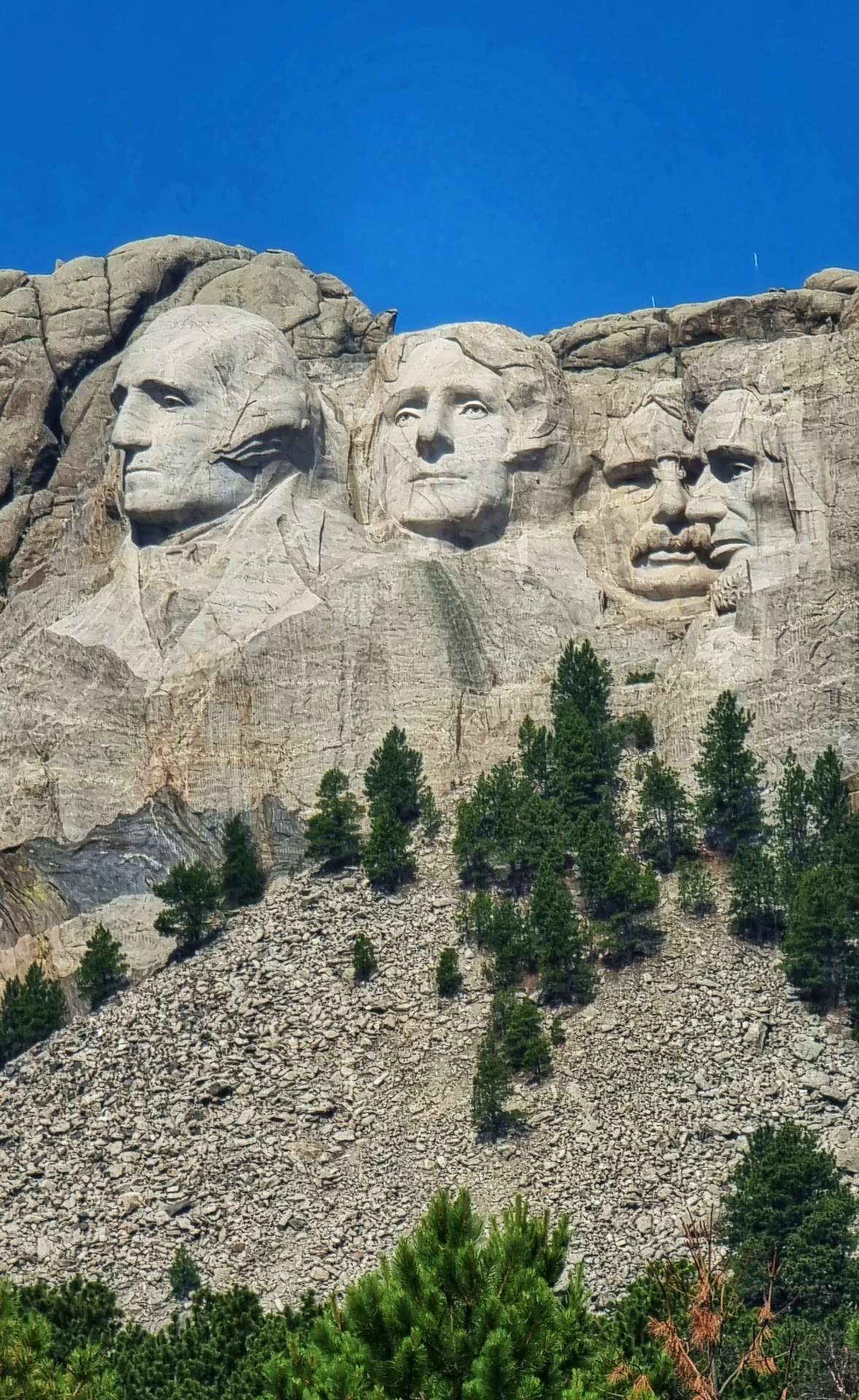
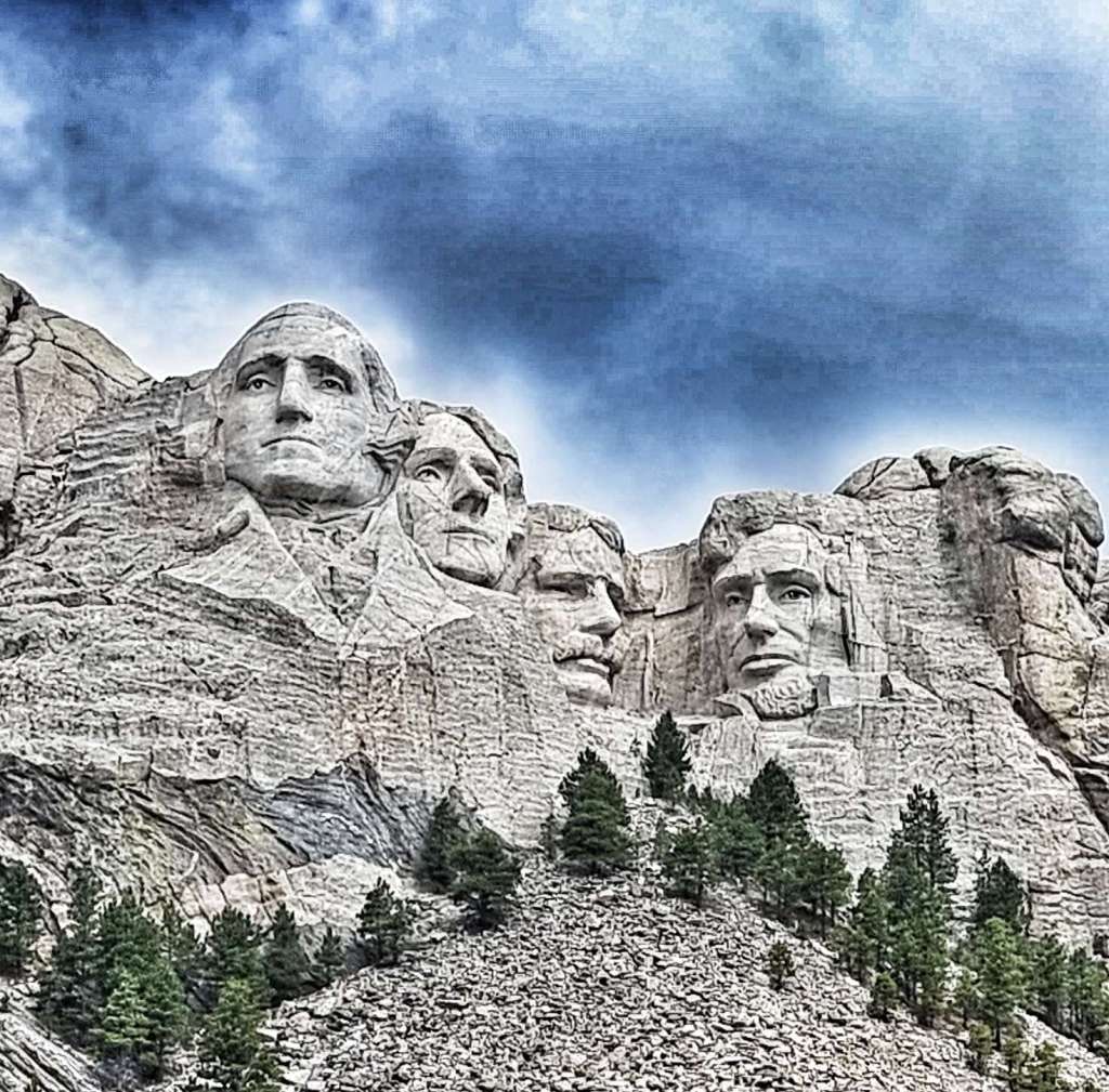
Mount Rushmore National Memorial is a massive sculpture carved into Mount Rushmore in the Black Hills of South Dakota. Construction started in October 1927 & it was opened in October 1941 under the direction of Gutzon Borglum & his son Lincoln. The four Presidents depicted in the sculpture are George Washington, Thomas Jefferson, Theodore Roosevelt & Abraham Lincoln – their faces are approximately 60 feet tall.
But why choose these four Presidents above others? It’s a question that is asked a lot & the answer is possibly more simple than you might expect – Borglum selected them because they represented the most important events in the history of the United States.
George Washington, first President of the United States – born in 1732, died in 1799. Washington led the colonists in the American Revolutionary War to win independence from Great Britain. He was the father of the new nation & laid the foundation of American democracy. He is the most prominent of the four Presidents & represents the birth of the United States.
Thomas Jefferson, third President of the United States – born in 1743, died in 1826. Jefferson was the primary author of the Declaration of Independence, a document which inspires democracies around the world. He purchased the Louisiana territories from France in 1803, which doubled the size of the country, adding all or part of 15 present day states (it also resulted in the Lewis & Clark Expedition – much of their route we’ve followed). Borglum chose Jefferson to represent the growth of the United States.
Theodore Roosevelt, twenty-sixth President of the United States – born in 1858, died in 1919. Roosevelt provided leadership when America experienced rapid growth as it entered the 20th century. He was instrumental in constructing the Panama Canal, linking the east & the west. He was known as the “trust buster” for his work to end large corporate monopolies & ensure the rights of the common working man. Borglum chose Roosevelt to represent the development of the United States.
Abraham Lincoln, sixteenth President of the United States – born in 1809, died in 1865. Lincoln held the nation together during its greatest trial, the civil war. Lincoln believed his most sacred duty was the preservation of the union. It was his firm conviction that slavery must be abolished. Borglum chose Lincoln to represent the preservation of the United States.
It was a real education to learn about the four Presidents, why they were chosen & how the monument was constructed. It should also be noted that it isn’t without its critics. The Lakota Sioux were the original custodians of Cougar Mountain (as it was originally known) & the United States asserted control of the Black Hills (including Cougar Mountain) when gold was discovered in the 1870’s, forcing the Sioux from their reservation. The legality of this act continues to be disputed to this day in the courts.
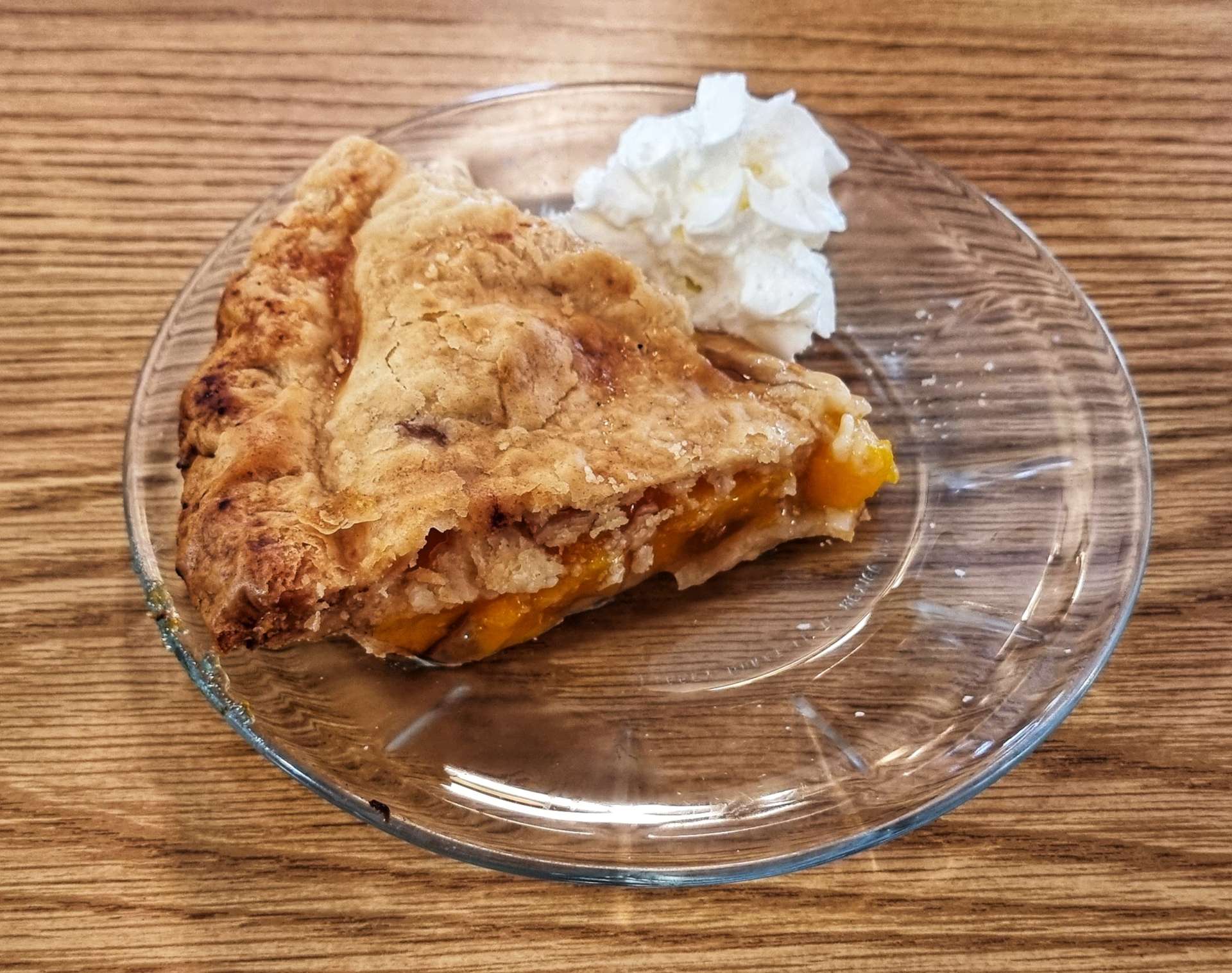
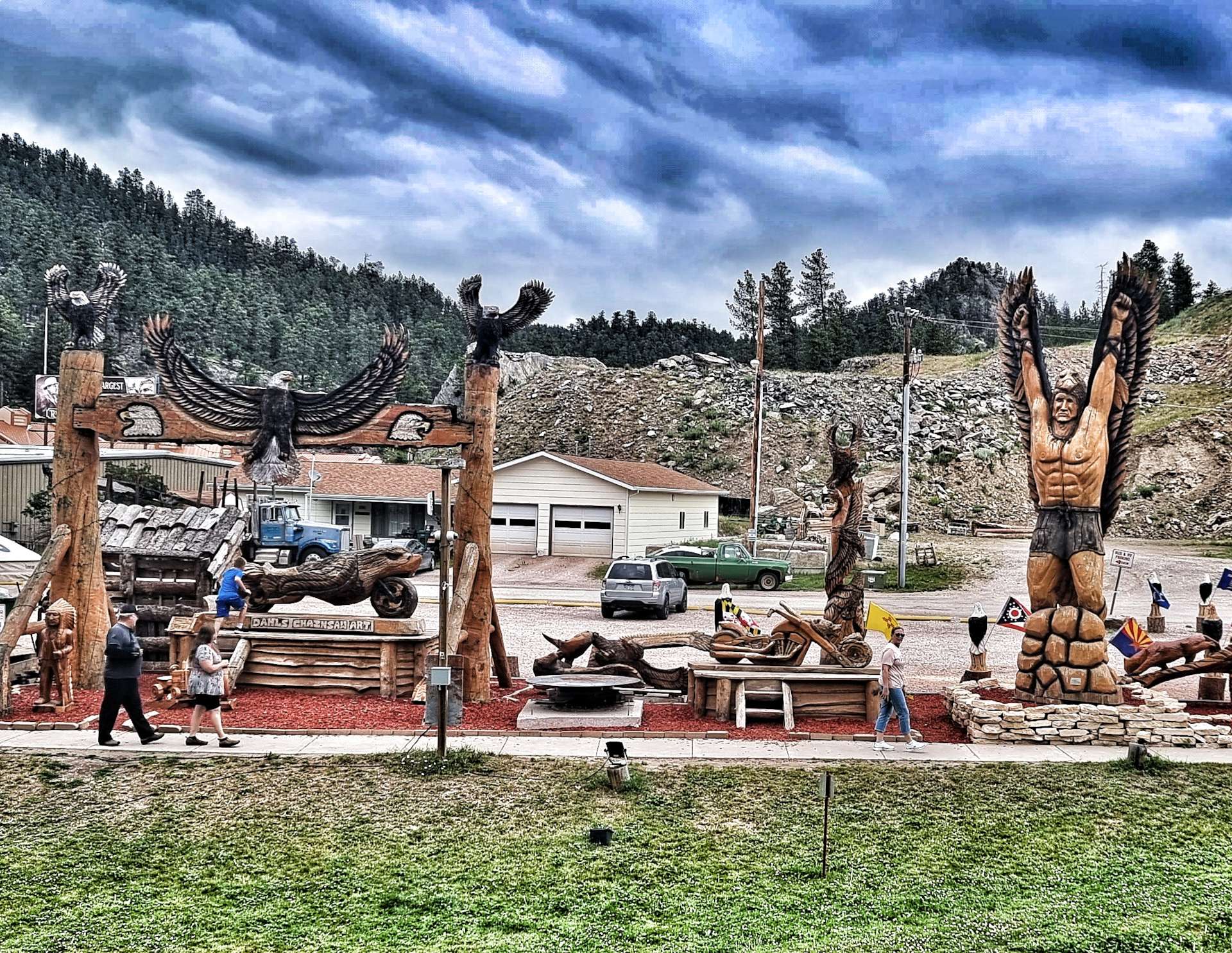
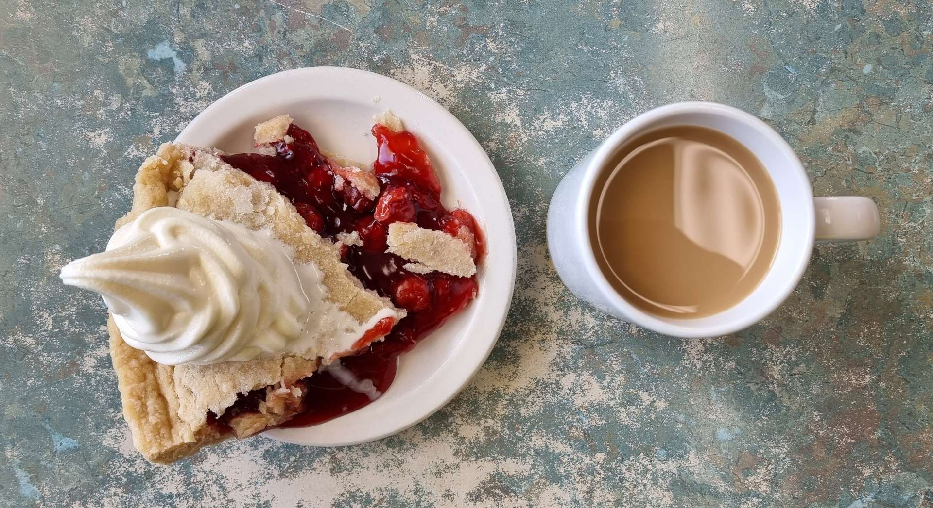
On the way back to the motel to pick up our kit, we made time to stop at Peggy’s Place for a tasty slice of peach pie & a coffee, as well as admire the sculptures at Dahl’s Chainsaw Art.
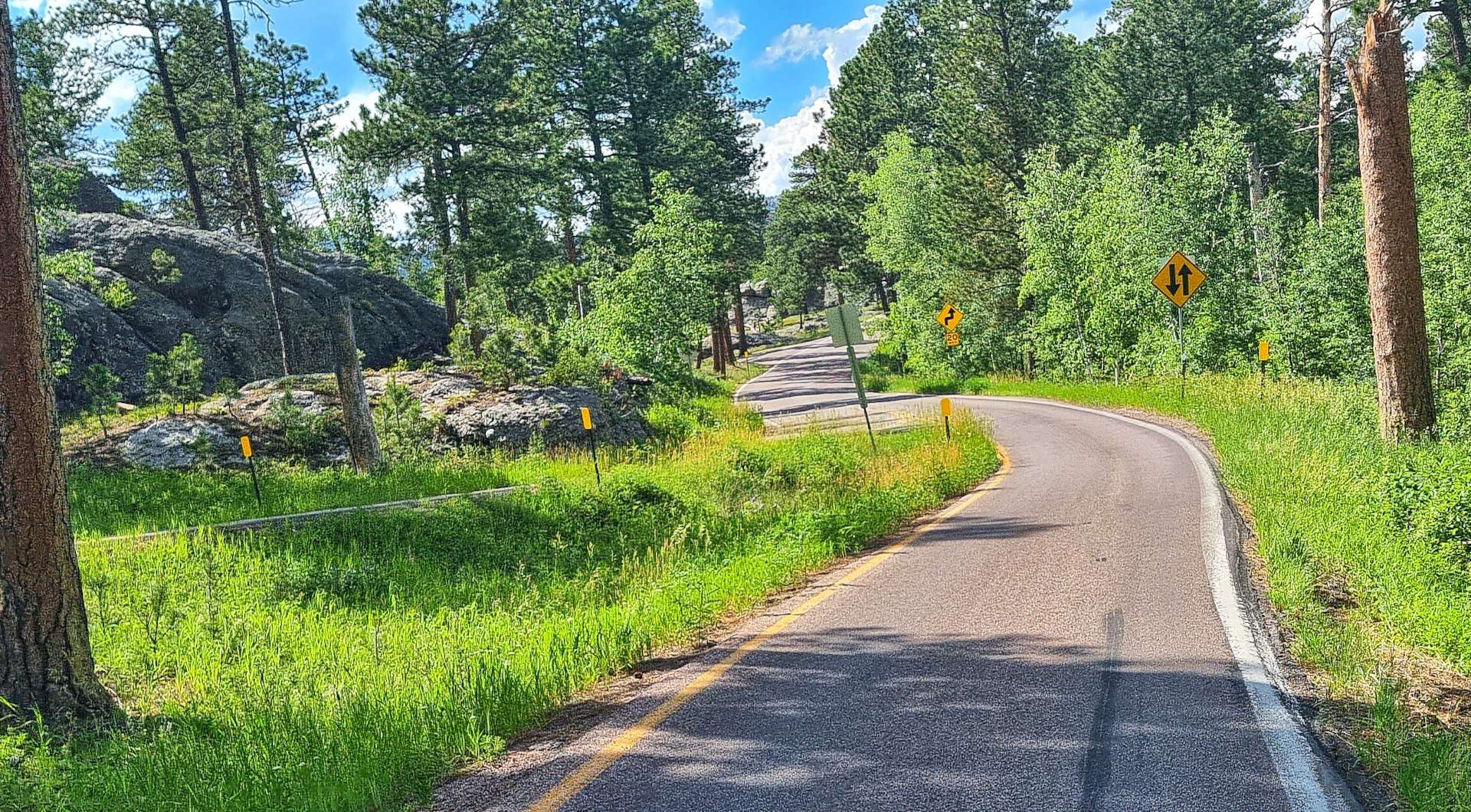
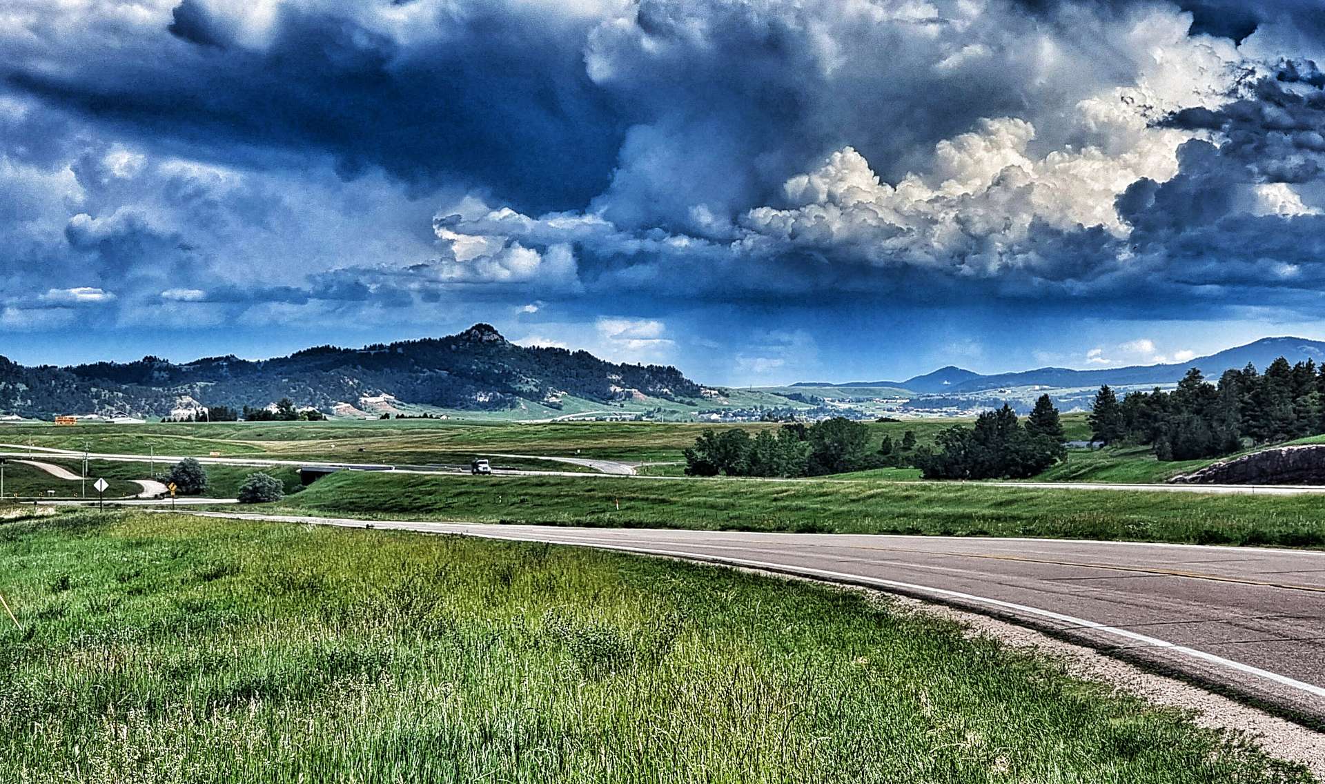
We loaded up the bikes, thanks our kind hosts for looking after our kit & set off on the short ride to Rapid City. We took the scenic Adventure Cycling Association route, which took us along quiet backroads that twisted & turned their way through the tight forest, as the topography required the road to rise & fall sharply – our legs were soon stinging!
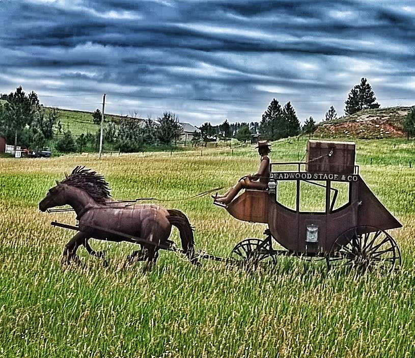
As we left the Black Hills National Forest Behind us, we encountered one last steep hill, then had big views across the valley below. As we descended to the main road, we had one final treat in the form of a life-size model of an old stagecoach & horses.
The final 5 miles of today’s ride took us across Rapid City to our motel for the next 2 nights – we have separate rooms, which is always a bit of a treat for us both, as it gives us a chance to unpack all our kit, spread out & relax! As tomorrow is a rest day, we had a couple of beers at 2 different bars & reflected on all we’ve seen & experienced recently.
One final statistic – today’s ride took us over 3,000 miles for the adventure so far!!!
Stage Stats – 29 miles, 2,543 feet of climbing. A climb up to Mount Rushmore, followed by a short ride to Rapid City for a well earned rest day tomorrow.
Wednesday 6th July – Rest Day
A lazy rest day which involved a relaxed breakfast, doing the laundry, sorting through our kit & identifying things to send home (we packed & shipped 9 pounds in weight between us) & planning routes & stops for the next 3 days. But as always, the plan is fluid.
Thursday 30th June to Saturday 1st July – Stages 48 & 49
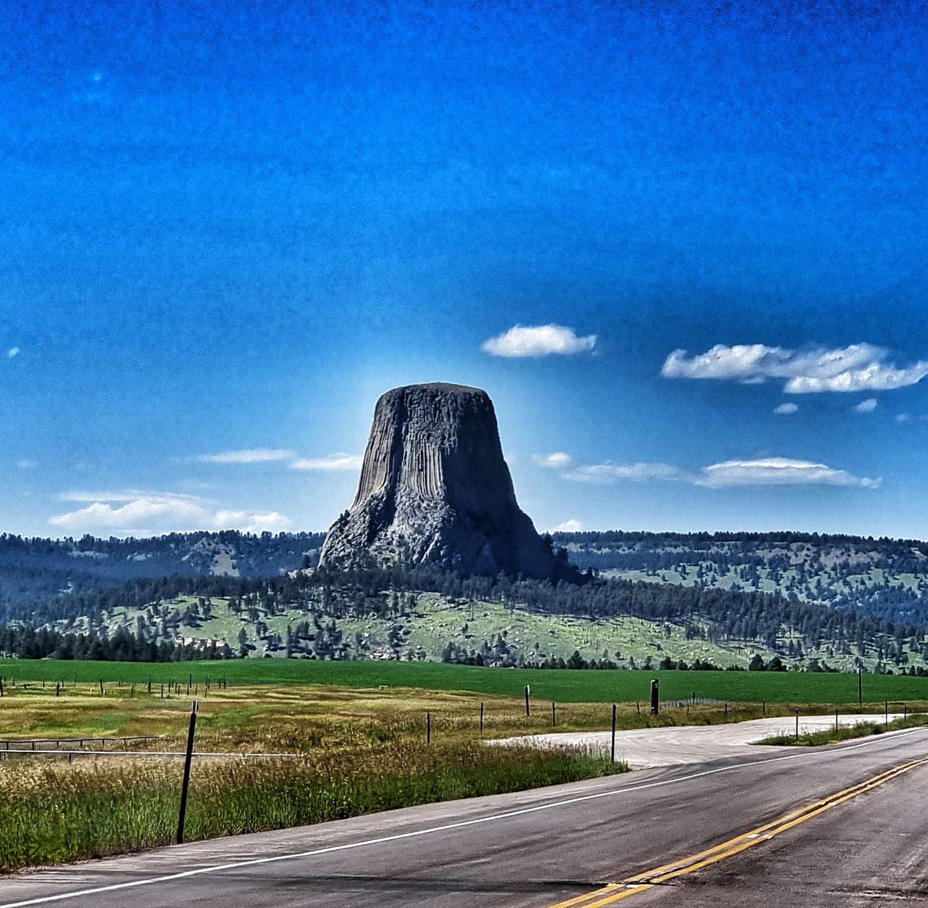
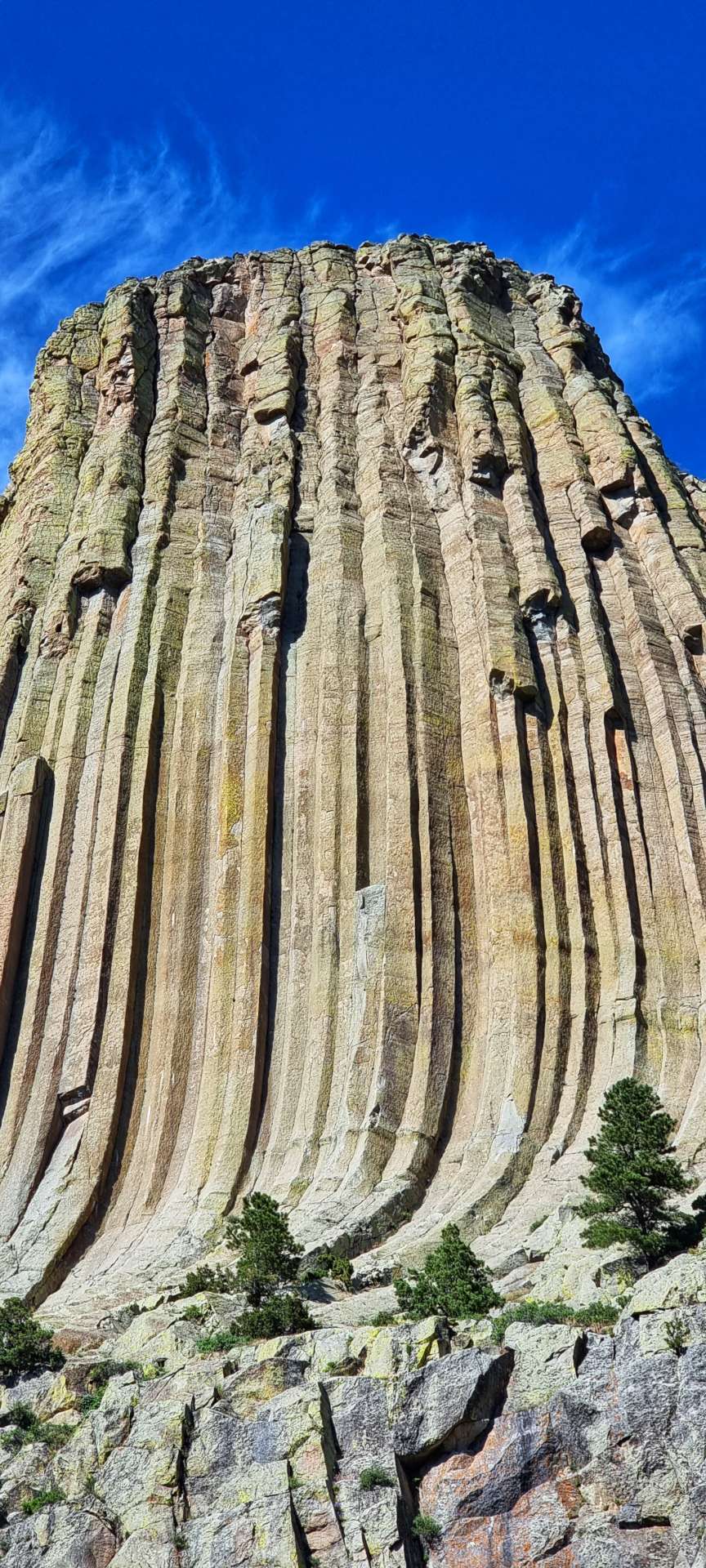
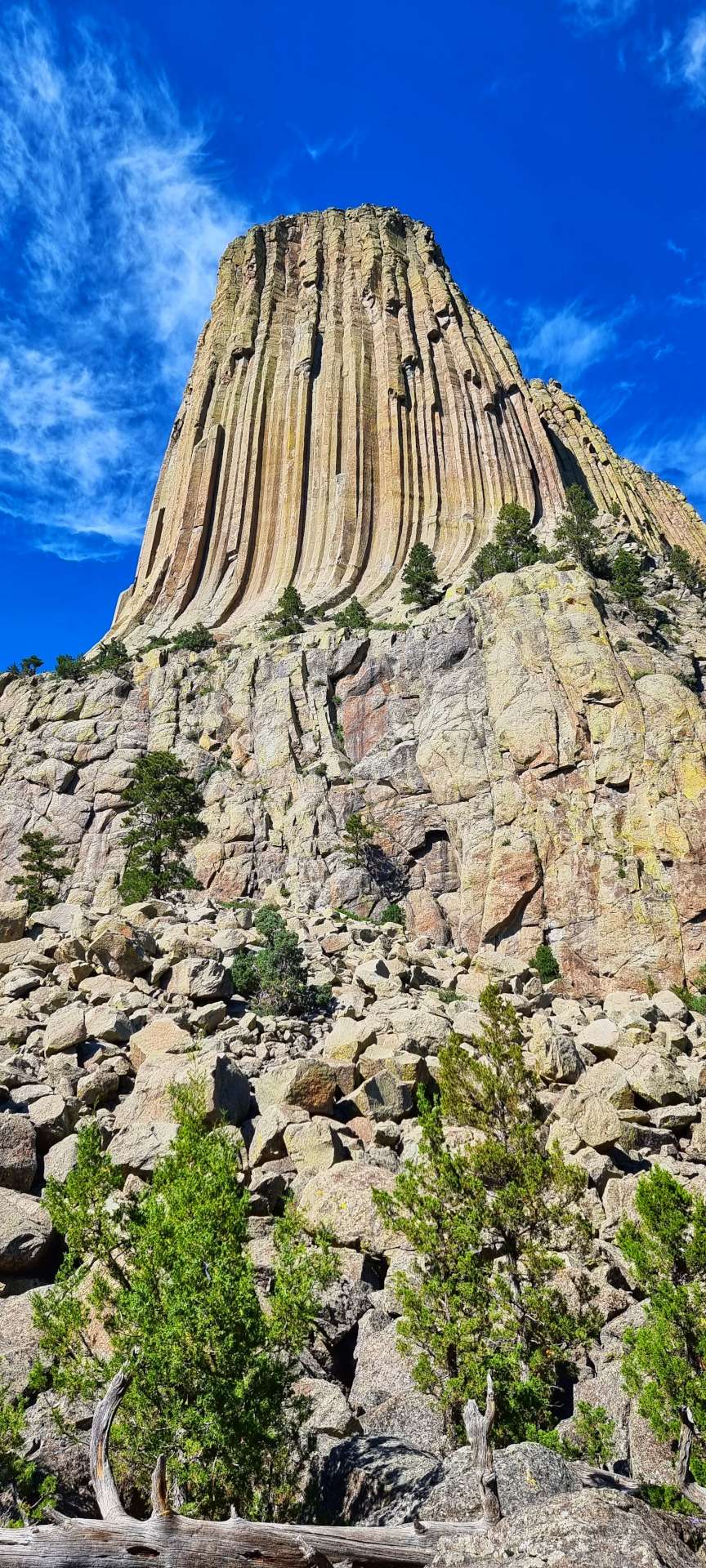
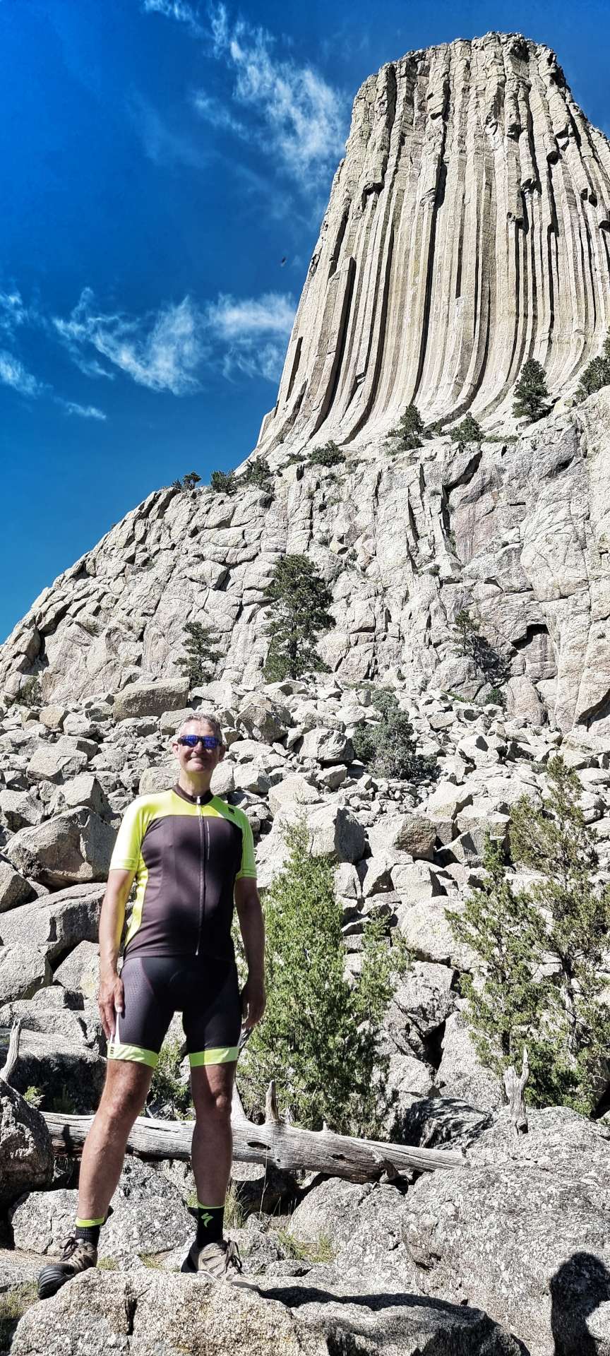
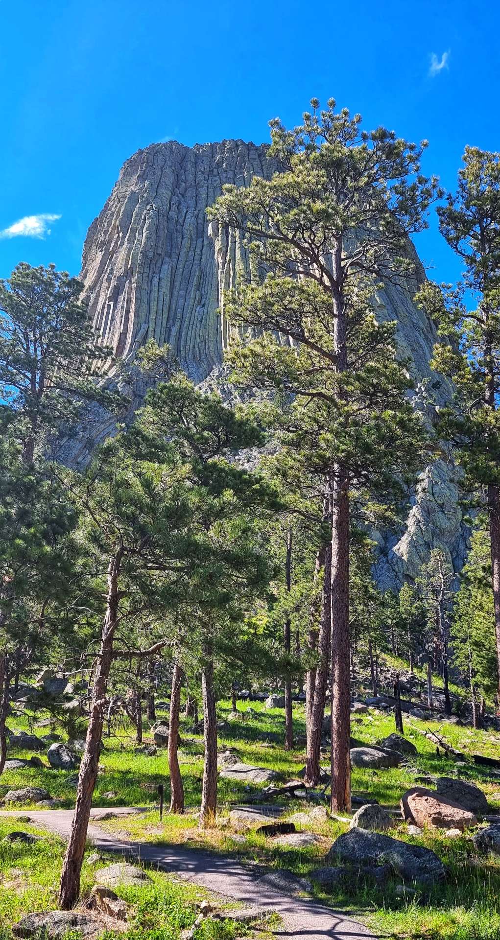
Thursday 30th June – Gillette to Devils Tower National Monument.
We were up & on the road by 8.30am, as we were hoping to arrive early enough at our accommodation to enable us to have a look around Devils Tower, made famous by Steven Spielberg’s blockbuster – Close Encounters of the Third Kind.
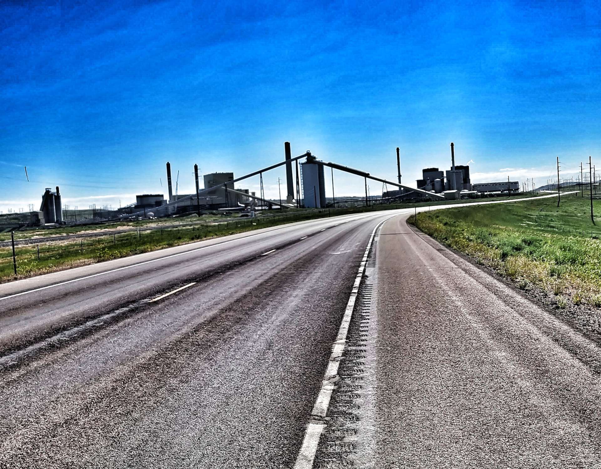
It took about 5 miles to cross town & make our way onto deserted roads & along the way we saw our first piece of industrial architecture in the form of the Black Hills Energy Complex. It seemed a big coincidence to see this the day after reading about Powder Basin’s supplies of low-sulphur content coal!
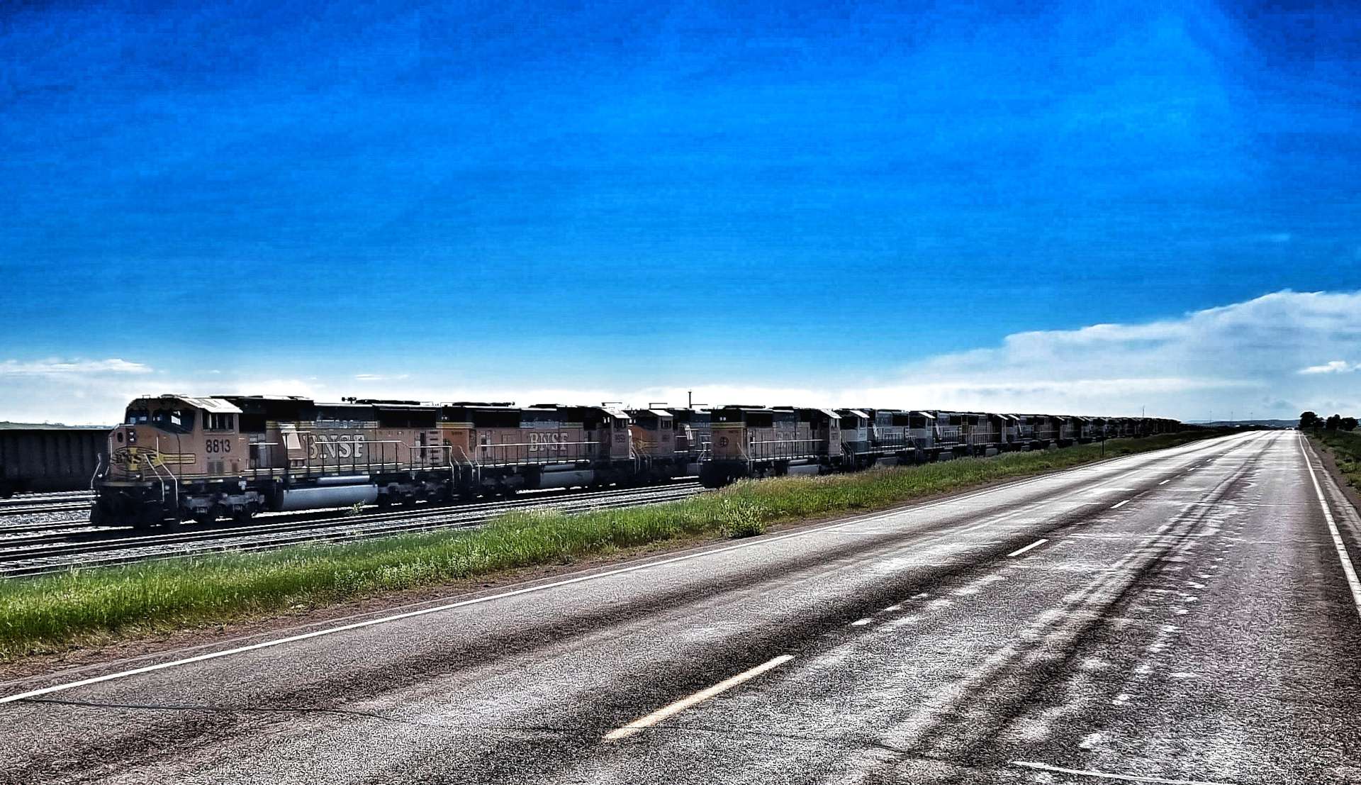
We were soon following the course of the Donkey Creek & a railway line from the Black Hills Energy site on Highway 51. As we crossed a bridge I was pleased to see a train on its way towards us on a separate line. Little did I know that around the next corner in Rozet, we would pass a railway siding where thousands of locomotive engines were lined up, one behind the other. There wasn’t any freight, just engines!
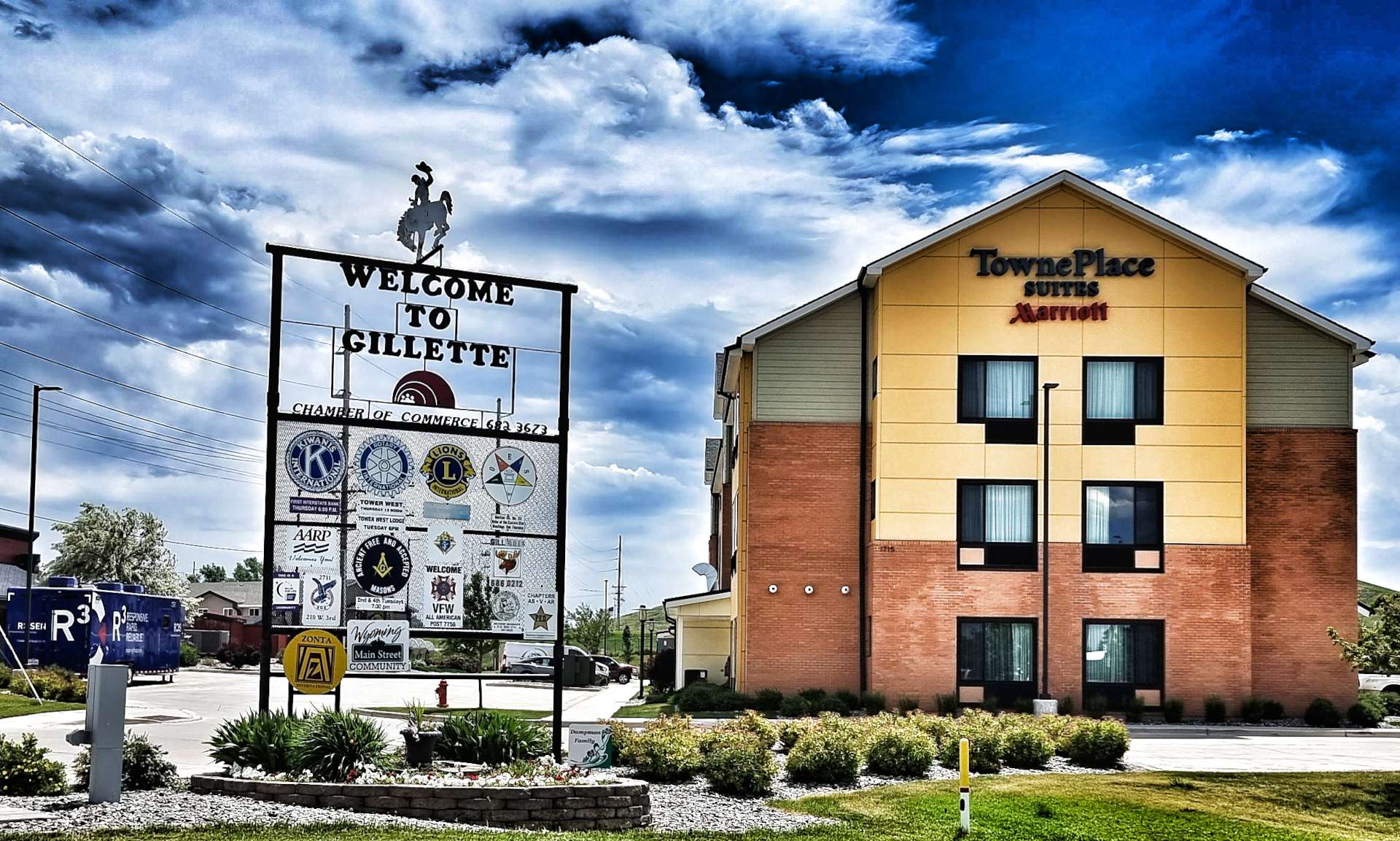
I did some research after today’s ride to find out why – in the region of 40% of all the coal produced in the USA is from Wyoming & the majority of that passes through Gillette. However, the USA has finally re-joined the Paris Agreement on climate change & as it starts finding & using cleaner & cheaper sources of energy, there is less need for coal.
Donkey Creek is where all the spare locomotives are ‘parked’ – as recently as 2020, over 2,500 locomotives were mothballed here. There looked to be even more there now. This will have serious ramifications for Gillette – it’s still the coal capital of the USA, but that may not be the case for much longer. The largest coal mine in Wyoming is 90 SQUARE MILES in size & the coal is near the surface, so it’s mined by trucks with shovels so big, a US size family car would fit inside it!
Like so many towns & cities before it, Gillette needs to re-invent itself, but that won’t be simple or quick to do.
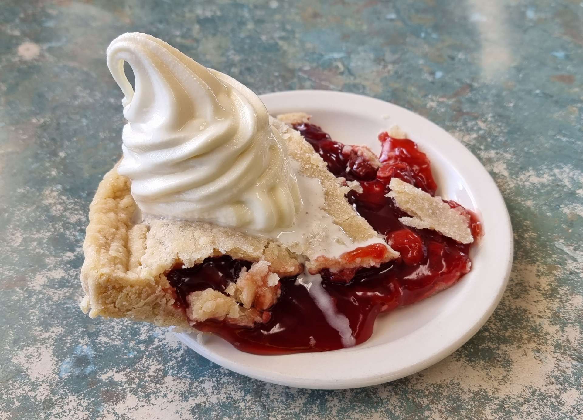
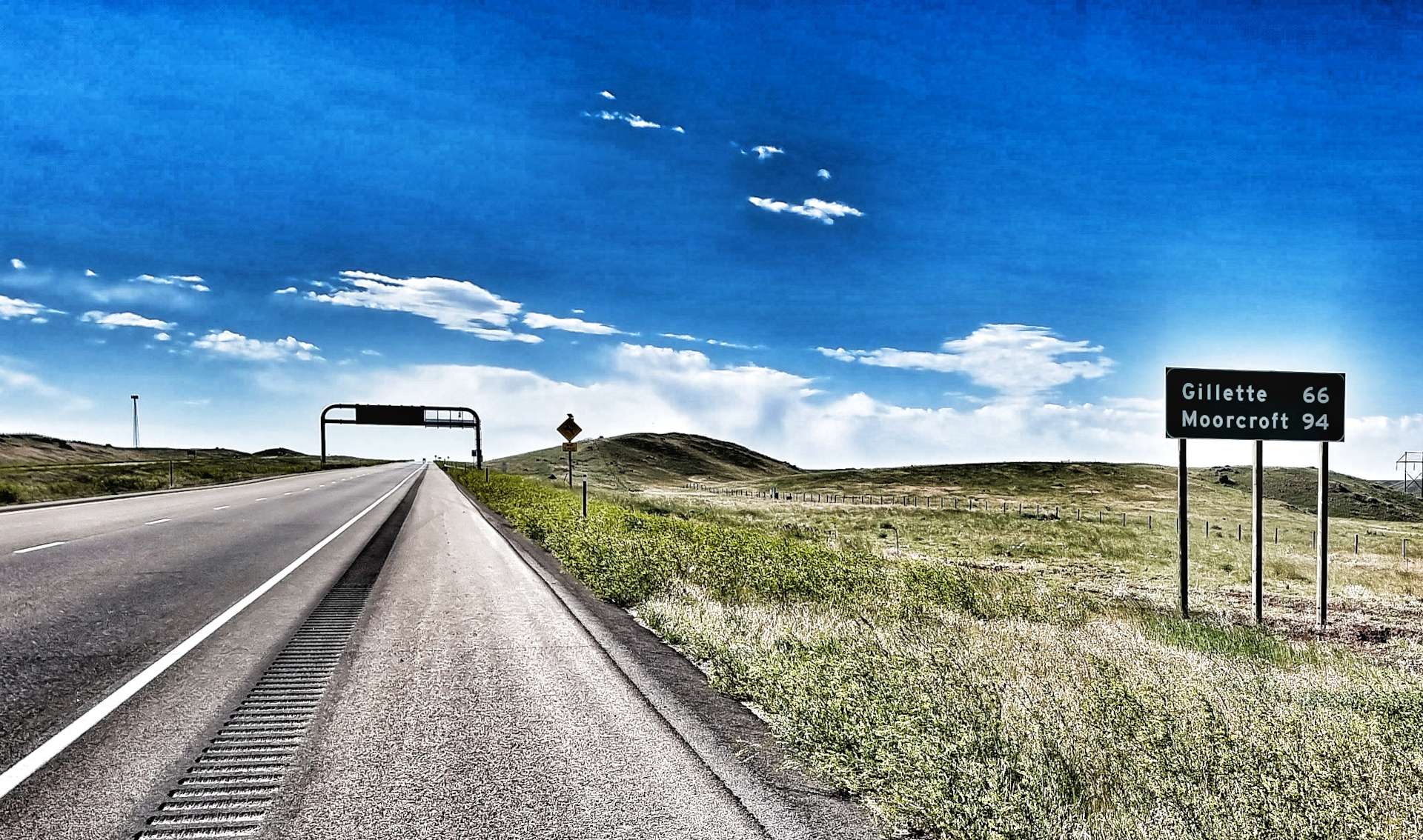
Continuing along the deserted 44 (it’s a frontage road for the I-90), we were hopeful that the small town of Moorcroft might offer up a coffee option. When we pulled up at Donna’s Diner we knew we’d hit the jackpot – home-baked fruit pies served ala mode were on offer. I chose the cherry pie & Sean went with the blueberry option. It was absolutely delicious & made up for the barren days since our stop in Boulder (on our way to Helena)!
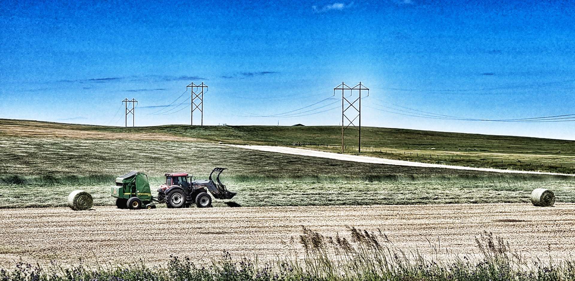
As we left Moorcroft, we saw our first sign for today’s main event – a mere 31 miles to go. We passed farmers working hard in their fields, as they baled up the hay. At Keyhole Reservoir, I was expecting the green fields in the photo to be under water. As we circumnavigated the lake, the road took us up & down gentle rollers, which created a photo opportunity!
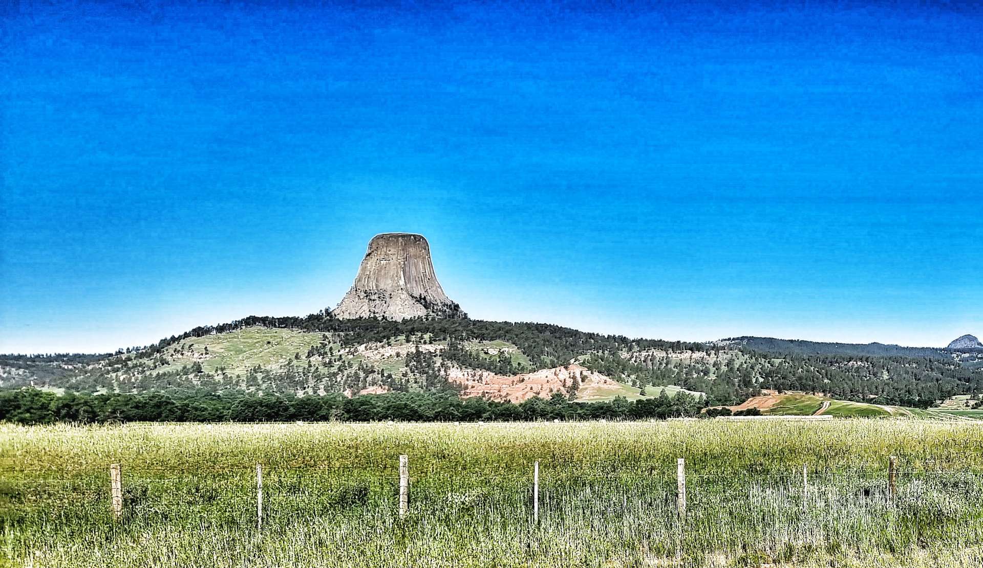
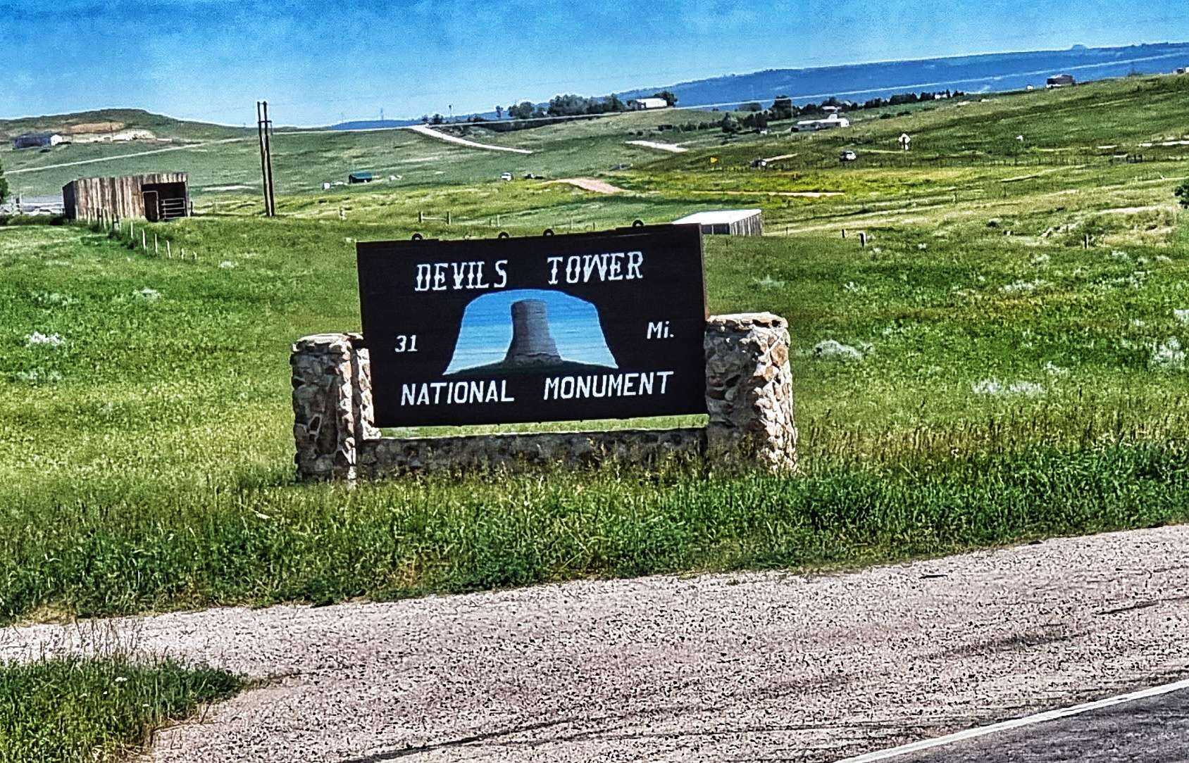
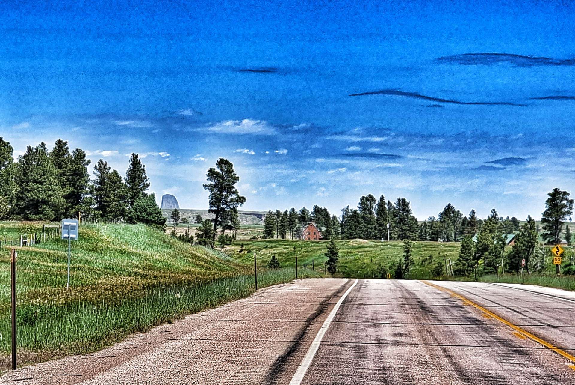
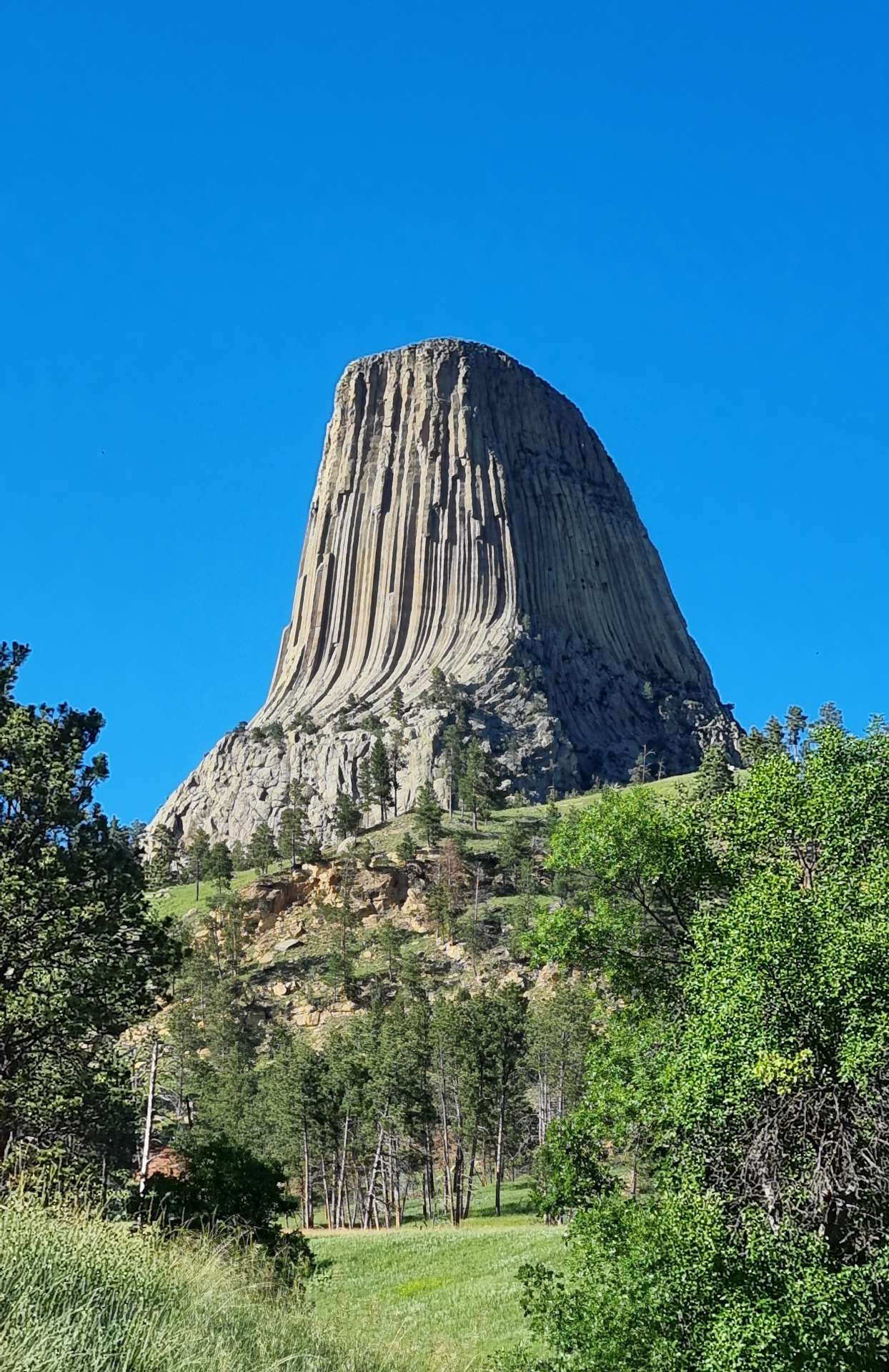
We still had a couple of 20 minute climbs ahead of us & the first one came into view soon enough. We were still skirting the edge of Black Hills National Forest, which offered us some protection from the mid-day sun. The climb up to Carlile would take us up to the plateau where we’d get our first long distance view of Devils Tower.
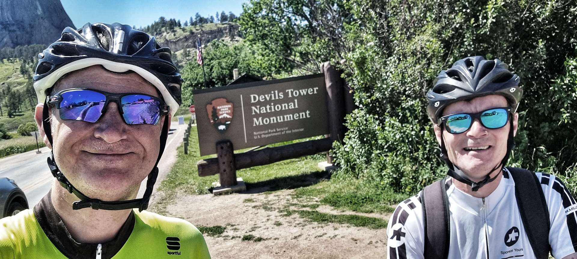
We were still 10 miles away from the National Monument & for the next 6 miles it hid from view, until we turned onto Wy24 & climbed a short, but steep hill.
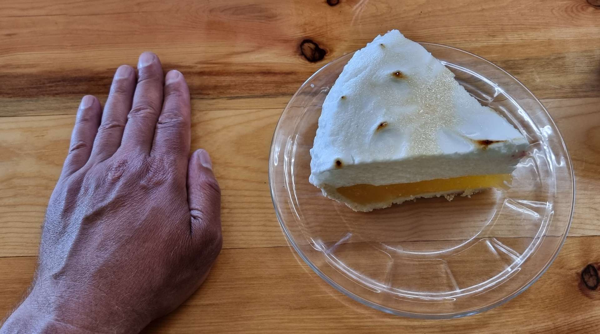
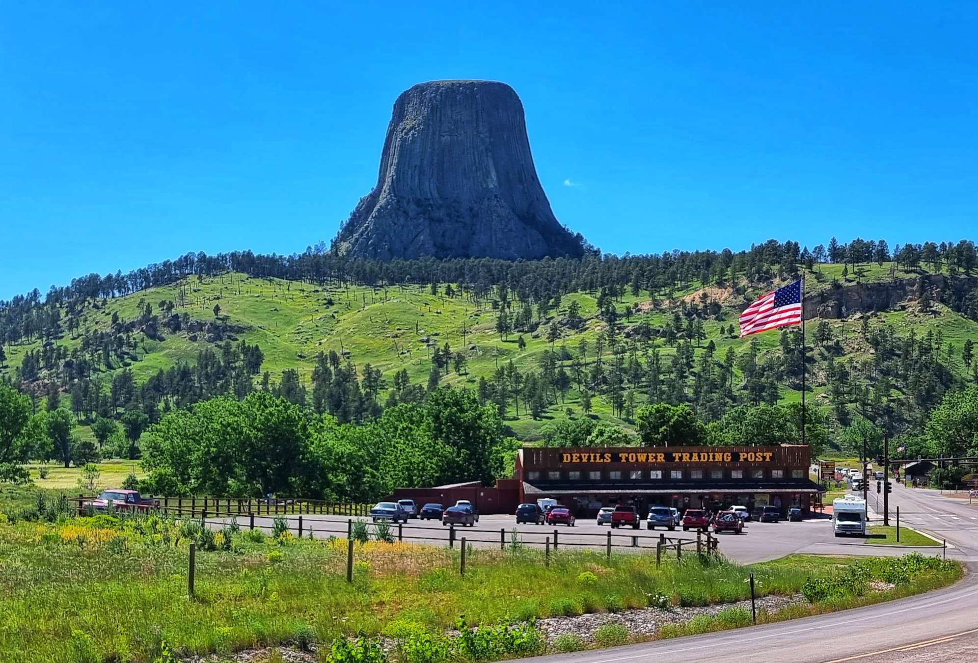
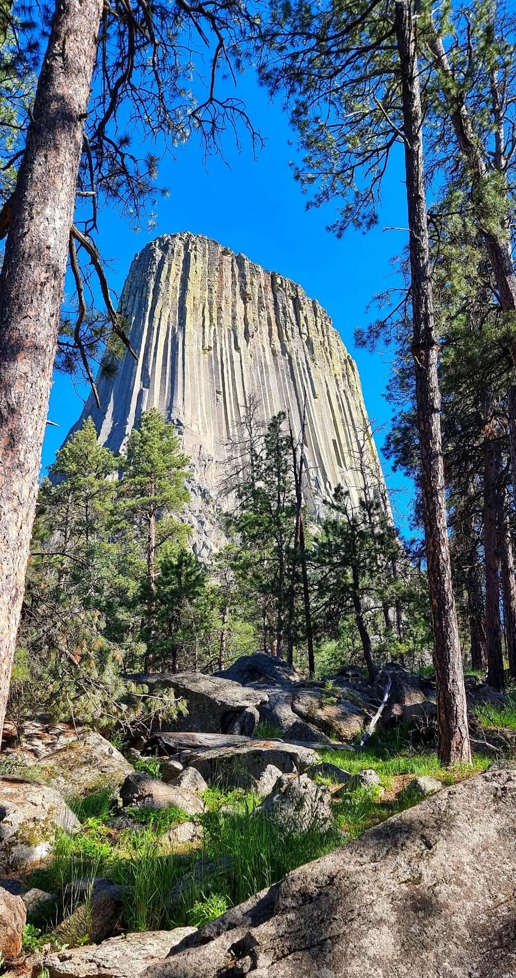
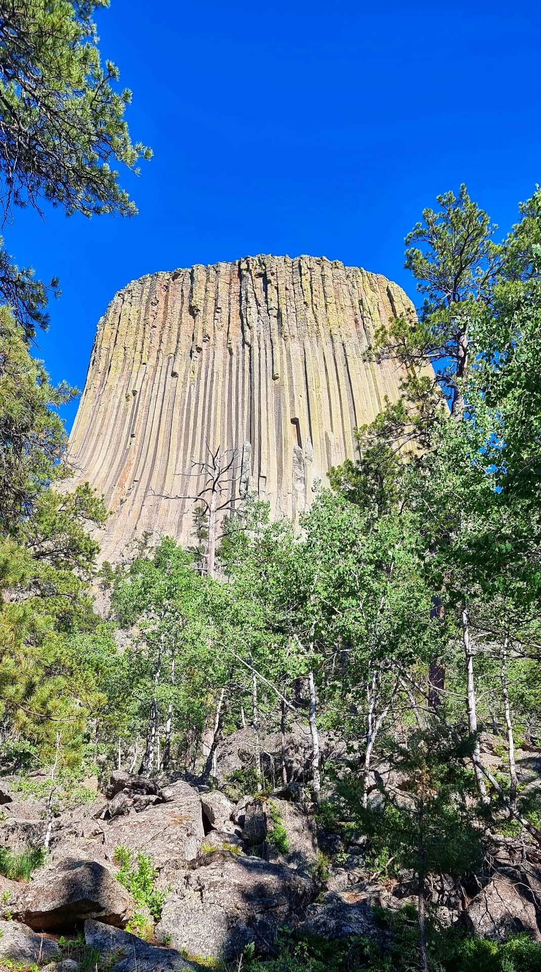
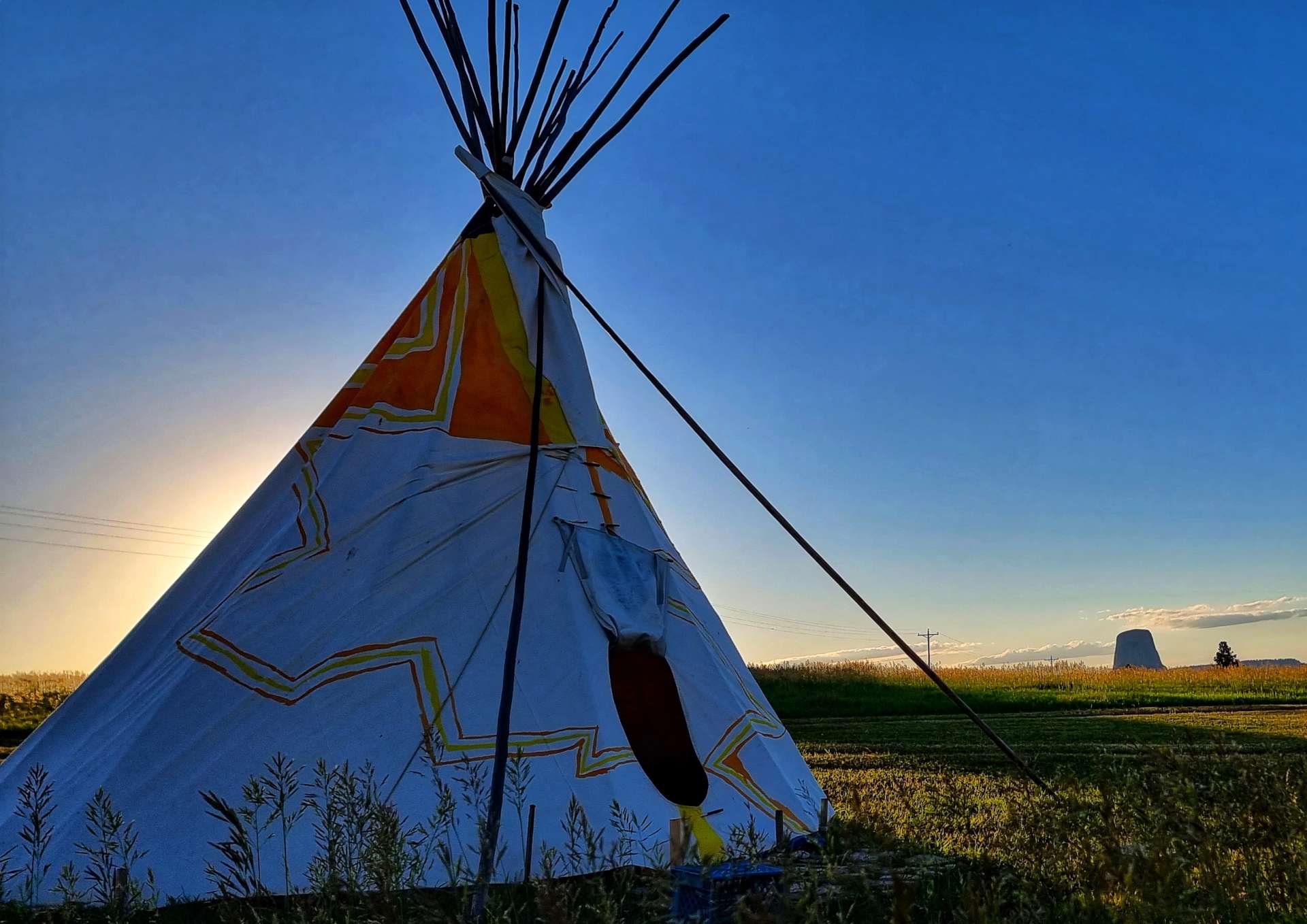
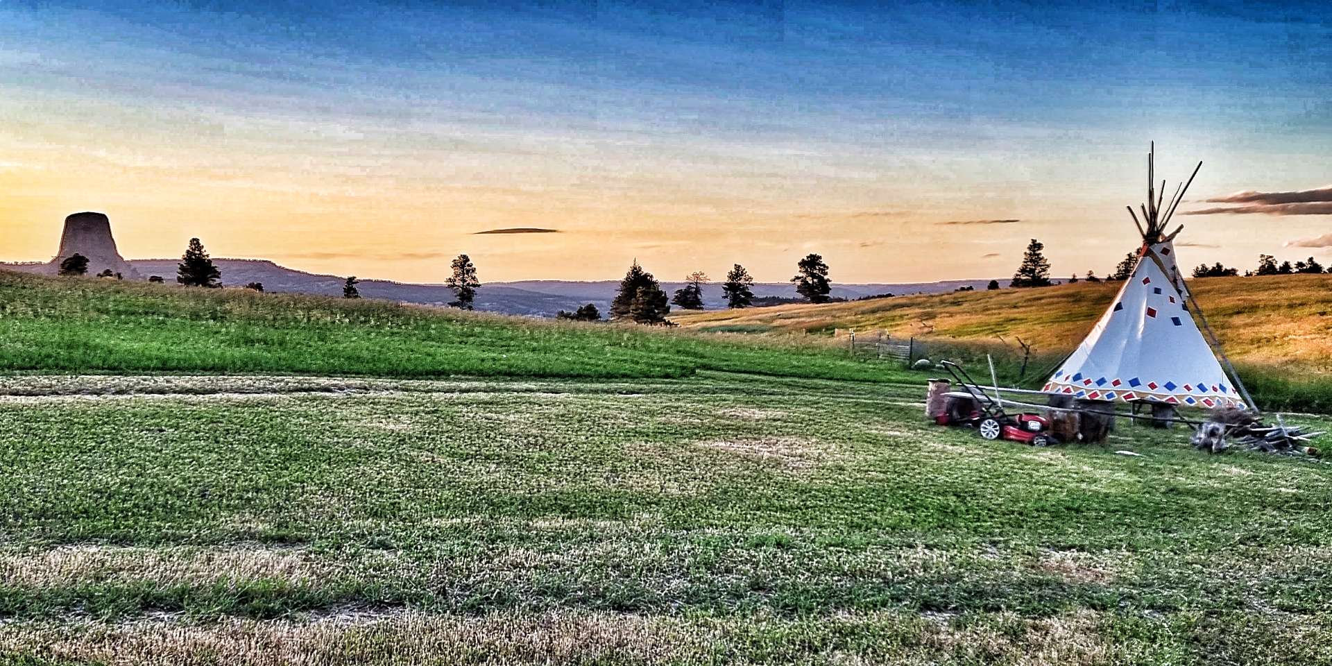
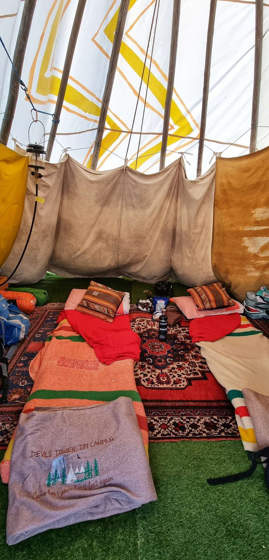
Our accommodation this evening is being provided by Julianna & we met up with her at the Devils Tower View, where I had a big slice of lemon meringue pie. We then rode back to our tipi lodging where we dropped off all our kit & set off so we could explore Devils Tower further.
To reach Devils Tower, we had to descend for about a mile, pass the Trading Post, show our pass at the Entrance Gate & then climb a twisting 3 mile back road up to the Visitor Centre, which offered up big vistas of the Belle Fourche river valley below.
Devils Tower holds special significance for Native Americans & stories have been passed down the generations. Two young boys became lost trying to find their way across the giant prairie & they realised they were being tracked by Mato, an exceptionally large bear. Soon the bear was upon them & they dropped to their knees, praying for the Great Spirit to save them.
Suddenly the ground beneath them rose up, lifting them high on a giant pillar. The bear continued to try & catch them, getting onto his hind legs & scratching his claws down the pillar. Mato couldn’t catch the boys & he eventually retreated, tired & exhausted. The story ends with the boys being carried back to their village on the wings of Wanblee, a giant eagle.
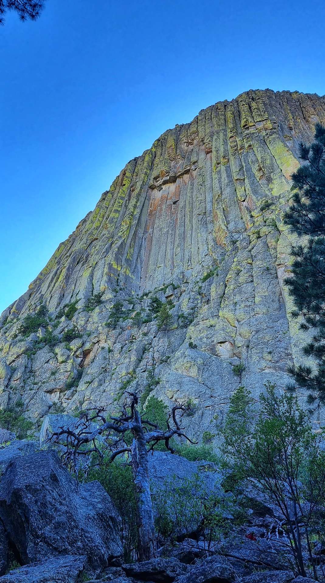
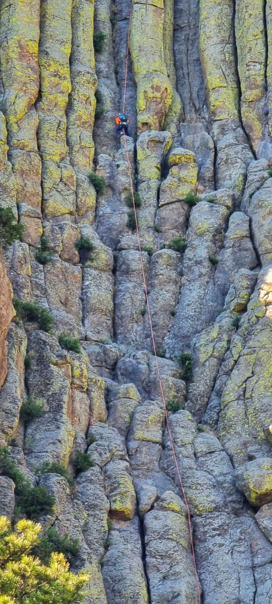
As we walked round a 1 mile paved path at the base of Devils Tower, we spotted a climber in the shadows, who was rappelling his way back down. You can see him more clearly in the 2nd photo.
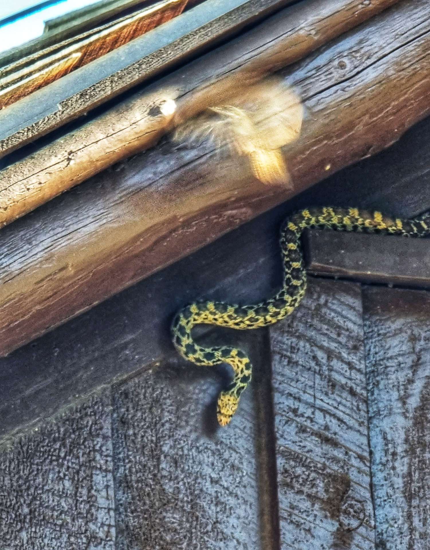
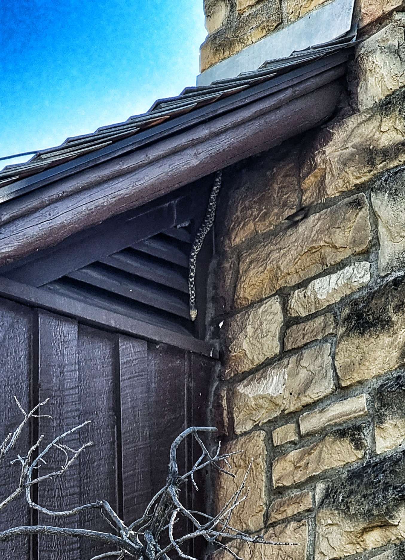
When we completed our walk, Sean went to the Visitor Centre & called me over, saying there was a snake in the eaves! A Bull Snake was trying to get into the roof to hunt the bats that were in there. However, that required the snake getting close to a birds nest with eggs in it – the parent bird wasn’t happy with this & kept attacking the snake & pecking its head!!
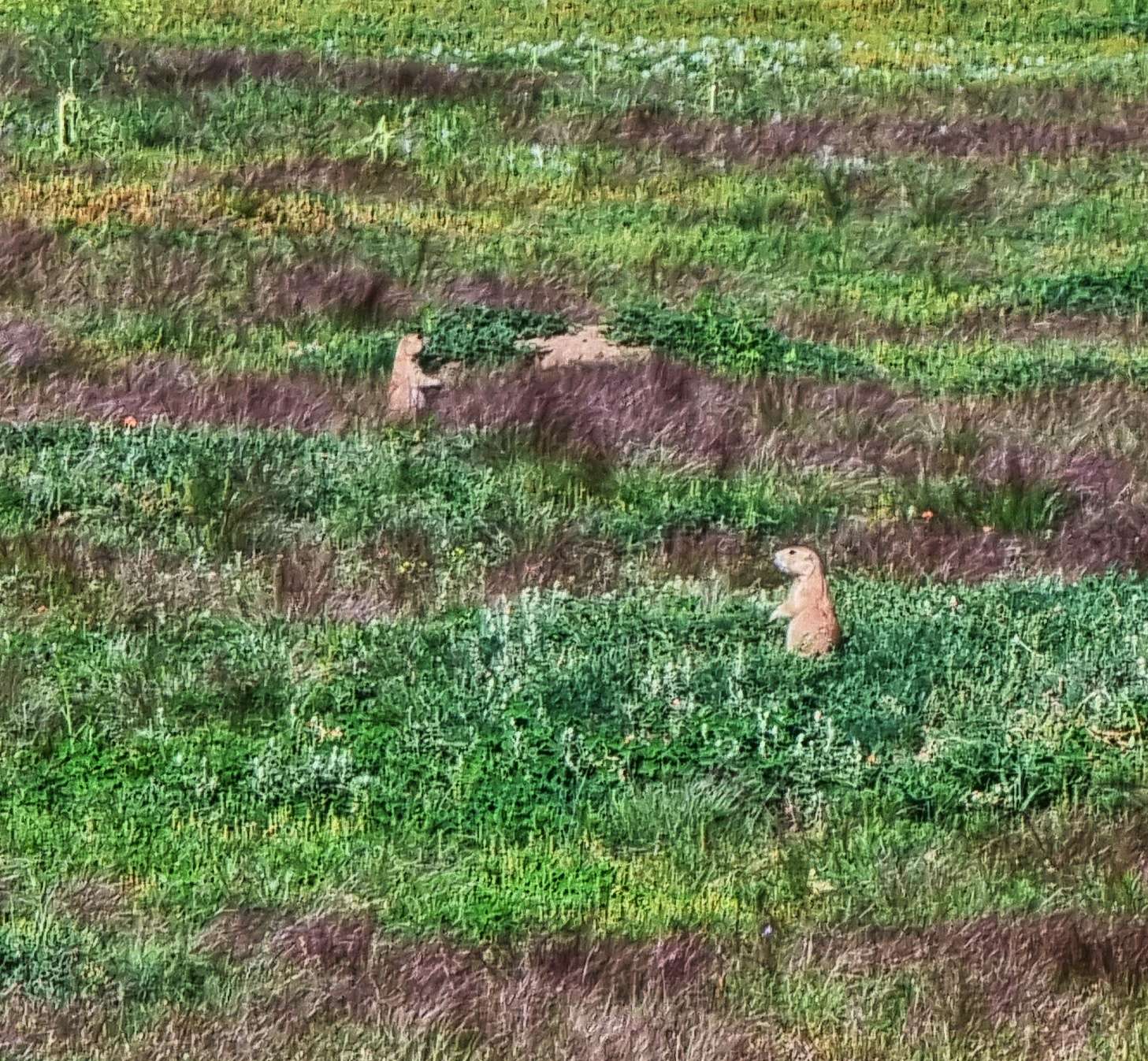
Descending back to the Entrance Gate we also passed a Prairie Dog city – they were all calling to each other & keeping an eye out for predators.
I stopped for a few more photos on the way back to Devils Tower View, where we stopped for fish & chips, washed down with a beer! It had been a long day of cycling & walking around the Devils Tower, but it was also an epic day out.
It wasn’t over yet, however, as we still had an evening in a tipi to look forward to & we also met Sue, who had travelled from Kansas City. I really enjoy meeting people & sharing our experiences, as it really gives an insight into how people live. Sue was planning to visit Devils Tower in the morning, then explore further afield from there.
There was a also a stunning sunset to enjoy, as the moon rose to take its place.
Stage Stats – 72 miles, 3,176 feet of climbing. A big day of cycling, followed by a couple of hours exploring the Devils Tower. We didn’t experience any Close Encounters!!
Friday 1st July – Devil’s Tower National Monument to Spearfish Campground.
We were up & on our way by 8am – our plan was to cycle 11 miles to Huwett & have breakfast at Red Rock Cafe. On the way I took a few more photos as we said goodbye to Devils Tower & headed along the Belle Fourche valley. My first thought was that I recognised the rocks colour from previous cycling trips to Utah & Colorado.
We had the road pretty much to ourselves as we made our way up & down small rollers on the way to Hewett – a feature of every town is that the City Limits sign includes the size of the population & the town’s elevation. Recently the numbers for the population have been small, while the elevation numbers have been big!!!
Red Rock Cafe was recommended by Julianna (our tipi hostess) & it delivered a great breakfast! While we were eating, Sue (who we met last night) came over & said hello. She’d got up early, driven to Devils Tower, walked the paved route & driven on to Red Rock Cafe too! We also met Rudy & his wife, 2 Dutch cyclists who were riding East to West – in a really uncanny twist of fate, Annmarie (who I met on a US cycling trip to Yellowstone in 2010) had hosted him at the very beginning of his adventure! I only found this out a few days ago when Annmarie got in touch!!!
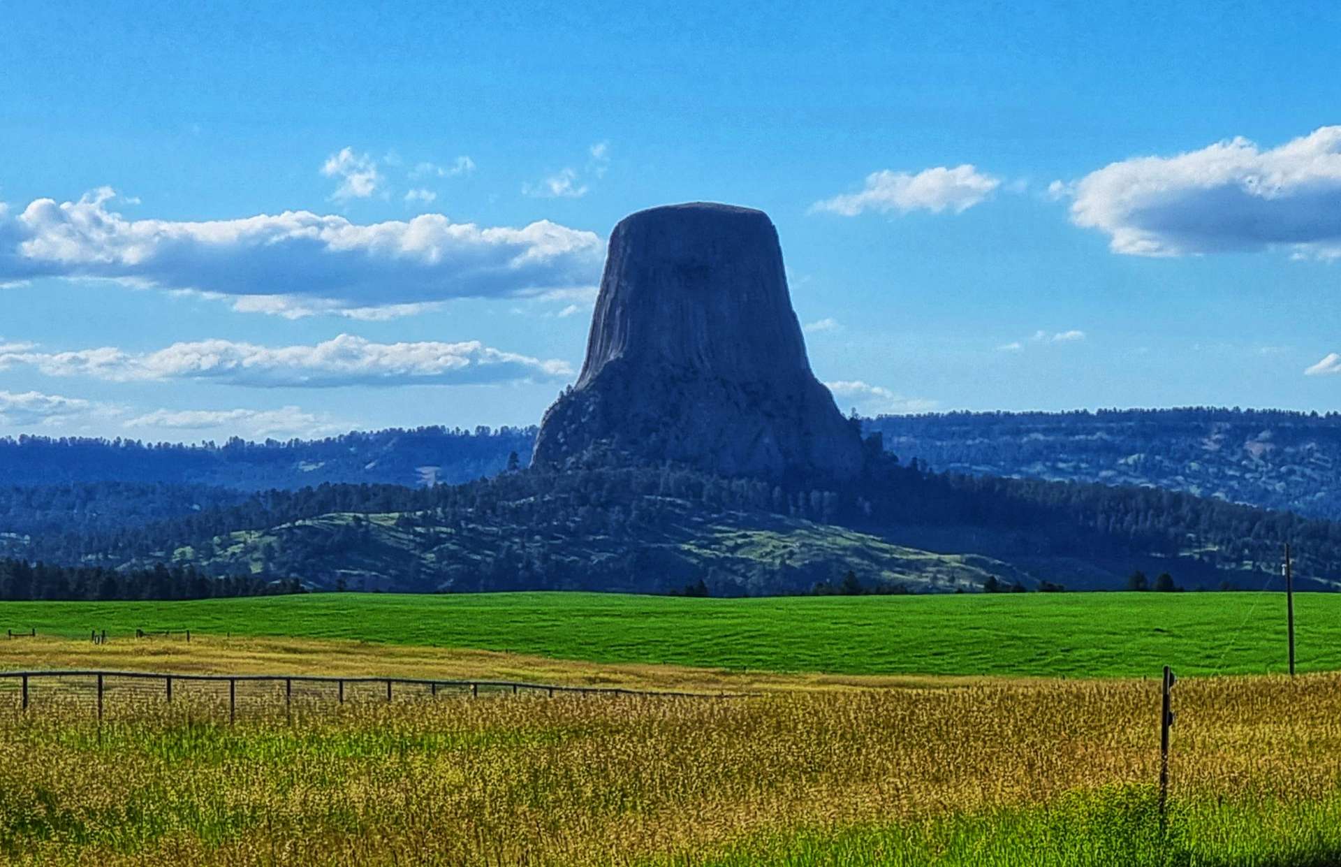
Leaving Huwett, we were climbing for the next 90 minutes, slowly at first as we continued along the Belle Fourche valley, then we had one final look back to Devils Tower over 20 miles away.
After a short descent, we hit the main climb of the day, which went on for about 40 minutes & hit 10% near the summit. I was hoping for a sign at the top of the climb, but I was disappointed! Close to where the 3rd photo was taken, we learned about the first official government expedition to the Black Hills, led by General George Armstrong Custer. The expedition had more than 1,000 men to scout for a new fort location – the presence of engineers, geologists & miners indicated that recording the topography, geography & location of gold deposits were other important goals.
The expedition’s discovery of gold led to miners rushing to the Black Hills. This was a breach of the Laramie Treaty, which in turn resulted in the Sioux Indians defending their lands. The Sioux defeated Custer in the Battle of the Bighorn in June 1876. In 1877 the United States officially confiscated the Black Hills lands from the Sioux, the legality of which is still being disputed in the courts.
Dropping into Aladdin, we stopped at the General Store (the best preserved of the remaining 5 mercantile stores in Wyoming – opened in 1896) for coffee from a pod machine & a processed slice of banana bread. I wasn’t a big fan, but I had to check it out to know for sure that it wasn’t my thing.
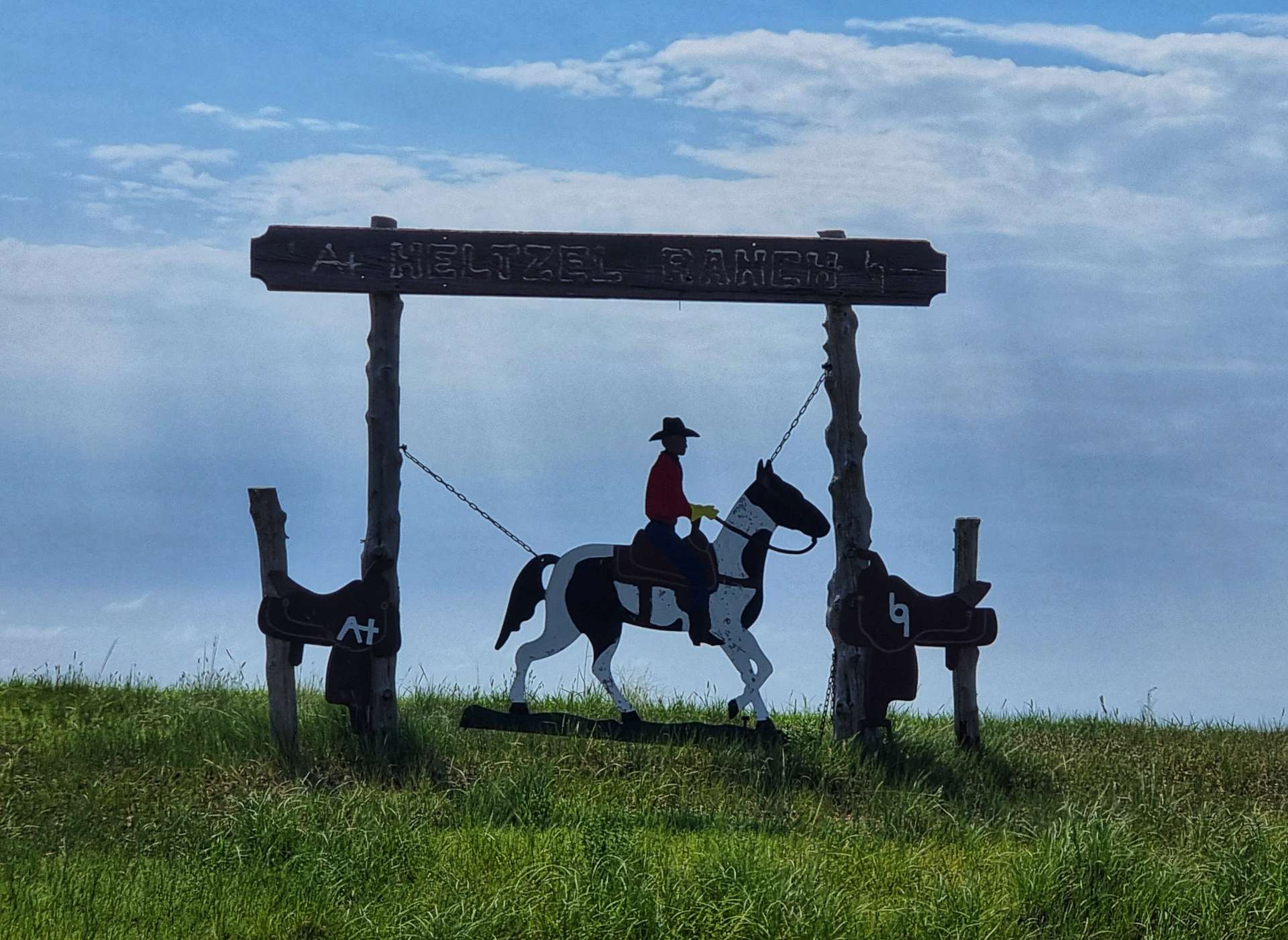
We took Highway 111 & headed south, passing a number of ranches & farmsteads with customised gates & signs. We continued to climb (it was beginning to feel as if the whole day was one long climb!) through farmland, with occasional stands of trees – on the far side of the road the soft, sandy soil was being eroded away, as the grassland binding it together had been removed.
As we reached the I-90, we took a small frontage road that took us through Beulah, home of the annual Test Fest – yes it’s a Rocky Mountain Oyster festival, where humans eat bulls balls & it’s an annual June event!!!
Beulah also marks the last town on the I-90 on Wyoming, as the border with South Dakota is just along the road. Spearfish City Campground was now less than 5 miles away, but first we rode along a road on the edge of town where almost every residential property had flowers in the garden – my favourite example is below. As we entered the City Park, we passed a couple of people fishing in the creek that ran through the centre of the Campground.
We were quickly checked in & wasted no time getting our tents set up. I then set about charging up my tech – phone, laptop, power bar & Wahoo, so I can document my adventure.
While we were charging up our gadgets, we met Don (for the next day we called him Gus by mistake – luckily he already knows before he reads this!!). Don is now retired & spends a proportion of his time exploring the world on 2 wheels & has been to places as diverse as Germany, Norway, Denmark, Patagonian region in Chile & the USA of course. His current trip started in Astoria (Oregon) & is likely to end in New York, but it’s all open to change. We’re currently on a similar route & schedule, so we hope to meet Don again in the next couple of days.
While we were on our way to dinner in town, we got caught in a flash storm – the skies changed colour. the skies opened & for the next 20 minutes we were trapped under separate trees as the rain absolutely bucketed down. Ask Mr Google to look up Derecho for even more extreme examples of these types of storm in South Dakota – they saw green skies.
We finally made it to dinner at Nonna’s, where we both chose pasta courses & washed them down with a cheeky beer to toast another 3 days of glorious riding. Tomorrow’s a rest day, so it will be interesting to see how we cope with 3 nights of outdoor living on the trot!
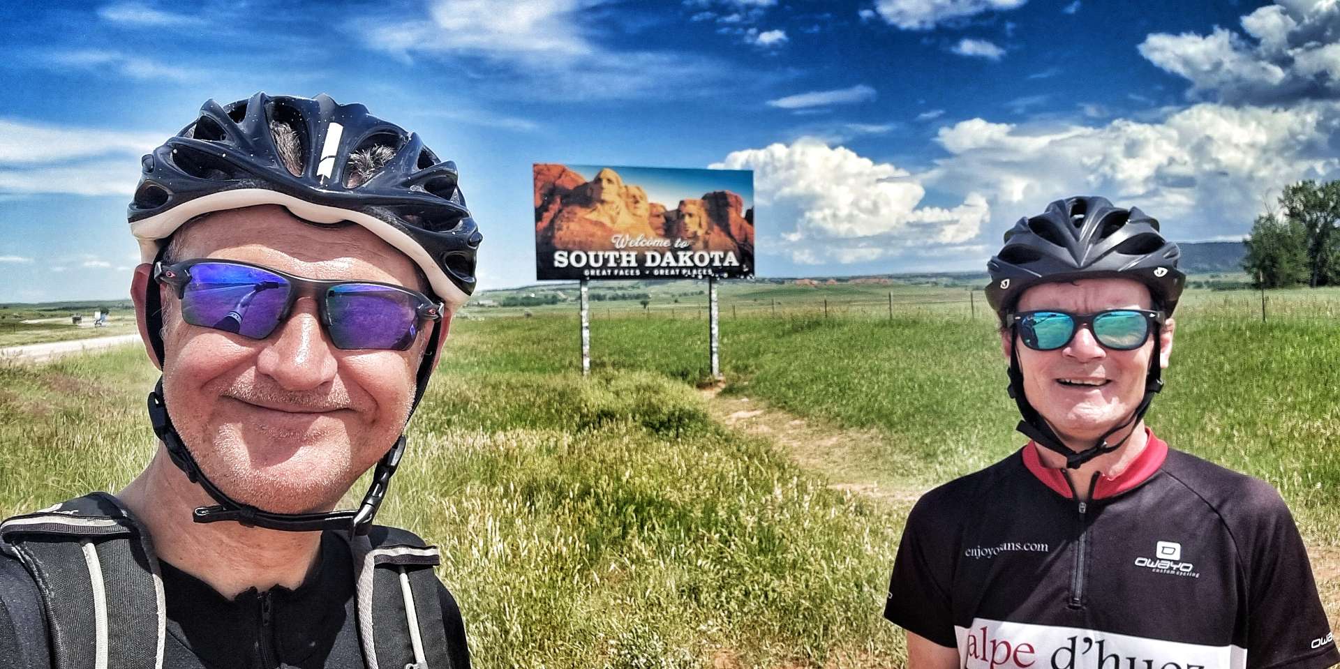
Stage Stats – 66 miles, 3,133 feet of climbing. It felt like we were climbing all day as we crossed the state line from Big Wyoming – to the Great Faces, Great Places of South Dakota.
Saturday 2nd July – Rest Day.
Our rest day started with a walk to the laundromat to wash our cycling kit & off-bike clothes. We then strolled into town & stopped at Uncle Louie’s for breakfast, a 3 egg omelette, toast, juice & coffee.
On the way back to my tent I bumped into Kari from Rapid City, who was camping with her children for the weekend. Stella, her 7 year old daughter was having trouble with the stabilisers on her bike, so I was able to help them sort the issue out & ensure that Stella could continue on her bike ride! This is one of the very few things I can fix & it felt nice to finally be able to help someone else after all the assistance I’ve already received.
We caught up with Don this morning, he’s setting off later today & planning to stop at Trailside Campground tomorrow evening – he gave us the details & we’ve booked a couple of pitches there too.
We picked up dinner from the local grocery store & got about halfway through eating it before an evening storm threatened for the 2nd day running – luckily it didn’t come to anything! As I was washing up my bowl & cutlery, I met Gary & Denise from Wisconsin – they were due to visit the UK this year, but a combination of the war in Ukraine & rising Covid numbers in January meant they’ve had to delay their visit. Hopefully they will get to visit Cornwall & London next year, as well as take their cruise. I really enjoyed spending 30 minutes with Gary & Denise.
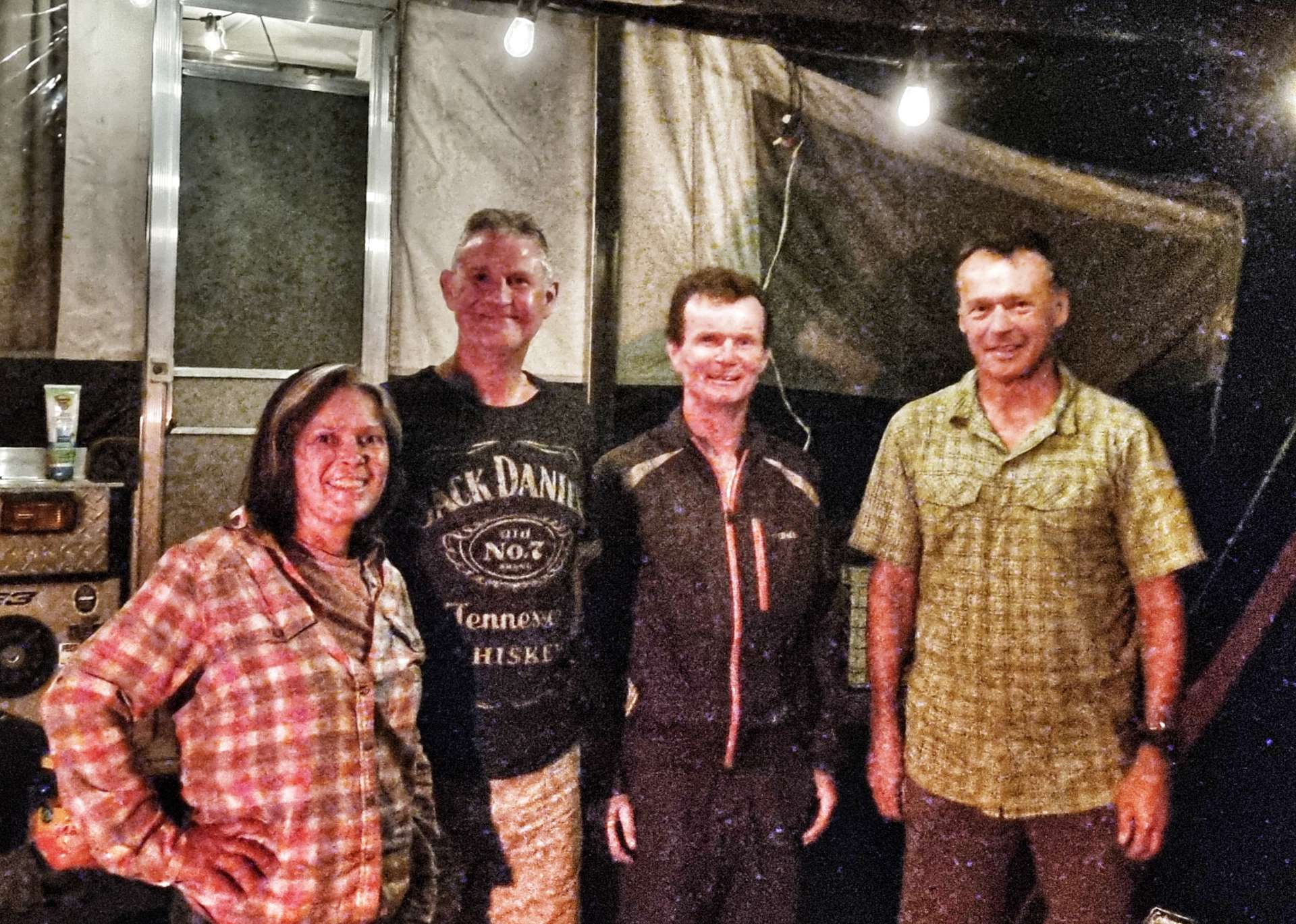
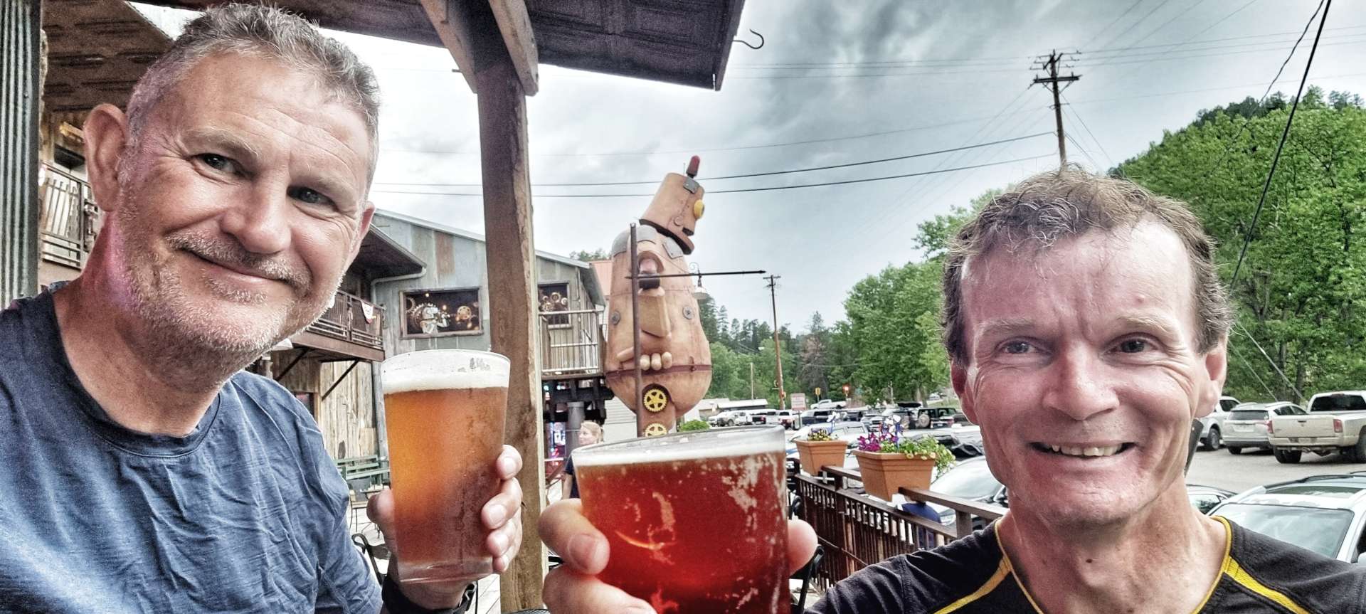
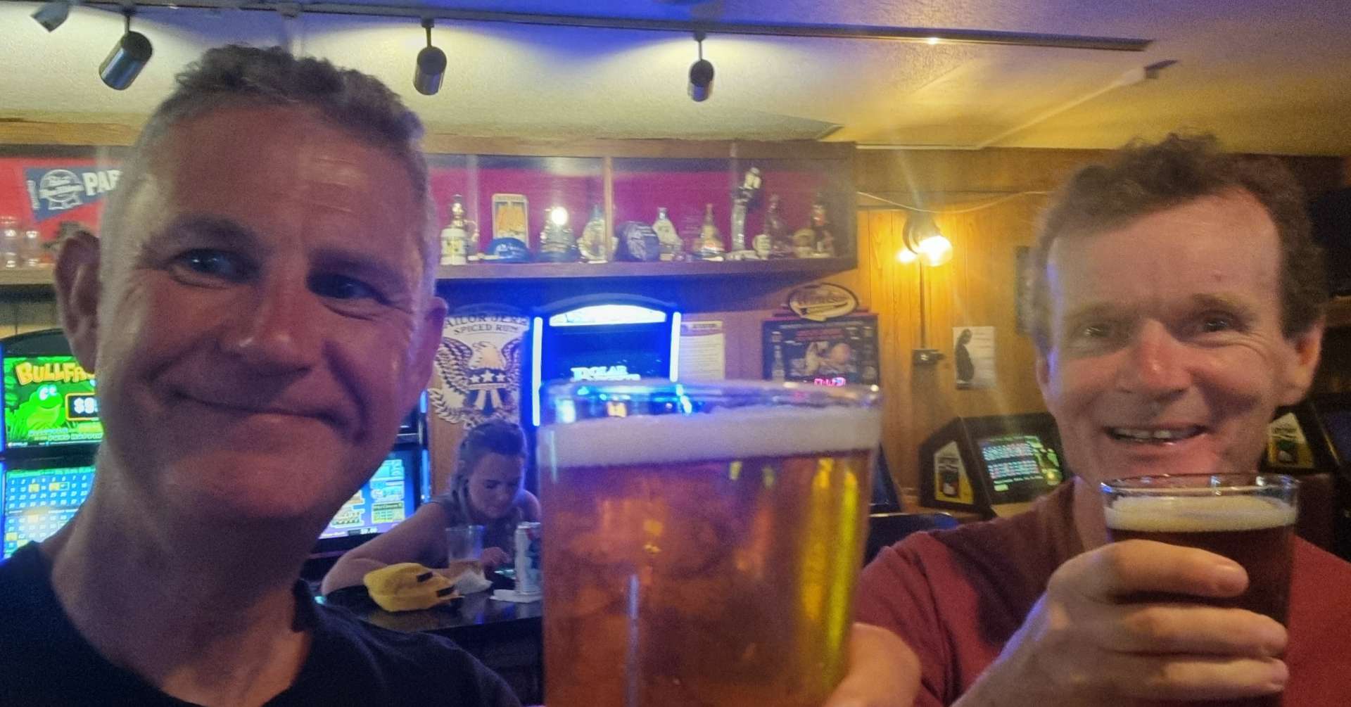
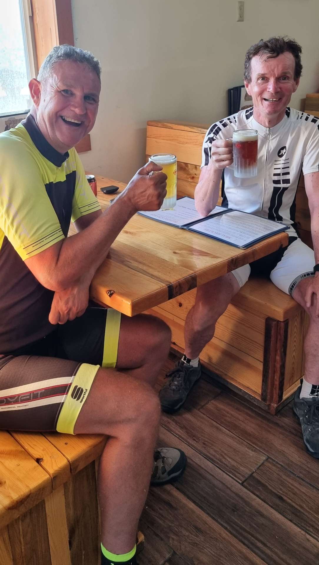
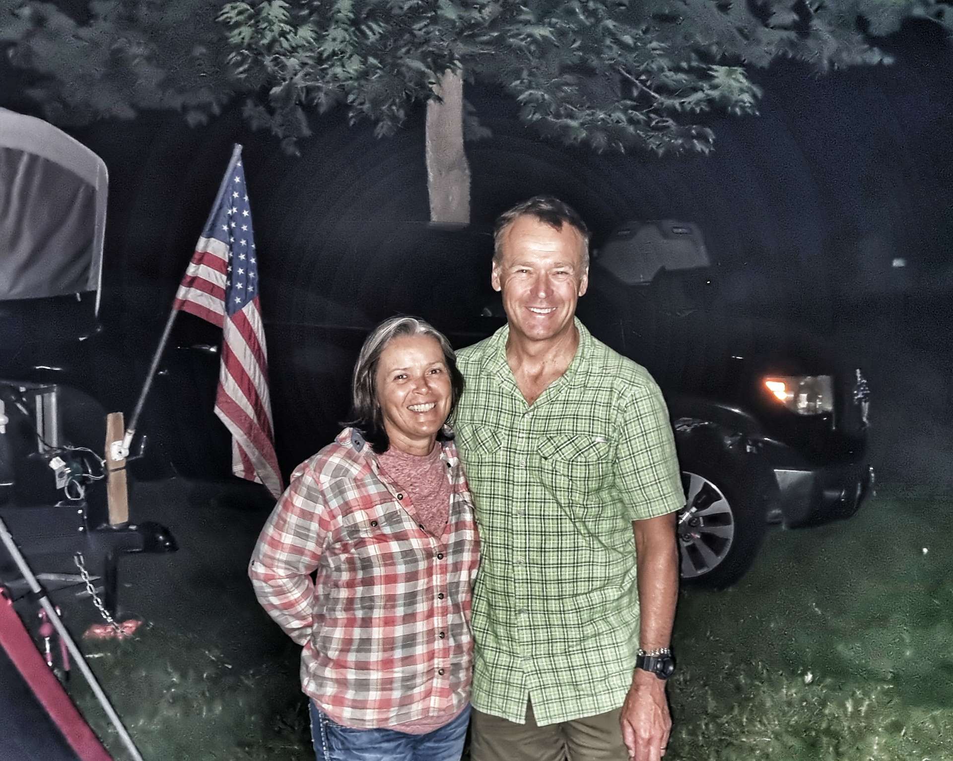
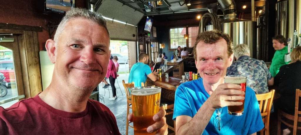
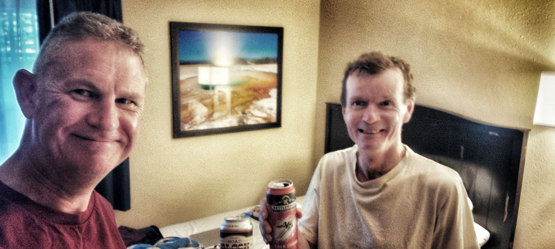
At about 9pm Alex from Colorado Springs came over & asked if we fancied joining him for a beer – it would have been rude to refuse! We spent a couple of hours enjoying Alex & Mary’s company (& beer!) – they shared some great ideas on places to visit when we get a bit further East. I’m pleased that I remembered to get a group photo of us all -thanks Chloe for taking the picture.
We headed for bed about 11pm, as we have another big adventure planned for Sunday.
You may remember that the original plan when we set off on 30th April was to ride an average of 5 days in every 7 & to average 50 miles a ride.
There were 30 possible riding days in June, so we were expecting to have ridden just under 21 days in the month.
June totals were;
12.4 – average speed in mph.
23 – number of days ridden.
53.3 – highest speed achieved in mph.
59.1 – average mileage per ride.
104.08 – longest single ride.
109 – number of hours ridden.
1,360 – total miles ridden.
53,855 – feet climbed.
CUMULATIVE TOTALS
There have been 62 possible riding days since we started our adventure on 30th April, so we should have ridden just over 44 days so far.
The totals since 30th April are;
12.5 – average speed in mph.
48 – number of days ridden.
53.3 – highest speed achieved in mph.
58.8 – average mileage per ride.
104.08 – longest single ride.
225 – number of hours ridden.
2,823 – total miles ridden.
119.871 – feet climbed.
We’re still nowhere near where we expected to be – due to;
April & May’s unseasonably cold weather, which has resulted in road closures due to snow in the mountains.
Late snow in Washington required us to navigate The Cascades via Stevens Pass, rather than Rainy & Washington Passes.
More snow in The Rockies meant we couldn’t explore as much of Glacier National Park as planned & the Going To The Sun Road was closed. As a result we didn’t visit the Canadian Rockies.
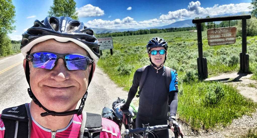
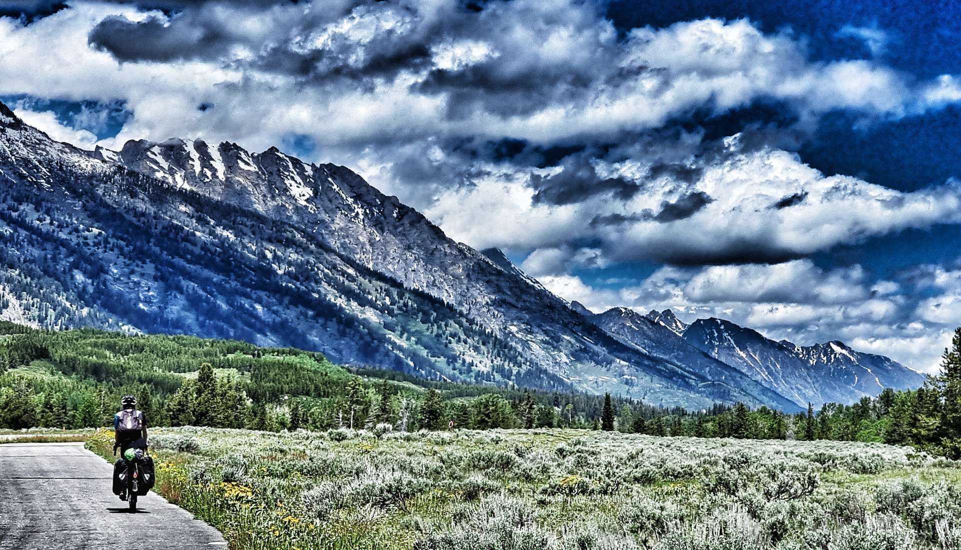
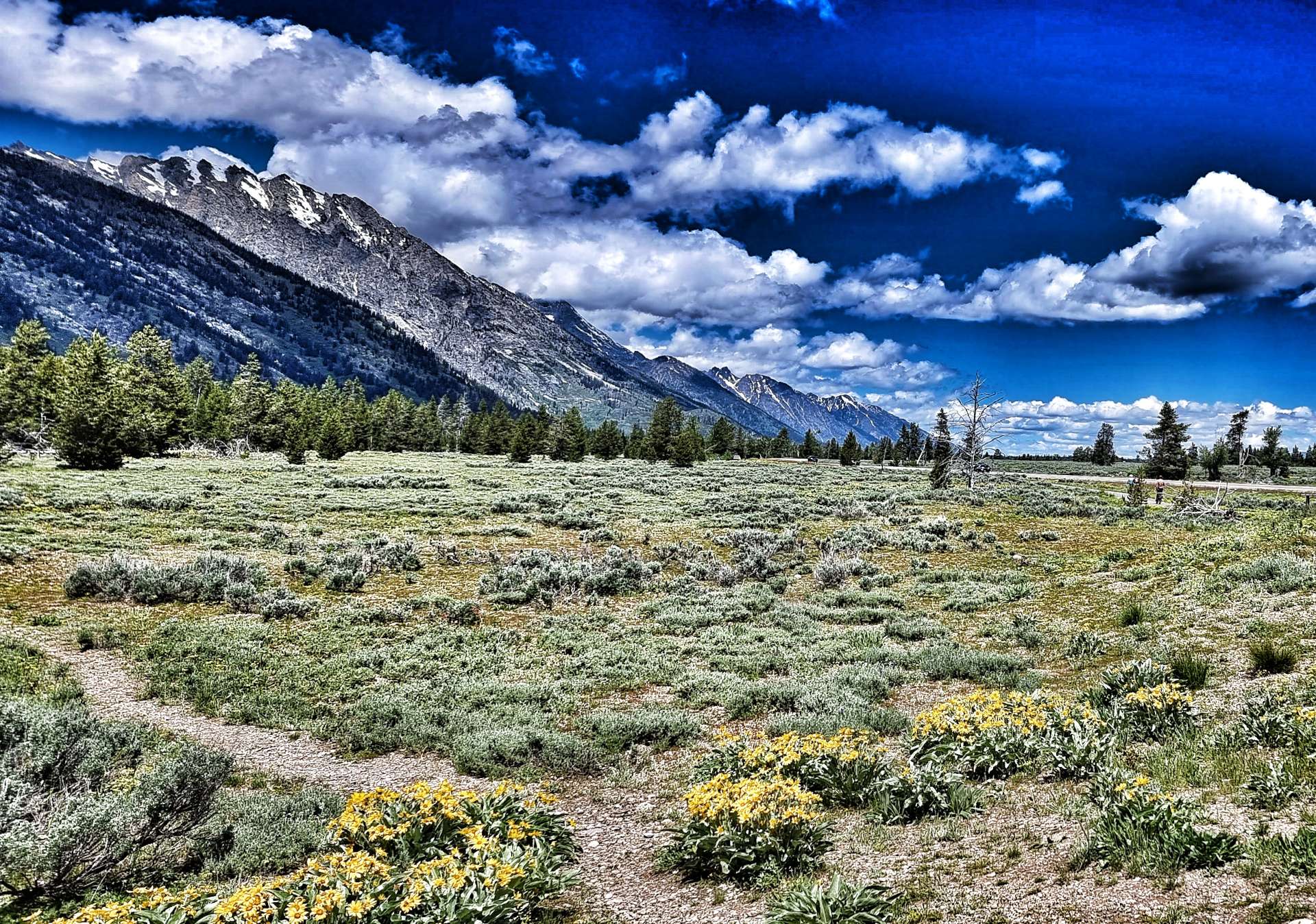
Our extended tour of Montana delayed our arrival in West Yellowstone – by then there had been flooding which caused Yellowstone National Park to be closed. We detoured via Jackson & Grand Teton National Park, so we could enter via the South Entrance on the day the National Park re-opened.
The changes to itinerary have all added to our experience & have taken us to some amazing places – Grand Teton is one of my favourite places on the adventure to date.
I fully expect the route to remain fluid & will embrace them as they occur.
Sunday 26th to Wednesday 29th June (Stages 45 to 47).
Sunday 26th June – Greybull to Tensleep, Leigh Creek Campground.
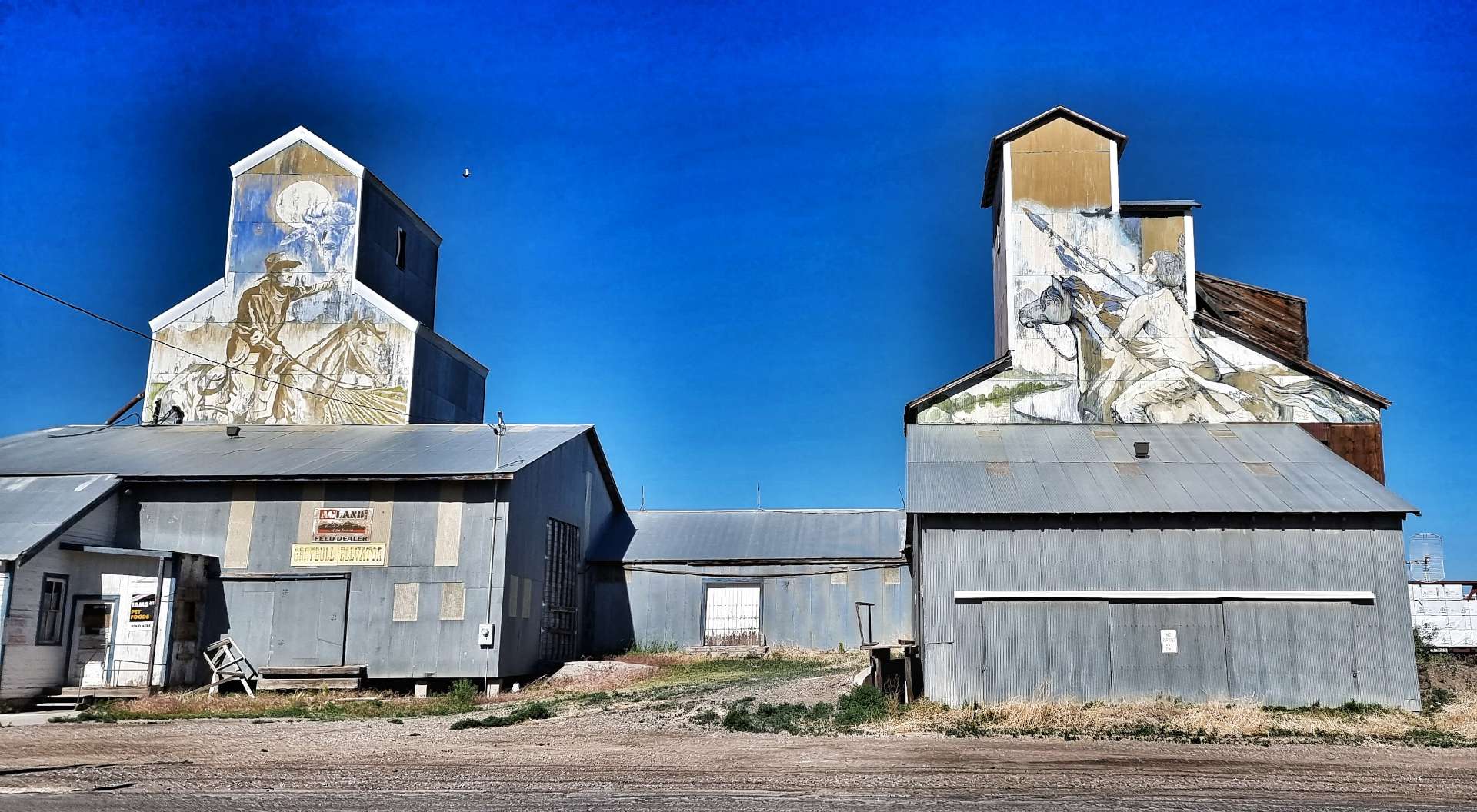
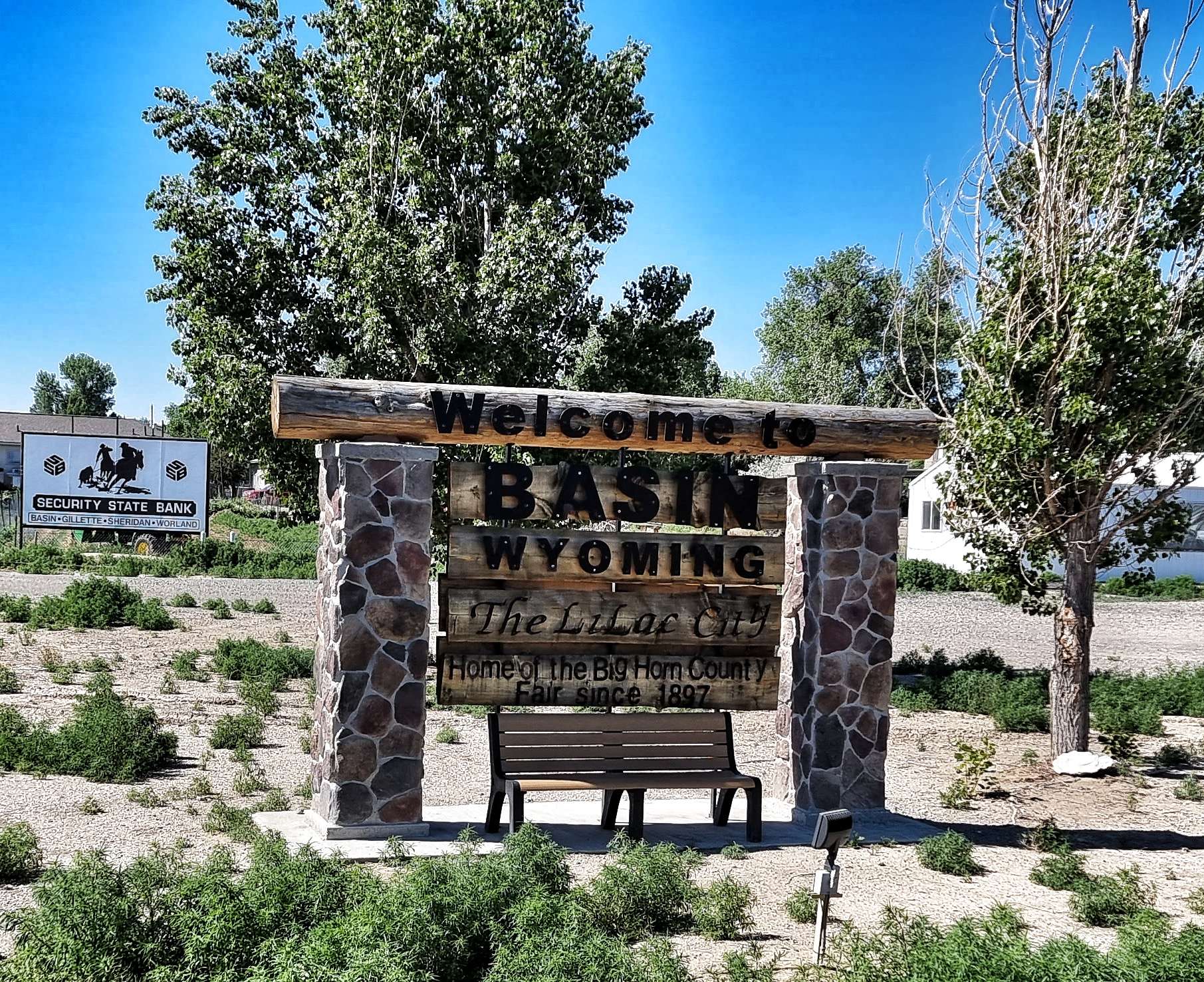
After a continental style breakfast at the motel, we were on the road by just after 9.30 – this was the first morning it felt hot from the moment we set off. Right outside our motel some top quality murals had been painted on the Elevator Buildings. Leaving town on Highway 20, we crossed the Greybull river before heading in the direction of Basin. The surrounding landscape was fairly barren, with the snowy peaks of the high mountains just visible in the far distance.
As we exited Basin we took a left turn onto a small two lane road – this was another Adventure Cycling Association recommendation that would ensure we saw no roadworthy cars for the next 45 minutes, although we did see a classic car at Lewis’s Place!!! It also gave me an opportunity to get in some Hay Bale Surfing practice & looking at the photo I still need quite a bit more training!!! Eight weeks of cycling has certainly reduced my flexibility in my lower back & hamstrings.
As we reached Manderson & crossed the Bighorn river, we watched a boat heading upstream & pull in by the boat launch point. They’d spent an hour or so fishing further downriver – it didn’t look like they’d caught anything. Within 5 minutes we were in the wild wilderness, with nodding donkeys off to the left & right of us, while directly ahead was a shimmering heat-haze.
There was no protection from the sun & we were also getting slightly concerned about our water supplies, as we hadn’t seen anywhere to top up ou 3 bottles & the water was starting to get warm & a bit unpleasant to drink.
The Nowood river snaked its way across the valley floor, resulting in pockets of green verdant pastures every now & again, before we were plunged back into prairie & brush. It was hot enough that regular applications of suntan lotion were required – on one stop I managed to find a slightly arty photo opportunity.
Eventually the Nowood river joined the larger Bighorn just before we took a right turn along County Road 43 1/2 – the roads were becoming ever more remote & the views were beginning to grow larger, with the red, yellow, purple & grey bachdrops.
Remember me mentioning it being hot & us not finding anywhere to re-fill our bottles? Well, we were now carefully rationing our drinking to ensure we could make it to Tensleep, the next place we knew there would be supplies. This also required us to ride slightly slower, so we could manage how much we sweated – we weren’t in any danger, just facing a minor inconvenience! In the end it wasn’t a problem, as Nathan from Bicycle Adventures was providing support to a private cycle tour & he pulled in as he passed us.
We chatted for about 20 minutes & he kindly topped us up with water, as well as giving us an ice cold coke – a real treat on a baking hot day! We shared a few cycling adventure stories & he told us about some of his European trips. Once again we’ve been introduced to the generosity of the people we’ve met. I dropped him & his tour company a thank you email a couple of days later, when we got back to civilisation.
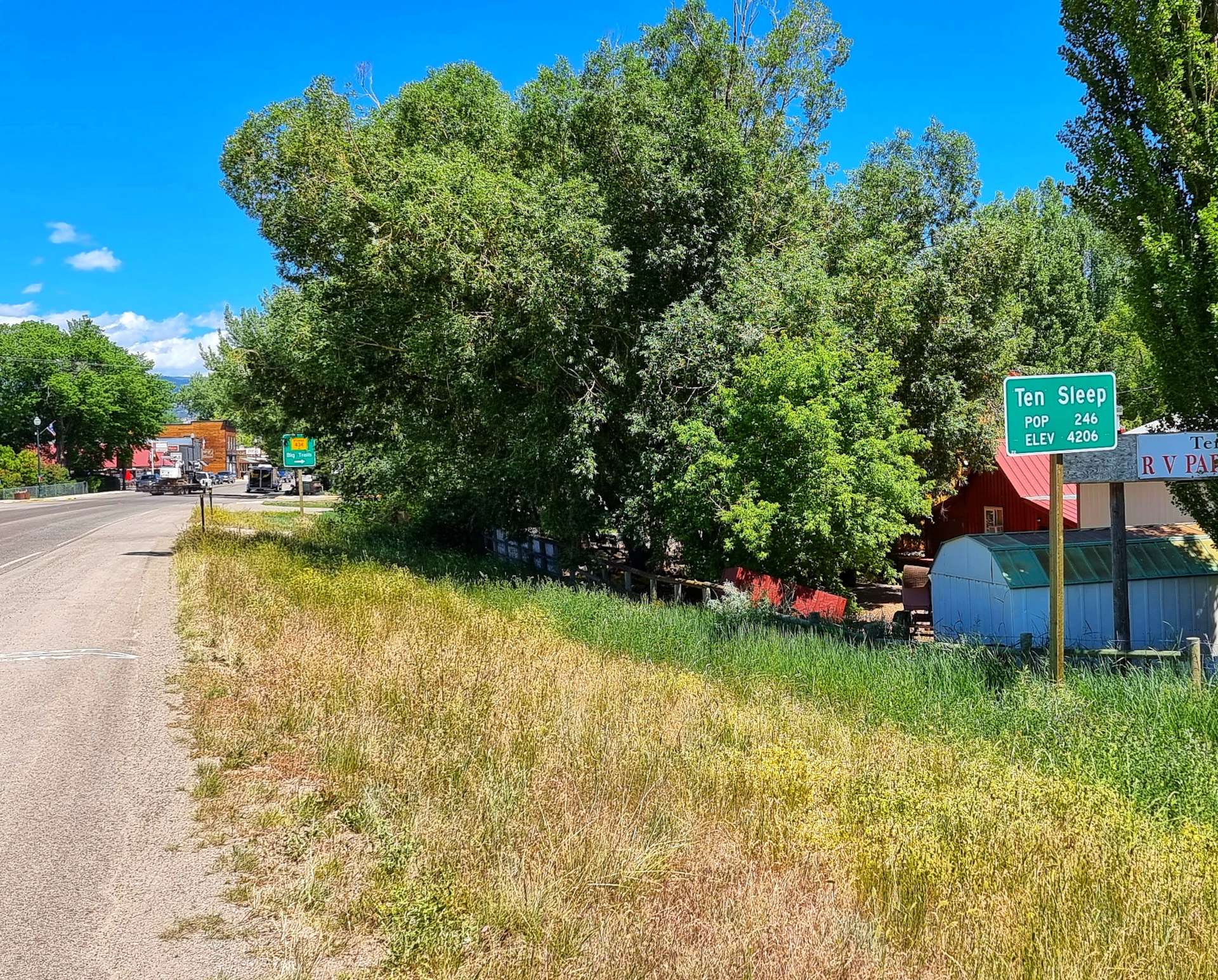
As we set off again, our spirits were lifted, in part by Nathan’s generosity & in part by the coca cola! The 5 miles into Tensleep (population 246), passed in a flash & we stopped to stock up on supplies for our camping dinner this evening. Tensleep was an American Indian rest stop & is so named because it was ten sleeps from Fort Laramie in one direction & Yellowstone in the other.
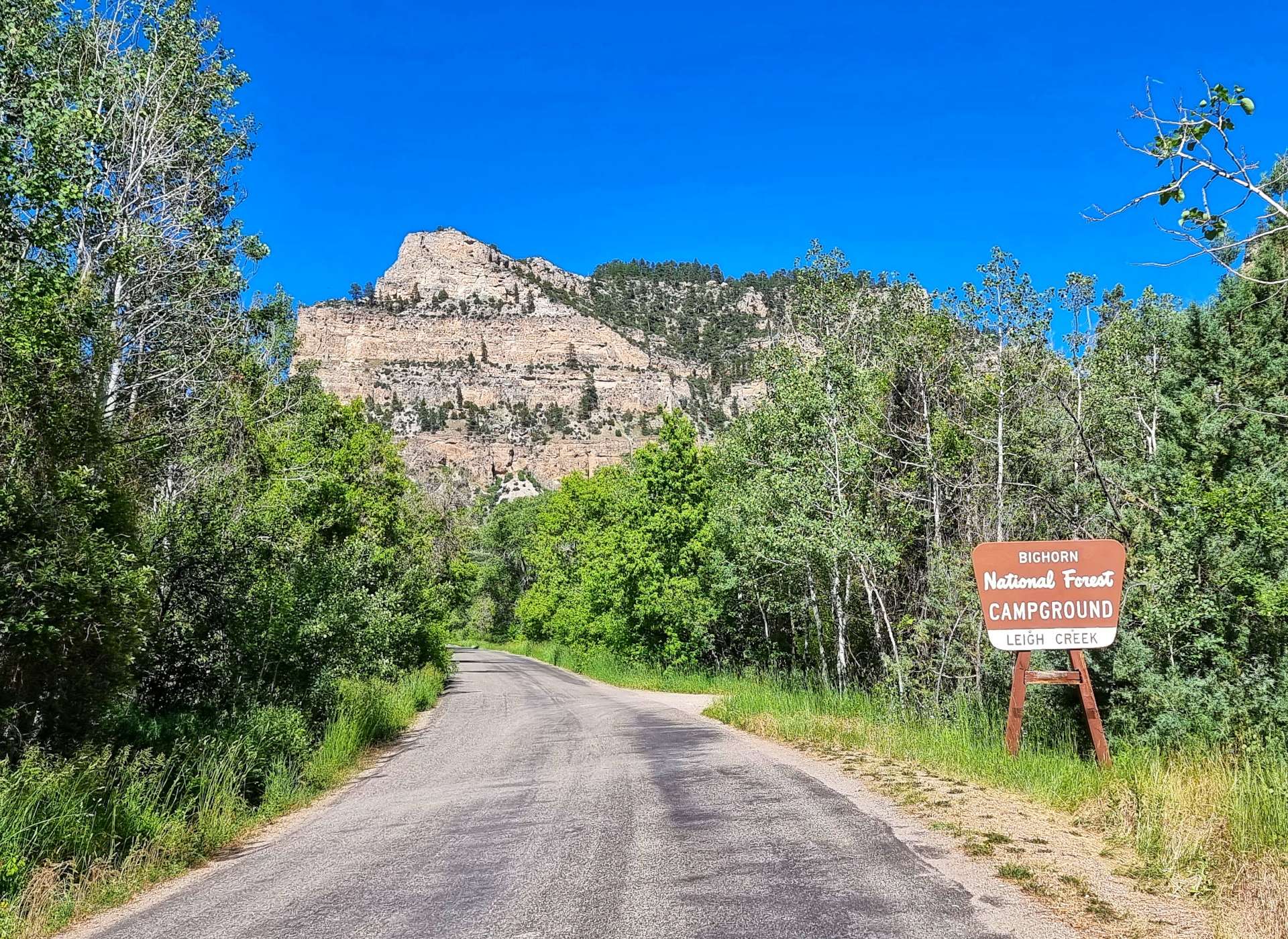
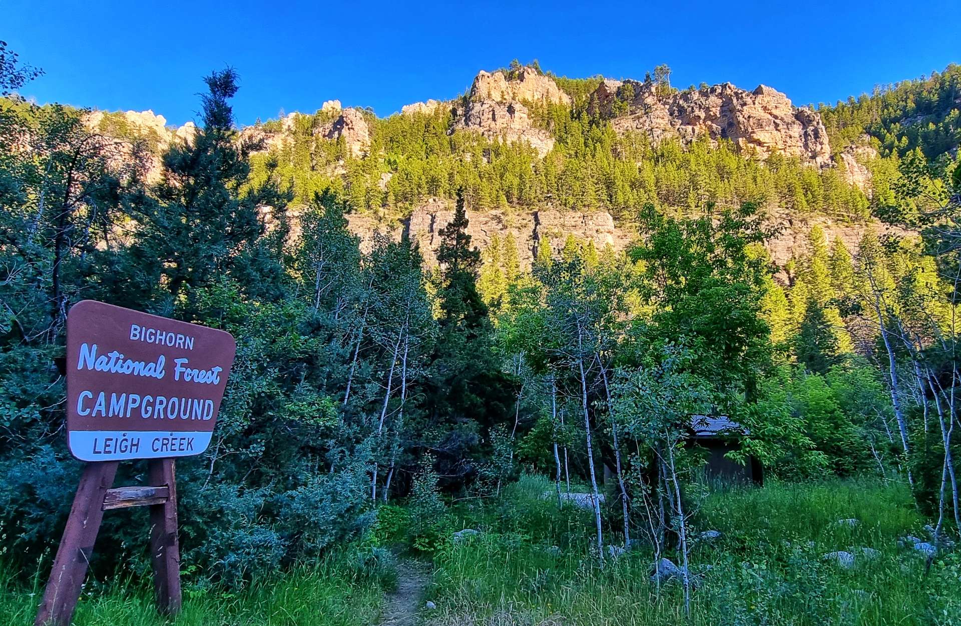
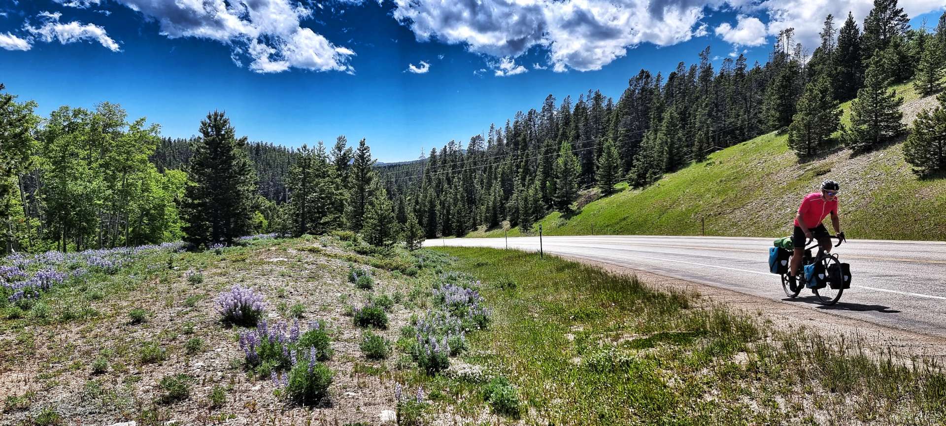
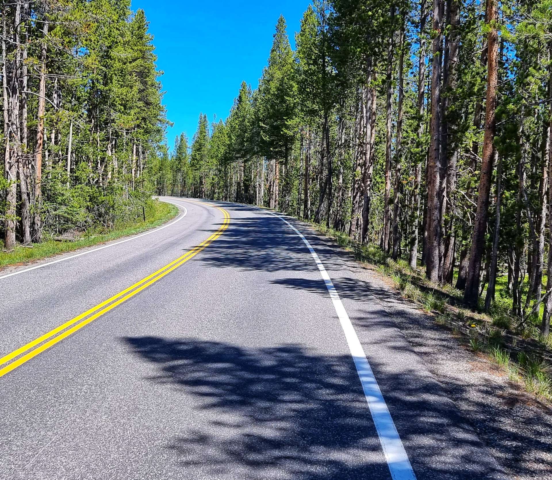
Leaving town we picked up new tarmac as we joined Scenic Byway 16. We continued for about 8 miles, as we climbed the shallow, lower slopes of the Powder River Pass – the big climb is tomorrow!
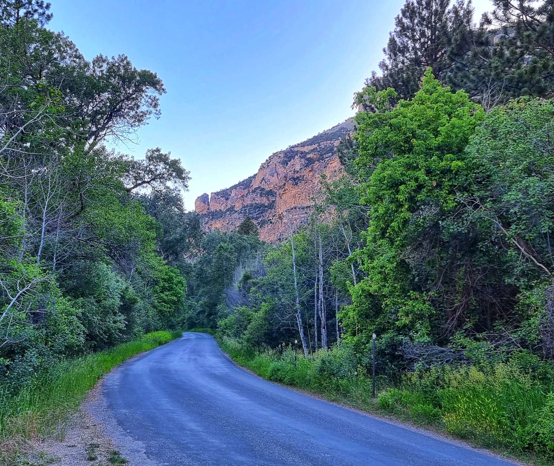
Leigh Creek Campground is a National Forest site on the old road. We were hemmed in on all sides by the imposing ancient rocks & valley walls. We quickly set to work on getting our tents pitched, so we could relax & enjoy the late afternoon sunshine.
The creek is filled with run-off from the snow some 5,000 feet above us – we had our very own ice bath on site!!! We tucked in to a dinner of very average shop bought sandwiches, breakfast bars & a bag of crisps. We don’t always eat like kings!!!! Tomorrow is due to be another long day in the saddle, so we retired to our tents early to recover.
Stage Stats – 62 miles, 2,411 feet of climbing. A hot day in the saddle, rounded off with an ice bath for our feet.
Monday 27th June – Tensleep, Leigh Creek Campground to Buffalo via Powder River Pass.
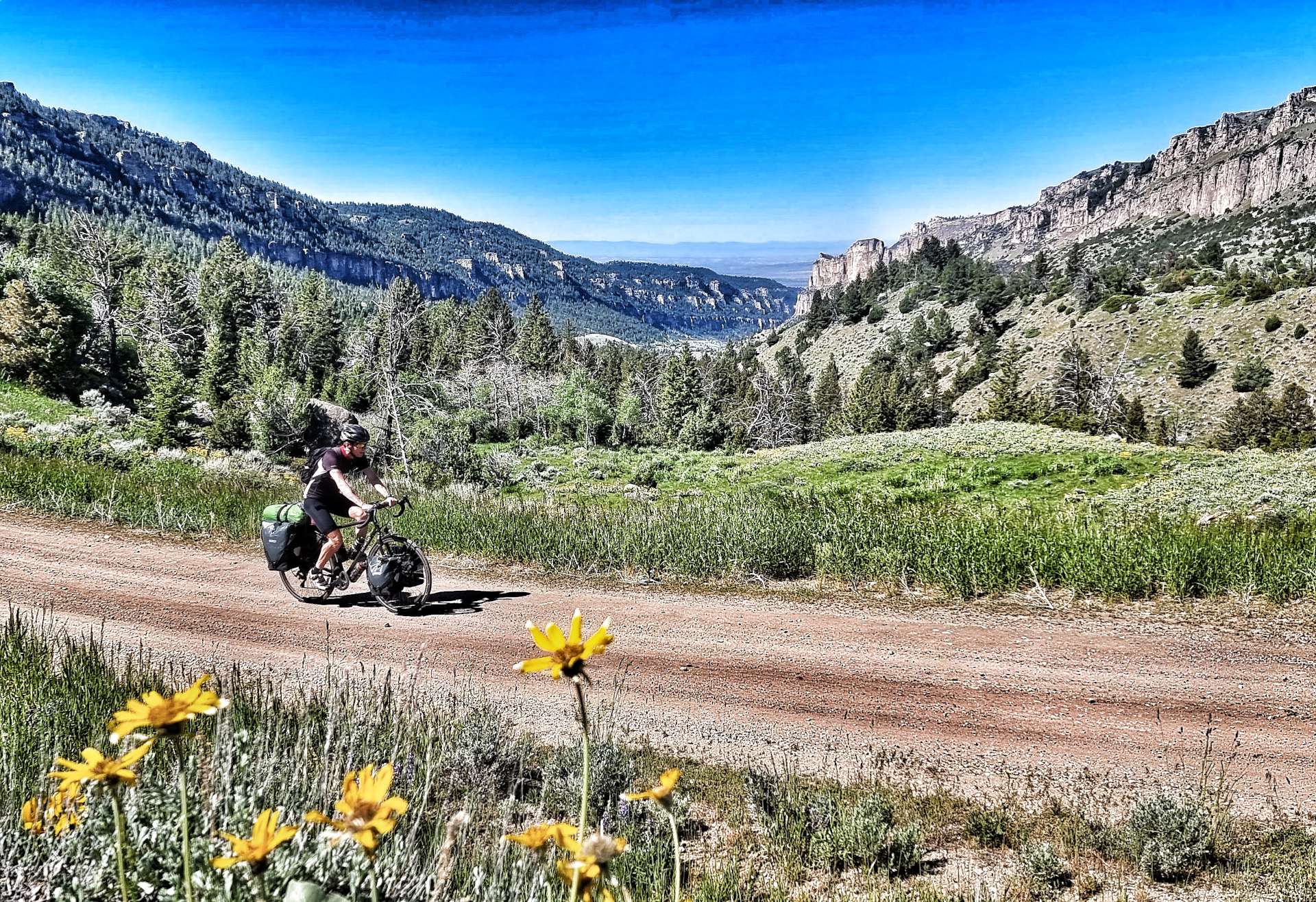
We were up bright & early with the aim of being on the tarmac by 8am. A couple of different events impacted that plan, when first of all I found my tyre had gone flat overnight. Pumping it up appeared to resolve the issue, although as I found out later it hadn’t!! Secondly, after only 1 mile of tarmac, the old road turned to rough gravel & stayed that way for the next 7 miles!!!
As you might have noticed, in addition to the road being on gravel, it also rose at a steep gradient (7% plus for most of the 7 miles) – it took us 1 hour 45 minutes to complete the 7 mile stretch on gravel!!! At times we could see across the valley to the new road as it hair-pinned its way ever higher. The stunning views helped to take our minds off the slow progress, but it couldn’t take away the feeling of the power being sapped from our legs.
I’d been able to better cope with the gravel, but the roles were instantly reversed when we finally joined the new road & its pristine tarmac. We’d researched where we might be able to stop to replenish our water bottles & we stopped for the first time at Boulder Creek Campground to fill all 3 bottles – we’d run out in less than 2 hours of riding!!!
This was also where I had my only moment of self-doubt on the adventure to date – we were 9 miles into a 21 mile climb, all of it over 5% & the sheer scale of what remained hit me hard. After 2 minutes of feeling sorry for myself I stood up & said to Sean “I need to get going now, otherwise I may not get started again”.
The views were stunning as we continued through the forest & passed Meadowlark Lake, but the gradient didn’t get any easier!
After another 1 or so of riding we saw what we knew would be the only coffee & cake stop opportunity of the day. We had a coke, coffee & cake – I made the mistake of asking for my cinnamon bun to be gently heated up…… it came out looking like it had been nuked!!! It was so bad I wasn’t able to finish it & that’s never happened before!!! On a more positive note, the coffee was nice & we managed to fill up our 3 water bottles again for the final push to the summit.
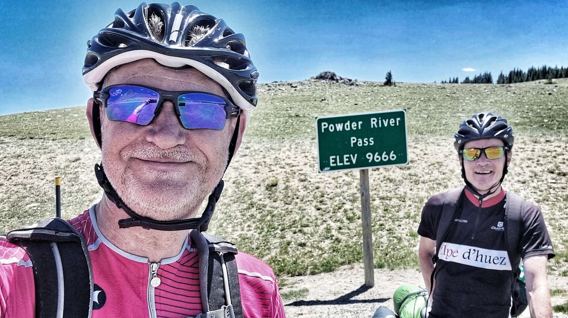
The summit was still another hour away – when we finally made it to Powder River Pass at 9,666 feet above sea level, it had taken us 4 hours of climbing to cover the 21 miles. When we rode through Tensleep at the bottom of the climb yesterday, we were at 4,205 feet above sea level – it really is a monster of a mountain!
At least it would all be downhill from here, so we had that to look forward to – although, I was slightly troubled that Sean could ride in my slipstream without any difficulty!
All became clear a few minutes later as my rear tyre became spongy! That instant remedy this morning was no such thing, I had a puncture & it needed to be fixed now. After my practice in Yellowstone, I had the tyre off, a piece of debris removed & the innertube replaced in 15 minutes & was feeling good about myself.
Until 10 minutes later, when I got a 2nd puncture on the same back tyre! I eventually found another nick in the tyre & scratched out a really small piece of glass. I was out of inner tubes, so had to borrow one from Sean (& a gas cannister). While all this was going on, a Department of Transport lorry started honking its horn at us as it descended the mountain – it was painting the white lines at the side of the road & had no intention of stopping!!!
Although we moved my stuff as far out of the way as we could, the lorry kept on coming & sprayed small amounts of paint over my bike, helmet, rucksack & panniers as it continued on its way. I can’t repeat my comments, but they were Anglo-Saxon in origin!
We also found out that there were 5 short, sharp, steep climbs to be endured on the way down too!
Suddenly the road opened up in front of us with enormous views across to Loaf Mountain, Bighorn Peak & Darton Peak. They tower over the valley below. Finally, after just over 6,000 feet of climbing & 6 hours of tough cycling, we could make out the town of Buffalo below us. It would take us less than 30 minutes to cover the final 10 miles, in sharp contrast to the 2 hours 30 minutes it took to climb 10 miles!
Today was a truly epic day out & was what I was hoping to experience when I originally planned our Coast to Coast Adventure – sometimes though you need a little bit of time to really appreciate what a great day it really was! Today was one of those days & my moment of self-doubt is now far behind me.
Stage Stats – 58 miles, 6,070 feet of climbing. Our biggest day of climbing to date as we crested the monstrous Powder River Pass!
Tuesday 27th June – Rest Day.
Our Rest Days now have a familiar pattern to them – enjoy a bit of a lie-in & then have breakfast, before heading out to get the laundry done. We only have 3 sets of cycling kit, so every 3rd day is laundry day! We’ve also had to be frugal with the amount of off the bike clothing we brought – 2 pairs of lightweight trousers, a pair of shorts, 3 tee-shirts, 2 long sleeved tops, 3 pairs of socks & boxers. Not much for a 6 month adventure!
I needed to get a new tyre, innertubes & gas cannisters. A quick look at Mr Google told me that I needed to visit The Sports Lure, as it eas my best chance of getting what I needed – my tyre had done 7,500 miles, so I’d got my money’s worth from it. I was directed to the workshop where I met Helene – she found a similar tyre & fitted it for me, as well as sorting me out with innertubes & gas cannisters.
While Helene was doing all the work, I got out the way & found a coffee shop & tucked in to a peanut butter & chock chip slice! When I returned, Helene had replaced the tyre & I was good to go. Once again I’d met a kind & generous soul who had taken pity on me & helped me out of a tight spot.
Helene – Thank You so much for your kindness.
While I was in town I took the opportunity to have a stroll round & see the murals & sculptures in the historic district. The remainder of the day was spent planning the upcoming routes & also writing my next instalment of our adventure.
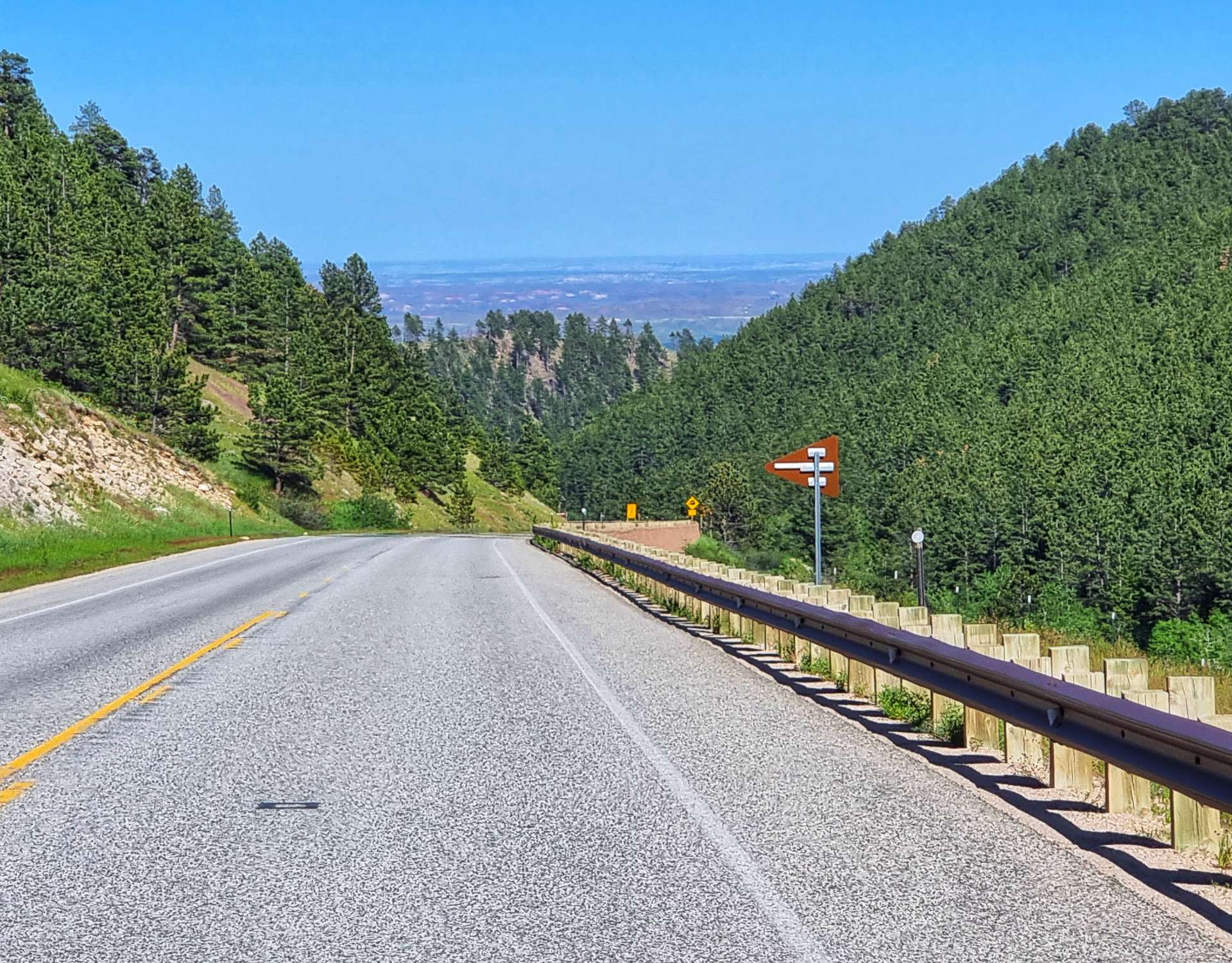
Wednesday 29th June – Buffalo to Gillette (Stage 47).
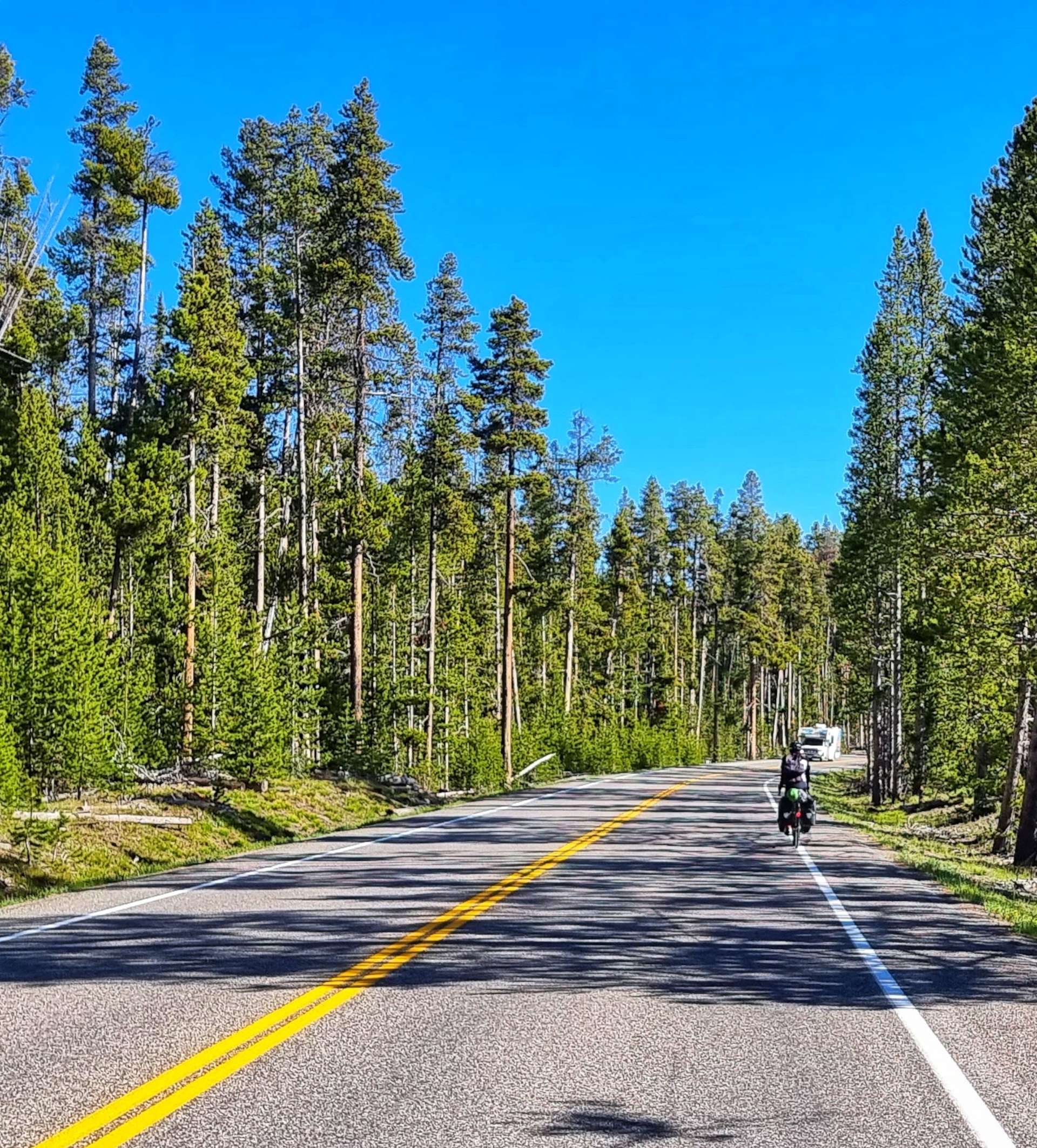
We were on the road for 9am, after a breakfast of cereal, yoghurt & toast from the hotel. Today is all about getting to Gillette in the shortest distance possible. We had two possible routes, one was over 90 miles long, through remote & deserted backroads. The second option was to cycle on I-90 from Buffalo to Gillette, which is 70 miles with a single stop for water.
There will be no services other than this single rest area. We would prefer a 3rd option, but of the two we have, cycling on the Interstate is the least bad & is allowed as far as I’ve been able to establish. We took a final look behind us to Powder River Summit, before setting off for a 66 mile ride on the Freeway.
We chose to enjoy today regardless of the somewhat limited opportunities to take photos – there were still great views on offer, the road was very quiet & we were in good spirits!
At the 30 mile marker we reached the rest area – we took the opportunity to top up all 3 of our water bottles, as we learned about the history of the Powder River Basin. For example, it produces 1/6 of the world’s power, due to it’s low sulphur coal reserves which are shipped around the world.
We also learned that the Hole In The Wall hide out of Butch Cassidy & The Sundance Kid was on the Middle Fork of the Powder River. This is in addition to the lesson we learned yesterday – Powder River Pass is a high mountain pass!!
Someone spotted our touring bikes & came over to talk to us – he only stayed 5 minutes, didn’t give us his name, but did seem excited when we explained we’d been in Jackson a few days ago, as that’s where he’s from & he used to train on Teton Pass when he was younger.
We crossed the Powder River almost as soon as we re-joined I-90. The only potential cloud on the horizon was the real cloud on the horizon – rain looked imminent! We chose to ignore it & enjoy the downhill parts of the ride instead.
At least the cloud resulted in temperatures falling by a few degrees, which ensured we had enough water to comfortably complete the riding on the Freeway. We’d had a tailwind for most of today’s ride & it was also relatively flat – we were checked in to our motel by about 2pm. We only realised how lucky we were 30 minutes later, when large hailstones were bouncing off the car park floor. If we’d had headwind or crosswind today, we’d probably have still been riding when the storm struck.
We decided to pop out to a local Italian restaurant to toast our good fortune today & to ask for more interesting views tomorrow!
Stage Stats – 70 miles, 2,306 feet of climbing. Our first experience of riding the Freeway – neither of us are in a rush for a repeat performance!!!
Well, How Did We Get Here? Miles, Feet Climbed, Maps & Profiles.
Parts One to Three described how we travelled from Seattle to Helena in the first 6 weeks of our adventure. Now find out where we went & what we did in Weeks 7 & 8! Hopefully picking a single photo to represent each day will refresh my mind when it comes to looking back on my adventure!
Thursday 23rd to Saturday 25th June (Stages 43 & 44).
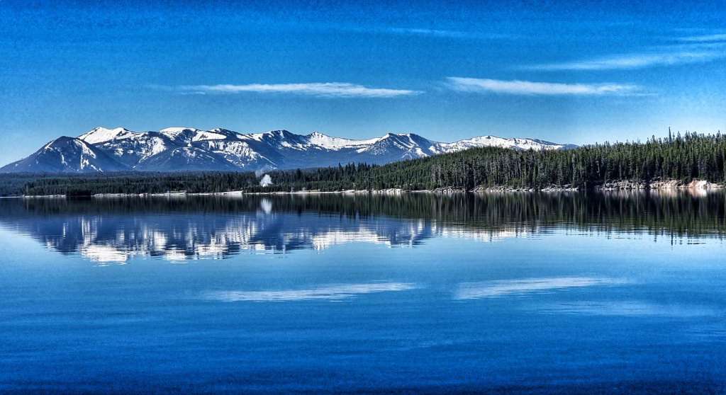
Thursday 23rd June – Grant Village, Yellowstone to Cody (Stage 43).
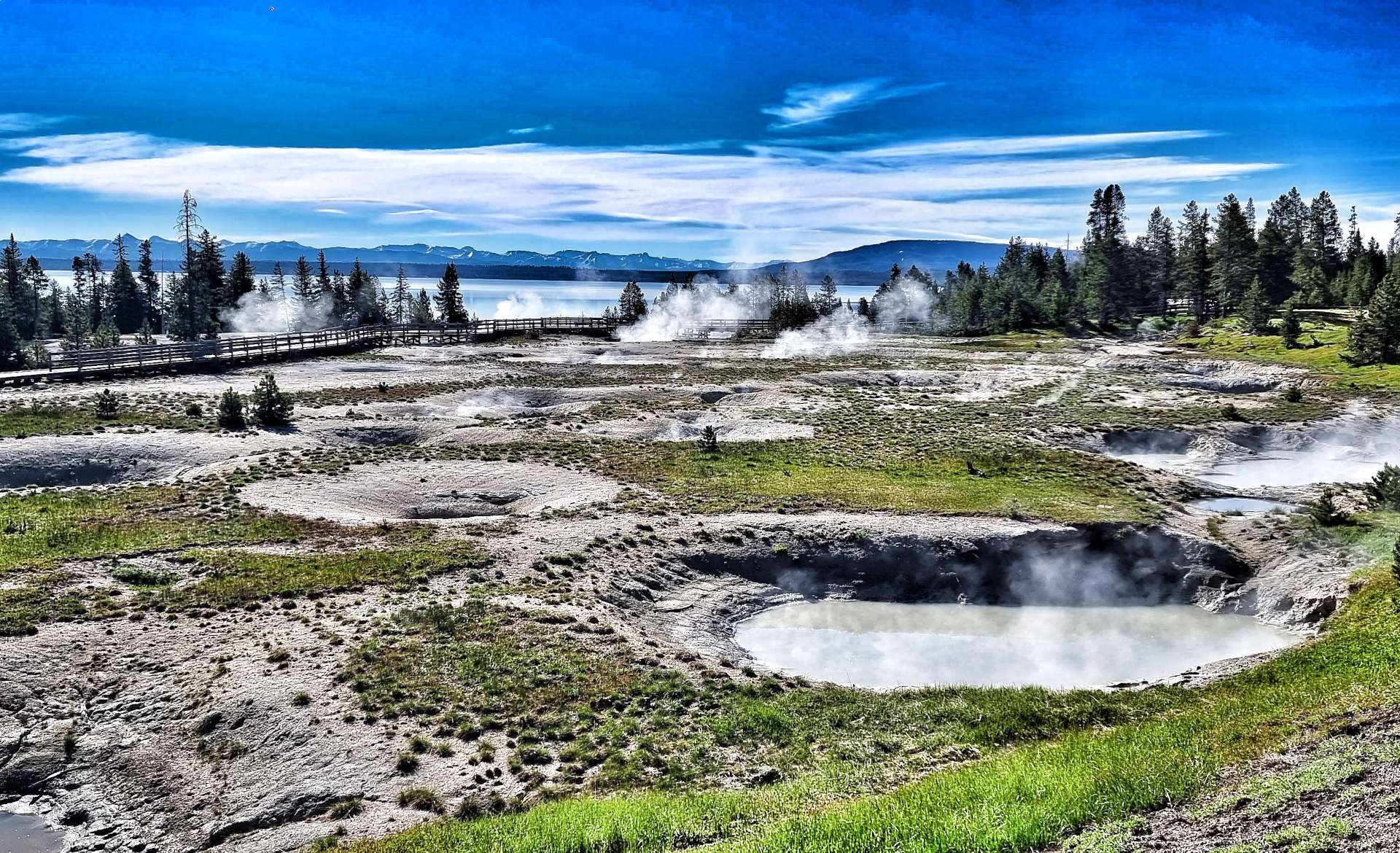
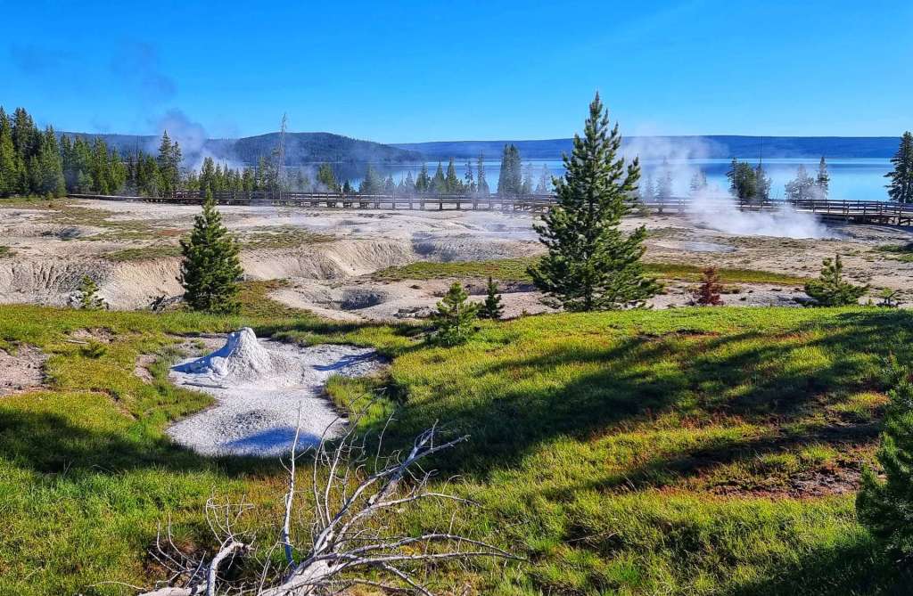
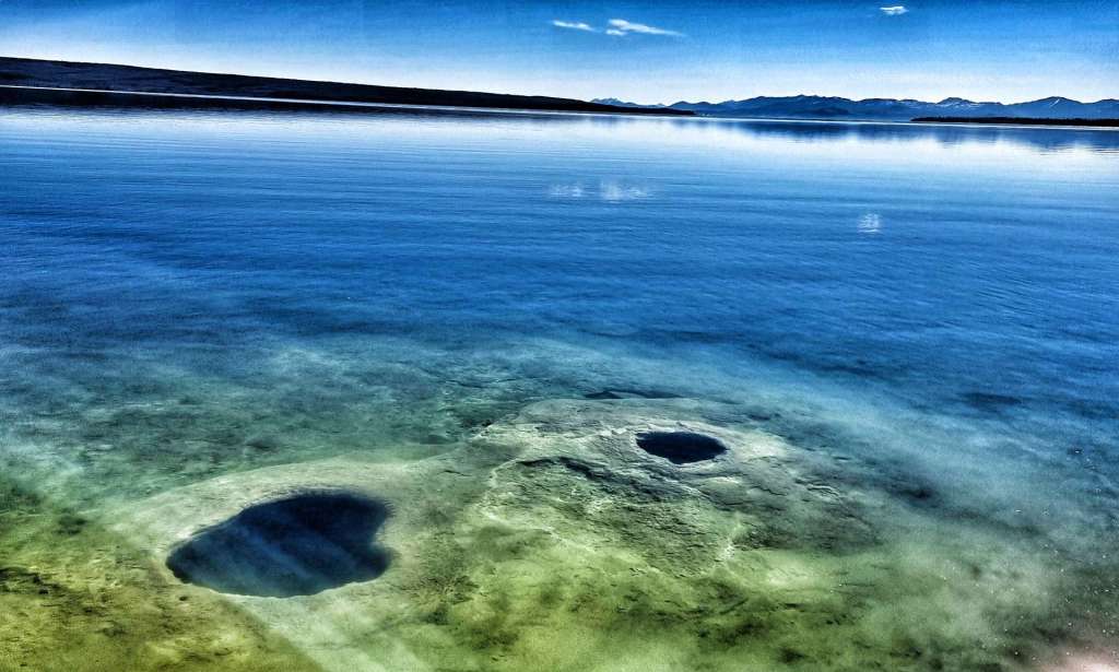
We were up bright & early today for what is the longest ride day of the adventure so far. Leaving Grant Village at 8am, the first 5 miles were very much like the end of yesterday’s ride, taking us through forest, but as we were turning right onto Highway 20, we made a last minute decision to stop at the West Thumb Geyser Basin.
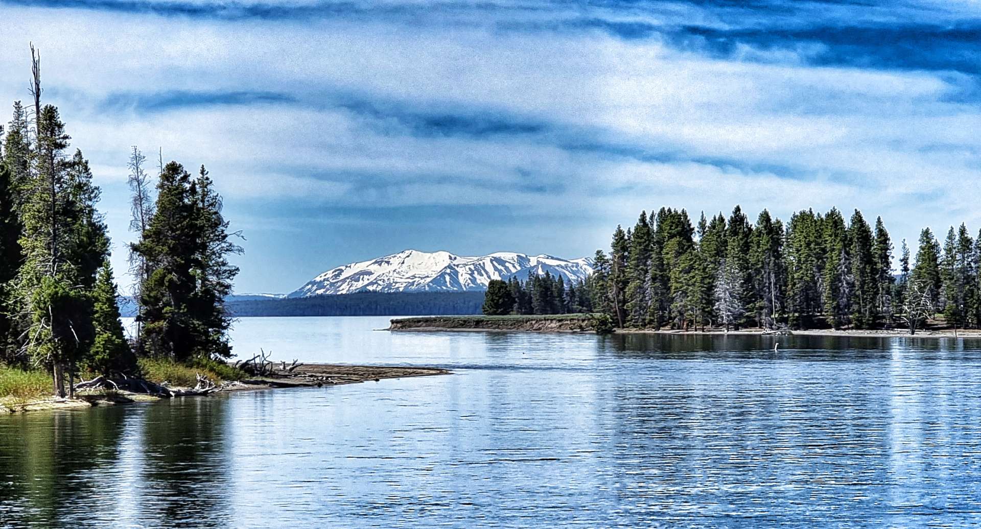
Being located on the shore of Yellowstone Lake, it’s one of the stand-out features on the Southern Loop, although it’s also one of the least visited sites. It doesn’t have the obvious thermal activity that some of the other hotspots can offer, but its views over the lake to the distant mountains are second to none. Yellowstone Lake is quite full at the moment, which resulted in a couple of the geysers either being completely or partly submerged which gave them an ethereal quality.
We followed the wooden walkway (see first photo) around the various geysers including the Thumb Paintpots, Seismograph Pool & Bluebell Pool.
As we continued to make our way towards the lake, we could look across the basin & make out the steam rising from the active geysers at the opposite end of the trail. Reaching the shoreline, we came face to face with the Winter Spring & Lakeshore Geysers, both of which were completely submerged.
Fishing Cone geyser was next, offering stunning views across the smooth lake, followed almost immediately by Big Cone & Hillside geysers. While the photos look good, they really aren’t a patch on the real thing!
The Black Pool & Abyss geysers led us on towards the Painted Pool & Thumb Paintpots – every time you thought there couldn’t be a more spectacular geyser, one appeared!!
There was an opportunity to get a long shot of the West Thumb basin, as well as a couple of shots looking across the lake, before finding ourselves back where we started. The geyser basin couldn’t be any more different to the forest of yesterday – Yellowstone has the ability to keep throwing different scenery & wildlife at you. We spent about an hour walking round the trail & it was worth every second!
While I know I’ve mentioned the correct geysers, I may have mixed up which photo is which, so please just enjoy them anyway.
Forest covers about 80% of the park with lodgepole pine being one of the dominant species. It requires temperatures of between 104 to 122 centigrade for the cones to open & start the reproduction cycle. The trees themselves have thick bark which gives it the ability to resist low intensity fires.
There is a sub-plot taking place when lodgepole pine are absent – Subalpine fir & Engelman spruce battle for supremacy. This explains why some of the forest photos look so different to each other.
Every now & again there were lookouts & gaps in the treeline, allowing views across the lake to the Grand Tetons in the far distance.
At Bridge Bay Marina a lone motor boat was setting off for a day on the lake, while a little further down the road we could see cars parked all over the road. This is a sure sign there are large animals in the area & on this occasion we met a gang of very docile elk – while they have fuzzy antlers they are less likely to attack anything, as their antlers are very sensitive. However, once their antlers have hardened, they are much more dangerous!
We took the right turn towards Fishing Bridge – I stopped for a couple of photos before we pulled in to the General Store for a coffee. Setting off again, we’d assumed that we’d had our last opportunity to spot some of the larger wildlife, when we saw what looked like large black boulders over to our left…..
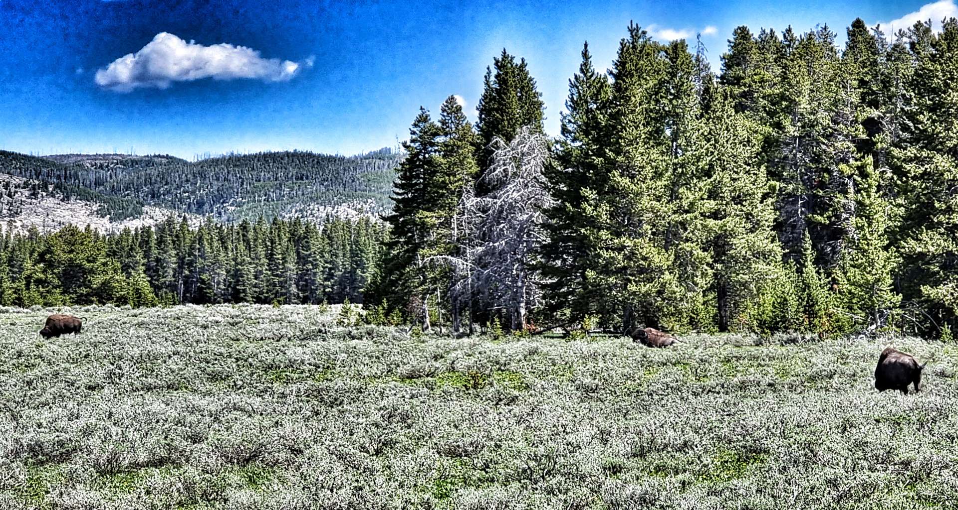
In the space of 5 minutes, we saw a small herd of 3 bison (they must have been a couple of hundred yards away), then a single bison grazing on the grass – I was about 30 yards away. I read that on 27th June, someone was gored by a bison when it became agitated because the man got too close (advice is never get closer than 25 yards to most wildlife, but keep 100 yards away from bears & wolves.
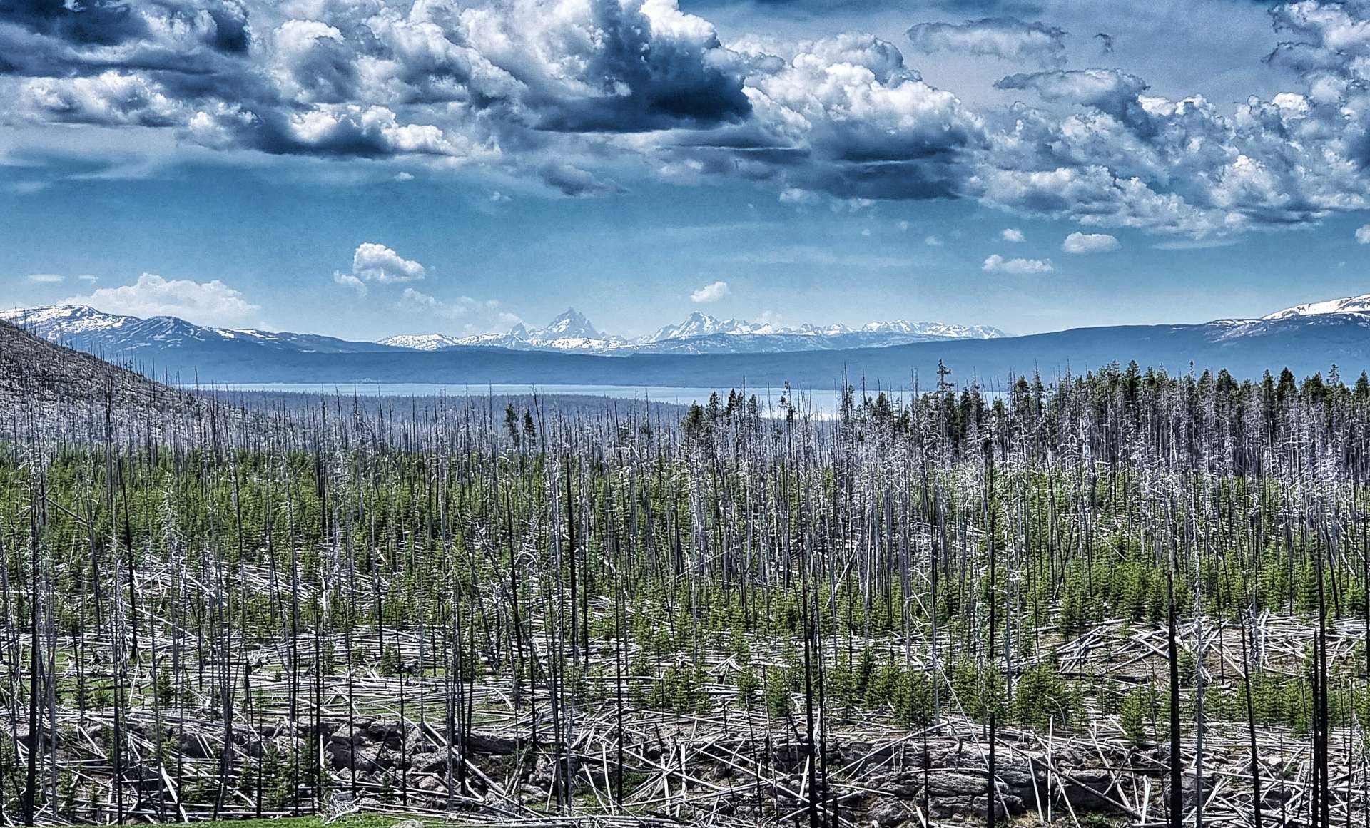
In 1988, wildfires caused damage to just over a third of Yellowstone – they burned for months & the entire park was closed for the first time in its history. Although the fires looked to have caused irreparable damage at the time, Yellowstone has recovered & new growth trees are now well established & some of the trees survived as only the ground vegetation was burned. As we cycled from Yellowstone Lake towards the East Entrance, we could see this at first hand.
We had th
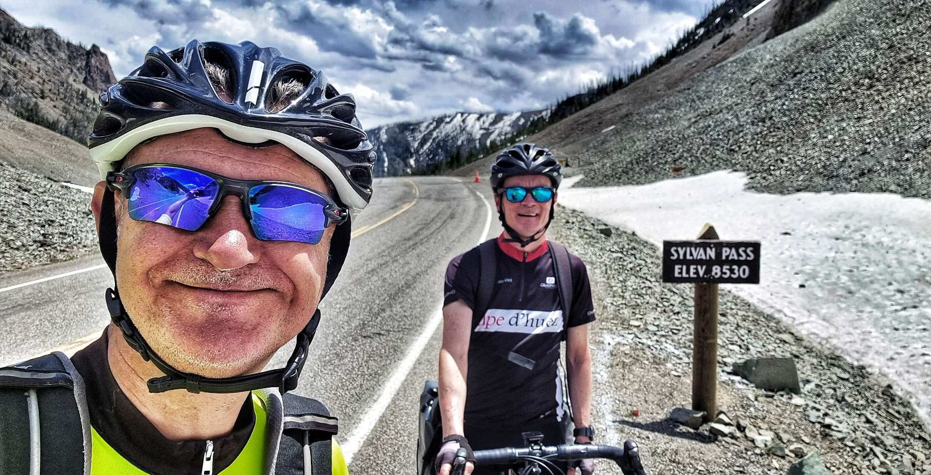
A couple of small alpine lakes added a European feel as we climbed up to Sylvan Pass (at 8,530 feet above sea level, it’s the highest pass in the park). We still had another 58 miles to cycle, but from here it would be mostly downhill! We descended 1,600 feet in the next 7 miles, which delivered us to the East Entrance Gate – time for a final photo from Yellowstone!
Leaving Yellowstone behind us, I was on a familiar road – in 2010 I rode the final 52 miles into Cody on a Cycling Adventures tour. As we descended, following the course of Middle Creek, we saw the last of the yellow volcanic rock.
The cliffs became red sandstone & siltstone as we descended the Wapiti (Elk) Valley, now following the course of the Shoshone river. The rock formations reminded me of Utah (especially the areas around Bryce, Zion & Moab), with hoodoos & arches high up. We passed Buffalo Bill Cody’s hunting lodge at Pahaska Tepee (we stopped for a quick coffee) as a tailwind pushed us down the valley.
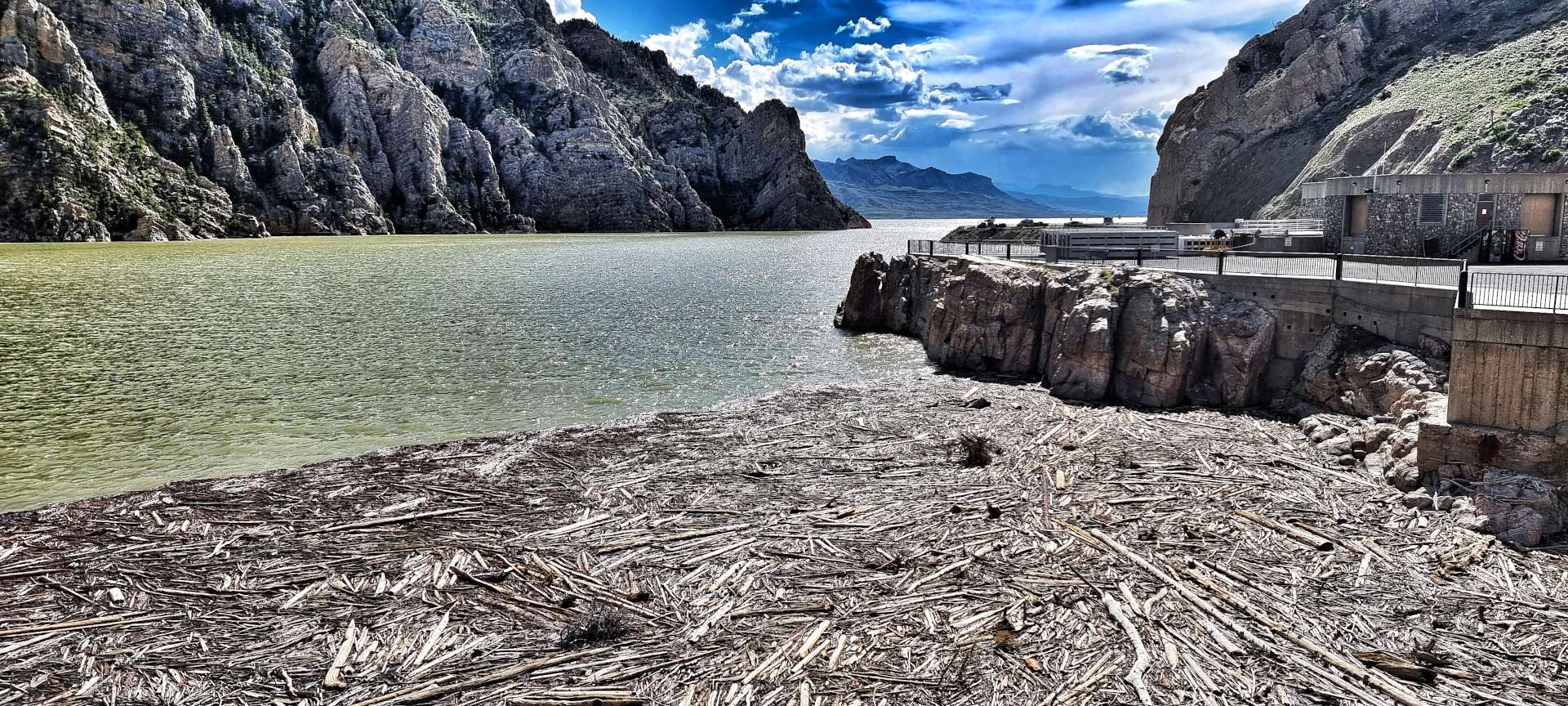
As the Wapiti Valley opened out, we got our first views of the Buffalo Bill Reservoir – constructed between 1905 & 1910, it was one of the first concrete dams built in the USA & at the time it was finished, it was the tallest dam in the world at 325 feet. The dam was raised an additional 25 feet when work was completed in 1993. Although I couldn’t find any information to explain why, you can see there is significant log debris near the dam.
The power of the water as it cascaded to the valley floor was breath-taking! I’ve included a small video clip.
The final 5 miles from the reservoir to our motel passed in a flash – this had been our longest day ever on the touring bikes by a significant margin (our previous longest ride was 86 miles & it almost broke us!). We’d had a truly special day that started with the Thumb Thermal Basin, we saw exceptional scenery & got to meet Yellowstone’s wildlife at close quarters. It was time to celebrate 3 glorious days in Grand Teton & Yellowstone National Parks!!
Stage Stats – 104 miles, 3,274 feet of climbing. A thermal basin, up close wildlife & stunning scenery, plus a climb over the highest pass (Sylvan Pass) in Yellowstone.
Friday 24th June – Rest Day.
A short update to say hello & thank you to a couple of people I met when I was getting my bike serviced at Joyvagen (which translates as “Path To Happiness”) in Cody.
Pam, it was lovely to meet you, I hope you get many hours of happiness from your new bike! Thanks for sharing your knowledge & thoughts on routes in Wyoming. As I write this, we’ve made it as far as Gillette!
Marshall – I can’t thank you enough for fixing my gears & brakes. It was great to spend some time chatting with you & I hope you got to enjoy the bike festival in Shell on the Saturday & that you all raised a huge amount for cancer. Your friendliness, professionalism & kindness was well above & beyond what you had to do – thank you so much!!!
Saturday 25th June – Cody to Greybull (Stage 44).
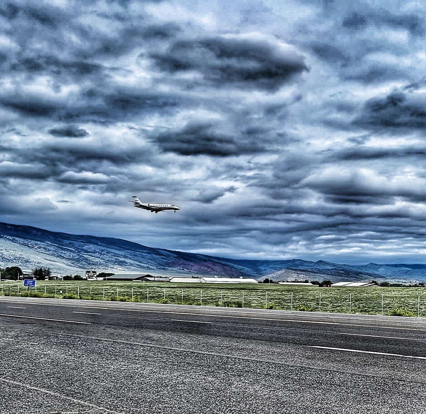
We woke to overcast skies, but warm temperatures. As it was a short ride we decided to have a slightly later start than normal – we were on the road just after 10am. As we left town, we spotted a mule deer almost immediately, quickly followed by some American Avocets at Alkali Lake. As if that wasn’t enough excitement for the first 10 minutes, we also watched a plane as it swooped over the road before landing at the nearby airport!
After 3 days of stunning views, today was always going to be a bit like the day after the Lord Mayor’s Show – being on long, straight roads with featureless vistas in all directions simply reinforced that feeling! However, as we chatted to each other we were reminded what an enormous privilege it is to be on the adventure of a lifetime. We’re exploring the best scenery, experiencing the best wildlife & meeting some of the kindest, friendliest people along the way.
We stopped at a couple of Points of Interest, where we learned about the McCullough Peaks wild horses. They’re more well known as Mustangs (derived from the Spanish word Mustengo – ownerless beast) & they live on 109,814 acres of land just outside Cody.
We also learned about the Bridger Trail – following the discovery of gold & silver in Montana, a faster route to the mining territories was required. The trail funnelled large numbers of emigrants into Montana.
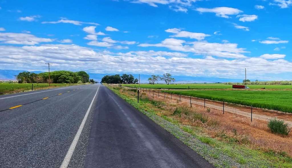
On a bike you get a better feel for how far places are apart & how desolate the landscape really is – we spoke to someone who said that Greybull was about 45 minutes away by car – it took us just over 3 1/2 hours in favourable conditions on the bike to cycle the 54 miles! It helps me to appreciate how adventurous the early pioneers really were.
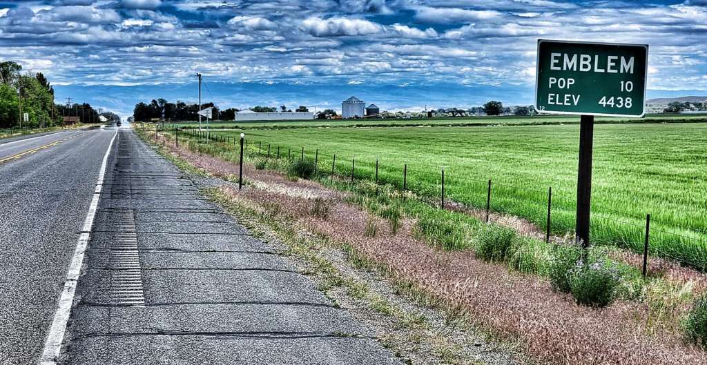
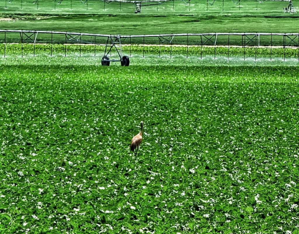
The only town on today’s route was Emblem – it had a declared population of 10! We’re expecting more of the same for the next few days, as we really are in the remote part of Wyoming. In fact we saw as many sand cranes on todays ride as the number of people we spoke to (2 of each)!!
The one small drag of the day was made more of a challenge than it should have been, as the top layer of tarmac had been treated, resulting in a rough ride (imagine a road in the UK with the ironwork showing – this was the American equivalent).
As the day progressed, the sun burned away the lower cloud & the temperature rose into the high 80’s, our first experience of the hot sun. Luckily we were on a shorter day, so water wasn’t an issue, but it reminded us of the importance of topping up wherever the opportunity arises.
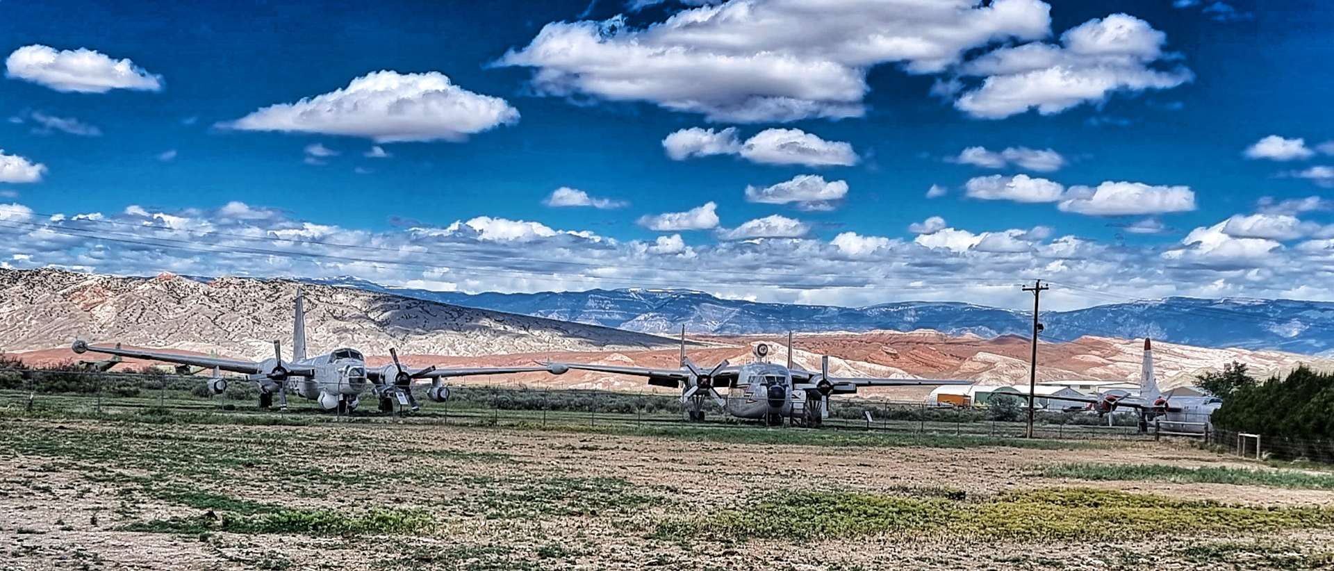
Just outside Greybull we passed the Museum for Flight & Aerial Firefighting, with exhibits of historic firefighting planes. Unfortunately, it appeared closed, as this was somewhere I would have really enjoyed exploring further – I definitely picked up Dad’s interest in planes.
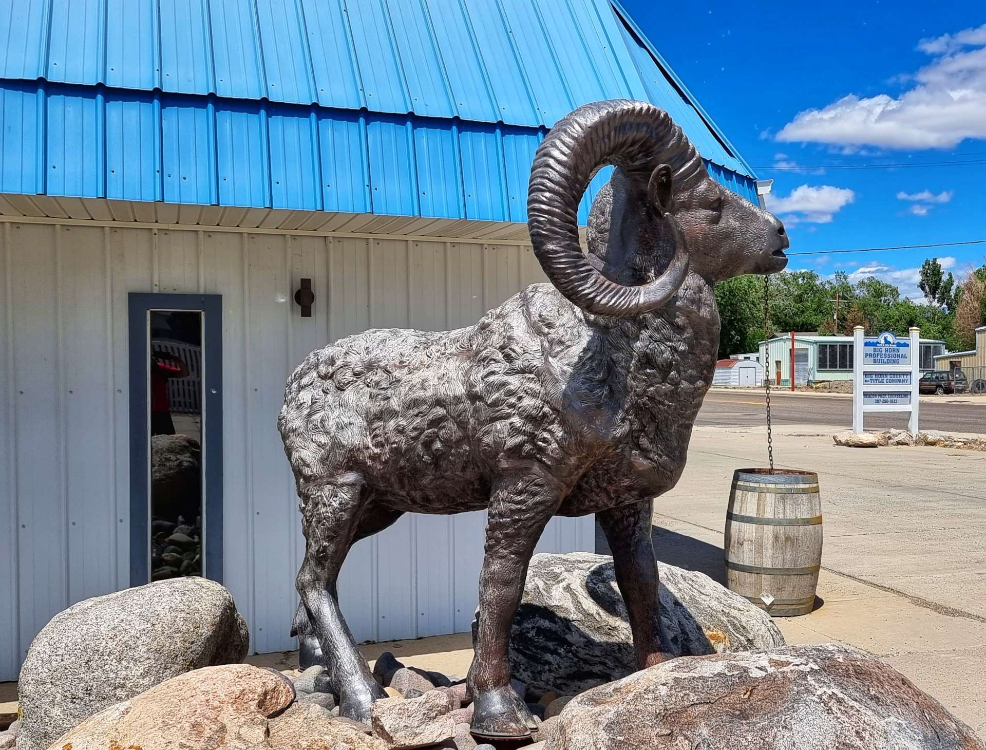
After a small descent, we hit the outskirts of town (another neat Welcome sign) & now we’re entering the Bighorn Mountains, we saw our first bighorn sheep – admittedly it was a sculpture!
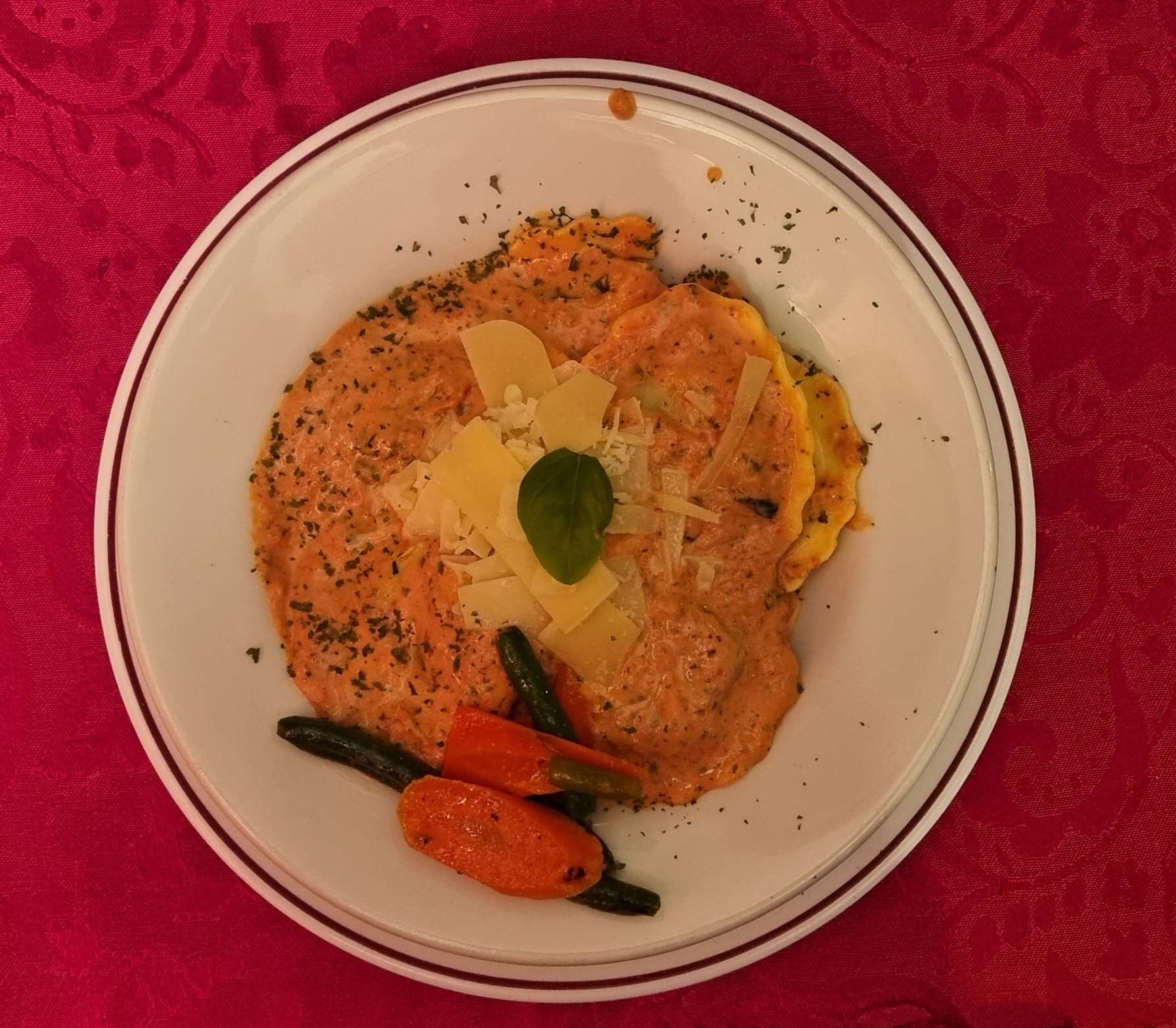
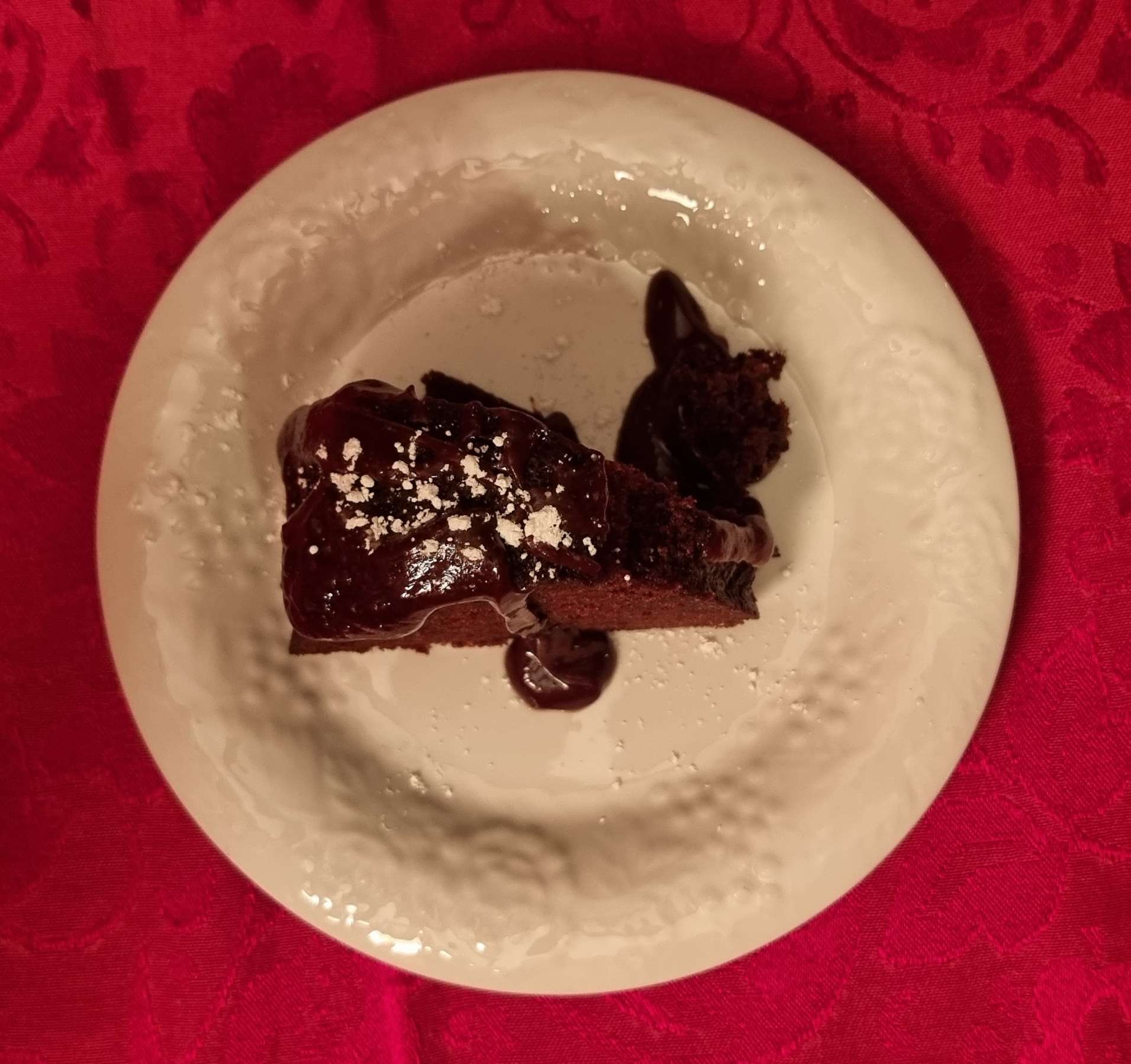
After checking in to our Motel for the evening (very nice it was too), we set off to the Historic Hotel Greybull & The Speakeasy restaurant, where we enjoyed cheese & spinach ravioli & chocolate fudge cake, washed down with a local IPA!
Stage Stats – 54 miles, 771 feet of climbing. Into a cross/headwind for most of the day.
The Long Way Round (Part Two) – Monday 20th to Wednesday 22nd June.
Monday 20th June – Driggs to Jackson (Stage 40).
Rain was forecast from 10am in both Driggs & Jackson, so we took the decision to get up a bit earlier & be ready to leave by 9am, so at least we would start riding in the dry. There was another long distance cyclist from the UK staying in our motel & we set off almost together, however, he was soon a long way up the road!
Leaving Driggs, we picked up a cycle track almost immediately that we’d be able to use for the first 9 miles until we reached Victor. We could see rain showers falling to either side of us, but somehow we remained dry – even one of the horses looked on in surprise! You may be able to see in the 2nd photo that Sean had taken most of his kit out of his rear left pannier, we were hoping that the reduced weight would increase the chance of the pannier surviving until Jackson.
When we reached Victor, two things happened; firstly, the cycle track ended so we were back on Highway 33. Secondly, the road started to gradually head uphill, as we joined the very early & easy slopes of the Teton Pass. As we passed Trail Creek Pond we spotted an eagle who had a fish dangling from its talons as it flew by – sadly it all happened too quickly to get a photo, but it was a great moment & the first time I’d ever seen this happen in real life!
We followed the Trail Creek as it climbed the valley & after a couple of miles we reached the State Line crossing from Idaho into Wyoming (the Highway changed from ID 33 to WY 22). This also marked the point at which the gradient increased from about 2% to 4 – 5%, still very manageable, it just made for slower going.
Because the summit of Teton Pass was over 8,000 feet above sea level, I’d researched the climb. This isn’t always a happy place to be, as I knew that from the next corner to the top (about 4 miles in total), the gradient wouldn’t dip below 9% & would max out at 13% – in the first photo you may be able to make out a thin line just to the left & above the treeline, this is the road. The second photo is taken from that spot looking back down the valley into Idaho.
In the video below I tried to downplay the steepness of the climb for my own confidence – as you’ll see, I was struggling to keep pedalling, breathing & talking at the same time!
As we climbed higher, we saw two more cyclists daft enough to be climbing the brutal Teton Pass & as we passed them very slowly, we gave them encouragement to keep at it & focus on the vast vistas around a few more corners. As we continued on our way, we could see the first indications that blue skies were coming our way! We’d avoided the rain all morning & couldn’t believe our luck – perhaps the price was having to tackle the steep slopes!!
We finally made it to the summit at 8,432 feet (2,570 metres) above sea level & after taking a few moments to gather ourselves, we took a photo & then admired the spectacular views into the Jackson Hole valley from the lookout point.
I took a video of the first 30 seconds or so of the descent, but I picked up speed so quickly I had to put the camera away – LOOK AWAY NOW MUM!!! I hit 53mph in next to no time & decided that was fast enough for me. I’ve not been that fast on my carbon bike!!! I won’t lie, it was exhilarating, but I knew not to push my luck.
There are a couple of great turnout spots (layby to the Brits). At the first one I could see back to the lookout point a couple of miles away, while the second & third viewing spots gave huge views of the valley as it spread out below.
We regrouped at Wilson & agreed that we should continue on to Jackson, so Sean could try & get his pannier fixed. It was a short 5 mile ride along the valley floor – I’d done some research the night before, so knew that there was a bicycle shop next to our hotel that may be able to help. Within 15 minutes The Hub Bicycles had been able to repair Sean’s pannier – they were absolute legends & wouldn’t even accept any money for doing the work! On an adventure like our we’re totally reliant on the kindness & generosity of others to keep us on the road – The Hub Bicycles helped us out big time. Thanks guys! I’ve dropped them an email, so I’m hoping they may see how much it meant to us.
While we were waiting to check in to our motel, we met Owen & Cat, a couple of Brits who were also doing a long distance adventure. They’d started in Eugene & were following the Trans America route towards Virginia (via Colorado, Kansas, Missouri & Kentucky). We shared a really enjoyable 1/2 hour trading stories of our adventures so far.
We also went for a quick stroll around the historic part of town. Jackson is famous for its iconic Elk Antler Arches at the four corners of the park. The first arch was erected by the Rotary Club in 1953. Additional arches were added to the other 3 corners of the park between 1966 & 1969.
Elk Antlers have a life span & they begin to decompose after 30 to 40 years, so the oldest arch was rebuilt in 2007, followed by the other 3 arches in 2009, 2011 & 2013. Each arch is in the region of 10,000 to 12,000 pounds in weight (a single antler weighs about 5 to 10 pounds ) & the antlers are are individually weaved into a steel frame.
Final fact – the local boy scouts go out in the Spring when the arches are due to be replaced & pick up the antlers that Bull Elk have shed following the winter.
Stage Stats – 33 miles, 2,431 feet of climbing. One big hors categorie climb taking us over 8,400 feet above sea level.
Tuesday 21st June – Jackson to Lizard Creek Campground, Teton National Park (Stage 41).
We were on the road for 9.45am & retraced the 5 miles back to Wilson, using the car-free bridge to cross the Snake river & ride through Rendezvous Park (spot the Giant in the 3rd photo!).
For the next 10 miles we had our own cycle path which ran close to the road, but made for very relaxing & enjoyable riding. We saw a couple of runners & 3 cyclists, so we could take in the mountain views all around us. Before we knew it, we’d passed Teton Village & arrived at the entrance to Grand Teton National Park – thank you to the Ranger on the gate who humoured me when I asked for a selfie!
This isn’t a very popular entrance for cars, as the road quickly turns to rough gravel. The quieter roads increase the possibility of seeing wildlife & within 1/2 mile we’d spotted an eagle surveying the world from its eyrie. Tackling the 4 mile off-road section, it felt like we had the park to ourselves as we cycled through the forest. I’m writing this on 28th June & it’s a year ago to the day that I first went off-road on my touring bike – we were on Day One of a 5 day cycling trip to Wales & we did a mile or two of gravel on the Monmouth & Brecon canal towpath – how my adventures have grown!!!
The quiet backroad took us past babbling brooks & creeks which led into or out of the many small lakes & ponds. Then as we turned a corner the forest was replaced by plains & prairie as far as the eye could see. This signalled that we were nearing the end of our remote riding on Moose Wilson Road, but there was plenty more stunning scenery ahead of us.
We joined Teton Park Road at Moose, stopping to see the Visitor Centre along the way – I have a few friends (Jo & Tazzer – this is for you both!!) who will appreciate this next set of photos as they’re into Moose. I’ve added my favourite mousse photo!!!
Grand Teton National Park has gone to great lengths to be cyclist & pedestrian friendly. From Moose to Jenny Lake (about 10 miles) we were once more on a separate cycle path. Over billions of years, natural forces including earthquakes, glaciers & erosion have shaped the Teton mountains. The gneiss that makes up much of the range was formed 2.7 billion years ago when the sea floor sediments & volcanic debris were buried up to 18 miles deep as two tectonic plates collided – similar to what is happening to the Himalayas today.
The Tetons are young in geological terms, the uplifting which created them only commenced 10 million years ago. The range continues to uplift one earthquake at a time along the 40 mile Teton fault, a north-south crack in the earth’s crust. As the region is stretched in an east-west direction, this causes stress which is released in the form of an earthquake, lifting the mountain block skywards, while dropping the valley floor.
On average, the fault moves 10 feet with each earthquake – the mountain block rises 2 to 4 feet up, as the valley floor drops 4 to 6 feet. Over 10 million years it’s estimated that the total offset is about 25,000 feet – the flathead sandstone on Mount Moran (to the west of the fault) is at 6,000 feet above the valley, while the same layer is buried 20,000 feet below the valley floor on the east side of the fault. Enough with the geology lesson, here’s some more jaw-dropping scenery!
The Grand Teton National Park also has a number of alpine lakes, some natural & others man-made to manage water levels & to create hydro-electric power. When combined with the majestic backdrop of the mountains, the views are out of this world. Jenny Lake is the centre piece of the park, with views of Teewinot Mountain, Mount St John & Cascade Canyon (directly between Tweddle Dumb & Tweedle Dumber!) – you may be able to make out a rowing boat behind us too.
Further up the valley is Jackson Lake – it’s a 400 foot deep natural lake, that was modified in 1916 by the Bureau of Reclamation when they added a 39 foot dam to the lake & rebuilt it in 1989. The lake is a remnant of glacial gouging from the Teton mountain range to the west & the Yellowstone basin to the north. It extends 15 miles up & 7 miles across the valley & is one of the largest high altitude lakes in the USA.
Continuing up the valley, it became more obvious that the water level in Jackson Lake is currently quite low, as more of the shoreline beach became visible. We stopped briefly at Colter Bay Village (a grand name for a gas station, if ever I heard one!) where we stocked up on sandwiches, crisps & fruit for our gourmet dinner later.
Lizard Creek Campground, where we’d be camping for the night was a mere 8 miles up the road. When we arrived, our friendly campground hostesses Marni & Mandy welcomed us & made sure we found our pitch for the evening.
We set up camp, then ate our luxury dinner of ham & cheese sandwiches with either salt & vinegar or plain crisps. A little after 9pm we took a 2 minute stroll to the shoreline of Jackson Lake, where we watched the sun go down – huge thanks to Sean for sharing his sunset photo with me. The perfect end to the perfect day. Grand Teton National Park is a breathtakingly beautiful place & I’d encourage you to make time to visit if ever you’re in the region to see Yellowstone – you won’t be disappointed.
Stage Stats – 64 miles, 2,005 feet of climbing. Sunshine & blue skies all day as we explored a lesser known gem of a National Park.
Wednesday 22nd June – Lizard Creek Campground, Teton National Park to Grant Village, Yellowstone National Park (Stage 42).
It was bitterly cold overnight (below freezing) – I bought a beanie on 19th May in Sandpoint for just such an occasion & slept in it last night, along with long legged thermal bibs & a long sleeved jersey. We were on the road by about 10am & continued on a constantly rising road for 6 miles through a section of burned forest, before exiting Grand Teton National Park on the John D Rockefeller Jr Memorial Parkway as we headed towards Yellowstone.
John D Rockefeller was the only son of the founder of Standard Oil (now Exxon or Esso depending on which side of the Pond you’re from). He was a philanthropist & financier who donated $500 million to a wide range of causes, including Grand Teton, Acadia & the Great Smokie Mountain National Parks. Congress dedicated a parcel of 24,000 acres of land to recognise his contributions.
He was also involved in the Rockefeller Center (US Spelling), making him one of the largest real estate holders in New York City at one point. I’d encourage you to do your own research to better understand how he amassed his wealth so he could become a philanthropist. It’s not a simple or straightforward story so I’ll leave you to draw your own conclusion.
I’ll remember the stretch of road between Grand Teton & Yellowstone National Parks for two unrelated reasons.
Firstly, it’s where I experienced my first p*nct*re of the adventure – it took between 15 & 20 minutes to unload the bike, check the tyre, fit a new innertube & be on our way again. I’ll try & remember to take a photo next time!
Secondly, we cycled down the hard shoulder, passing a 4 mile tailback of cars queueing to get in Yellowstone’s South Entrance. As an aside, when we stayed at West Yellowstone, we were less than 1/2 mile from the West Entrance Gate – we took a 227 mile detour to get into Yellowstone via the South Gate. But look at the unexpected adventures the last week has brought us!
A friendly Ranger took a photo of us both by the Yellowstone sign, before we set off up the Snake River valley.
Yellowstone opened today for the first time in over a week – while this increased queues for cars trying to get into the park, the upside was no traffic was leaving the National Park, so traffic could overtake us safely whenever they wanted to. The climb up the Snake River valley was relentless – never steep, but also never ending as we threaded our way through the forest!
As we headed towards the rim of the canyon, views to the other side of the valley opened up, with occasional sightings of the river below.
Then all of a sudden the Snake River revealed itself as it cascaded down the valley at Moose Falls & Lewis Canyon Falls – there was white water all the way, suggesting that the water was fast running & the river lost height quickly.
Although the climbing hadn’t quite finished for the day. we were now on much kinder gradients – instead of fast running rivers, we were surrounded by lakes that fed into the Lewis River. As we passed Lewis Lake itself, we knew the climbing was at end end & we had a reward waiting for us……
We were on the Continental Divide once more! After a quick selfie, we were on our way again for the gentle descent into Grant Village, where we’d managed to secure a non-air conditioned, no tv, flaky wifi room for the bargain price of $366 (including tax) between us. Luckily sandwiches were slightly cheaper than that at $8 each, but dinner in our room still cost $35 each, including a tinny to celebrate making it to Yellowstone in the first place!
Tomorrow our Yellowstone adventure continues!
Stage Stats – 31 miles, 2,251 feet of climbing. Sunshine & blue skies all day again as we said goodbye to Grand Teton National Park & hello to Yellowstone National Park.