Tour de Suisse Summits – Tour de France Stage 17 – July 2016

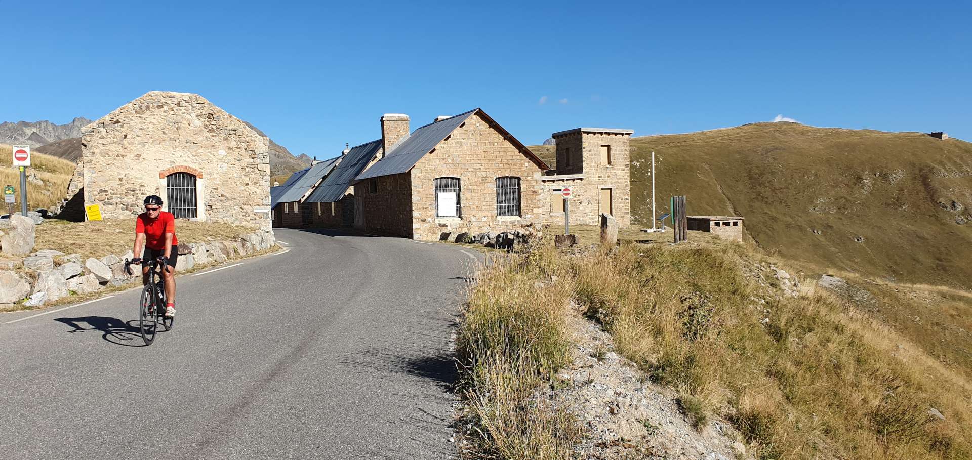
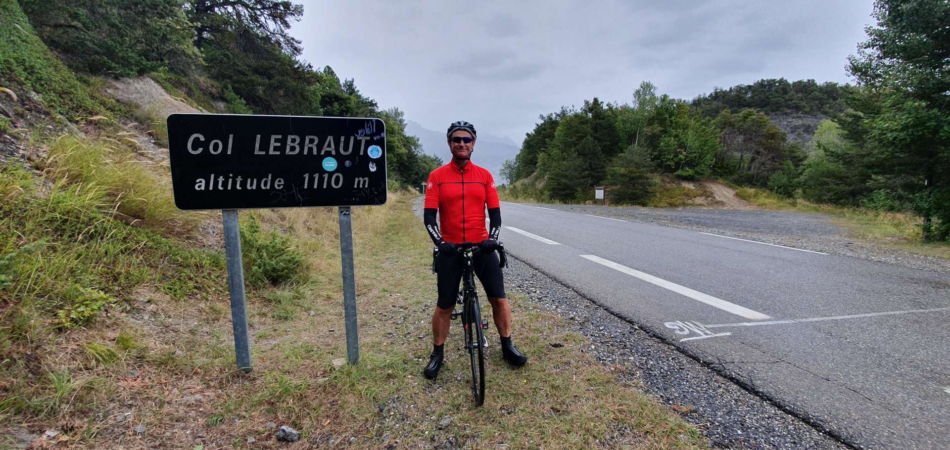
Col de la Forclaz & Col de la Guelaz – Day Five

The Queen Stage of the Swiss Alpine Adventures trip – the final two climbs from Stage 17 of the Tour de France 2016 (Col de la Forclaz & Col de la Gueulaz up to Lac d’Emosson). This is likely to be a pivotal stage in this year’s Le Tour & the big names of Froome, Contador, Aru, Quintana, Van Garderen & Porte are expected to duke it out for overall victory.

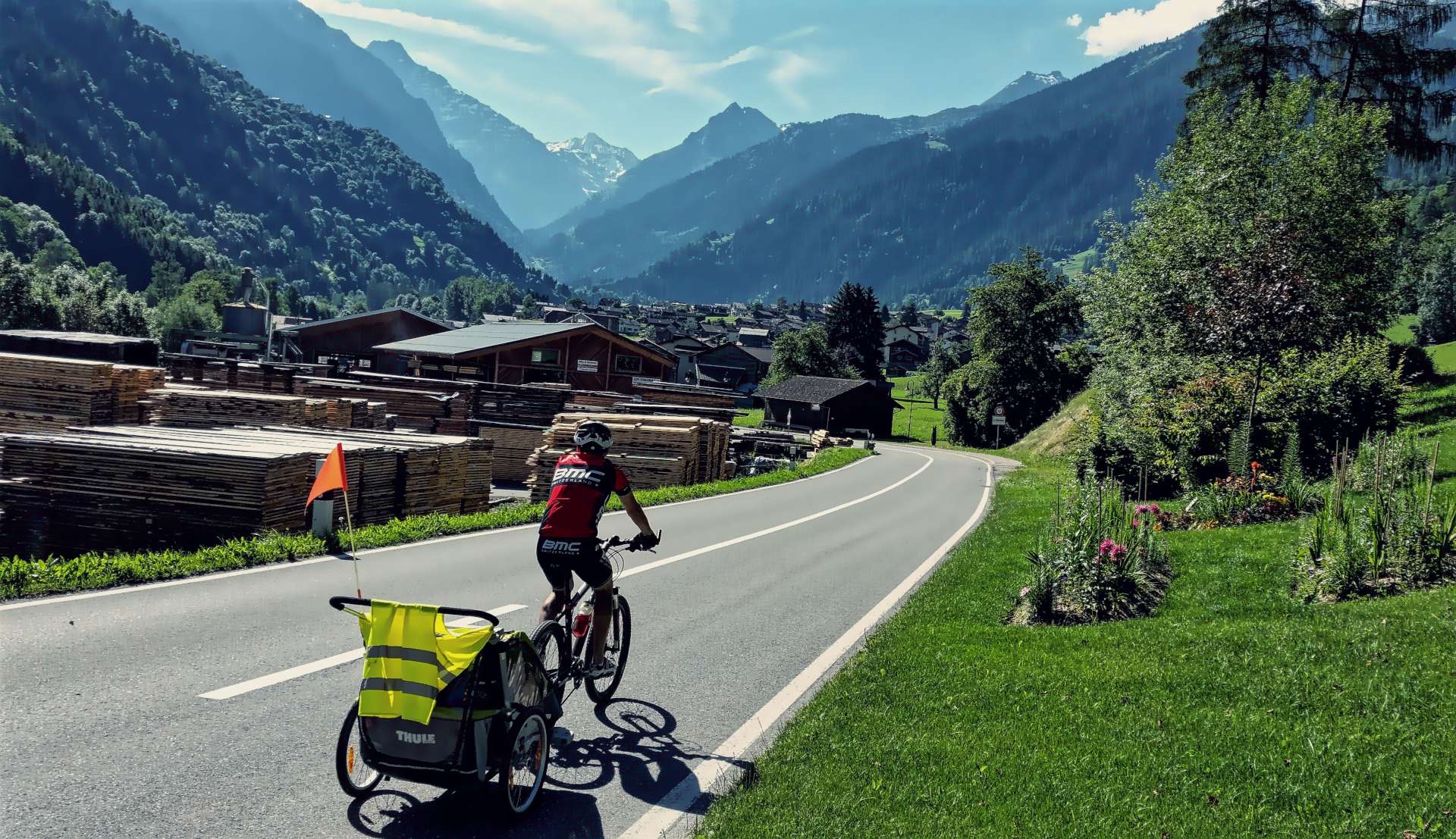
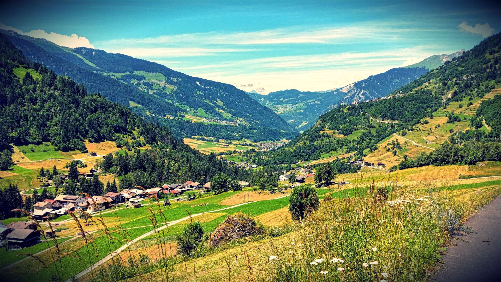
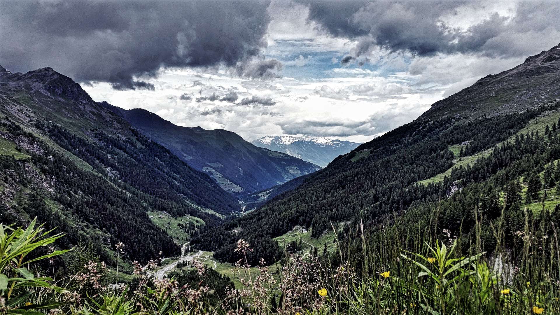
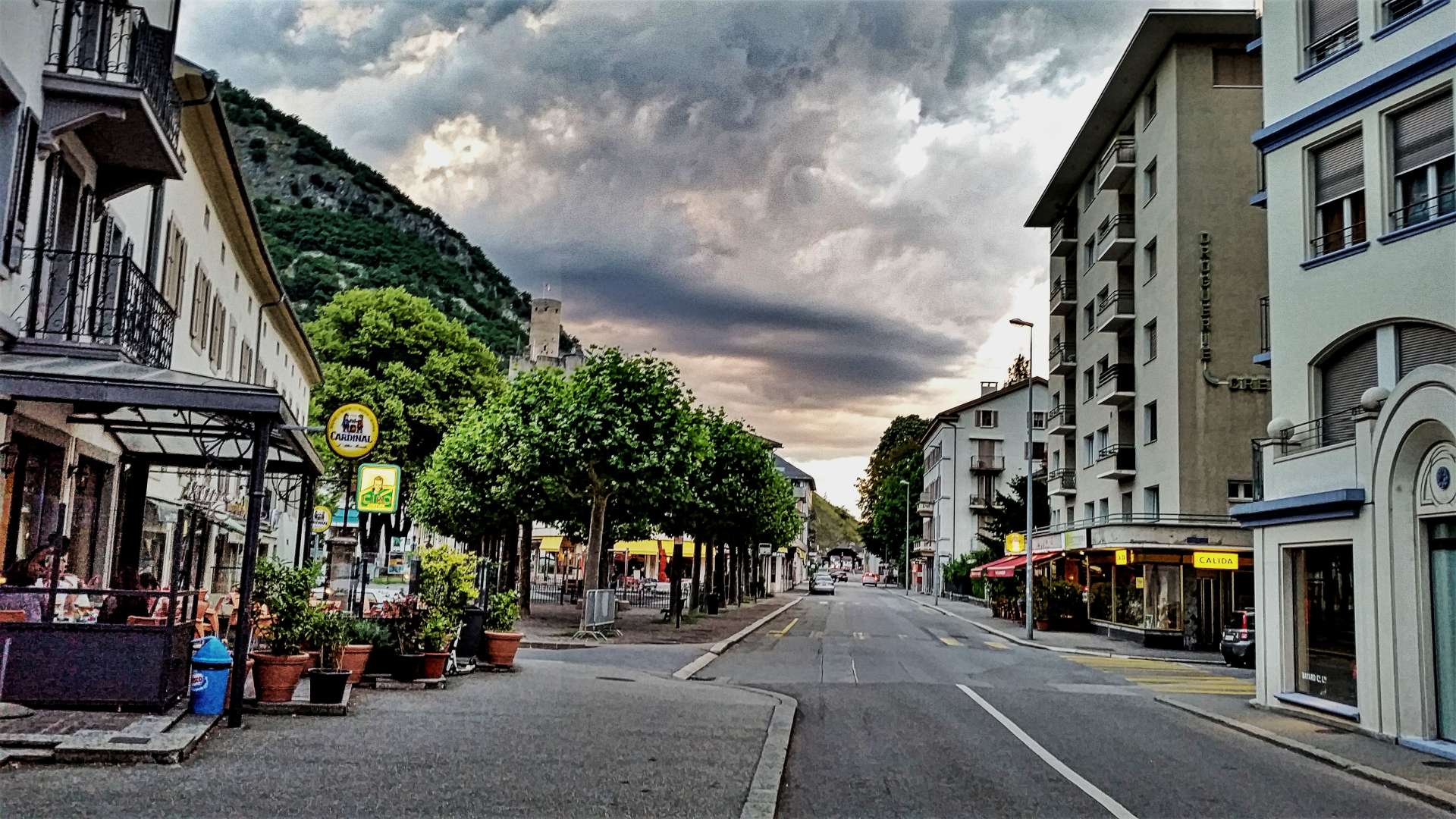
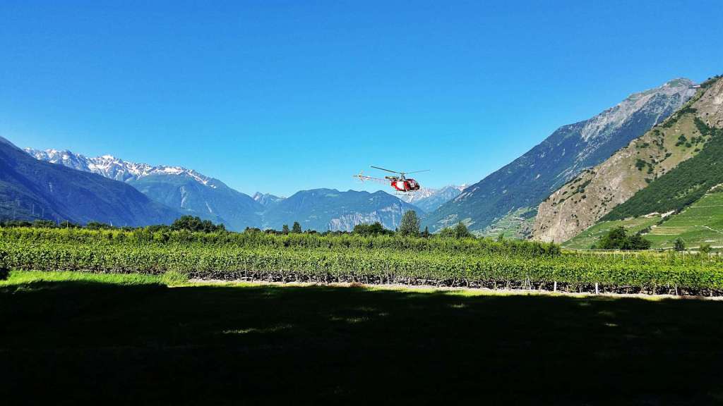
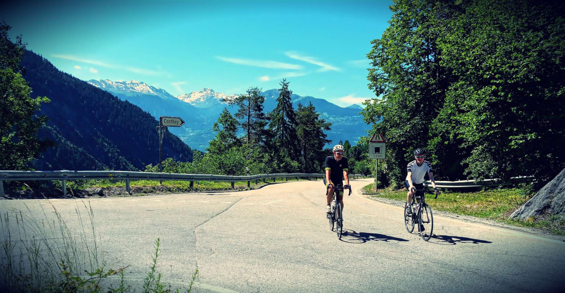
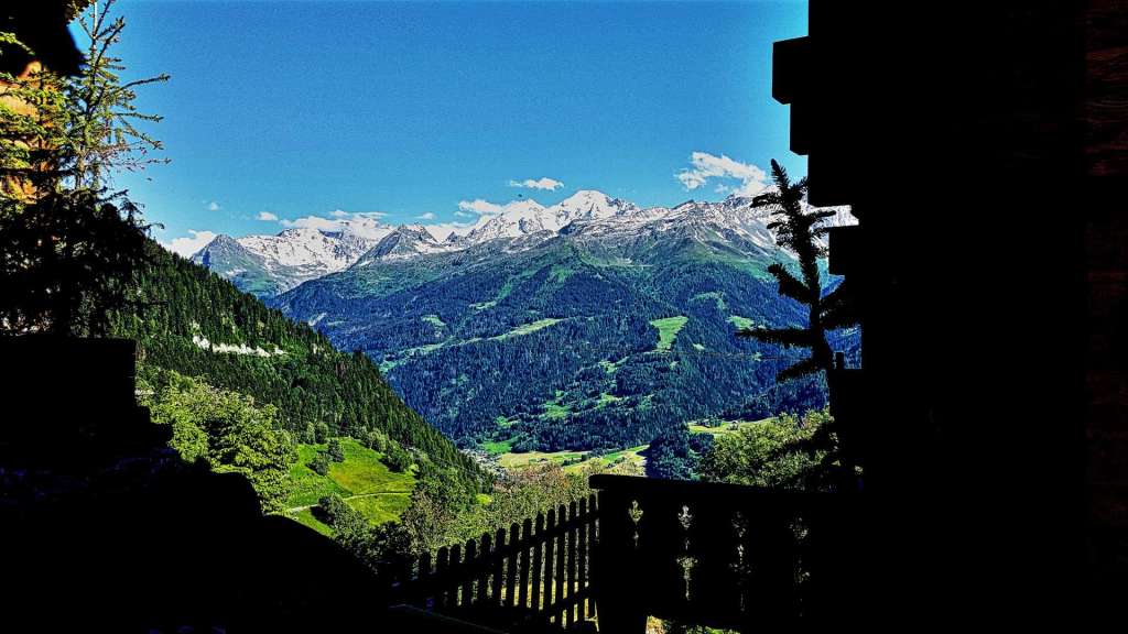
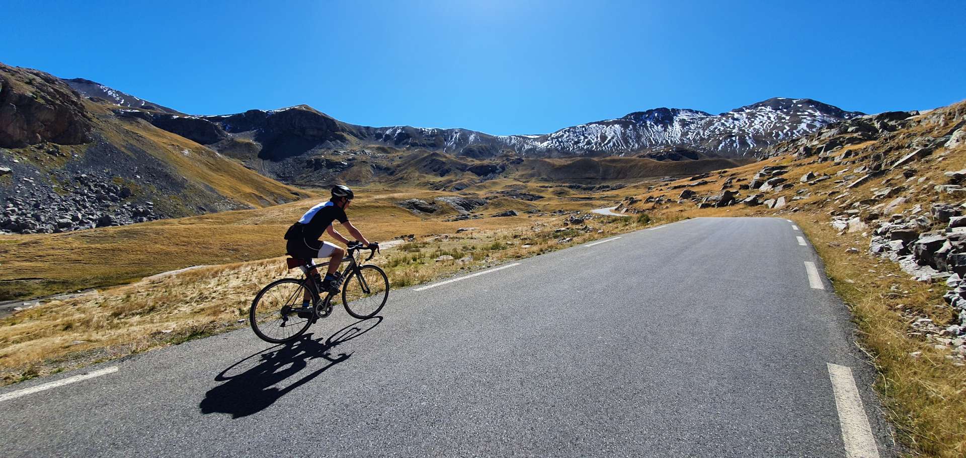
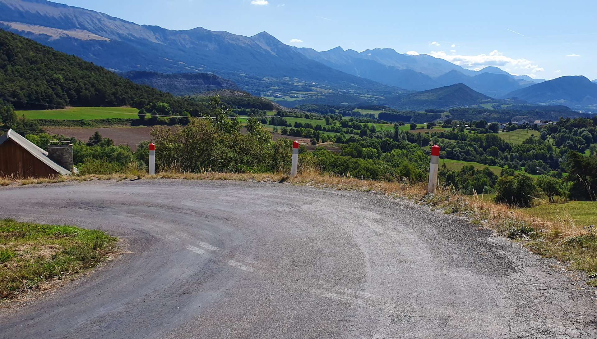
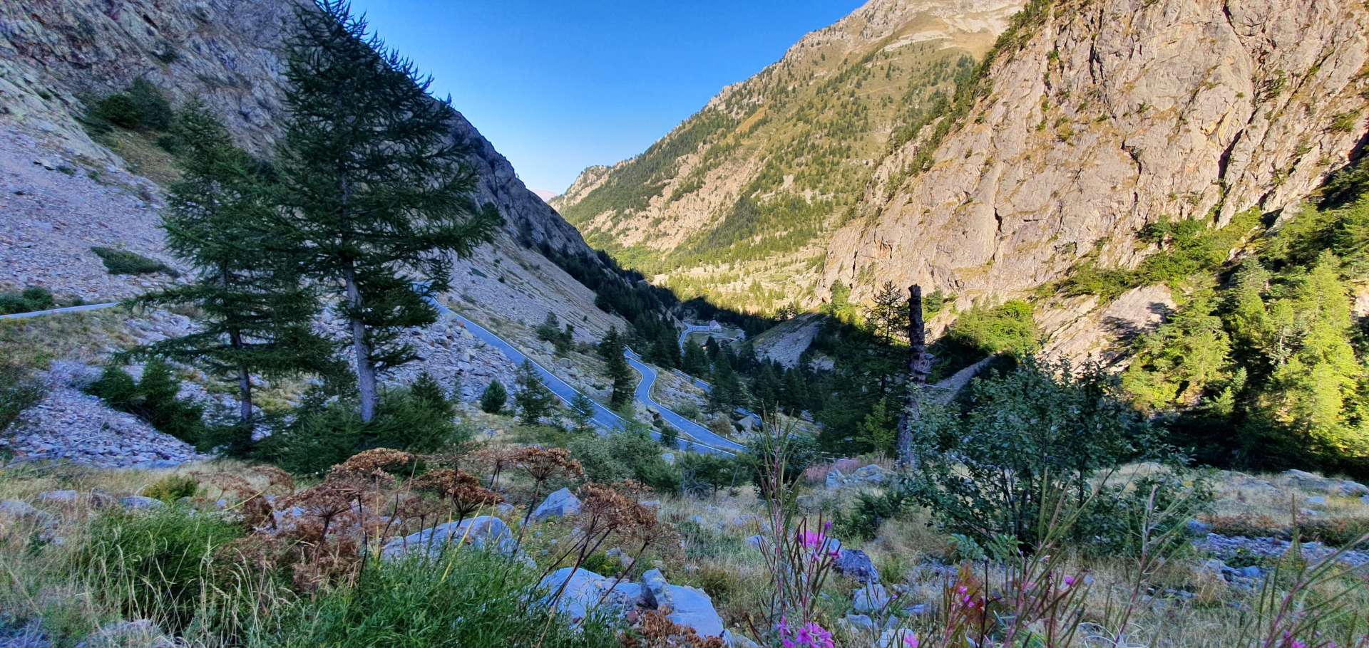
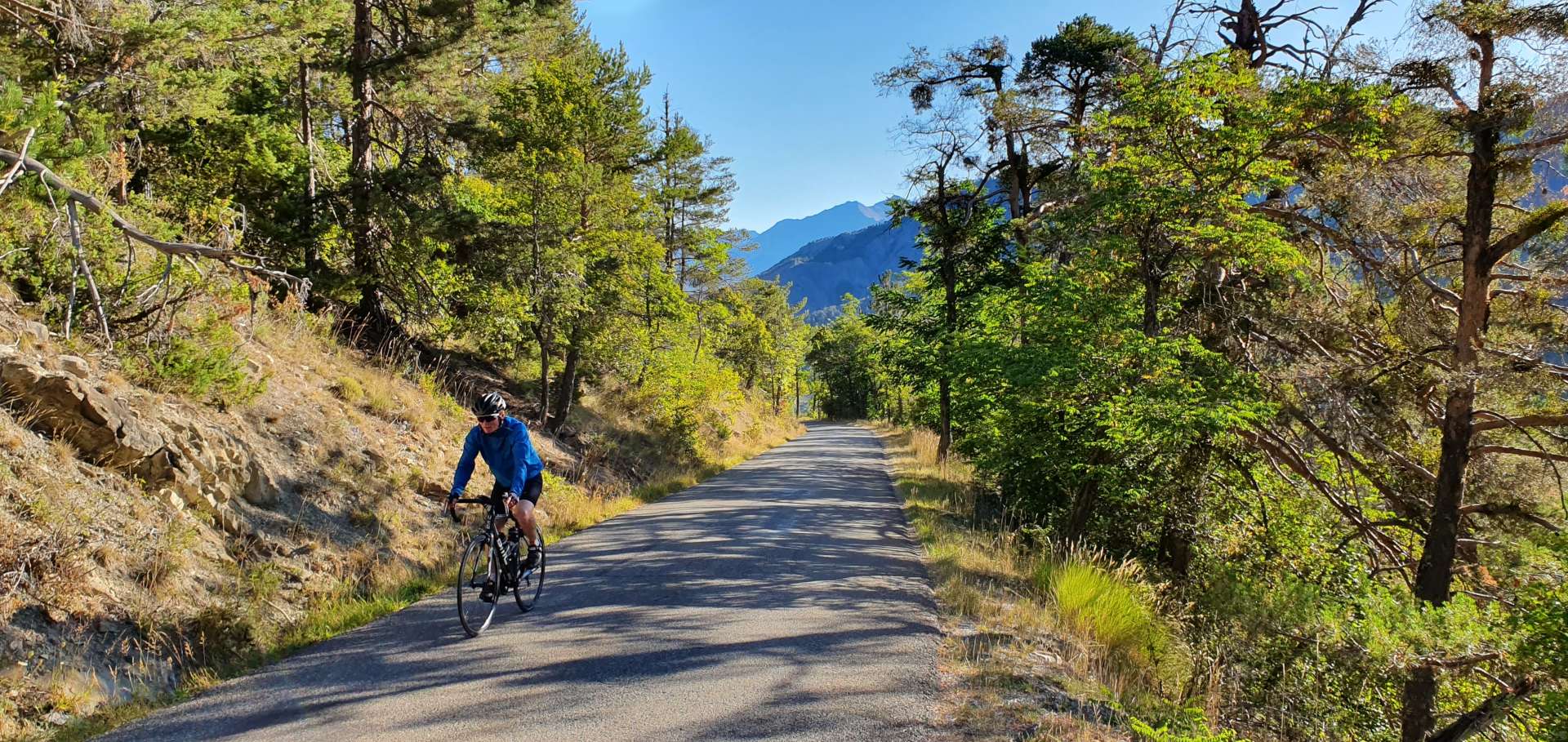
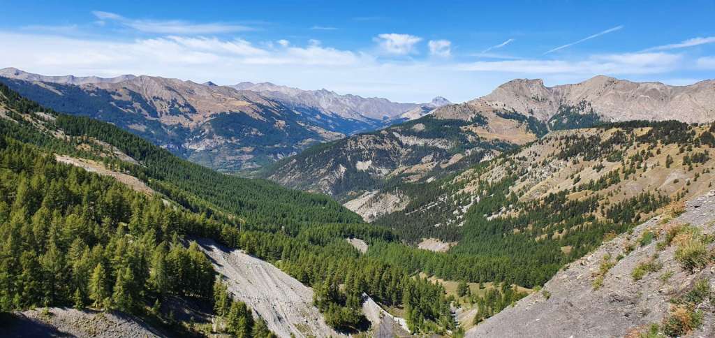
Le Tour will be heading up the St Bernard Pass for about a mile, before taking a right turn up the old road to Col de la Forclaz. We followed this route too & the early slopes took us past vineyards & through small villages – the first surprise was that the gradient was significantly steeper than we expected, as it regularly popped over 12%. The views over Martigny & the Rhone valley below became more spectacular & by the time we joined the new road we’d climbed over 1,000 feet in just under 25 minutes.

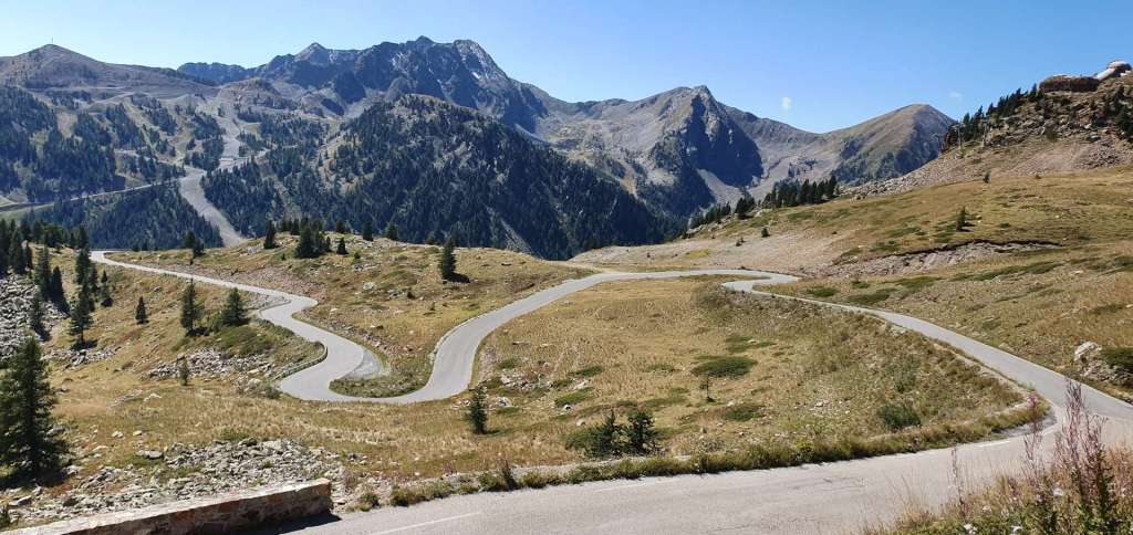
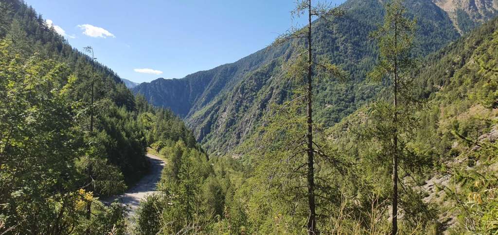
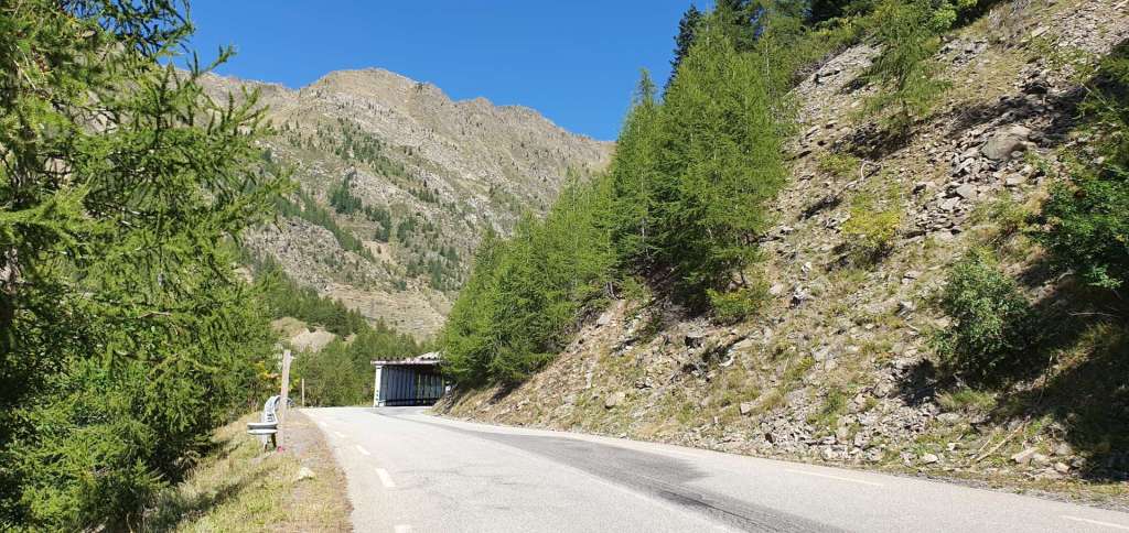
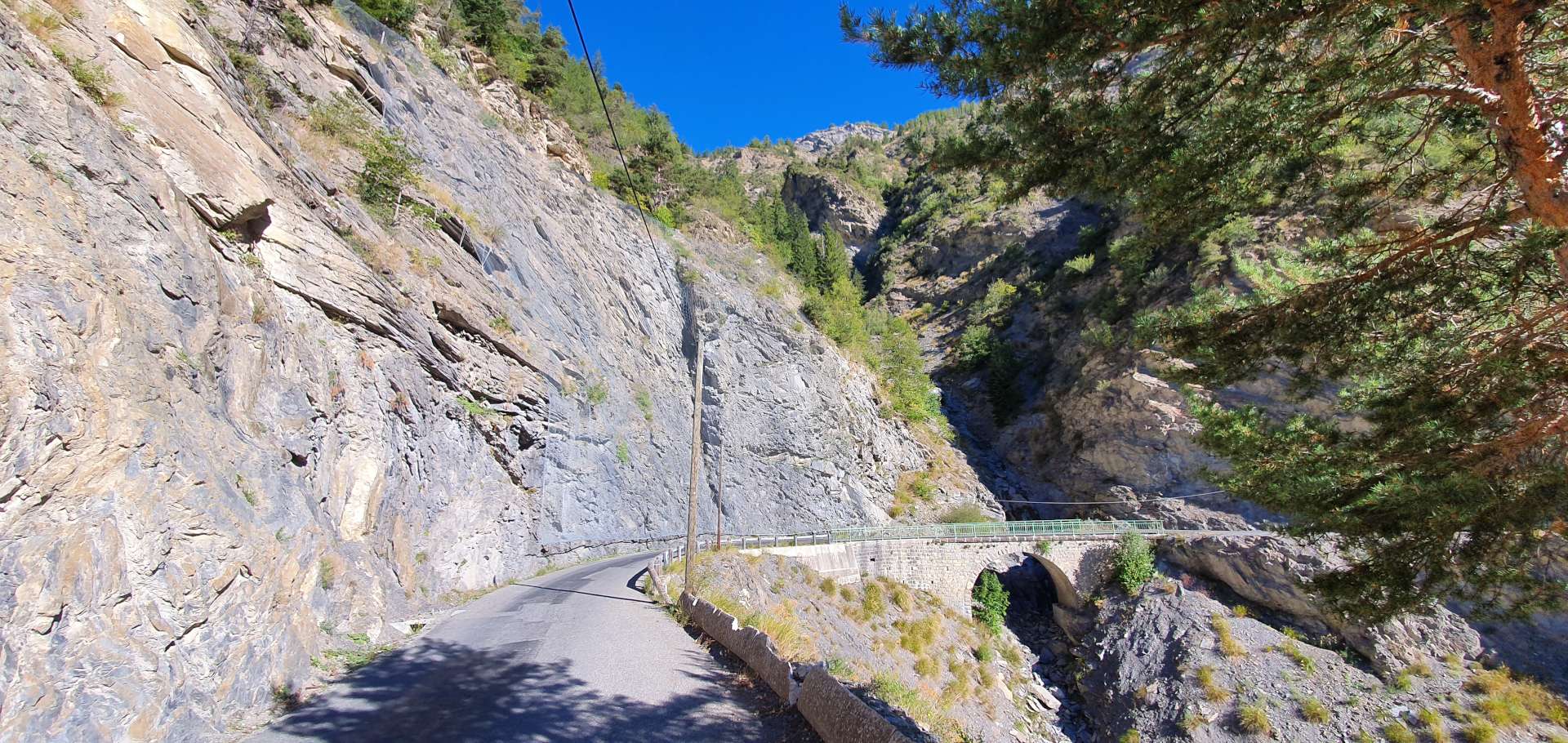
The new road has a very consistent 7.5% to 8% gradient all the way from Martigny up to the summit at Col de la Forclaz (narrow gap in French), as it twists & turns up the side of the mountain. A stunning climb that offers huge views from the café at the summit. Although this is the main road between Martigny (in Switzerland) & Chamonix (in France), the traffic today was relatively light, allowing us to enjoy the 4 mile descent to Trient – this included a tunnel that had motion activated lights that came on as we cycled through it!

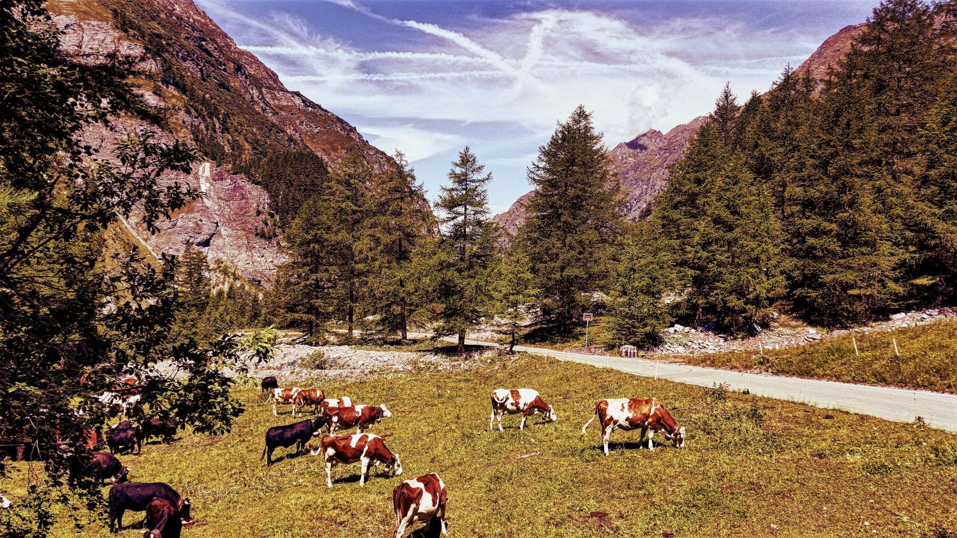
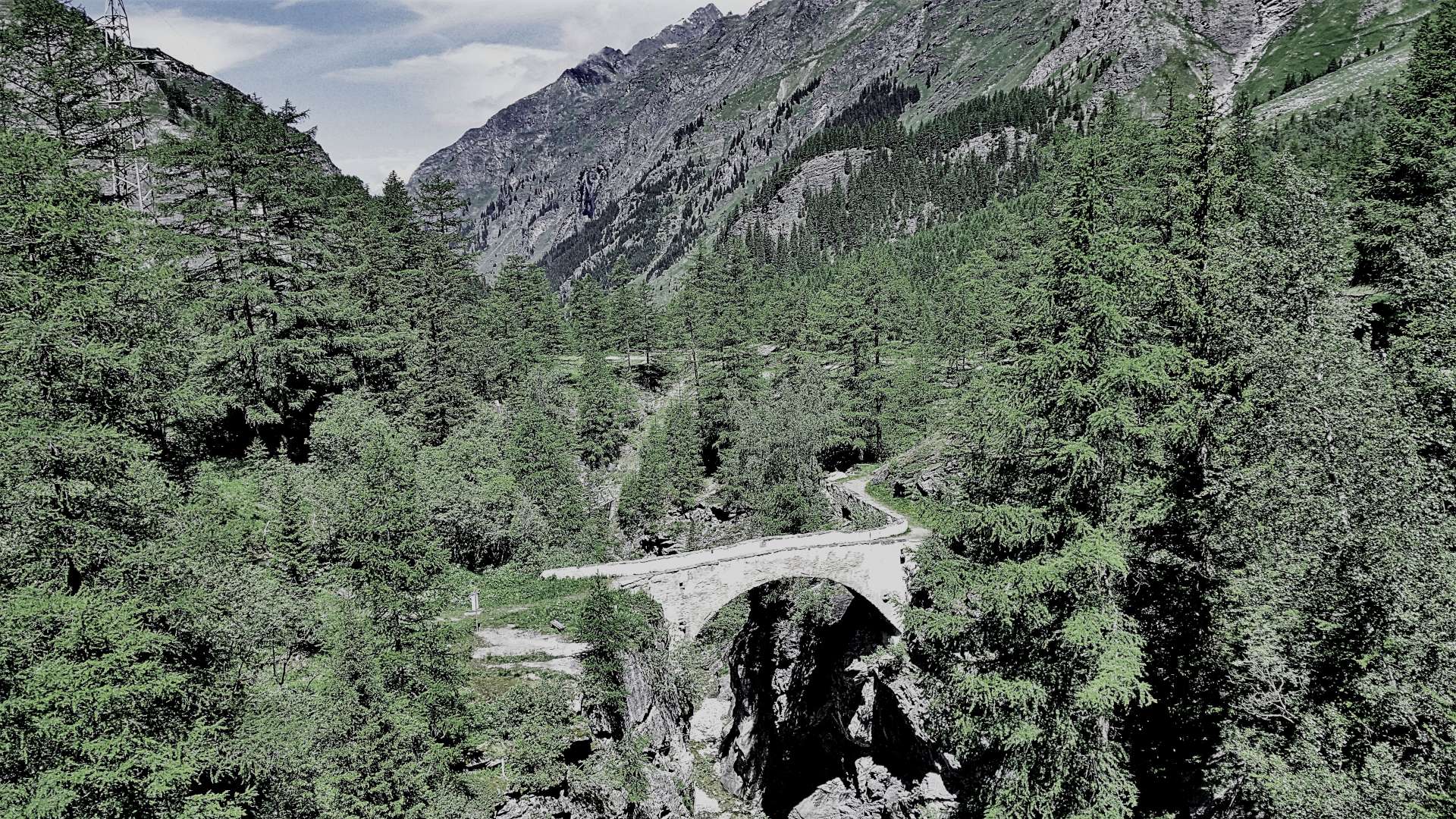
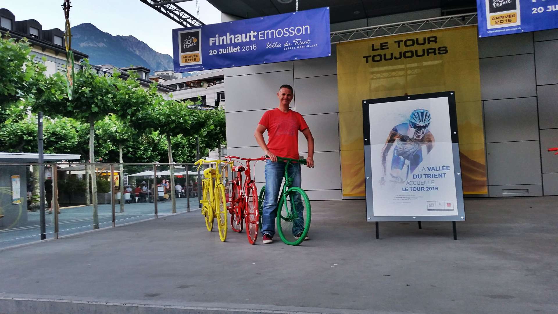
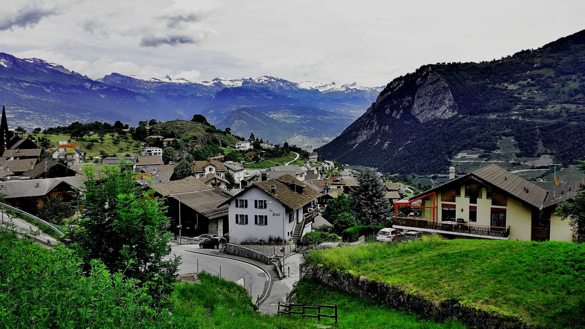
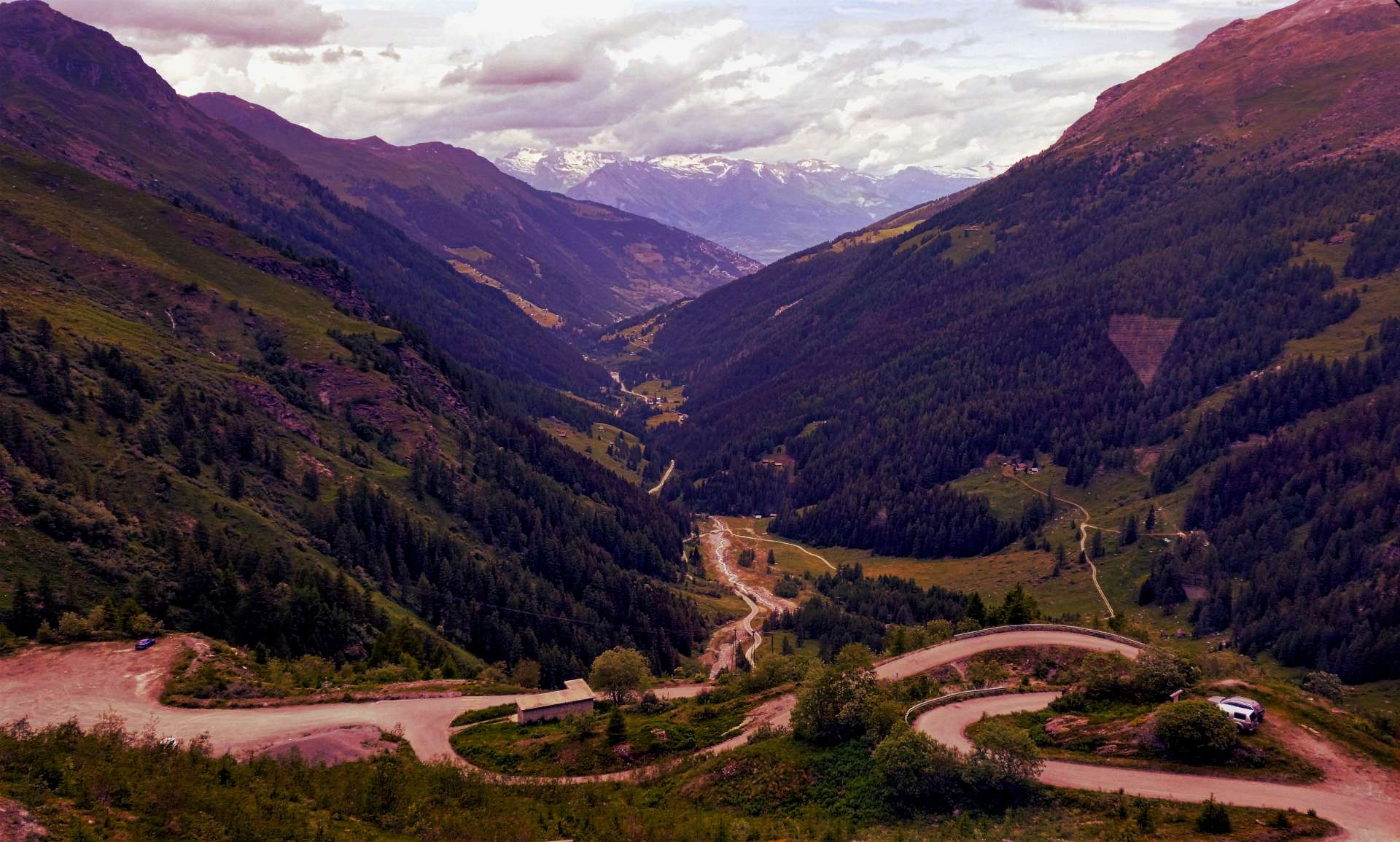
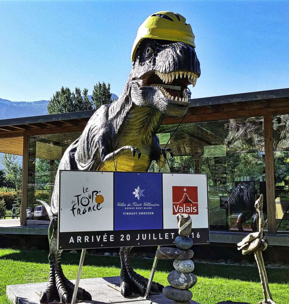
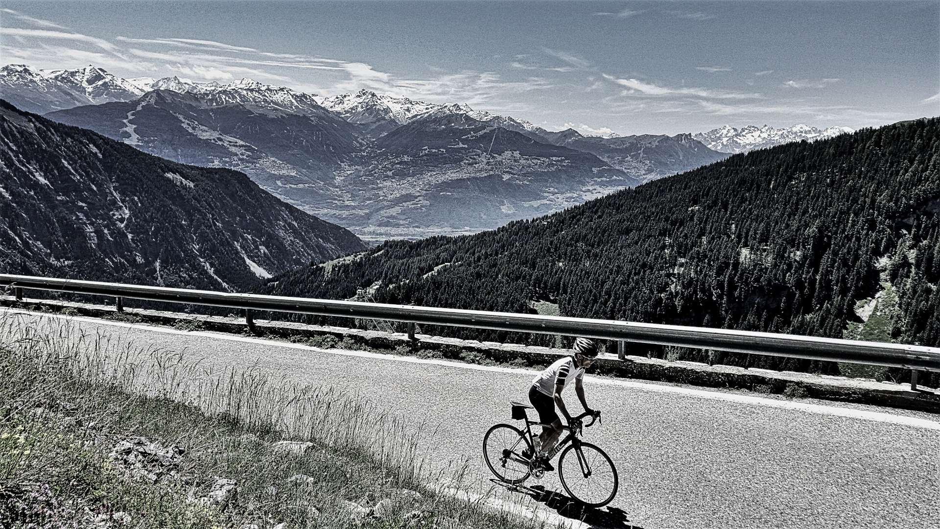
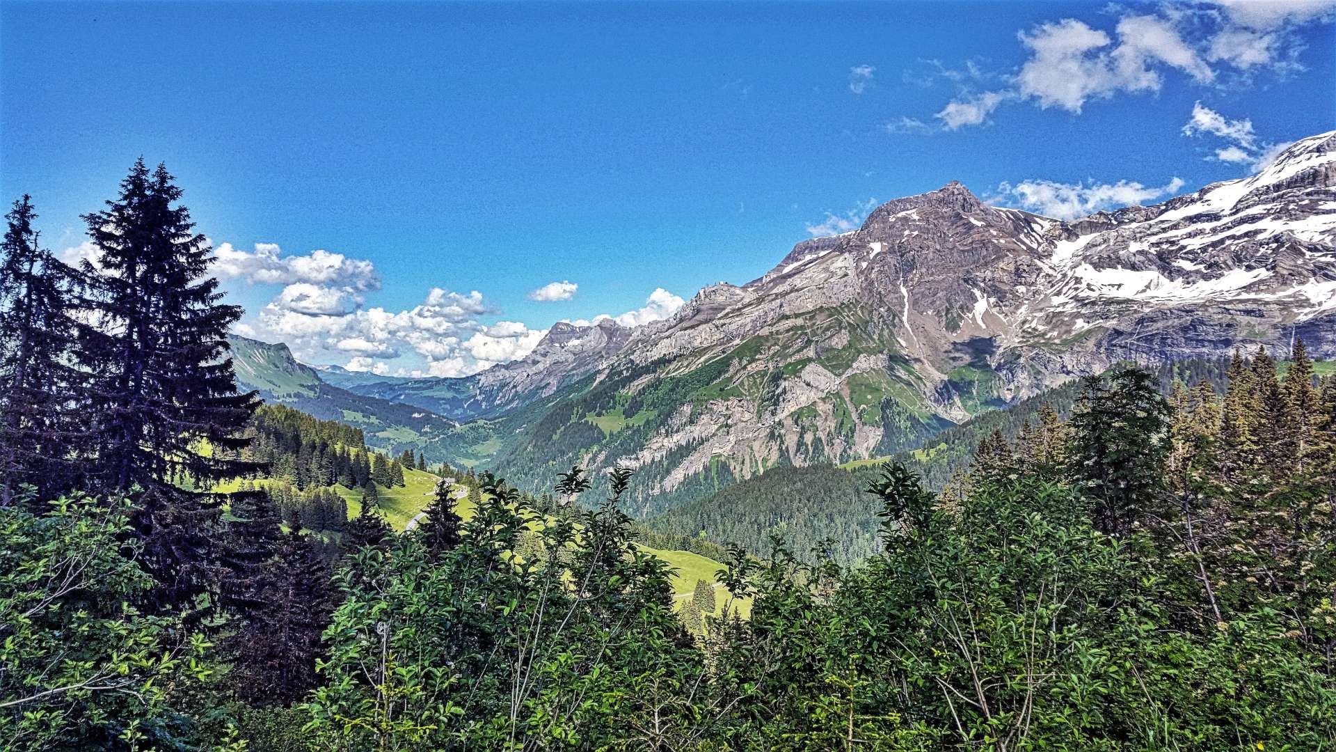
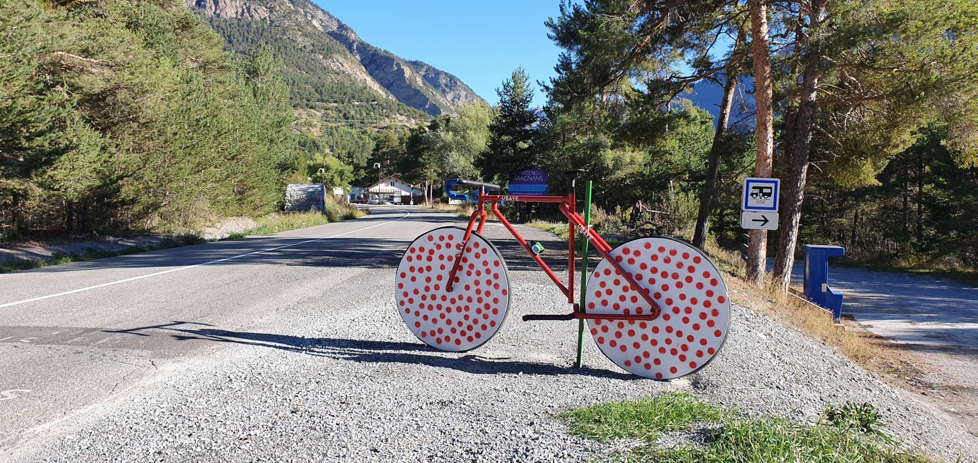
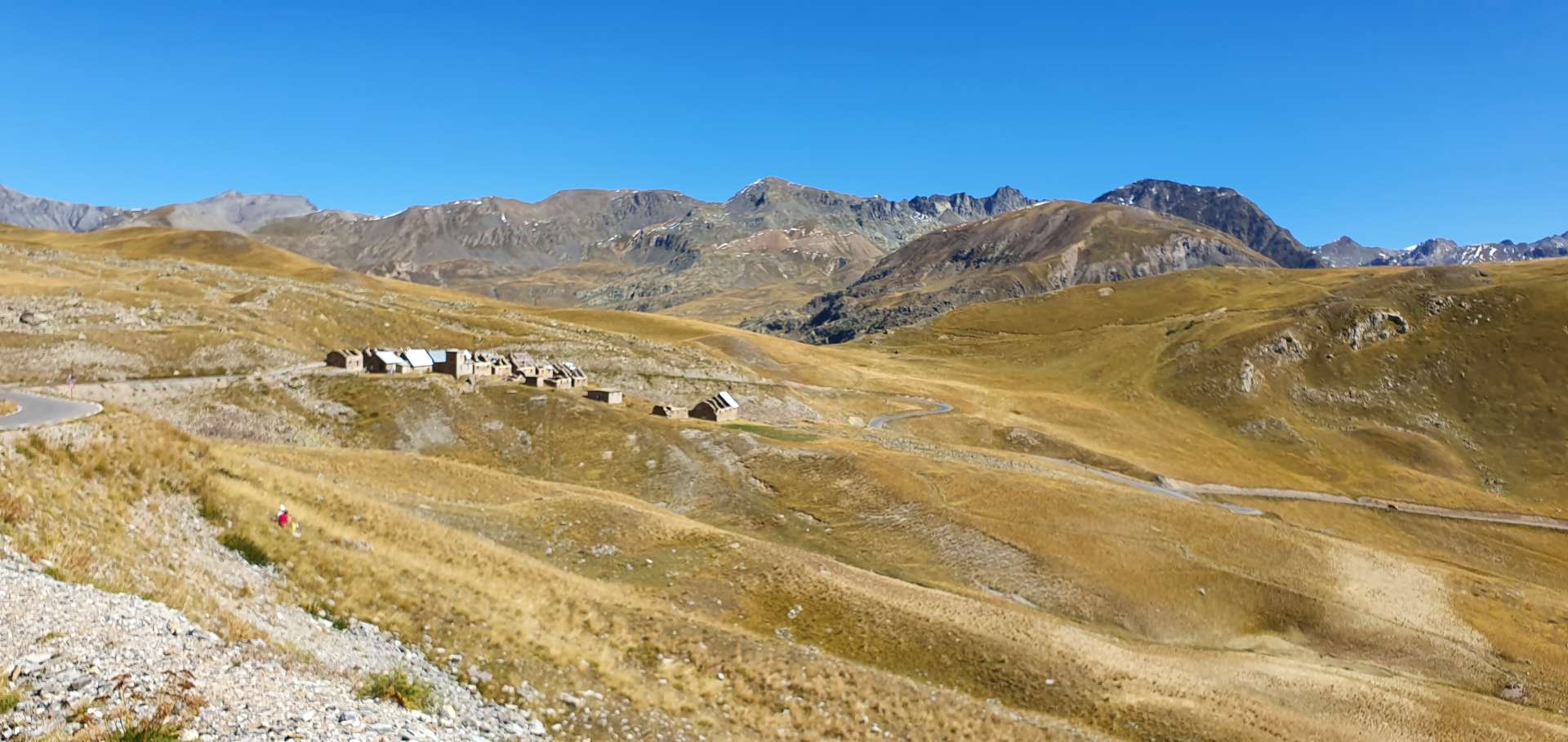
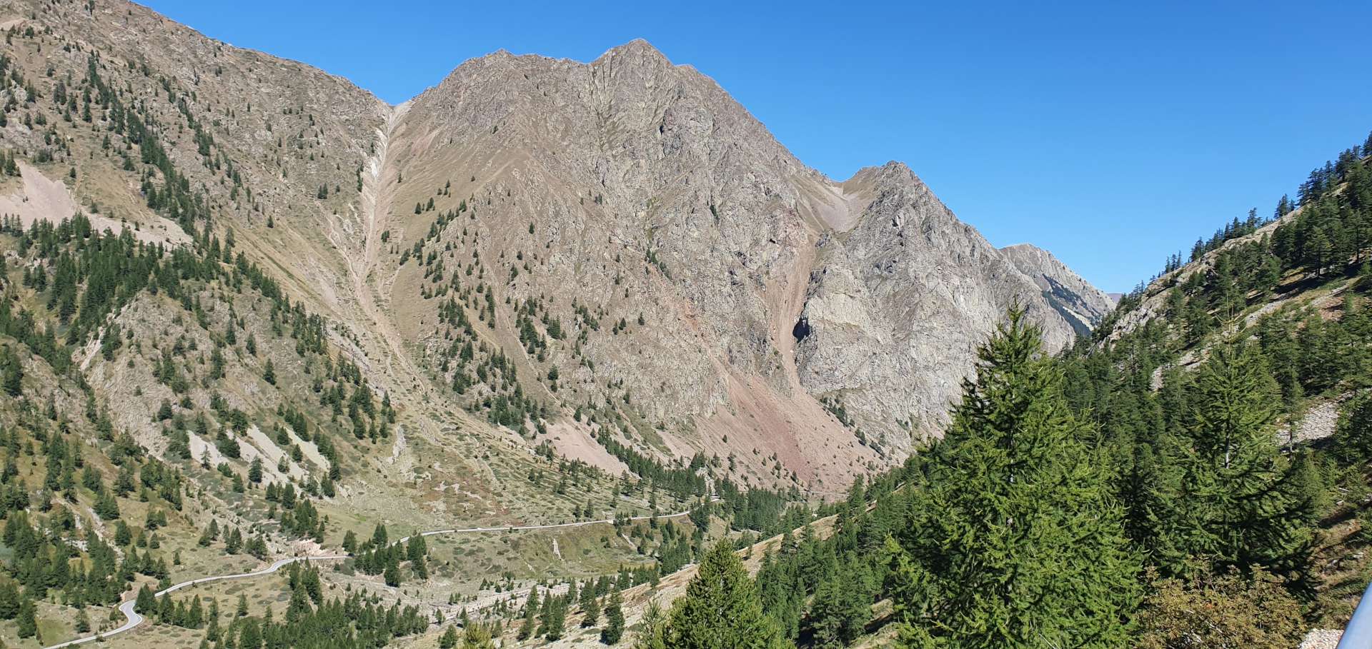
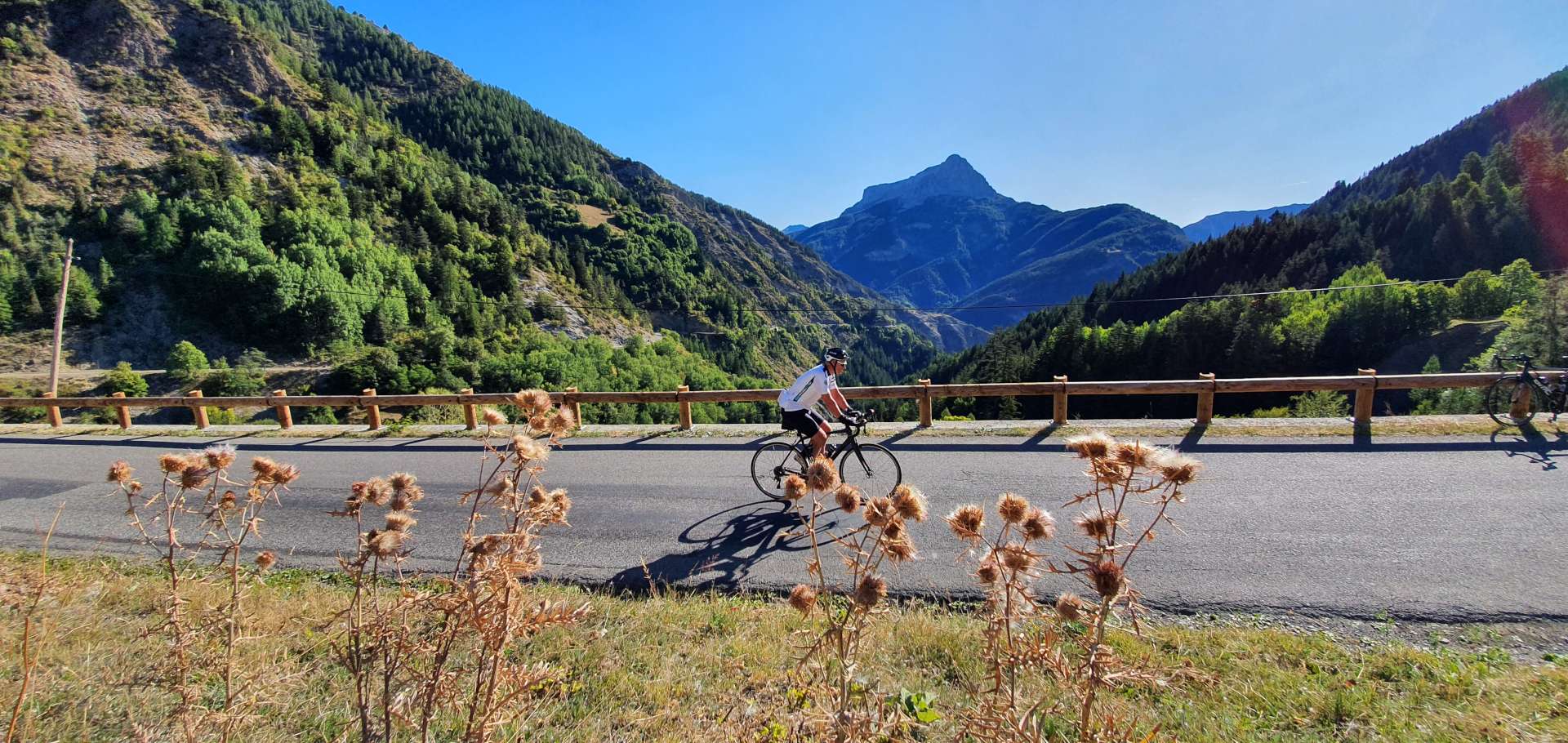
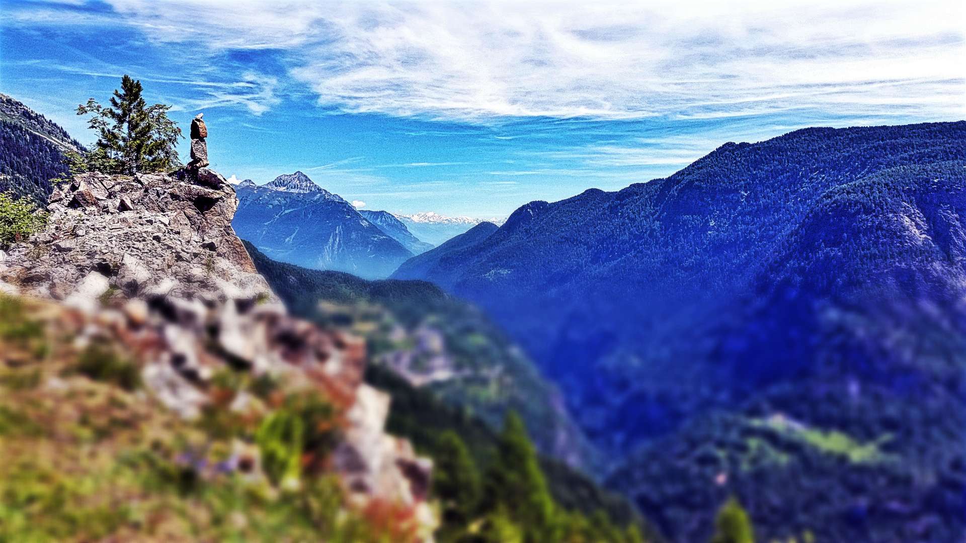
A right turn onto the D1506 took us over a bridge to the opposite side of the valley & this marked the start of the 7.5 mile climb up to Col de la Gueulaz. The early slopes took us through the quaint village of Finault, which has already started decorating the streets with Le Tour bunting. The region is famous as dinosaur footprints have been found high in the mountains, which helped explain why the village had decked out a dinosaur in a ‘King of The Mountains’ polka dot jersey!!!

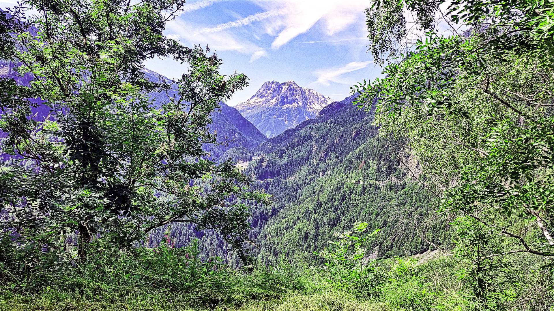
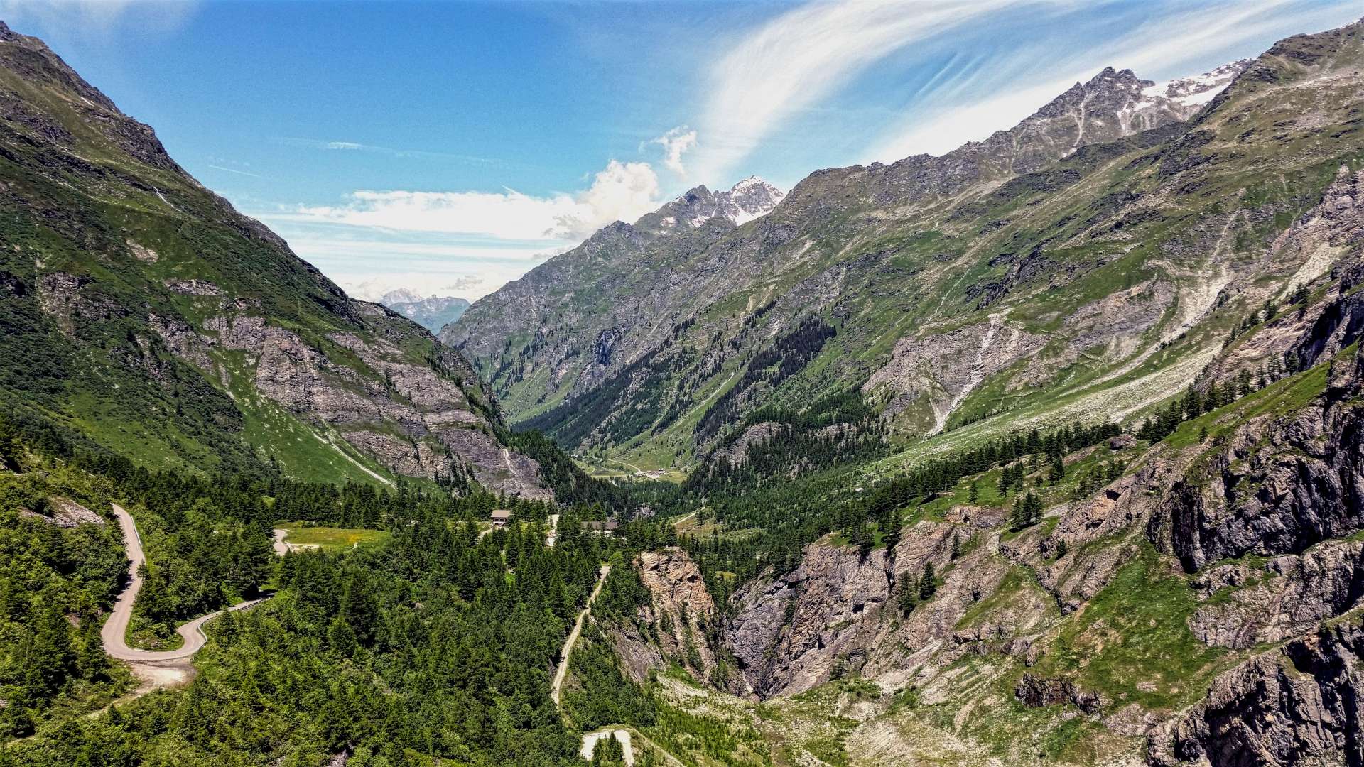
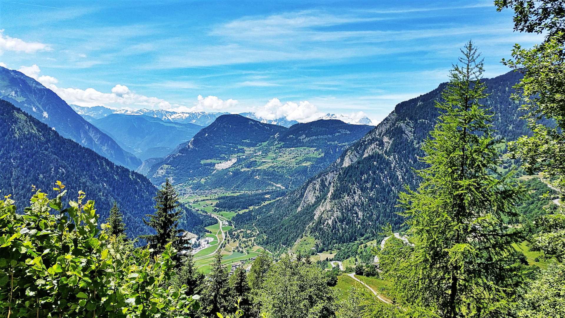
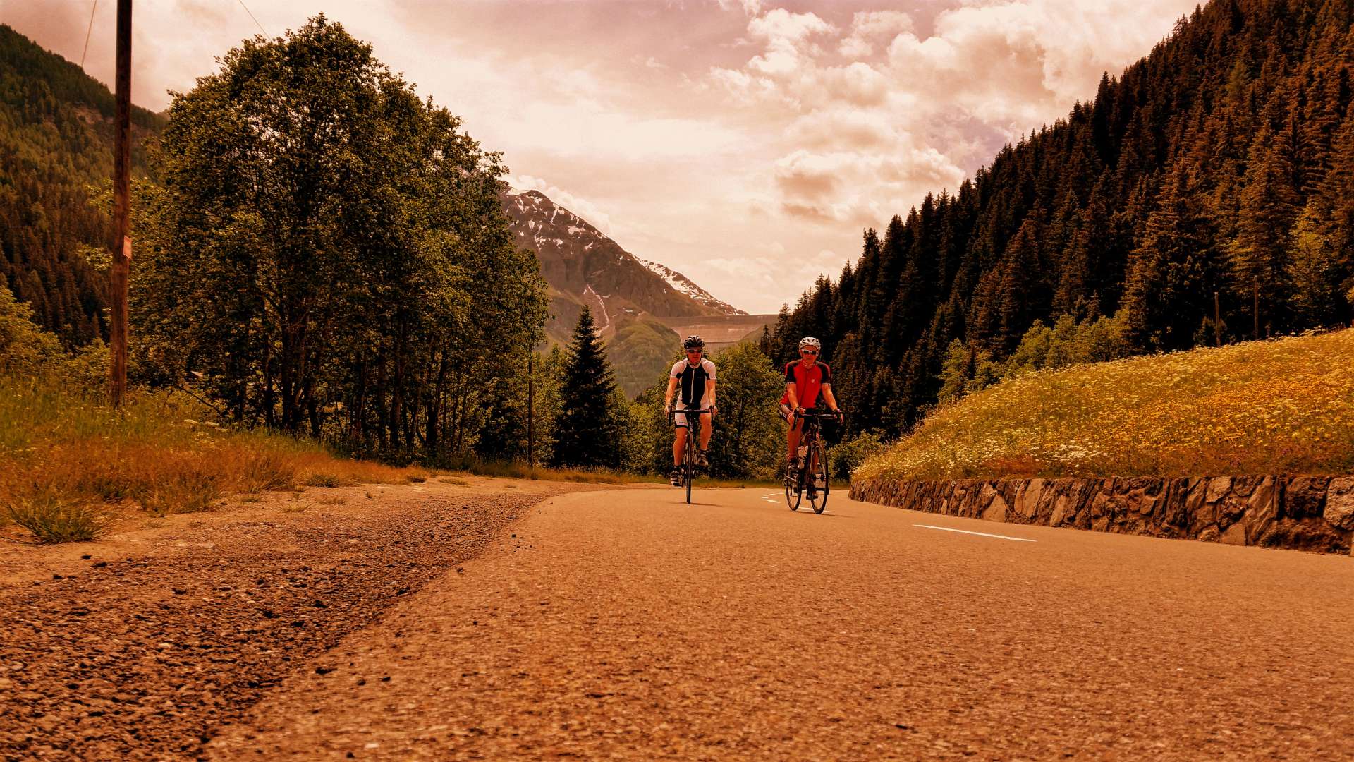
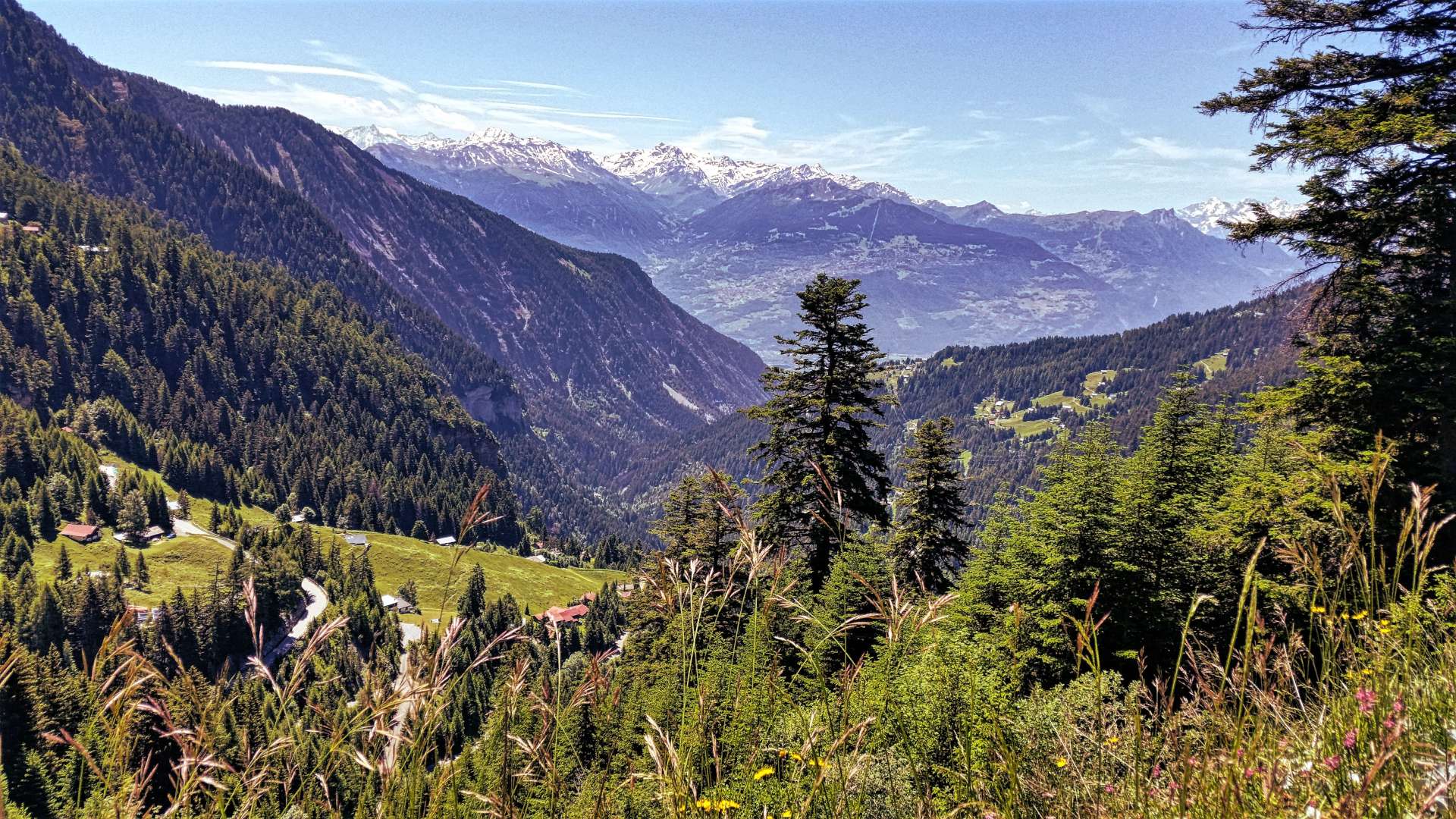
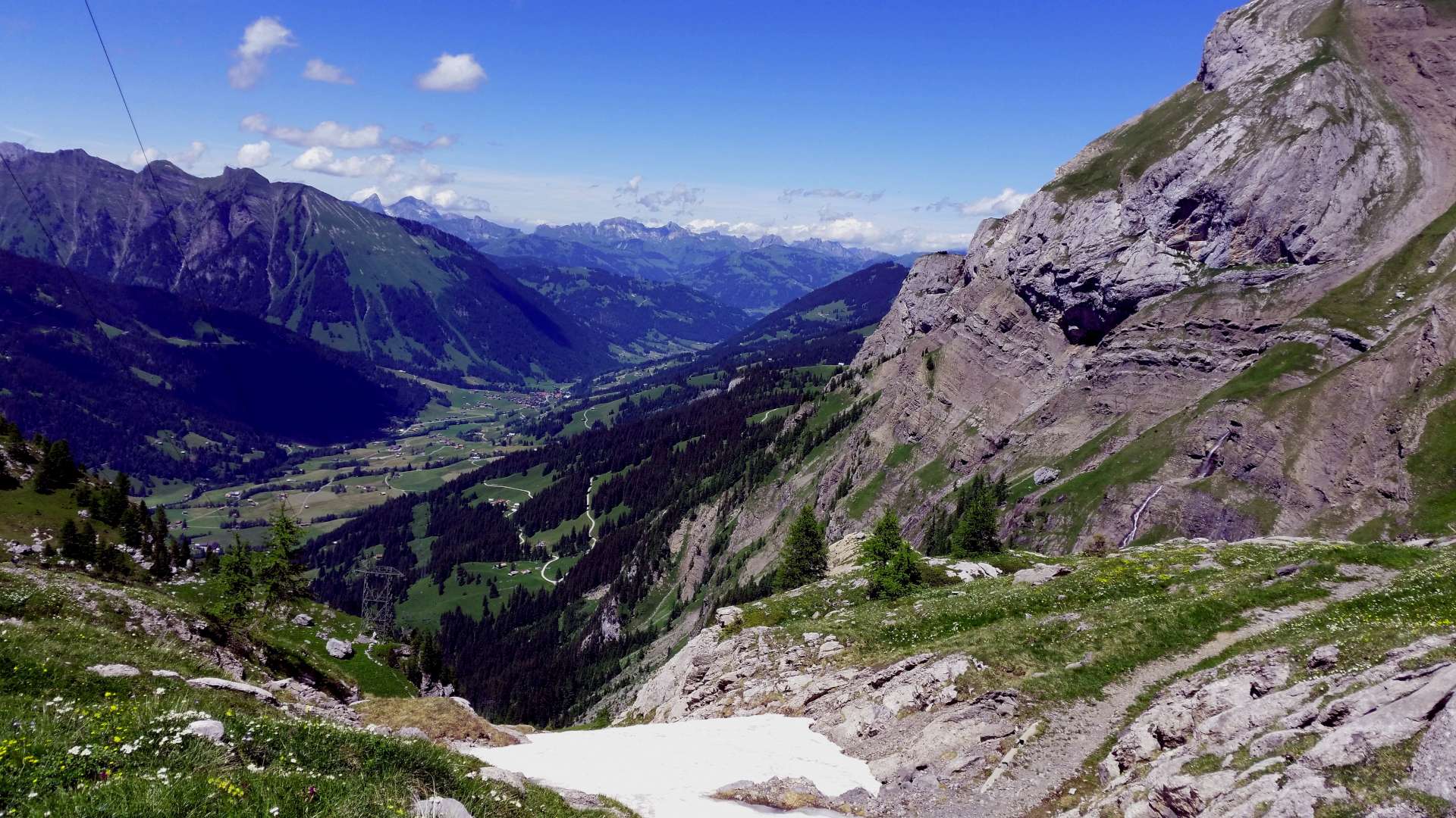
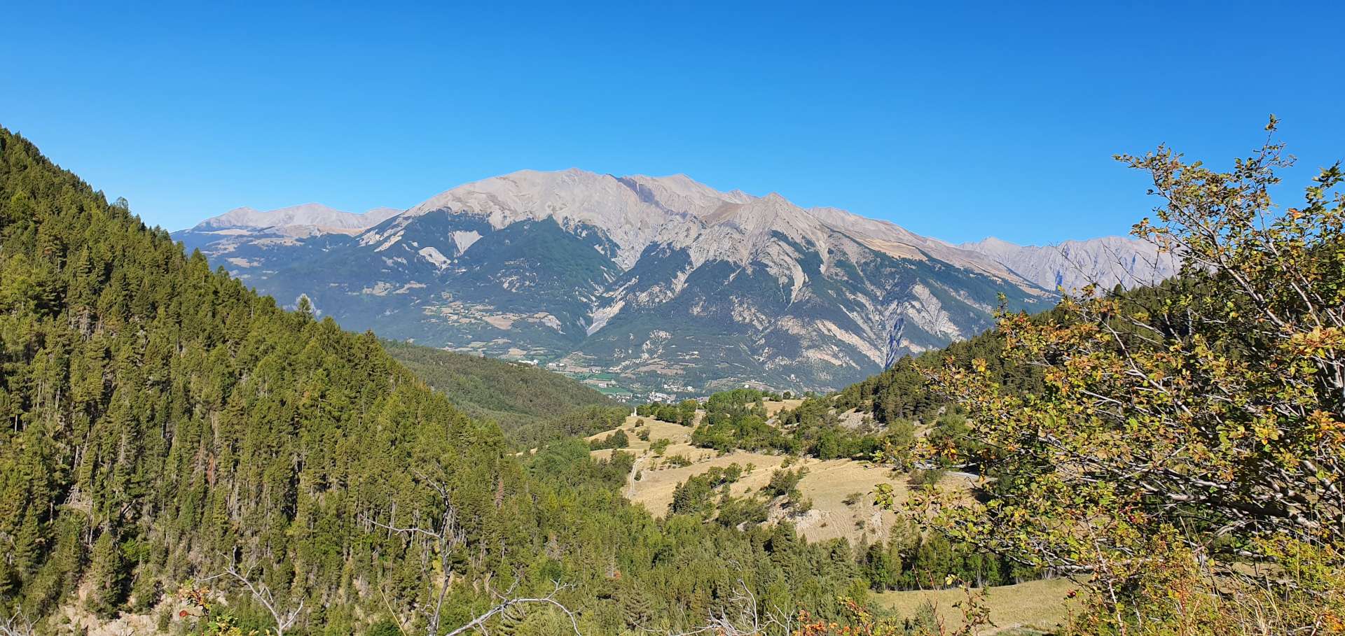
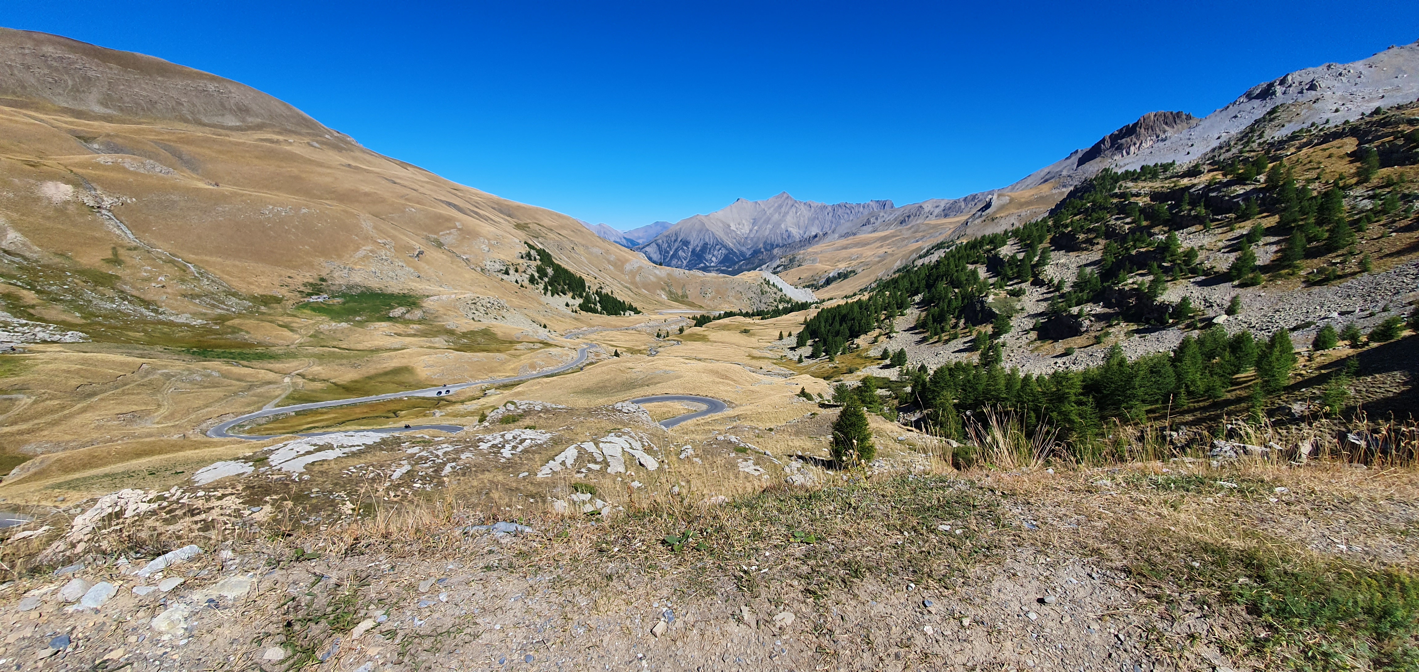
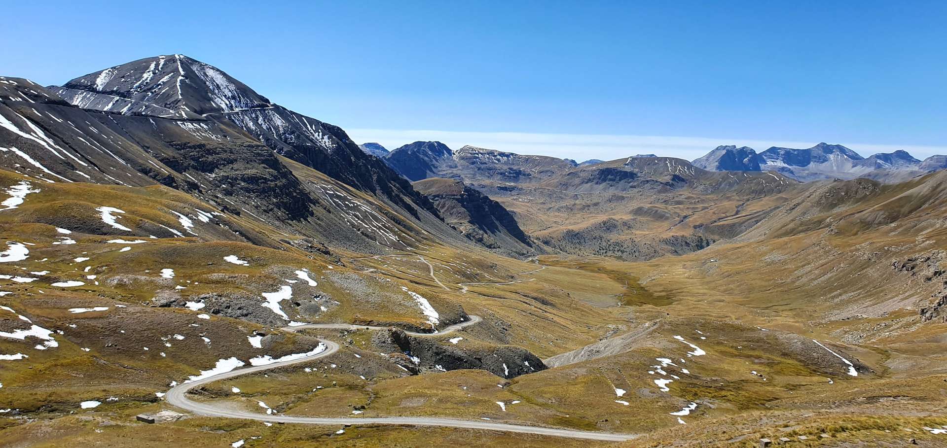
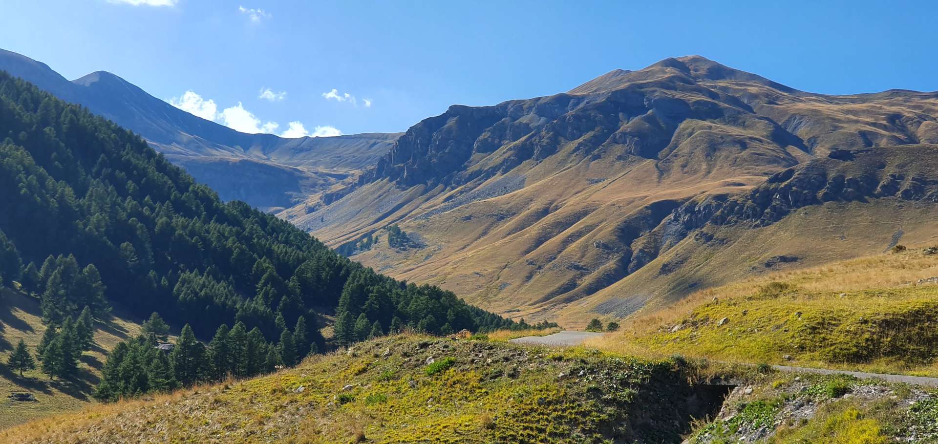
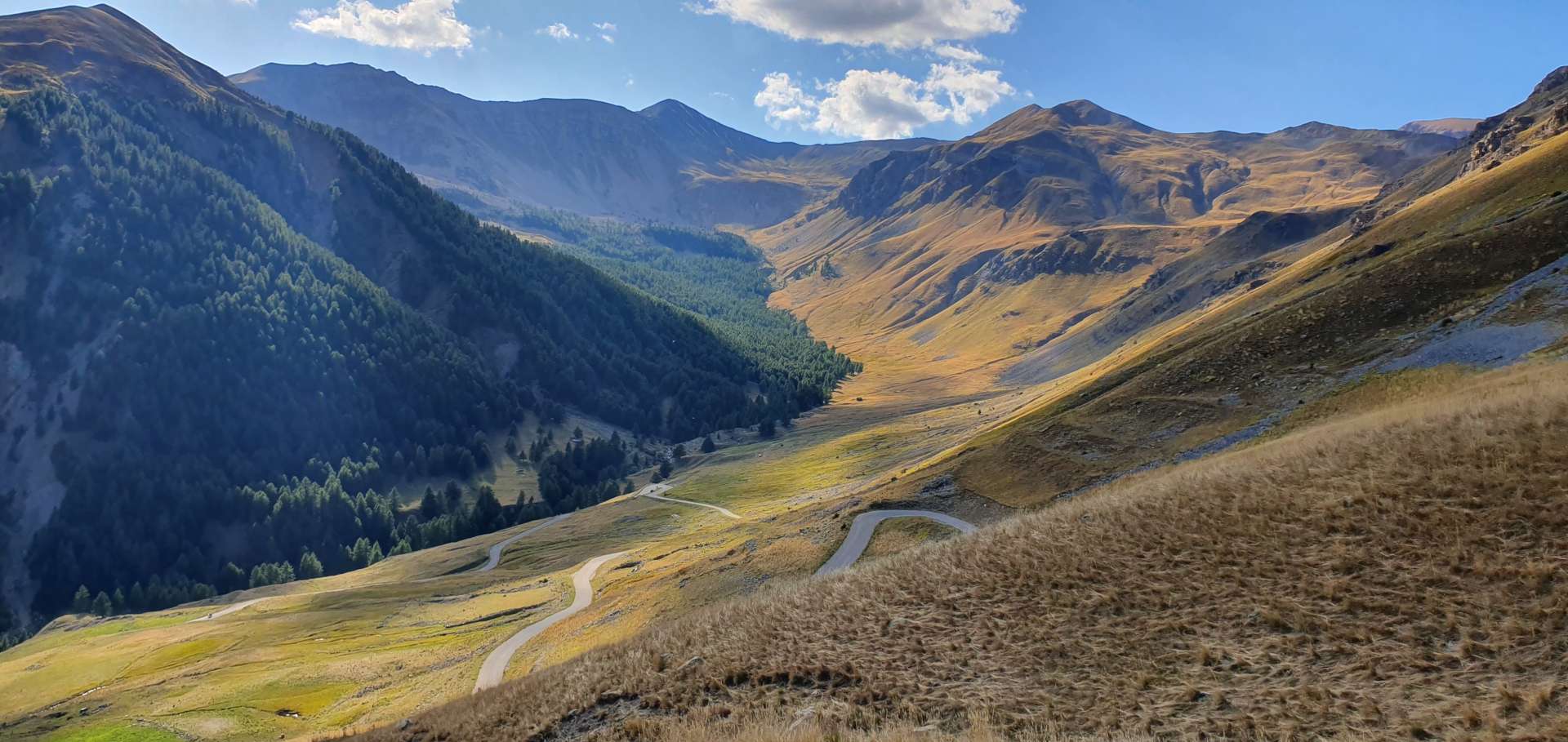
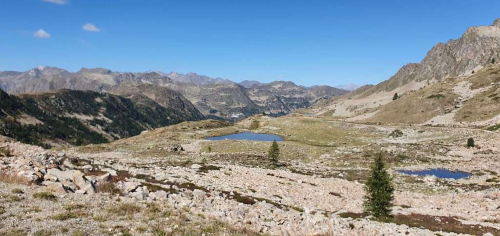
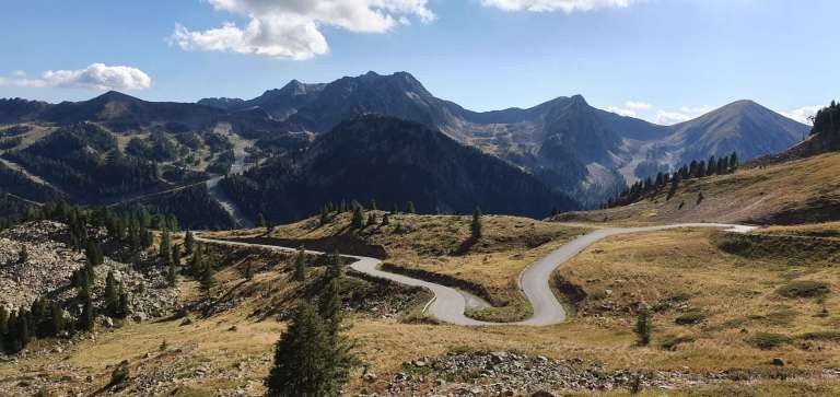
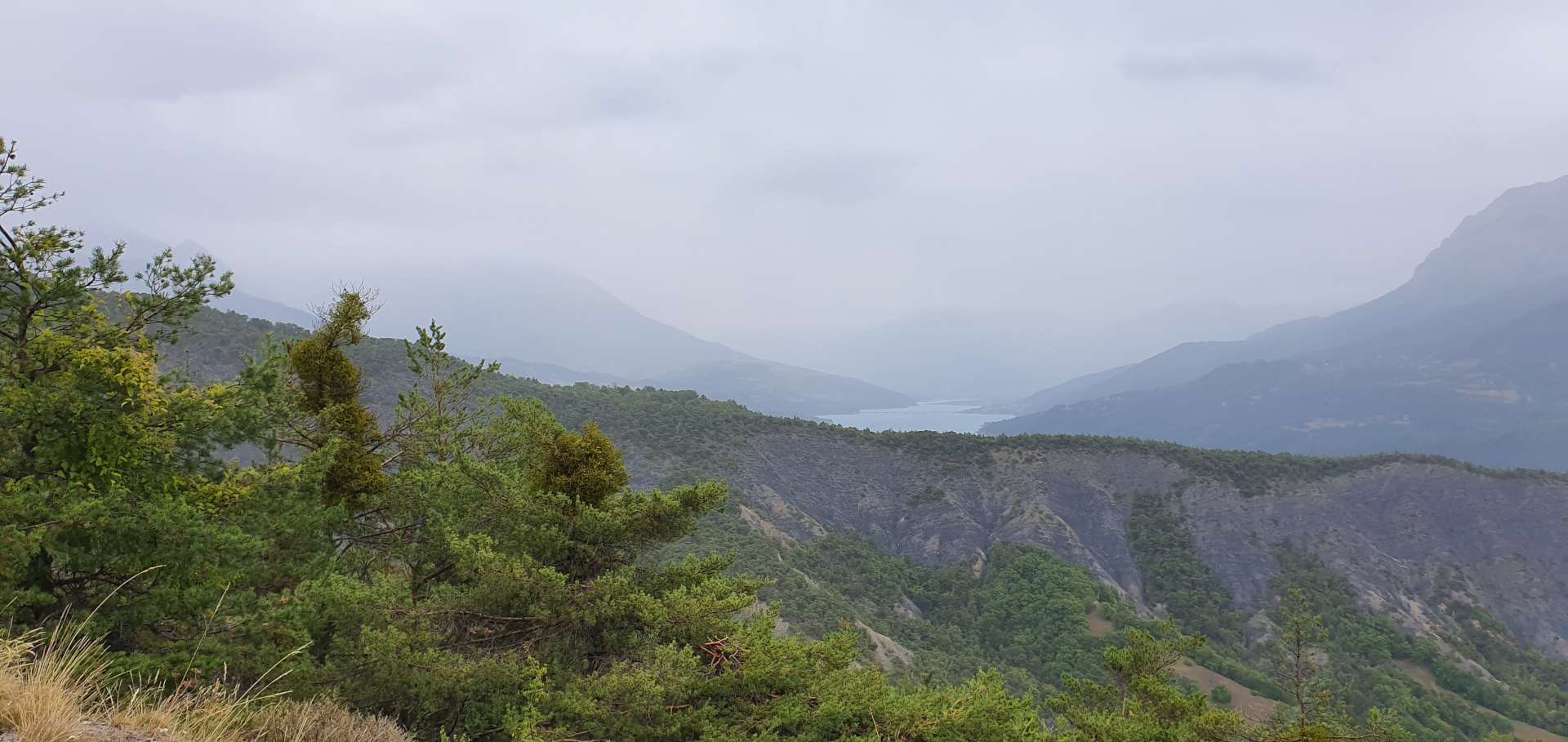
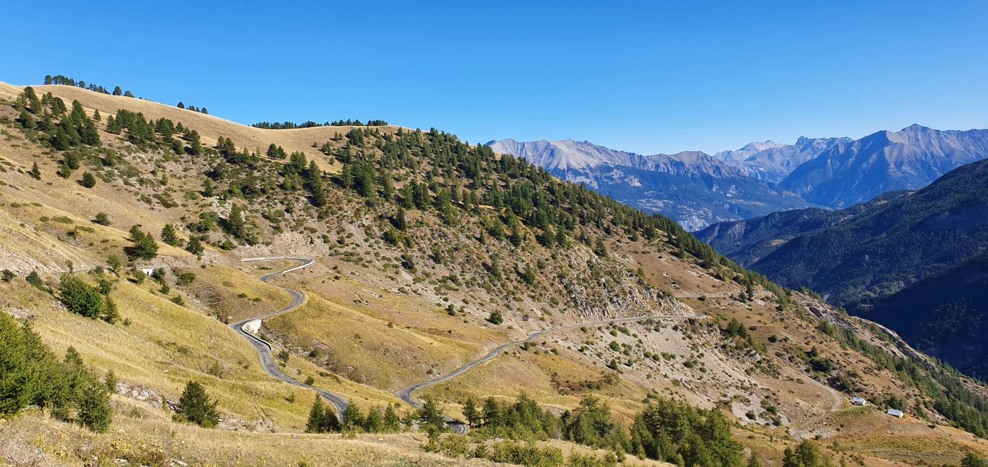
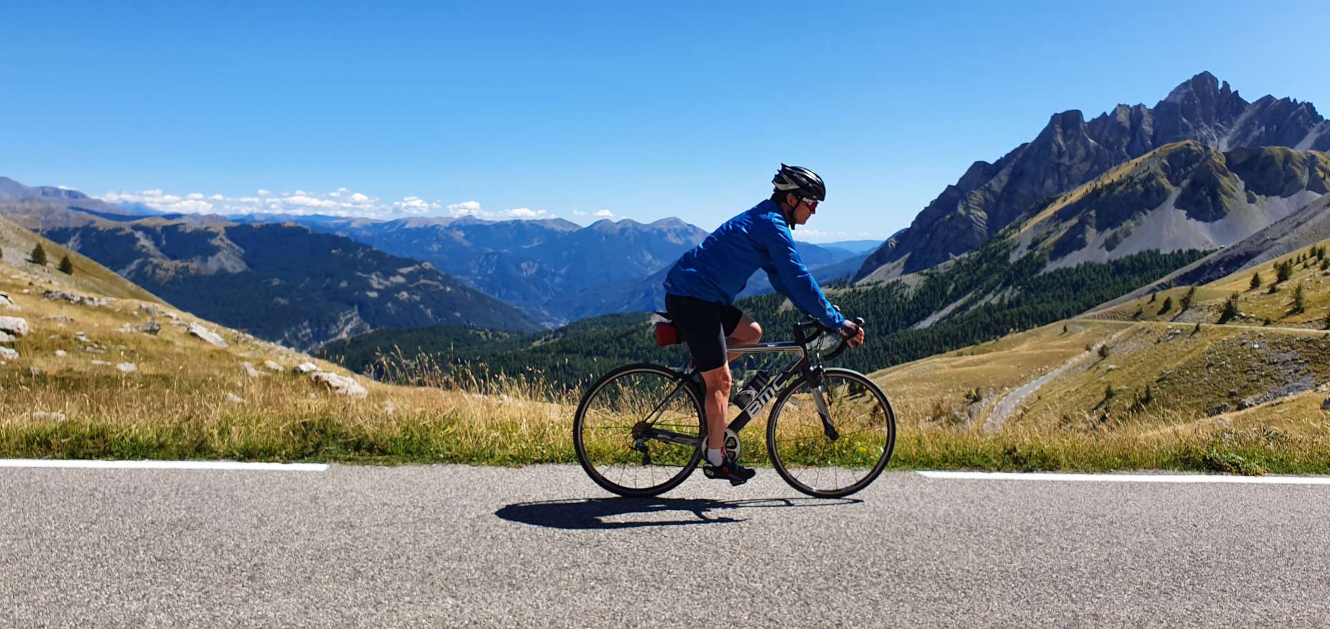
The climb started in earnest from this point on – 4 miles where the gradient averages between 9% & 10% the entire way. Thank goodness there were some amazing views over to the Trient Glacier & towards Mont Blanc to take my mind off the gradient. As we approached the summit, the final 1km was having the tarmac re-laid for Le Tour. It’s was stunning & challenging in equal measures, so I can’t wait to see the TV coverage & watch the pros as they bid for glory!!

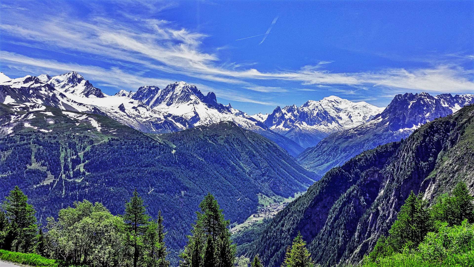
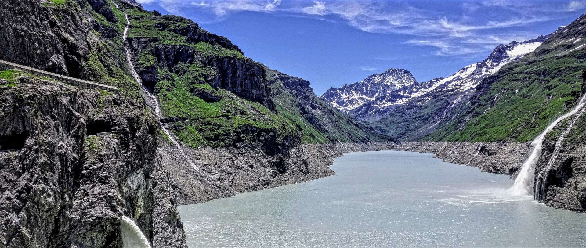
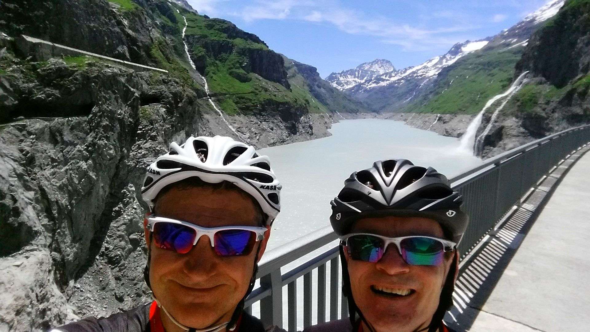
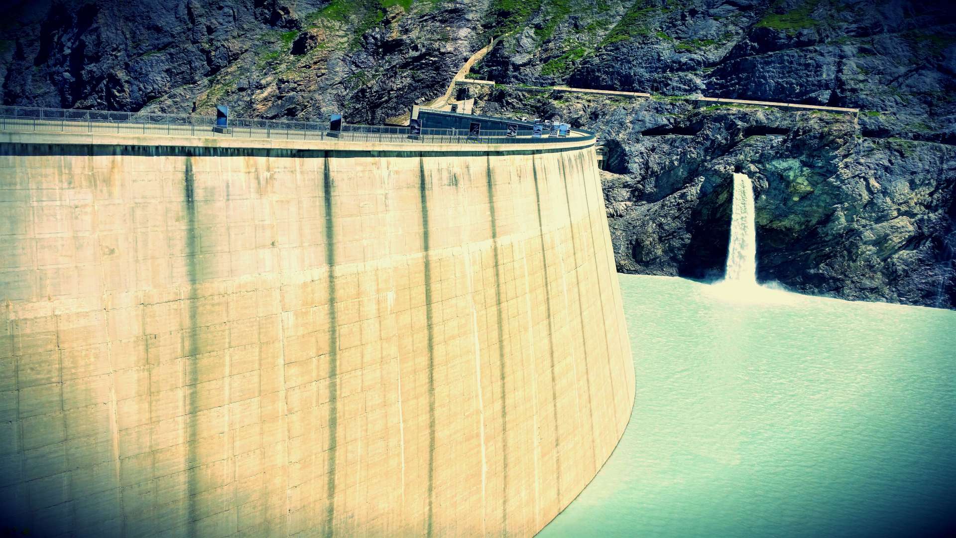
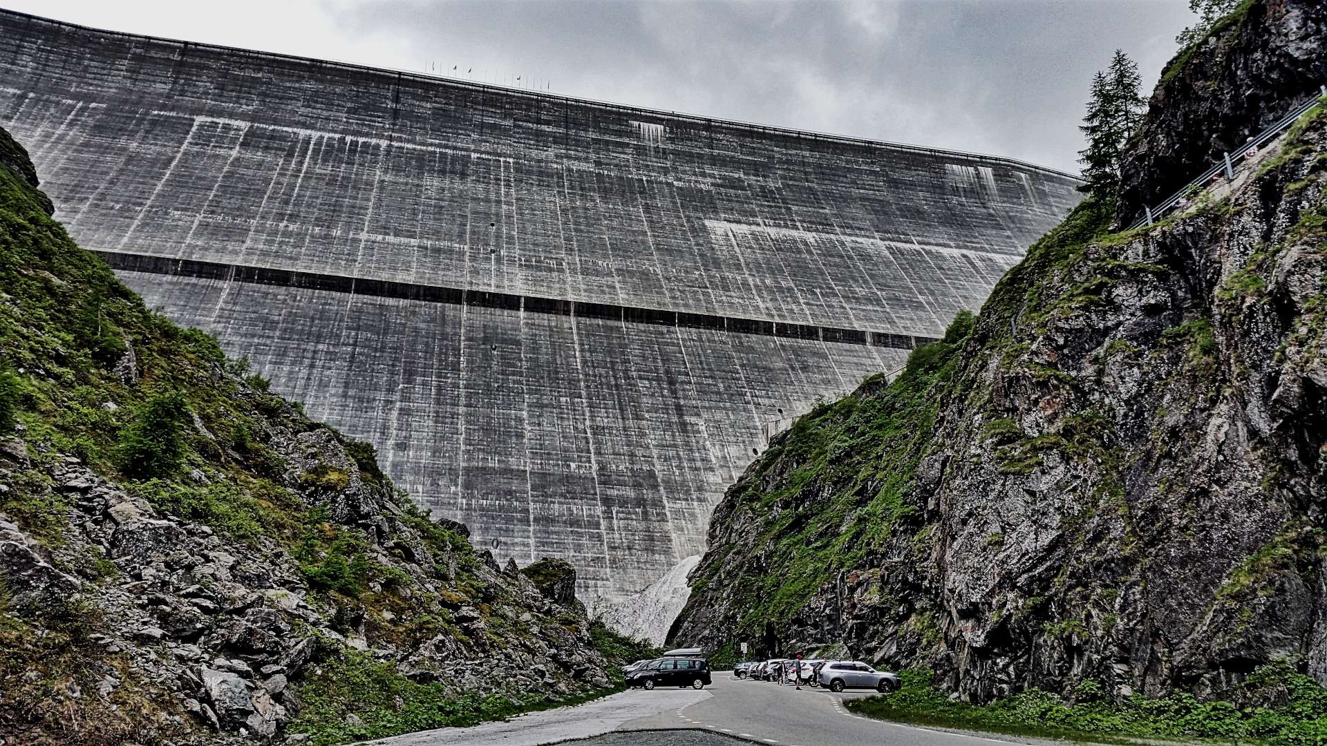
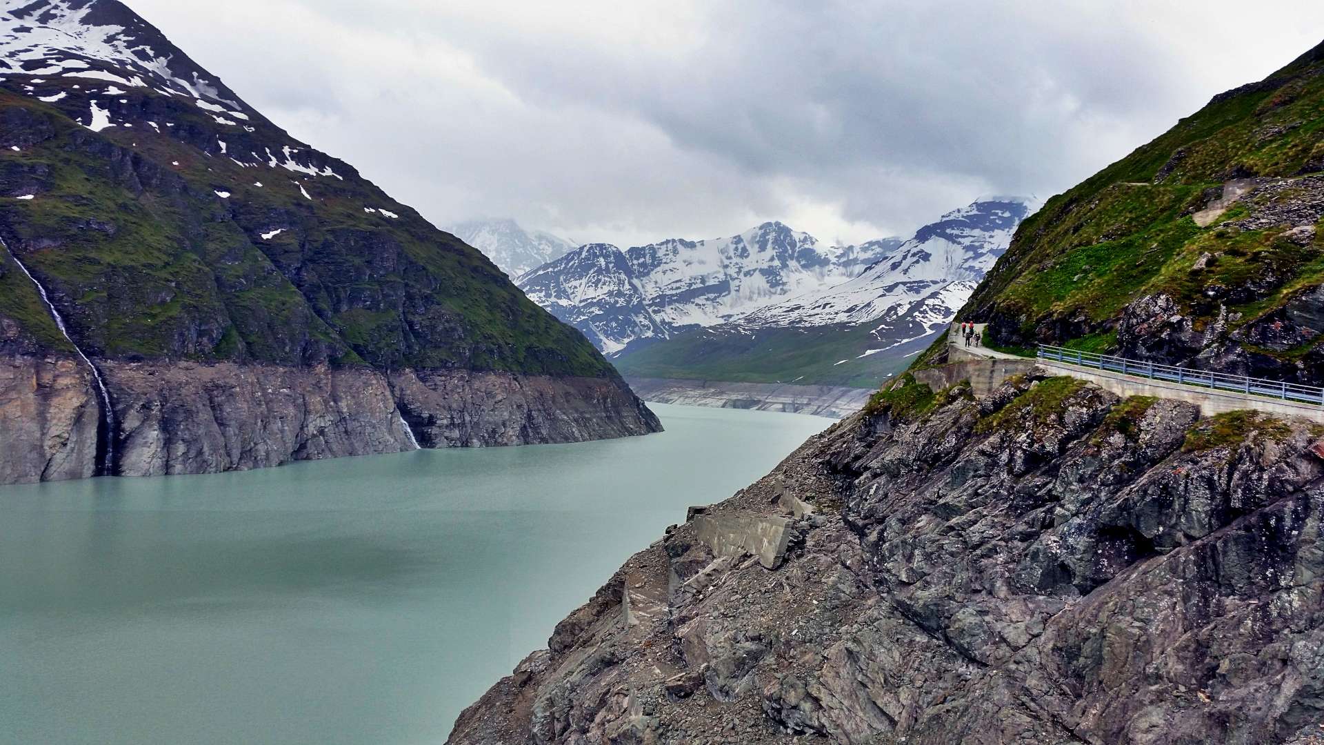
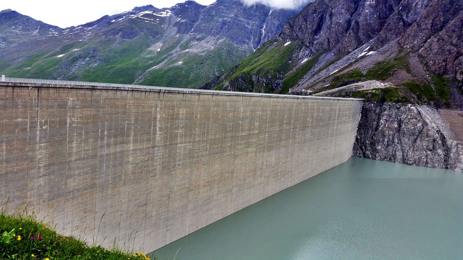
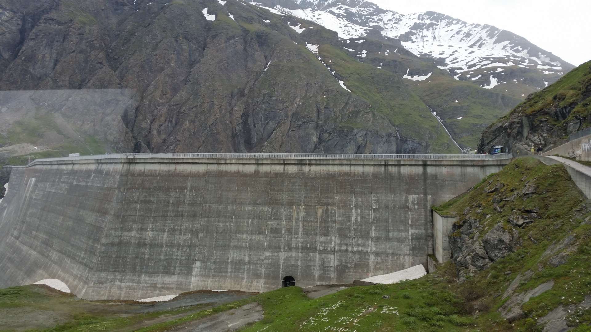
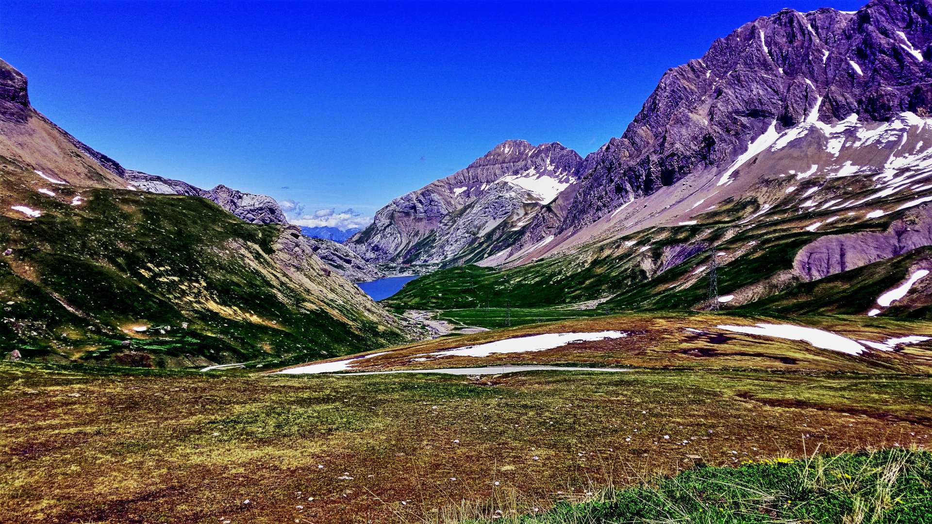
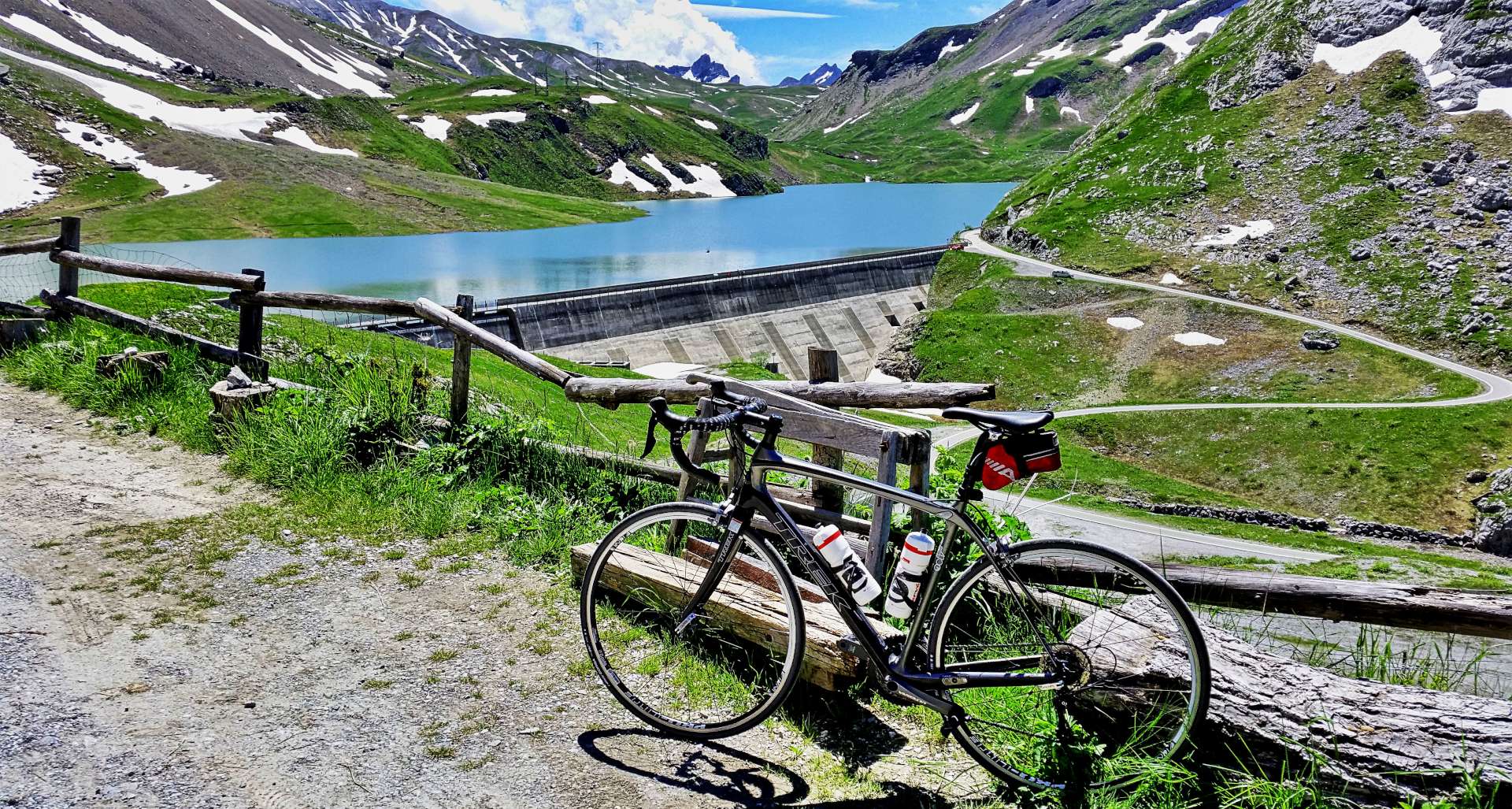
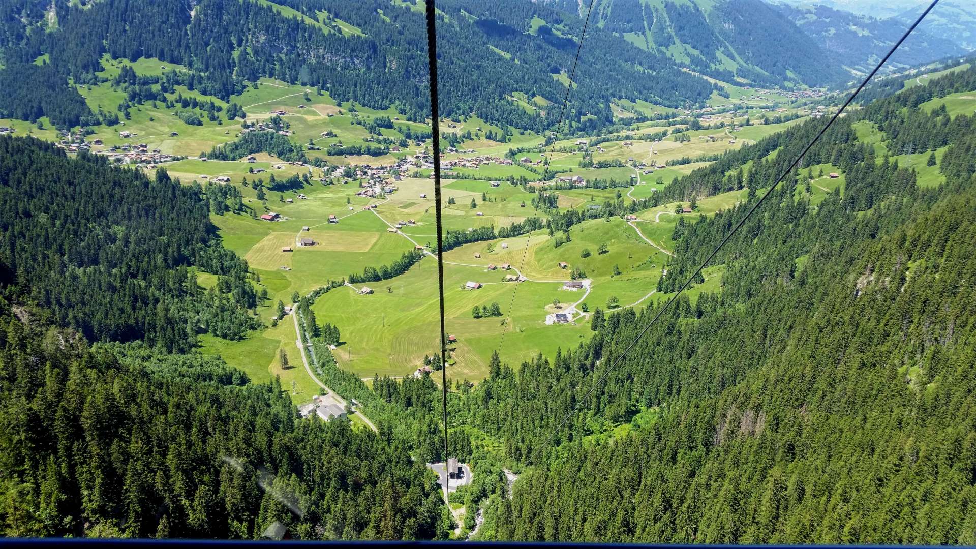
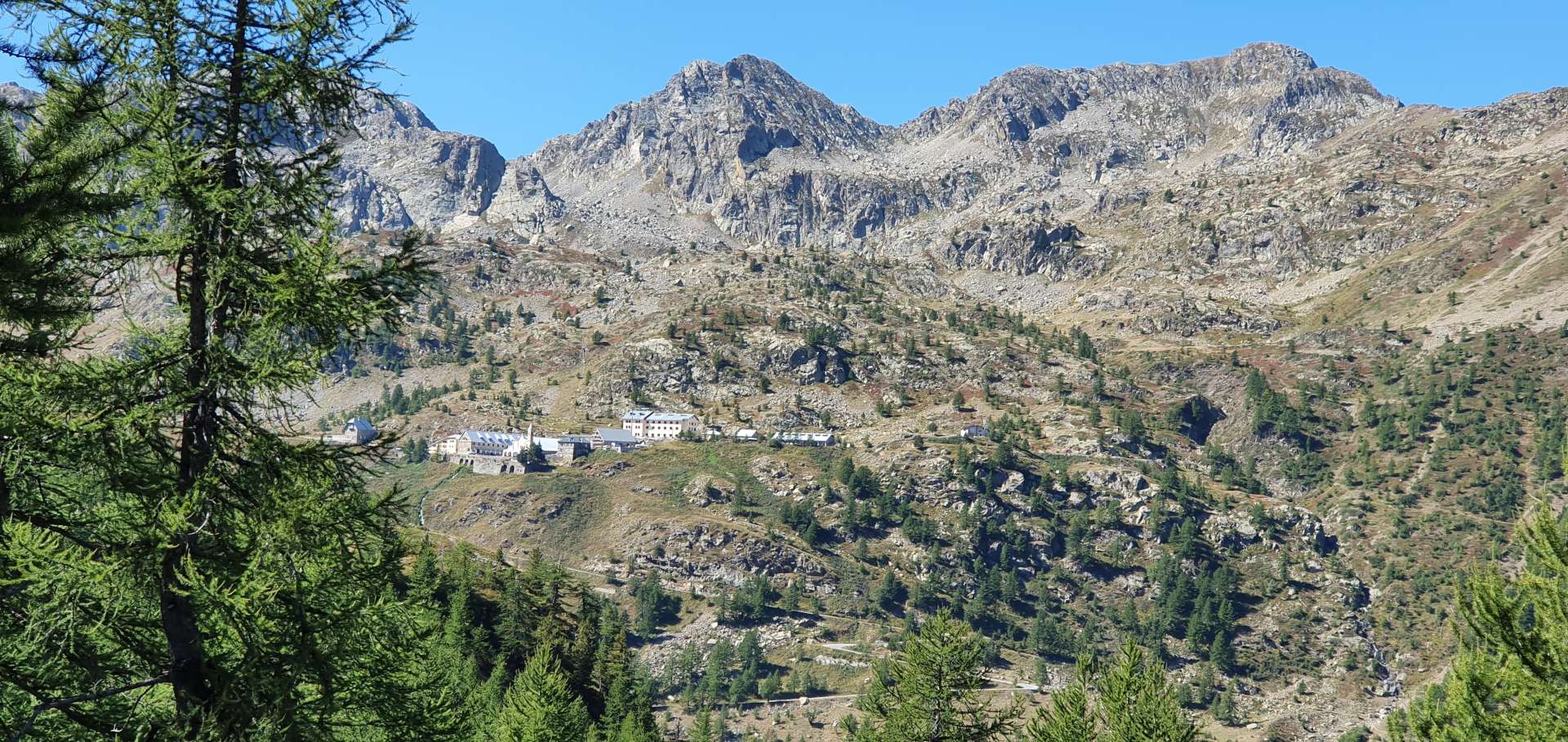
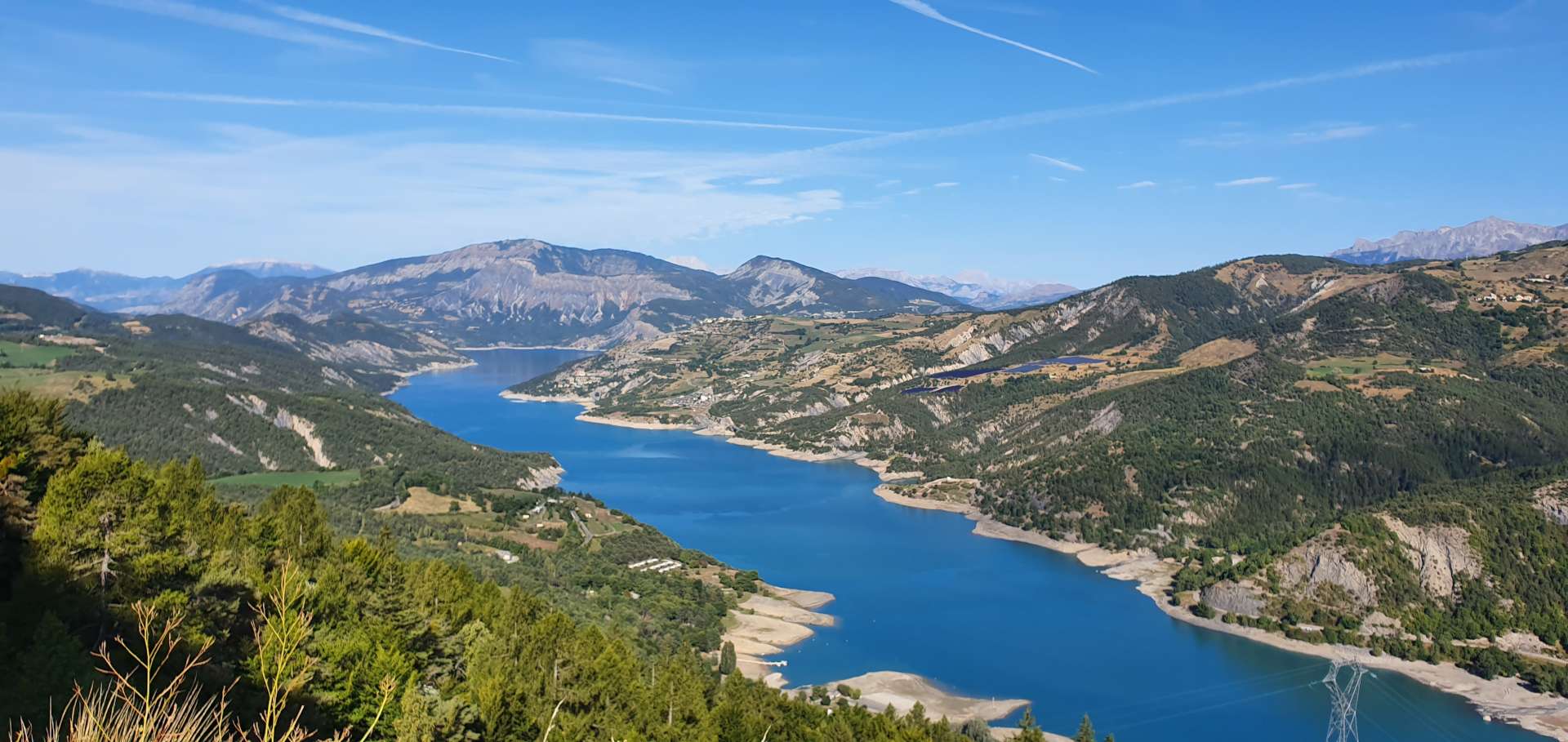
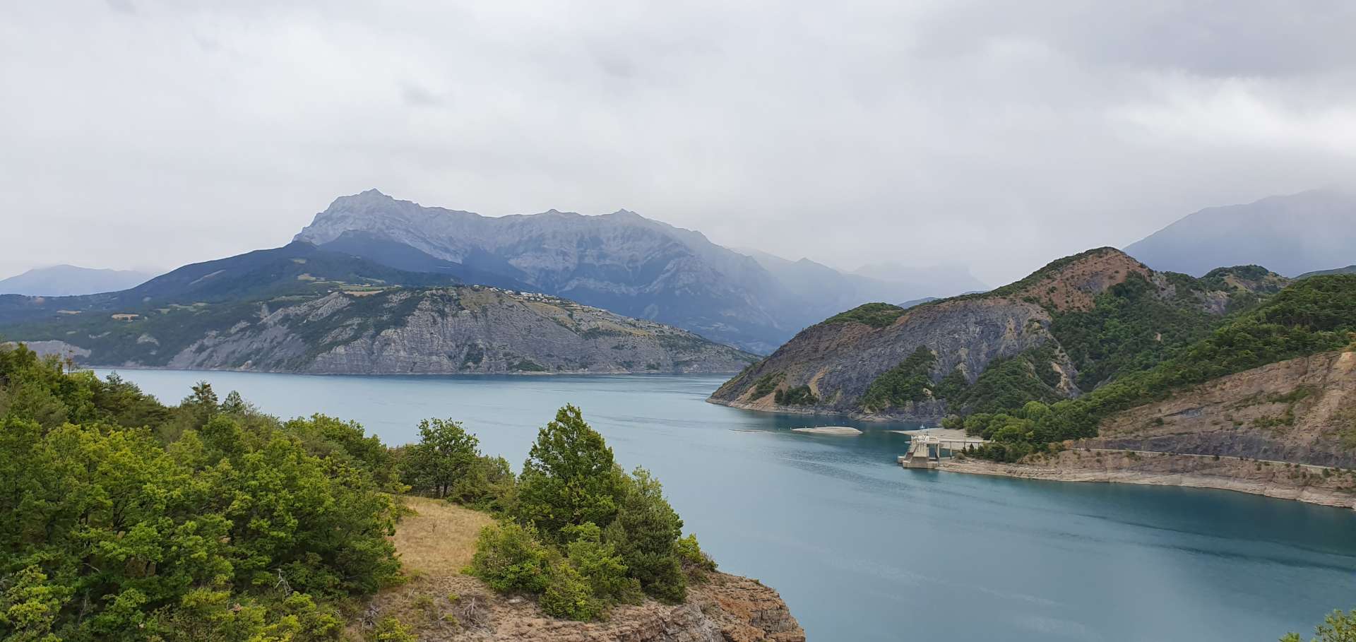
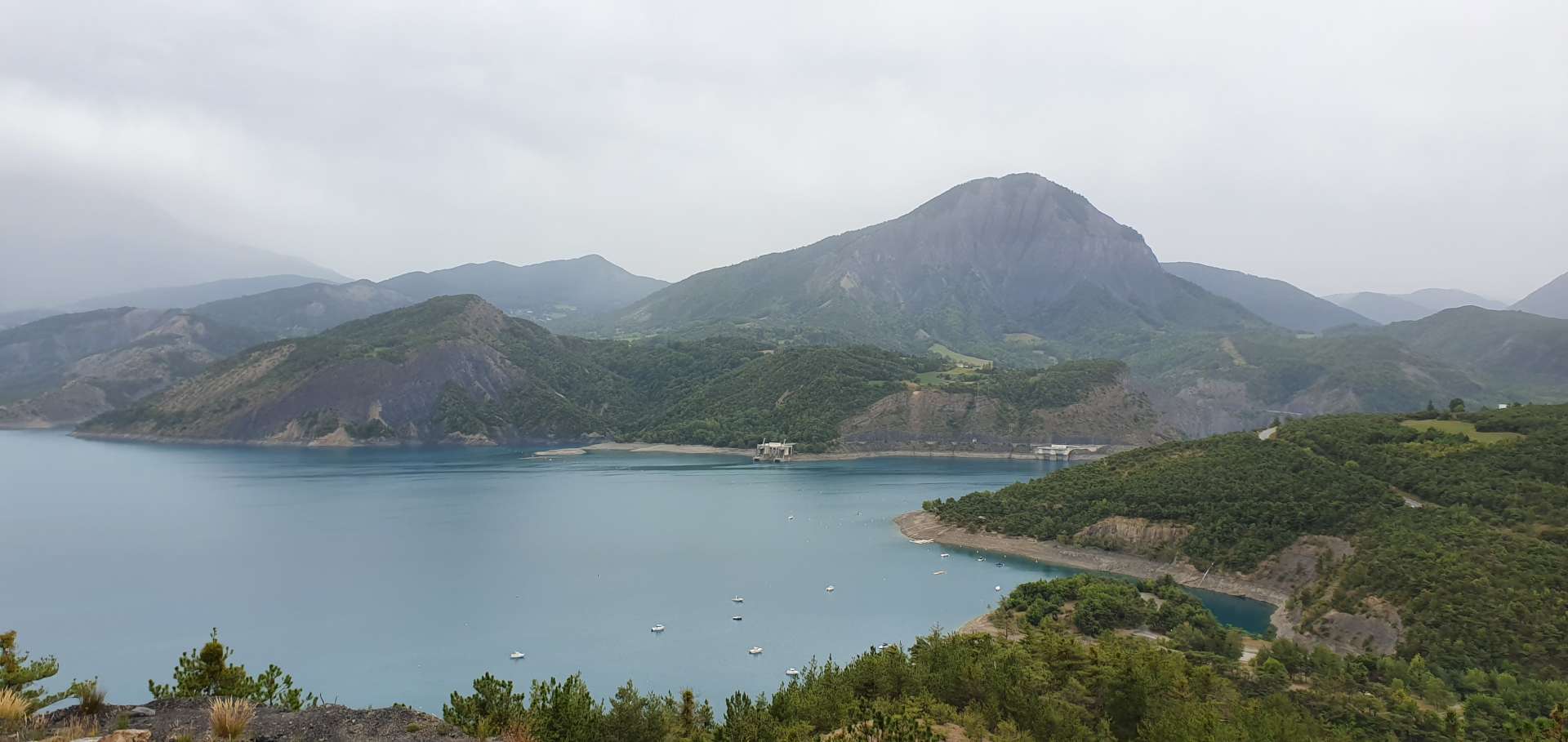
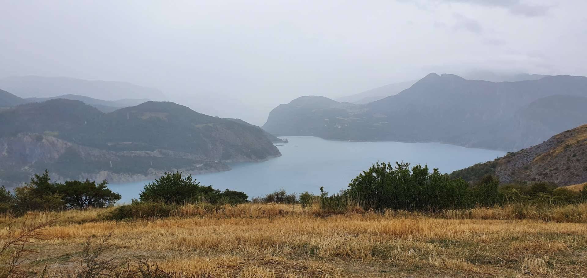
Just beyond (& below) the summit of the Col is…..a Hydro Electric Dam! The original dam was completed in 1925 & some clever engineering resulted in the new Barrage d’Emosson going into service & flooding the old dam in 1973, to a height of 180 metres. For the brave of heart it’s possible to take a funicular railway from the valley floor – at 87% (yes, 87%!), it’s the steepest two cabin funicular in the world. I thought cable cars were scary until I saw this!!!

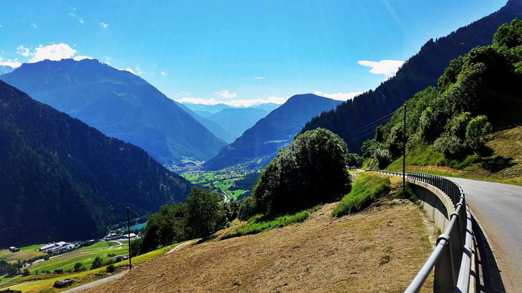
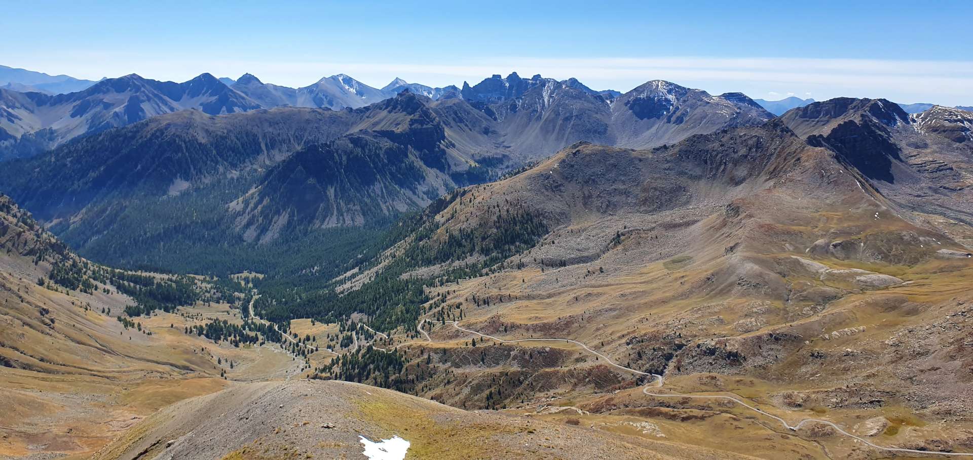
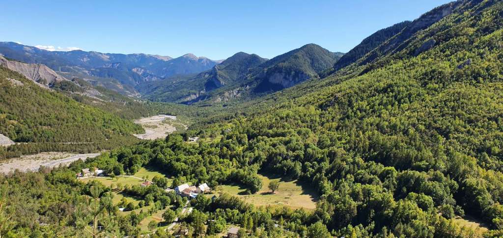
Unfortunately there was construction work taking place, so we weren’t allowed to cycle across the dam & as a result, my photo opportunities were limited. This is a stunningly beautiful location, with enormous views across to the Trient Glacier & Mont Blanc in one direction & the Rhone valley way off in the other direction. To get here, we’d already ridden 22 miles & climbed 6,750 feet, so decided that spaghetti bolognaise was in order – tasty & instant energy as all cyclists know!

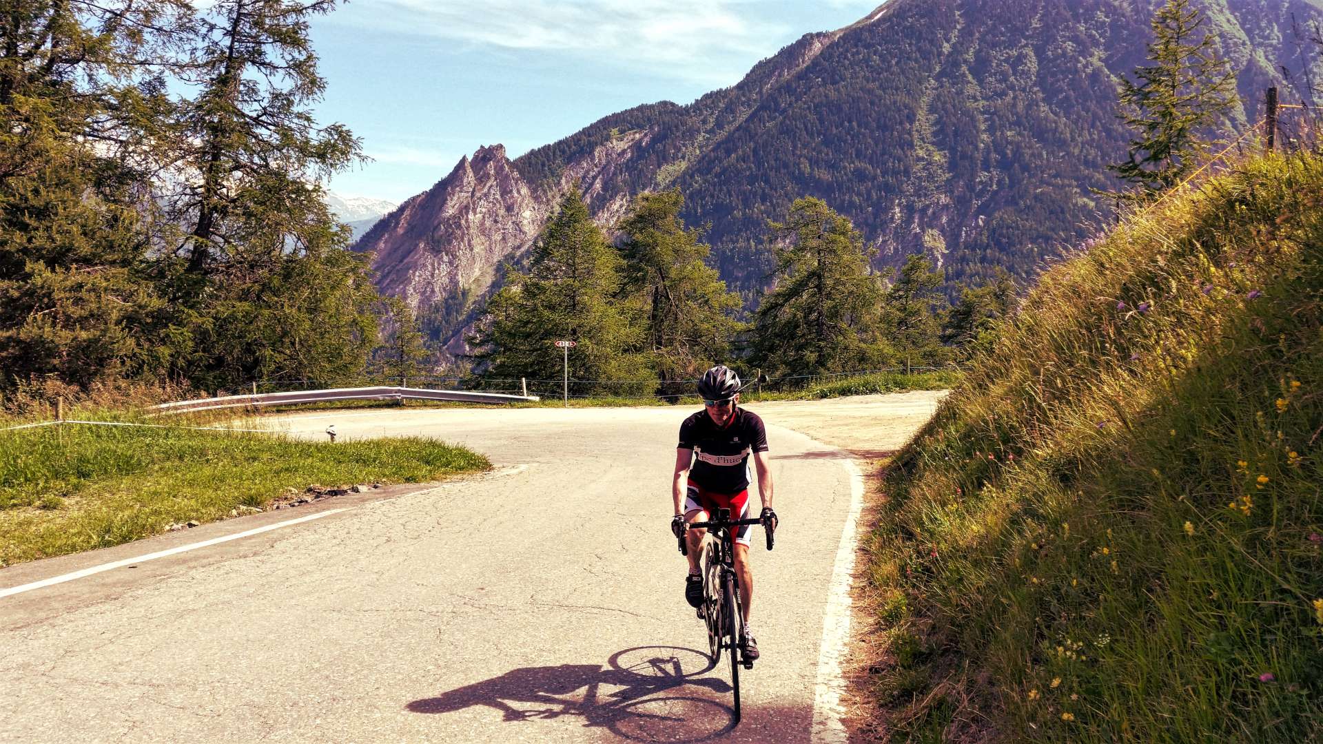
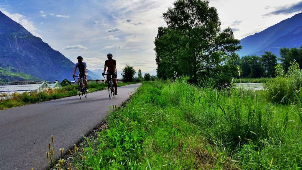
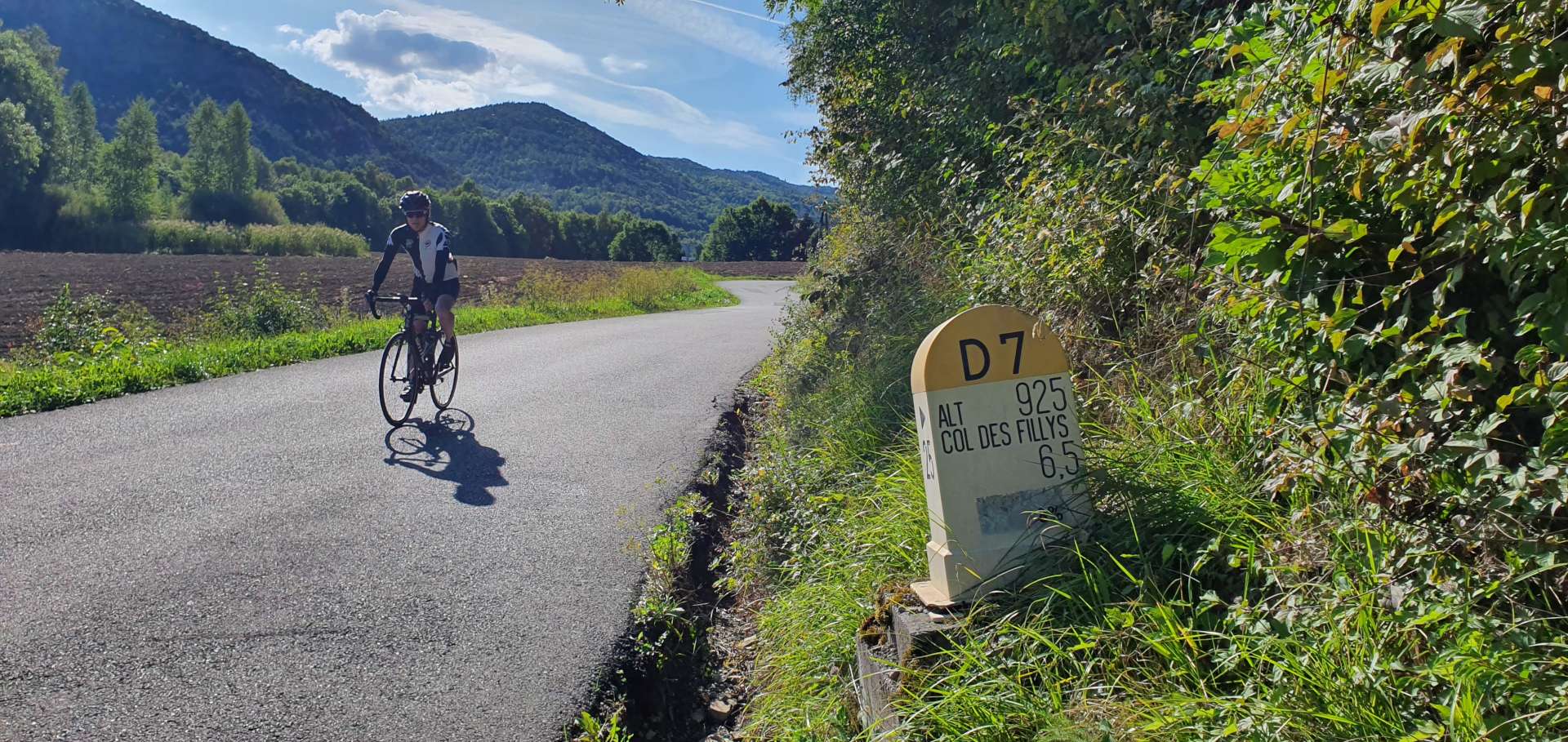
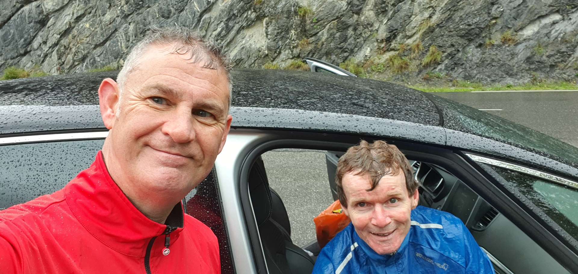
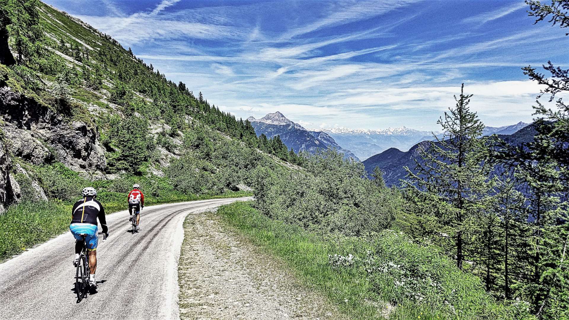
The descent seemed to be over in no time – that’s the thing with a steep climb, you get the benefit on the way back down. We needed to keep our wits about us, as there were huge trucks & buses coming up the mountain, so it wasn’t a time to be too adventurous. We overtook a couple of riders on the way down, who had set off just as I was taking some photos – they added to the shot, so thank you, whoever you are!

The final climb of the day was the reverse side of the Col de la Forclaz, a tiddler at 4.5 miles that was by far the kindest climb of the day. After a quick espresso to sharpen the senses, it was time to descend the new tarmac back to Martigny – this felt like a fast road on the way up (very few bends & huge views down the mountain) & so it proved to be. I was so busy concentrating that I didn’t check my speeds until I uploaded the ride this evening – I hit a top speed of 48.6mph, but it never felt like I was travelling that quickly.

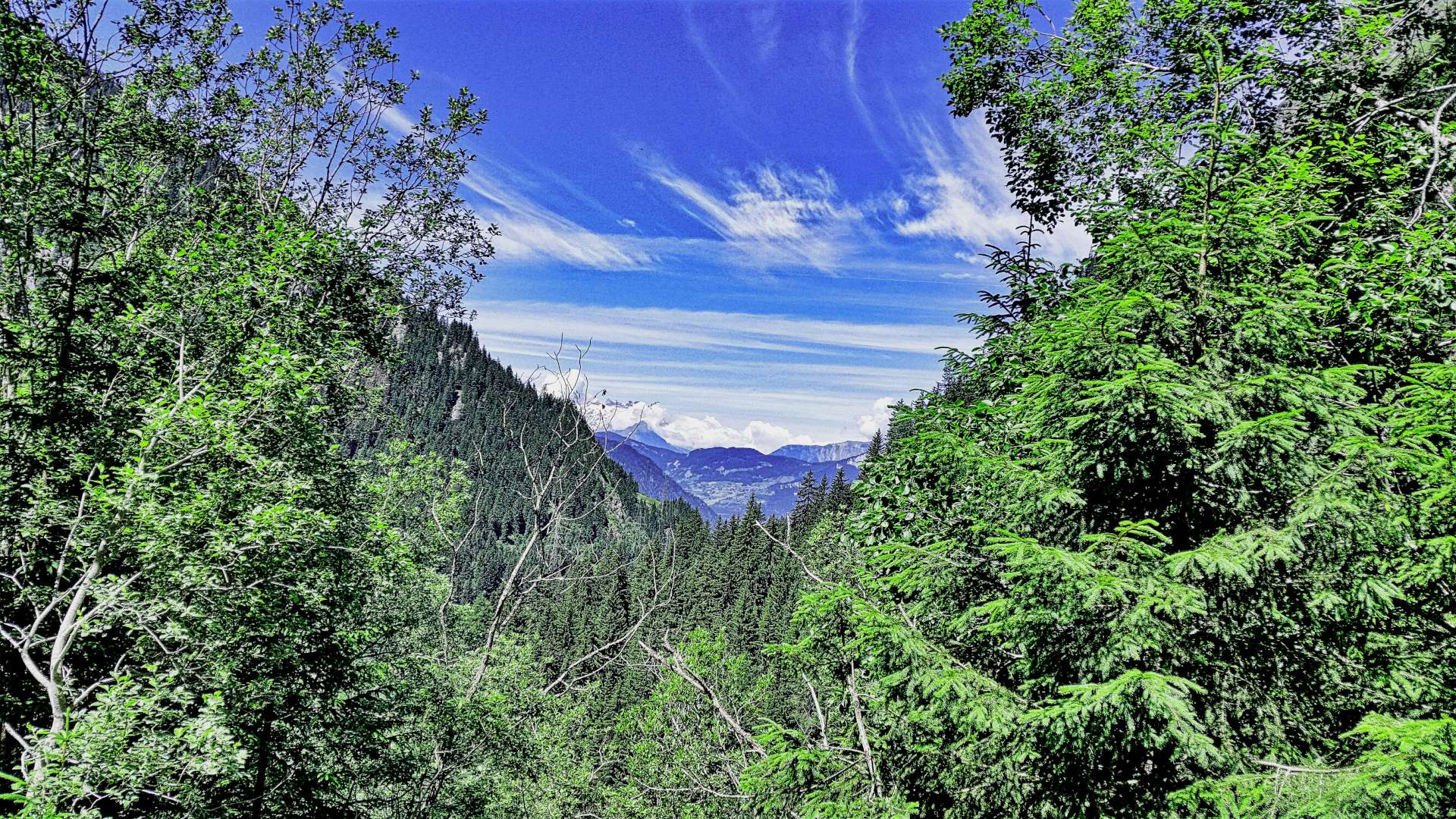
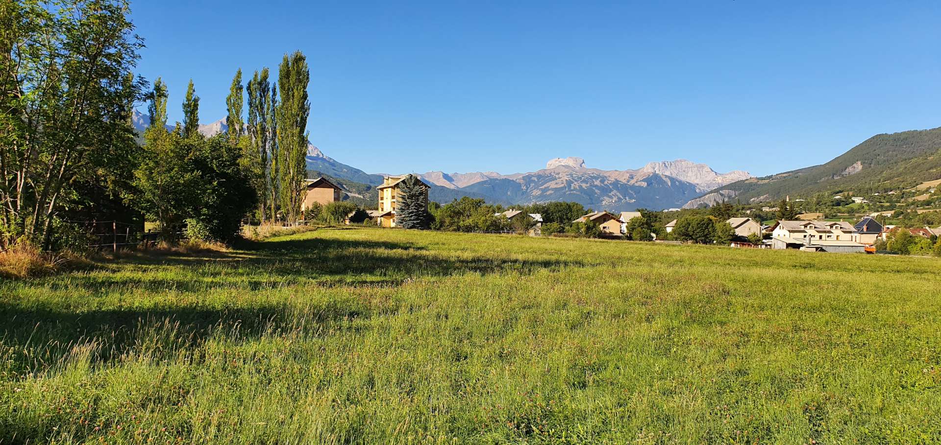
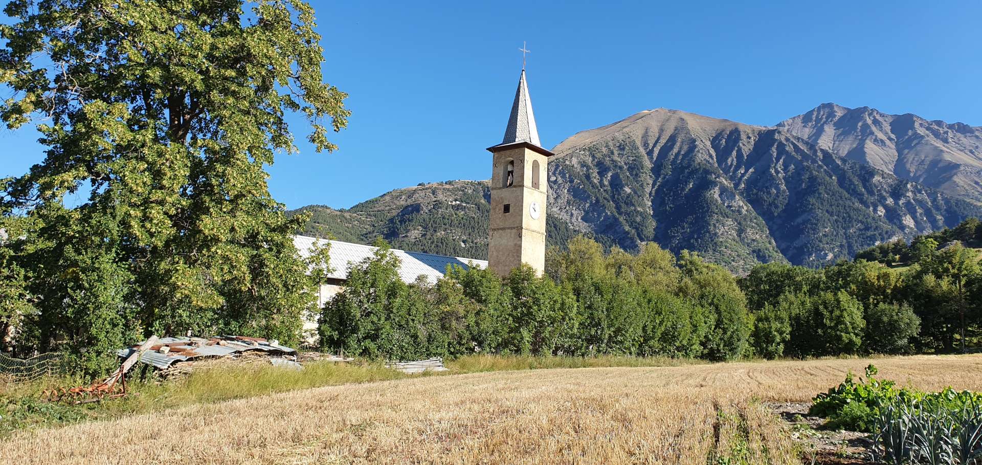
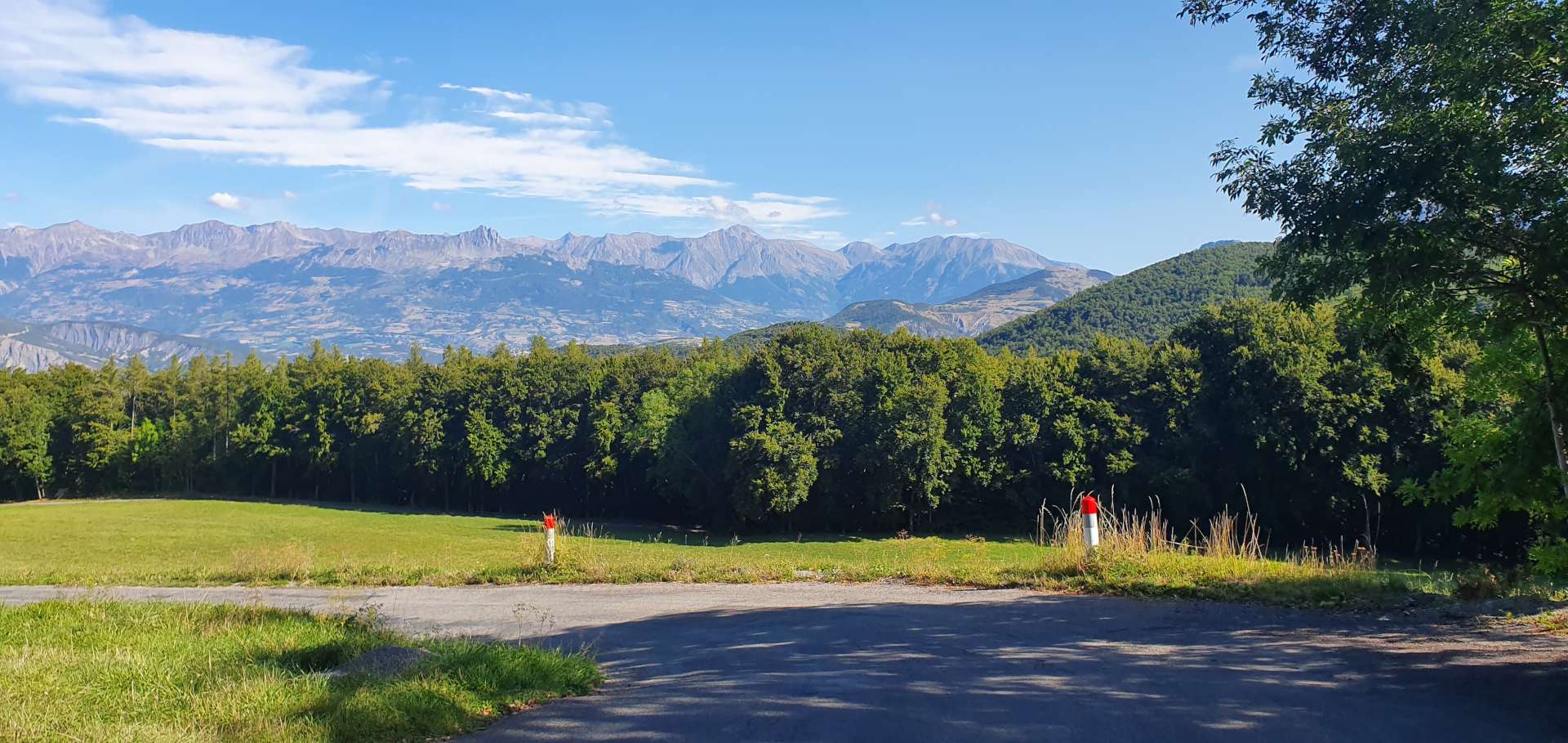
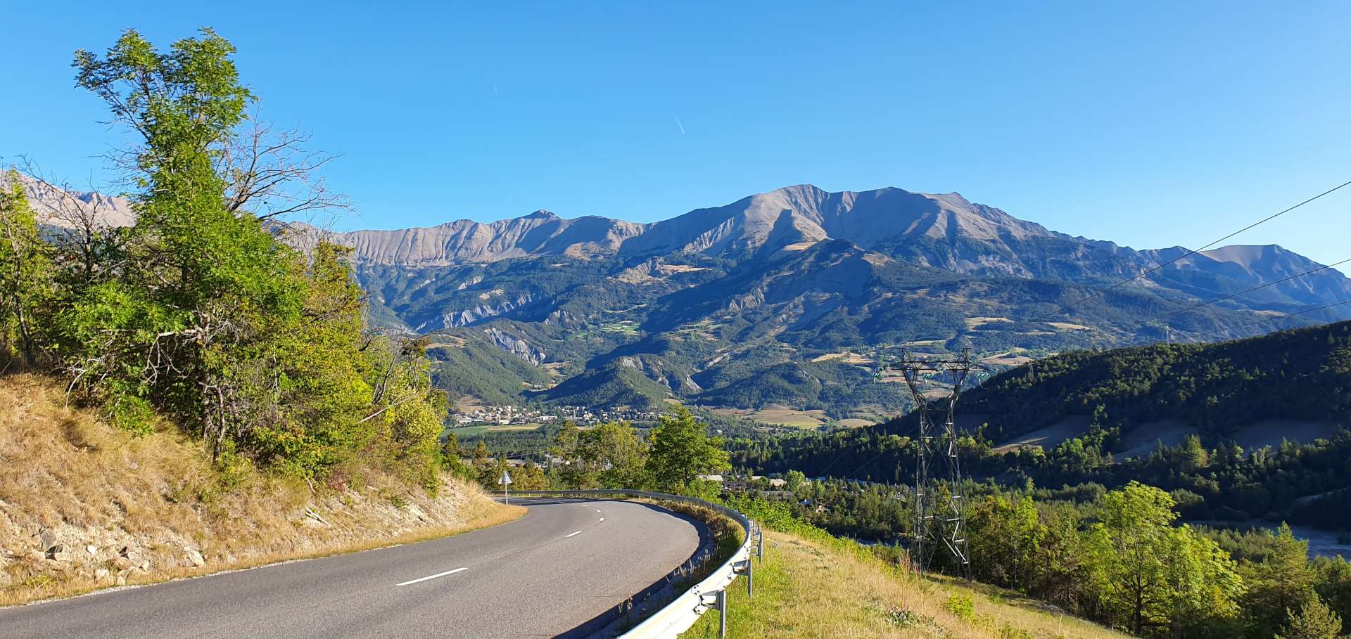
When I first planned today’s ride, it was all about riding part of the Queen Stage. However, by today it was all about experiencing another glorious day in the Valais – once again we had beautiful blue skies all day, benign conditions & stunning vistas in every direction.

Tour de Suisse Summits – Barrage du Mauvoisin – July 2016

Dam Busting Stage 2 – Day Four

Another Epic day in the saddle up to Barrage du Mauvoisin – another hydro-electric dam, however, today the road was either climbing or descending (so no flat miles to pad out the distance) once we left town. In addition to the main climb of the day (4,850 feet of climbing in 25 miles), I’d also identified a couple of bonus climbs in case our legs felt strong….

The first 12 miles followed Sunday’s route to Le Chable, at which point we turned off the main roads & headed towards the snow covered mountains way off in the distance. The views continued to get ever more impressive as we climbed higher & deeper into the mountains – physically as well as metaphorically, as we passed through a couple of tunnels! For the first time this trip we got to see a marmot, rather than just hear them squeaking as we approached.

We made a quick stop for Tarte Tartin with ice cream & a cappuccino in the middle of nowhere, before the final push.

As we rounded the very next corner after our stop we saw our target for the day – the Barrage du Mauvoisin, as it towered 250 metres above us! It’s the 11th tallest dam in the world, took 6 years to build & spans 520 metres from side to side.

After taking in the majesty of the dam, lake & surrounding area (Mont Blanc was visible in the distance), we descended back towards Lourtier, taking in a cliff road detour on the way to view the valley below.

We still felt good, so took the decision to climb a back road (including a 3km gravel section along the summit balcony) towards Verbier. The climb was always ‘comfortable’ & as we gained height the views widened until we again got to see paragliders as they soared on the thermals above us.

We took the same descent as on Sunday until Le Chable, where we stopped for lunch. Our legs still weren’t totally cooked (although well on their way!), so we threw in yet another bonus climb – the Col des Planches. This was on a deserted road that took us high above the main road we cycled this morning, with stunning views towards Col de Grand Saint Bernard in one direction & Mont Blanc in the other. The climb ascended 2,100 feet in 5 miles, so averaged about 8%, but with a couple of short stretches up over 13%.

As we started the descent towards Martigny this was all forgotten, as incredible views up & down the Rhone valley showed themselves.

We popped into town to celebrate another awesome day in the saddle & to take in some of the Tour de France reminders & to top up the calories ahead of tomorrow’s adventure!

Tour de Suisse Summits – Barrage de la Grande Dixence – July 2016

Dam Busting – Day Three

Today’s adventure was a monster climb up to the world’s fifth tallest dam (it was 2nd tallest until 2010), the Barrage de la Grande Dixence.

The day started in a similar fashion to yesterday, the first 20 miles or so followed the River Rhone through fruit orchards (apples, pears & apricots to name a few), vineyards & fields of vegetables. For once I had a bit of a nightmare getting us to the start of the climb, but luckily we were still in high spirits, so it didn’t matter, plus it added to the adventure!

The early part of the climb is on a relatively busy road, but this only affected us for the first four miles until we reached our coffee stop of Vex. After an invigorating slice of apricot tart & a cappuccino, we turned onto an almost deserted road, as we continued to climb towards Dixence – everything was hunky dory, my training had prepared me for just this sort of challenge…..

At which point we turned a corner & there some 5 miles in the distance was the Barrage de la Grande Dixence & it was still several thousand feet above us! I can only assume that the engineers that planned & built the road were sadists, as the gradient never dipped below 10% from this point on & the majority of it was between 11% & 13% – my training hadn’t prepared me for this.

It was even more challenging than the hardest bit of the Sanetsch yesterday, so it was time to look in the suitcase of courage – sadly I’d only packed a rucksack of despair!! After a quick energy bar it was time to man-up & get on with it & a mere hour of pain later we’d reached the car park at the foot of the dam.

A few statistics for you;

At 285 metres, the Barrage is 9 metres higher than the top platform of the Eiffel Tower.

The dam took 14 years to complete & was finished in 1964.

This is part of the Cleuson-Dixence complex, which provides hydro-electric power to 400,000 Swiss households per year.

At peak capacity the reservoir can hold 400 million cubic metres of water.

The top part of the descent required total concentration, as the steep road we’d previously climbed now dropped in a series of tight hairpins & the price of getting it wrong was too severe to consider. Once we’d negotiated this tricky start, the remainder of the descent back into Vex was easy. After a quick baguette for lunch we continued to descend on a fast, open road back to Sion – look away now if you’re family…. I maxed out at 45 mph as you got such a great view of what lay ahead, which included a posse of horse riders crossing the road!

From Sion, we reversed the route along the cycle path into a tough head/side wind, but we made really good time as it was also very slightly downhill. All in all, another day that was fully worthy of being called an Alpine Adventure & deserved to be celebrated in style with a slap up meal in town!!

Tour de Suisse Summits – July 2016

Lac de Sanetsch, Col de Pillon & Col de la Croix – Day Two.

An EPIC day in the saddle – this is one of my favourite five rides & one of the hardest. The numbers by themselves don’t tell even a part of the story – 75 miles with 9,750 feet of climbing. Once again the weather gods smiled on us, as we were greeted with blue skies & light breezes as we set off on the day’s adventure. The Tour de France is visiting Martigny for a couple of stages this year, so there are reminders all over town.

The majority of first 15 miles were on a cycle path that hugged the edge of the River Rhone – the valley is glacial in origin, so there’s agriculture all along the valley floor & on the lower slopes. Helicopters buzzed overhead throughout these early miles, as they sprayed the crops – amazingly we rode past just as one was refuelling & preparing to take off. This gentle introduction finished after about an hour of leisurely riding – the day’s main event was a climb up to Lac de Sanetsch, one of many hydro-electric dams in the Valais region.

This was a brute of a climb – 16 miles long with 6,200 feet of ascent. The views back down to the valley floor helped to take away some of the pain, as did the fact that we were riding a road that ‘dead-ended’ at the summit. As a result the road was pretty much deserted.

There was a 4 mile stretch where the gradient didn’t drop below 10% & at one point my Garmin was showing a 17% incline – no amount of training in the UK fully prepares you for these kind of climbs, so I chose to admire the views & tried not to look at the slope!!! We needed a couple of espresso stops, so we could keep our water bottles topped up – the temperature was now in the 80’s, so staying hydrated was essential.

As the steep stuff relented, we rounded a corner to meet our next challenge – a ½ mile tunnel with fairly basic lighting. If I’m honest, these are the sort of things I love being confronted with on my trips – if I wanted a simple pootle on a cycle path, I could go to Bath & back!

Finally after just over 3 hours of climbing, we reached the summit, before dropping down a couple of hundred feet to the lake. Time for lunch & mushroom risotto looked like a great choice……well actually it was the only choice! Two main courses & two cokes set us back an eye-watering £45.

You may remember me saying the road runs out at the lake, yet we did a loop – how so, I hear you ask. By taking a cable car down to Gsteig on the other side – this gains in significance when I share the fact that Sean hates heights. In spite of this fear, he still got in the cable car & lay on the floor so he didn’t have to look out at the 2,000 foot shear drop!!!

From here, it was a straightforward climb up the Col de Pillon, before descending to Les Diablerets.

This was decision time, continue the descent back to the valley floor, or take a detour & add in the climb of Col de la Croix. Foolishly we chose the detour, as I’m sure you knew I would!!

Another brutal climb, rising just over 2,000 feet in a little over 5 miles. It was a steady 8% all the way & a real struggle after all the steep climbing we’d already completed. However, there were stunning views once again to distract me from the pain.

Once we summited, we were rewarded with a glorious descent, as the road twisted in & out of tiny towns & villages on its way back to the Rhone valley. All that remained from there was a 15 mile ride home along as we headed up the Rhone valley once again.

Tour de Suisse Summits – July 2016

Verbier & Back – Day One.

A 3.30am alarm call means it’s time for another Alpine Adventure to commence – this time a 7 day expedition to Martigny in Switzerland. The flight to Geneva to us over Lac de Leman with huge views across to Mont Blanc which dominated the horizon. Having landed on time, we were ready to pick up the Ford Mondeo estate from Thrifty at 11am local time. Unfortunately, our car wasn’t ready & wouldn’t be for at least another hour – initial disappointment was quickly turned to happiness however, as the Reps friend at Hertz was able to rustle up a BMW 216 Estate instead. I hope our luck holds for the rest of the trip too!

We reached our hotel by 1.30pm, so we were able to check in immediately, having the bikes re-assembled & ready to ride by 2.30. Martigny is a major town in the Rhone Valley, so there are mountains everywhere – as a result, I had planned more rides than we had days available & this seemed like the perfect opportunity to use one of them! I’d read about the climb from Martigny up to Verbier, as it regularly features in the Tour de Suisse & is also where Alberto Contador blew the 2009 Tour de France wide open. This was the perfect opportunity to go & try it for myself!

The early couple of miles took us out of town & past several temperature gauges, which confirmed we were in for a warm afternoon – 31 degrees centigrade & blue sky everywhere. The road from Martigny to Sembracher is the start of the Grand St Bernard Pass (the main route into Italy from the Valais valley), so is relatively busy. However, once we got off the main road, the fun really started – while the serious part of the climb is only 5 miles long, it regularly ramped up to 9 & 10% as it twisted & turned up the sheer face of the valley. The heat & severity of the gradient meant it was a real challenge, even if it wasn’t particularly long – just under 2 hours to ride 18 miles & climb 3,750 feet from the base to summit.

The views from Verbier were stunning – views across the valley to snow covered peaks were made even more spectacular by paragliders, as they flew the thermals.

Like many ‘out of season’ ski resorts, most of the cafes & bars were shut & those that were open didn’t have any cake! We stopped long enough to grab a quick espresso & a few photos, before what should have been a fast & lazy descent back to Martigny.

The wind had other ideas, as Ed Wind blew so hard, we had to pedal on some of the downhill stretches, otherwise we would have ground to a stop! An unexpected bonus was that we got to see all the scenery, as we were travelling so slowly!

What a great first day, fingers crossed the rest of the week follows the same pattern!

Alpine Adventures – Tour de Barcelonnette – September 2019

Col de la Bonette, both sides – Day Six

The final day of our Barcelonnette trip took us to the highest mountain pass in Europe, according to the local signs. The Cime de la Bonette, is 2,807 metres (8,701 feet) above sea level & the plan was to do an out & back route to St Etienne de Tinee which would involve climbing both sides of this enormous mountain.

Once more we woke to clear blue skies overhead, & the first 6 miles of the ride replicated our route on Sunday as we headed to Jausiers. There was plenty of graffiti on this stretch of road, as the Tour de France passed through Barcelonnette & Jausiers this year, on the stage that took in Col de Vars, Col d’Izoard & Col du Galibier. We also passed a couple of pieces of cycling related memorabilia on the way.

After 6 miles, we took a right turn & almost immediately the road started climbing. While the climb is 14 miles in length, it had a constant gradient, which meant I could get into a rhythm & take in the big mountain views all around us.

We’d climbed the Col de la Bonette from Jausiers on a previous visit, so knew that at about the halfway point of the ascent was a great little café & this was our first target & we weren’t disappointed when we reached Halte 2000 – we had a delicious slice of Blackcurrant plan & a cappuccino, as well as purchasing a Col de la Bonette fridge magnet for collection!

As we left Halte 2000, we started climbing a set of switchbacks, giving huge views to the mountains on the far side of the valley. The gradient briefly eased off as we headed towards the Fortin de Restefond, a military barracks originally built in !901 as a defensive barracks.

As we continued climbing, we could see an alternative gravel route to our right & we caught our first view of the Cime de la Bonette, a 2km extension of tarmac with huge views of the surrounding peaks.

We quickly descended to the Col de la Bonette, then set off on an exhilarating 16.5 mile descent to Saint-Etienne de Tinee, stopping briefly for lunch at Restaurant Pratois (I was too hungry to take a photo!). There were some roadworks on the outskirts of town & as we had a green light, we carried on over the newly laid tarmac – big mistake!! As we rolled over the new tar, it stuck to the tyres & then the grit stuck to the tar…….we spent about 30 minutes cleaning the worst of the grit & tar from the tyres so we could continue our adventure.

Turning round in town, we took to the path to avoid the new tarmac & then followed a babbling brook as it gently climbed for a couple of miles until we reached the start of the climb as we re-joined the M2205. Waterfalls lined the valley walls & it was at this point that a group of Porsches shattered the peace & quiet as they roared past us.

At this point, the valley opened up in front of us & gave us a view all the way up to the pyramid shaped Cime de la Bonette some 12 miles away & 4,000 feet above us. The road twisted & turned its way up the mountain, passing through a couple of small villages before heading through Camp des Fourches, another military barracks built at the start of the 1900’s.

Looking below, we could see the lower slopes of the climb, as well as having regular reminders of what still faced us – there were markers every kilometre, showing how far remained to the summit, as well as the average gradient. After 2½ hours of climbing we’d reached the Col de la Bonette, where we stopped briefly for a photo.

The 13 mile descent back into Jausiers was over in 30 minutes & it ranks as one of my favourites – switchbacks galore & long sweeping corners on a deserted road, this was cycling heaven! All that remained was to retrace our cycle tracks back to Barcelonnette, where we quickly showered & went out to celebrate the end of another epic Alpine Adventure.

Alpine Adventures – Tour de Barcelonnette – September 2019

Both sides of Colle della Lombarde / Cold de la Lombarde – Day Five

Blue skies overhead for the second day running, so we decided to jump in the car for a 1 hour commute to Italy, to climb the Colle della Lombarde from Italy, descend to Isola in France, climb the Col de la Lombarde from France & descend back to the car. Just in case you didn’t realise, this is the same mountain, but I’ve used their Italian & French names!

Today’s adventure would only involve climbing or descending, so while we would only be riding 53 miles, more than 26 miles would be uphill. As soon as we set off the road began climbing a sheer cliff face in a series of tornantes (hairpins), very similar in appearance to the Lacets de Montvernier in France. The gradient was a constant 8% for the first couple of miles, as the road weaved its way through a deciduous forest & followed a roaring river that was below us & off to our right.

The road surface was potted & rough from the constant freeze/thaw cycle that takes place during winter, but wasn’t an issue as we were ascending. There wasn’t much in the way of views to talk of in the first 5 miles, as we were surrounded by tall trees. However this all changed when we crossed a bridge to the other side of the river & the landscape switched to meadow, with views of the huge mountains all around us.

As we continued to climb, there were great views of the road below, as the switchbacks allowed the tarmac to find its way between the outcrops of rock. The views also helped to take my mind off the consistently steep gradient of the climb. As we continued to gain altitude, the valley opened out & we had our first views of where the road would be taking us – a long way up!

To the right of the valley a group of baroque buildings came into view – at 2,035 metres, the Sant Anna Sanctuari is the highest in Europe. Unfortunately, time was against us today, so we followed the signs to Francia & crossed back to the forested side of the valley. As we continued to climb, there were great views across & down to the Sanctuari. We were now about 9 miles into the 13 mile climb & as we rose above the treeline, we were back in alpine meadows.

The Colle della Lombarde was just visible in the far distance, some 1,500 feet above us. Along the way, we spotted parked cars where their passengers had set out for a day’s hiking on one of the many trails into the wilderness. There were also a couple of people who had set up a picnic on the edge of an alpine lake – they really had got back to nature.

At the 12 mile mark, the climb eased off slightly for about ½ mile, which enabled me to gather my breath & prepare for the final push up to the summit. In the distance I made out what looked to be a statue of a deer, perched above the Col. I decided to explore further when we returned later in the day. Once we reached the summit, I took a couple of snaps, pulled on my windproof jacket & set off into France, for a 13 mile plummet to Isola, via the ski station of Isola 2000.

The first 3 miles of the descent were full of twists & turns, as the single track road zig-zagged down to Isola 2000. As with many other ski stations, the roads up to them are wide affairs – what struck me as being different about this one was how steep it seemed to be. If I let go of the brakes, I picked up speed incredibly quickly – it was only the sharp bends that forced me to moderate my speed. The first warning signs about the climb back up to the summit!

Once we reached Isola, the plan was to grab some lunch, however, the village/town only appeared to have 1 restaurant & it was just closing when we arrived. Although we had enough cycling food to get us back to the summit, there’s something morale building about sitting down & enjoying a nice meal – oh well, a banana bar & raspberry gel it was for lunch.

The early miles of the climb out of Isola were brutal – the first 3 miles averaged 10%, but due to the hairpin bends being level, the actual climbing was nearer 11 or 12%. As we toiled away under a baking sun (the temperature hit 27 centigrade), we could almost feel our energy draining away. The climb itself followed a river, but the valley was really narrow, so there wasn’t much in the way of views.

There was welcome relief from the sun as we passed through a number of avalanche tunnels, this also provided a degree of recovery time, as the gradient eased slightly through the tunnels. The higher up the mountain we climbed, the harder it felt – this could have been a combination of lack of food & water / our 5th big day of riding / being at altitude (the summit tops out at 2,350 metres). In any event, we were relying on good old British grit to see us through!

As we reached the 6 mile point in the climb, we got a glimpse of Isola 2000 & our spirits rose – we’d both seen a restaurant on the way down & there were people sat outside. This spurred us on as the road continued to climb through the trees, taking us ever closer to…….disappointment! The restaurant was long closed. We took a few minutes to regroup & down our final gels before the final push to the summit.

The good news was that it was only another 3 miles to the summit, the bad news was the final mile was at a gradient of about 9%. All around us the mountain peaks loomed above us, providing some great views as we continued to climb. As we turned to tackle the final steep ramp, we realised that we had a tailwind to help us get to the summit! An Italian couple were sat on the verge watching us battle up the climb & as we passed them they shouted out ‘Bravissimo!’ – a small gesture, but one that was really appreciated, as they could see I was at my limit to finish the climb.

More snaps at the summit, then a short hike to get a closer look at the animal sculpture on the mountain peak – it appeared to be a bull, but with elongated coloured antlers, rather than horns. I’m none the wiser as to what it represented, but I enjoyed looking at it anyway.

After strolling back to the bikes, we put on our jackets for the descent on the single track road & with regret, we both agreed we were too tired to do the extra climb up to the Sant Anna Sanctuari. All that remained was to buckle up & enjoy the banzai descent back to the car as we returned to Italian soil.

An epic & challenging day in the high Italian & French Alps – the views were spectacular & the climbing was about the toughest I’ve experienced on any of my Alpine Adventure trips to date!

Alpine Adventures – Tour de Barcelonnette – September 2019

Bal Blanche Loop – Day Four

After yesterday’s almost constant rain, we woke to clear blue skies overhead, so today’s plan was to tackle the mighty Col de la Bonette. However, after heavy snow yesterday, the roadside col information signs said that the col was closed. We found this out about 2 miles into the planned route. We’re in Barcelonnette for another couple of days, so hopefully we’ll still have a chance to explore both sides of the Bonette.

I suggested that we cycle down to towards the Lac de Serre-Poncon again (we rode around it yesterday) & explore some of the lesser known climbs of the Val Blanche (a popular skiing area). We retraced our tyre tracks across town, before gently descending the Ubaye valley towards the lake for the next 15 miles. We passed our parking spot from yesterday’s ride & for the next 7 miles took the same route. The views were totally different under blue skies, as we could see the huge mountains beyond the lake.

We then took a left turn onto a small side road, the D7. It was little more than a single track lane, just the sort of road we were hoping to find ourselves on! We were immediately onto the first climb of the day, a 5 mile ascent up to Col des Fillys, which at times had small ramps with gradients of 12 to 15%. The road twisted its way through a forest, which limited the views slightly, but every now & again we caught a brief glimpse of the lake way below.

On the way up, we also bagged an unexpected bonus col, the Col de Charamel, which didn’t show up on the route plan – there was a Col sign, so it counts in the Col climbing stakes!

At the summit of Col des Fillys, the views opened out in front of us, as we caught our first look at the UNESCO Geoparc de Haute-Provence. As we crossed into the Val Blanche, we passed through a couple of tiny hamlets as we plummeted towards the valley floor below.

As we passed the medium sized village of Selonnet, we spotted a café/restaurant, where we stopped briefly for our first ice cream of the trip & a coffee. Almost as soon as we set off, the road took us past a field full of hay bales, so I had to pull in & attempt some hay bale surfing – after 3 full days of riding, I’ve lost some flexibility & my technique clearly needs some work!

We continued along quiet back lanes for another couple of miles, before joining the wider (but equally quiet) D900 towards Dignes. This marked the start of our next climb, which was probably our easiest of the day, as the gradient was only 3 or 4% for the 3 miles up to to Col de Maure – we both felt that it didn’t really qualify as a Col, but we were happy to bag it. We were still surrounded by huge mountains, quite a few of which had coatings of snow showing on their summits.

We stayed on the D900 for another 6 miles as it descended down the opposite side of Col de Maure. We then took a single track road (which had the best tarmac of the trip so far) as it continued the drop to the valley floor. At the 47 mile point we turned onto an even smaller track, which marked the start of our 4th climb of the day – the 5 mile climb of the Col du Fanget through a beautiful forest.

The first mile averaged 9%, which included a short stretch where the road crossed a river below. I was a bit concerned about what this unknown climb may throw at us, but after the initial slap to the face, the gradient dropped to a much friendlier 4 & 5%. As we made our way round a blind bend, we could hear an almighty screeching noise in front of us – we’d stumbled across a crew of workmen using an enormous caterpillar digger to dig a trench & lay cable. We had to get off our bikes & walk through the long grass to get past them. This was also where the gradient increased to an average of 9% for the final mile & a half, with stretches hitting 15%.

The huge views from the summit of Col du Fanget made the effort all worthwhile – big panoramic views to the mountain ranges in the far distance. The 4 mile descent was on a badly rutted & potholed surface, but we didn’t see a single vehicle on the way down, so could use the full width of the road to try & find some decent tarmac.

We were now back in the large village of Seyne, where we’d hoped to grab some lunch, however, everywhere was shut as it had just past 2pm. We only had one more climb to go, so after eating a banana & downing a gel, we were on our way again. The Col de St Jean showed on the map as being just before the ski resort of St Jean-Monclar, however, there wasn’t a sign, so we simply rode on & continued on our way.

As we passed through St Jean, we took a sharp right onto a much wider road which would drop us down to the main lake road. From here we just had to follow our path back to Barcelonnette, via a late lunch stop at Le Lauzet-Ubaye – although the chef had closed the kitchen, the owner very kindly made us a ham & cheese bagette each.

The road back up the Ubaye valley to Barcelonnette wasn’t something we were looking forward to, as it seemed like we flew down the hill in the morning. However, fate was on our side & we had a tailwind the entire way home! Just as we were riding into Barcelonnette at the end of the ride we passed a local airfield & I stopped for a quick photo op outside.

We had the sun on our backs, had ridden the most amazing day on quiet country lanes & now it felt like someone was pushing us up the hill – this was one of those days where everything fell our way. All that remained was to enjoy a celebratory beer in Bar Tandem & then top up the energy reserves, before a stroll home under the moon! What a great day out!

Alpine Adventures – Tour de Barcelonnette – September 2019

Lac de Serre-Poncon Loop – Day Three

My original plan for today involved a 1 hour drive to Vinadio in Italy to climb the Italian & French sides of Colle della Lombarda/Col de la Lombarde . However, when I shared my plans with the owner of the hotel we’re staying in, he advised that it wouldn’t be safe, as rain was forecast & at that altitude it would likely turn to snow. In my experience our hosts & hostesses have always been willing to share their local knowledge of weather / likely road conditions & I’ve learned to trust their recommendations.

One of our other planned rides was a 75 loop around Lac de Serre-Poncon, which is lower down the Ubaye valley than Barcelonnette, so I played around with that to come up with an alternative 58 mile route, with the option of further reducing it to 45 miles if the rain arrived as expected at 11am. We drove 15 miles to the start of the route, which was just outside Le Lauzet-Ubaye.

Once we’d either dressed in, or stowed, all our wet weather gear, we commenced a clockwise loop of the lake, under bruised & broody dark grey clouds, which looked ready to dump their rainfall at any time! The early miles gave brief glimpses of the lake far below, the water was a shade of turquoise that you only ever see in Alpine lakes, as a result of the moraine that gets washed down from the mountains above.

The lake was created when a dam was built across the River Durance to create a hydro-electric power station that is now operated by EDF. There’s also has a small overflow lake below it, which we would also have to circumnavigate.

The first 14 miles were on the main D900 which links Cuneo in Italy with Gap & Sisteron in France. Although it was a bit busy, all the traffic was very courteous & gave us plenty of room. The road itself rose steadily for the first 7 or 8 miles, then descended 5 miles on a wide road, with sweeping bends which meant I only had to brake twice – once because of temporary traffic lights that were on red & the other time to stop & turn on my lights as we had to go through a tunnel. The final mile took us round & over the small overflow lake, before we took a right turn onto a much smaller & quieter road, which followed the opposite side of the small lake.

The huge dam holding back the water from Lac de Serre-Poncon was in front of us, so the only way the road could go was to zig-zag up the side of the valley, until eventually we were level with the dam itself – I was hoping to get a few photos, but unfortunately it’s closed to the public. The road continued its hairpin ascent of the valley wall at a gently 5 or 6 % for the main part, until we reached an EDF PR site, where there was a panoramic view of the lake below & also information on the construction of the dam & the positive impact it has on the surrounding area.

We were 1 hour 15 minutes into our ride & we felt the first spots of rain, which fairly quickly turned to drizzle, so it was time to put on the remainder of our wet weather gear. We continued climbing with occasional views of the lake in the foreground with what should have been towering mountains in the background (today it was clouds!!).

At the 17 mile point we passed through a long tunnel which took us away from the lake, but we continued climbing towards Col Lebraut (the only signed summit of today’s ride) at the 19 mile marker. I stopped to get a quick photo, then we followed the road downhill, as it twisted & turned towards one of the lake’s numerous inlets, where there would have been bathers & kayakers if the weather had been dryer & warmer.

After the descent down to the lake, our feet & hands were soaked through (so much for the waterproof qualities of neoprene!), so we were feeling the cold. The next 6 miles followed the shoreline & was relatively flat, so we took the chance to build up some body heat with some high tempo pedaling. We now had a choice to make, continue around the lake & stop for lunch at Embrun (still another 12 miles away), or cross the lake via the Pont de Savines & shorten the ride. It’s an indication of how cold & wet we were that we chose to shorten the ride by taking the bridge & then stopping for lunch in Savines Le Lac. No photos of food today – we were so cold & hungry that we wolfed it down before I had time to take a picture!!

The road started climbing as soon as we left our lunch stop, but the gradient was always comfortable as we rode through the forest which surrounded us. To our left was a huge monolithic rock that towered over the surrounding hills –this is the Col de Pontis, which while being accessible by road, is a bit too steep for my comfort (about 4 miles at 10%) & as it was raining, I had the perfect excuse to give it a miss today!

La Sauze de Lac marked the top of the climb & under normal circumstances we would have had huge views across to the opposite side of the lake, with big mountains providing a stunning backdrop. However, today it wasn’t possible to see the mountains or the sky, all that was on offer was rain & dark grey clouds. The final descent back down to the shoreline of the lake was a twisting one, with several hairpins, made a little trickier than normal by the water streaming across the road.

All that remained was to head through one final tunnel, before a gentle 400 foot climb back to the car. In spite of the rain, it was a thoroughly enjoyable day out, in part because we cut the ride short before it felt like a chore – we have 3 more great days riding planned. Having driven back to the hotel & had a warming shower, I looked out the window & there was fresh snow visible on the lower mountain peaks, so goodness only knows what it must be like on the Col de la Lombarde, which is some 3,000 feet higher up.

The kit I wore today was so wet that I could wring out my gloves, jacket, socks & shoe covers – I even got the hair dryer out to try & get the rain jacket ready for tomorrow’s ride, where I plan to use it for its windproof qualities! All in all, another great day of cycling in the Maritime Alps.

Alpine Adventures – Tour de Barcelonnette – September 2019

Col d’Allos, Col des Champs & Col de la Cayolle – Day Two

Today’s ride was the Queen Stage of the Barcelonnette adventure. It was the biggest & boldest ride of the week, taking in a loop of 3 Cols (Col d’Allos, Col des Champs & Col de la Cayolle), all of which top out at over 2,000 metres in height.

The first surprise of the day was finding out the temperature had plummeted to -1 centigrade overnight & it was still properly chilly when we set off from the hotel at about 8.40am. Arm warmers & gilet were essential items of kit as we descended for the first 2 miles, before hitting the lower slopes of the Col d’Allos. The climb itself is just over 12 miles in length, with about 3,700 feet of ascent – I knew what to expect, as we’d ridden the Col d’Allos on a previous visit to Barcelonnette, back in May 2012 (it snowed on that visit!).

For the first few miles, the road climbed the side of the valley through wooded slopes, with occasional lookouts to the valley floor below. As we climbed steadily higher, we popped out from the shadows & the temperature instantly rose a few degrees, giving me the opportunity to shed my gilet & arm warmers. Behind us, our Barcelonnette base receded ever further into the distance, as we climbed ever higher. We were surrounded by huge mountains all around us, the majority of which were still free from human habitation.

After about 5 miles, the trees gave way & we found ourselves climbing a cliff road with little more than a 3 foot high wall between us & the valley floor 1,500 feet below. Luckily, we were on the opposite side of the road to the big drops! This was a great opening climb for me, with consistent gradients between 6 & 8% for most of the way up – this is within my comfort zone & also means I can climb at an acceptable 5 to 6 miles an hour.

At the 9 mile point, the trees thinned out & gave way to alpine meadows – in winter these are where the skiing takes place. At this time of year, however, it’s mainly hikers who enjoy the wild, open scenery. Before we knew it (well, 2¼ hours into the ride), we were at the refuge, just shy of the summit, so it was time for a brief stop to enjoy a freshly made blackcurrant & raspberry tart, with a café au lait.

After a brief stop at the summit for a photo of the Col sign, we were on our way again, for the 14 mile descent to Colmars.

The first 4 or 5 miles of the descent were on no much more than single track tarmac, with an amazing view of the surrounding mountains & a birds-eye view down to the ski resort of Allos below us. Once we were through Allos, the road widened significantly & the gradient became much shallower – this road was purpose built to ensure that coaches could ferry skiers in & out of the resort throughout the ski season.

At Colmars we took a sharp left onto a small lane & we started climbing again. The Col des Champs is a little known climb to anyone but the locals, but it’s a beautiful (if challenging) hidden gem. I’d been advised to tackle the route this way round, as the surface of the road had loose gravel & was a little rutted, which would have been no fun descending!

On the early slopes, the road hairpins through a pine forest & the gradient is a steady 7% – this is very gentle introduction for what lays ahead! The climb itself is only 7½ miles in length, but the real challenge on this climb is the 5 miles of climbing that averages between 9 & 11% in gradient (with sections that kick up to 13%). In truth, this is a bit too steep for me to enjoy, but there’s a real sense of achievement in having a few difficult moments on a ride – ultimately, it’s what escalates a ride to epic status!

After about 5 miles, we rose above the treeline & a rocky moonscape took its place – it looked & felt a little like the Casse Desert on the Col d’Izoard. We could see a gap in the rocks in the distance & we were convinced it was the summit, so put in a concerted effort to push on – we were rewarded by a false dawn, there was more climbing to do! The good news was we only had about another ½ mile to do before we summited, we’d climbed about 3,000 feet in 7½ miles, which had certainly left an impression on my legs.

There wasn’t a Col sign at the summit so we stopped briefly to put on windproof jackets – the views to the mountains in the far distance were amazing, it felt like we were on top of the world. This is a great descent, the tarmac was really smooth & grippy, while the road swept from corner to corner. This is marmot country & we were lucky enough to see 4 of them at various points on the descent – they’re very camera shy, but we could hear them calling to their friends & family as we passed them.

The plan was to stop part way down the descent & have some lunch, but unfortunately the restaurant was closed. As we continued to descend, the landscape changed & we returned to woodland, which also meant the road was tighter & the turns became hairpins – still great fun to ride! The road flattened out at the 45 mile mark & we took a left turn at Saint-Martin d’Entraunes, this was my back up for lunch, but nothing was open! I was out of cycling food & getting very hungry, not a good situation to be in.

However, we had to crack on, as we didn’t have any other options available to us. For the next 3 miles, the road gently rose as it took us ever closer to the start of the Col de la Cayolle, the day’s final challenge. The early slopes hugged a cliff as we zig-zagged our way ever higher & the scenery become more remote – we were surrounded by enormous buttresses of rock. By this stage I was in real need of food, we hadn’t eaten since 11am & it was now almost 4pm. As we reached the small hamlet of Estenc, the Relais de la Cayolle came into view – at last somewhere that was open. I downed a coke, twix, pear tart & coffee in about 5 minutes flat. Not the healthiest of meals, but essential fuel that would get me to the summit, a mere 4 miles away.

Back on the bike, I could feel the strength returning to my legs, as we continued to twist & turn up the side of the valley. Every now & again, we got a view of the wild mountains that were all around us. Less than an hour after our stop we rounded a corner & spotted the summit marker in the distance – as we got closer we could see hundreds & hundreds of sheep being herded down the mountain from the higher slopes, right towards the road!

After stopping long enough to savour the view, take a few snaps & wrap up warm, we were on our way – this is an exceptional descent, the road drops for about 18 miles, as it twists & turns down the valley. Every now & again we crossed a small stream that fed a larger river further down the slope. Almost all the corners were open enough to be able to see whether any traffic was coming up the mountain (it wasn’t, we saw 2 cars in 45 minutes!). We followed the course of the river down the valley & almost before we knew it, we’d completed the loop.

This qualifies as one of my top 5 days of cycling (along with Passo della Stelvio that I did earlier this year). A combination of the distance & climbing made this a real challenge, however, the route also took us through stunning scenery on quiet back roads in perfect cycling weather. This is why I train throughout the year to enjoy days like this!!