Alpine Adventures – Tour de Barcelonnette – September 2019

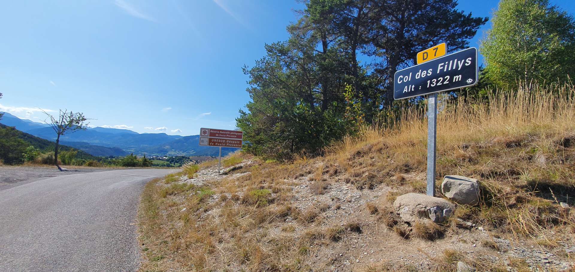
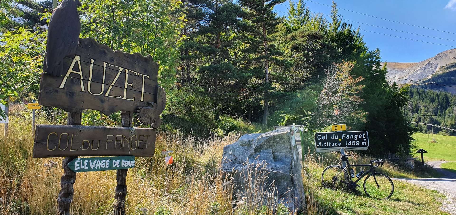
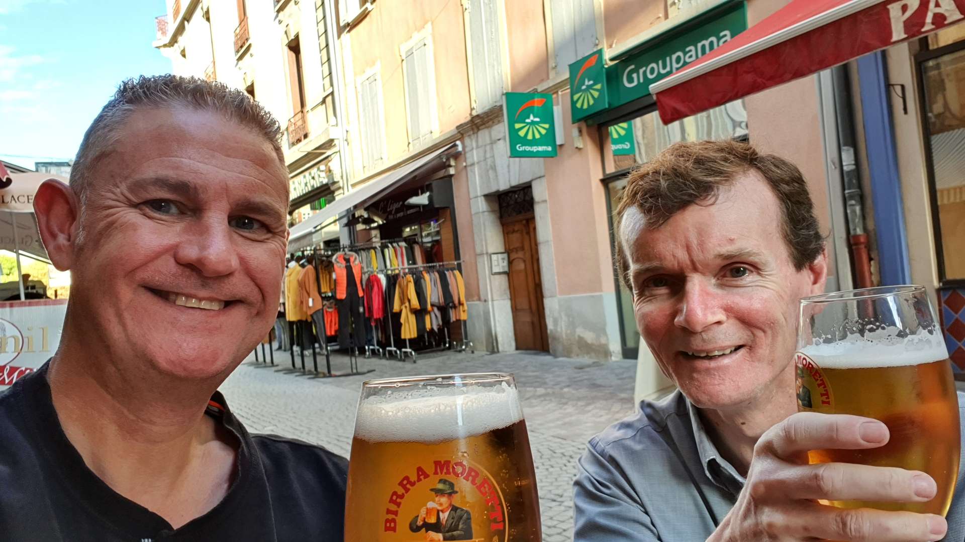
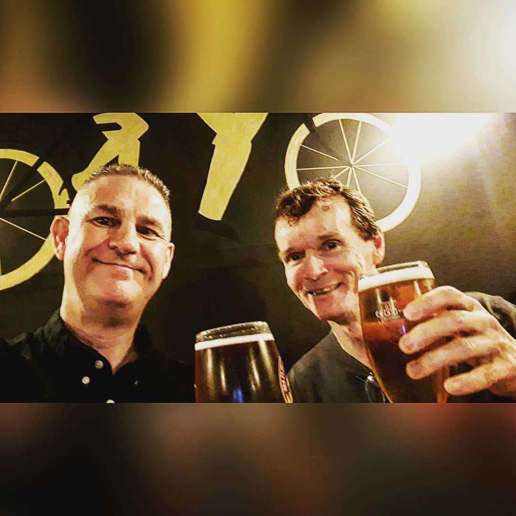
Both sides of Colle della Lombarde / Cold de la Lombarde – Day Five

Blue skies overhead for the second day running, so we decided to jump in the car for a 1 hour commute to Italy, to climb the Colle della Lombarde from Italy, descend to Isola in France, climb the Col de la Lombarde from France & descend back to the car. Just in case you didn’t realise, this is the same mountain, but I’ve used their Italian & French names!

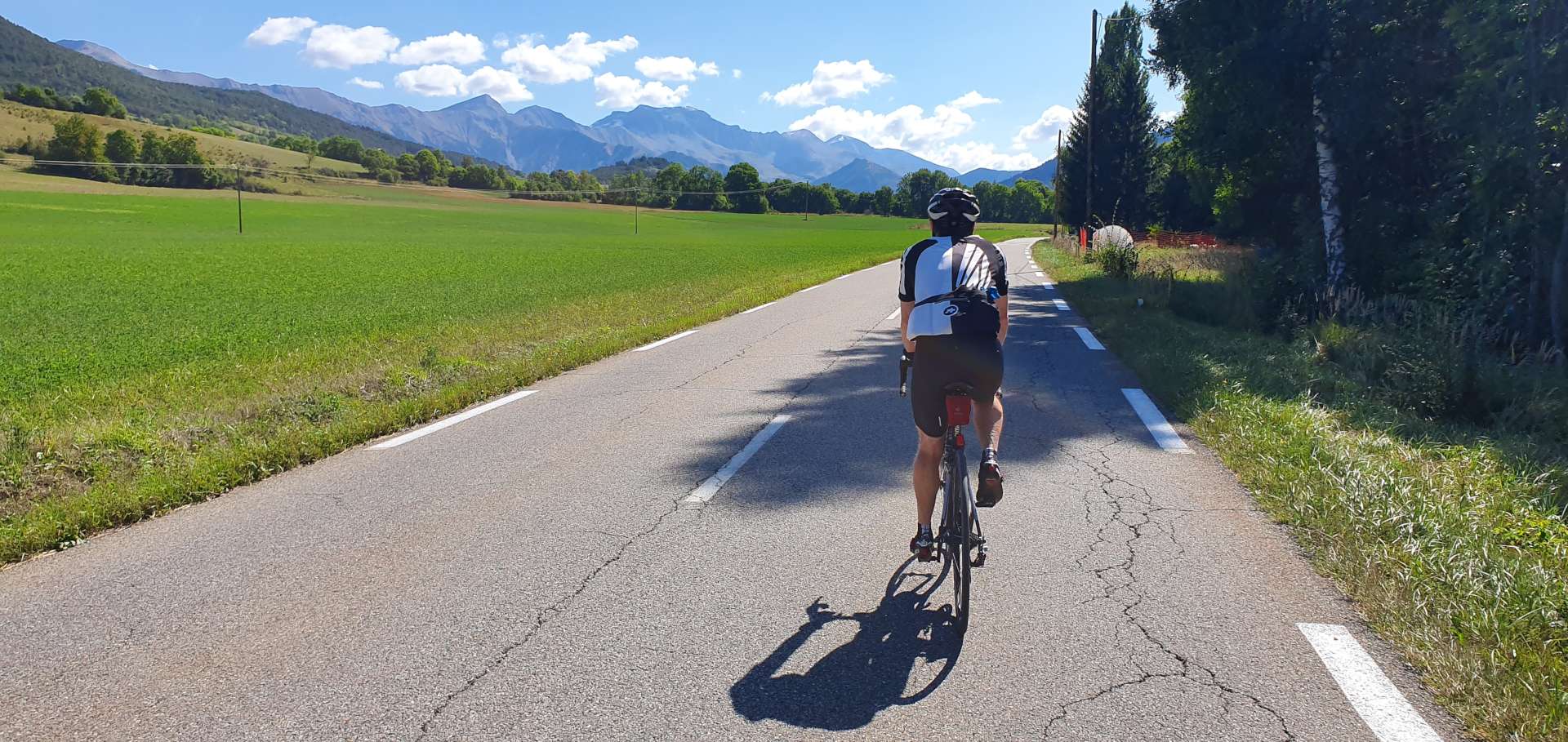
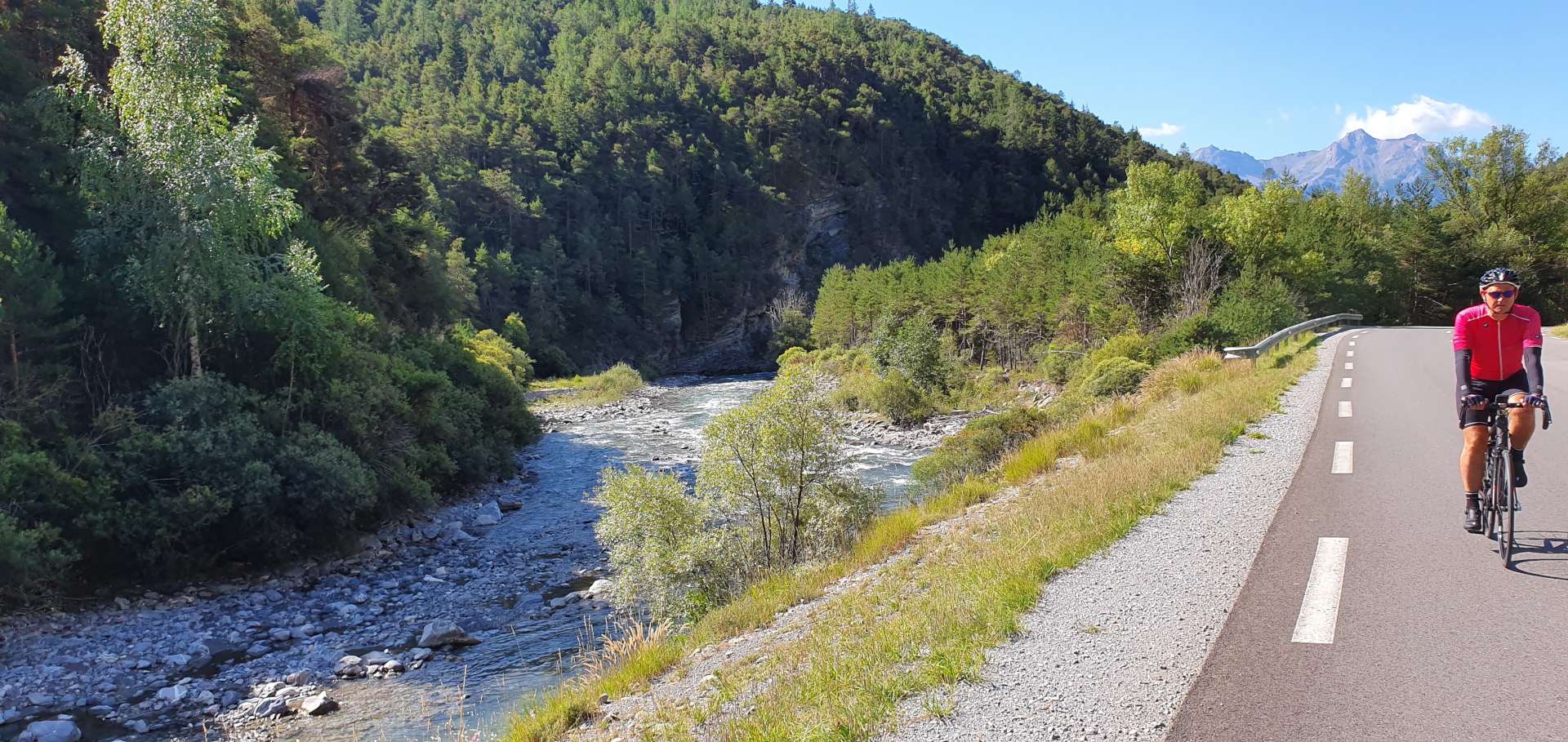
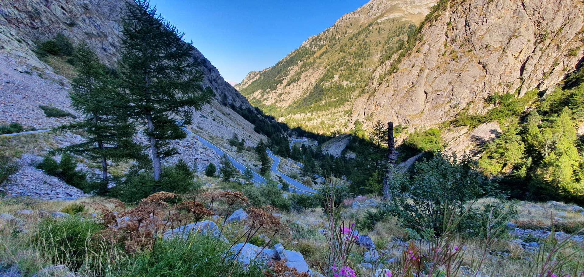
Today’s adventure would only involve climbing or descending, so while we would only be riding 53 miles, more than 26 miles would be uphill. As soon as we set off the road began climbing a sheer cliff face in a series of tornantes (hairpins), very similar in appearance to the Lacets de Montvernier in France. The gradient was a constant 8% for the first couple of miles, as the road weaved its way through a deciduous forest & followed a roaring river that was below us & off to our right.

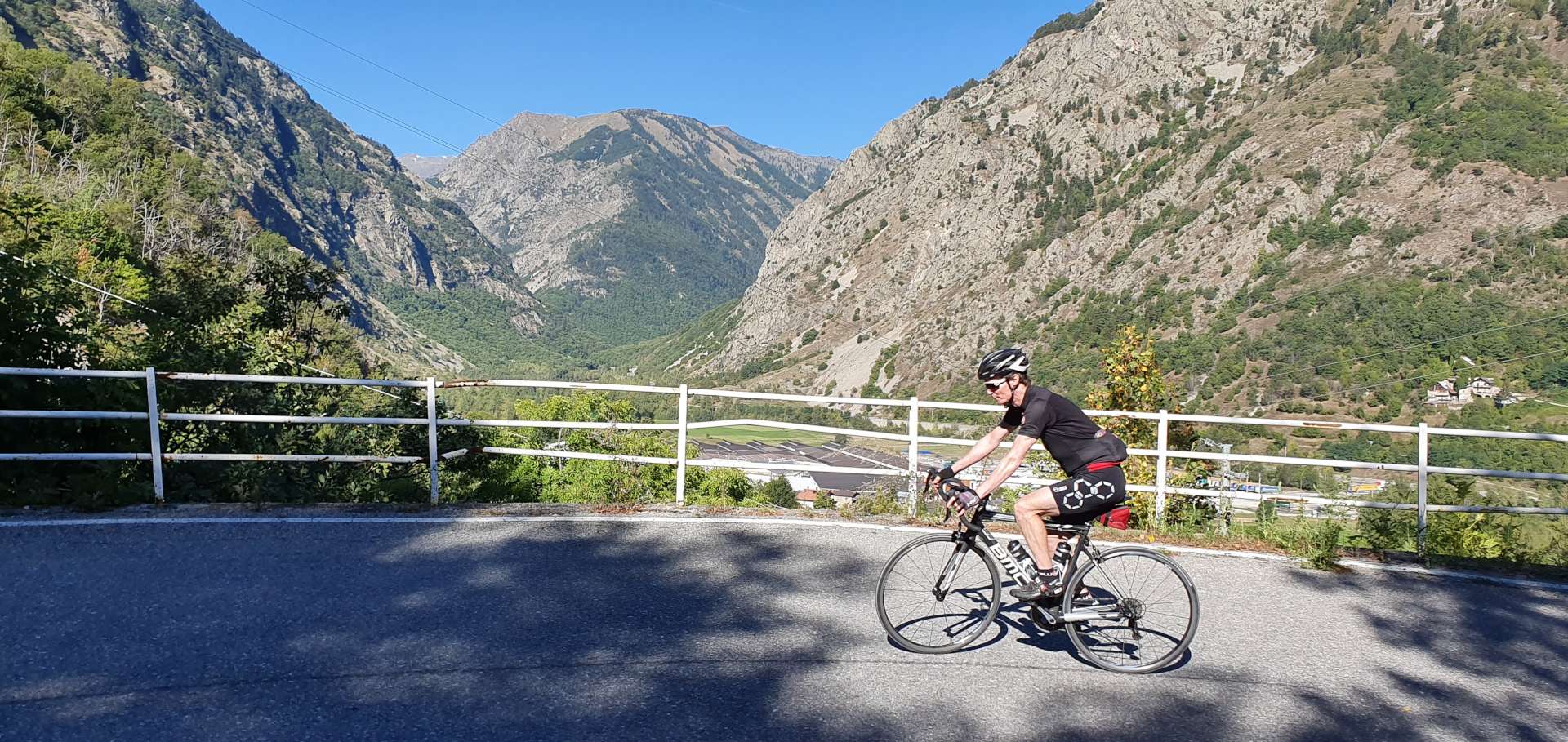
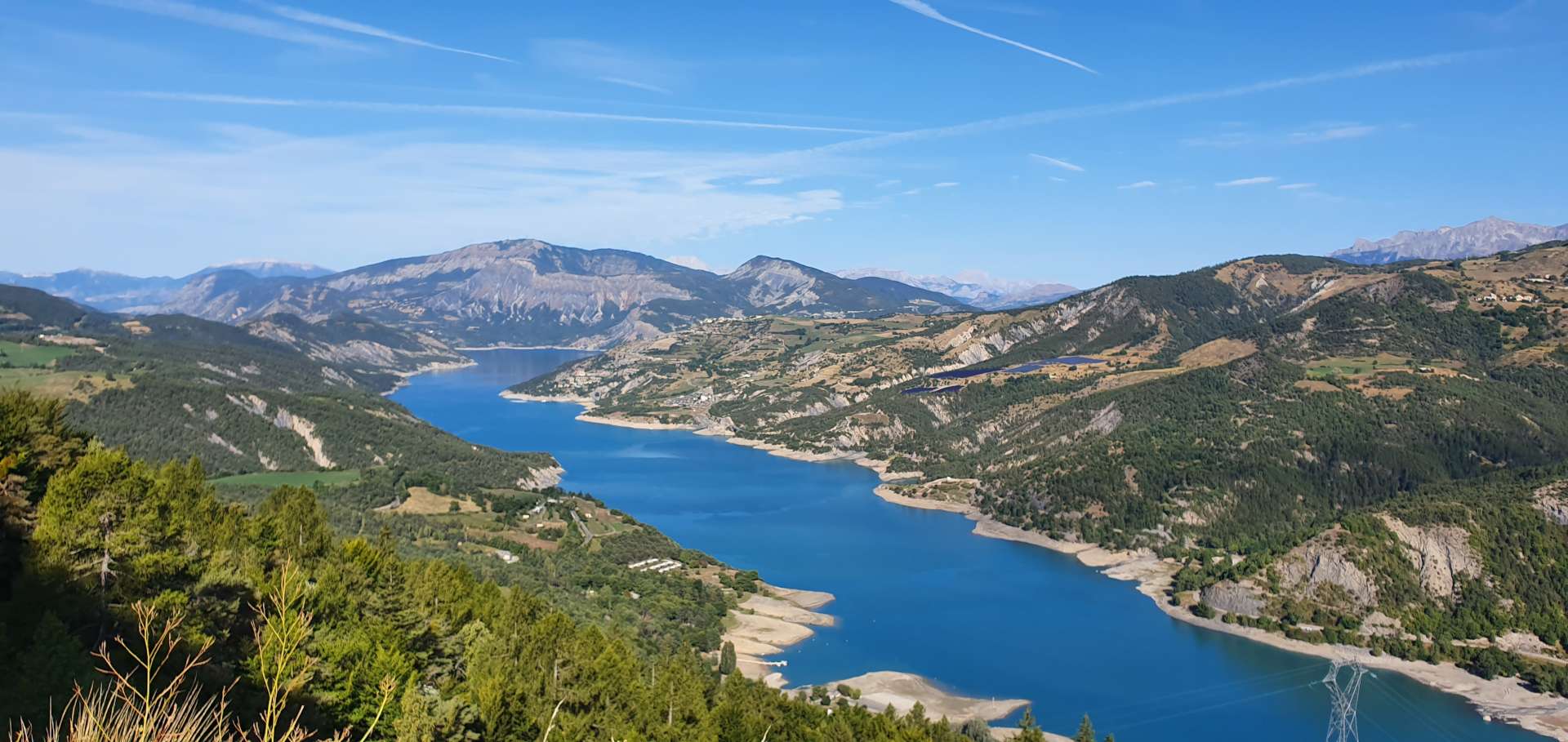
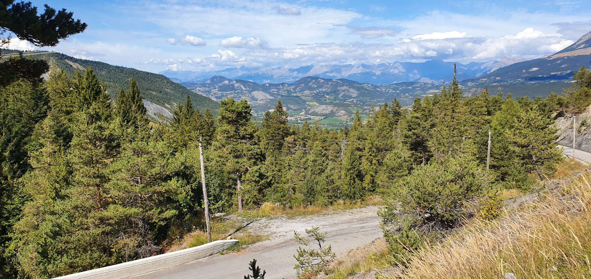
The road surface was potted & rough from the constant freeze/thaw cycle that takes place during winter, but wasn’t an issue as we were ascending. There wasn’t much in the way of views to talk of in the first 5 miles, as we were surrounded by tall trees. However this all changed when we crossed a bridge to the other side of the river & the landscape switched to meadow, with views of the huge mountains all around us.

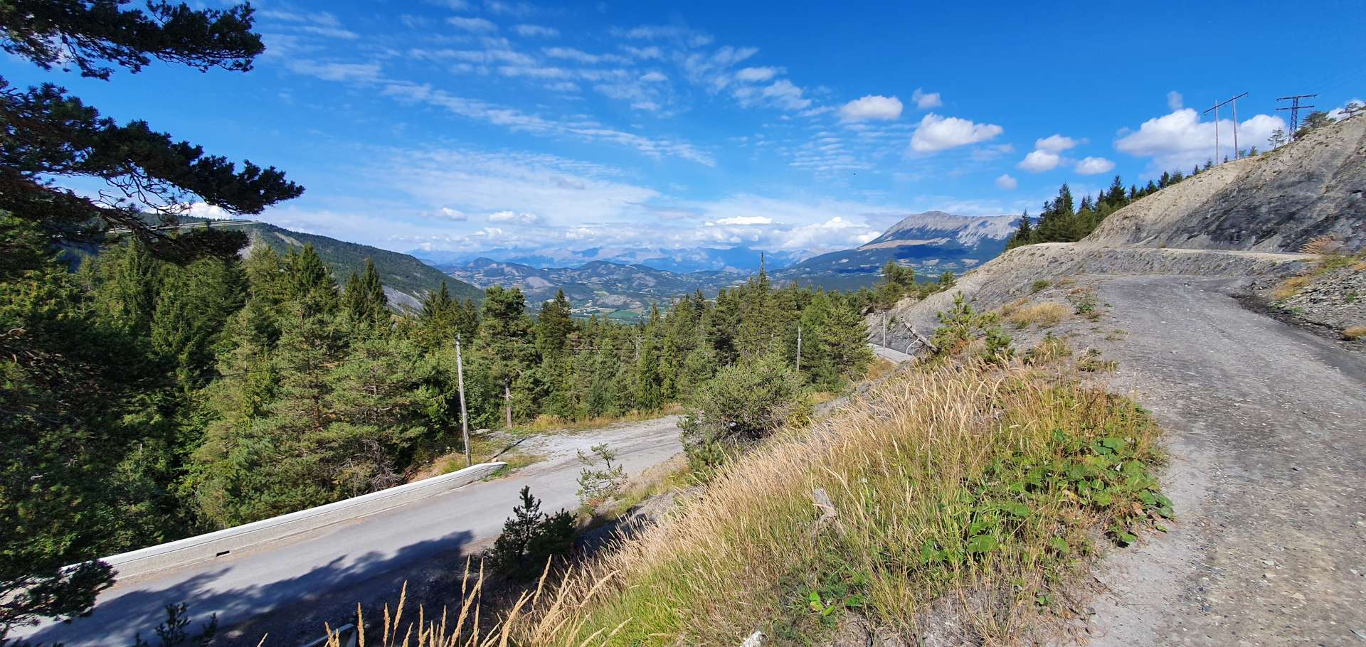
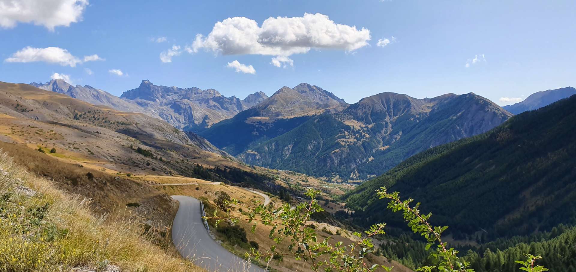
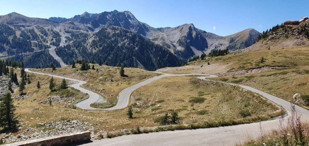
As we continued to climb, there were great views of the road below, as the switchbacks allowed the tarmac to find its way between the outcrops of rock. The views also helped to take my mind off the consistently steep gradient of the climb. As we continued to gain altitude, the valley opened out & we had our first views of where the road would be taking us – a long way up!

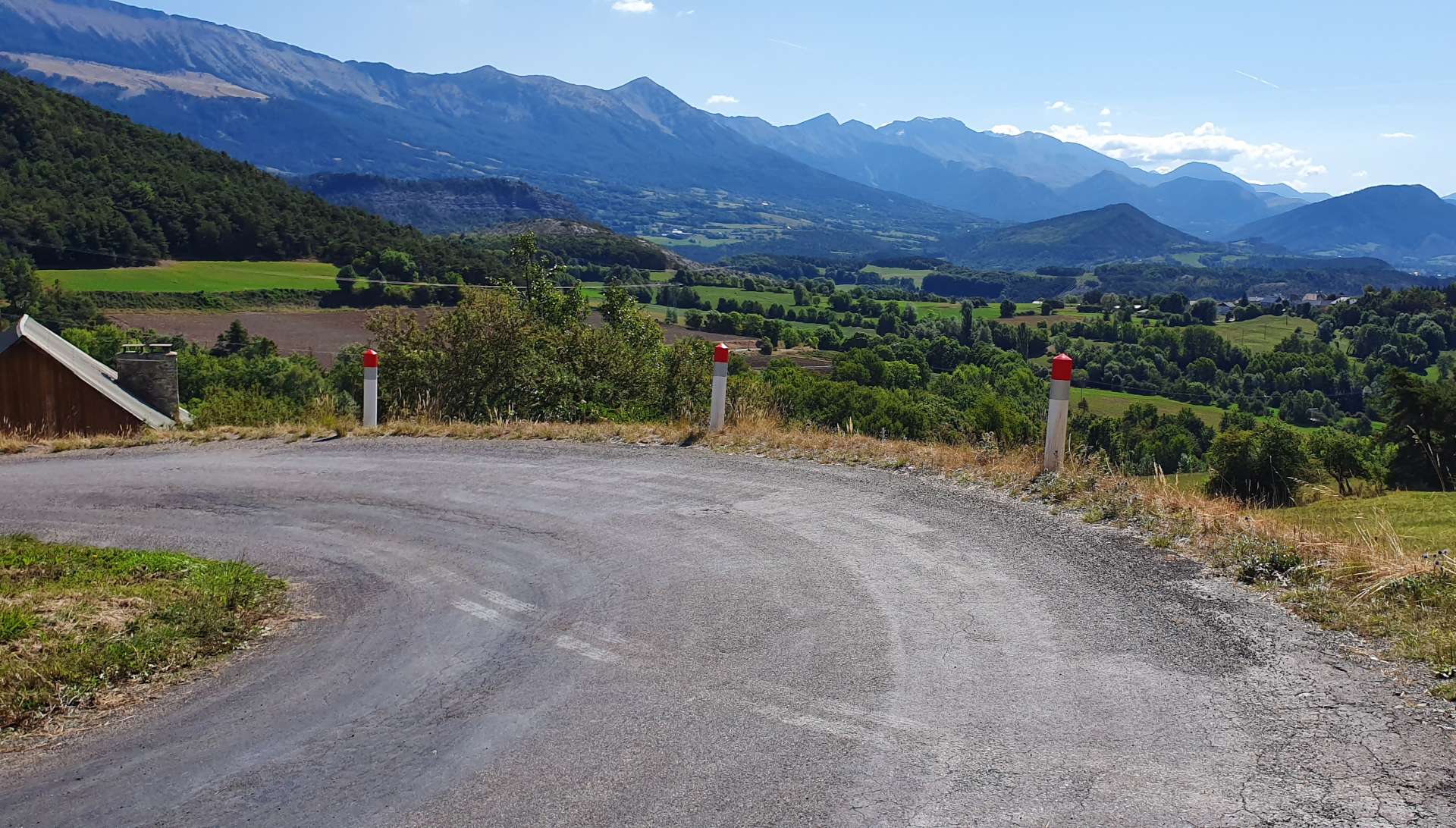
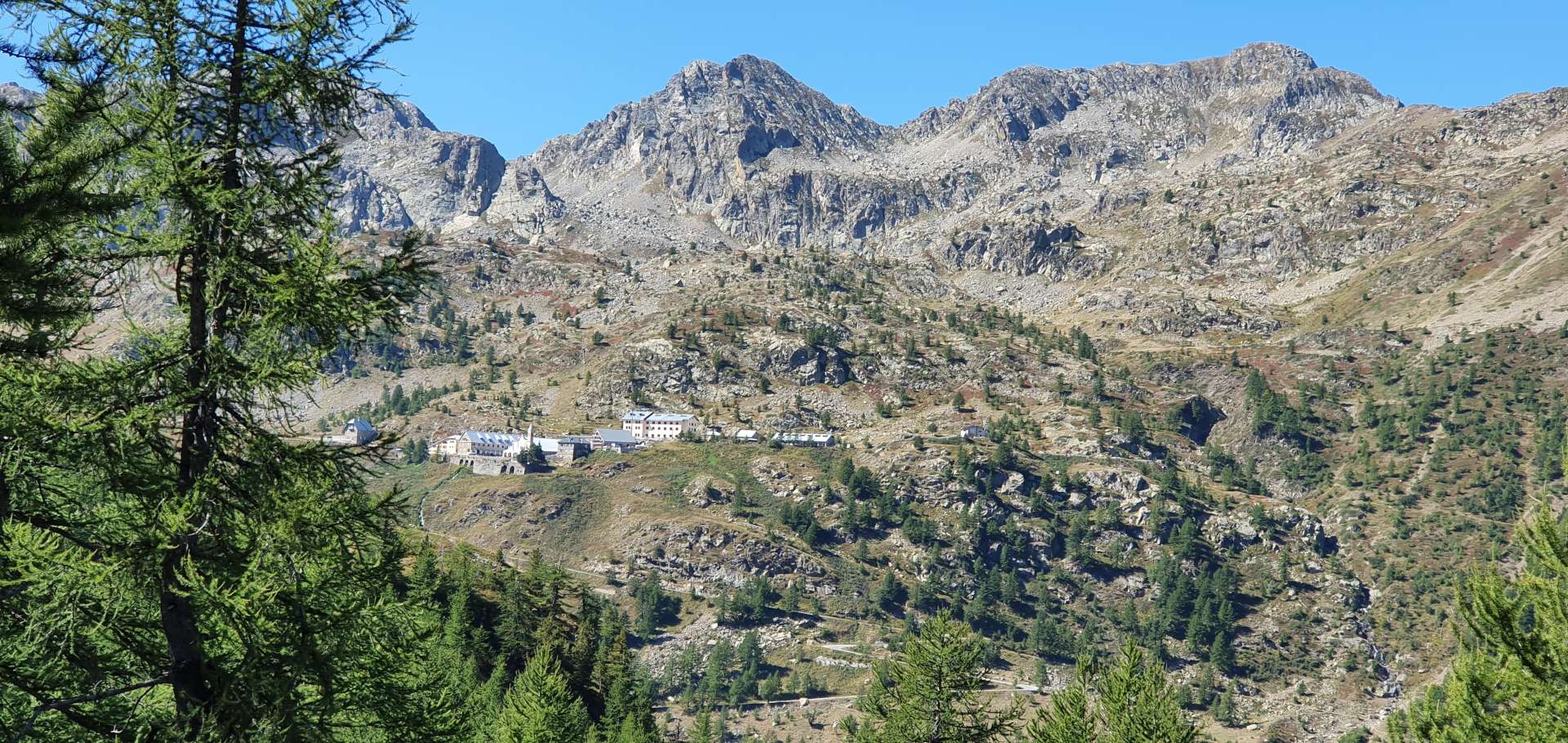
To the right of the valley a group of baroque buildings came into view – at 2,035 metres, the Sant Anna Sanctuari is the highest in Europe. Unfortunately, time was against us today, so we followed the signs to Francia & crossed back to the forested side of the valley. As we continued to climb, there were great views across & down to the Sanctuari. We were now about 9 miles into the 13 mile climb & as we rose above the treeline, we were back in alpine meadows.

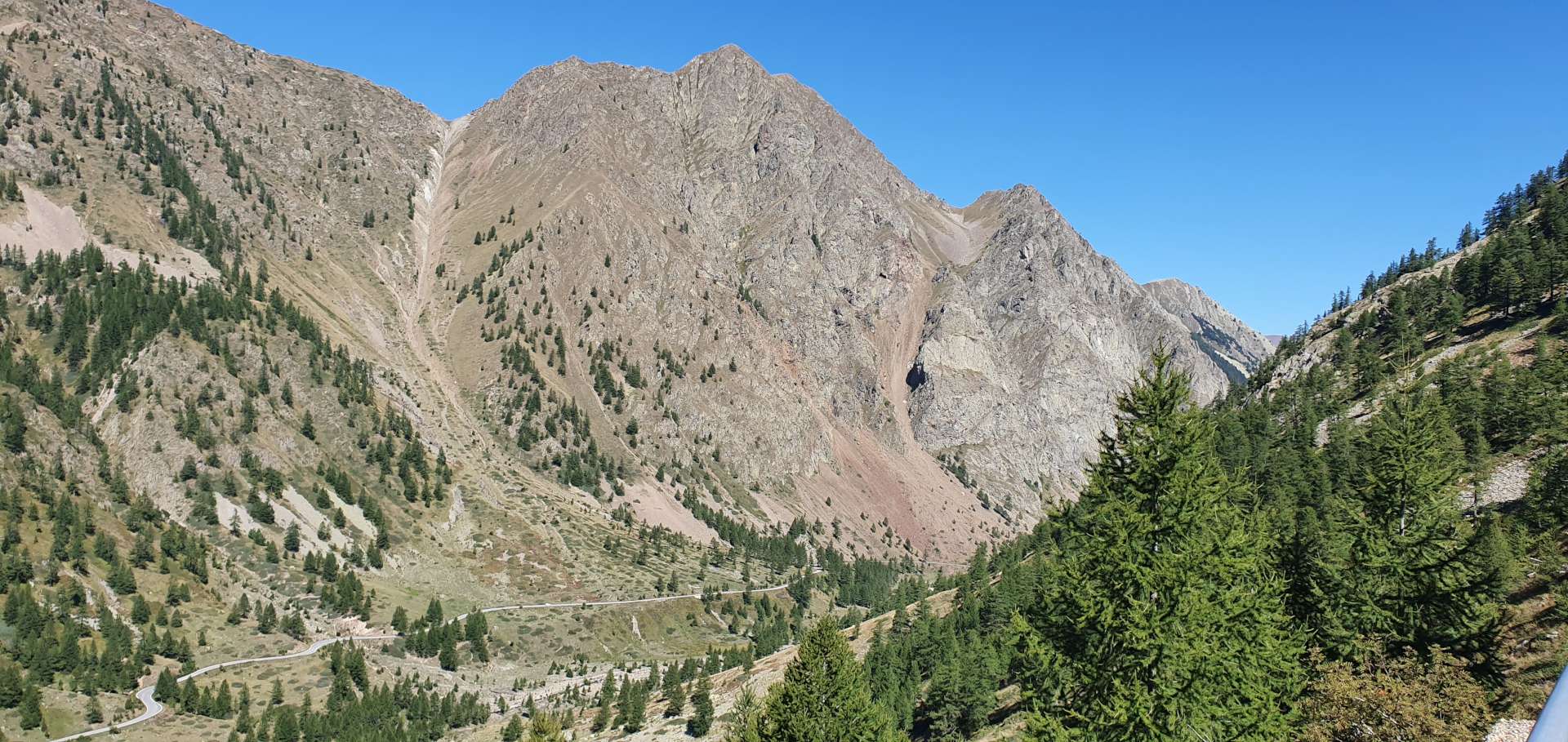
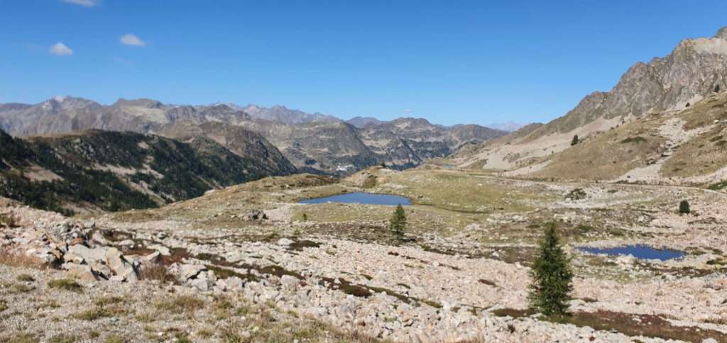
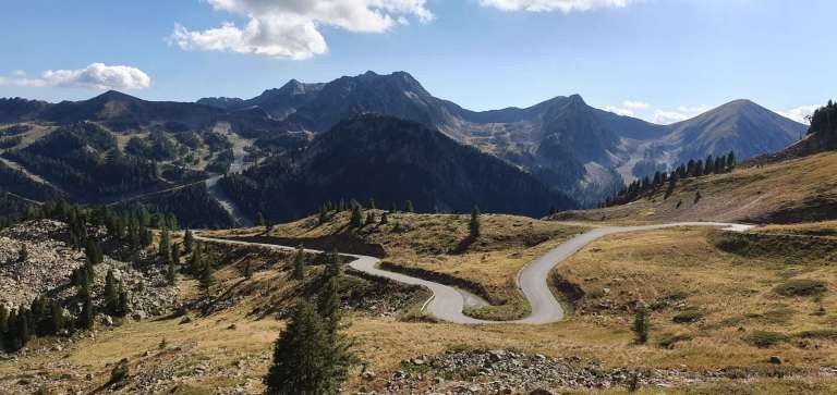
The Colle della Lombarde was just visible in the far distance, some 1,500 feet above us. Along the way, we spotted parked cars where their passengers had set out for a day’s hiking on one of the many trails into the wilderness. There were also a couple of people who had set up a picnic on the edge of an alpine lake – they really had got back to nature.

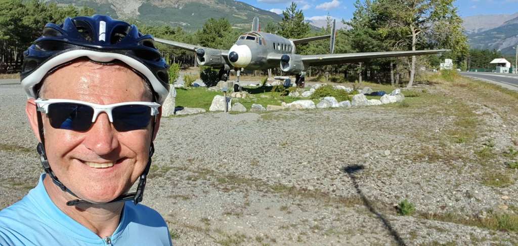
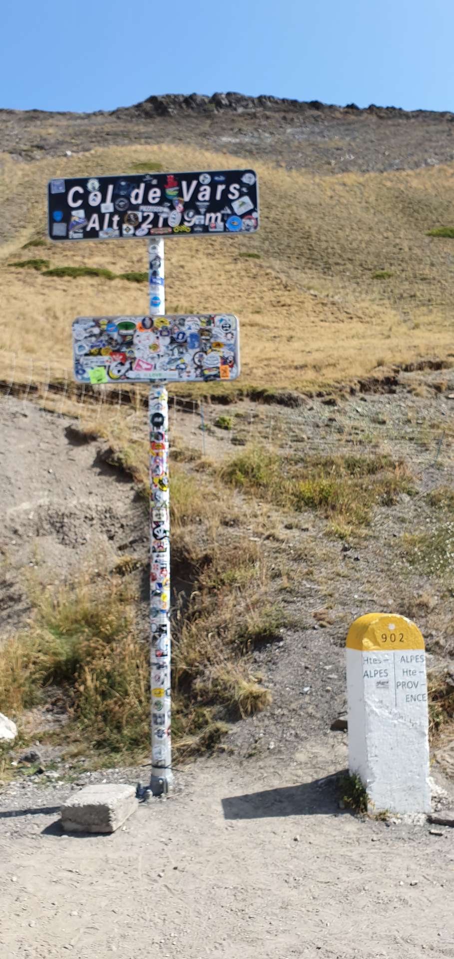
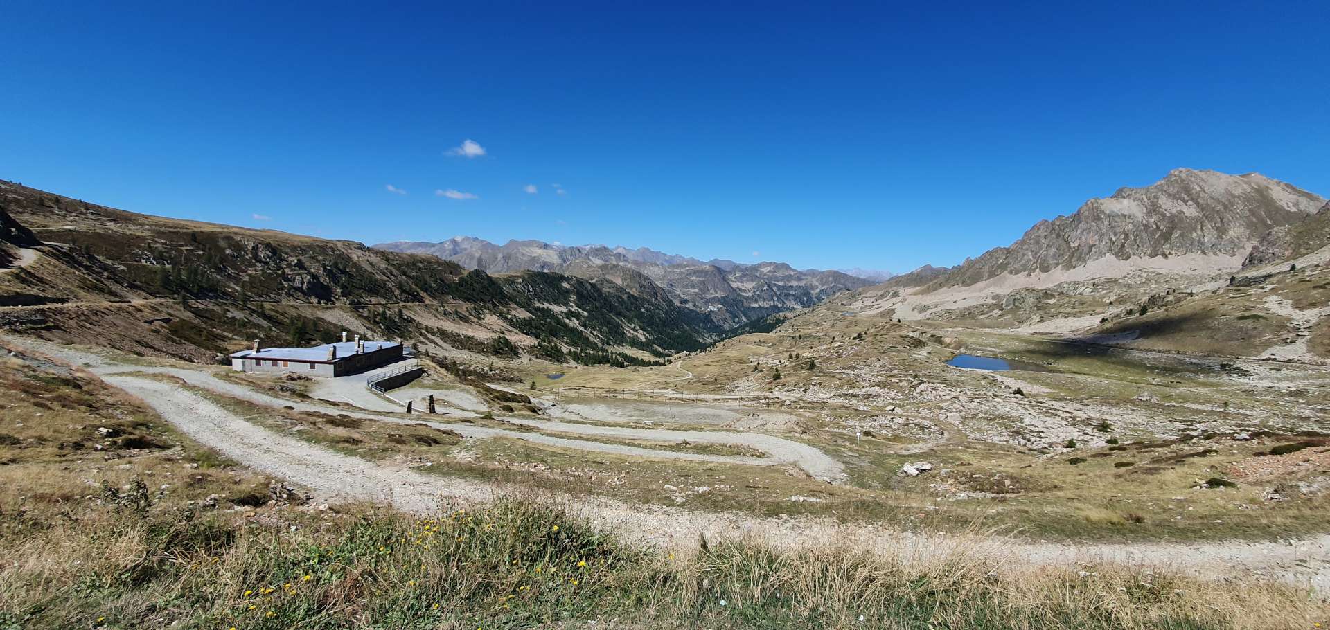
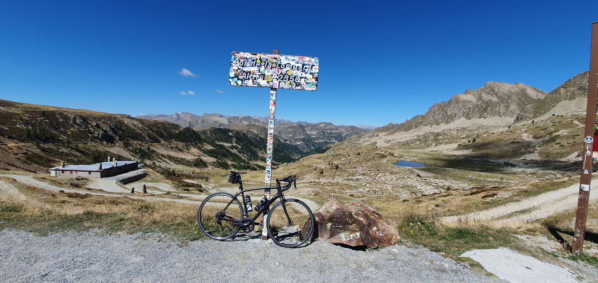
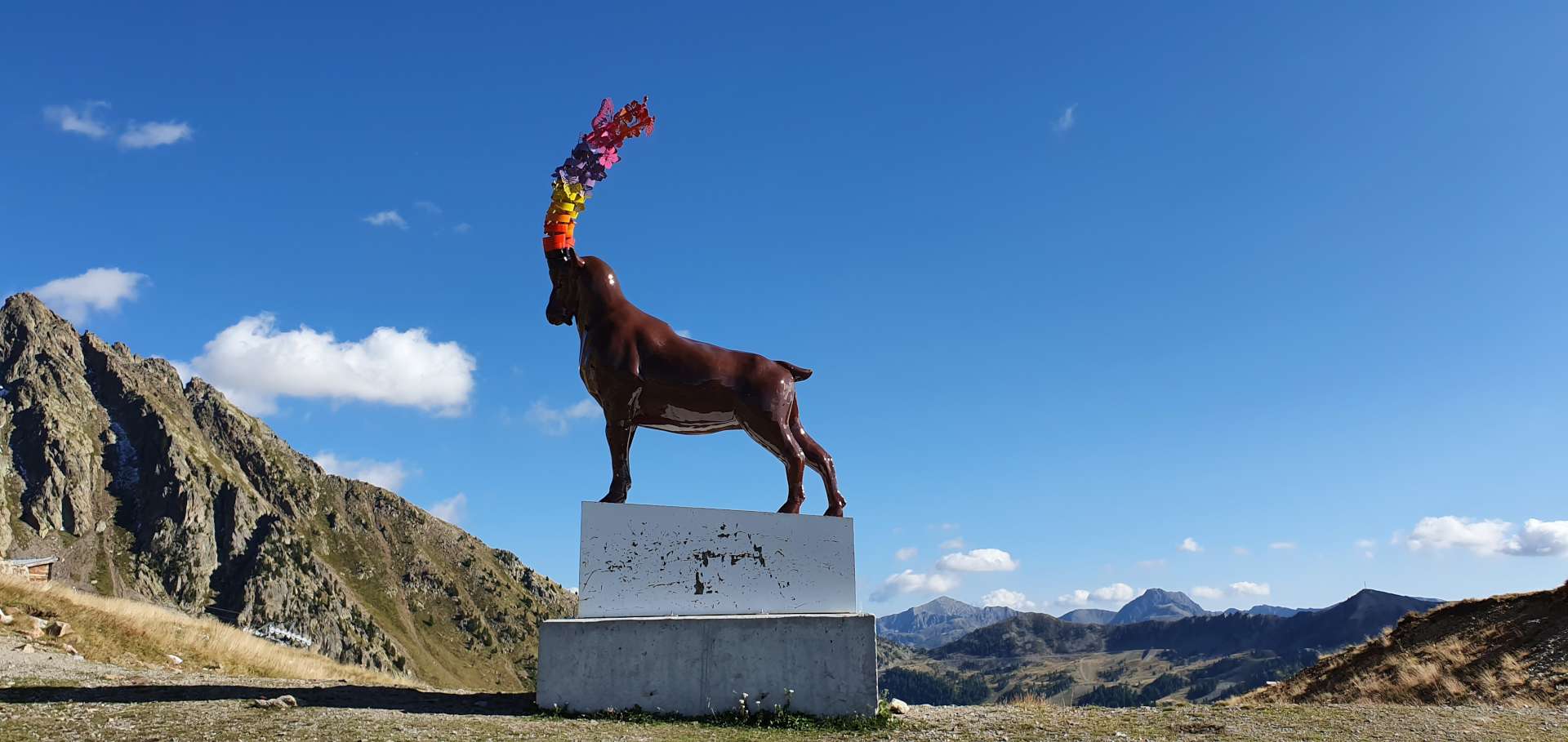
At the 12 mile mark, the climb eased off slightly for about ½ mile, which enabled me to gather my breath & prepare for the final push up to the summit. In the distance I made out what looked to be a statue of a deer, perched above the Col. I decided to explore further when we returned later in the day. Once we reached the summit, I took a couple of snaps, pulled on my windproof jacket & set off into France, for a 13 mile plummet to Isola, via the ski station of Isola 2000.

The first 3 miles of the descent were full of twists & turns, as the single track road zig-zagged down to Isola 2000. As with many other ski stations, the roads up to them are wide affairs – what struck me as being different about this one was how steep it seemed to be. If I let go of the brakes, I picked up speed incredibly quickly – it was only the sharp bends that forced me to moderate my speed. The first warning signs about the climb back up to the summit!

Once we reached Isola, the plan was to grab some lunch, however, the village/town only appeared to have 1 restaurant & it was just closing when we arrived. Although we had enough cycling food to get us back to the summit, there’s something morale building about sitting down & enjoying a nice meal – oh well, a banana bar & raspberry gel it was for lunch.

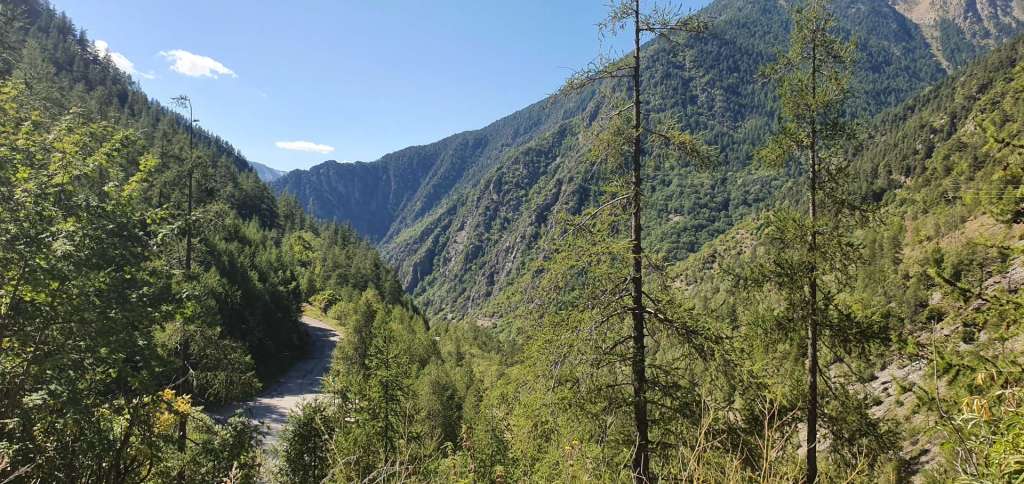
The early miles of the climb out of Isola were brutal – the first 3 miles averaged 10%, but due to the hairpin bends being level, the actual climbing was nearer 11 or 12%. As we toiled away under a baking sun (the temperature hit 27 centigrade), we could almost feel our energy draining away. The climb itself followed a river, but the valley was really narrow, so there wasn’t much in the way of views.

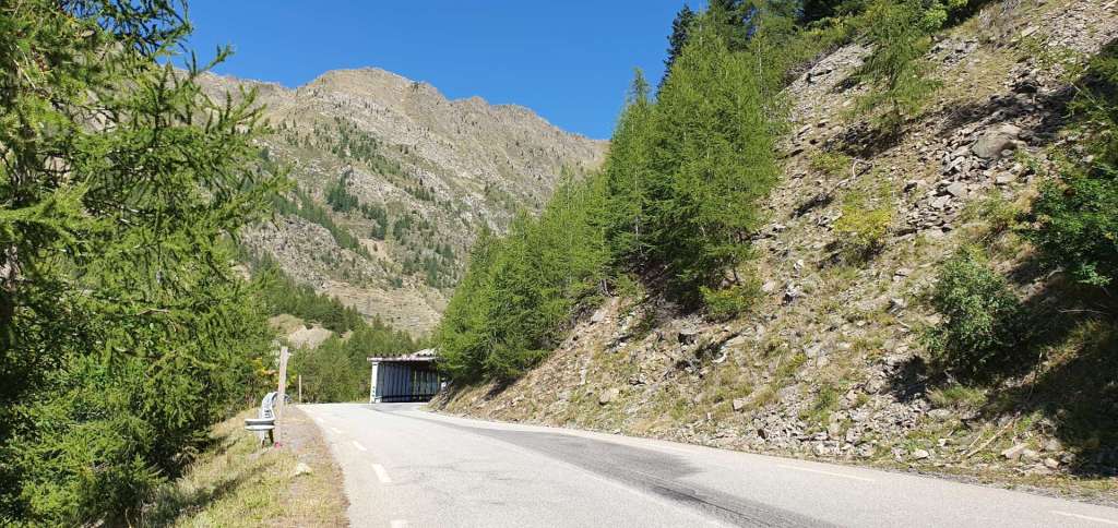
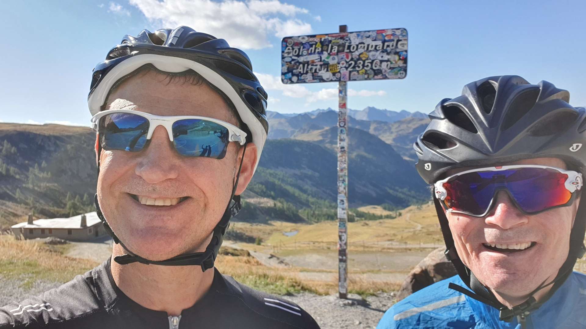
There was welcome relief from the sun as we passed through a number of avalanche tunnels, this also provided a degree of recovery time, as the gradient eased slightly through the tunnels. The higher up the mountain we climbed, the harder it felt – this could have been a combination of lack of food & water / our 5th big day of riding / being at altitude (the summit tops out at 2,350 metres). In any event, we were relying on good old British grit to see us through!

As we reached the 6 mile point in the climb, we got a glimpse of Isola 2000 & our spirits rose – we’d both seen a restaurant on the way down & there were people sat outside. This spurred us on as the road continued to climb through the trees, taking us ever closer to…….disappointment! The restaurant was long closed. We took a few minutes to regroup & down our final gels before the final push to the summit.

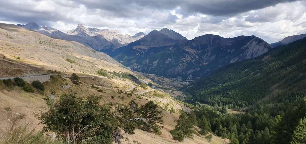
The good news was that it was only another 3 miles to the summit, the bad news was the final mile was at a gradient of about 9%. All around us the mountain peaks loomed above us, providing some great views as we continued to climb. As we turned to tackle the final steep ramp, we realised that we had a tailwind to help us get to the summit! An Italian couple were sat on the verge watching us battle up the climb & as we passed them they shouted out ‘Bravissimo!’ – a small gesture, but one that was really appreciated, as they could see I was at my limit to finish the climb.

More snaps at the summit, then a short hike to get a closer look at the animal sculpture on the mountain peak – it appeared to be a bull, but with elongated coloured antlers, rather than horns. I’m none the wiser as to what it represented, but I enjoyed looking at it anyway.

After strolling back to the bikes, we put on our jackets for the descent on the single track road & with regret, we both agreed we were too tired to do the extra climb up to the Sant Anna Sanctuari. All that remained was to buckle up & enjoy the banzai descent back to the car as we returned to Italian soil.

An epic & challenging day in the high Italian & French Alps – the views were spectacular & the climbing was about the toughest I’ve experienced on any of my Alpine Adventure trips to date!

Alpine Adventures – Tour de Barcelonnette – September 2019

Bal Blanche Loop – Day Four

After yesterday’s almost constant rain, we woke to clear blue skies overhead, so today’s plan was to tackle the mighty Col de la Bonette. However, after heavy snow yesterday, the roadside col information signs said that the col was closed. We found this out about 2 miles into the planned route. We’re in Barcelonnette for another couple of days, so hopefully we’ll still have a chance to explore both sides of the Bonette.

I suggested that we cycle down to towards the Lac de Serre-Poncon again (we rode around it yesterday) & explore some of the lesser known climbs of the Val Blanche (a popular skiing area). We retraced our tyre tracks across town, before gently descending the Ubaye valley towards the lake for the next 15 miles. We passed our parking spot from yesterday’s ride & for the next 7 miles took the same route. The views were totally different under blue skies, as we could see the huge mountains beyond the lake.

We then took a left turn onto a small side road, the D7. It was little more than a single track lane, just the sort of road we were hoping to find ourselves on! We were immediately onto the first climb of the day, a 5 mile ascent up to Col des Fillys, which at times had small ramps with gradients of 12 to 15%. The road twisted its way through a forest, which limited the views slightly, but every now & again we caught a brief glimpse of the lake way below.

On the way up, we also bagged an unexpected bonus col, the Col de Charamel, which didn’t show up on the route plan – there was a Col sign, so it counts in the Col climbing stakes!

At the summit of Col des Fillys, the views opened out in front of us, as we caught our first look at the UNESCO Geoparc de Haute-Provence. As we crossed into the Val Blanche, we passed through a couple of tiny hamlets as we plummeted towards the valley floor below.

As we passed the medium sized village of Selonnet, we spotted a café/restaurant, where we stopped briefly for our first ice cream of the trip & a coffee. Almost as soon as we set off, the road took us past a field full of hay bales, so I had to pull in & attempt some hay bale surfing – after 3 full days of riding, I’ve lost some flexibility & my technique clearly needs some work!

We continued along quiet back lanes for another couple of miles, before joining the wider (but equally quiet) D900 towards Dignes. This marked the start of our next climb, which was probably our easiest of the day, as the gradient was only 3 or 4% for the 3 miles up to to Col de Maure – we both felt that it didn’t really qualify as a Col, but we were happy to bag it. We were still surrounded by huge mountains, quite a few of which had coatings of snow showing on their summits.

We stayed on the D900 for another 6 miles as it descended down the opposite side of Col de Maure. We then took a single track road (which had the best tarmac of the trip so far) as it continued the drop to the valley floor. At the 47 mile point we turned onto an even smaller track, which marked the start of our 4th climb of the day – the 5 mile climb of the Col du Fanget through a beautiful forest.

The first mile averaged 9%, which included a short stretch where the road crossed a river below. I was a bit concerned about what this unknown climb may throw at us, but after the initial slap to the face, the gradient dropped to a much friendlier 4 & 5%. As we made our way round a blind bend, we could hear an almighty screeching noise in front of us – we’d stumbled across a crew of workmen using an enormous caterpillar digger to dig a trench & lay cable. We had to get off our bikes & walk through the long grass to get past them. This was also where the gradient increased to an average of 9% for the final mile & a half, with stretches hitting 15%.

The huge views from the summit of Col du Fanget made the effort all worthwhile – big panoramic views to the mountain ranges in the far distance. The 4 mile descent was on a badly rutted & potholed surface, but we didn’t see a single vehicle on the way down, so could use the full width of the road to try & find some decent tarmac.

We were now back in the large village of Seyne, where we’d hoped to grab some lunch, however, everywhere was shut as it had just past 2pm. We only had one more climb to go, so after eating a banana & downing a gel, we were on our way again. The Col de St Jean showed on the map as being just before the ski resort of St Jean-Monclar, however, there wasn’t a sign, so we simply rode on & continued on our way.

As we passed through St Jean, we took a sharp right onto a much wider road which would drop us down to the main lake road. From here we just had to follow our path back to Barcelonnette, via a late lunch stop at Le Lauzet-Ubaye – although the chef had closed the kitchen, the owner very kindly made us a ham & cheese bagette each.

The road back up the Ubaye valley to Barcelonnette wasn’t something we were looking forward to, as it seemed like we flew down the hill in the morning. However, fate was on our side & we had a tailwind the entire way home! Just as we were riding into Barcelonnette at the end of the ride we passed a local airfield & I stopped for a quick photo op outside.

We had the sun on our backs, had ridden the most amazing day on quiet country lanes & now it felt like someone was pushing us up the hill – this was one of those days where everything fell our way. All that remained was to enjoy a celebratory beer in Bar Tandem & then top up the energy reserves, before a stroll home under the moon! What a great day out!

Alpine Adventures – Tour de Barcelonnette – September 2019

Barcelonnette to Guillestre & back via Col de Vars – Day One

My second (& final) Alpine Adventure of 2019 was based around the small town of Barcelonnette, in the Maritime Alps of Southern France, about 90 miles north of Nice. Yesterday’s travel day was longer than planned, due to my inability to queue in the right car rental queue – I spent 45 minutes in the Europcar queue, before realising I’d booked the hire car through Hertz!

In the rush to put our bikes together before heading out for something to eat, Sean’s collar on his seatpost failed, which meant his saddle wouldn’t stay in the right place. All the bike shops were already shut, so it meant we had to adjust plans for this morning’s ride – in the end I found a bike shop in Jausiers (about 5 miles down the road) that opened at 10.30am, so today’s ride was a 64 mile ‘out & back’ to Guillestre, over both sides of the Col de Vars.

We started out following the River Ubaye upstream to Jausiers & within 15 minutes, the friendly mechanic at Technicien du Sport had found a replacement part & fitted it for the bargain price of €7 & we were on our way. After 10 miles of gently climbing alongside the babbling Ubaye, we turned left off the D900 & joined the smaller & quieter D902 – this is a legendary road in Tour de France history. In the space of less than 100 miles, this road goes over the epic Tour de France climbs of Col d’Izoard, Col du Galibier & Col du Telegraphe in addition to the Col du Vars, our climb(s) of the day.

For the next 5 miles, the road climbed steeply as it twisted & turned up the side of the valley, passing through quiet villages along the way. Whilst the climb wasn’t long, the gradient was consistently over 9% & I found it a challenge to keep up with Sean, although he was riding well within himself – I’m a few pounds heavier than my usual touring weight & I felt it today. The views across to the surrounding mountain peaks were amazing, with white clouds providing great contrast to the blue skies & they took my mind off the difficulty of the climb.

At the summit there’s a couple of signs, a café & a large car park. We stopped long enough to take a few photos, put on a wind proof jacket & then we were descending the longer, but shallower side of the col, heading towards Guillestre. Along the way, we rode through the ski resort of Vars – this is where the world record was set for skiing, some 254 kilometres per hour….on skis!!!!

Descending into Guillestre was fun, the road was wide (so coaches can get the ski resorts in winter), the corners were easy to navigate & the surface was good quality. After about 8 miles of the 12 mile descent, huge views down to Guillestre & across to the Izoard came into view. In less than 25 minutes we’d reached our lunch stop in town – we hoped to grab a panini somewhere, but all the restaurants in the main square were proper sit down affairs, so we settled in for an extended lunch & set about demolishing some pasta.

We were on our way again by about 2.50pm (at least a couple of hours later than we would have expected), now all we had to do was conquer the 12 mile climb back to the summit of the Col de Vars. We estimated that this would probably take us in the region of 2½ hours, on the basis we would climb at about 5 mph. The first 3 miles were a consistent 7 to 8% & this meant we could settle into a good rhythm. As the road hair-pinned its way ever upwards, we could see the climb spread out before us.

As we rode through Saint-Marcellin there were loads of wood carvings of winter sports characters, including a huge man on skis. After a brief stop to admire the artwork & take a couple of snaps, we were on our way again on what was my favourite part of the climb – it had a 1 mile descent at this point! The entire climb was less steep than this morning & as a result I was better able to enjoy the views & chat as we rode – this morning all I could do was huff & puff!

The final couple of miles of the climb took us past a moody looking lake, with big rain clouds beginning to gather in the distance. This was the direction we were heading, so the appearance of potential rain clouds was of interest to us.

After just over 2 hours of climbing we were back at the summit, once again it was time to wrap up warm for the descent (10% for the first mile) & then enjoy the ride!

It took just over 13 minutes to descend the 6 miles back to the main road – it was incredible how quickly I gathered speed when I released the brakes. Luckily there were plenty of twists & turns to ensure that we both took the descent sensibly. The road back to Barcelonnette via Jausiers was slightly downhill all the way, but any thoughts of free miles were scuppered when we picked up a full-on headwind! Oddly, the downhill section into the headwind took longer than when we rode it in the opposite direction as an uphill this morning.

After a slow start, the day turned into a truly great expedition into the high mountains of the Maritime Alps. I’m looking forward to finding out what tomorrow will bring, but in the meantime it’s time to toast today’s great adventure in Bar Tandem!