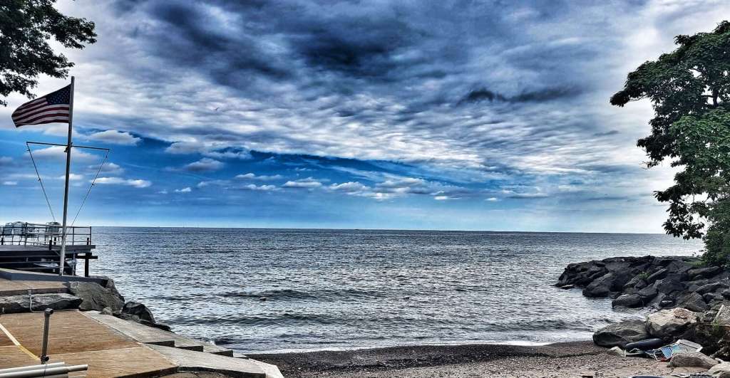
Sunday 15th August – North East to Angola-on-the-Lake (Stage 81).
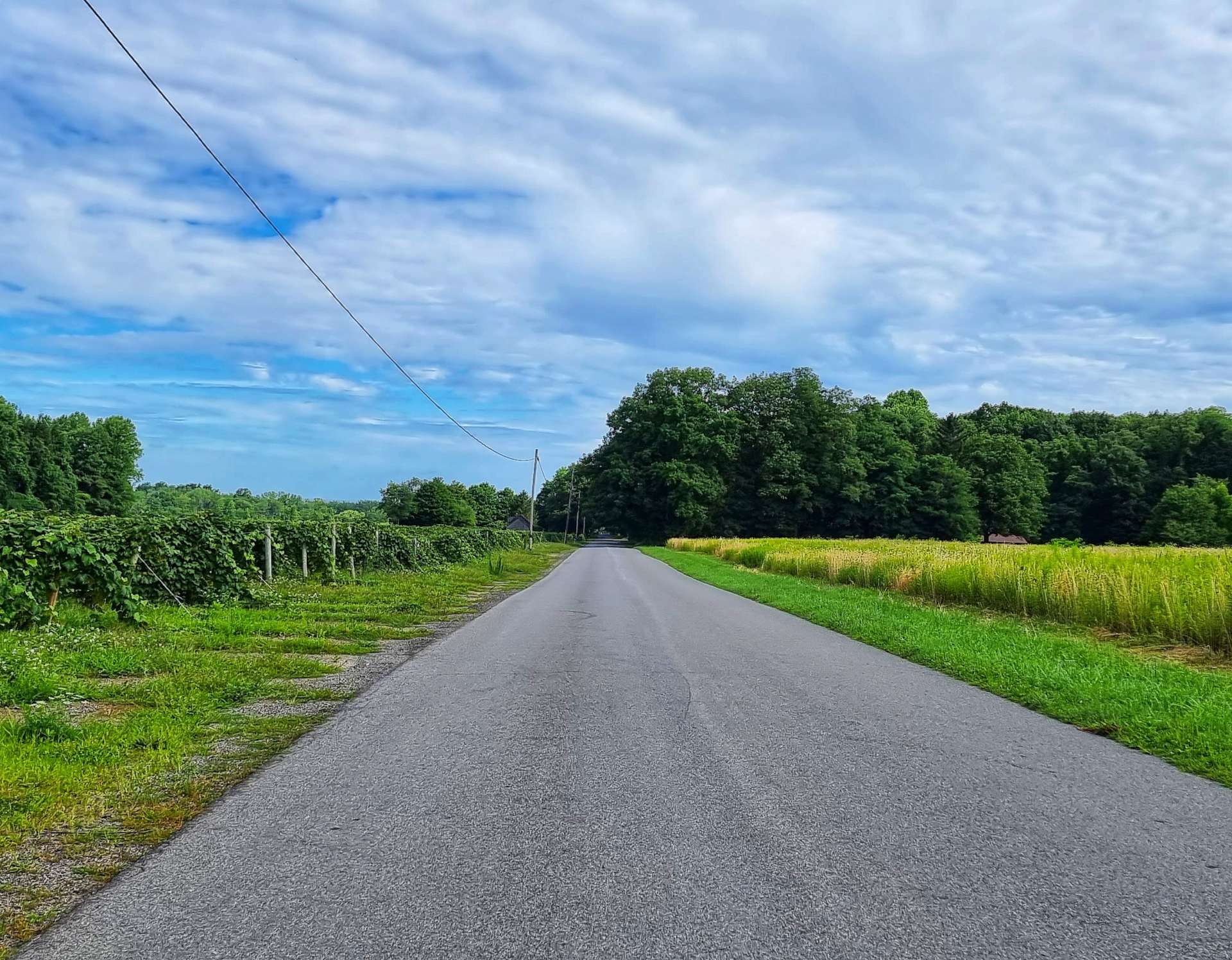
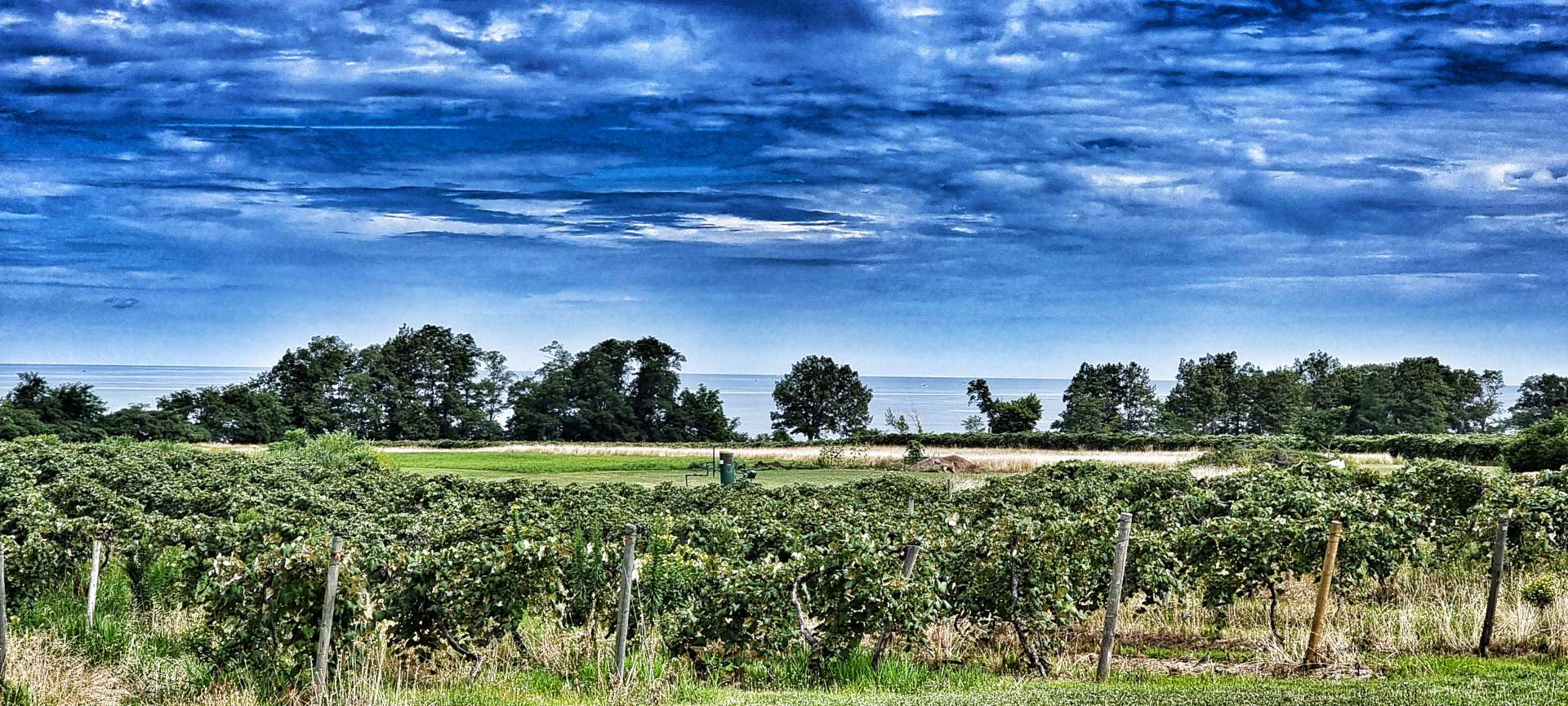
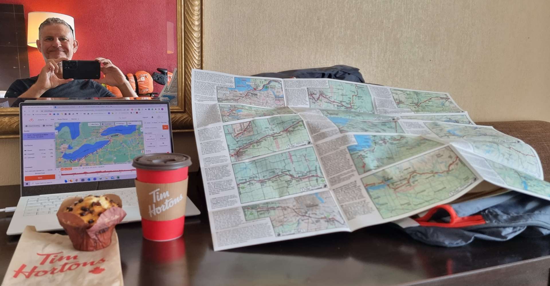
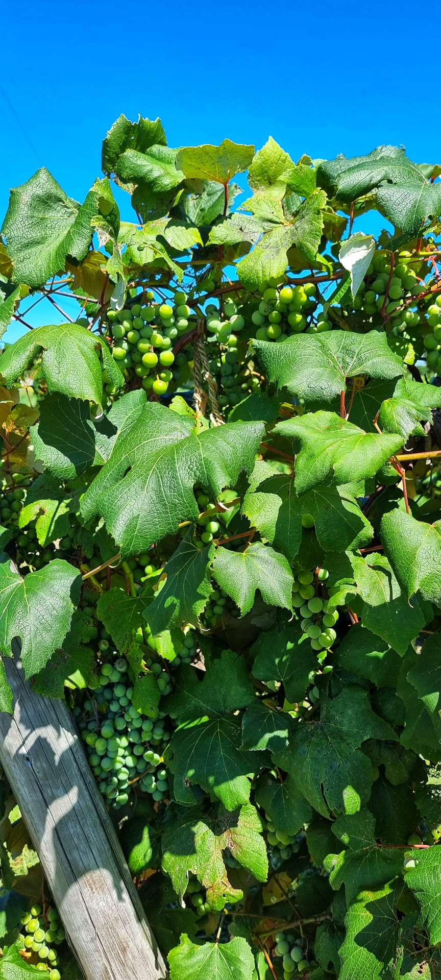
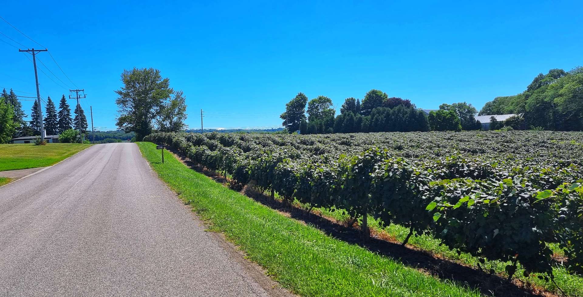
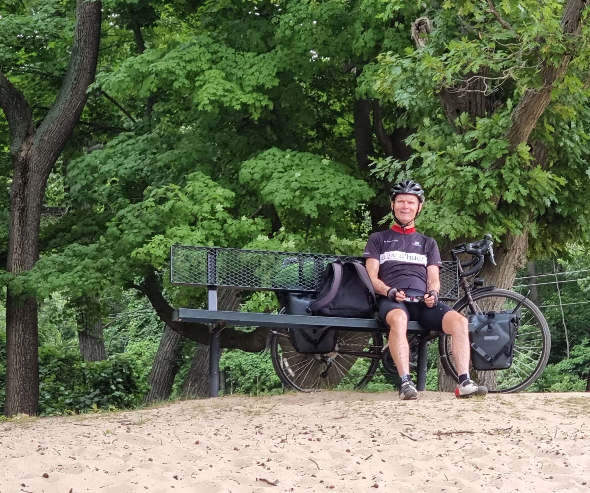
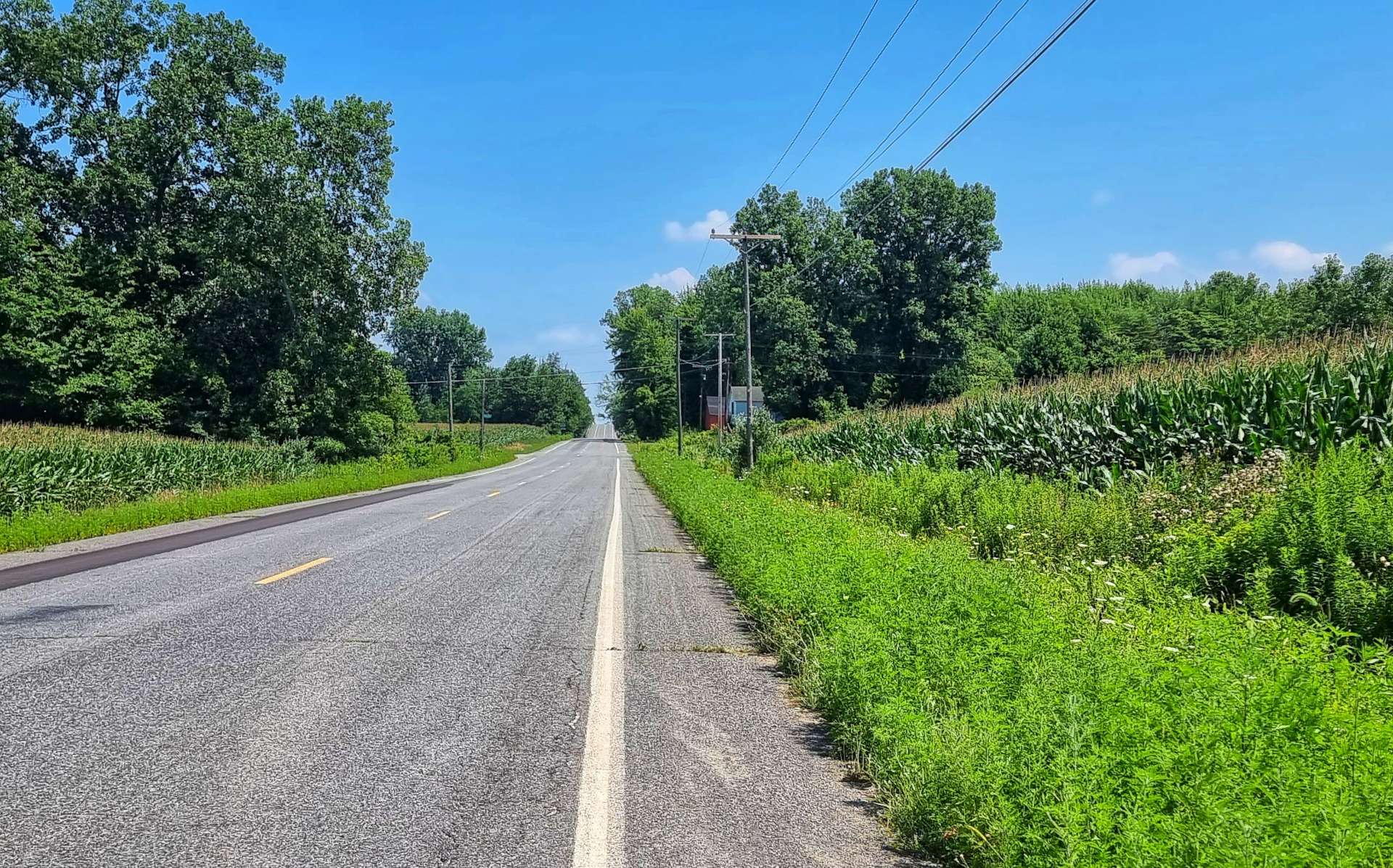
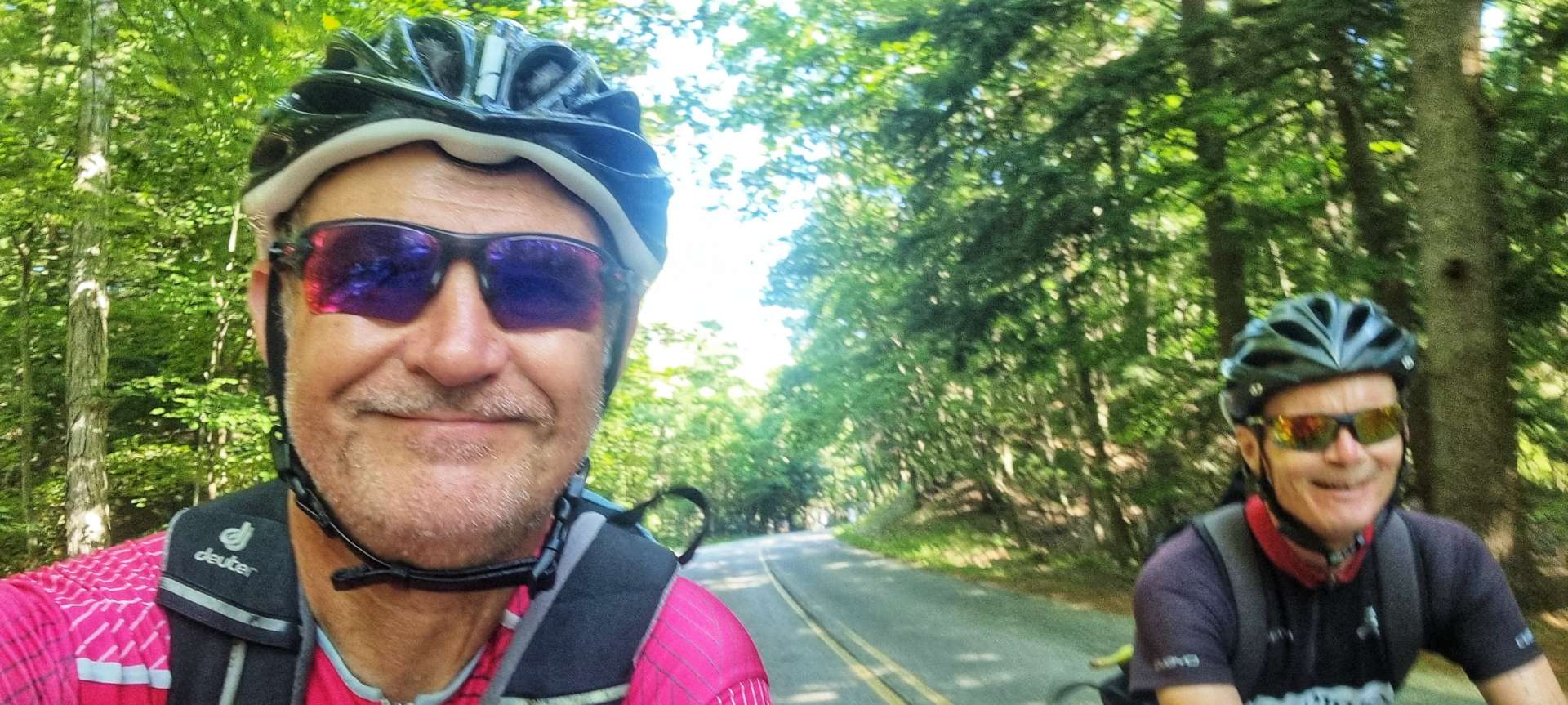
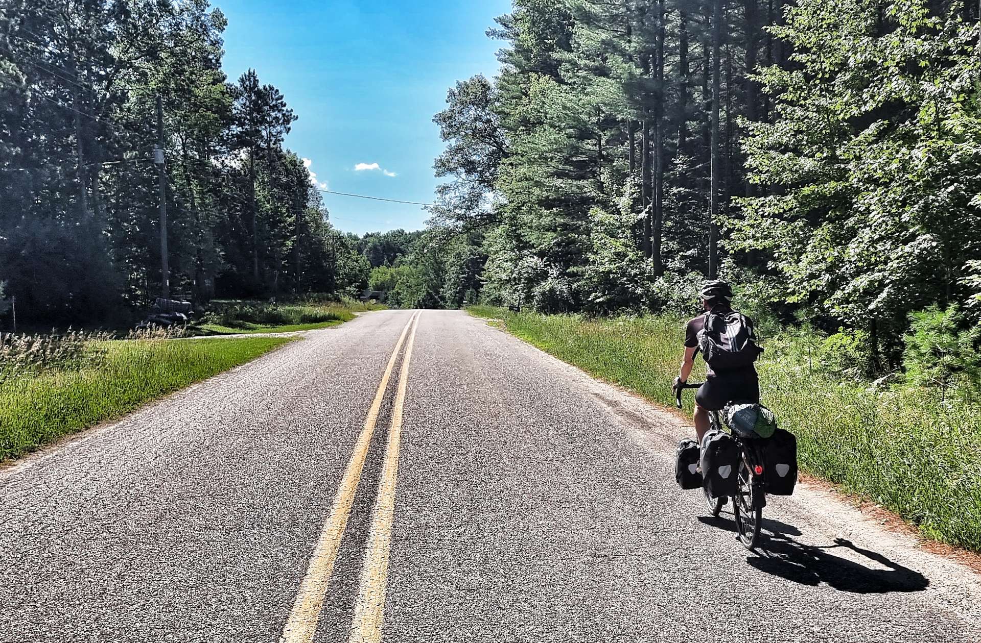
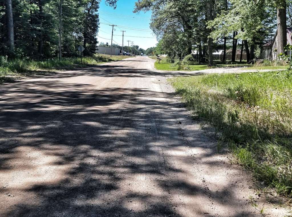
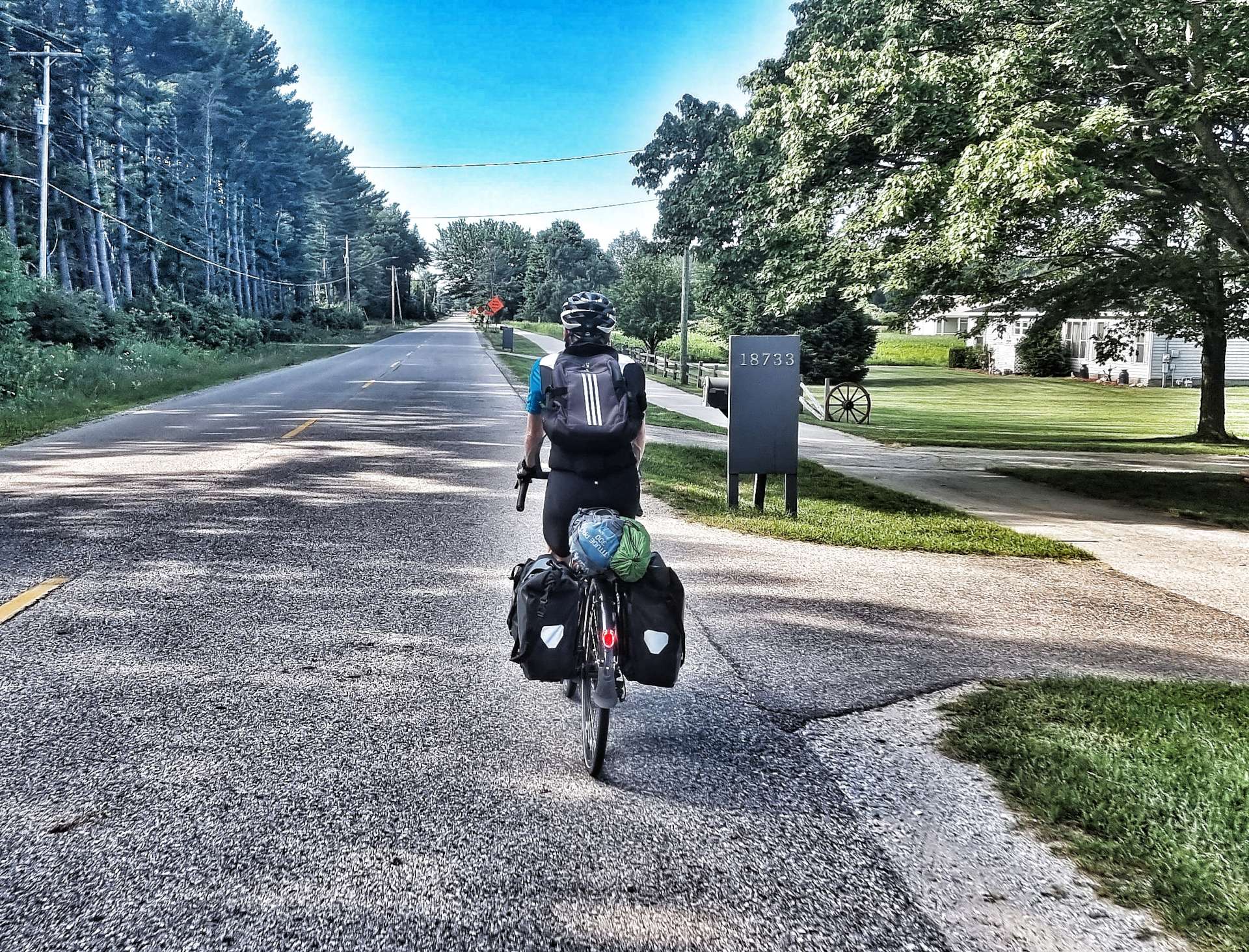
Yesterday’s rest day was spent writing & publishing my latest post, as well as planning routes & accommodation for the coming week. This morning we were on our way by 9am as we left North East on a deserted back road that took us past more vineyards.
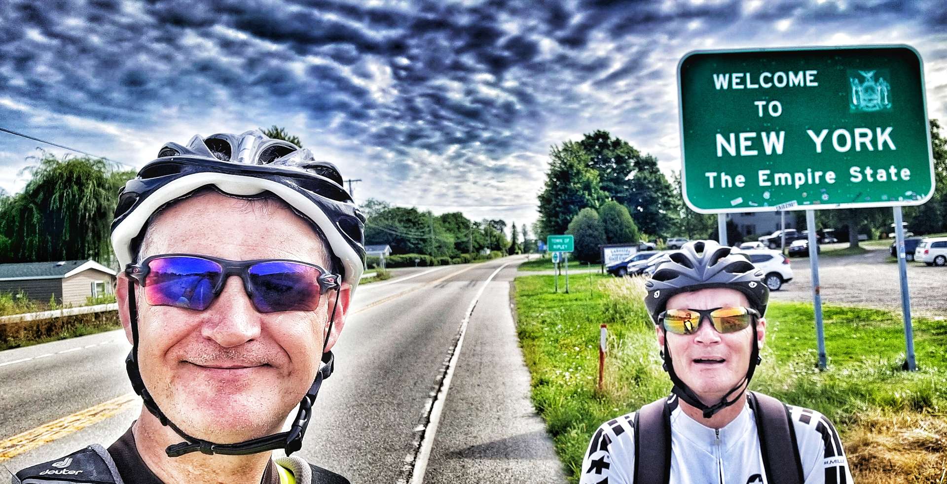
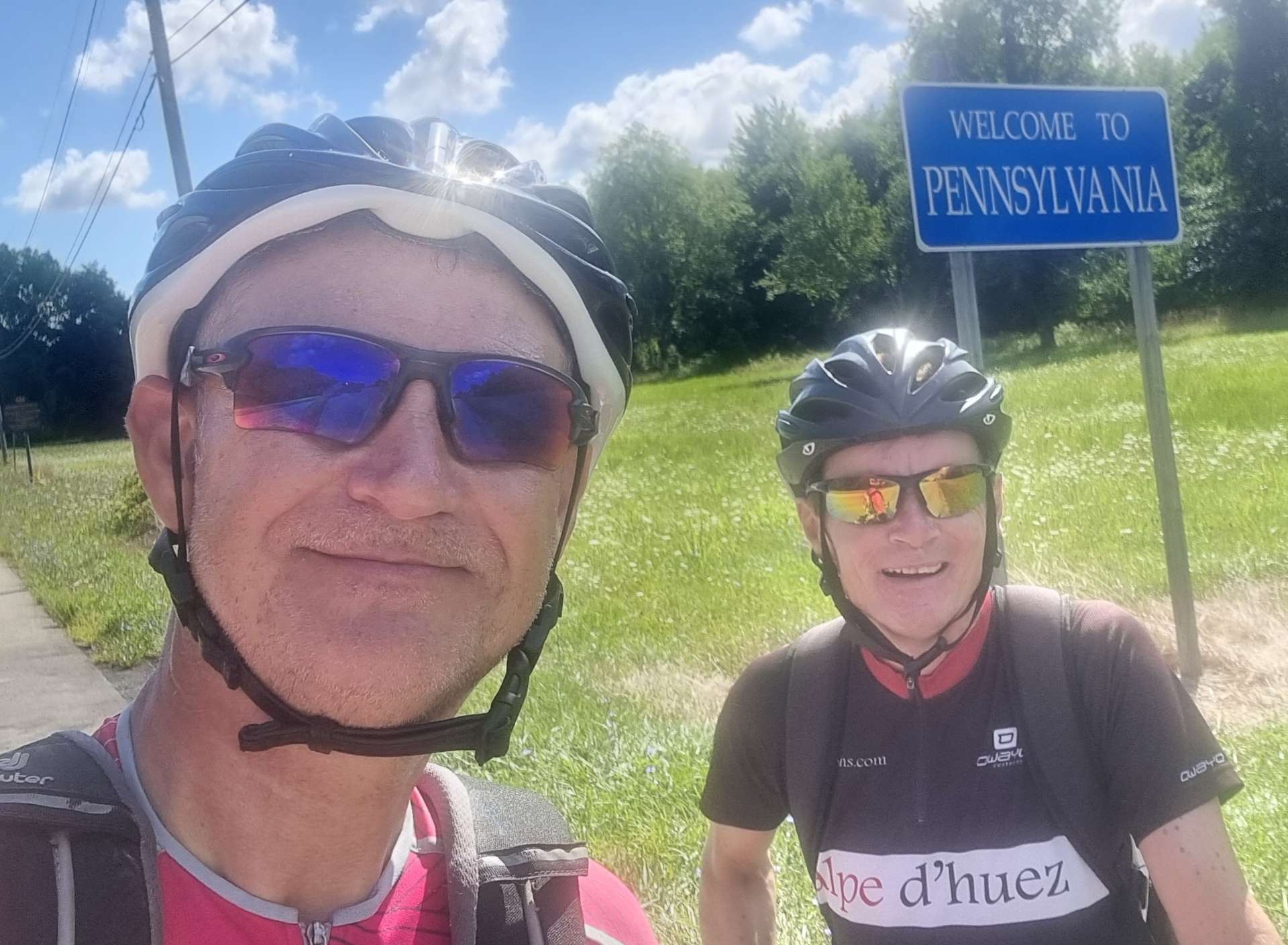
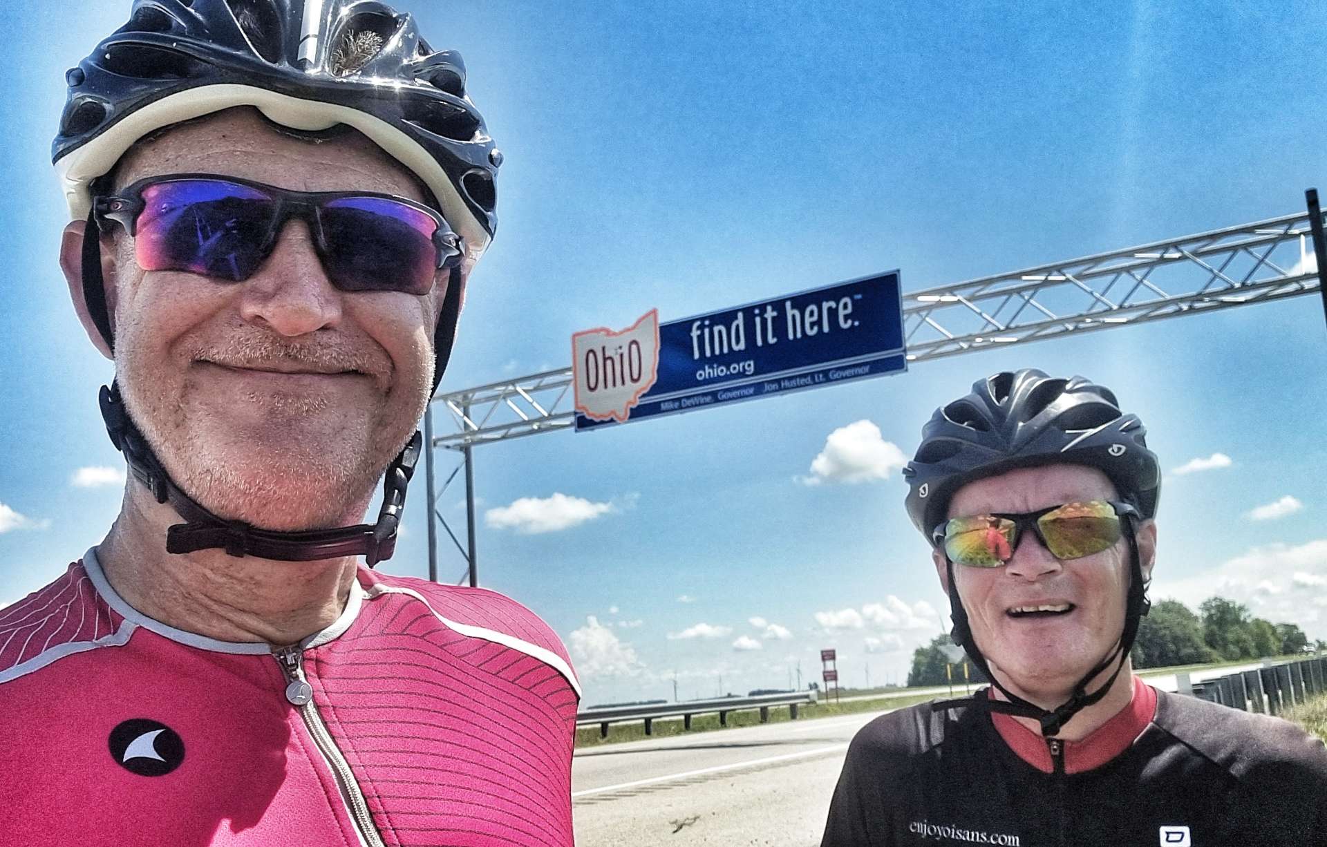
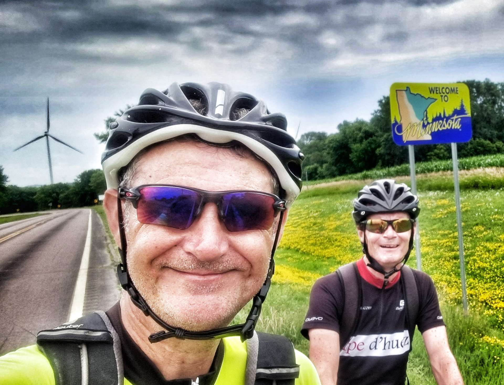
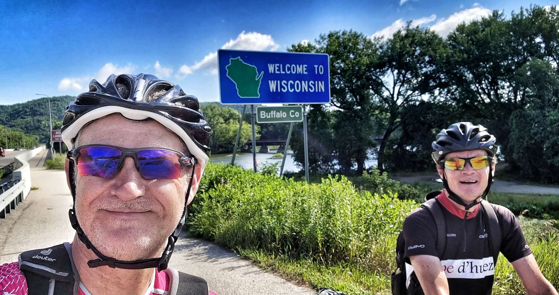
Almost as soon as we joined US 5, we were welcomed into The Empire State of New York – it would have been easy enough to ride through Pennsylvania on Friday if we’d have wanted to, but there’s something pleasing about spending a night sleeping in every State I’ve cycled in!
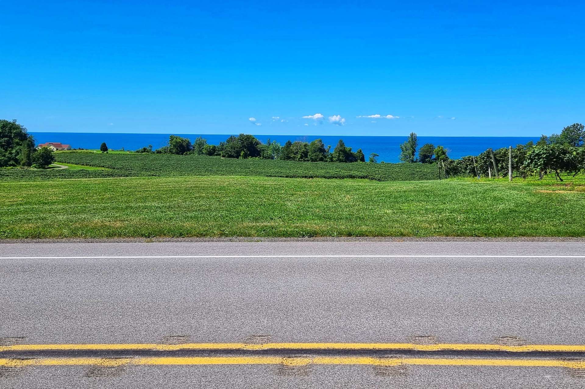
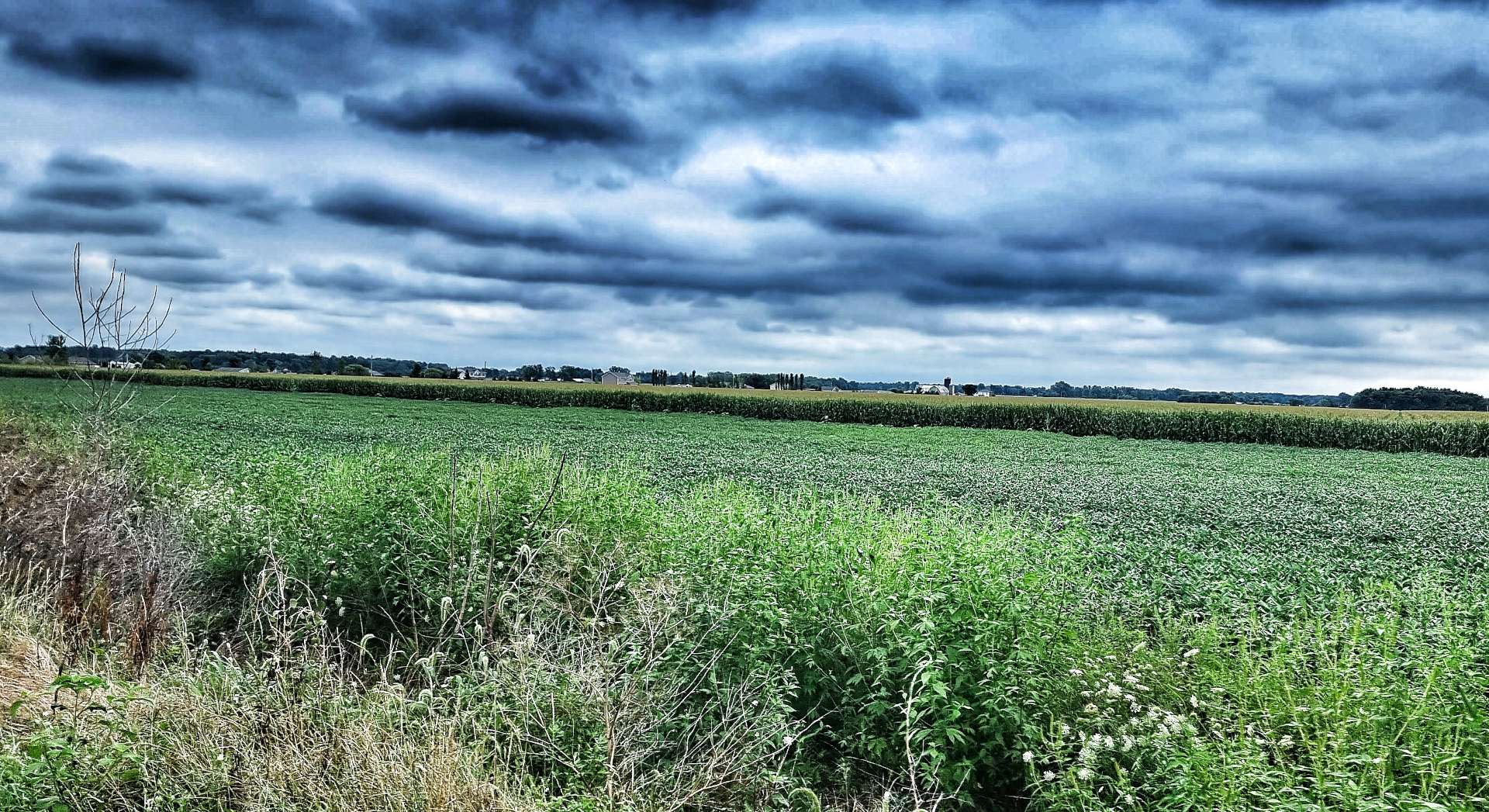
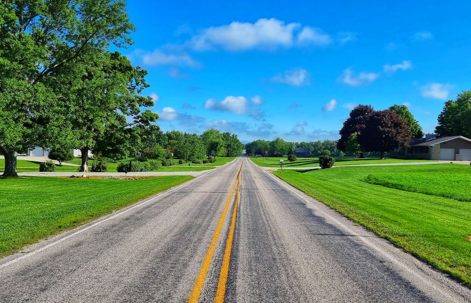
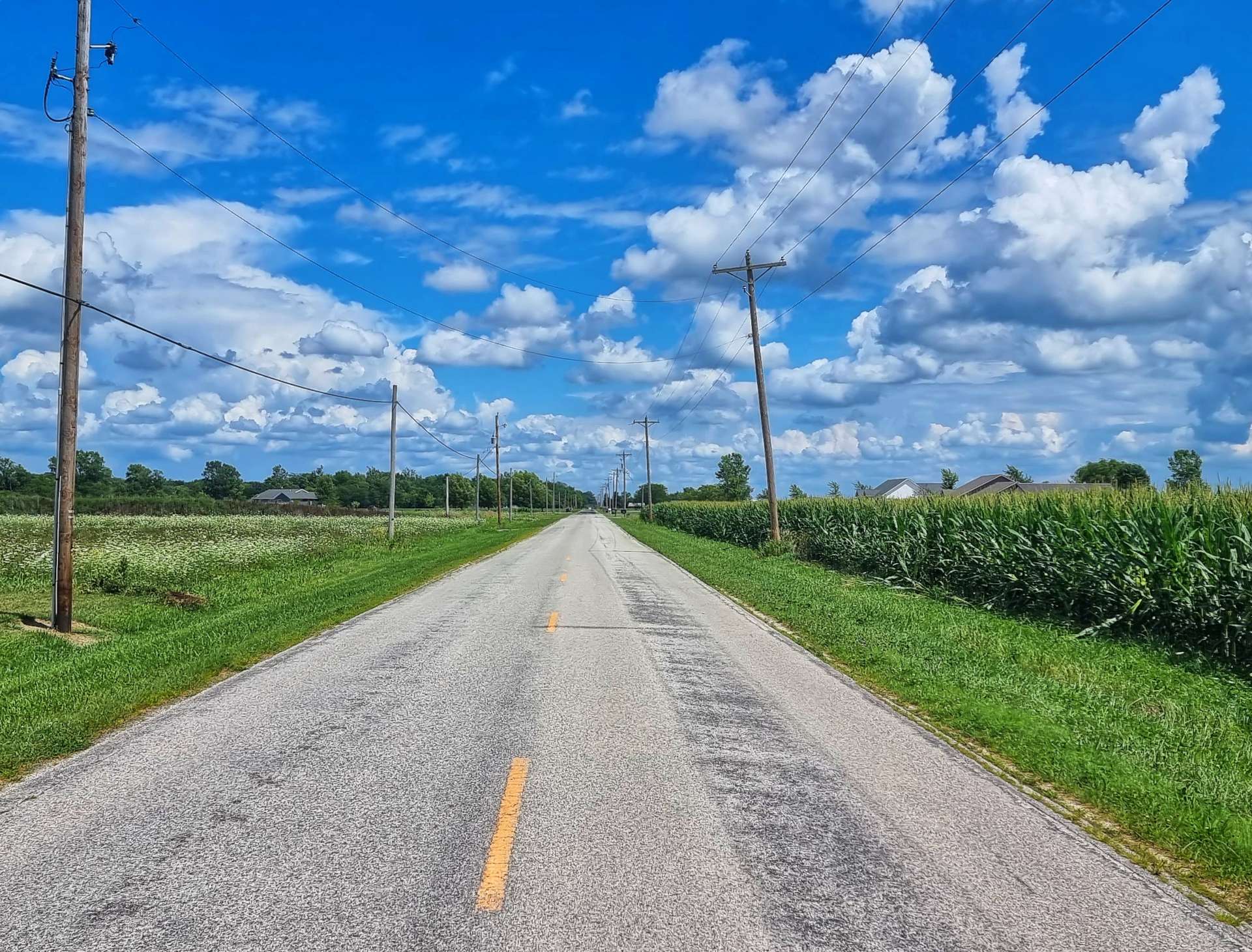
The early miles in New York were much like the last miles in Pennsylvania, as we climbed & descended the rolling hills, cycled between vineyards & had views across to the hills further South.
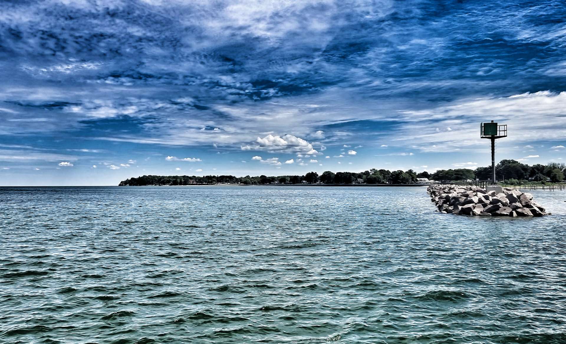
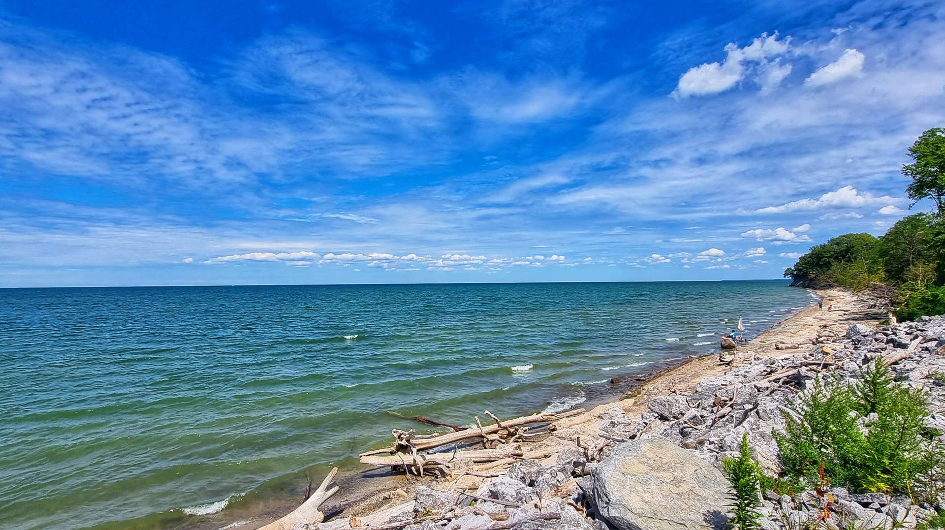
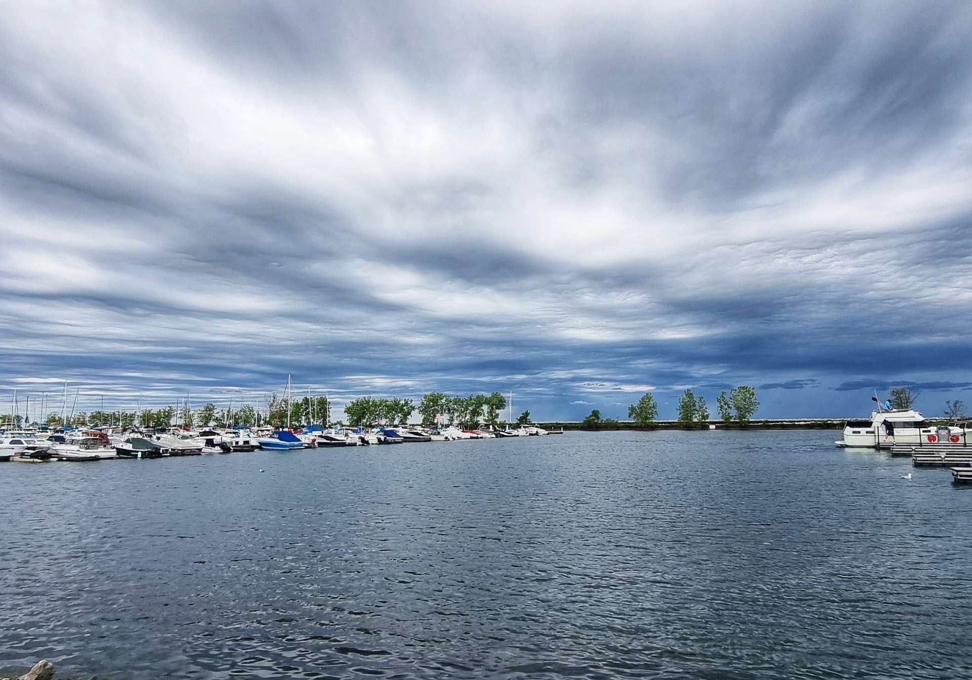
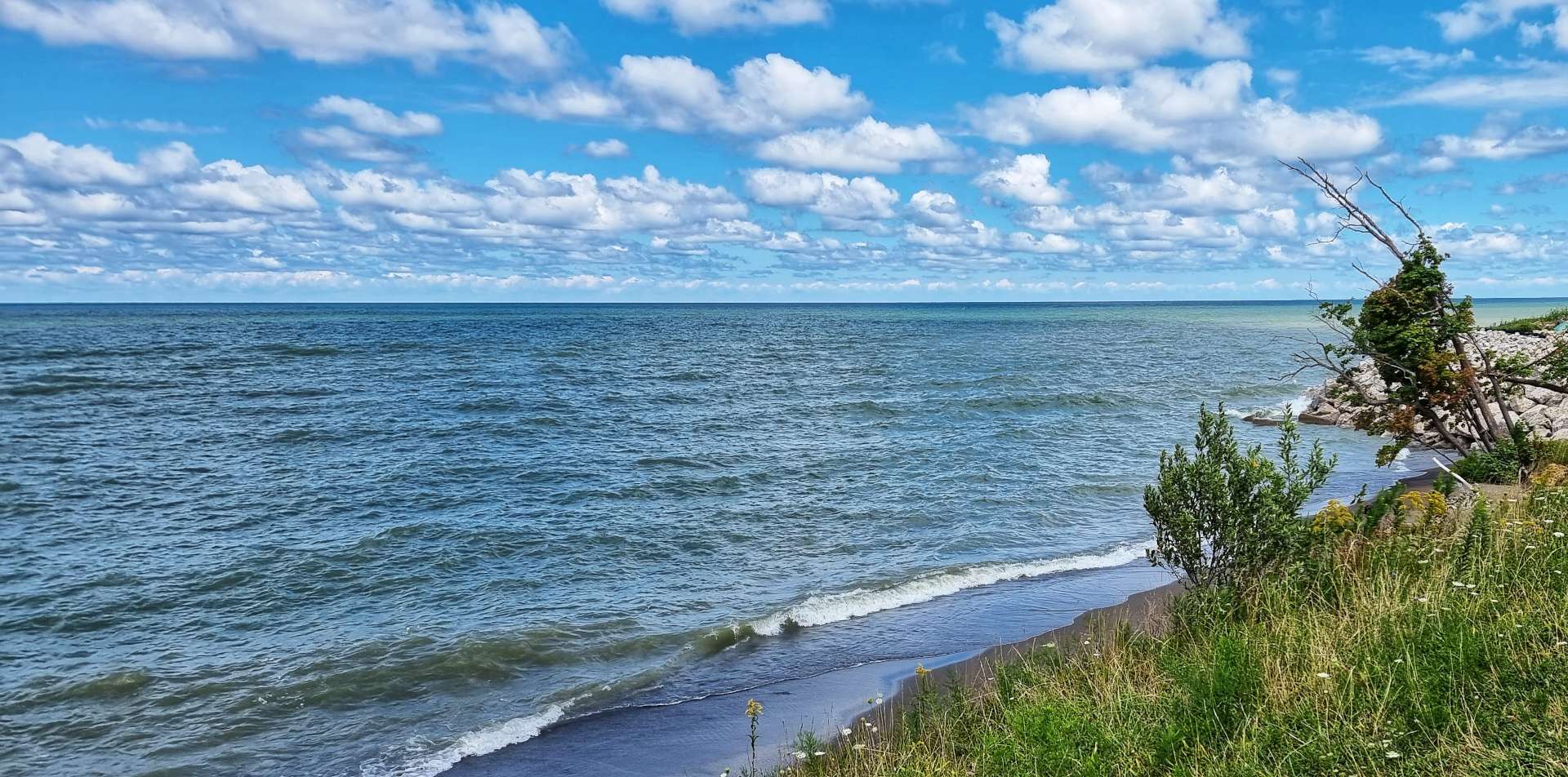
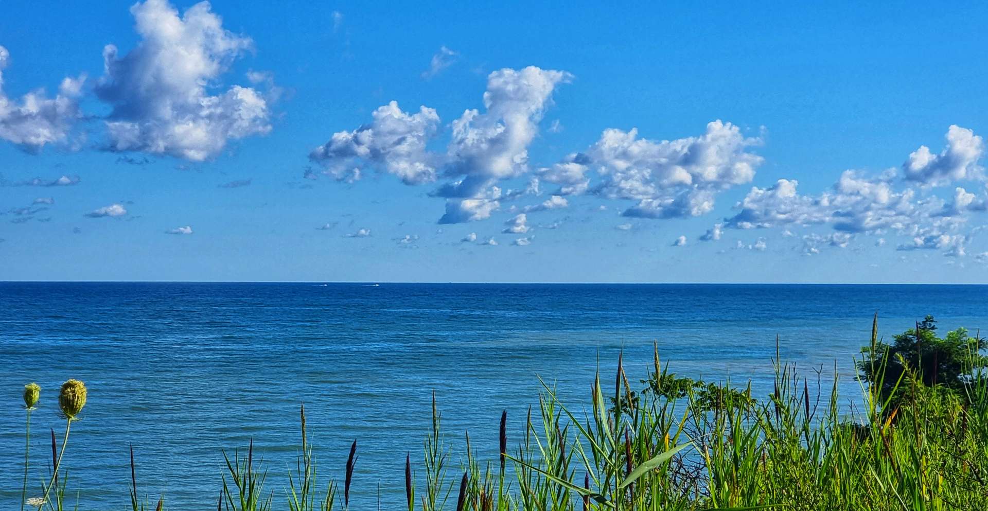
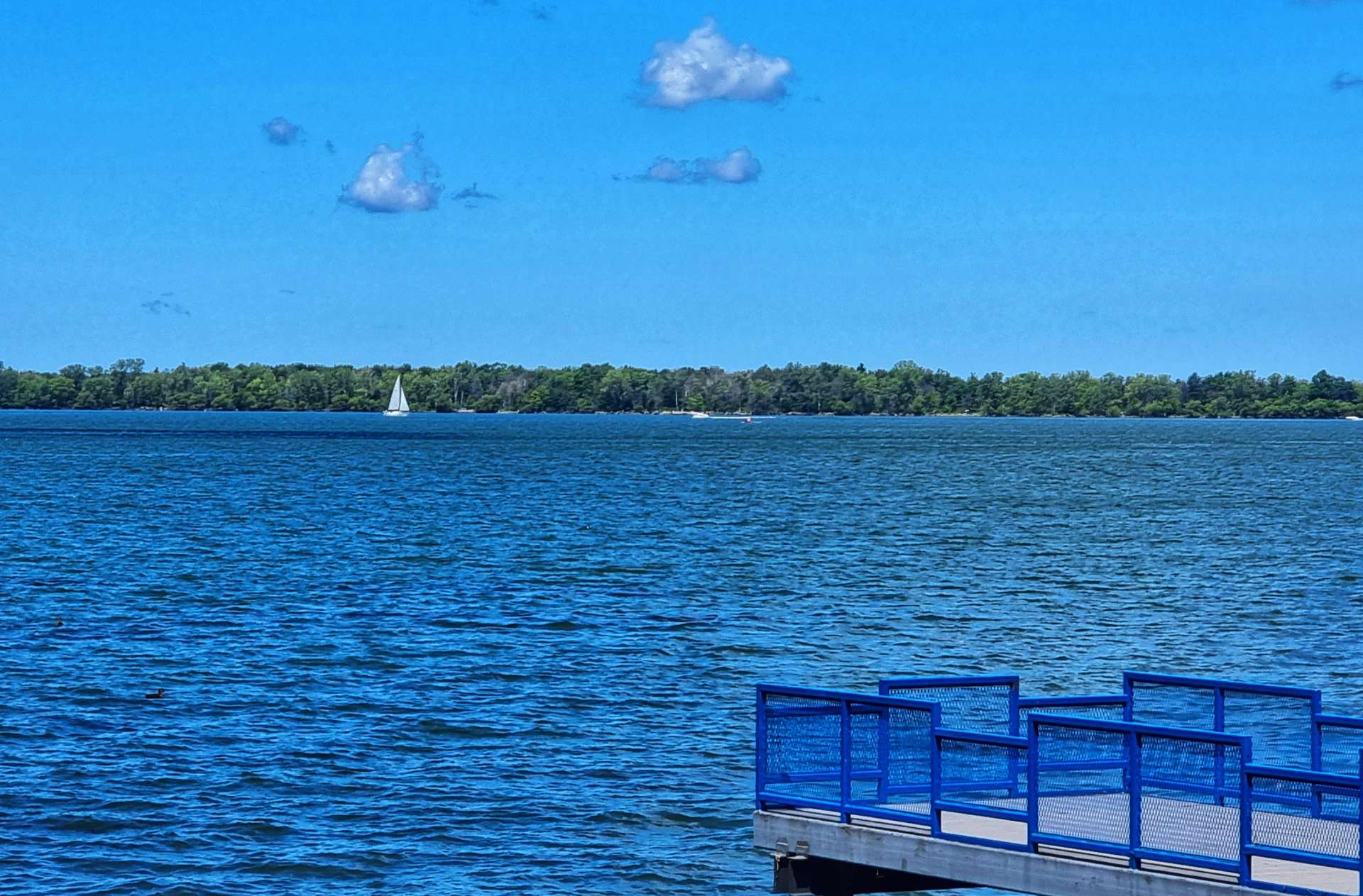
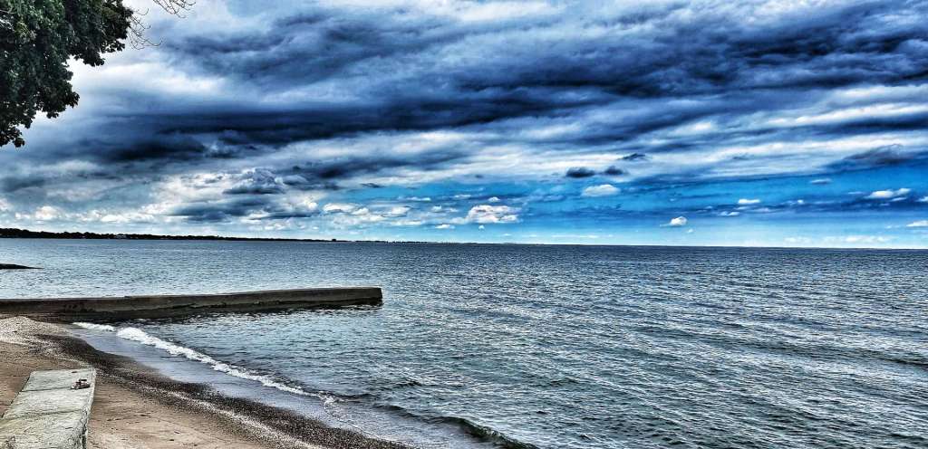
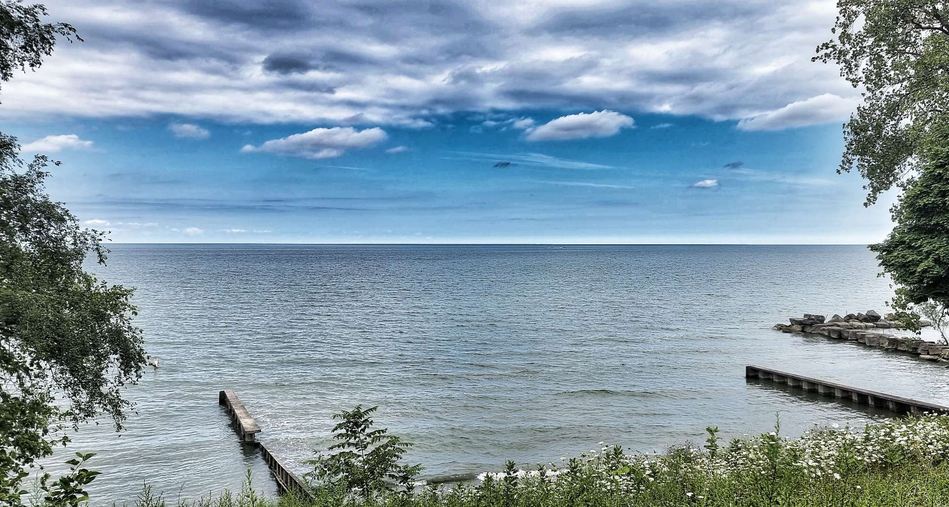
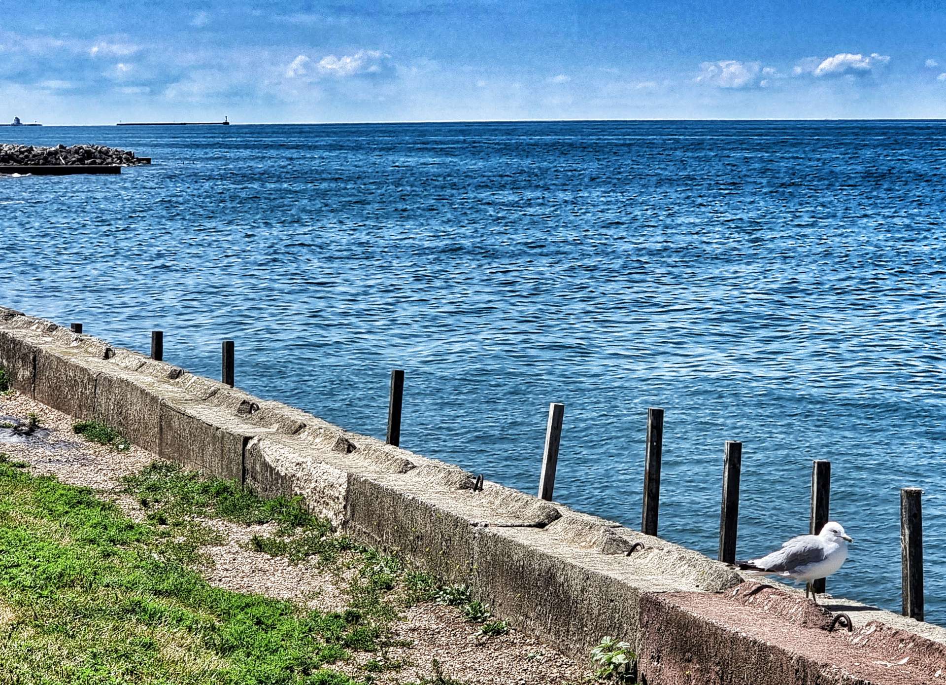
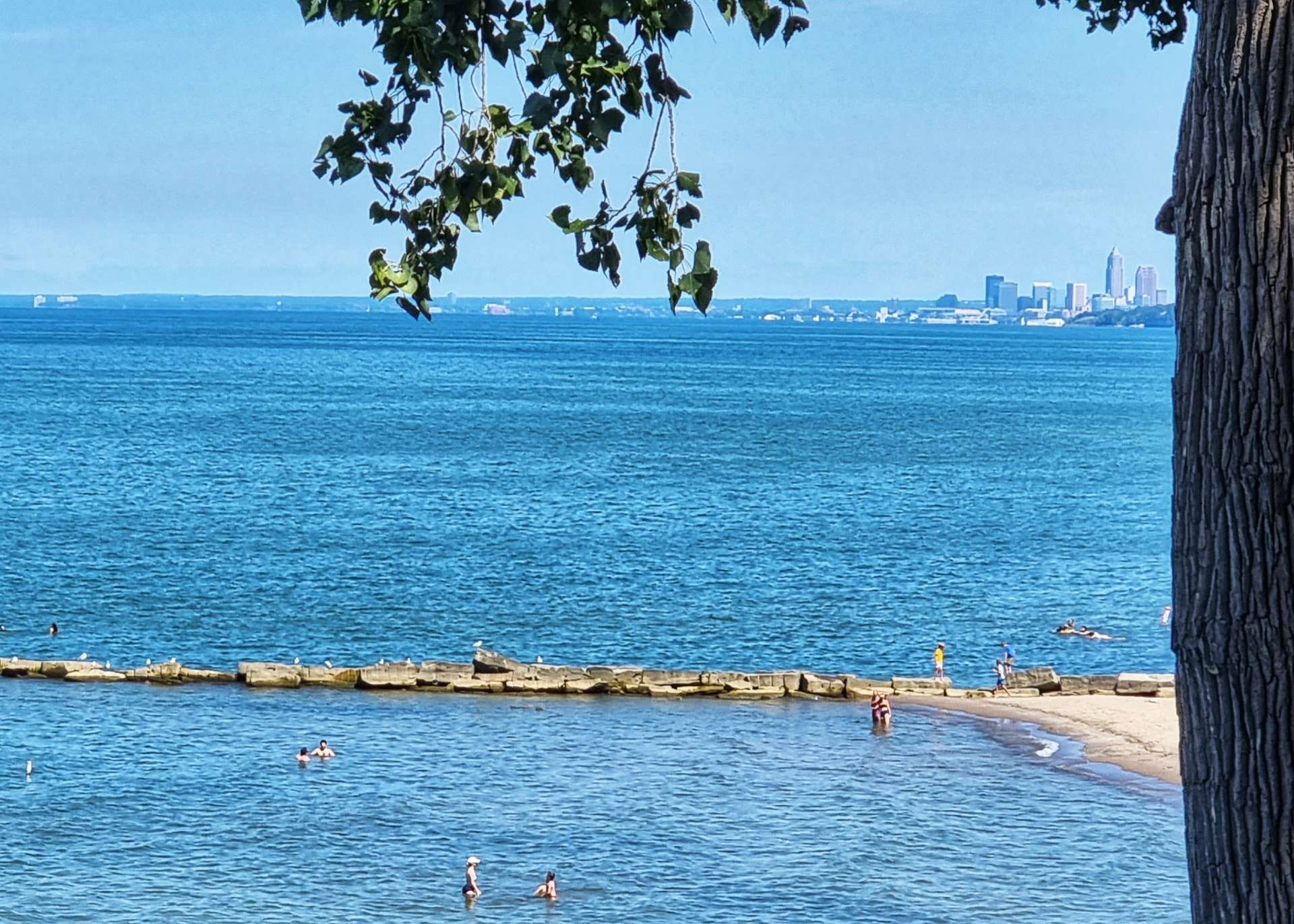
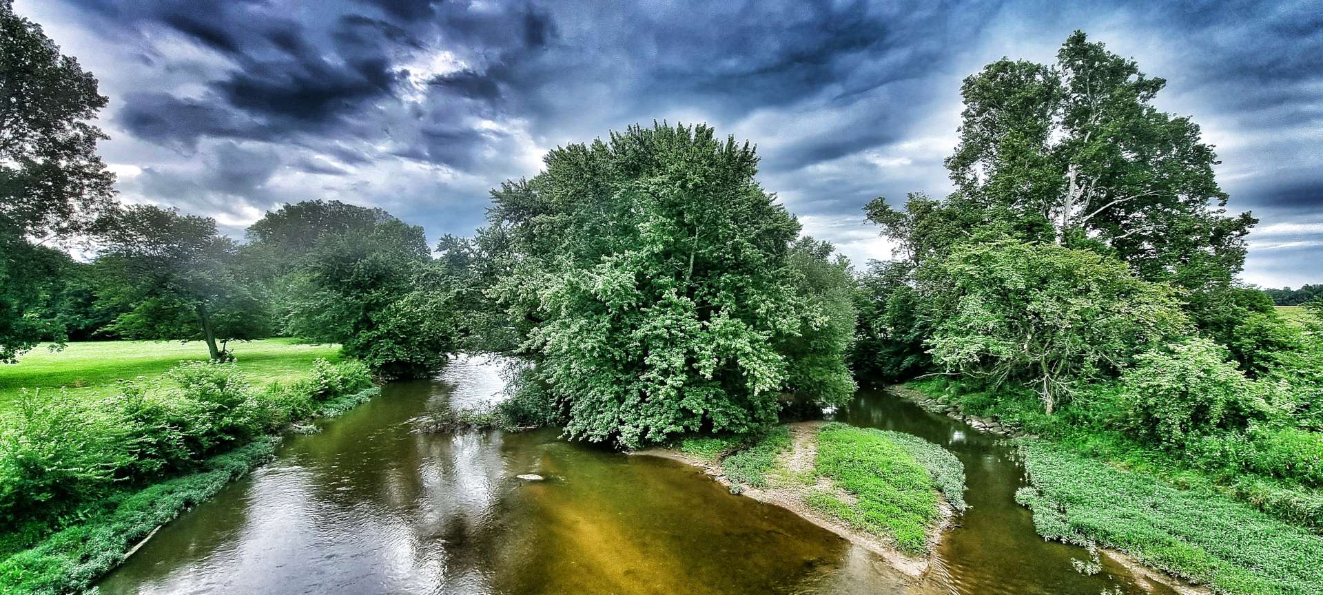
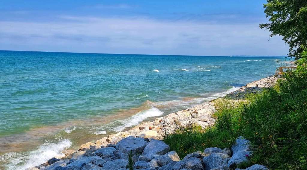
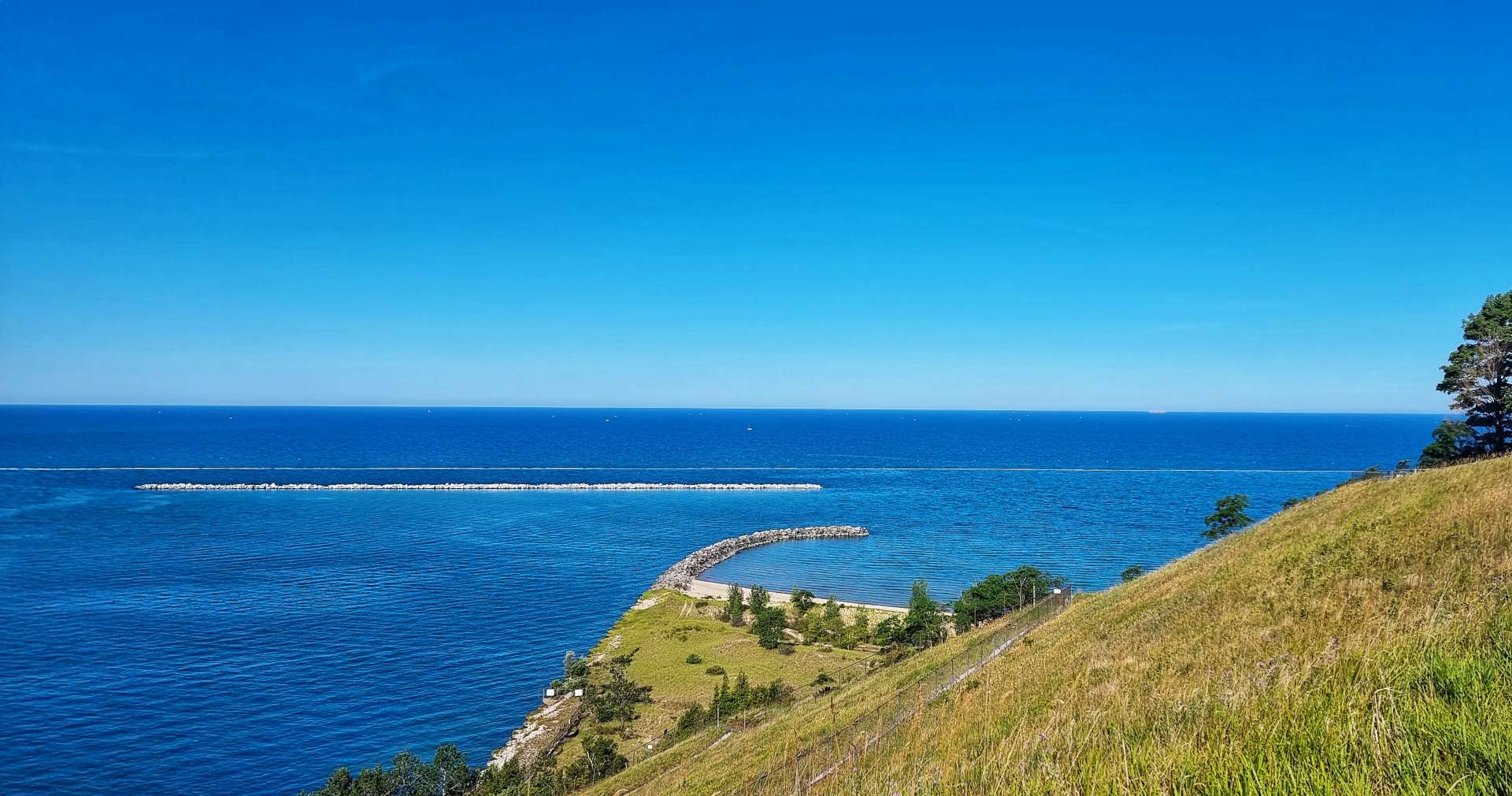
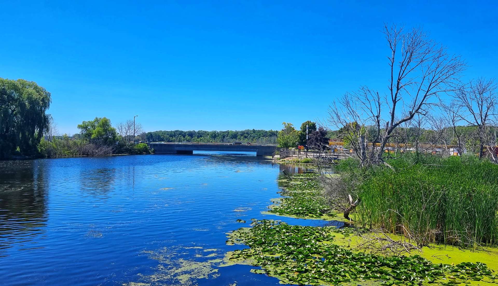
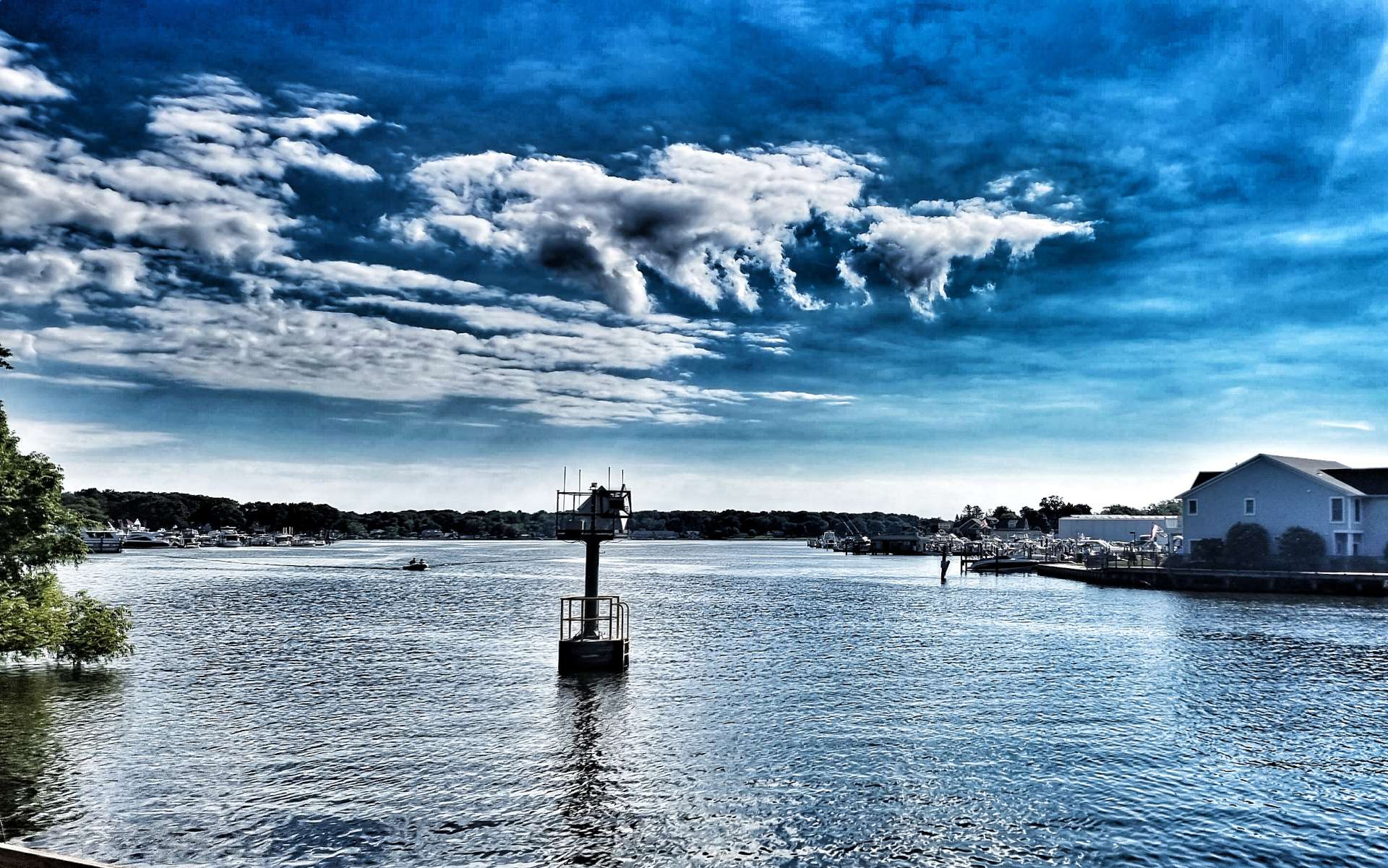
Our first view of Lake Erie in New York was when we were passing through Barcelona – it was the first lighthouse we’d seen along the shore of the lake & it also provided sweeping views of Barcelona Bay from the marina. This continued the European theme from Geneva yesterday.
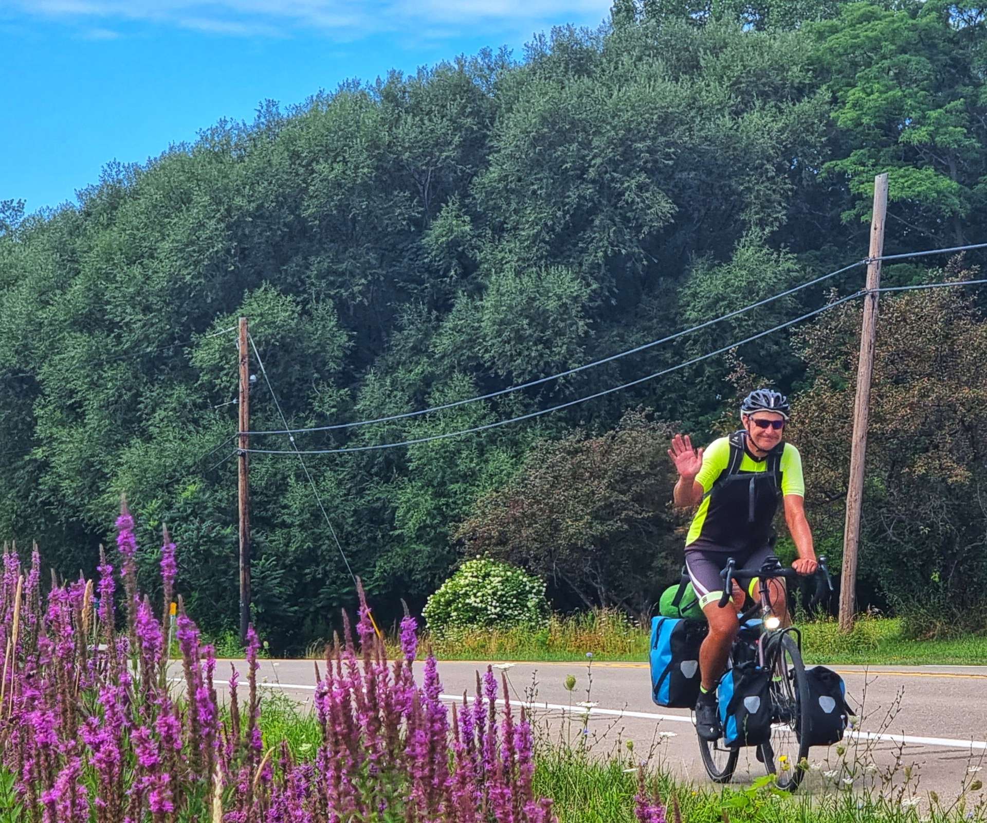
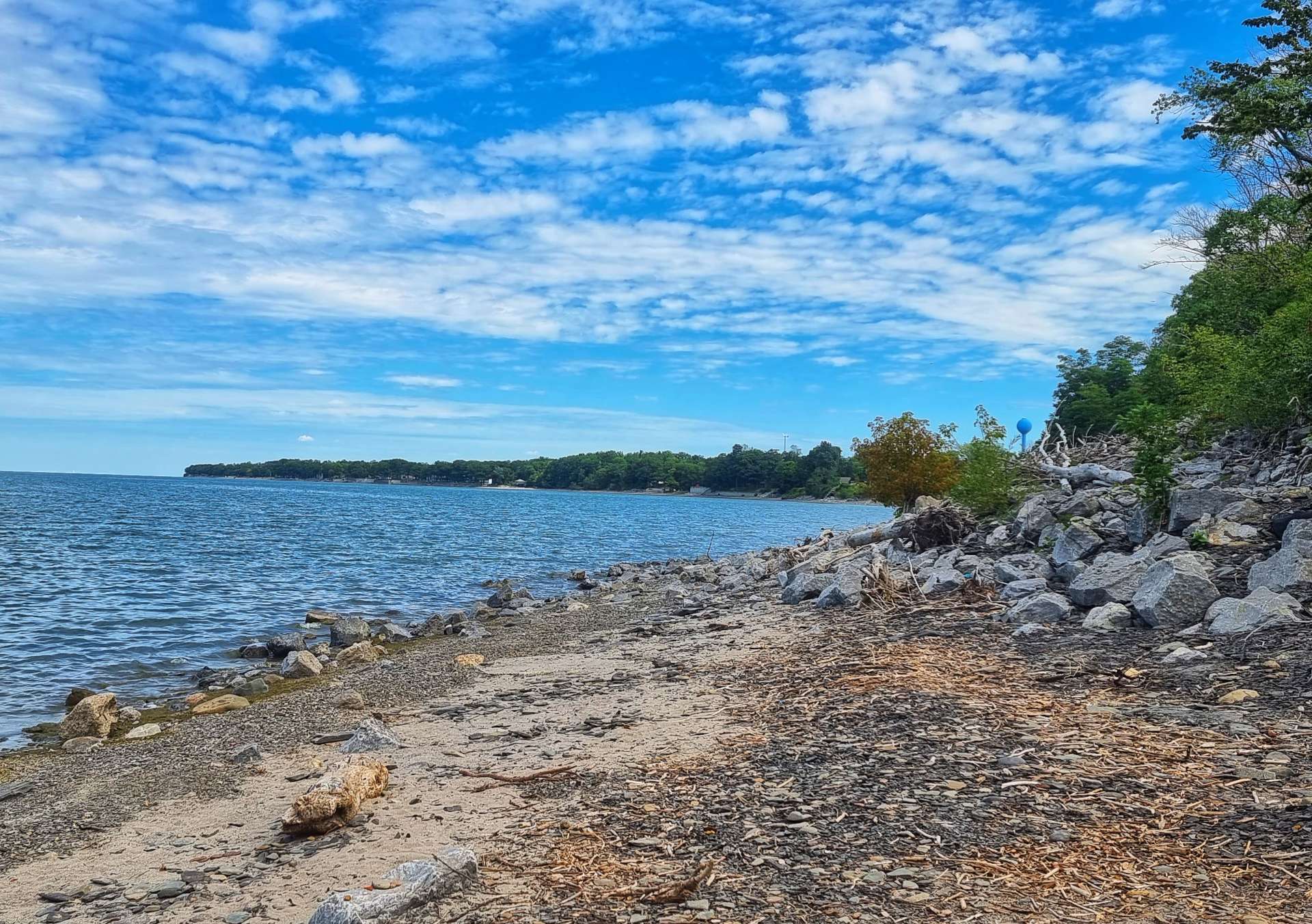
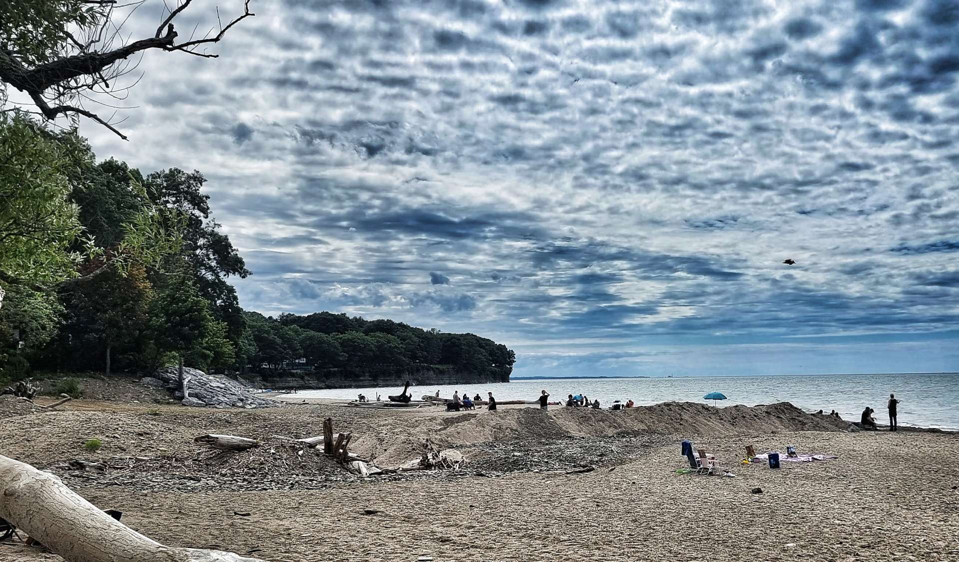
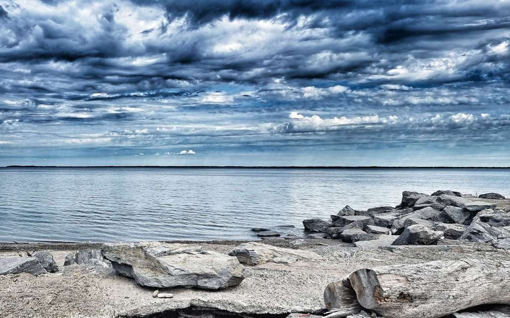
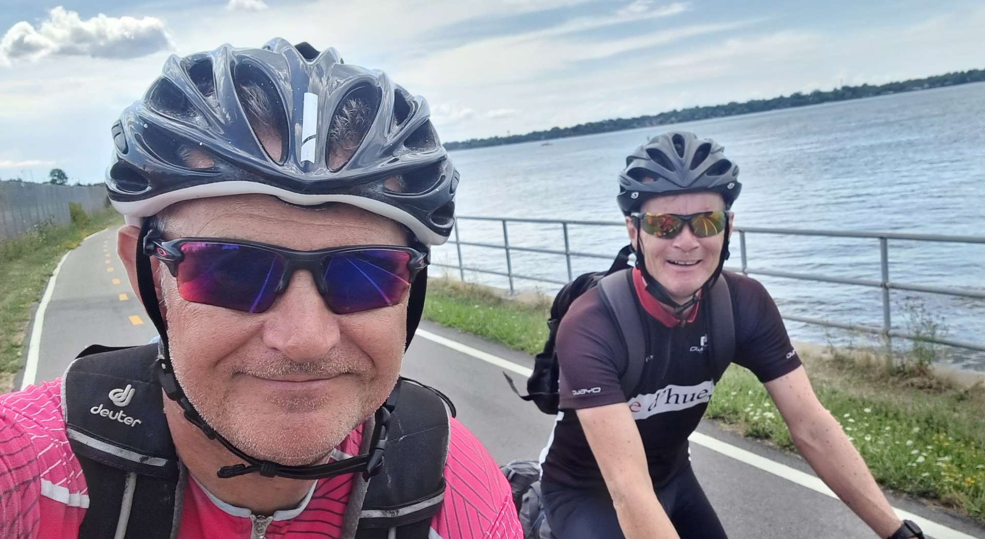
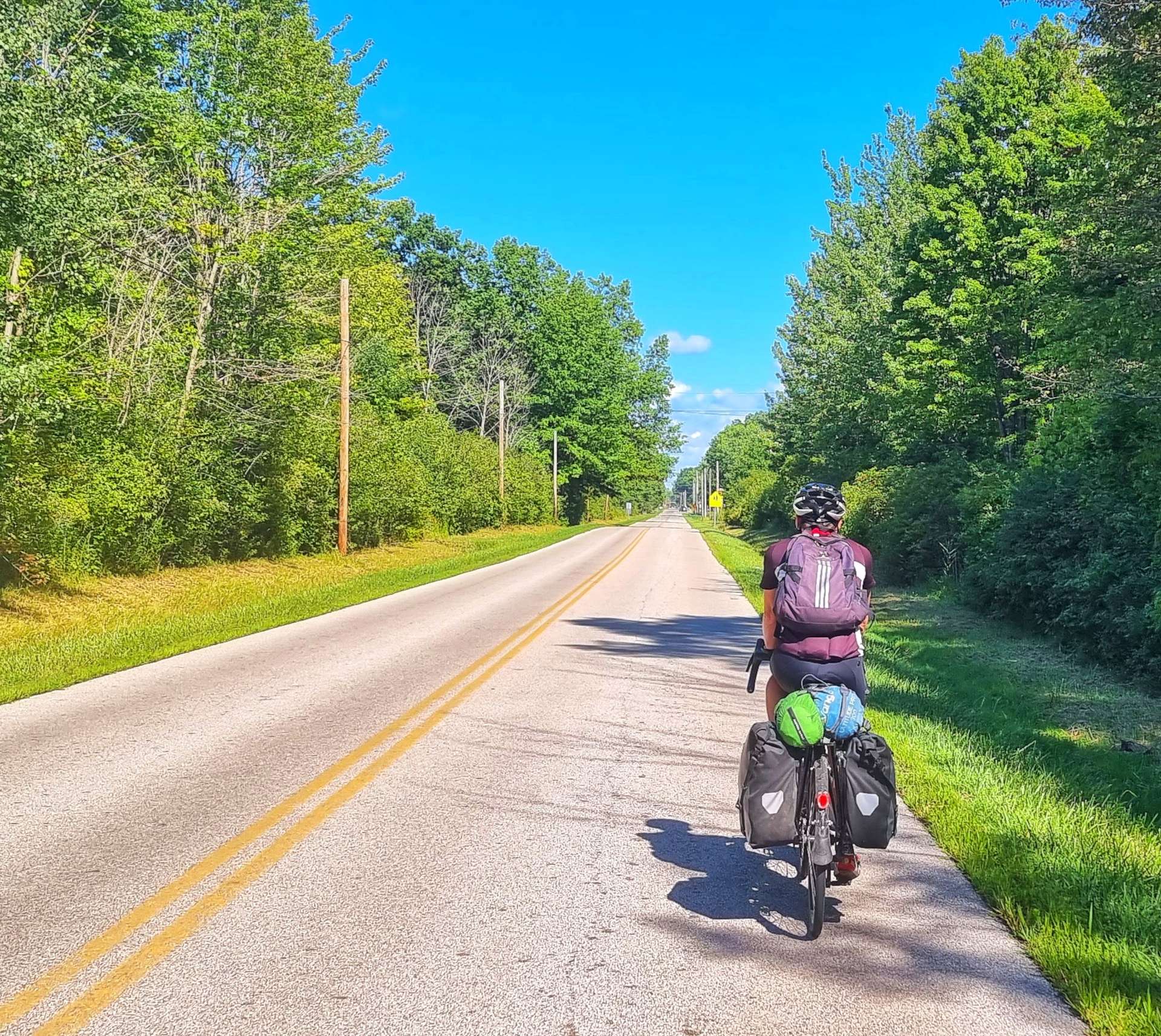
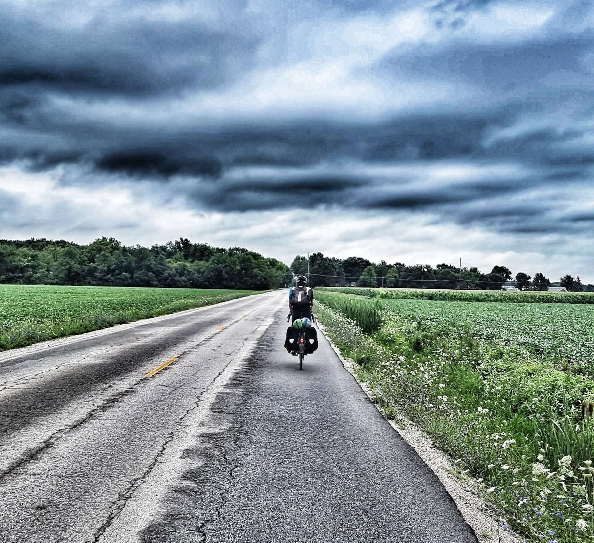
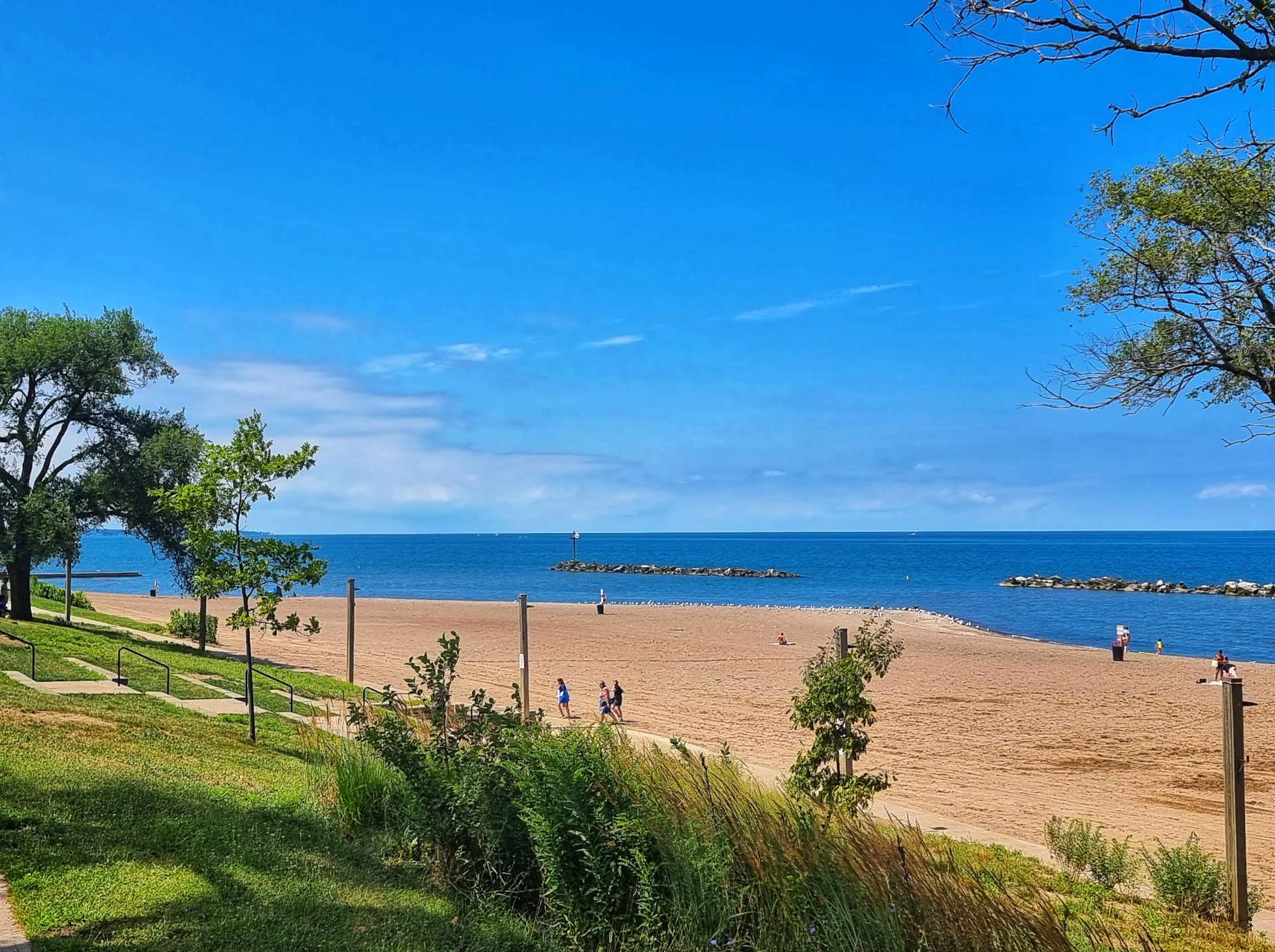
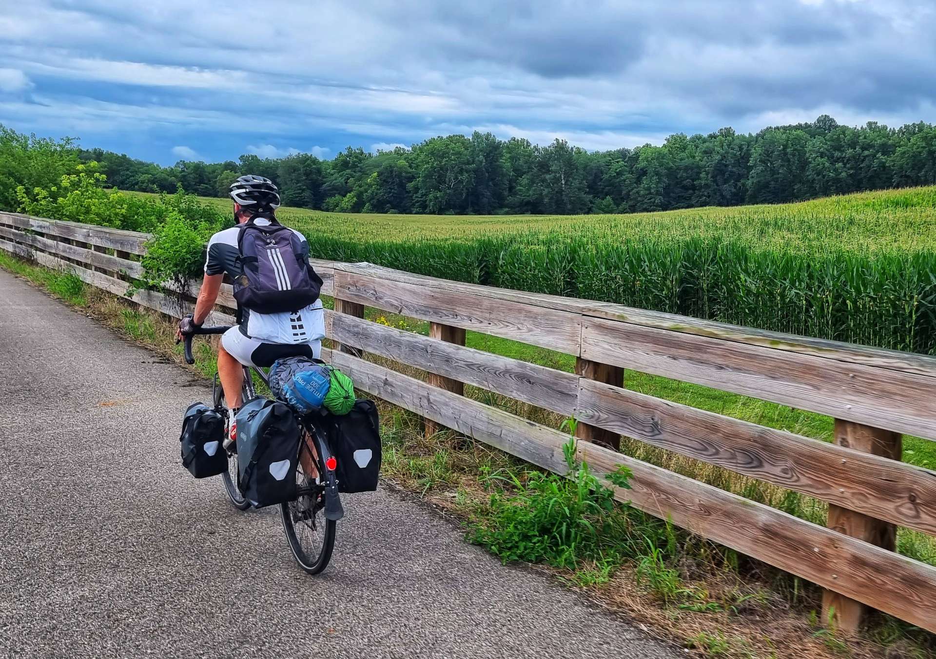
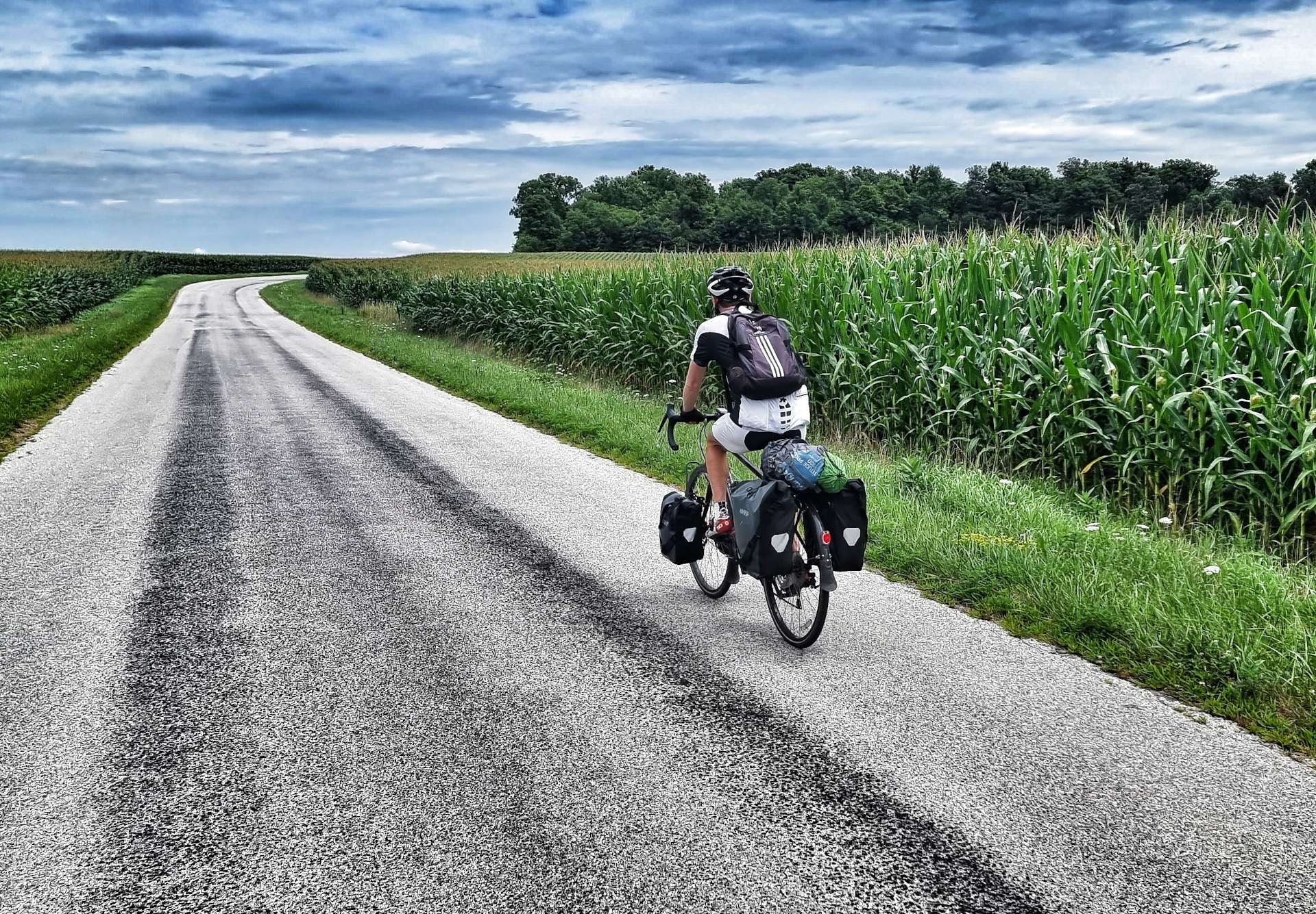
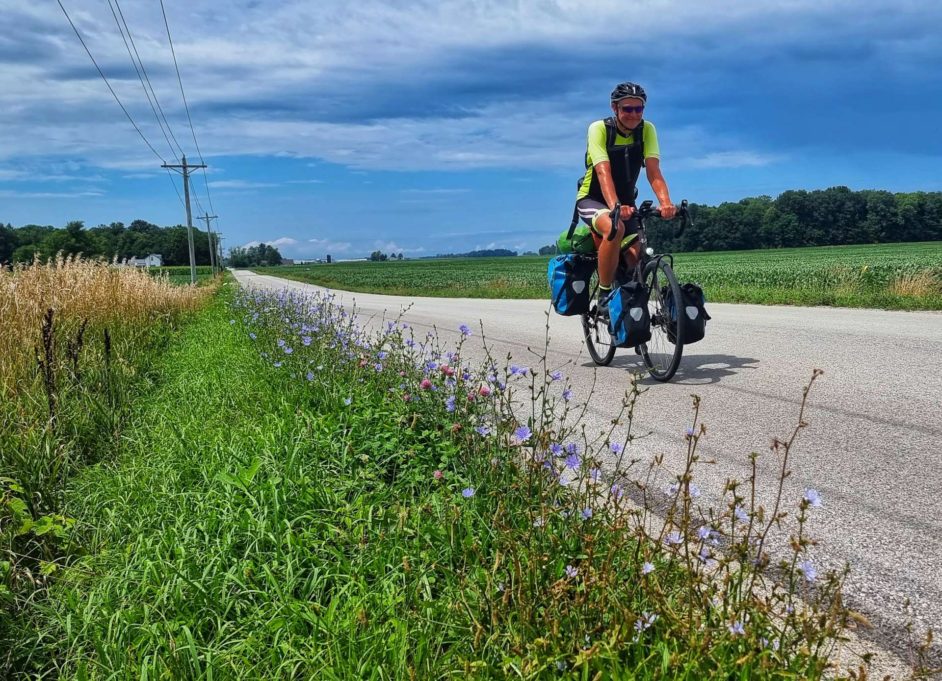
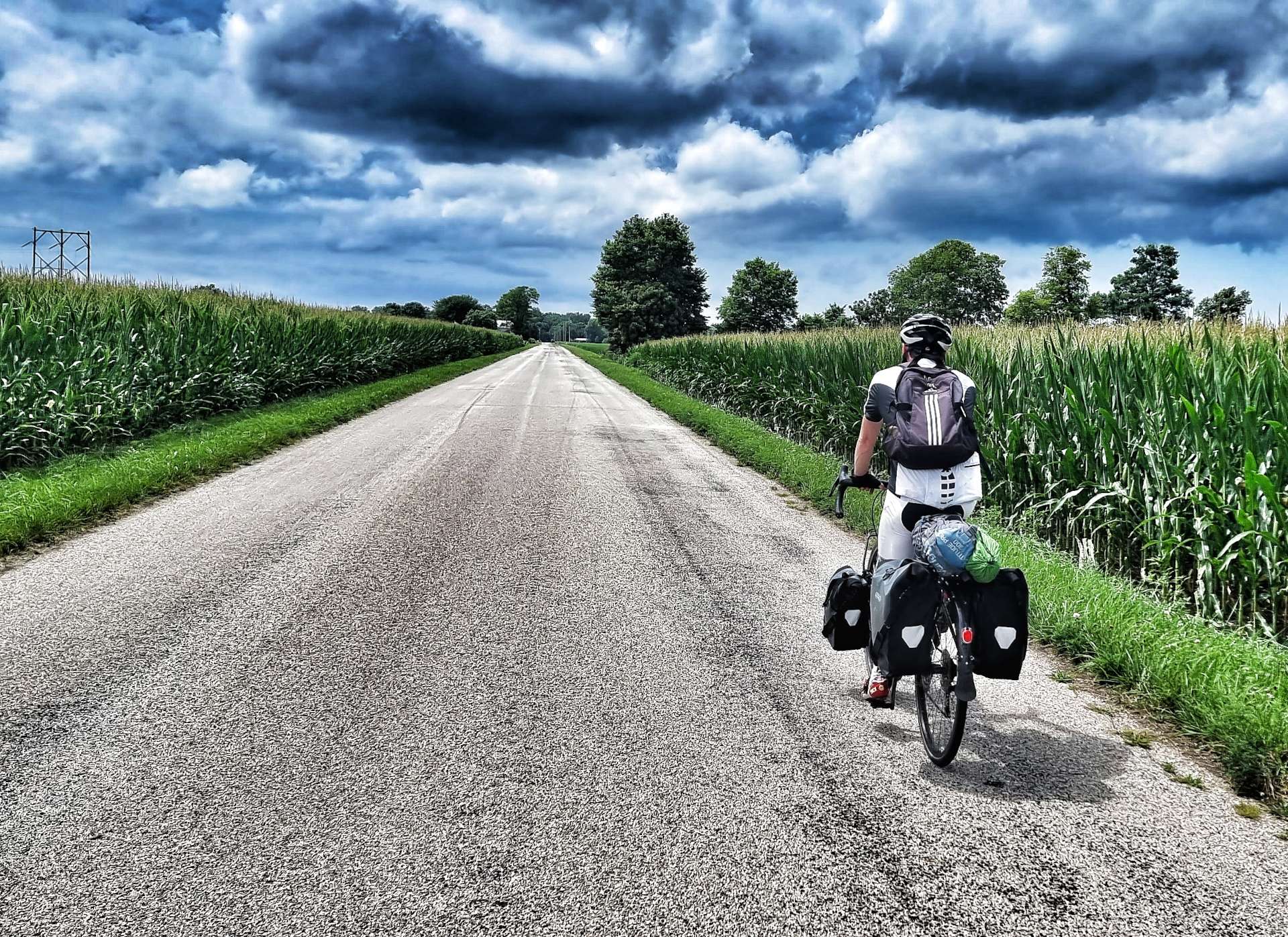
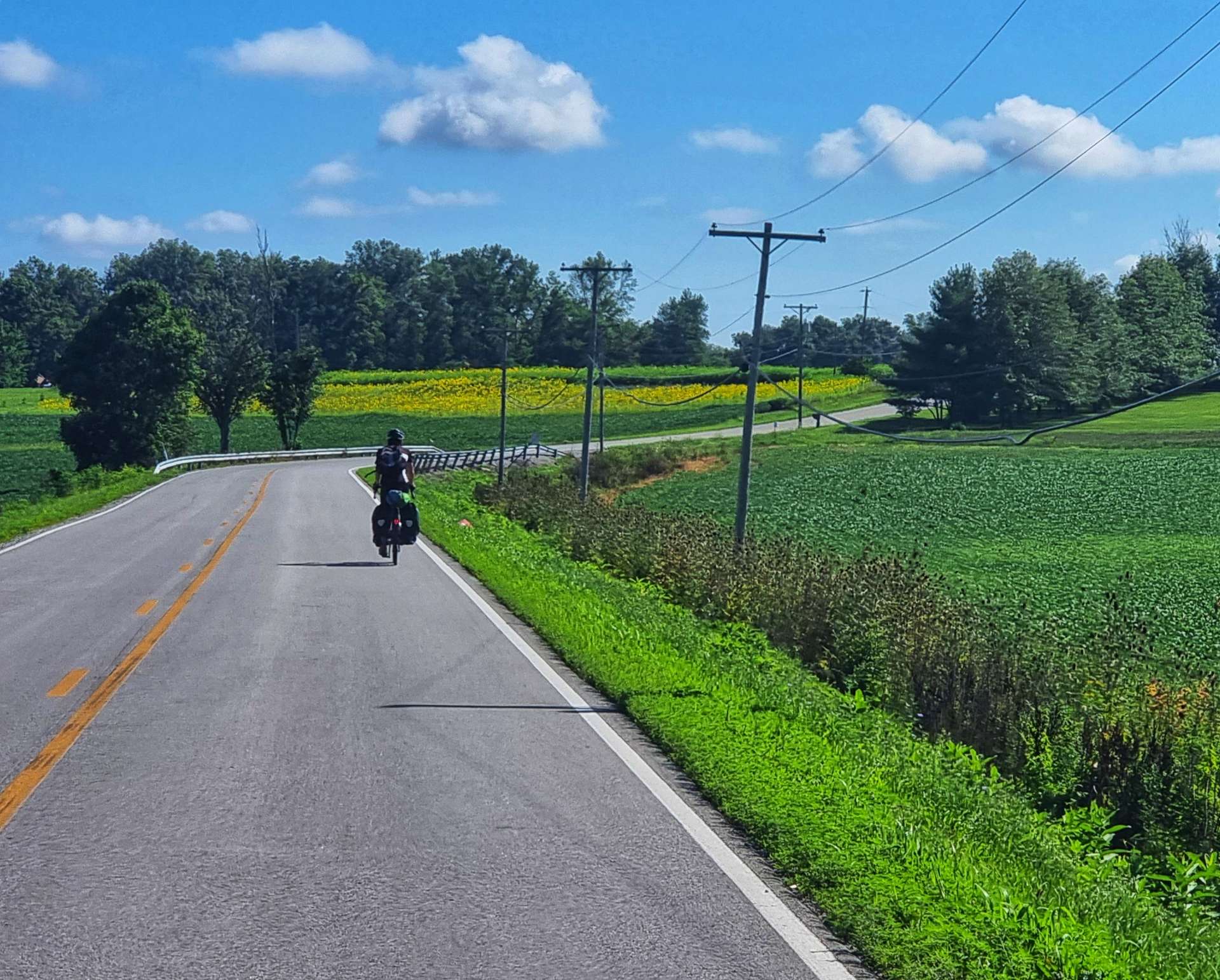
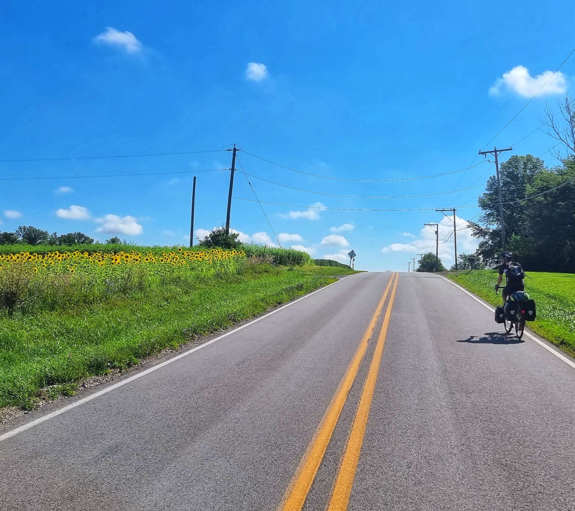
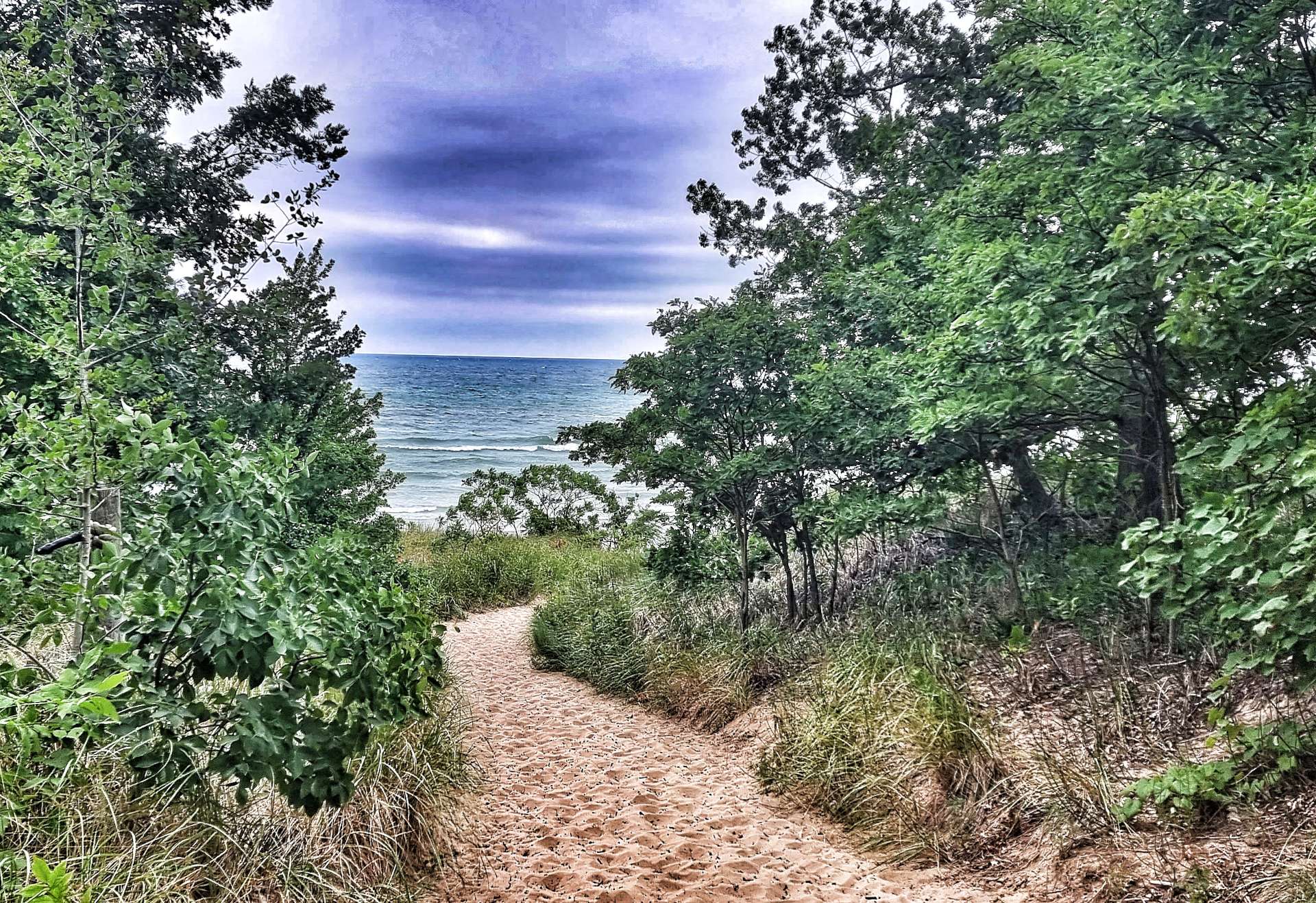
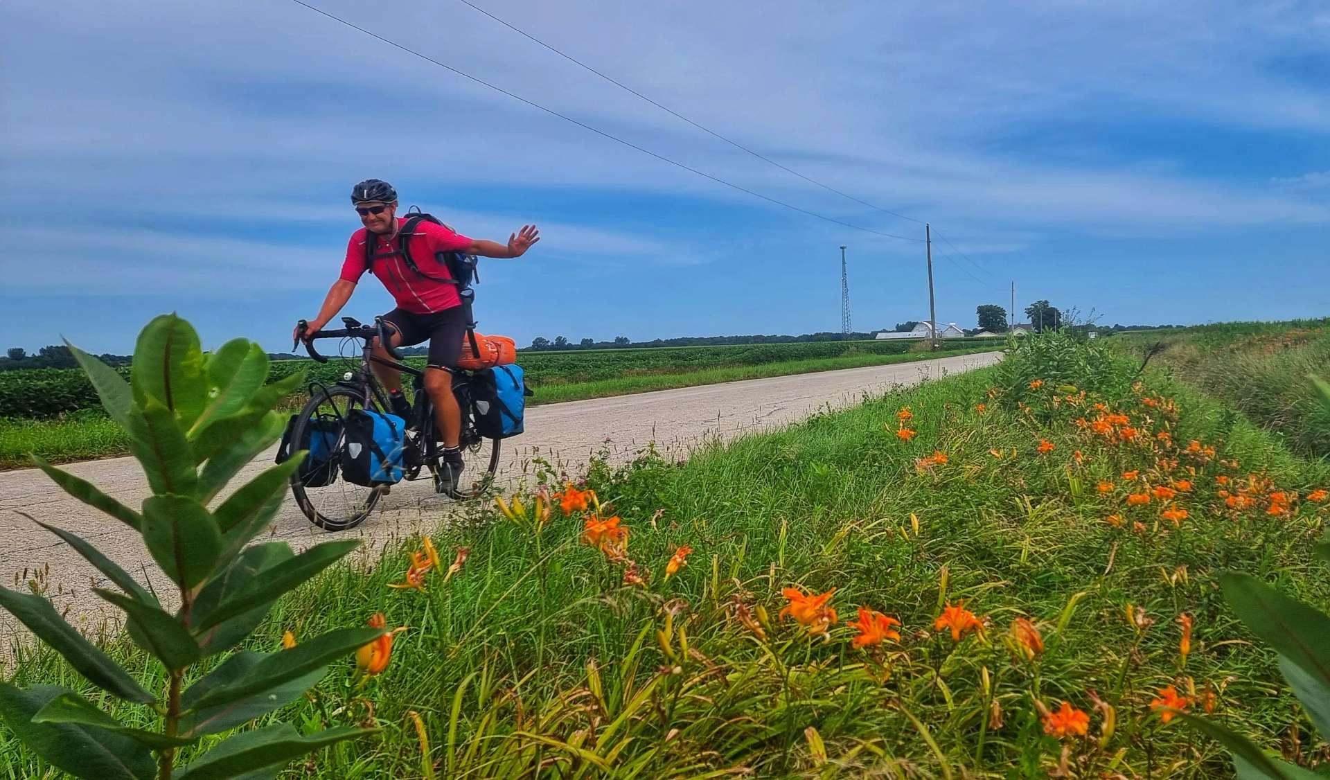
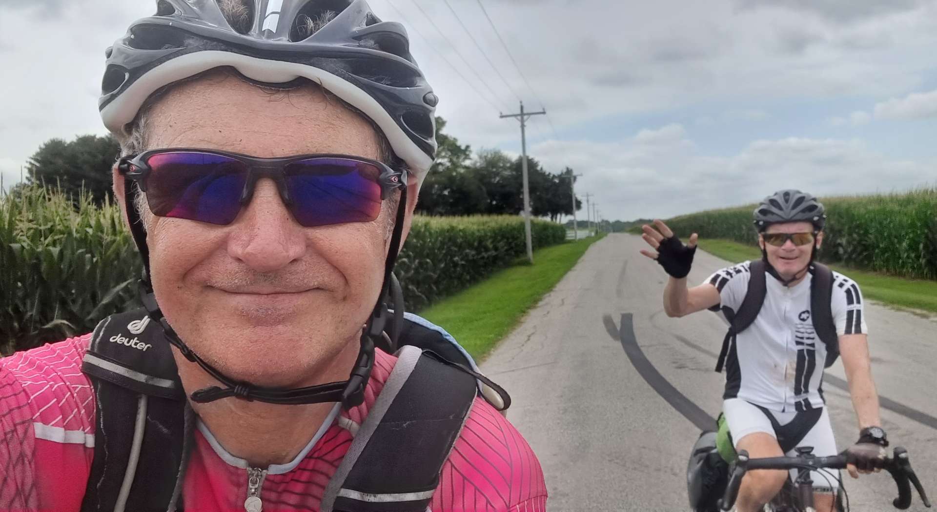
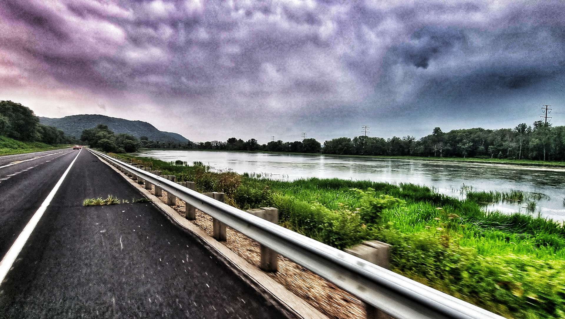
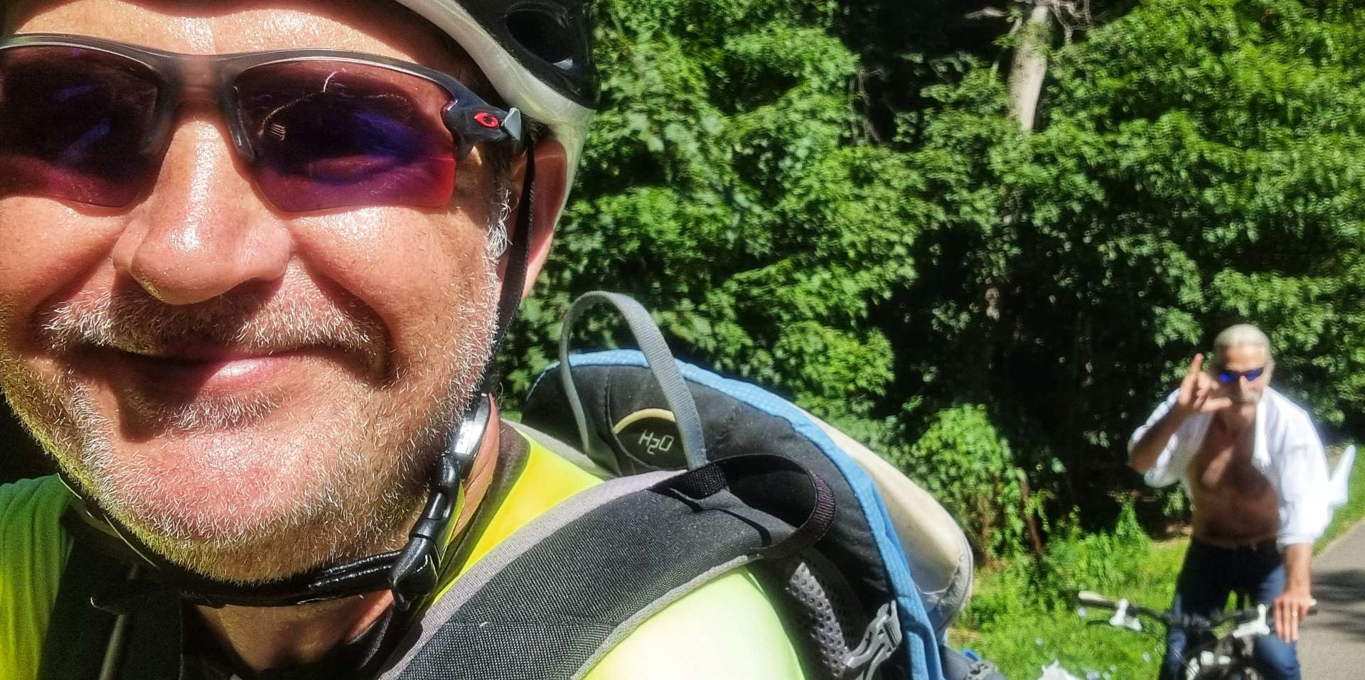
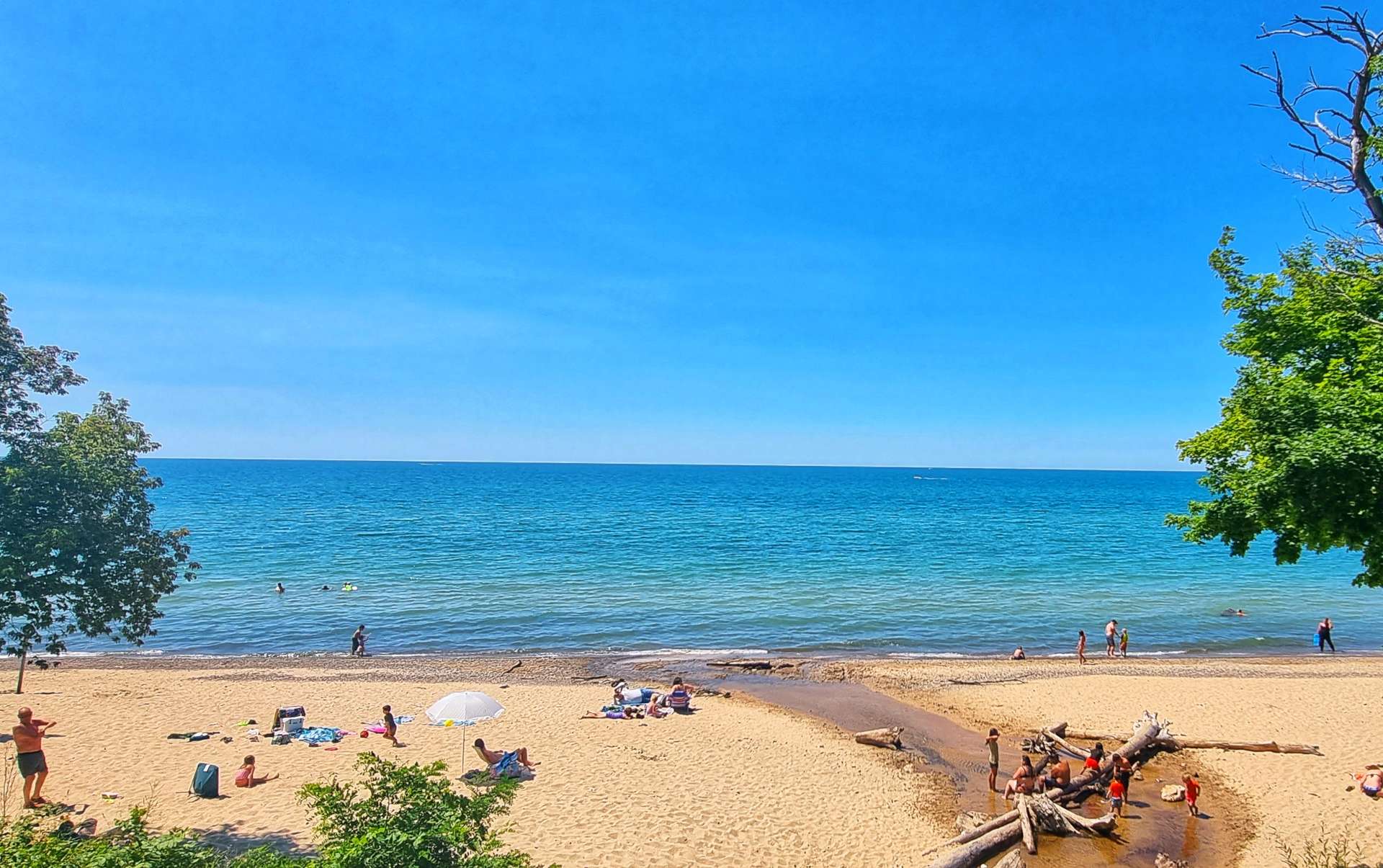
Between Barcelona & Lake Erie State Park, Sean popped on ahead so he could get an action shot of me (he did himself proud by getting some purple in the photo too). The beach at the park was mainly gravel, although it did provide some good views of the bay.
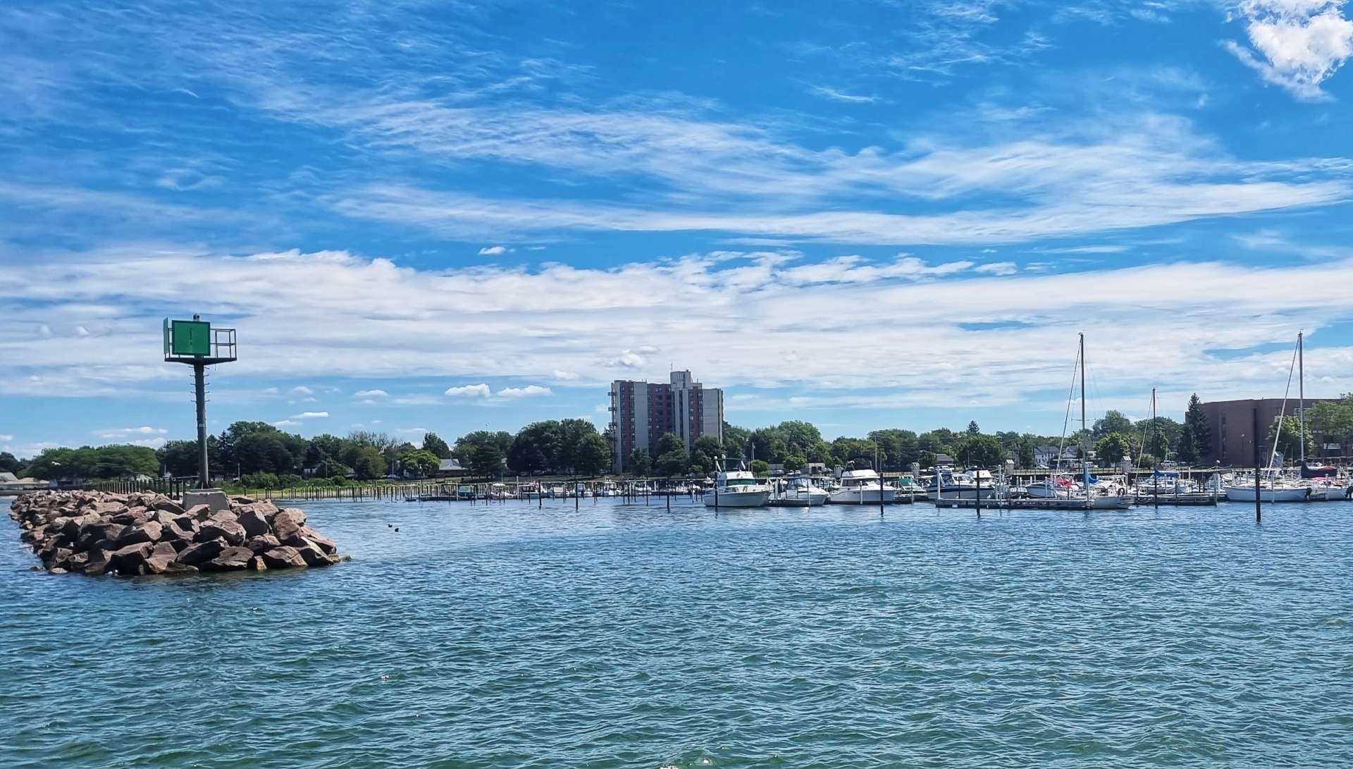
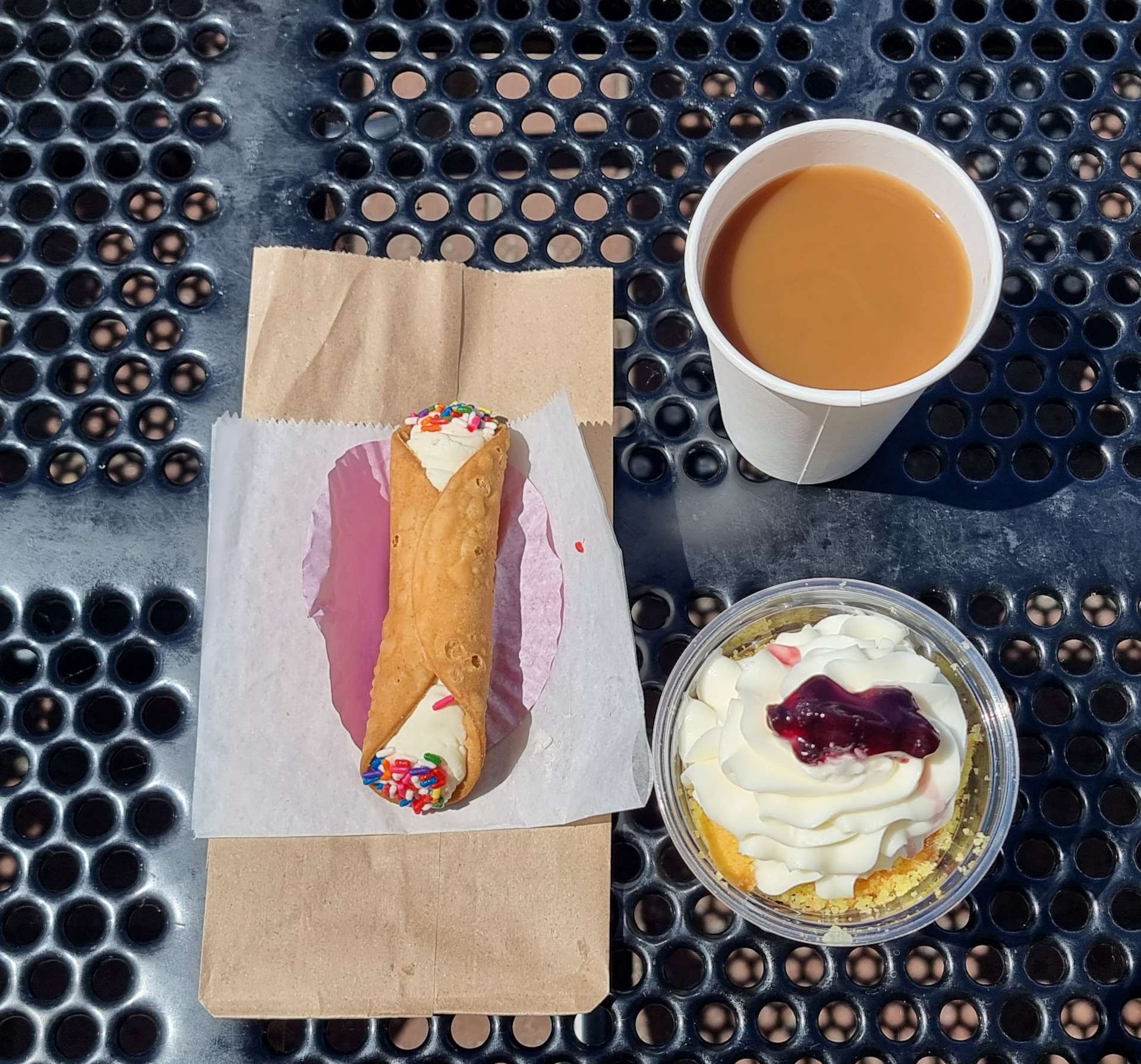
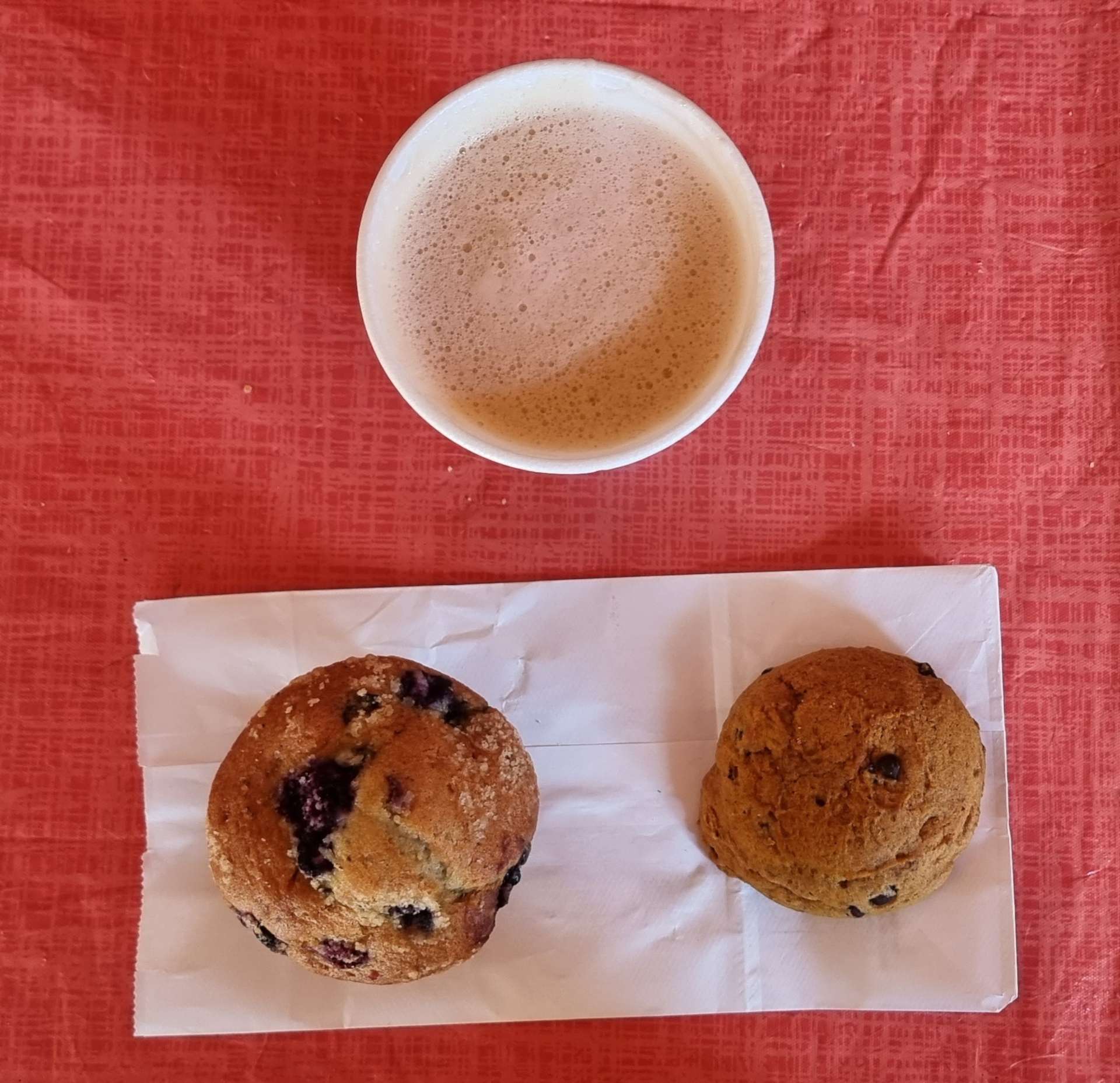
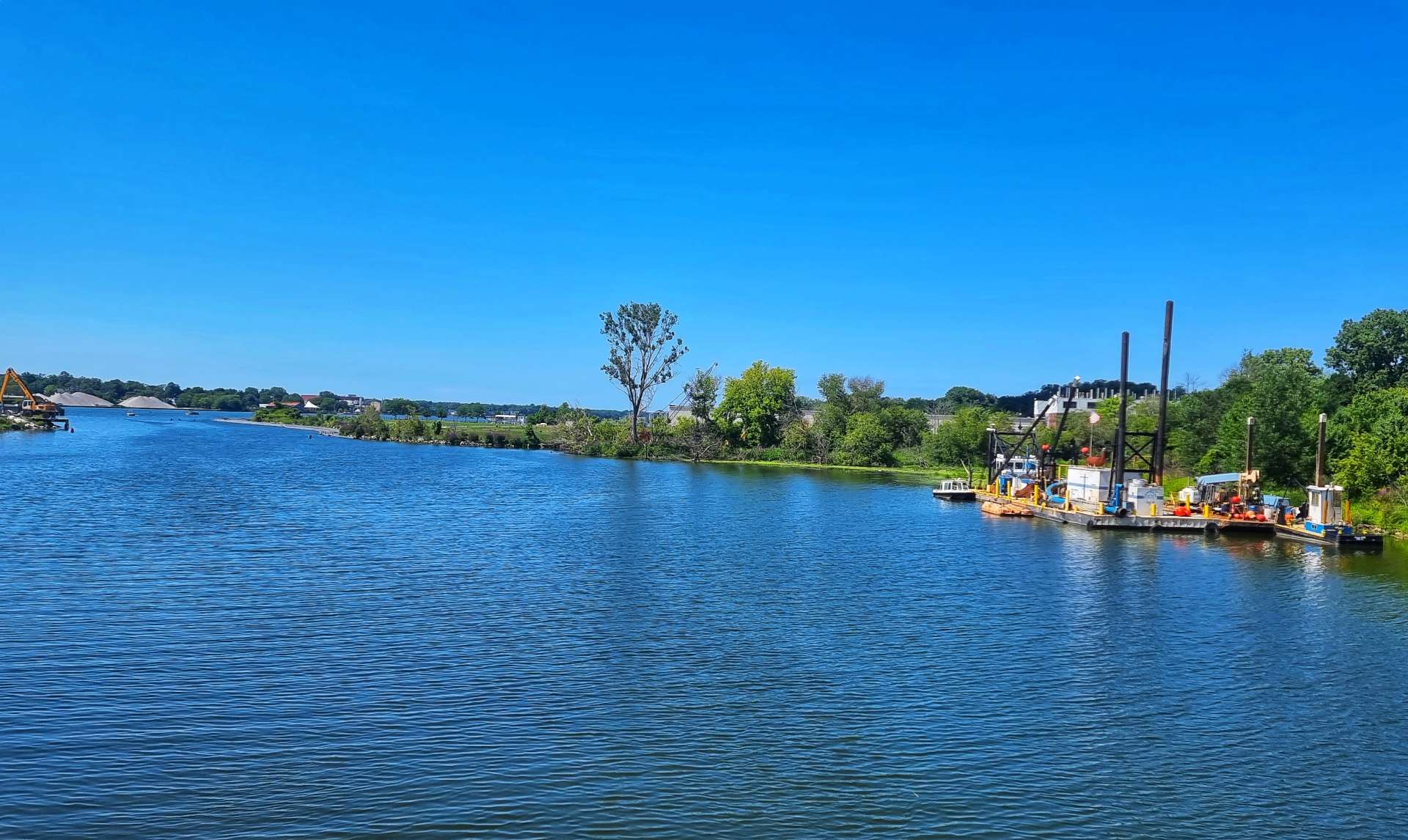
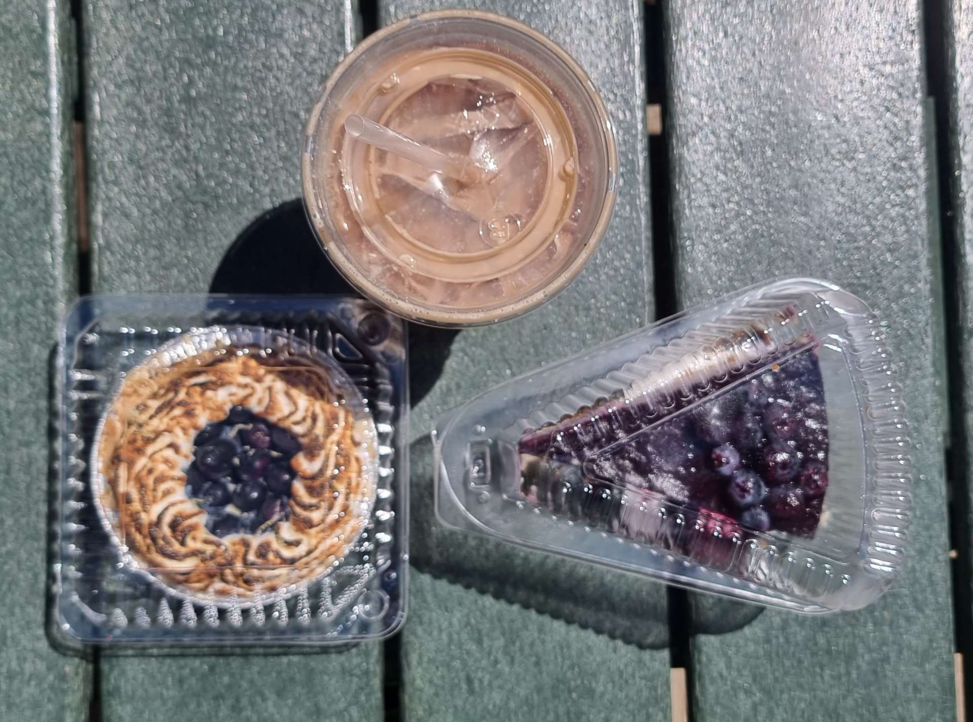
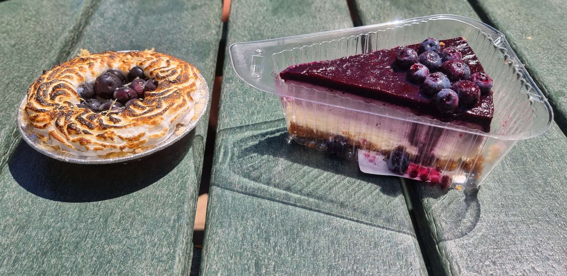
The European theme continued a little longer as we entered Dunkirk. I made my way to the end of the marina to get a few photos of boats that were moored & a view further along the shore. The real highlight was finding Chai’s Chocolates & Gifts on the pier, where I tucked into a cannoli, as well as a blueberry & lemon cheesecake and a coffee!
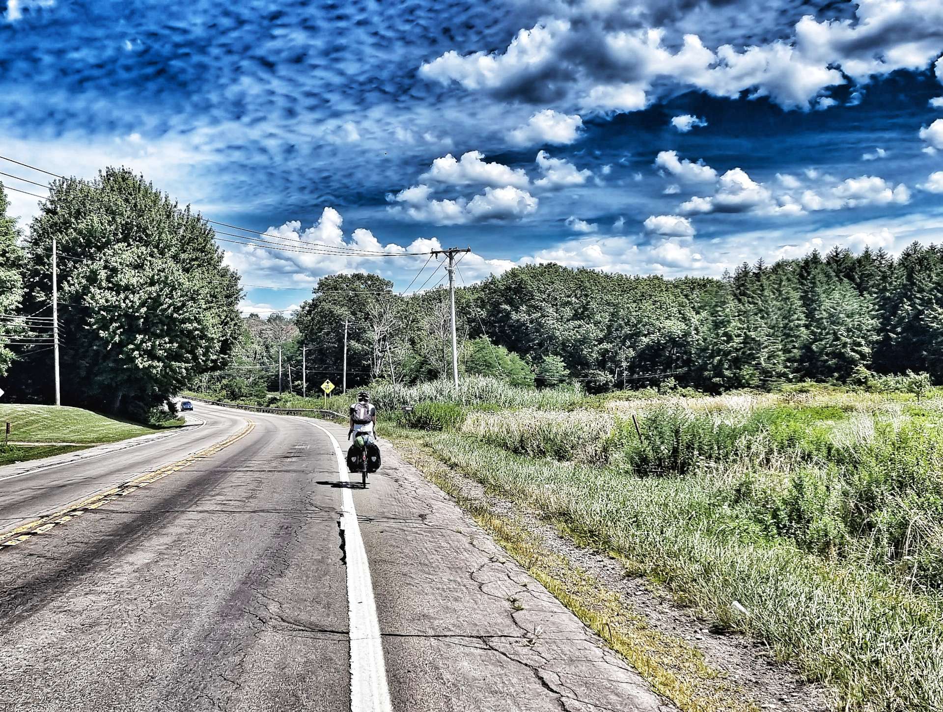
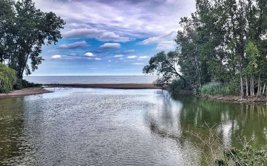
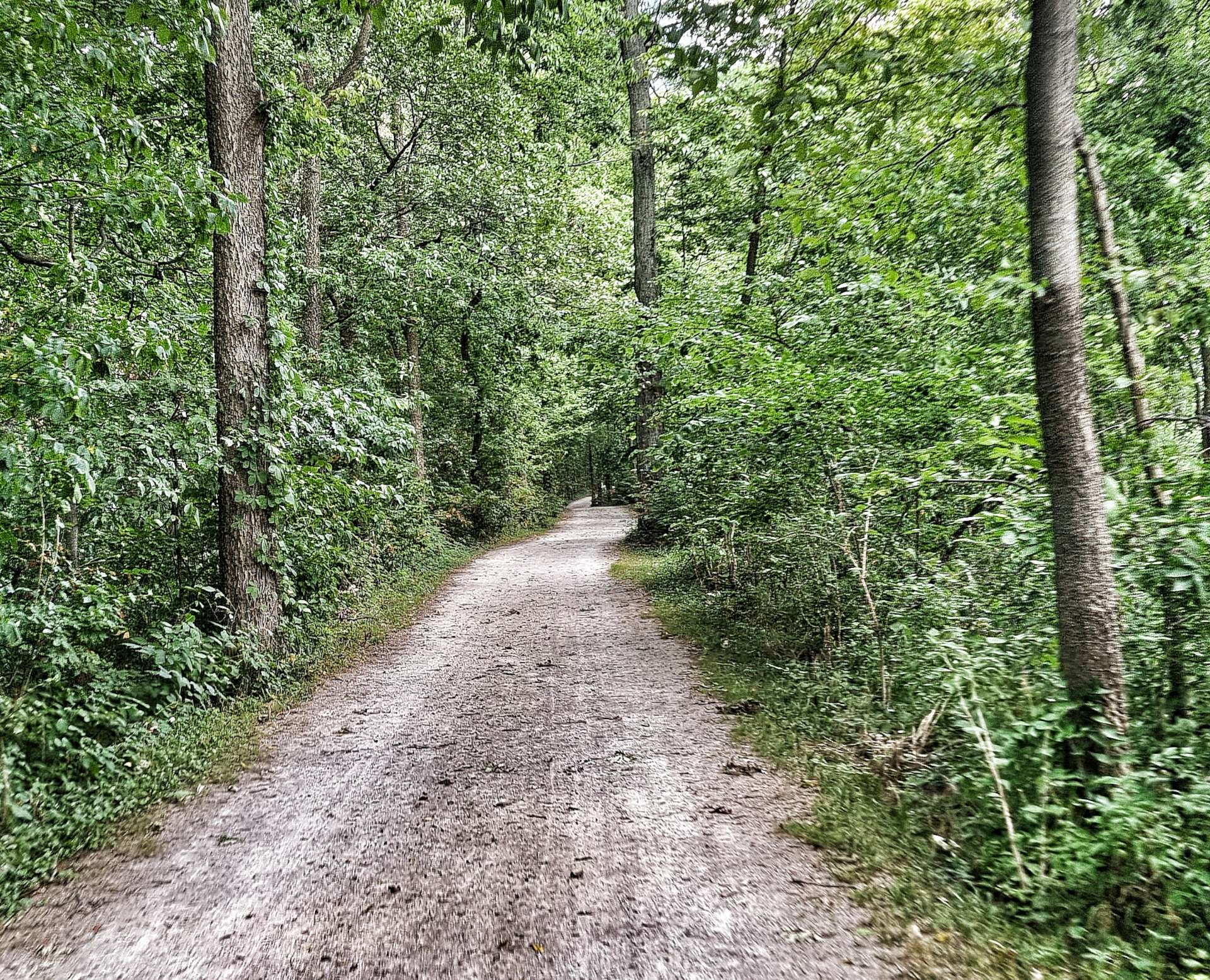
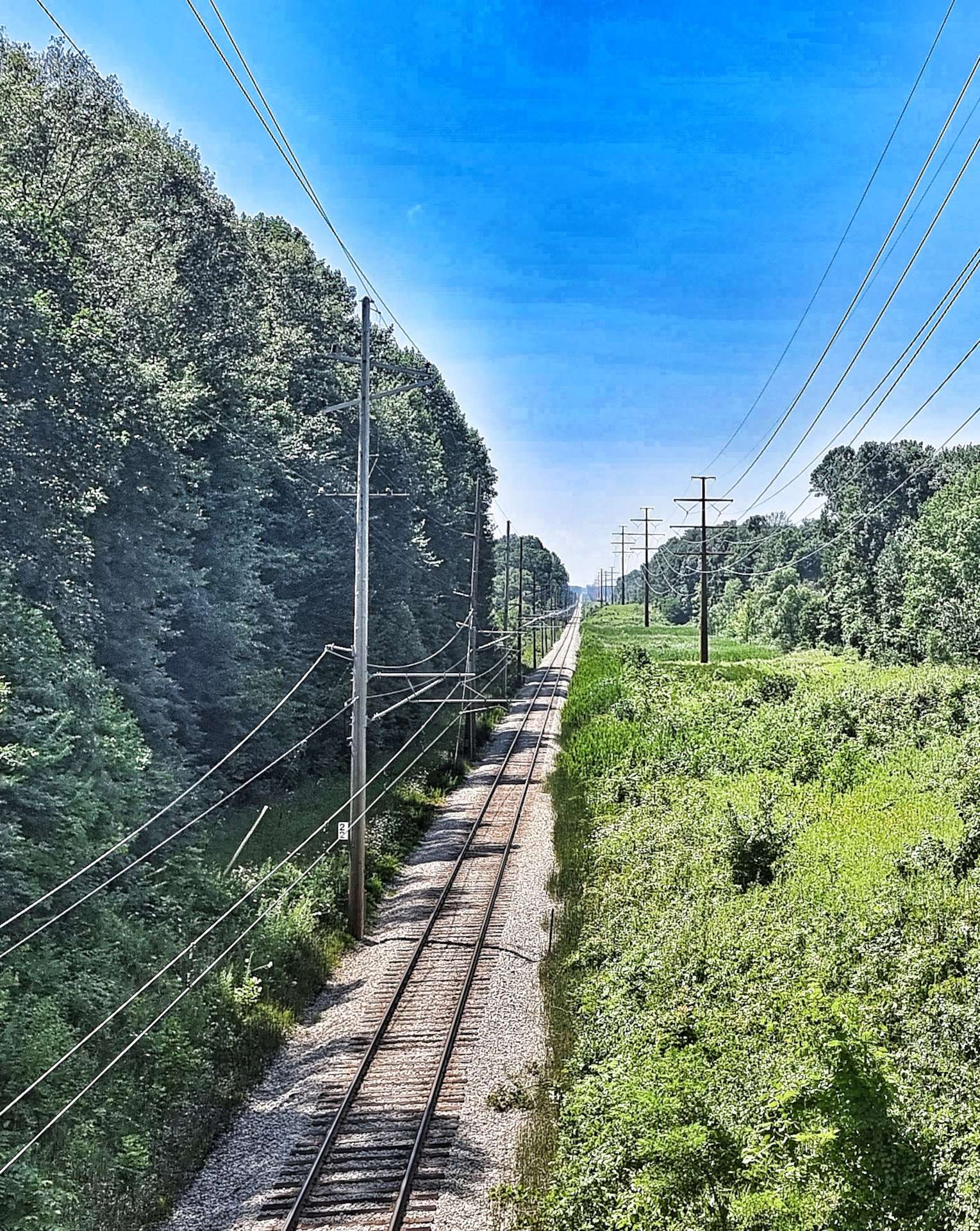
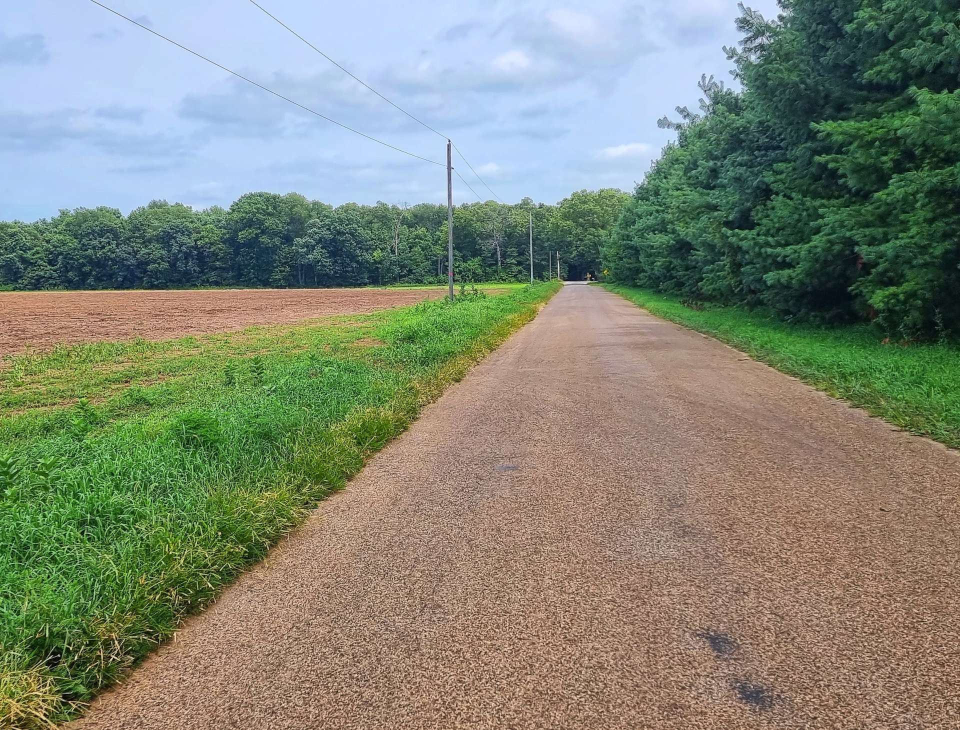
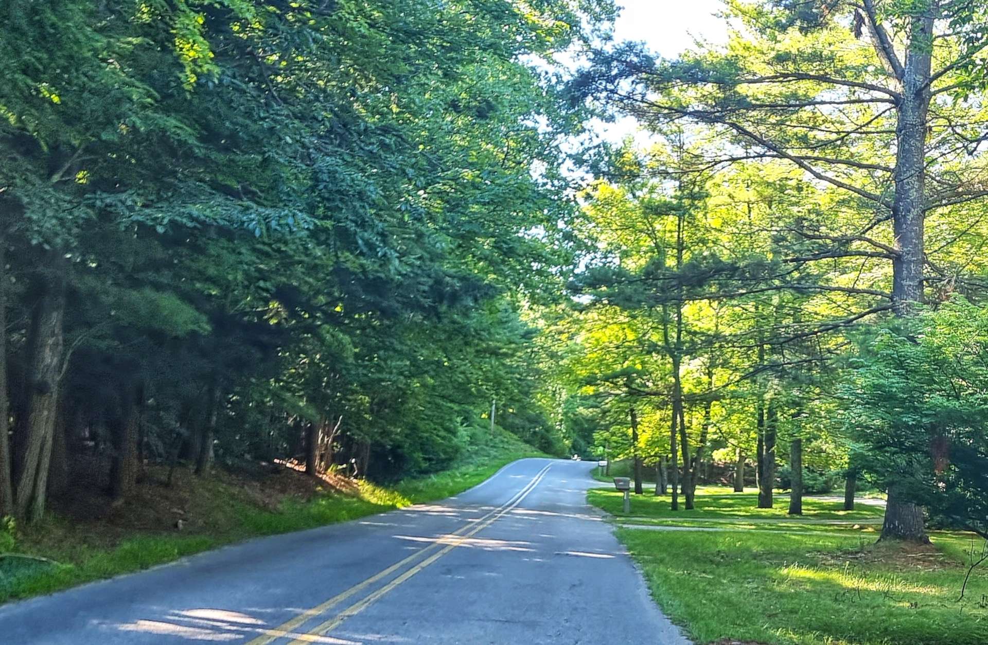
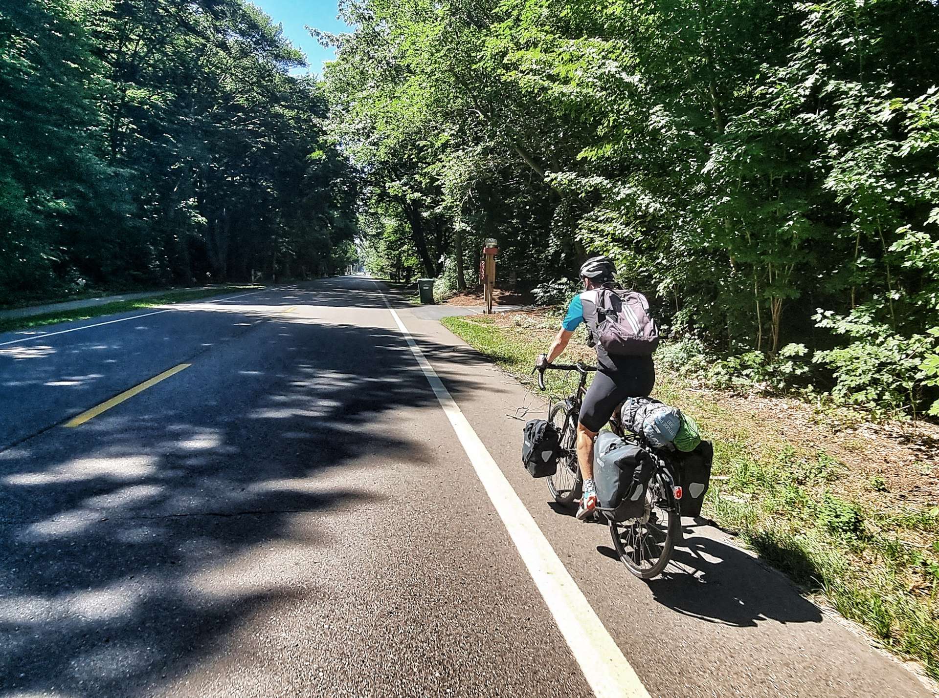
When we first left Dunkirk, we headed slightly inland & passed through woodland & wild meadows. We were still going up & down the same 100 feet of elevation as we continued to head back towards the lake.
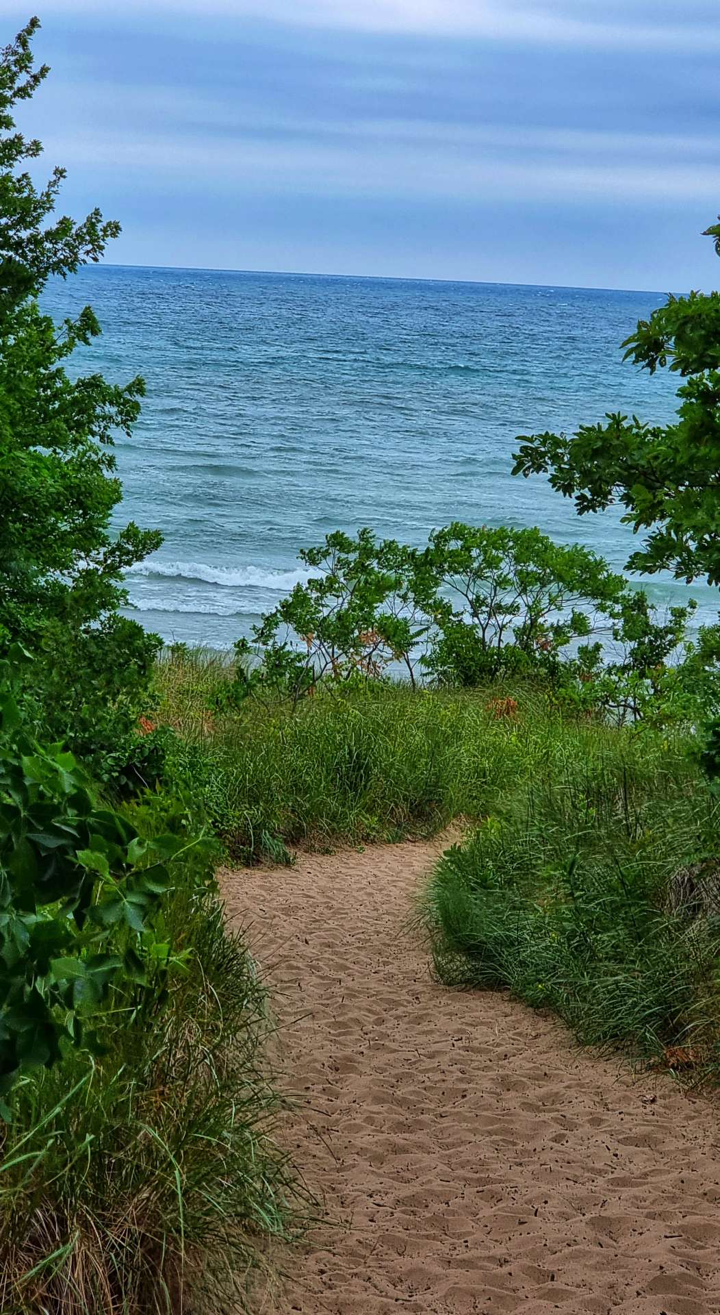
I found a couple of spots where I could park up the bike & go rummaging through the undergrowth (if you’re old enough, imagine David Bellamy or Lenny Henry saying it!) & look down on the sandy beaches below. I tend to take a bit of time when I do this, so Sean had gone on ahead at 60% effort so I could catch him up once I was done faffing.
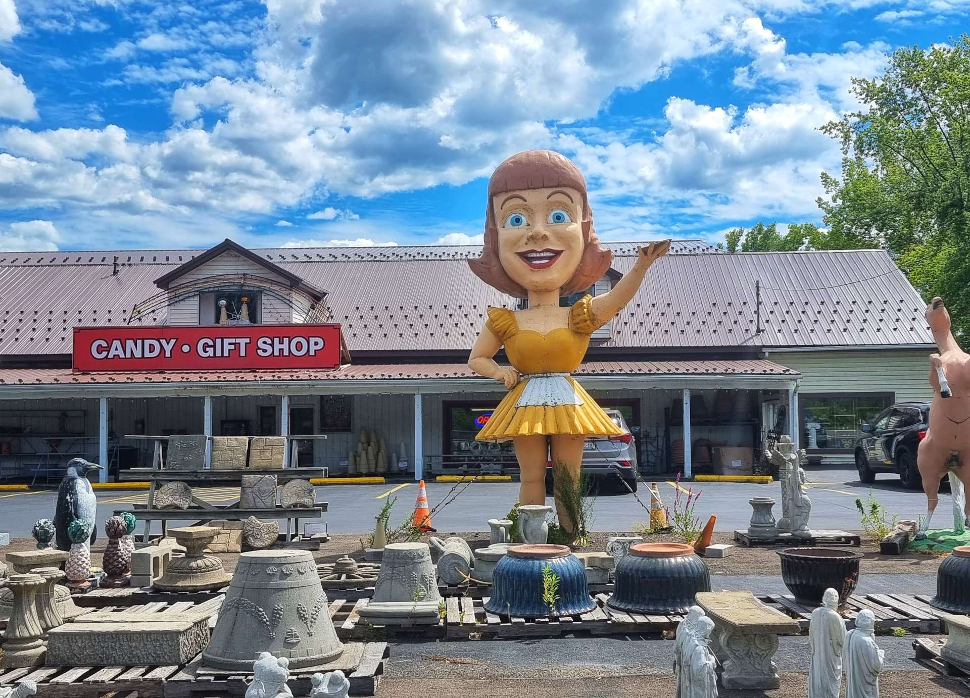
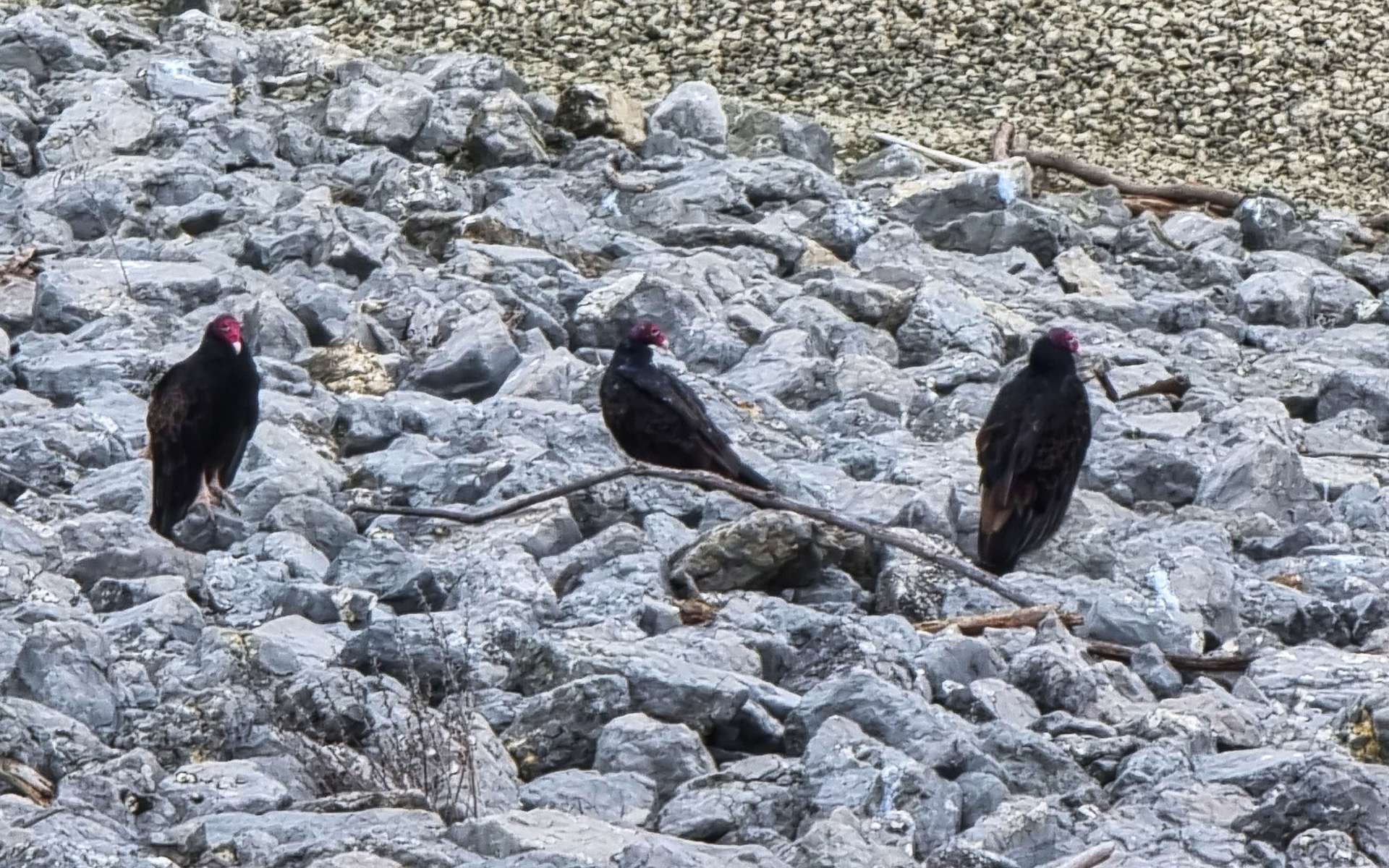
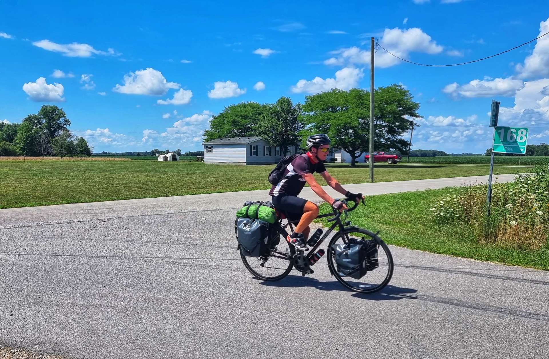
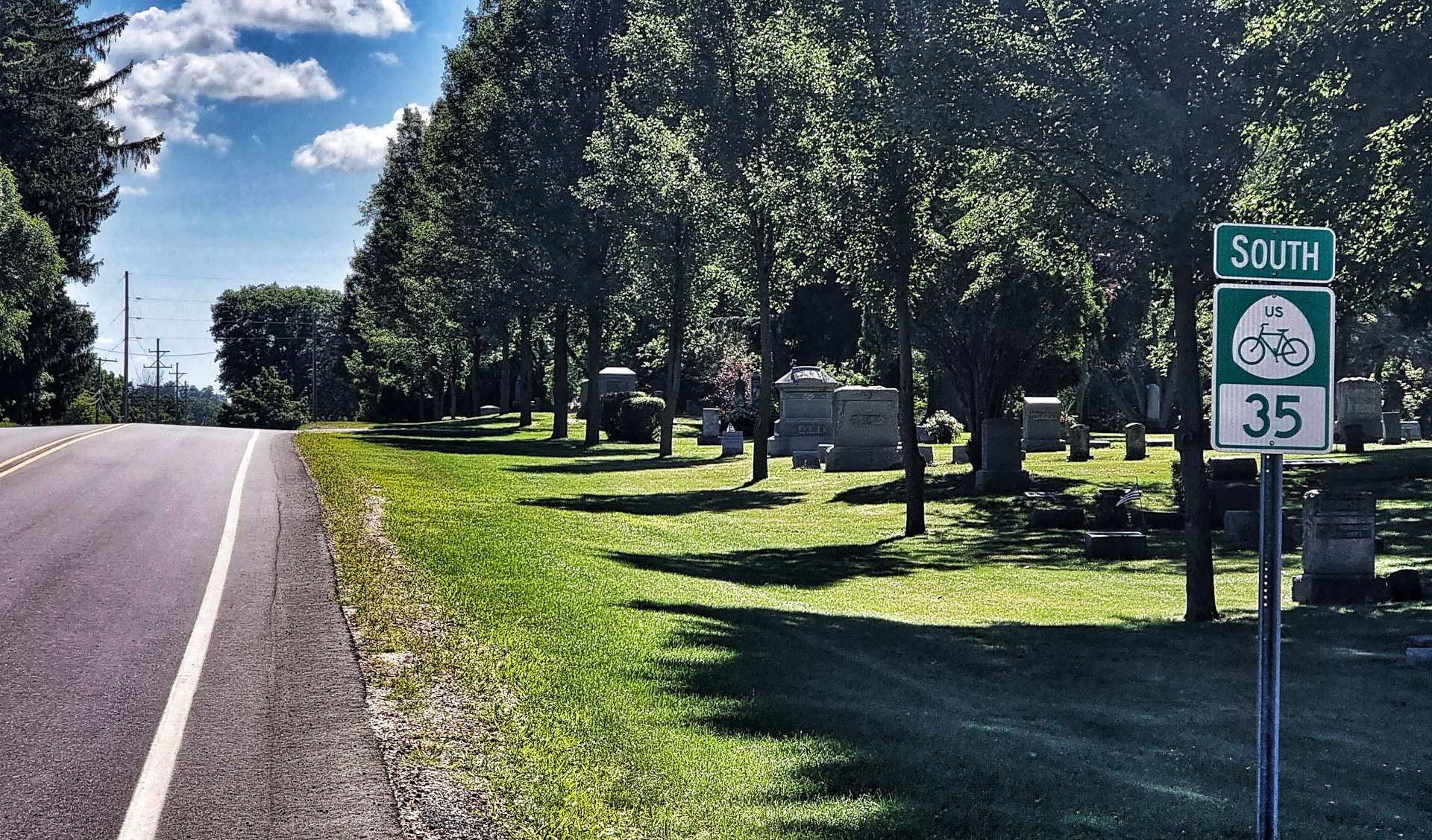
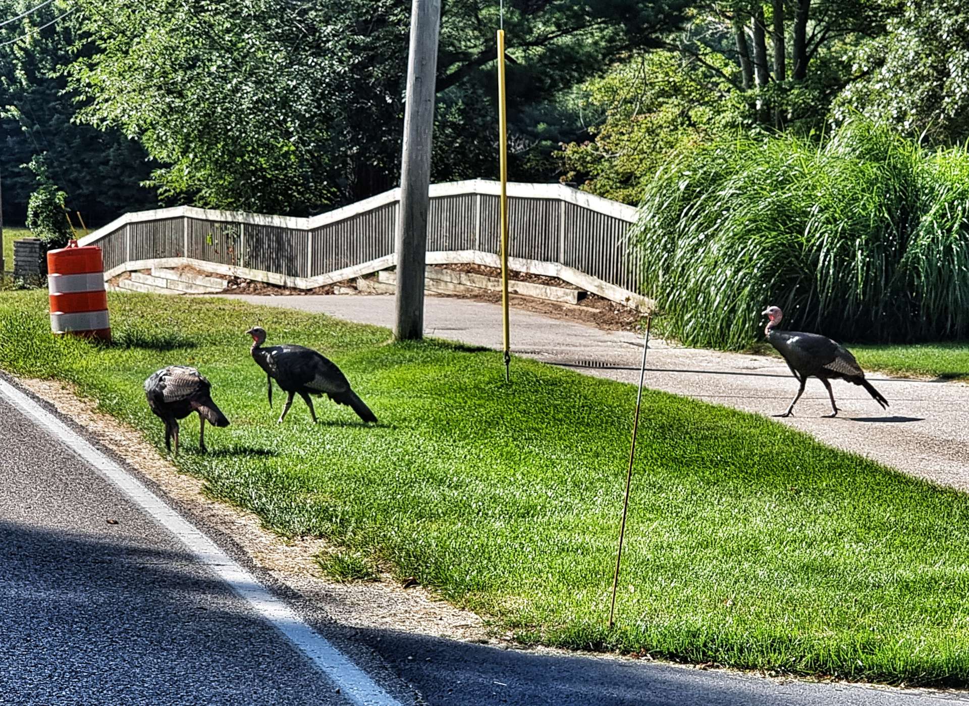
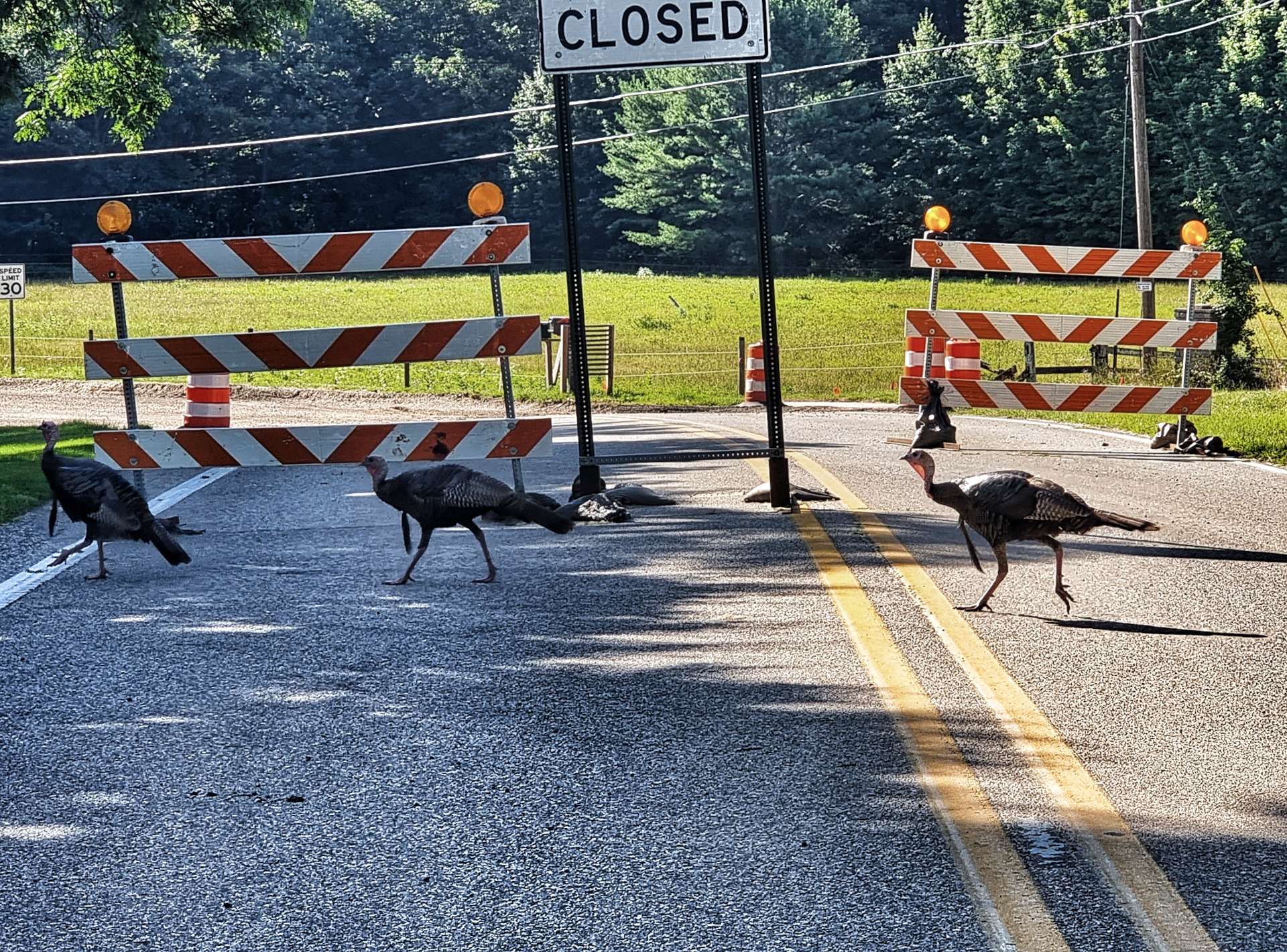
We headed inland again as we approached Silver Creek & the volume of traffic picked up slightly – the first photo below would qualify as busy for the last 3 days, so everything is comparative. There was a short steep hill out of town & as we summitted the climb, we were confronted with the biggest waitress I’ve ever seen – she towered over the building behind her!!!
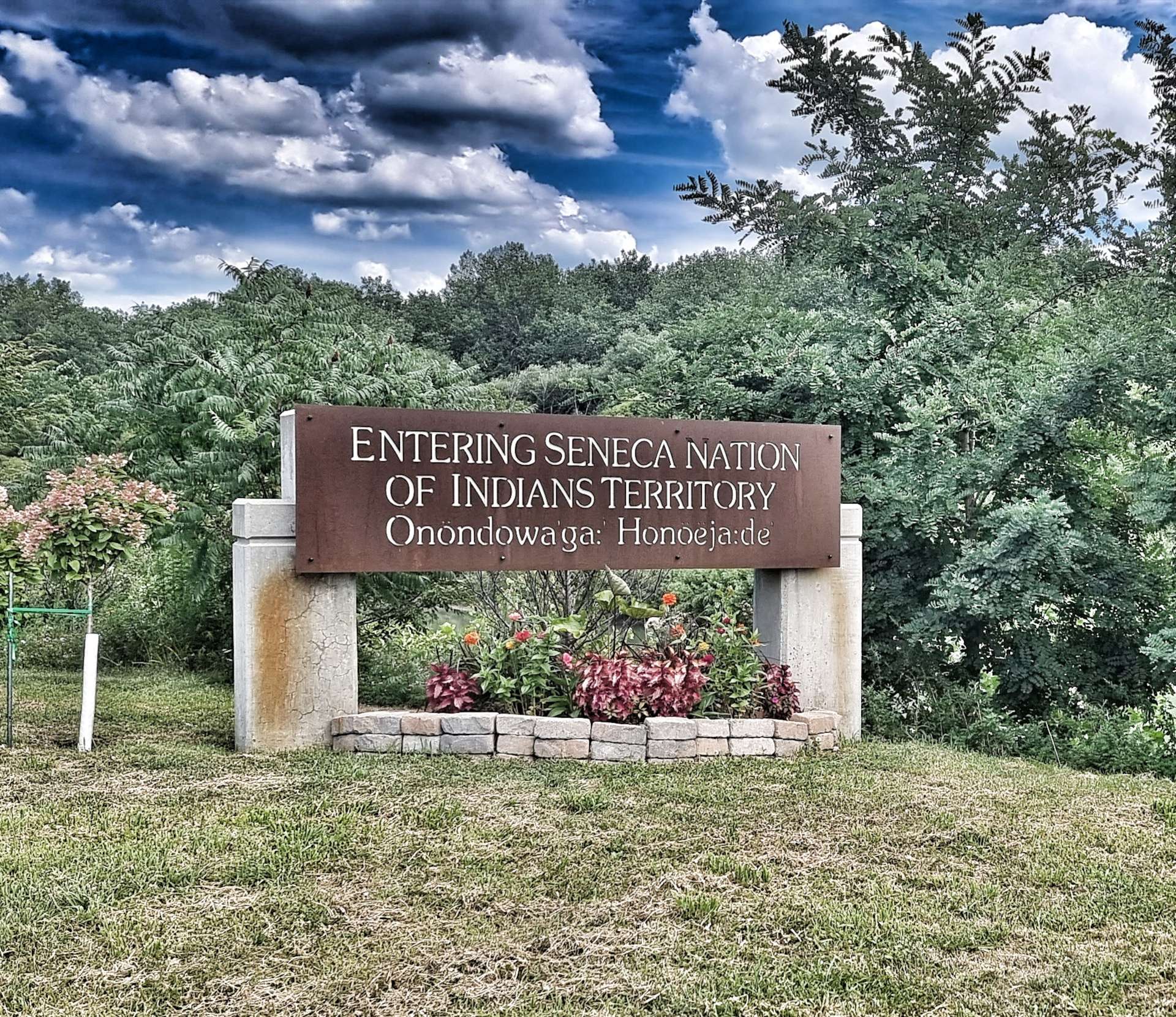
Approaching Irving, we entered into the Seneca Nation of Indians – “Onondowaga Honoeja de” translates as People of the Great Hill Place & is used by Seneca Indians to describe themselves.
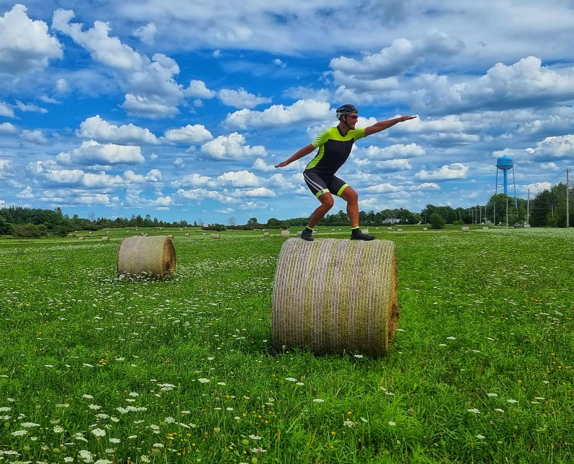
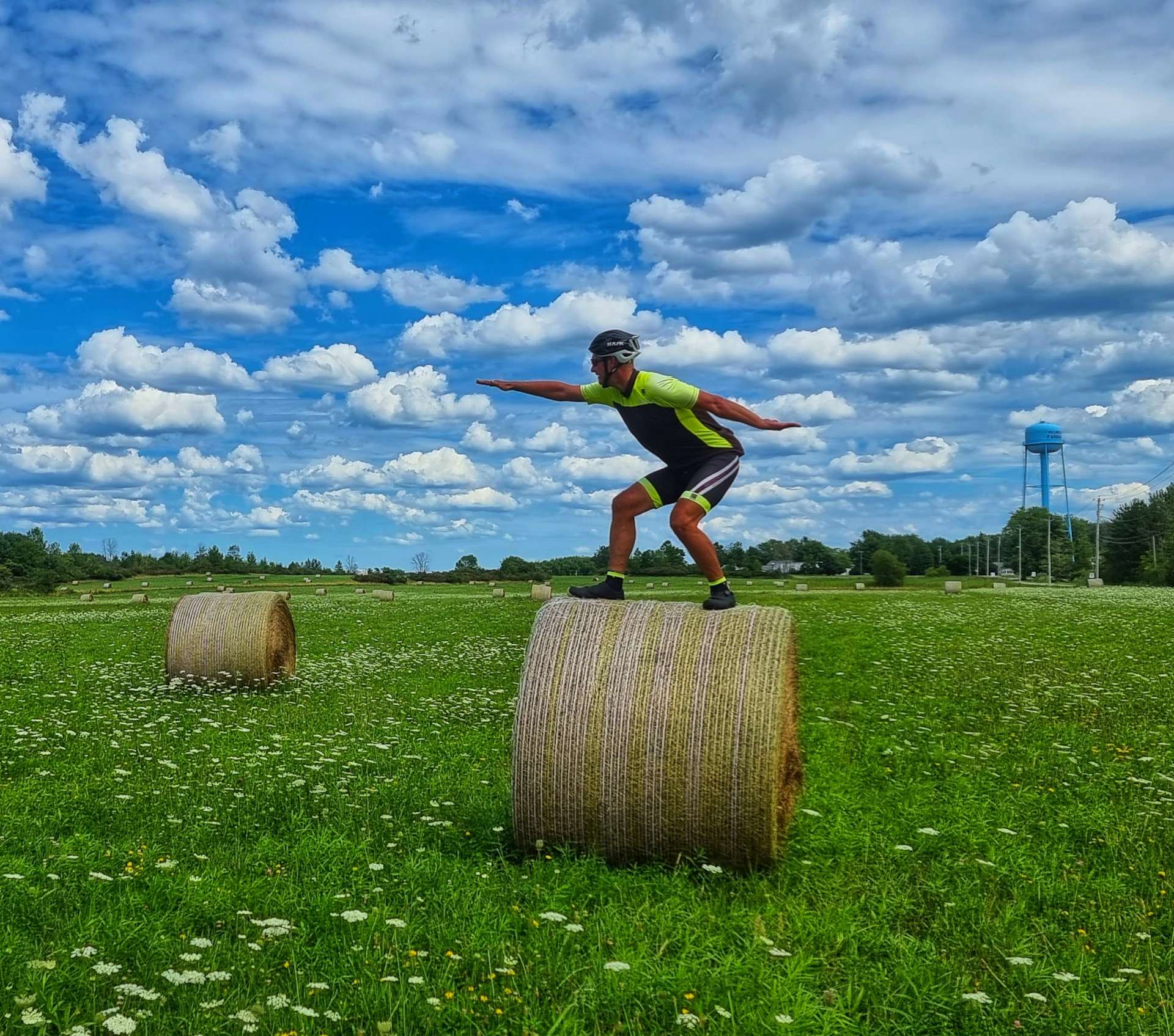
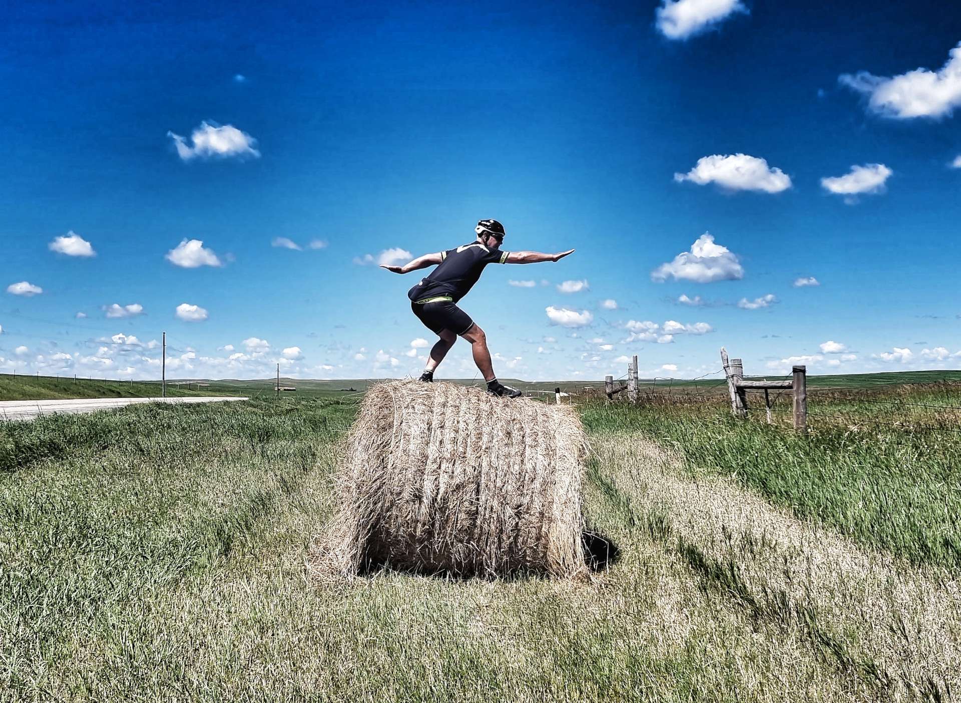
We turned back into woodland briefly, then as the road turned left I saw a whole field of hay bales calling to me. Dad was ambidextrous & in a cruel twist of fate, it appears that all he passed on to me is an inability to Hay Bale Surf to the right or left!!! I think my form may be slightly less bad in the second photo…..
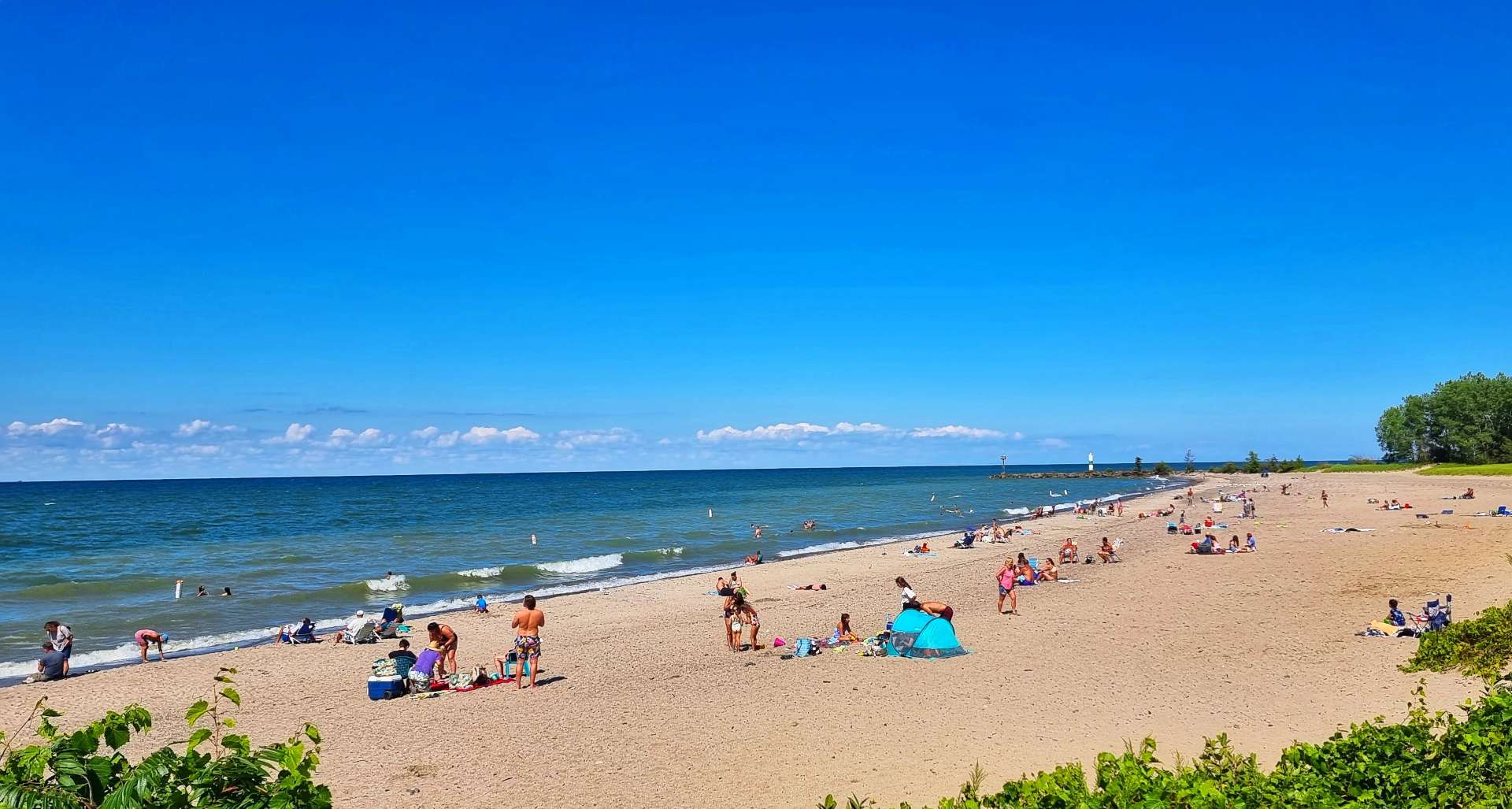
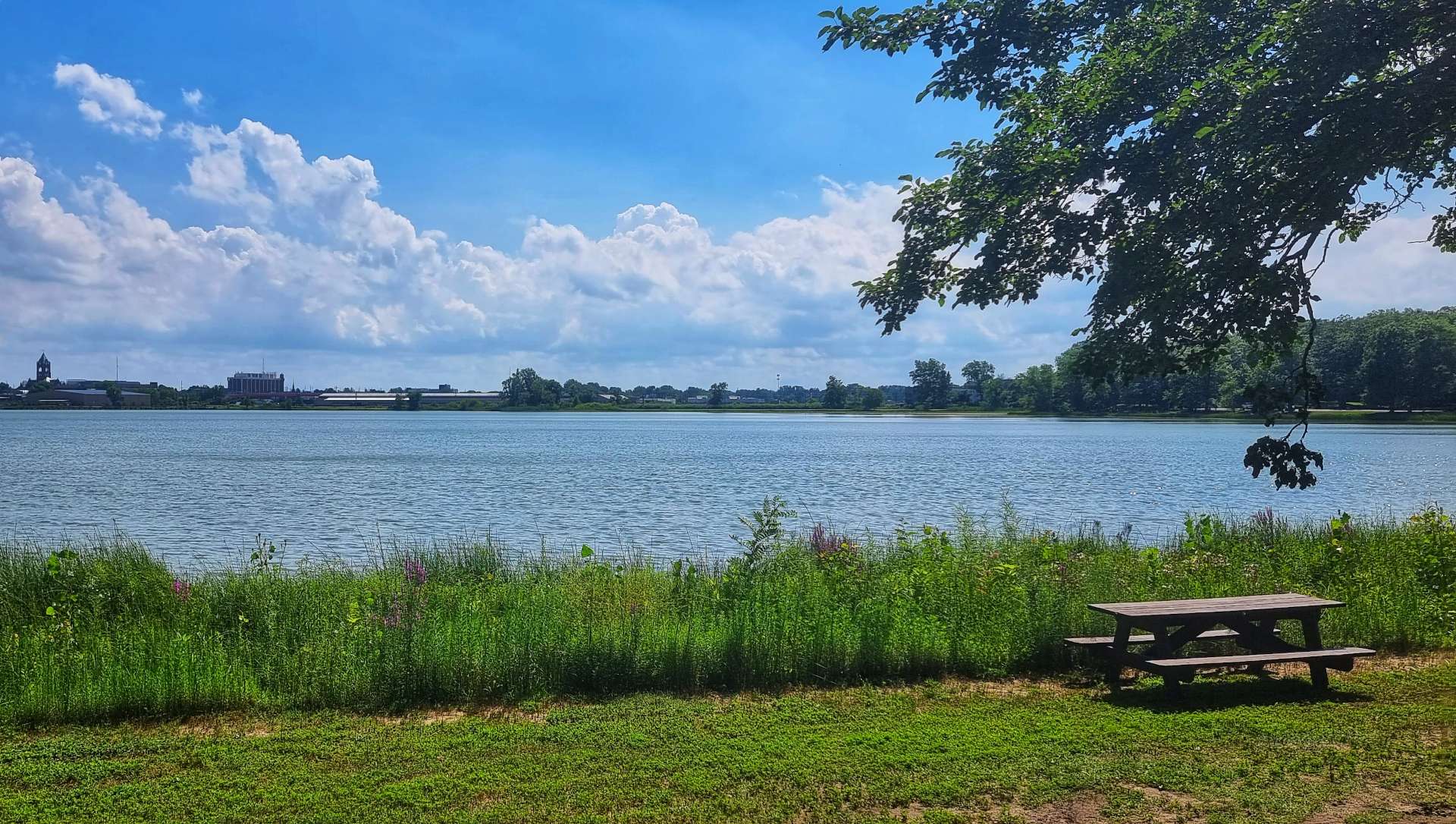
Sean said my surfing really was something to behold, although I don’t think he meant it as a compliment! I put his cruel barbs to one side & we set off for the next treat on today’s ride. Evangola State Park is located to the West of Farnham – I only mention this because there’s also a Farnham near where I was born in Surrey. It’s 733 acres in size & has a couple of top quality beaches & picnic facilities, as well as hiking & biking trails. It’s a little gem of a place & attracted over 140,000 visitors in 2019.
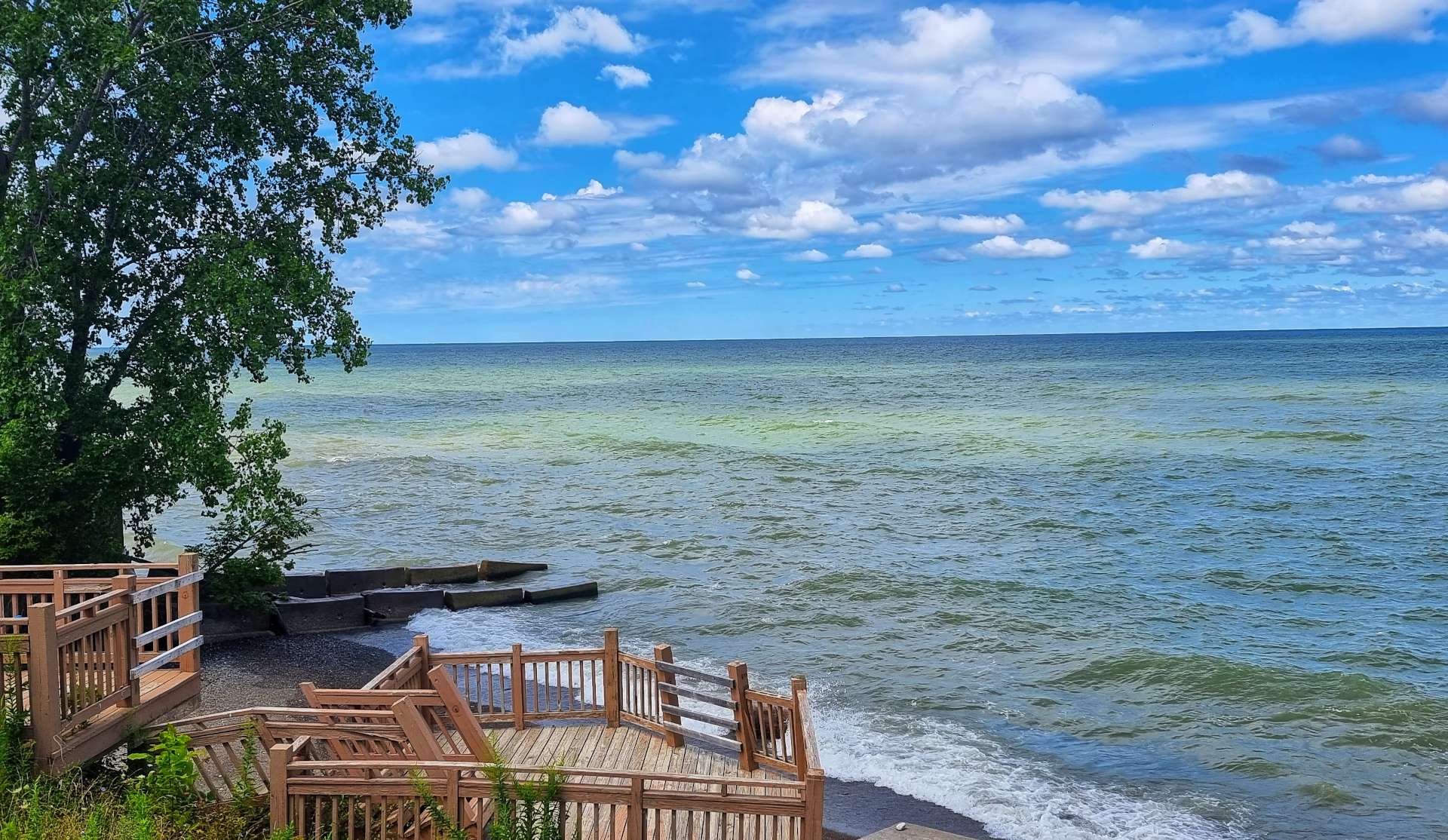
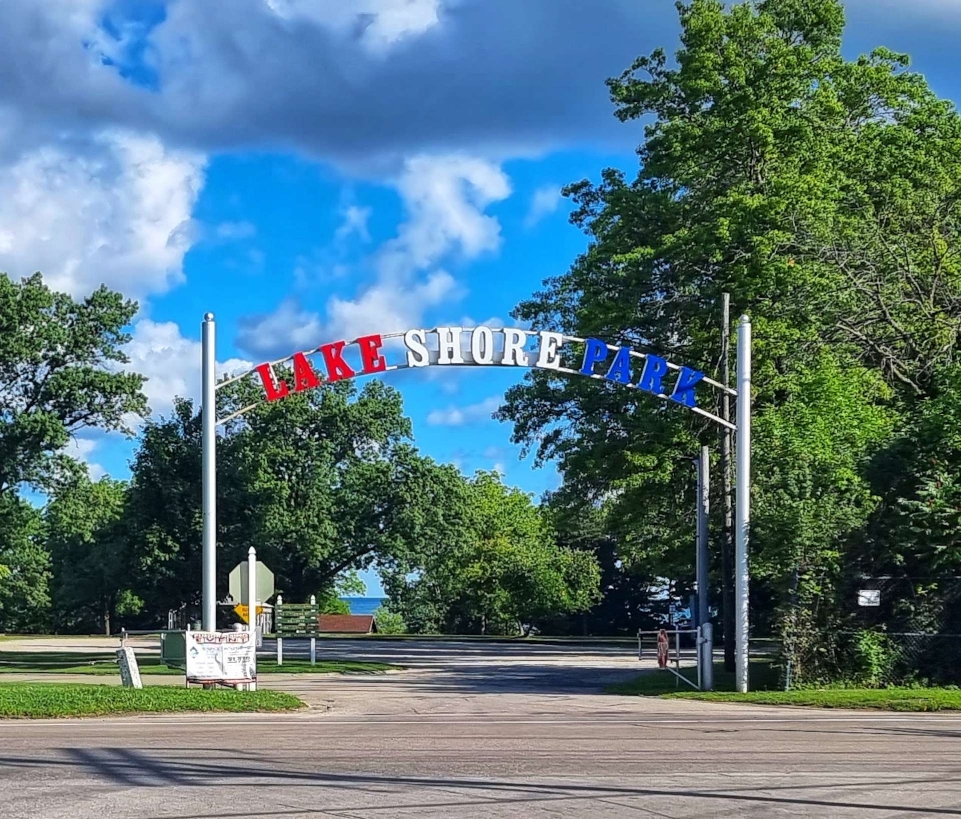
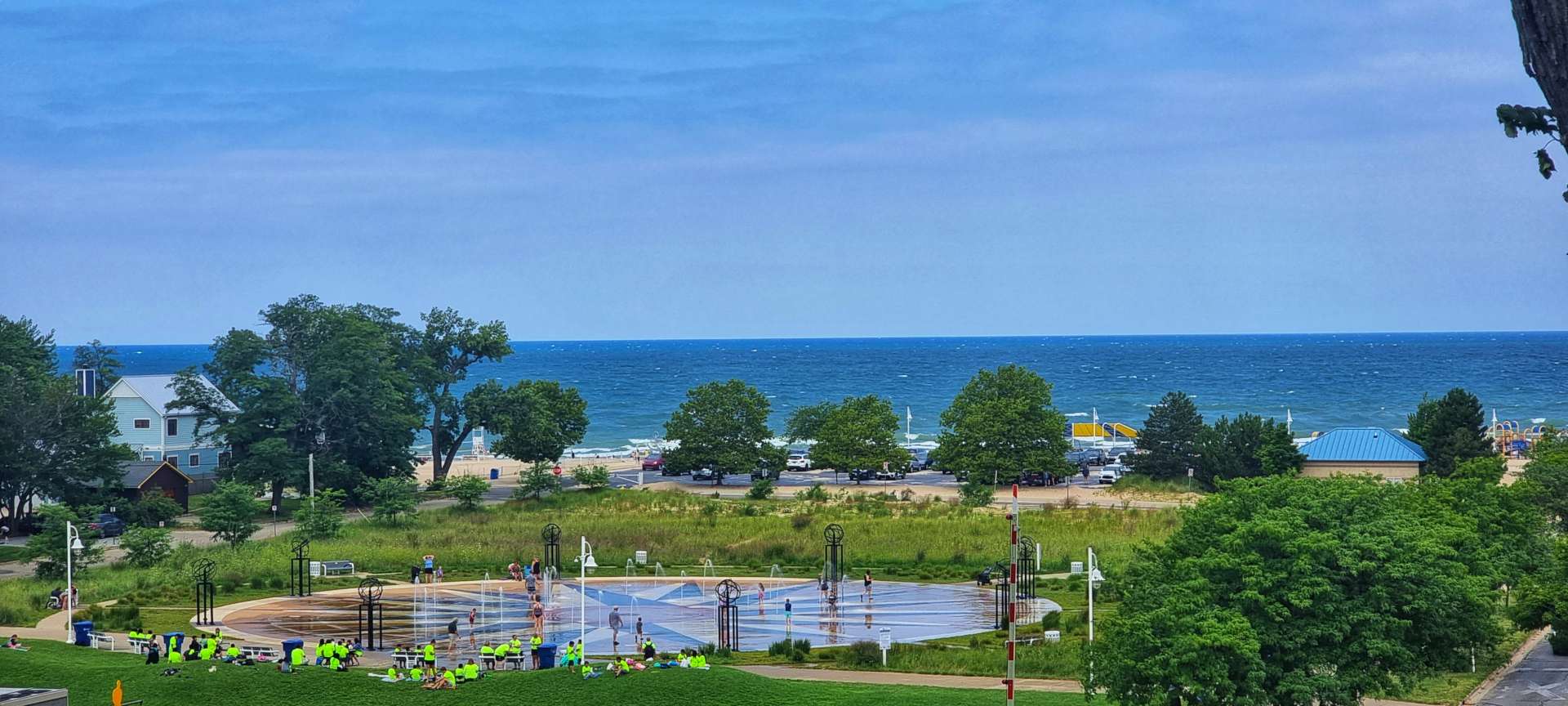
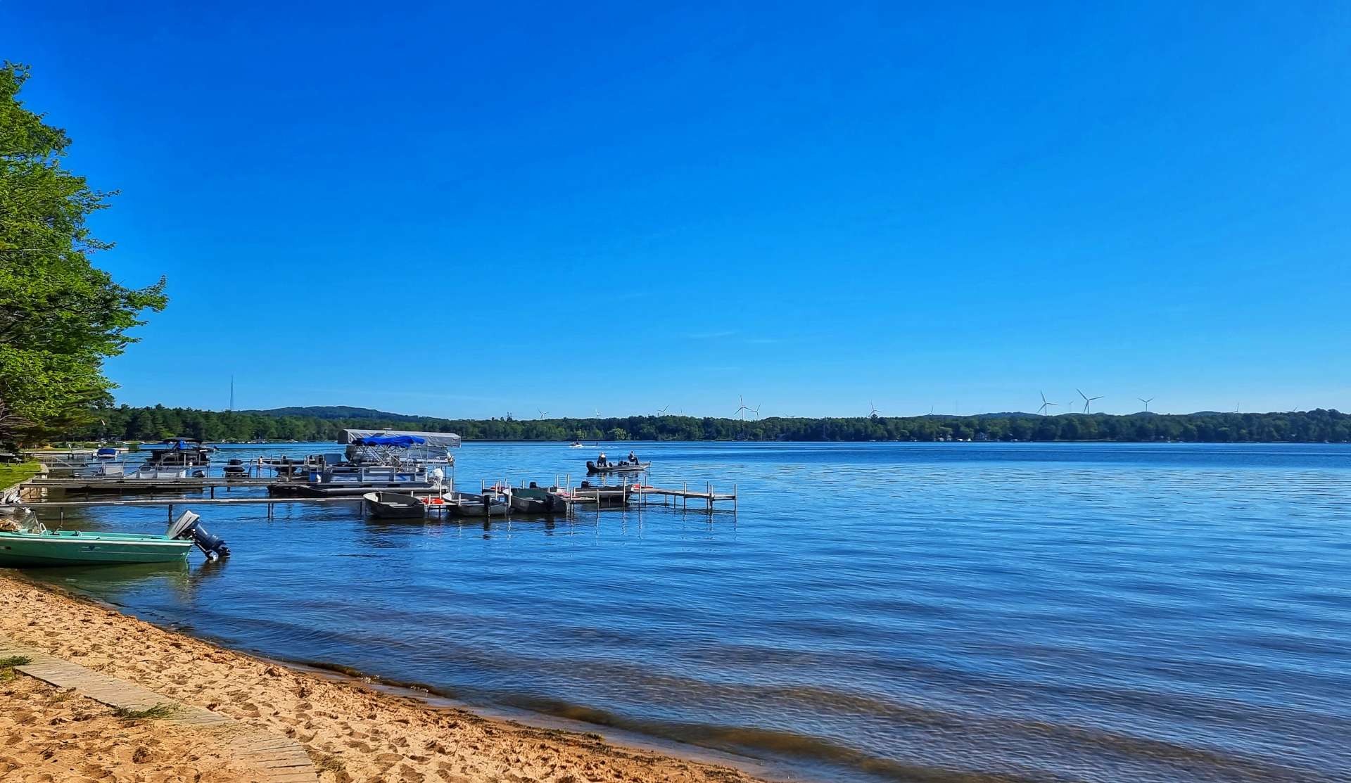
From Evangola we headed to Lake Erie Beach Park for our final view of the lake today. It was a buzzing little place, with a couple of beach bars & food joints which were doing a brisk trade. All that remained was an easy 3 mile ride to our motel in Angola-on-the-Lake, as we completed another great adventure along the shore of Lake Erie.
Stage Stats – 58 miles, 1,421 feet of climbing. Crossing the State Line into New York & making our way through more European towns!
Monday 16th August – Angola-on-the-Lake to Niagara Falls (Stage 82).
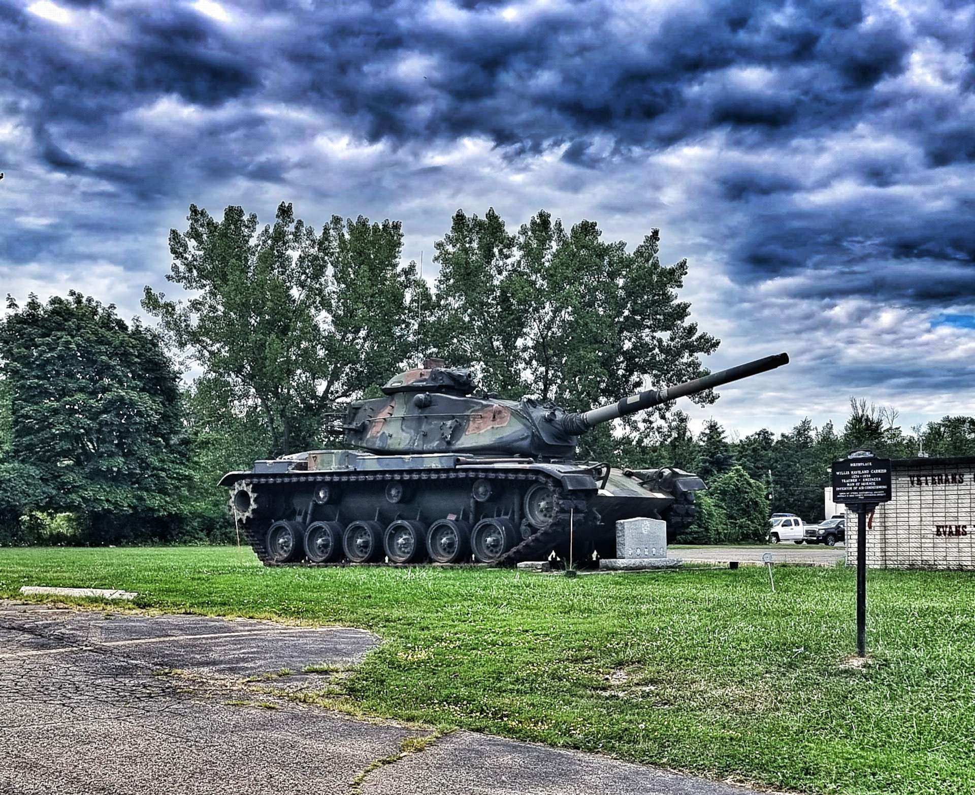
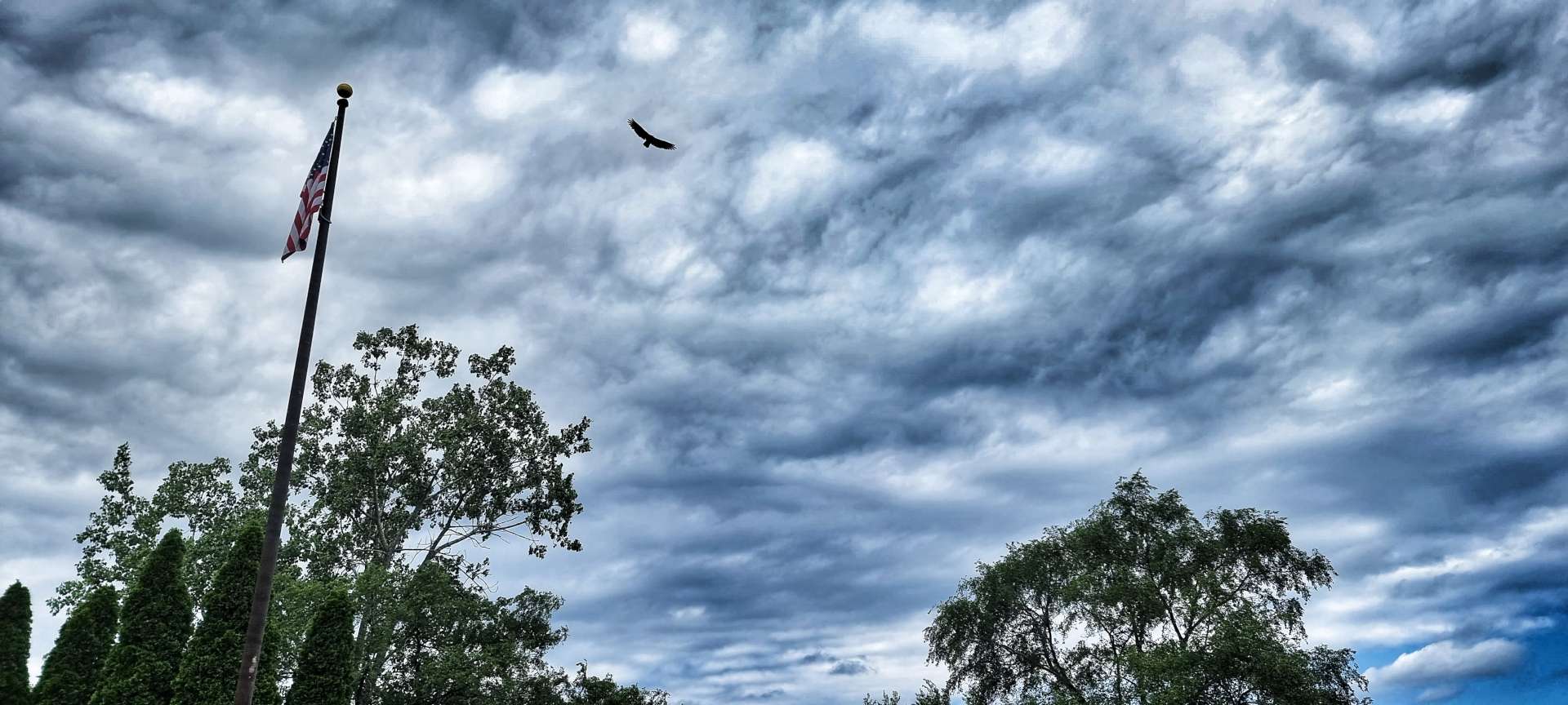
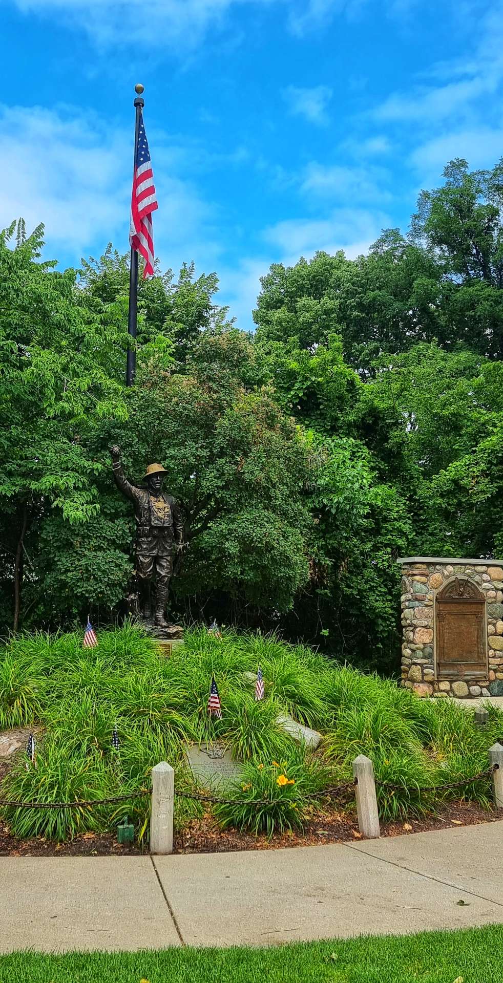
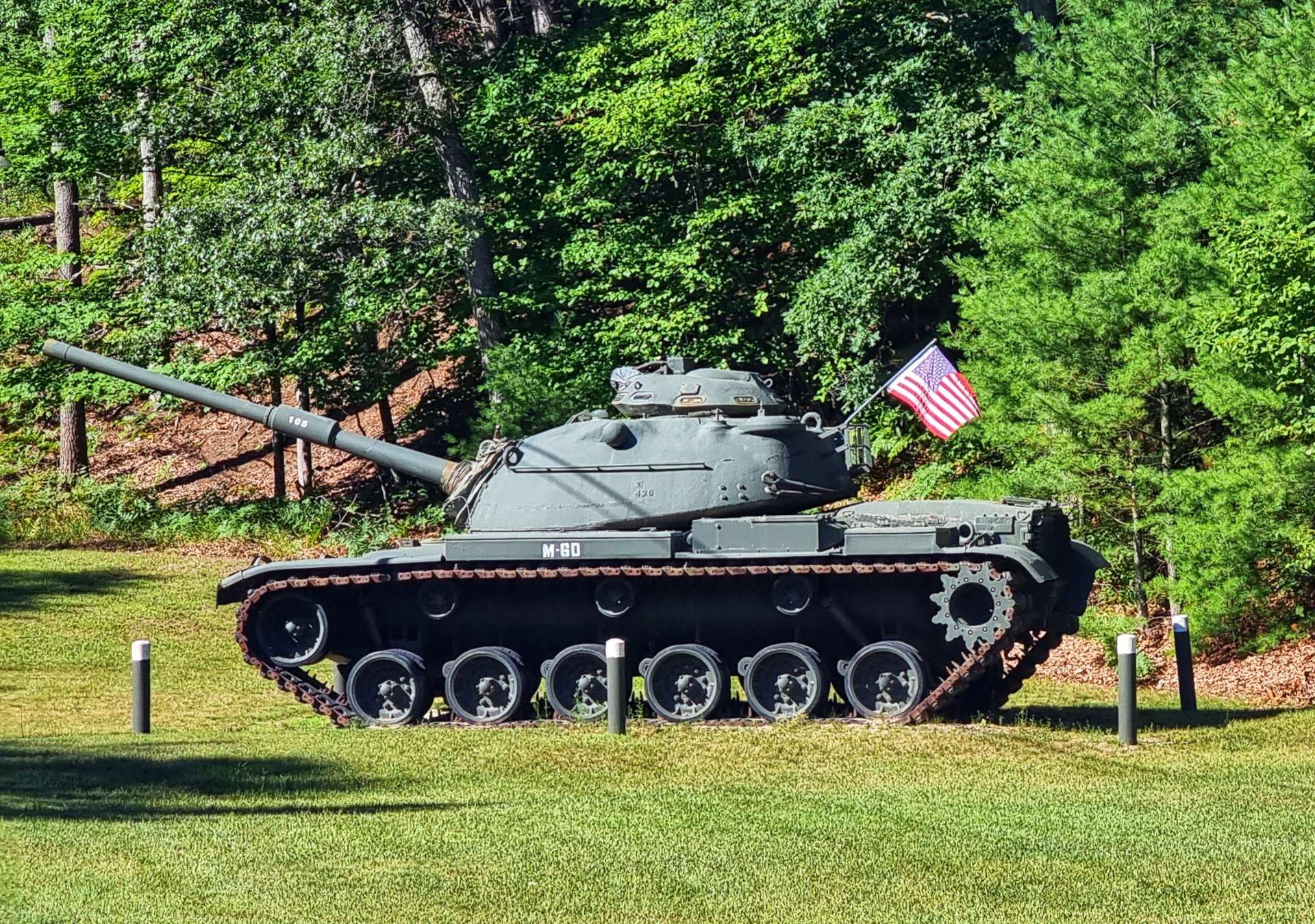
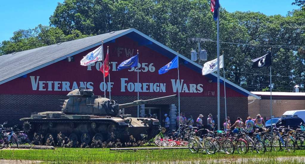
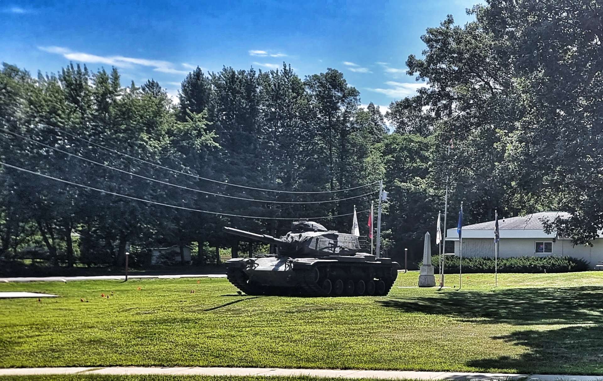
Setting off from our motel, we took a left towards the lake, but before we got there, we spotted a tank at the Veterans Park. War artefacts at the Memorials have become more prevalent as we’ve headed East.
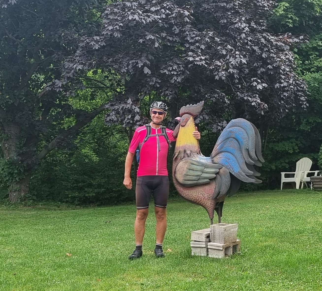
I then added a cockerel photo to my collection & sent it on to my good friend Bob (well, he was a good friend before I kept sending him photos of Man with big cockerel texts!).
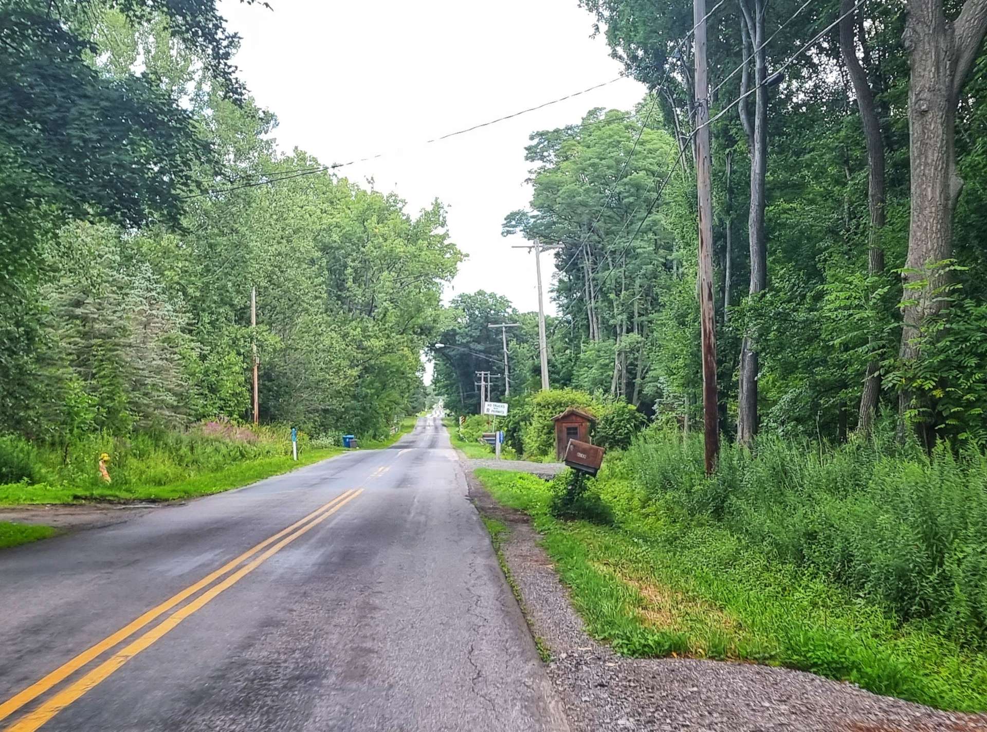
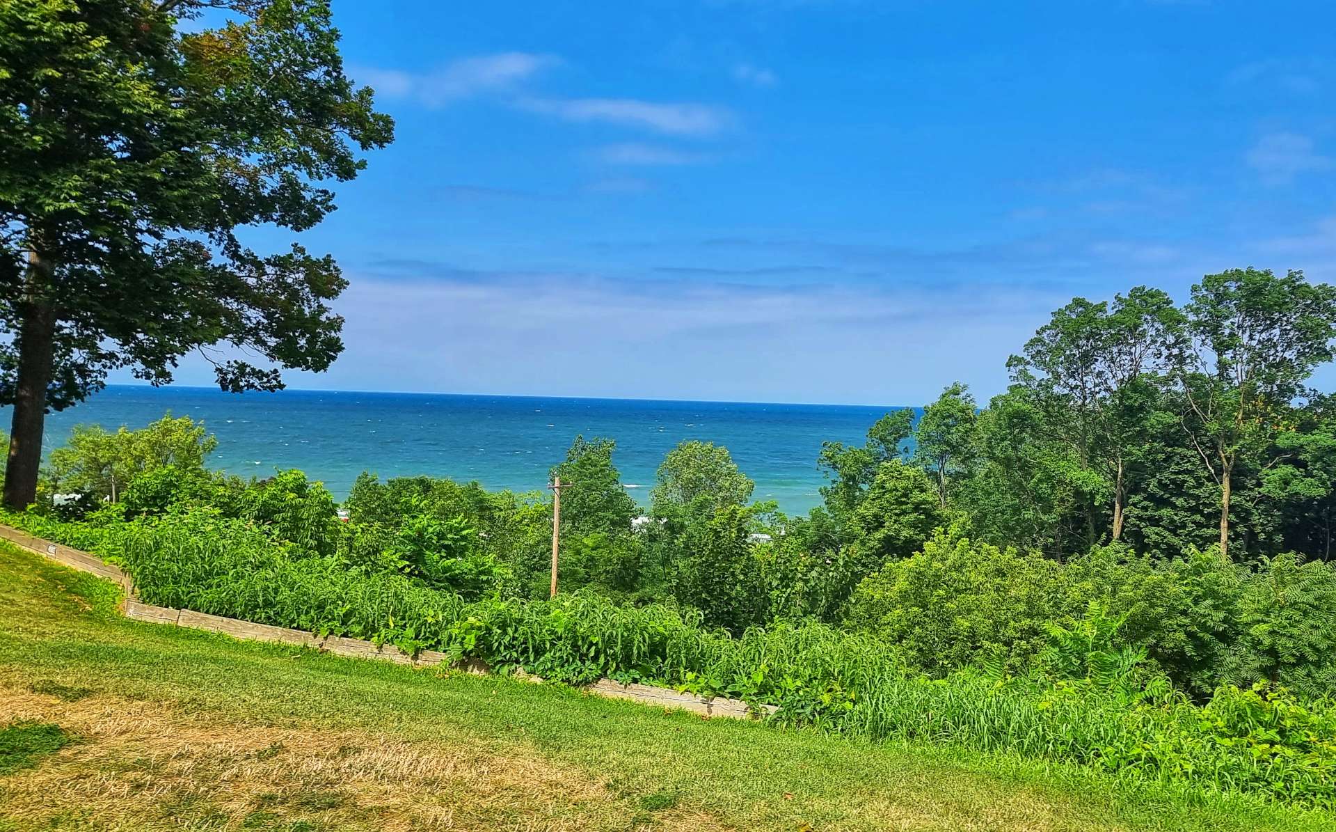
The road meandered through the woods, as the lake continued to hide away.
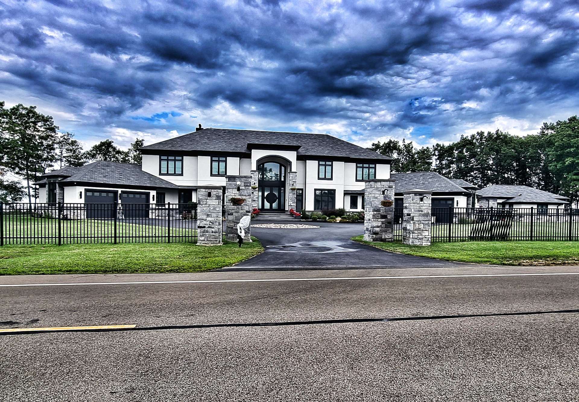
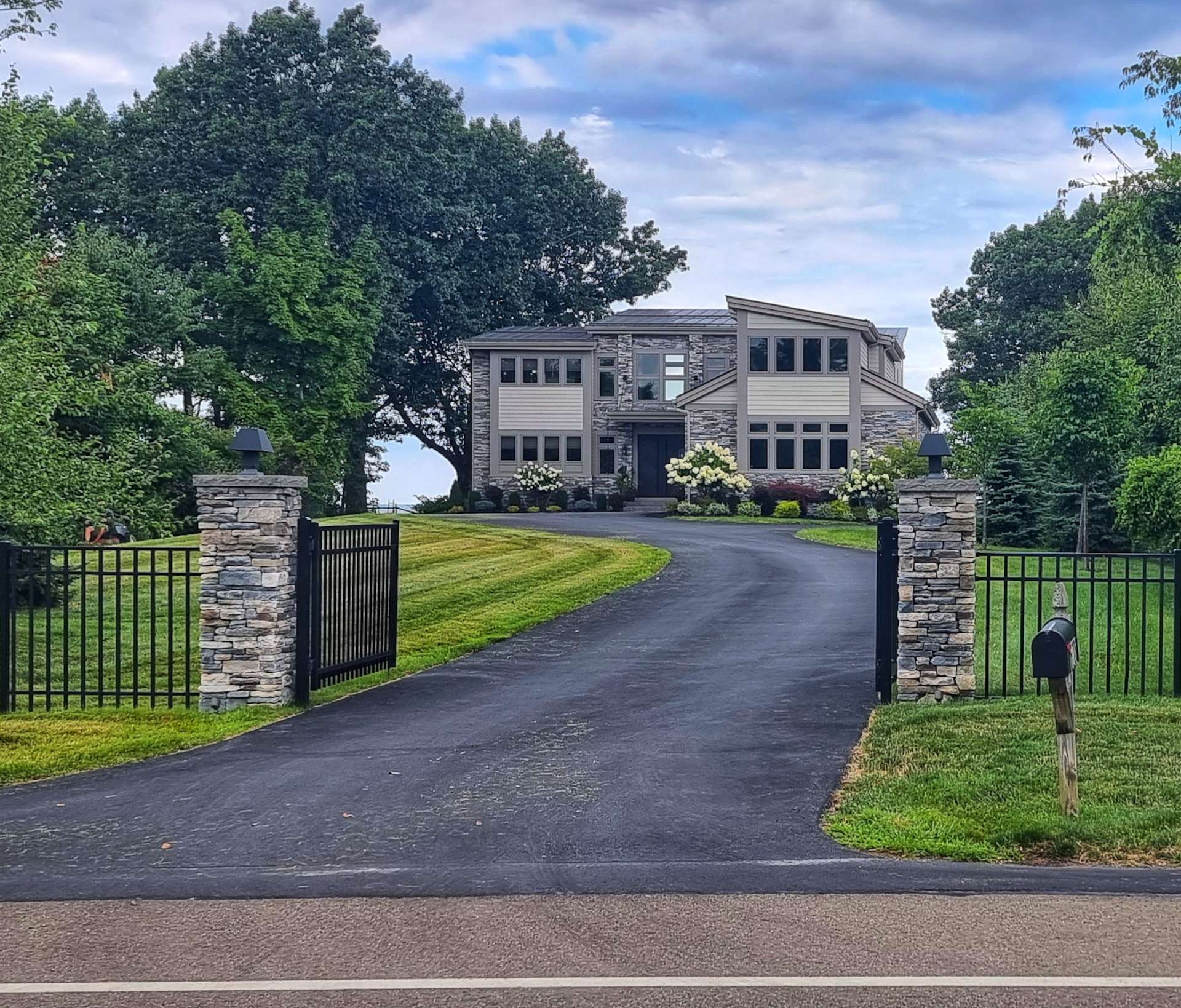
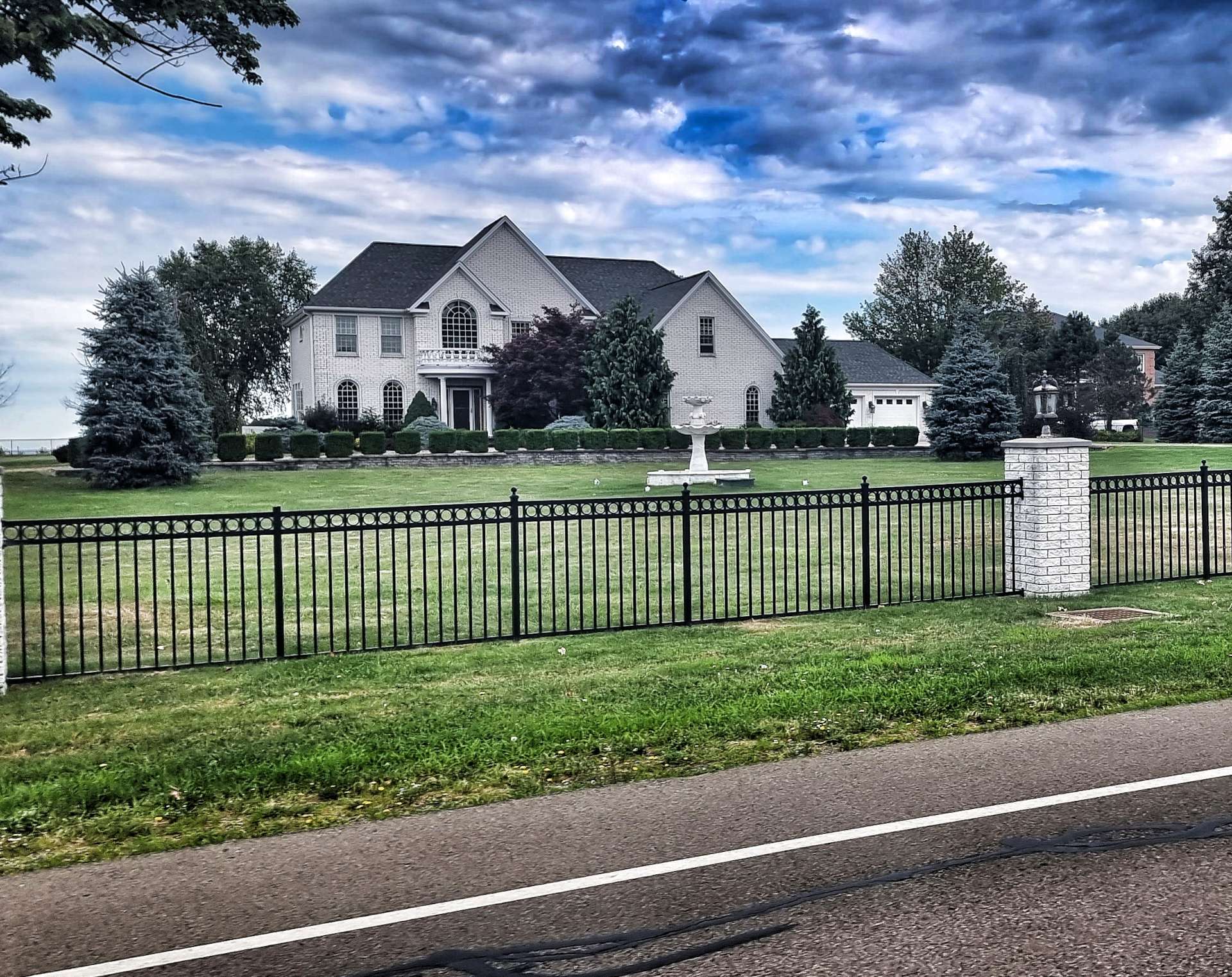
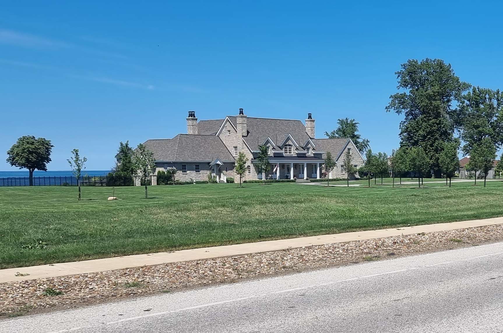
Below are three of the reasons we didn’t see the lake on this stretch of road! Massive mansions with waterfront gardens & CCTV protection above the gate pillars.
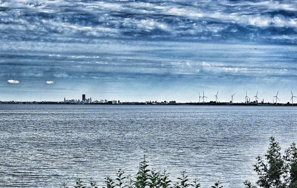
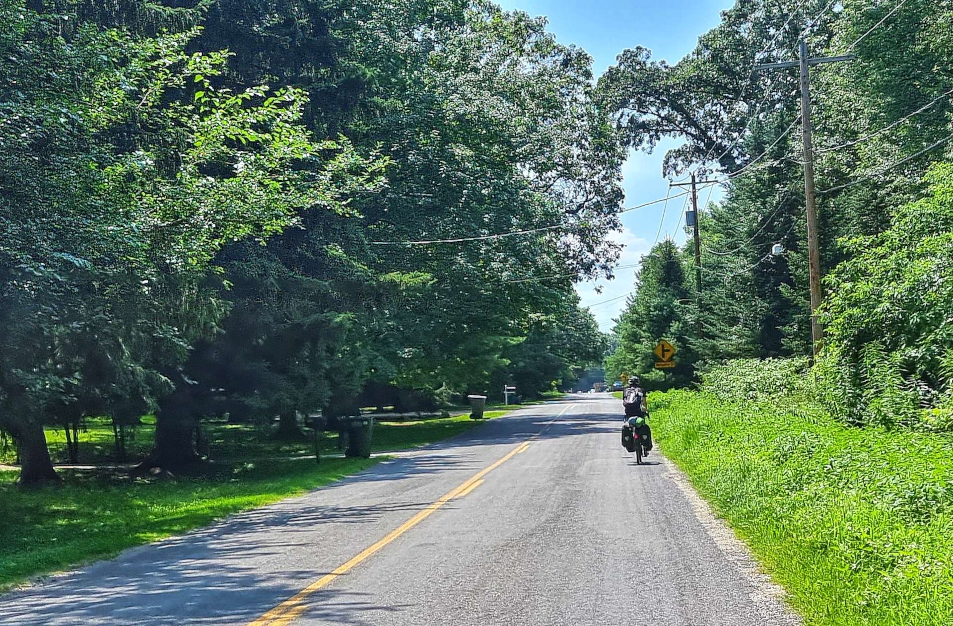
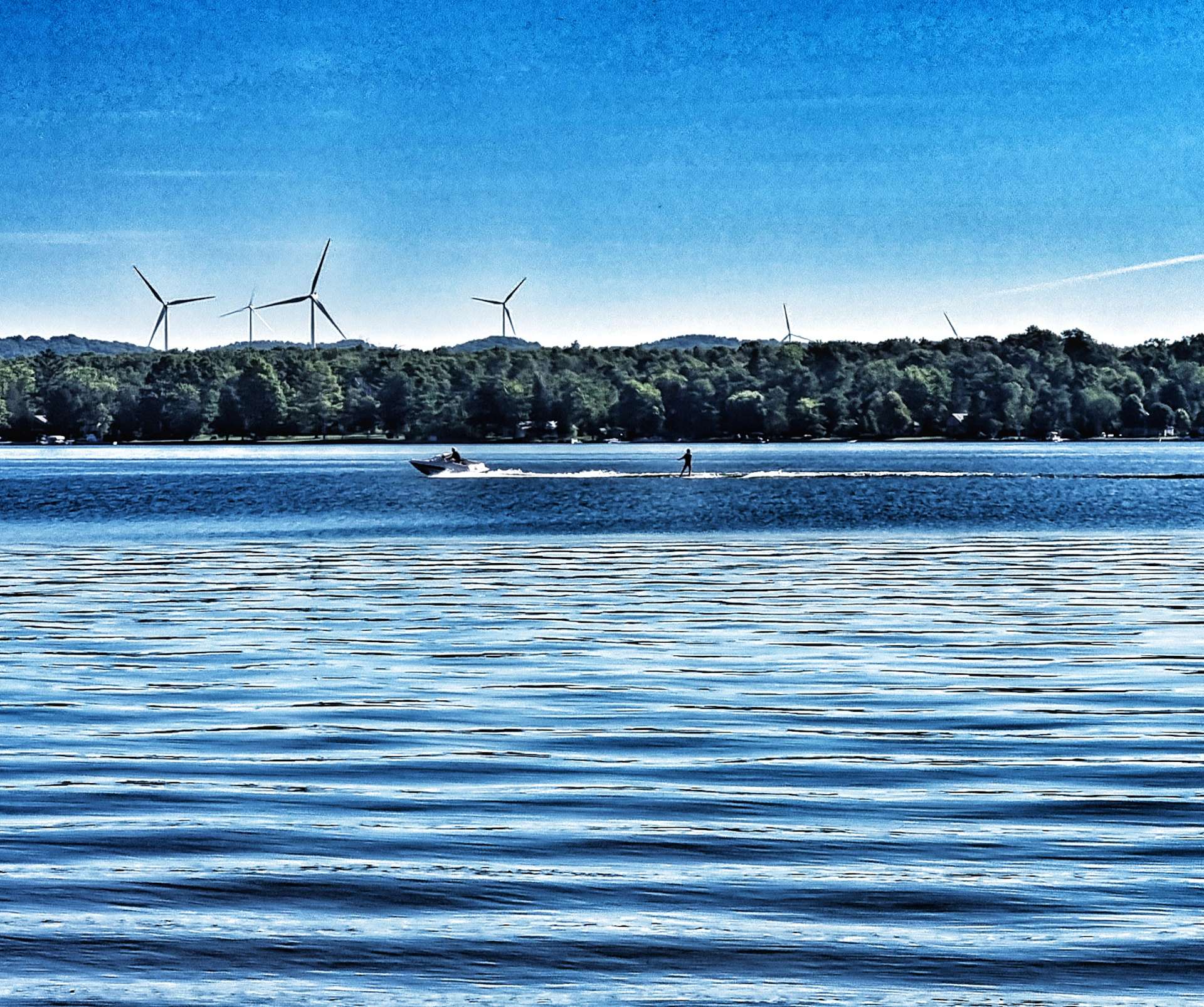
The route through Angola was an Adventure Cycling Association recommendation to keep us on quiet backroads. However, at some point we needed to head towards Buffalo & that required us to join the main road again. The upside was that this also enabled me to get some photos of Buffalo & a wind turbine farm, as well as views across the lake.
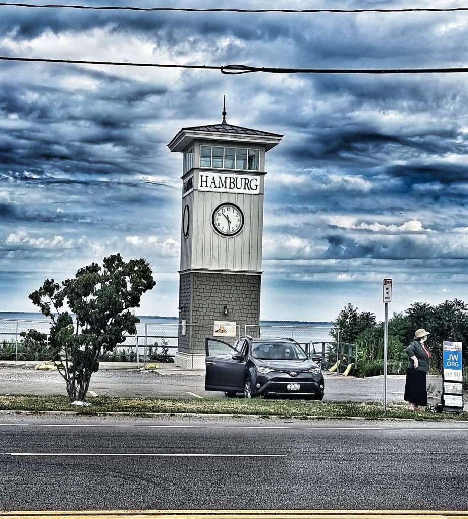
Our European theme continued as we passed through Hamburg – in a twist of fate, Hamburg (Germany) is the first place Sean & I ever went on an overseas cycling adventure, way back in 2006.
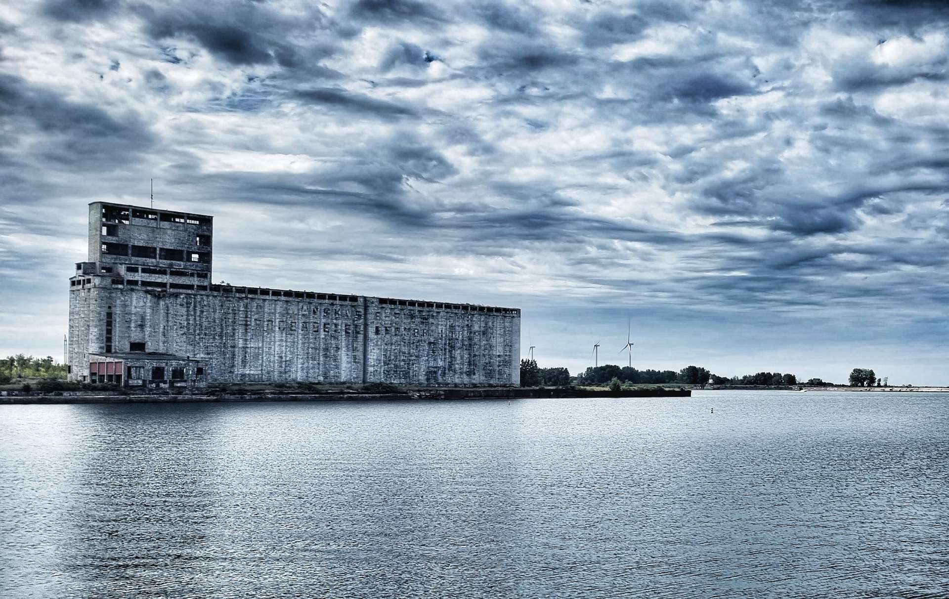
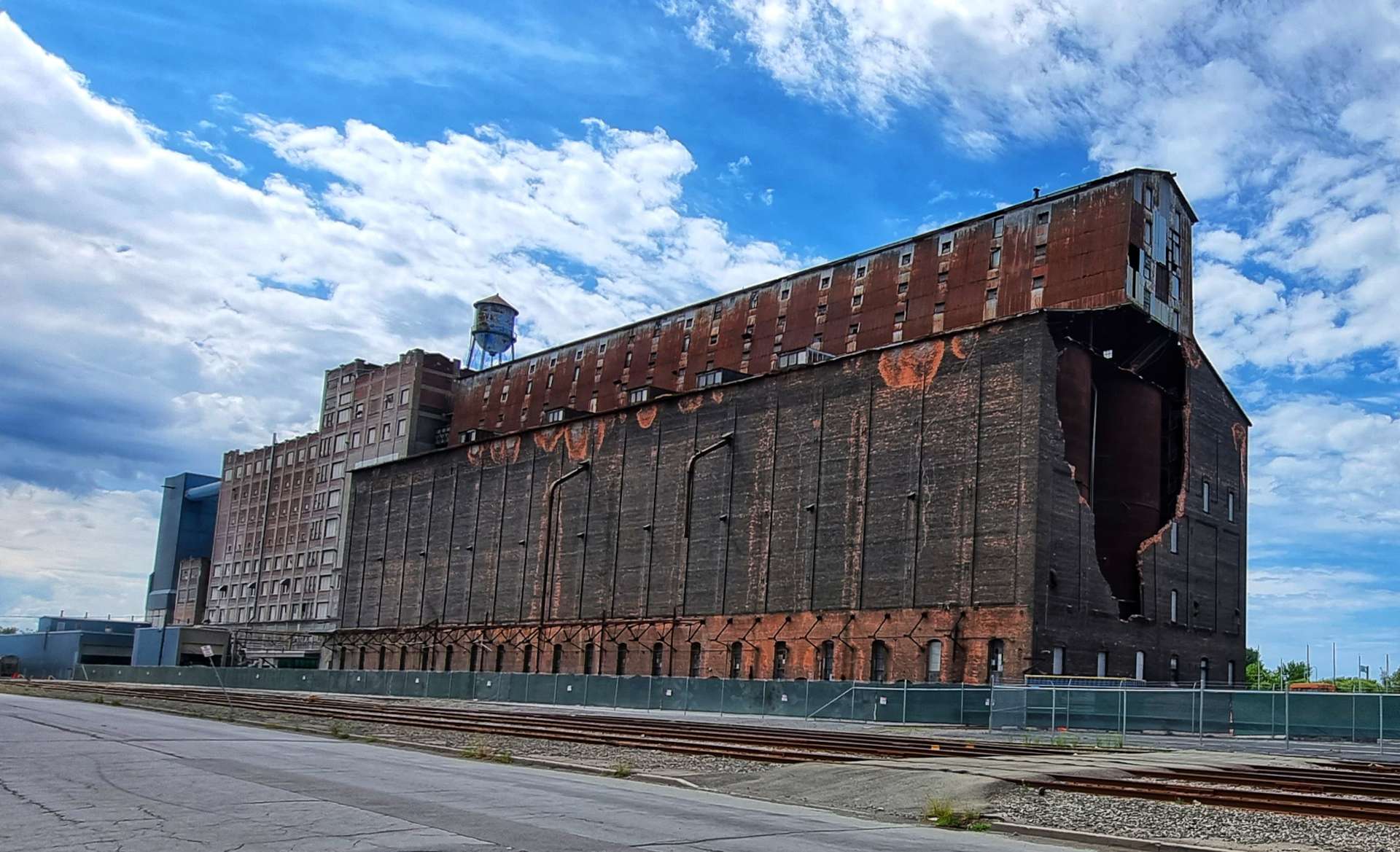
As we approached Buffalo, we passed a couple of reminders of Buffalo’s past as a major Great Lakes shipping centre & grain storage hub. It was also a major steel producer, automobile manufacturer & aircraft builder. All these industries have since departed, however, Buffalo is making a comeback.
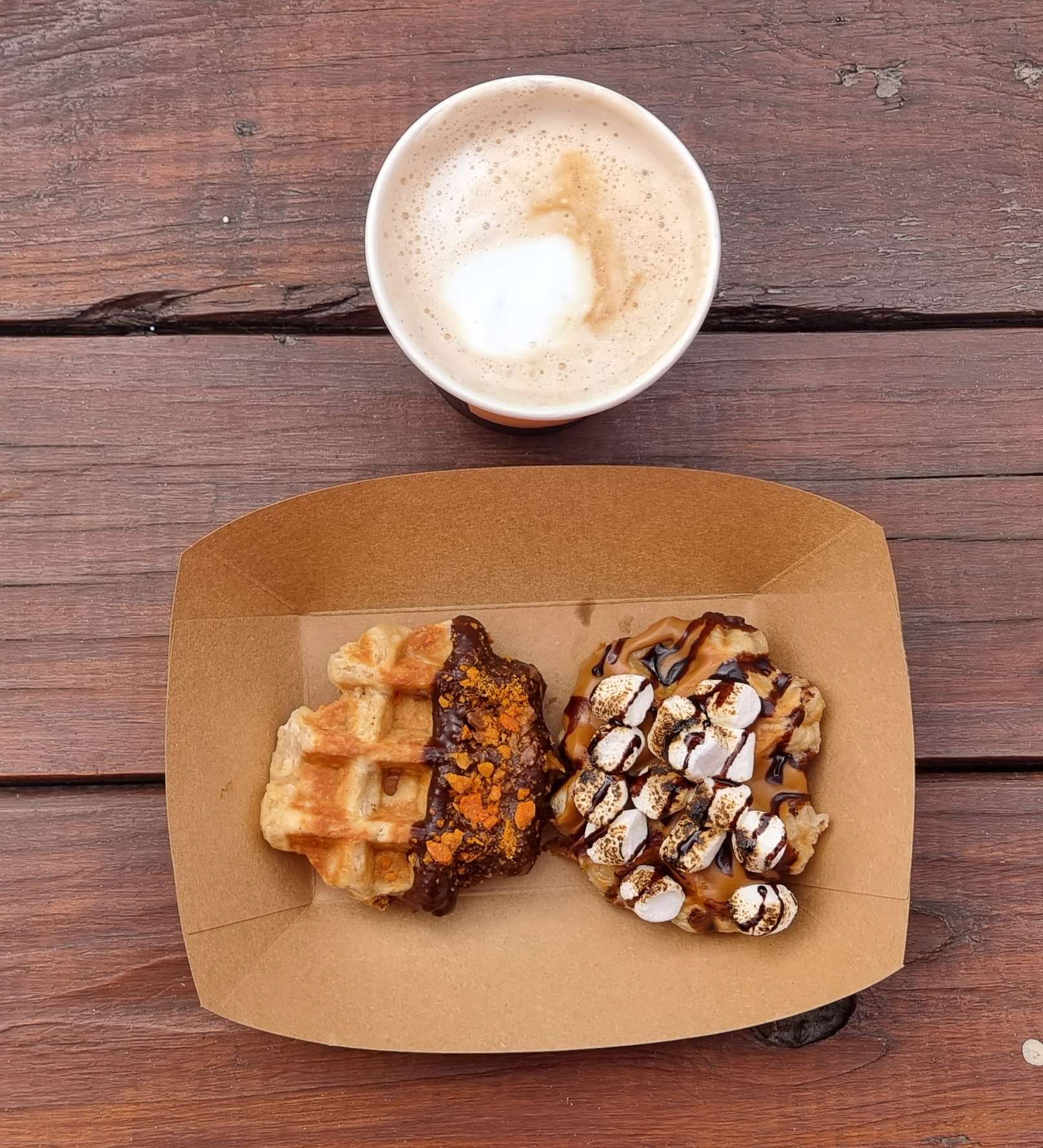
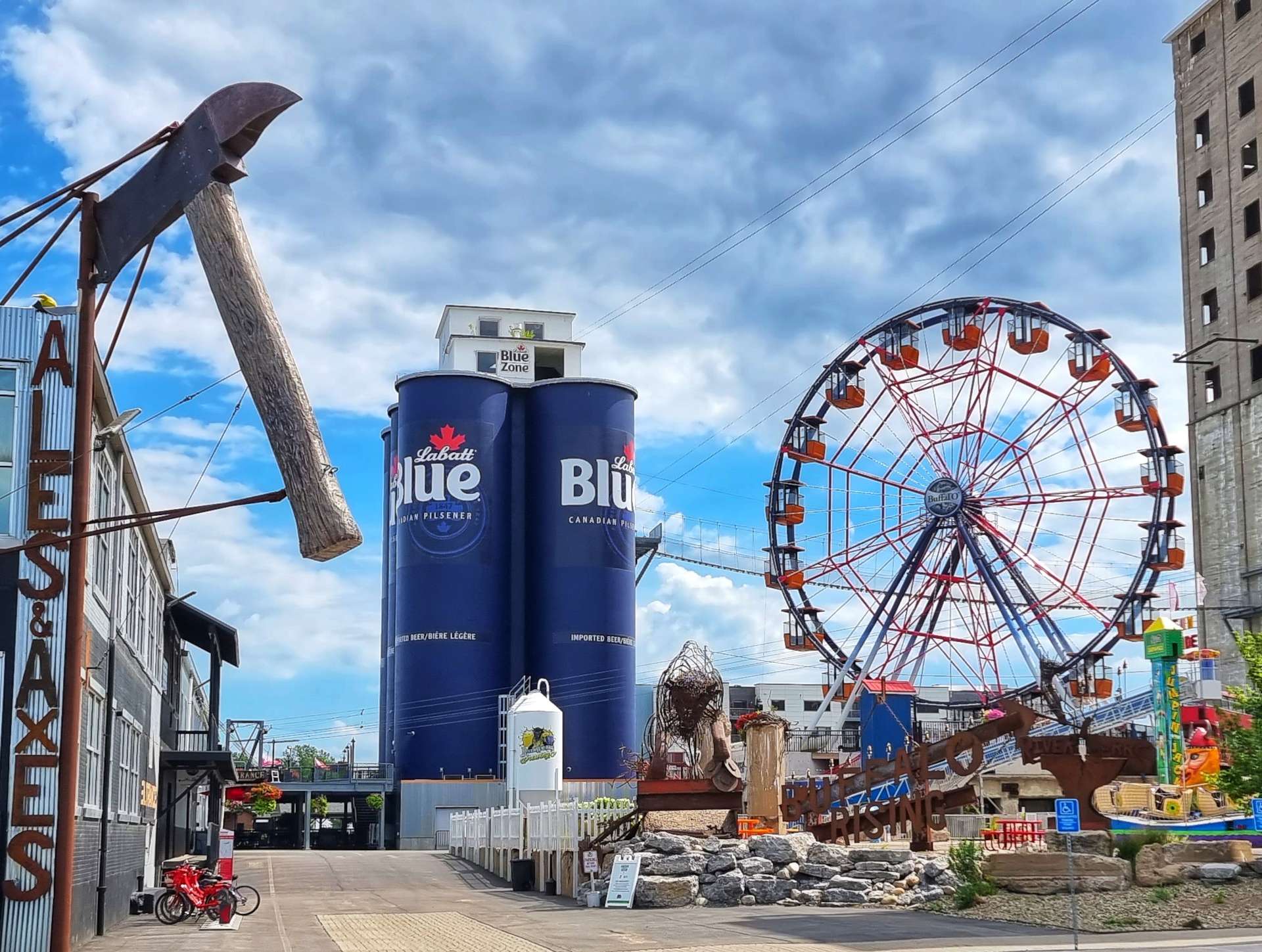
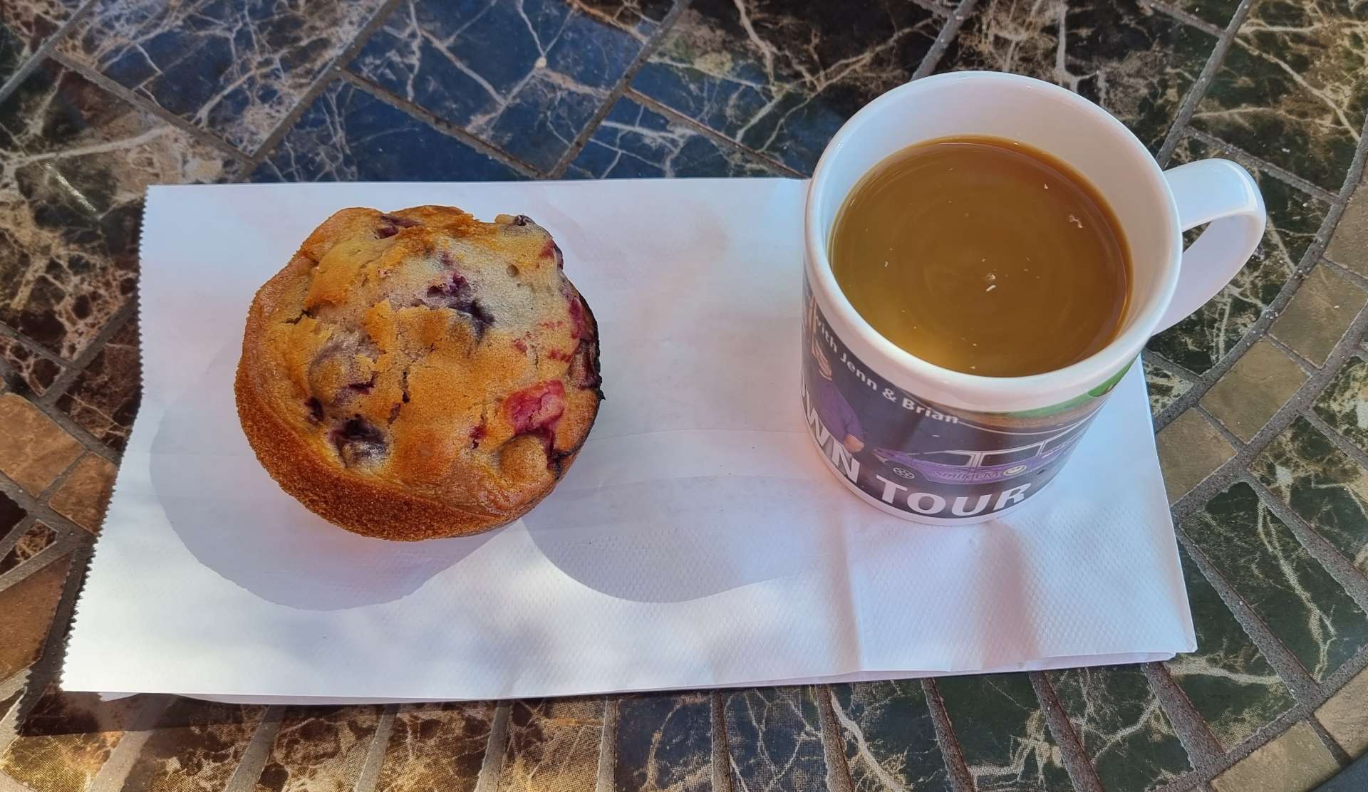
We had to take a detour because the bridge we planned to use was closed for roadworks & as a result we found the Buffalo Riverworks space & Wonder Coffeehouse, where I tucked into a s’mores & a peanut butter waffle along with a latte. Another great little coffee stop!
The Buffalo Riverworks complex includes a brewery, restaurant, sports, leisure, adventure & entertainment on the waterfront & has become a popular place with locals & visitors alike. We were on a tight schedule, but it looks like a fun destination.
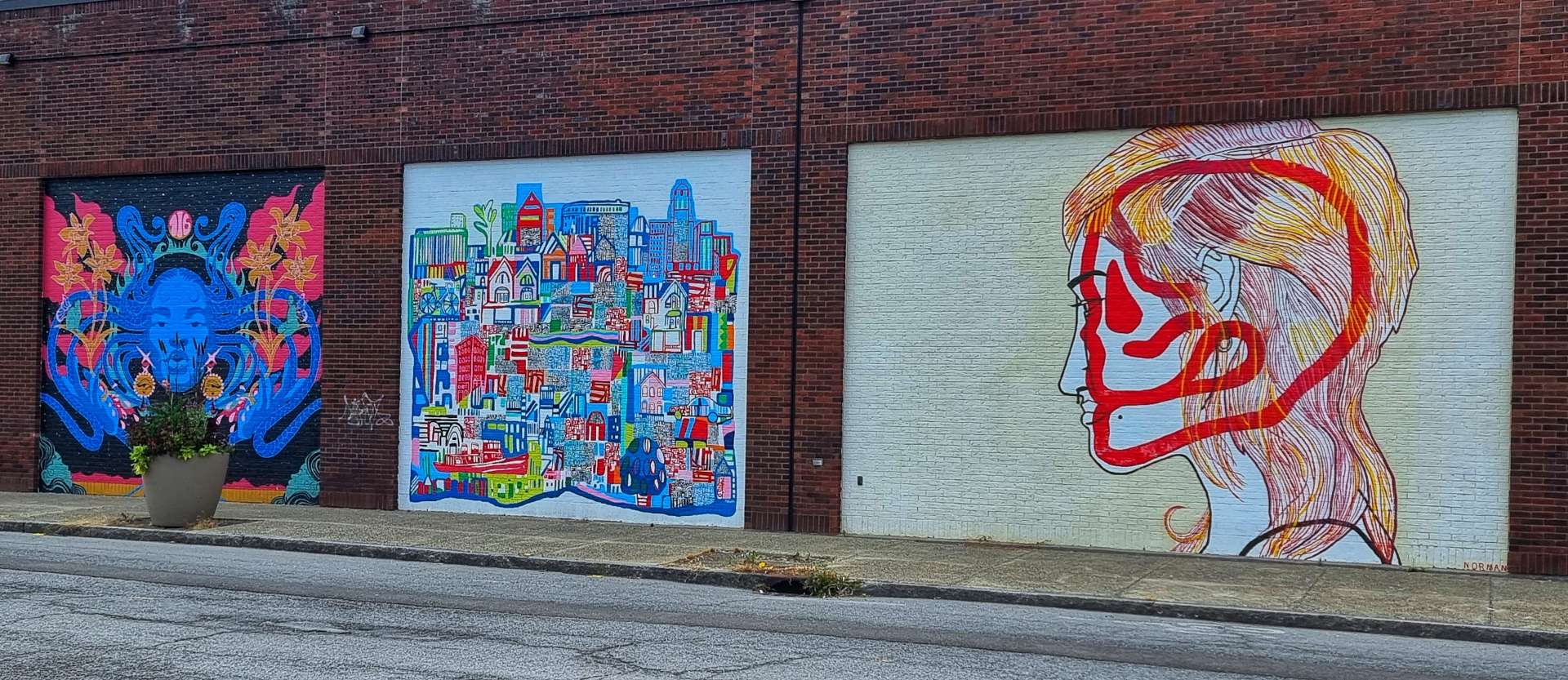
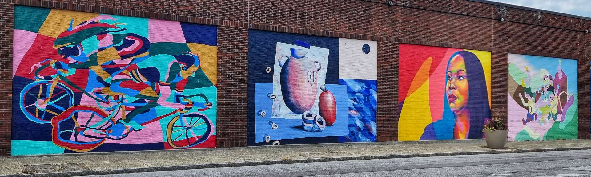
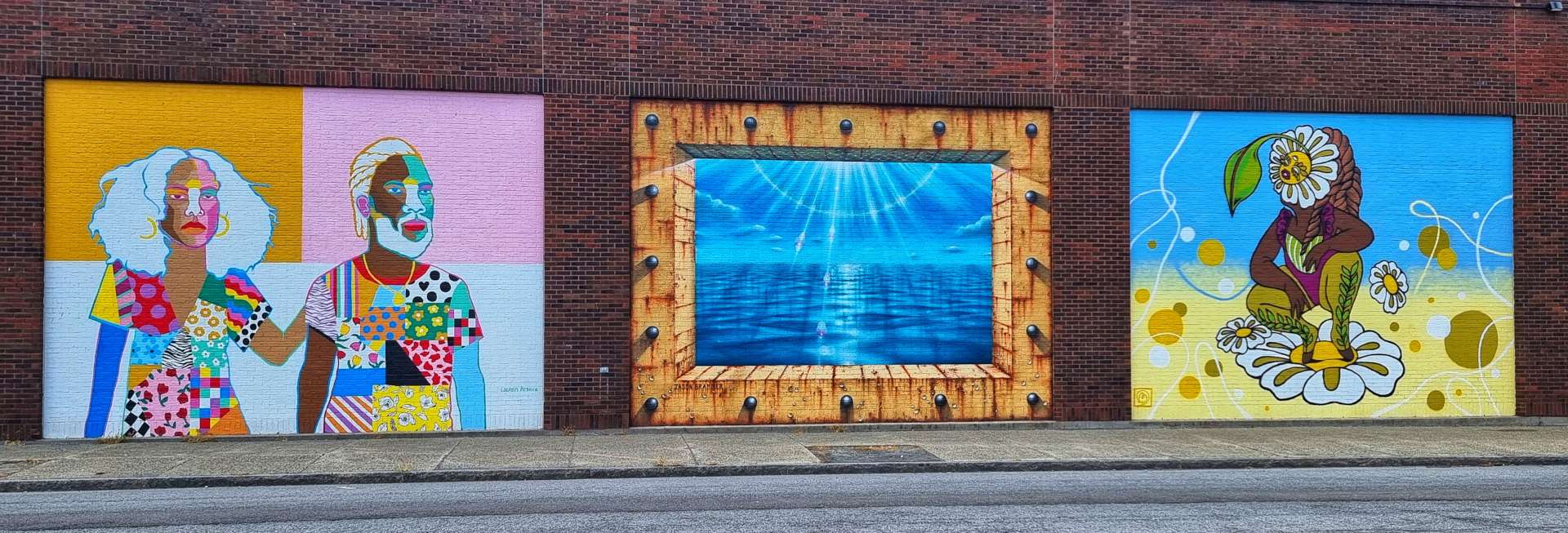
As we made our way across town, we passed a wall of stunning art on the walls – try to imagine all the separate pieces below in a long line, as that’s how they were set out. I’ve also included a shot of my favourite, which was obviously the cyclists!
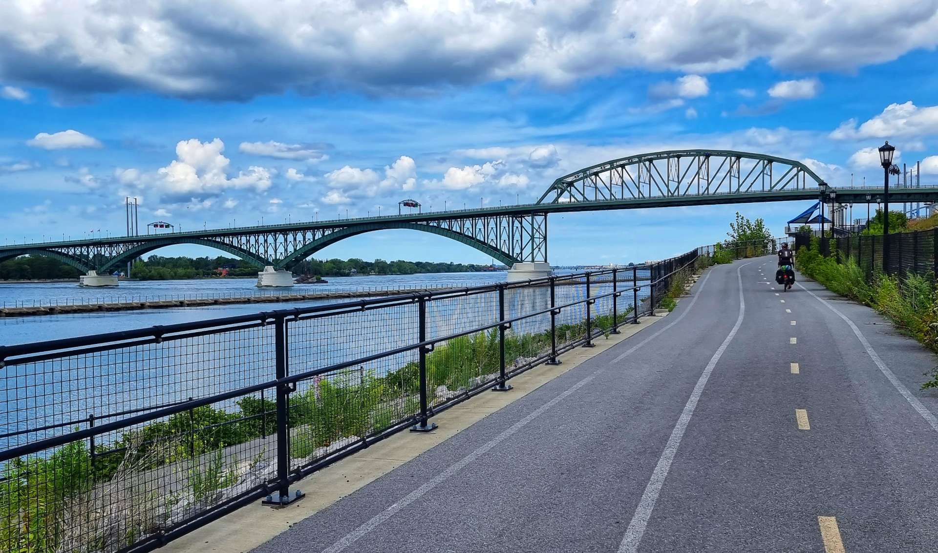
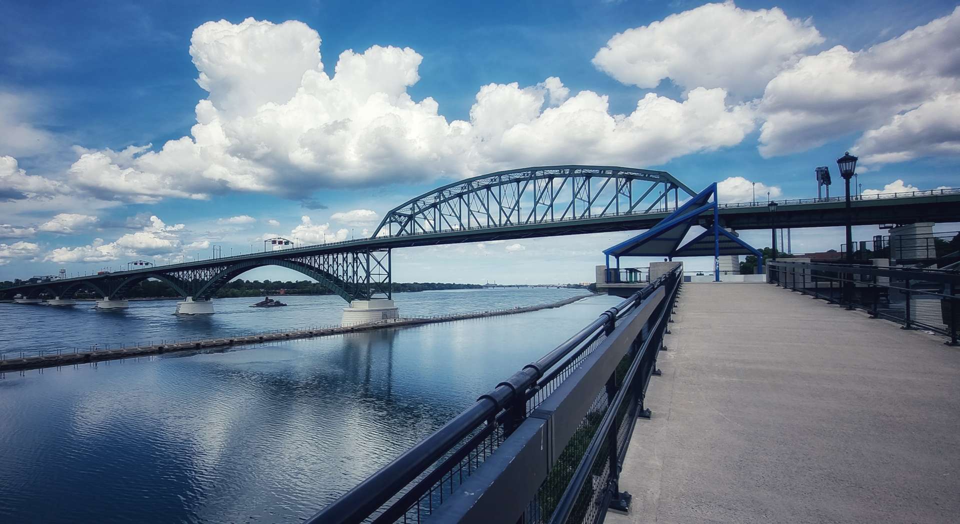
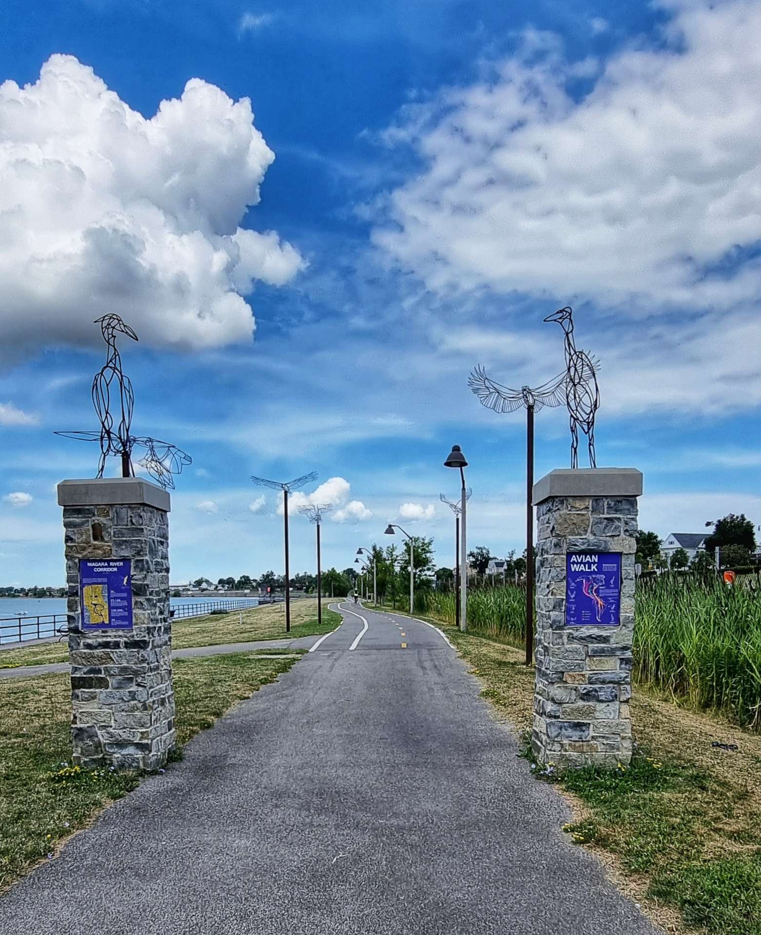
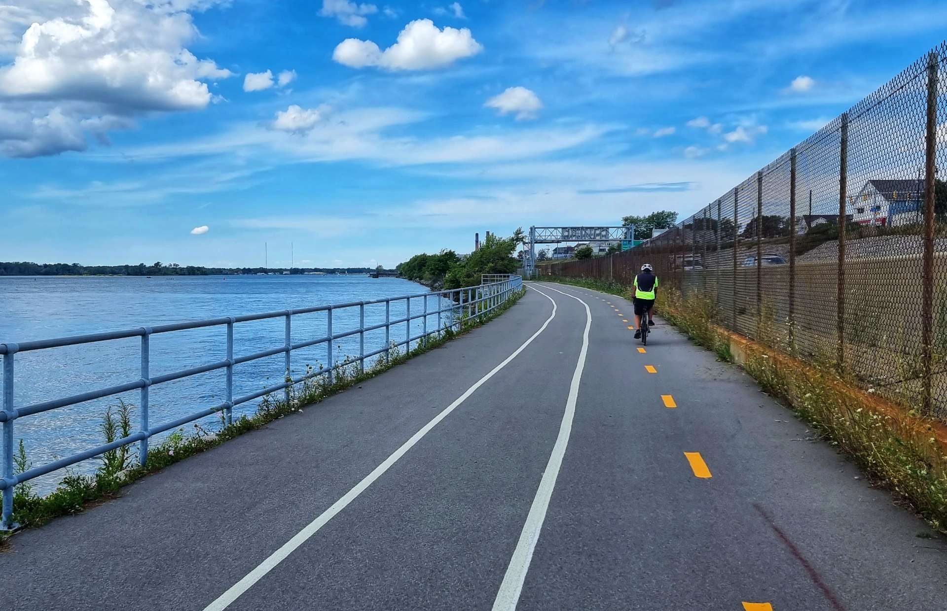
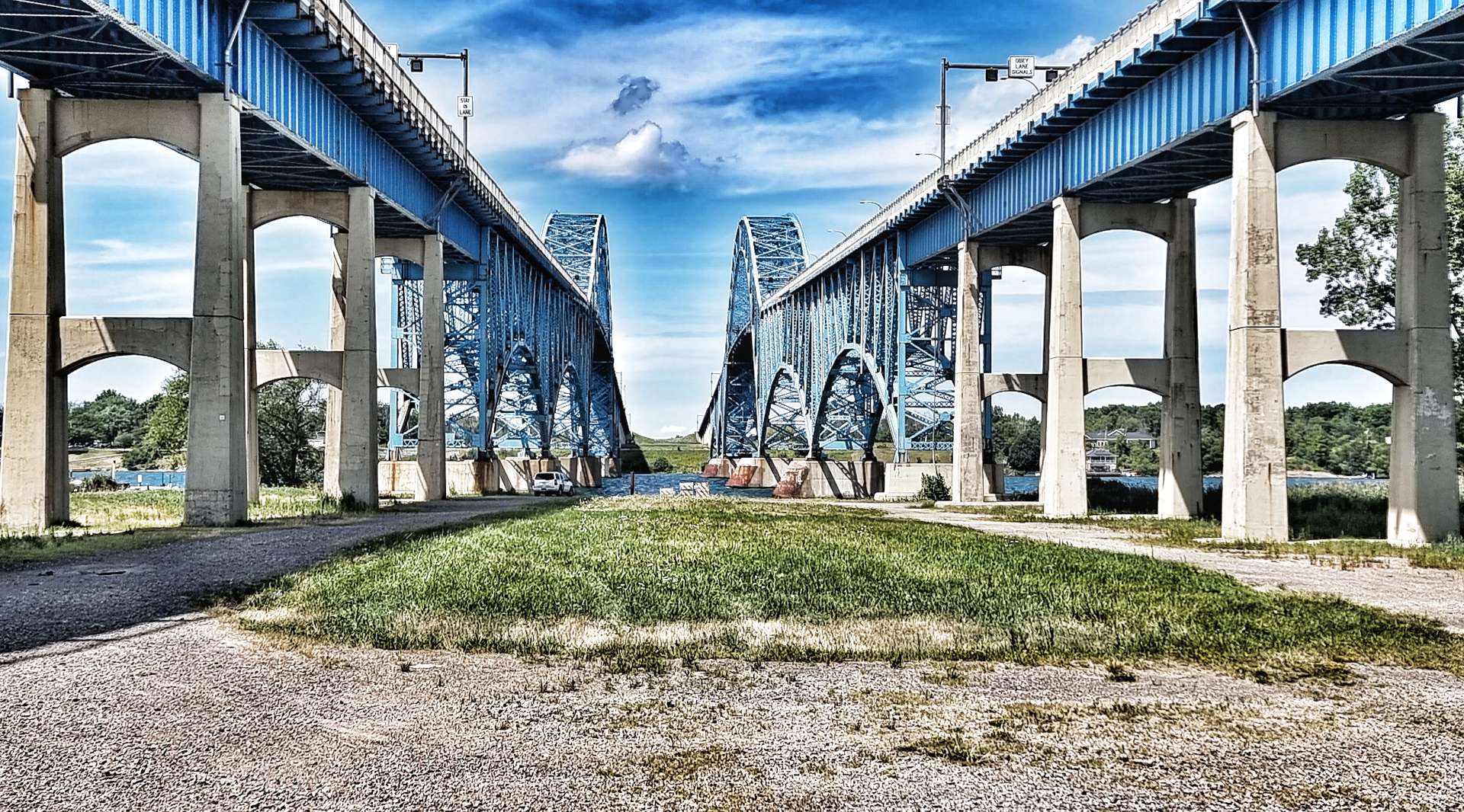
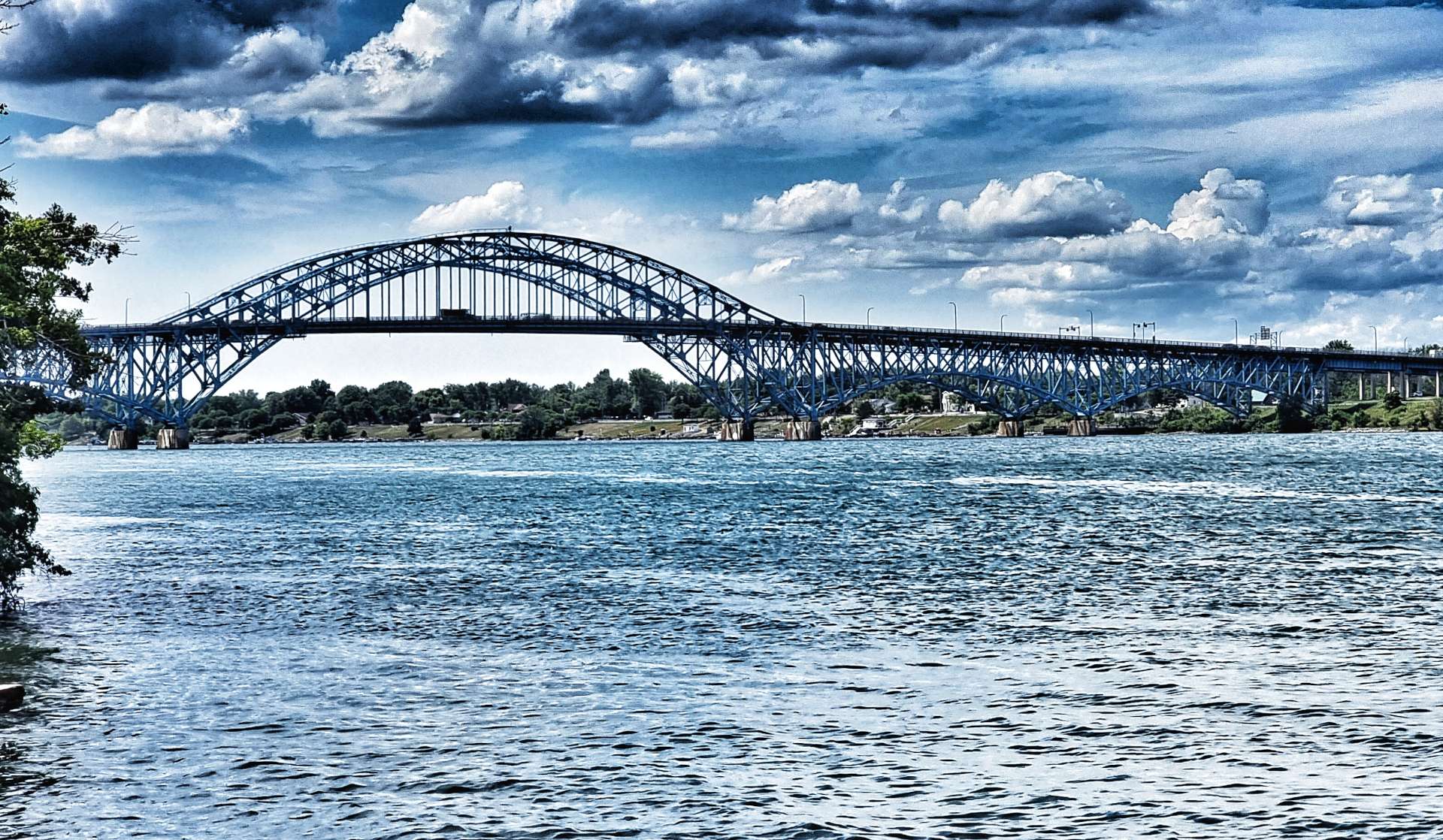
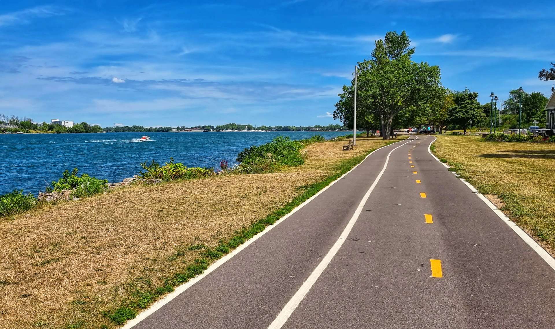
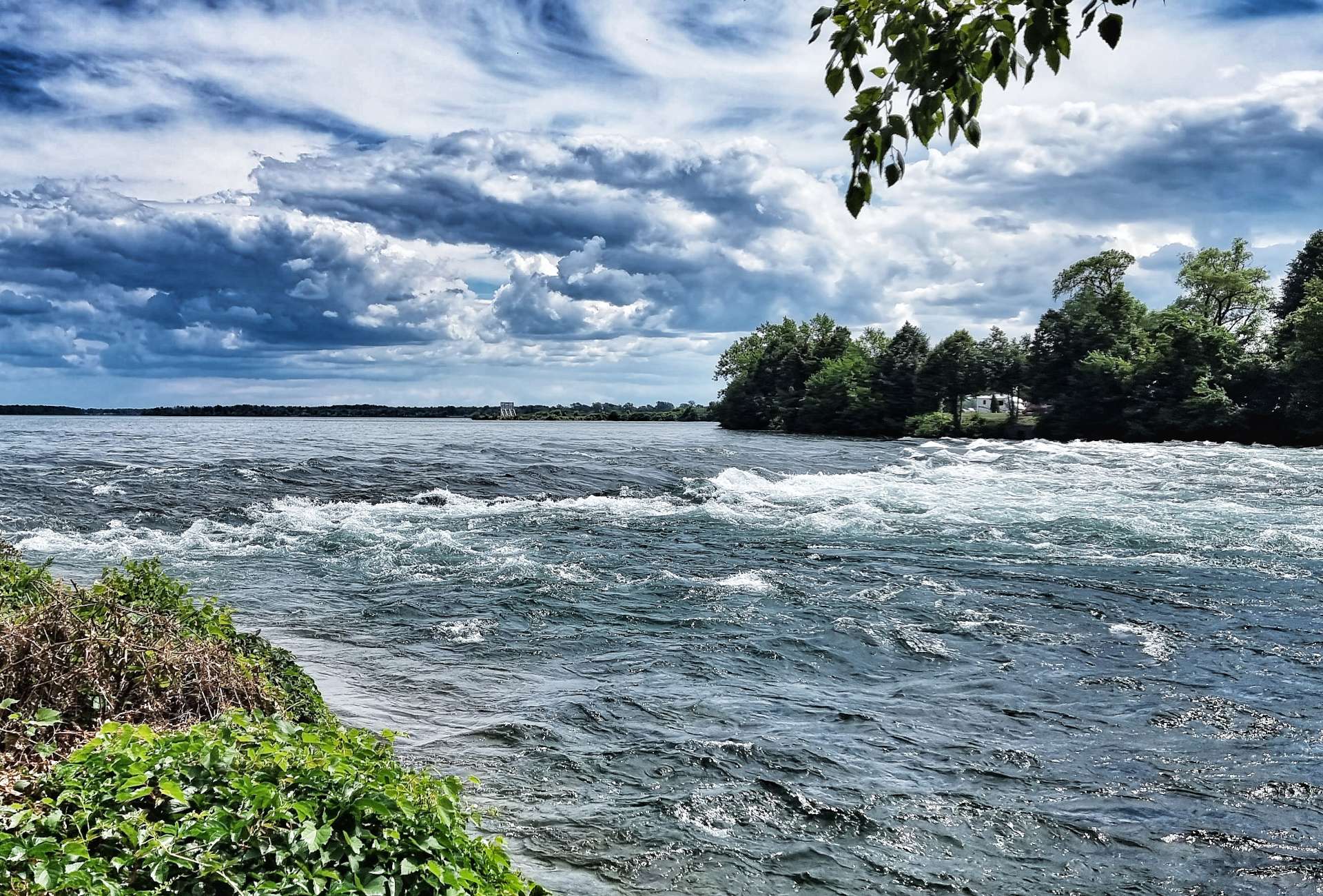
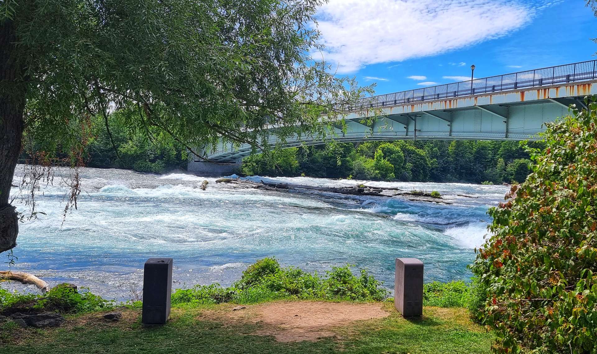
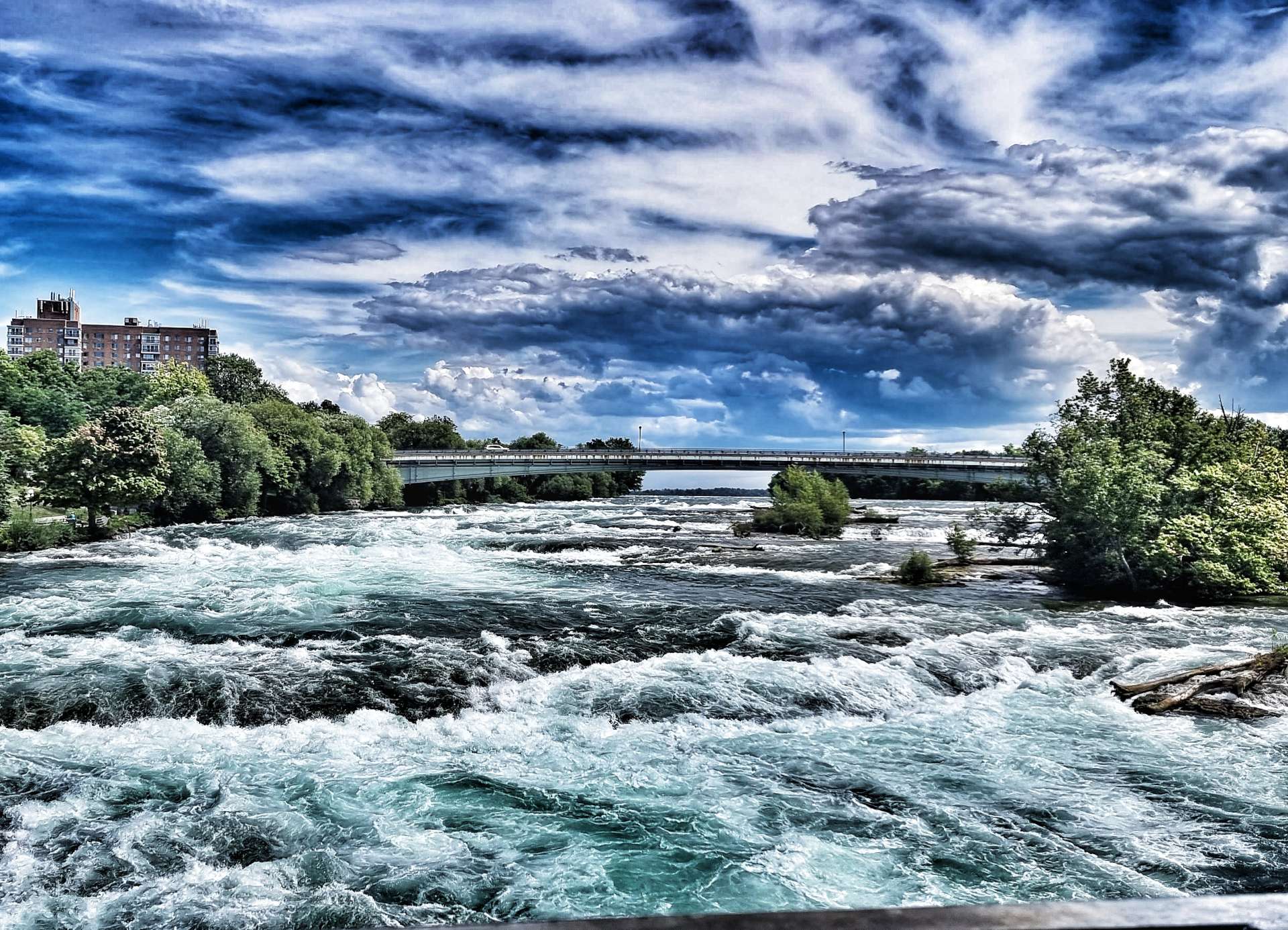
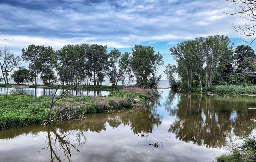
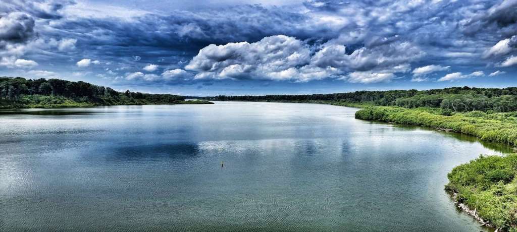
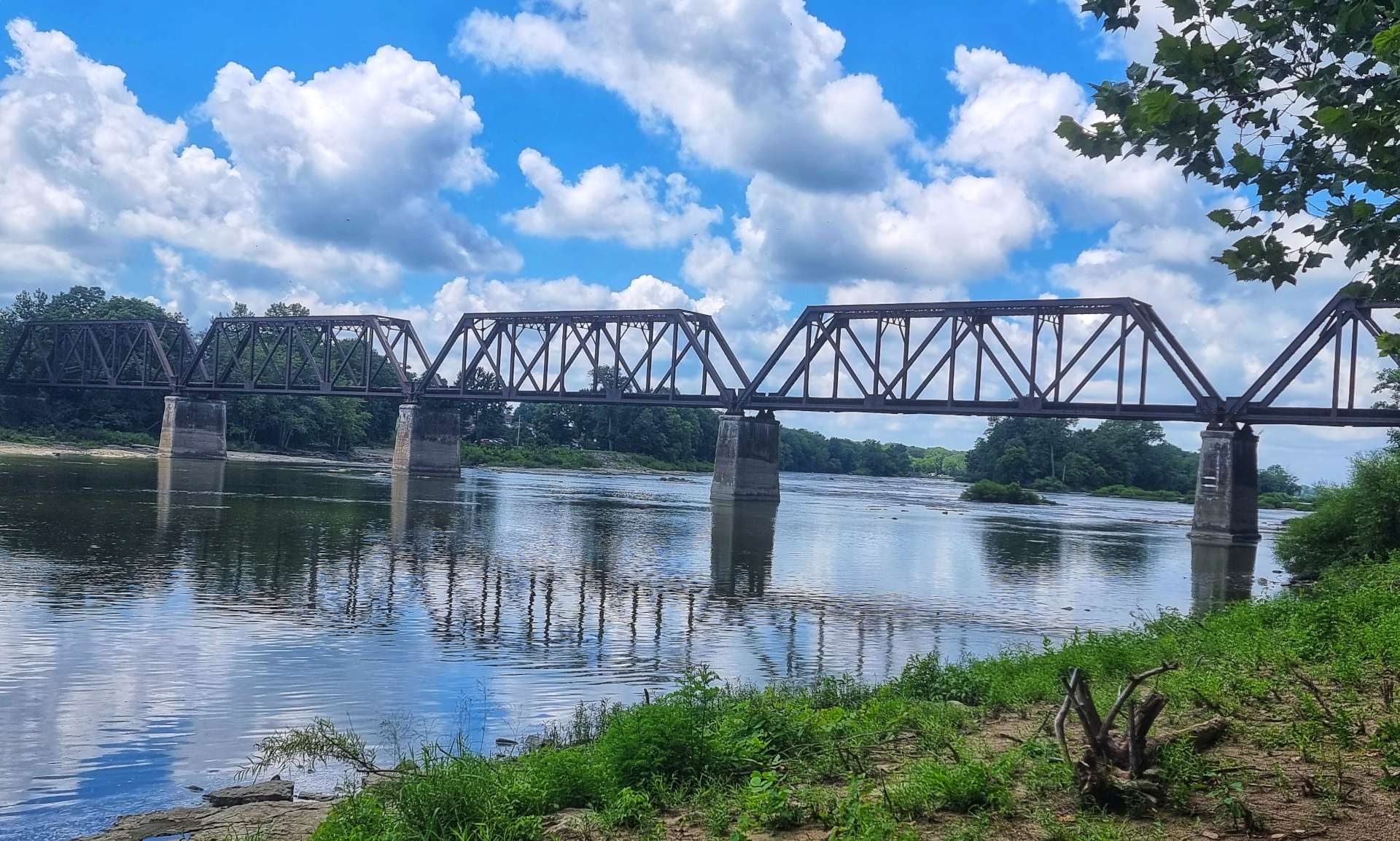
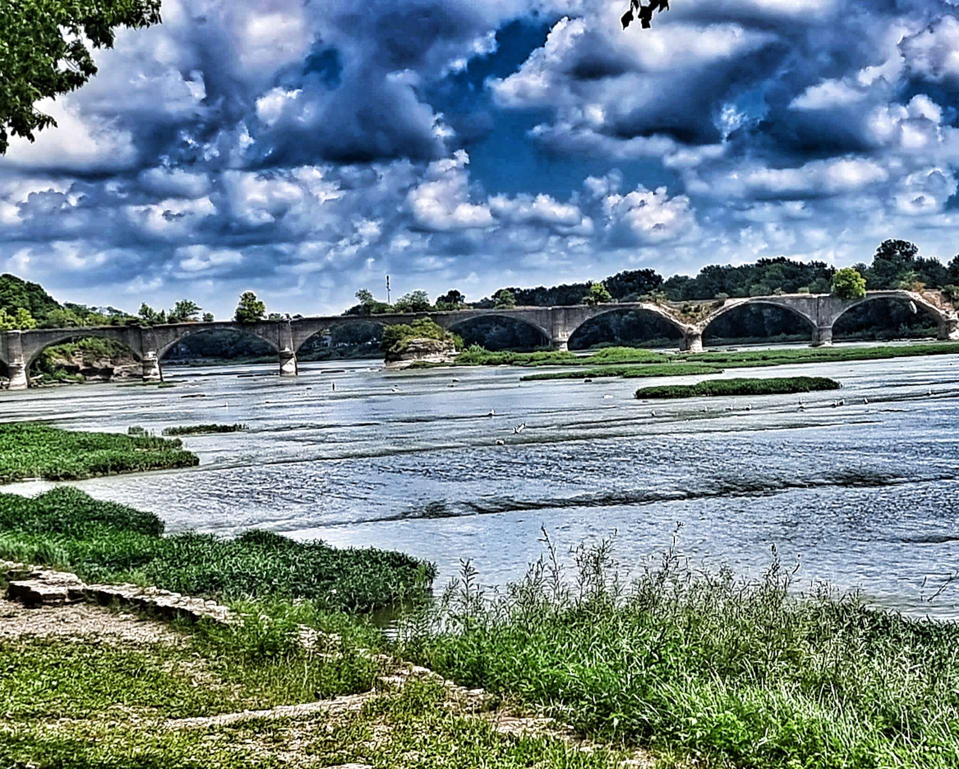
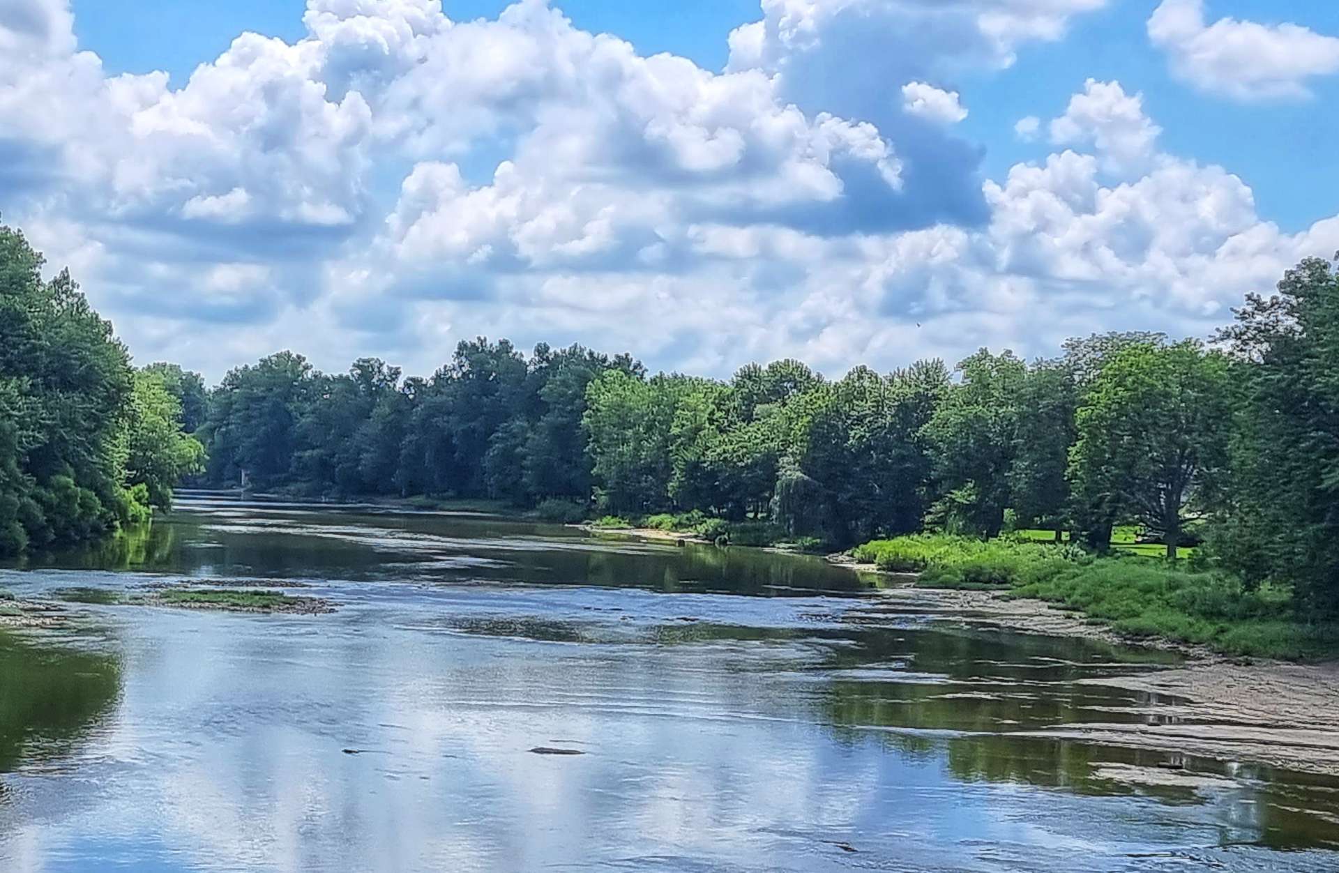
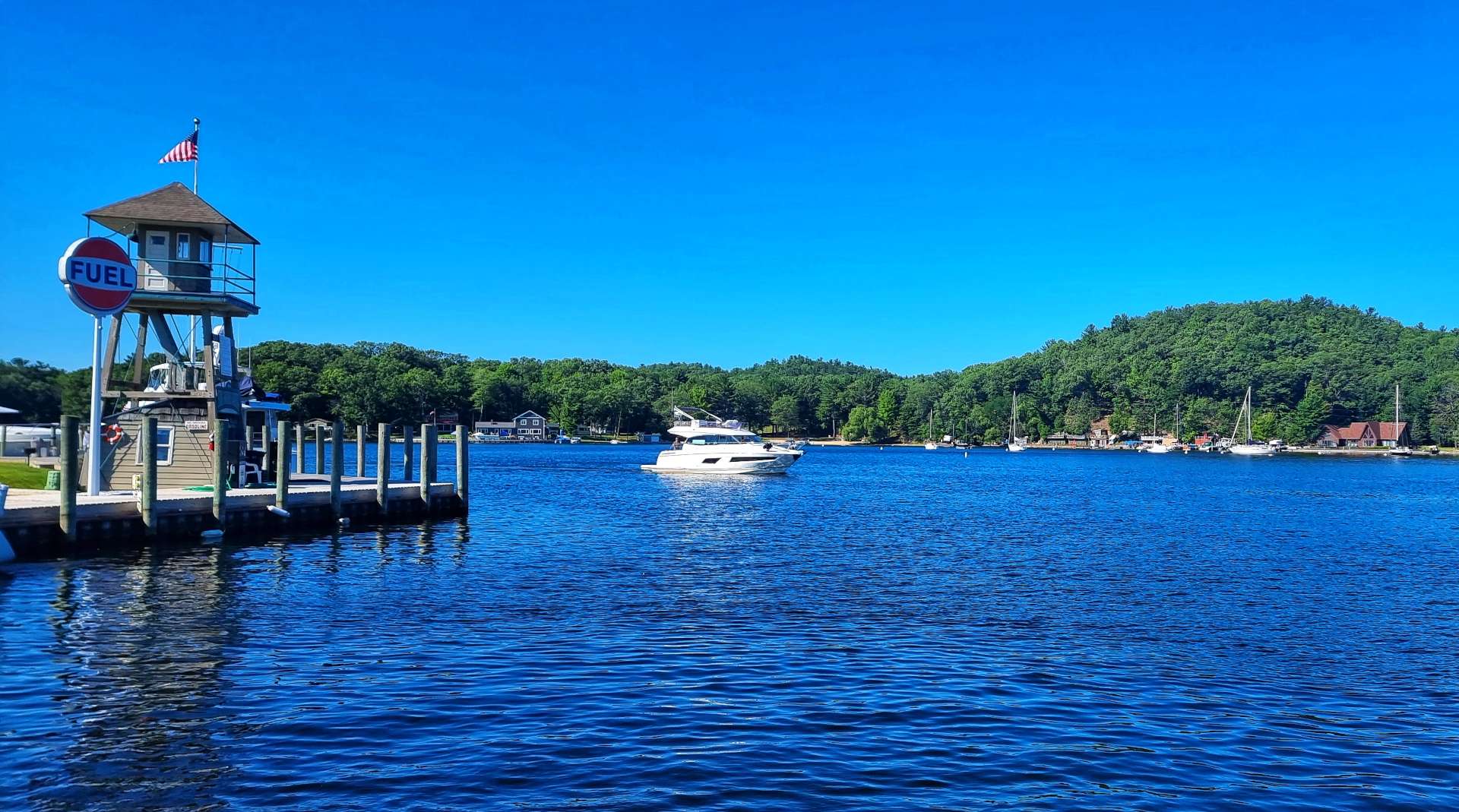
As we joined the Shoreline Trail, we took one final look at at the lake, as the Niagara River began its 36 mile journey from Lake Erie to Lake Ontario. We immediately rode by the Peace Bridge which connects the USA & Canada.
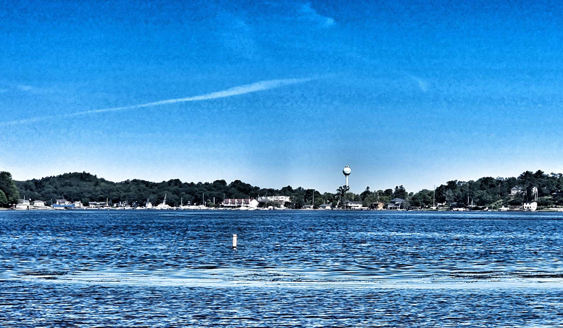
The Shorefront Trail is paved all the way from Buffalo to Niagara Falls, 23 miles down river. We had great views of the river & across to Unity Island & Grand Island as we made our way ever nearer the mighty Falls.
I was keen to get a long shot of the Grand Island Bridge, to go with my symmetrical photo above & it took a few attempts to find somewhere where I could get most of the bridge in the picture.
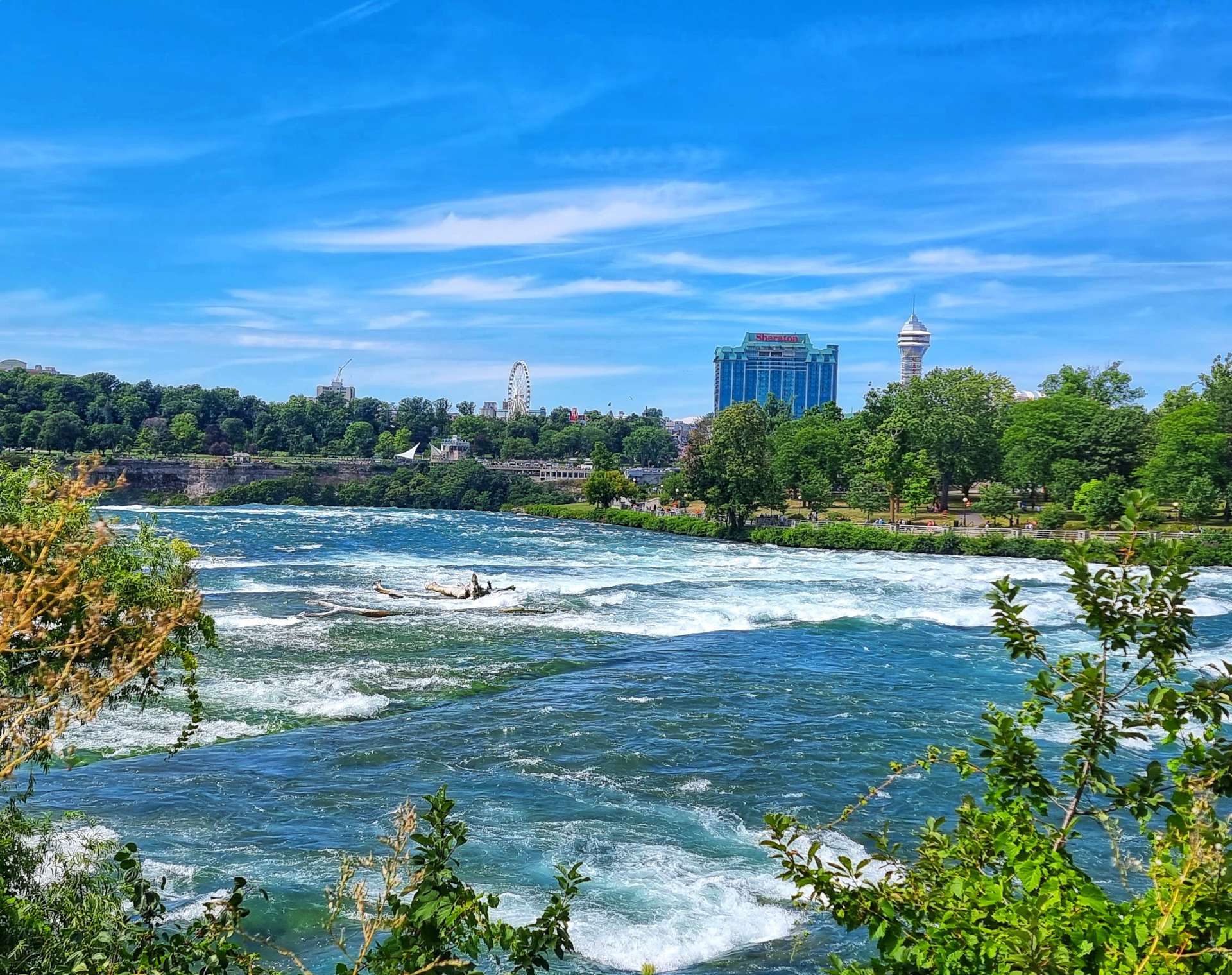
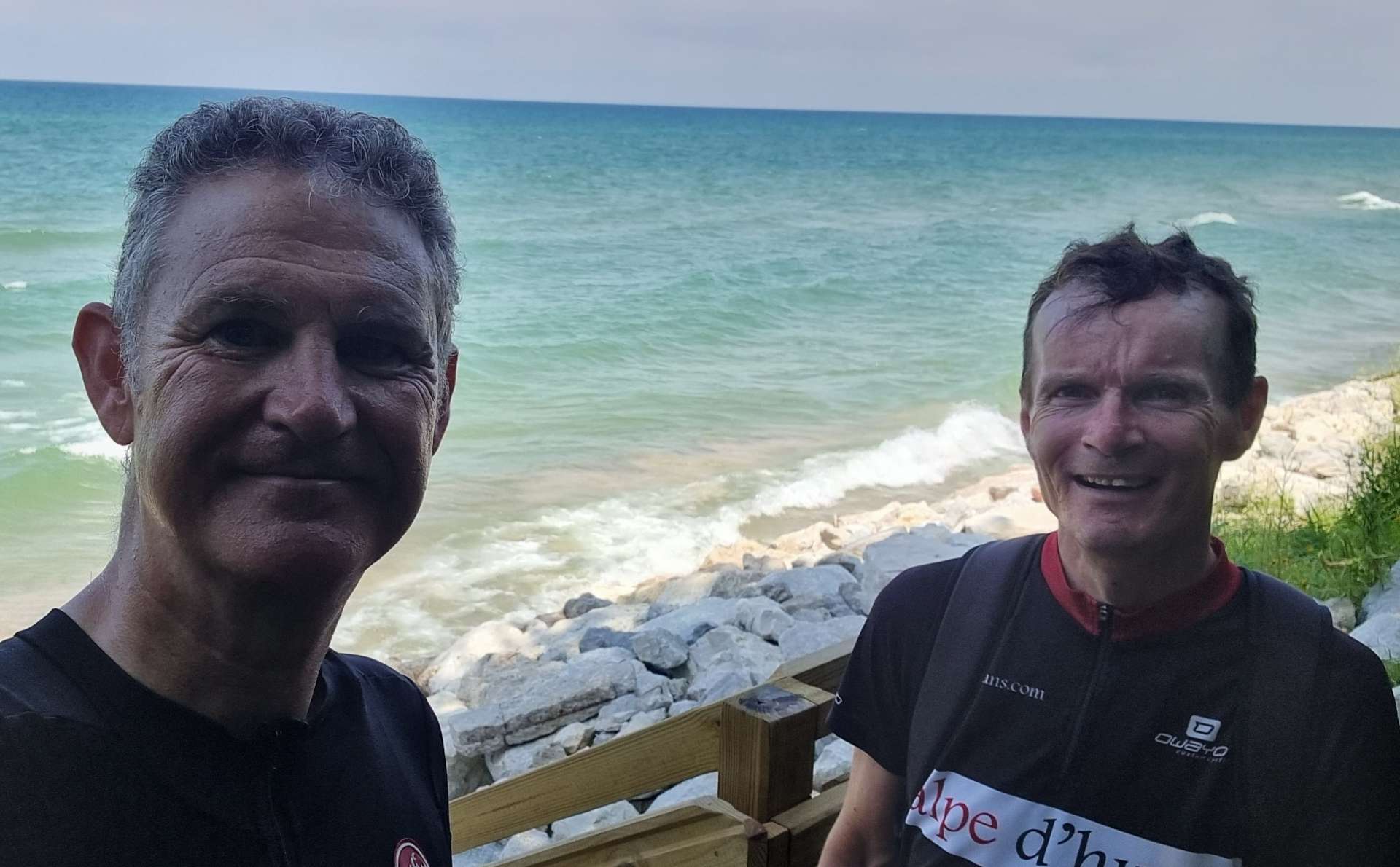
Finally the cycle path gave us our first view of the mist rising from Niagara Falls – a genuinely exciting moment, as I’ve been looking forward to returning to Niagara Falls for a while.
Sean & I did a cycling trip to Niagara Falls way back in April 2008 – we got sunburned on our first afternoon in Central Park NYC, then a week later, on Sean’s birthday, we watched as huge chunks of ice tumbled down Niagara Falls.
Before we knew it, we’d arrived at Niagara Falls State Park. Designed by Frederick Law Olmsted (he also designed Central Park in NYC) & established in 1885, it’s the oldest State Park in the USA & marks the start of Niagara Falls.
Tomorrow we’re planning to spend the morning exploring Niagara Falls, so I’ll do a separate post once we’ve seen what it has to offer! We still had just over 5 miles to our motel for the next 2 nights, so we said Au Revoir until tomorrow.
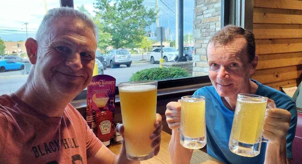
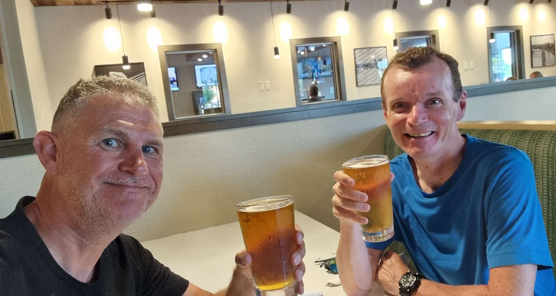
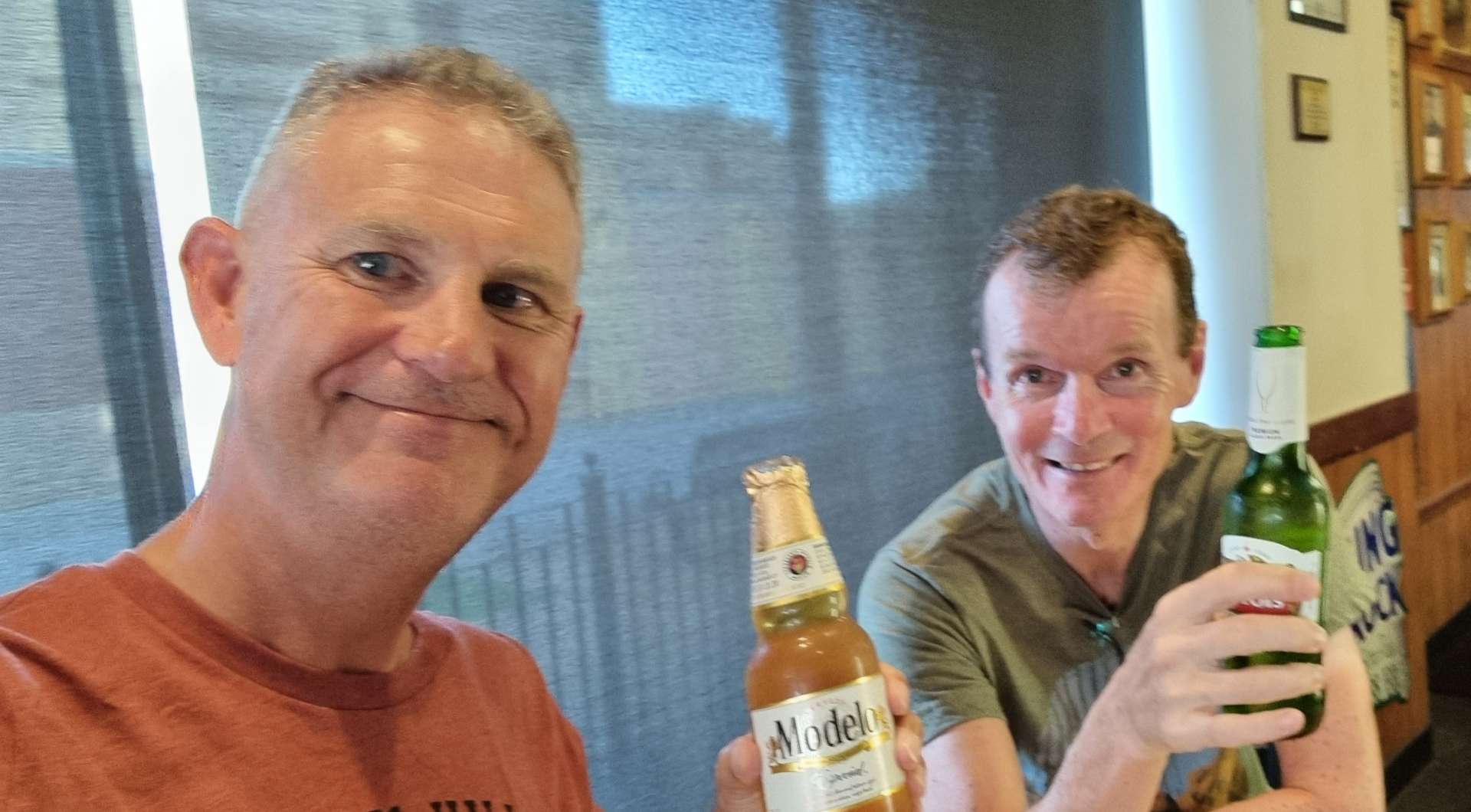
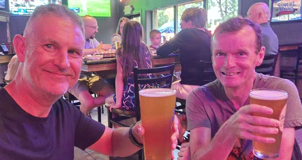
Once we’d checked in, we headed out to toast another brilliant day in the saddle! The story behind Sean being double parked is that his Sammy Adams was 2 for the price of 1, so he had 2 small glasses, while I dived in on a big glass – that’s his excuse & he will stick to it!!
Stage Stats – 58 miles, 1,040 feet of climbing. We said goodbye to Lake Erie for the last time as we made our way to Niagara Falls.
Well, How Did We Get Here? Miles, Feet Climbed, Maps & Profiles.
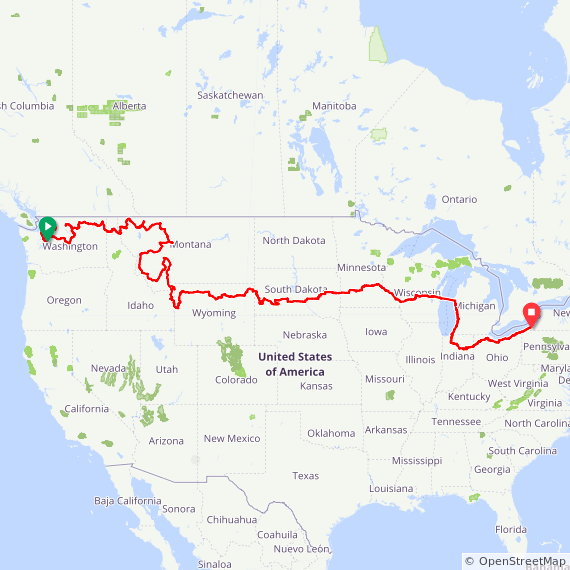
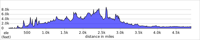
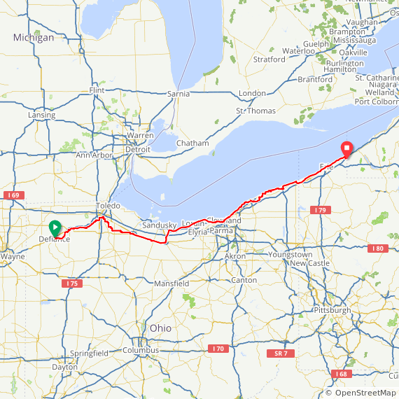
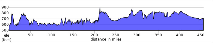
In a departure from the usual format, I’m started this week’s update with a map & elevation profile that covers the first 15 weeks of our trip – it puts in perspective how far we’ve travelled, as well as some of the North / South travel that gets lost when you say you’re doing an East to West route!
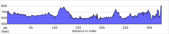
We’ve covered 4,900 miles & climbed 169,365 feet to reach North East.
Previous updates described how we travelled from Seattle in Washington to Defiance, Ohio in the first 14 weeks of our adventure. Now find out where we went & what we did in Week 15! Hopefully picking a single photo to represent each day will refresh my mind when it comes to looking back on my adventure!
Saturday took us from Defiance to Independence & on to Gettysburg via the Maumee Towpath Trail. We spent Sunday working out when we expect to complete our Coast to Coast cycling adventure, then on Monday we booked our flights back to the UK (we’re flying home on 6th September). Tuesday included a great coffee stop at Ideal Bakery in Gibsonburg as we picked up the North Coastal Inland Trail to Norwood. We passed through the birthplace of Thomas A Edison on Wednesday as we got our first view of Lake Erie, while on Thursday we saw the sights of Cleveland before the rains caught up with us on the way to Ashtabula. On Friday we crossed into Pennsylvania on the way to the wine country of North East.
The biggest mileage week yet of our Coast to Coast adventure.
Thursday 11th to Friday 12th August – Stages 79 & 80.
Lakewood to Ashtabula – Thursday 11th August (Stage 79).
We set off under grey, overcast skies with the threat of rain at some point in the morning. We expected the ride to have 3 distinct parts to it – first up we would be riding through the heart of Cleveland. We would then ride through built up commuter towns in rapid succession, before getting back to more remote roads & locations.
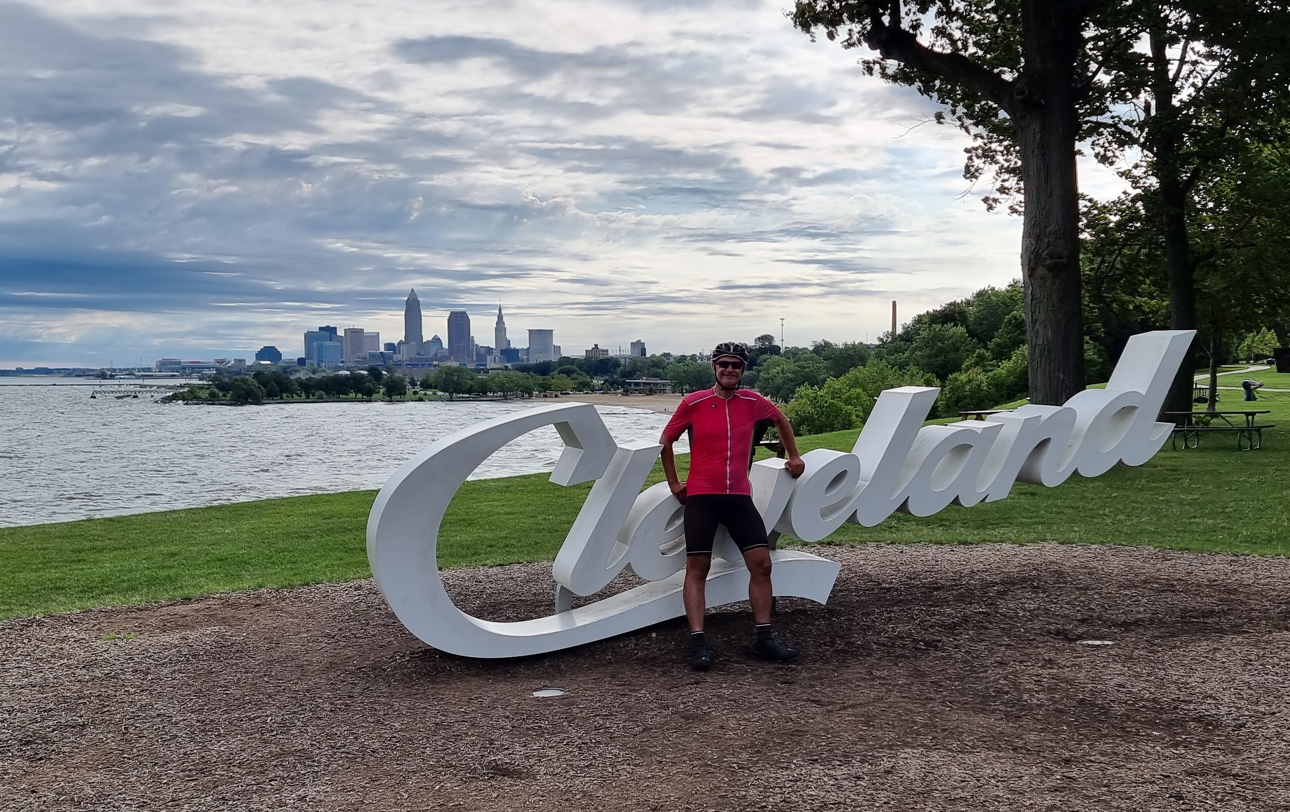
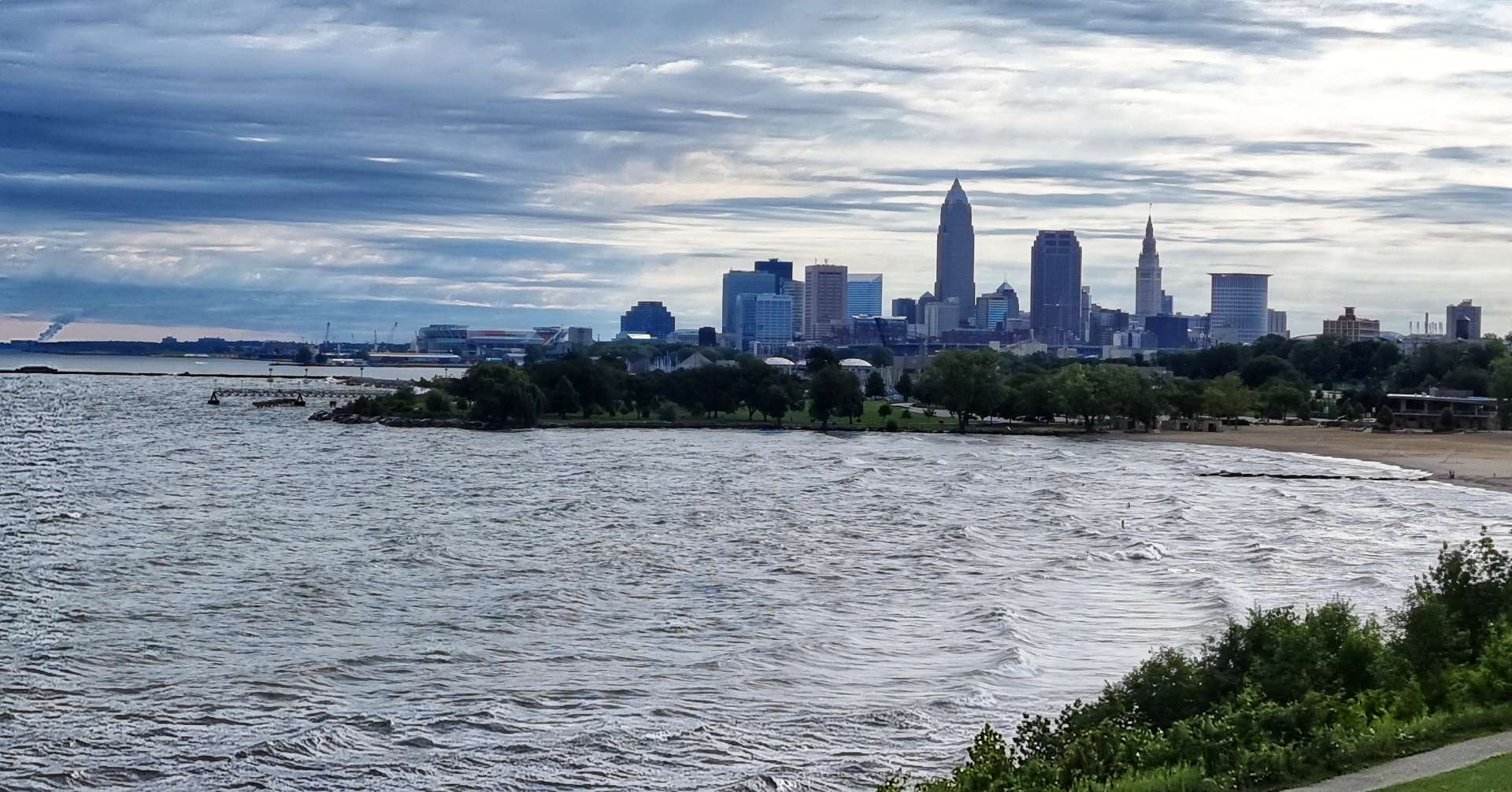
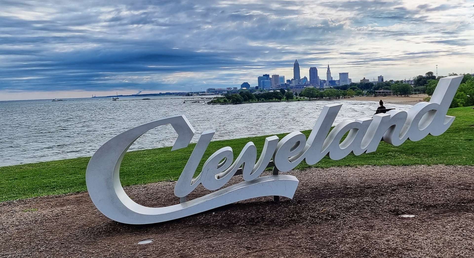
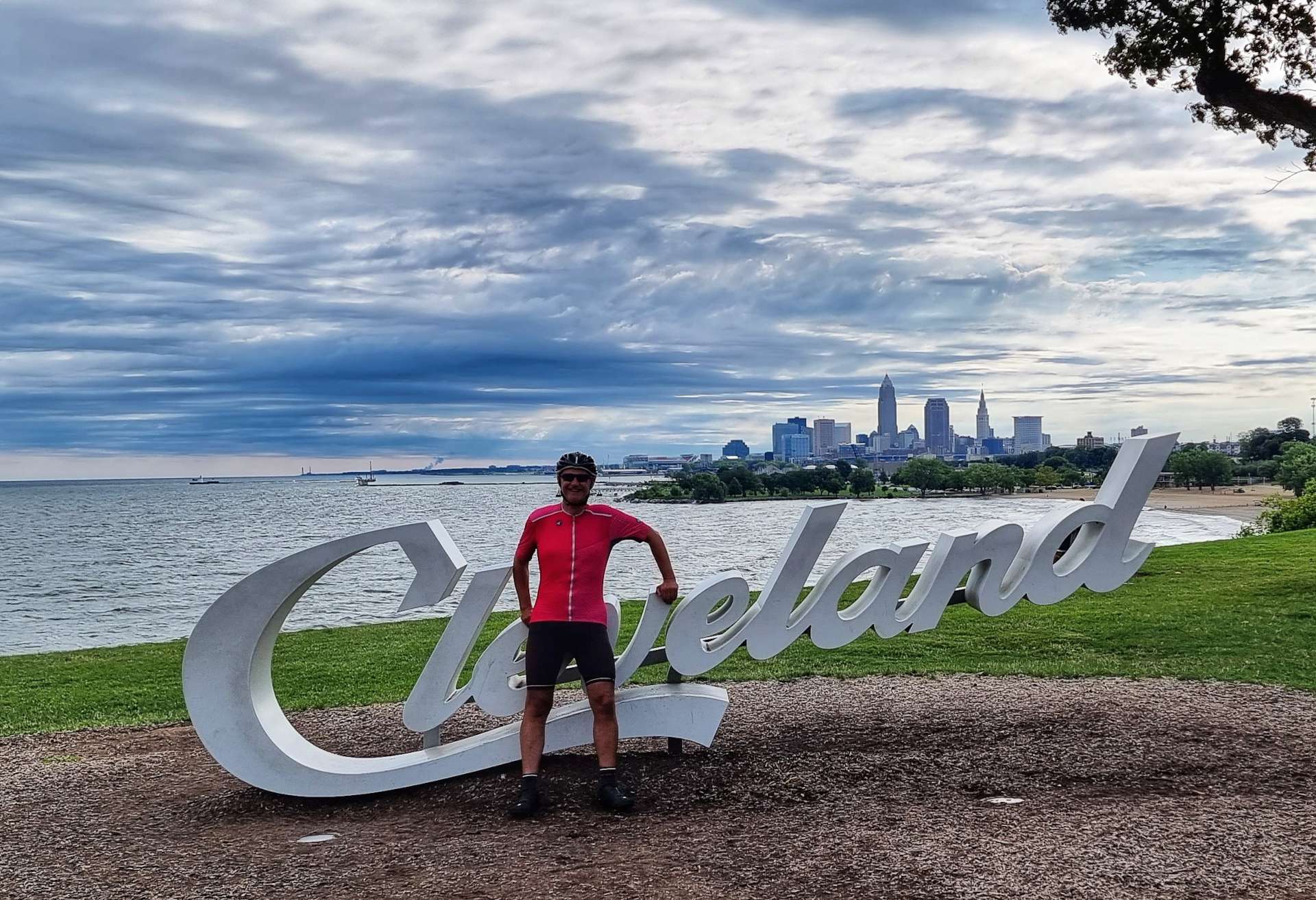
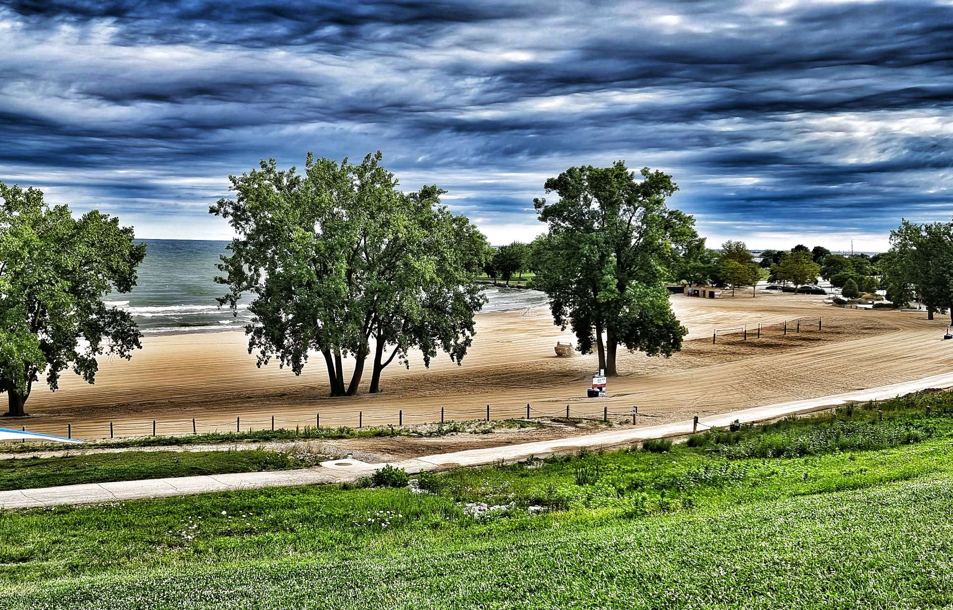
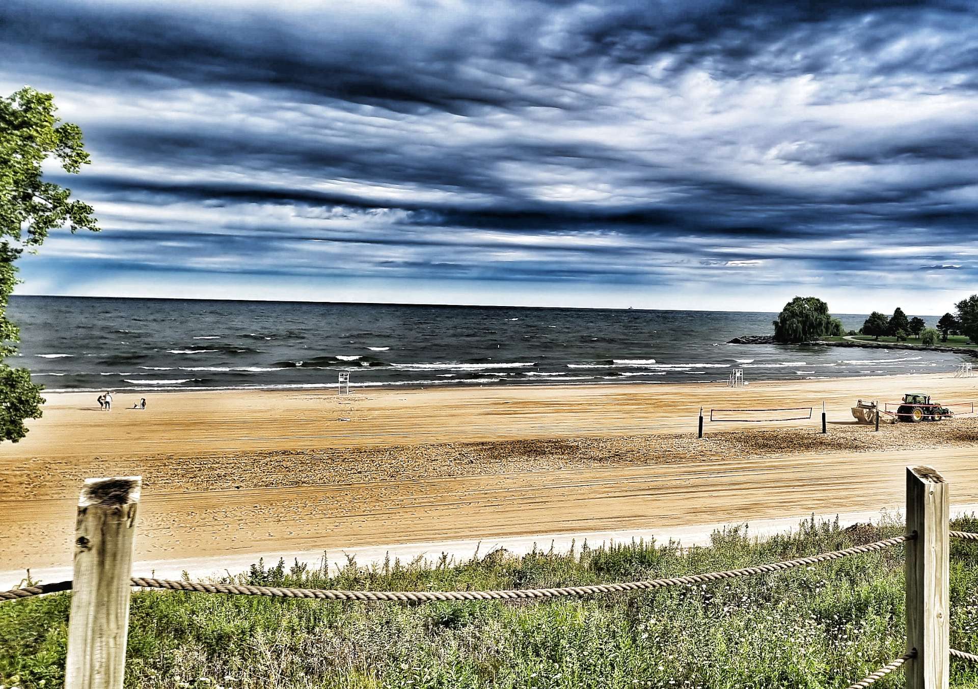
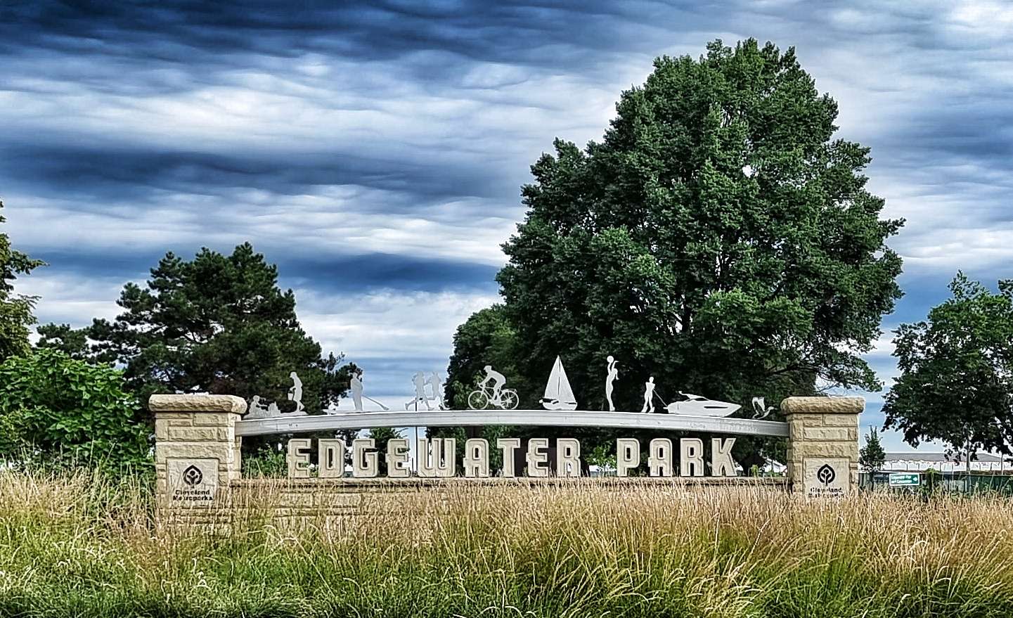
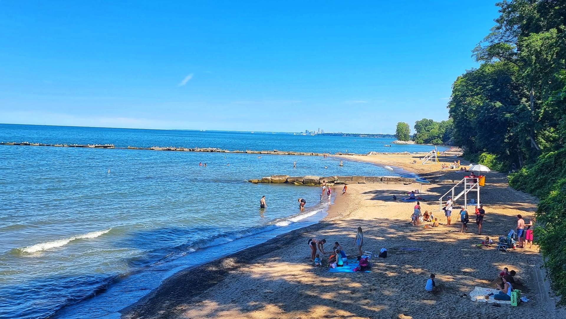
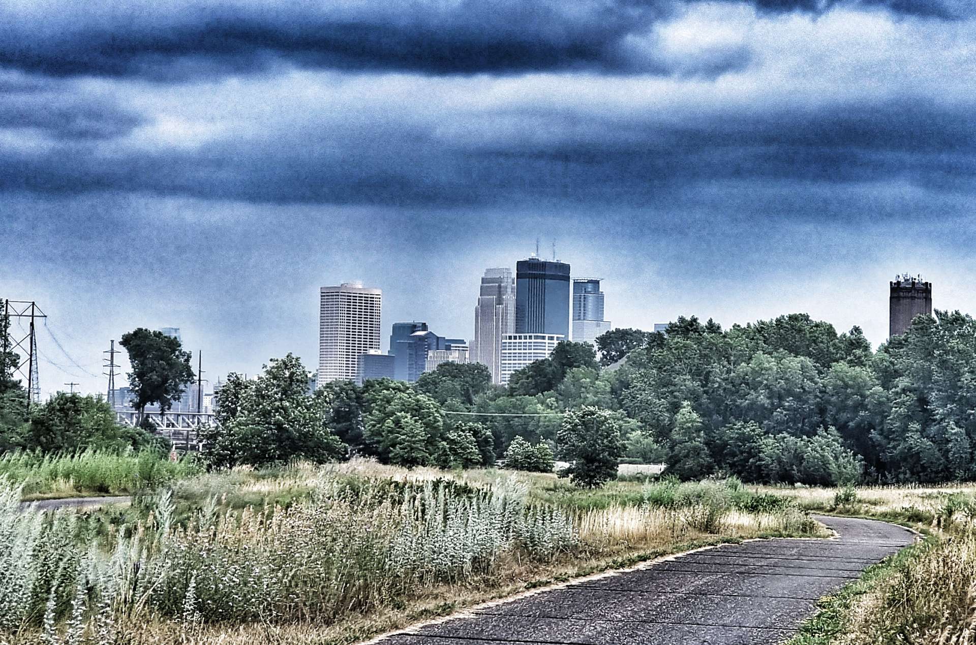
Within 5 minutes of setting off we entered Edgewater Park, a large recreational space with views to Downtown Cleveland below. I stopped at the iconic Cleveland Script Sign & traded photos with a couple who were also looking to get a memento of their visit.
Heading down to the beachfront past the volleyball courts, we watched the tractors raking the sand, so everything was in its place at the start of the day. Cleveland has done a wonderful job of making its beaches & Edgewater Park in particular, attractive & welcoming.
We left the cycle path behind as we made our way into town, but we were still on a cyclist designated road, with a lane marked out for us. The drivers were very patient & gave us plenty of space & time, which was very much appreciated.
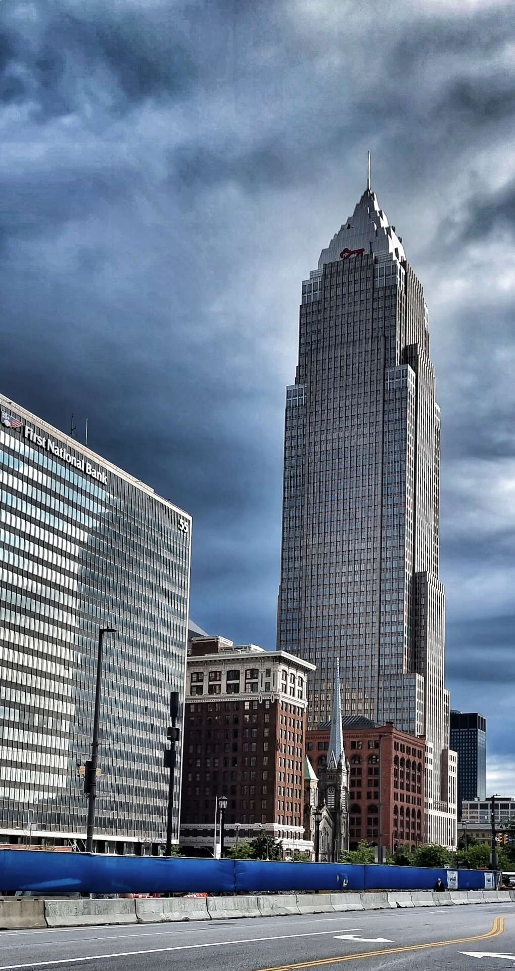
The Key Tower dominates the skyline & is the tallest building in the State of Ohio, at 947 feet tall. Completed in 1991, it rises 57 stories until the spire on the summit of the building & it changed hands in 2017 for £267.5 million.
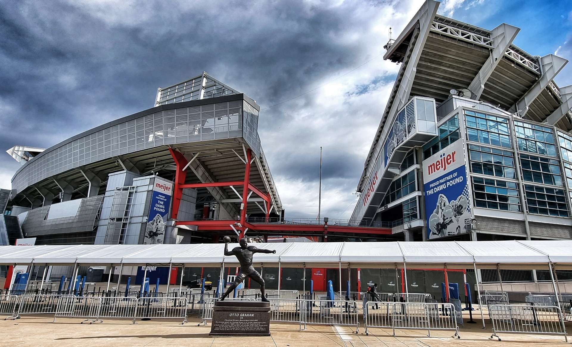
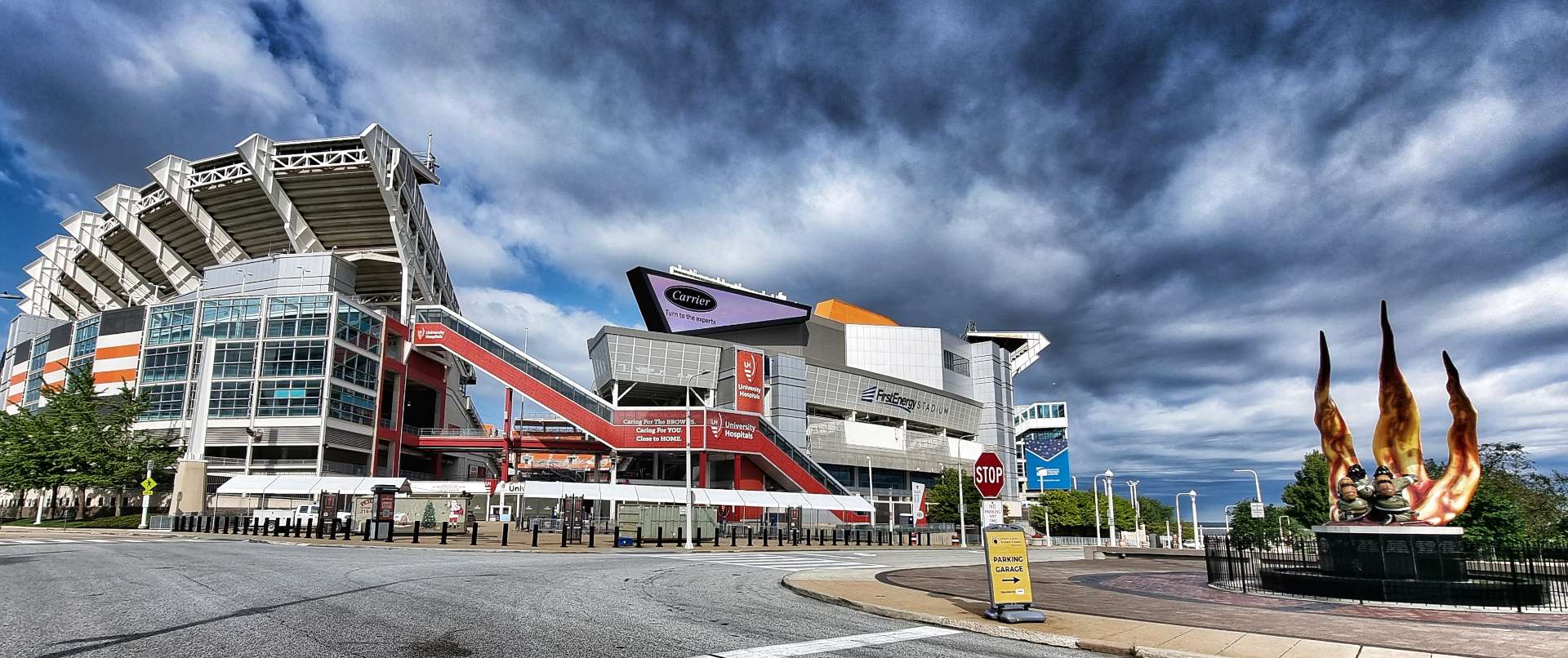
Less than 1/2 mile away on the lakefront, the First Energy Stadium is where the NFL’s Cleveland Browns play their home fixtures. It also hosts other major sporting & musical events – this weekend Avril Lavigne & Travis Barker were supporting Machine Gun Kelly.
Across the road from First Energy Stadium is the Fire Fighters Memorial honouring the 77 men who sacrificed their lives in the line of duty.
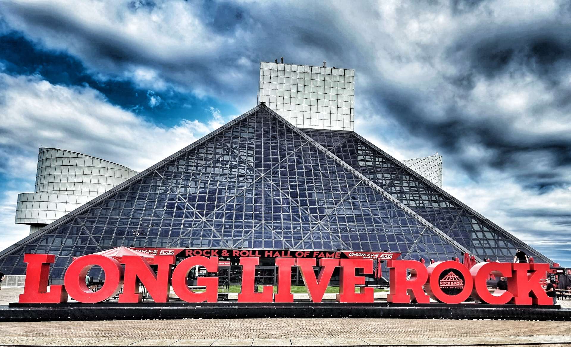
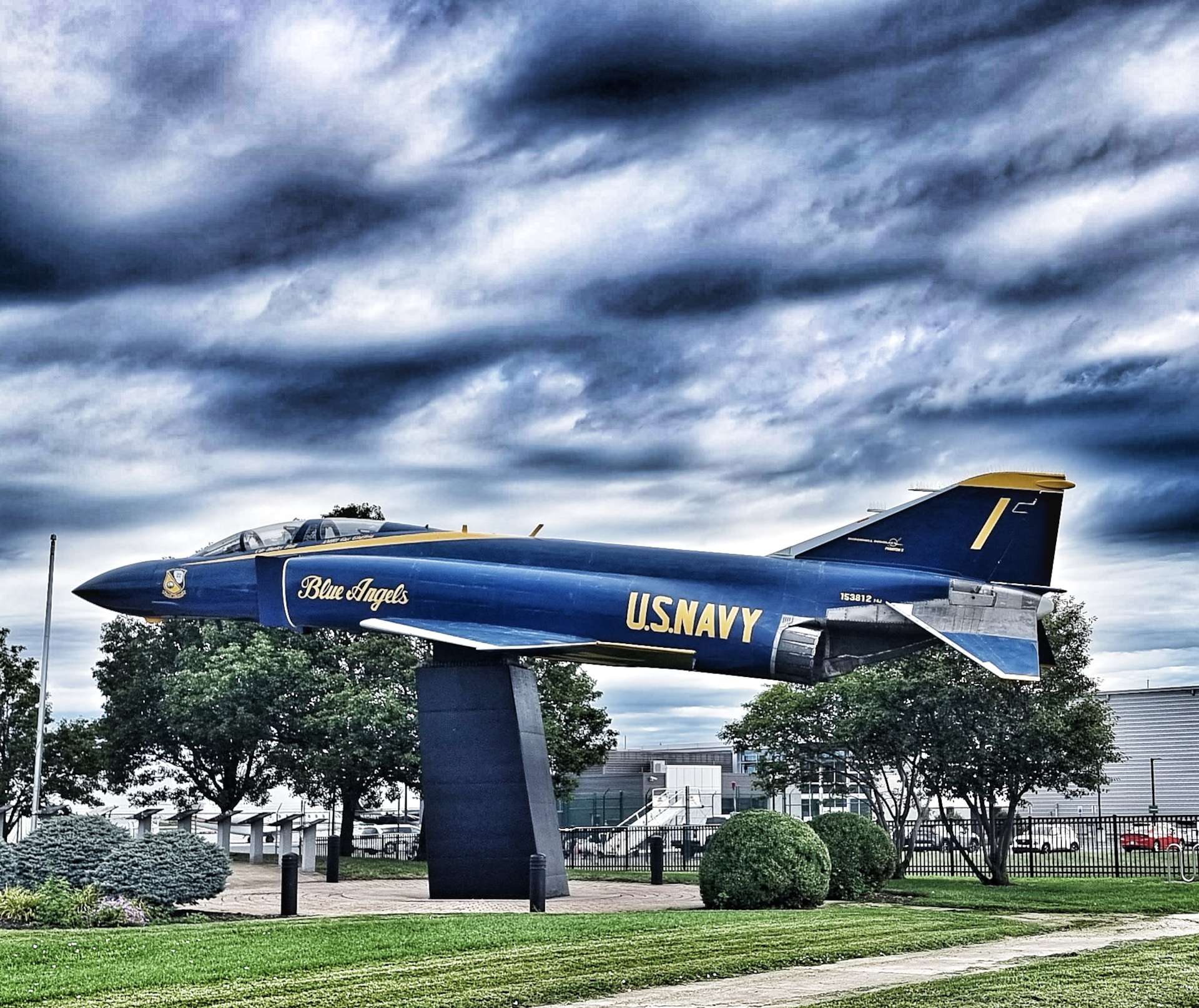
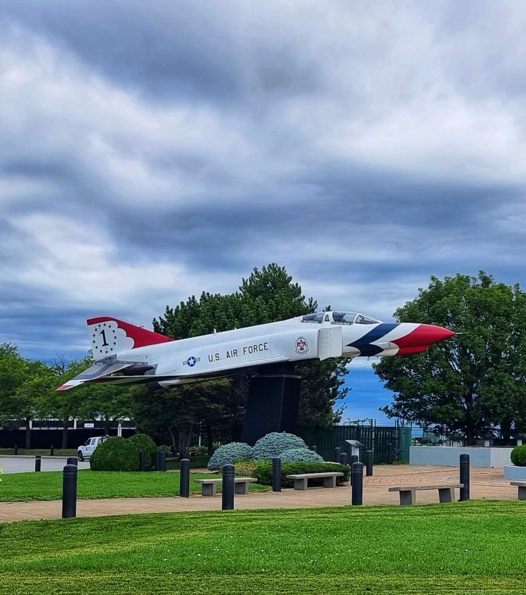
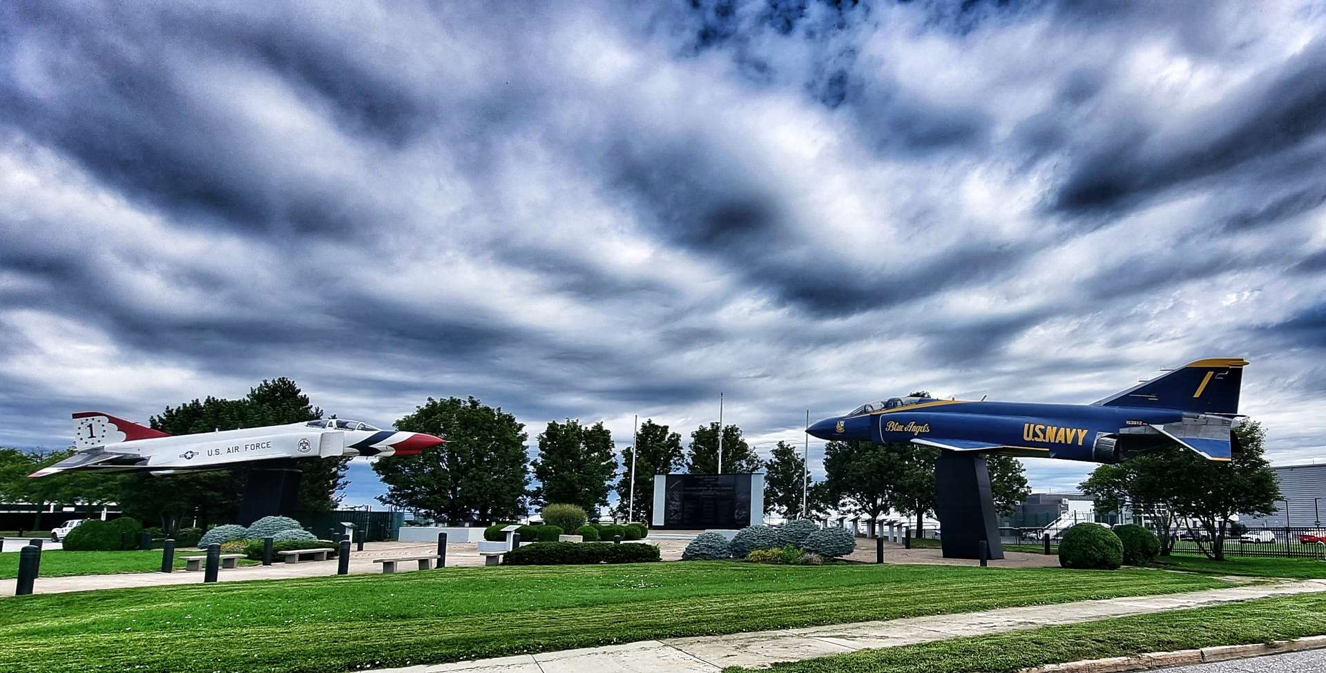
On the same block is the Rock & Roll Hall of Fame & 2 minutes further on is the International Women’s Air & Space Museum which had a Blue Angel McDonnell Douglas F/A-18 Hornet on display – they’re the equivalent of the Red Arrows & will be headlining the Cleveland Air Show in September.
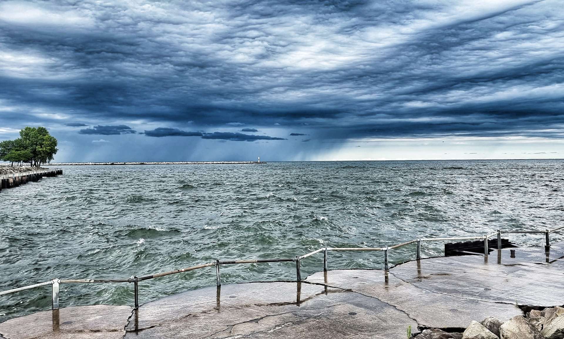
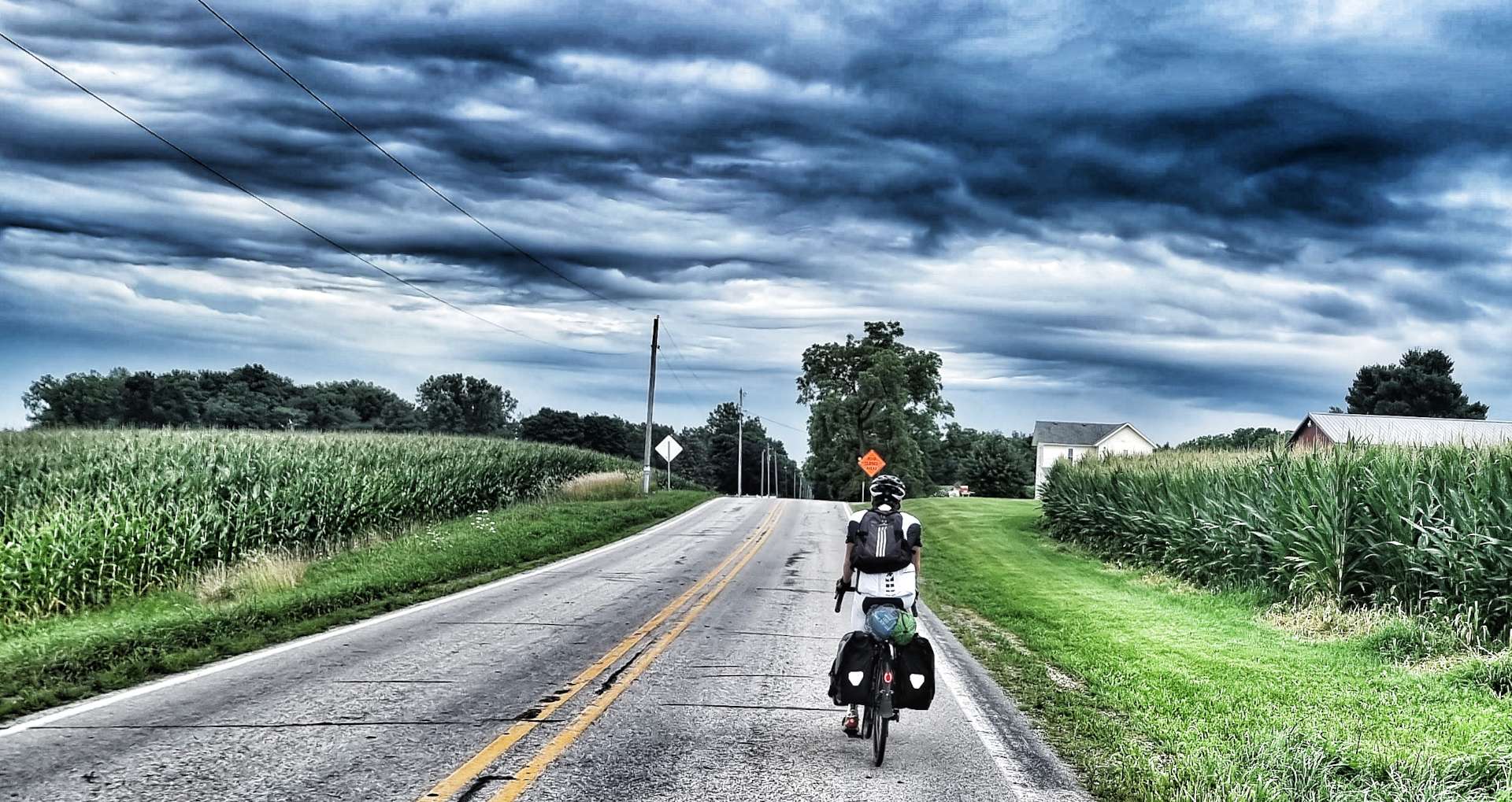
As we left Downtown Cleveland behind us, we found ourselves on a cycle path that took us right along the shore, so we were fully exposed to the wind that was whistling in off Lake Erie. Looking North towards Canada, we could see the rain heading towards us – we were definitely going to get damp in the next 30 minutes!
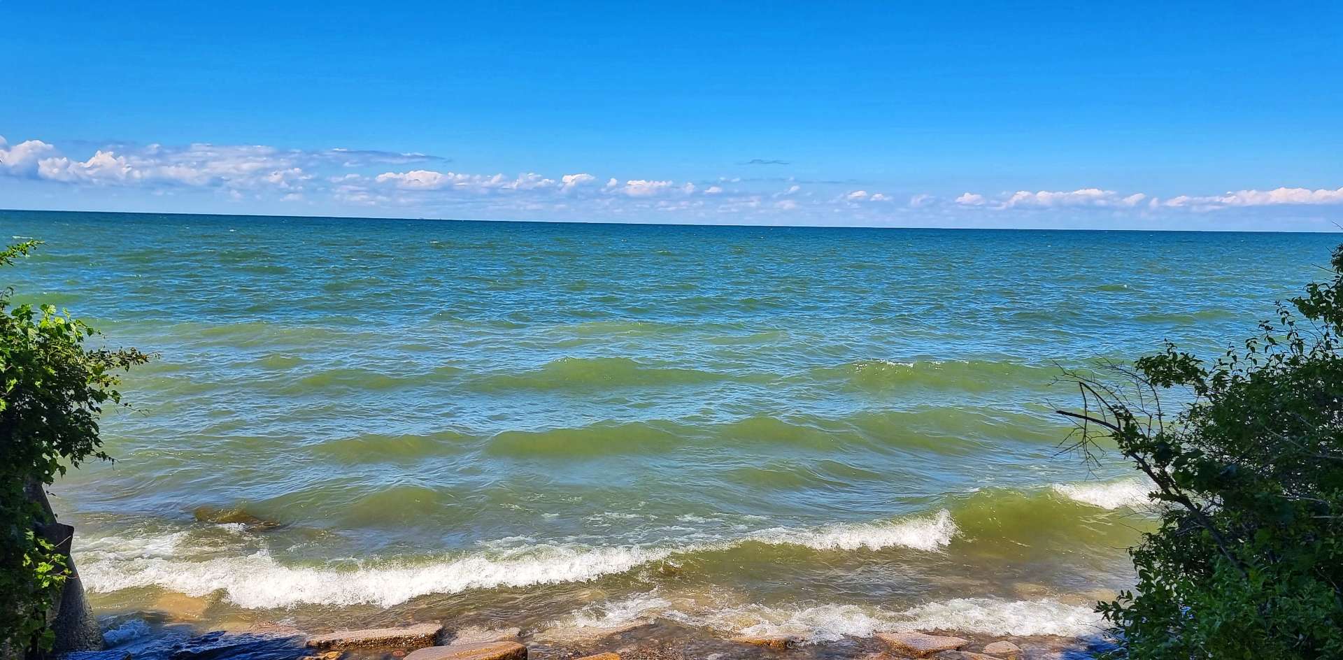
It was quite an experience to see Lake Erie with big waves breaking on the shore, but it helped me understand why it is known as the world’s worst tempered lake! On one sand spit alone, more than 100 ships & 1,000 people have perished. Lake Erie is the only one of the five Great Lakes to be entirely above sea level, when considering their depth. Herein lies the reason for Lake Erie being so dangerous – its relatively shallow waters can be quickly whipped up into 18 foot waves that batter the shoreline.
The waves weren’t 18 feet today, but they were larger than I was expecting!
Not long after I shot the video, the rains caught up with us – the worst of it had been dumped over the lake. Luckily it also coincided with us travelling about 15 miles through one residential district after another. The suburb of Bratenahl was the exception, as it appeared to be where all the moneyed people chose to live – right on the lakeshore in gated communities.
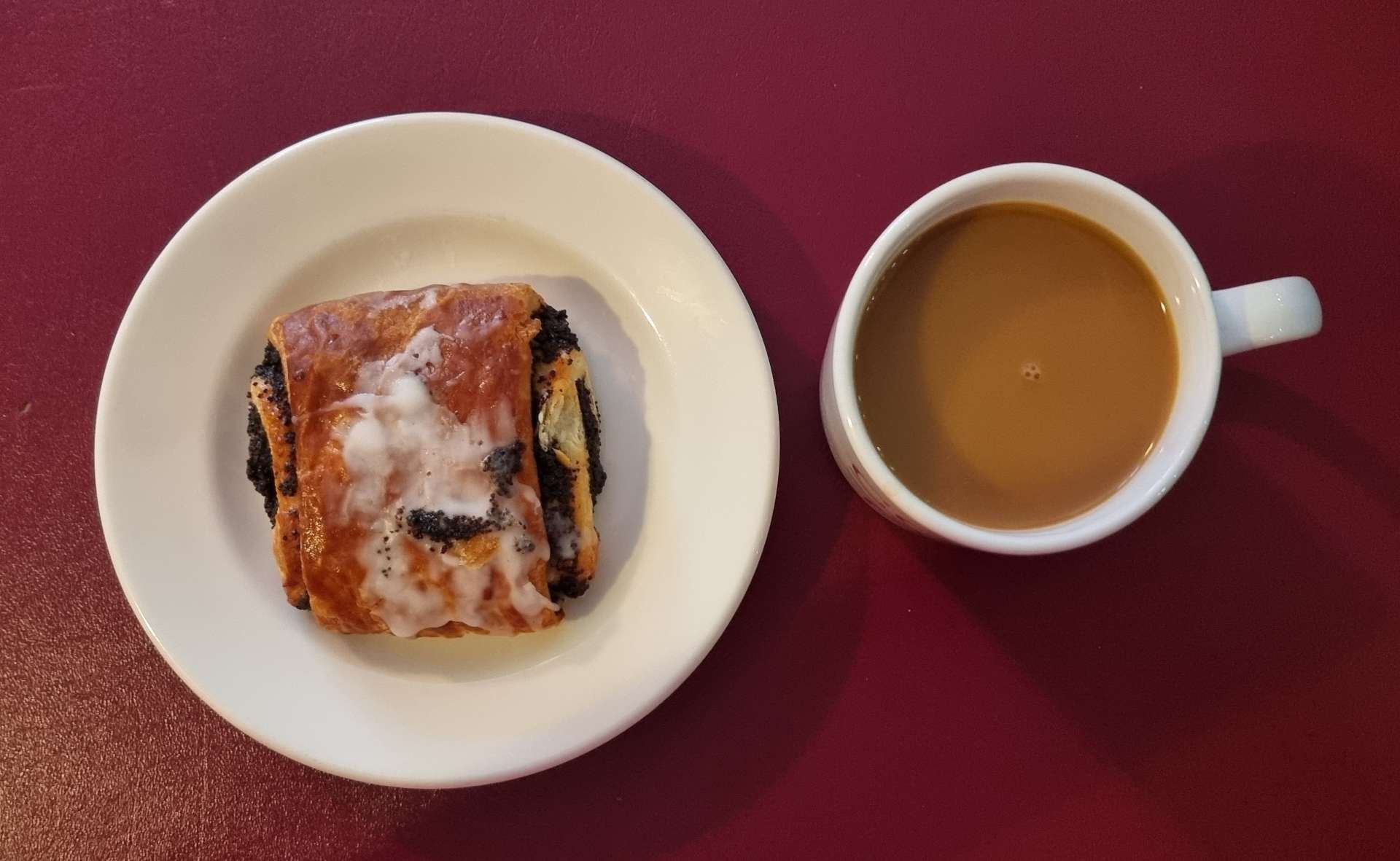
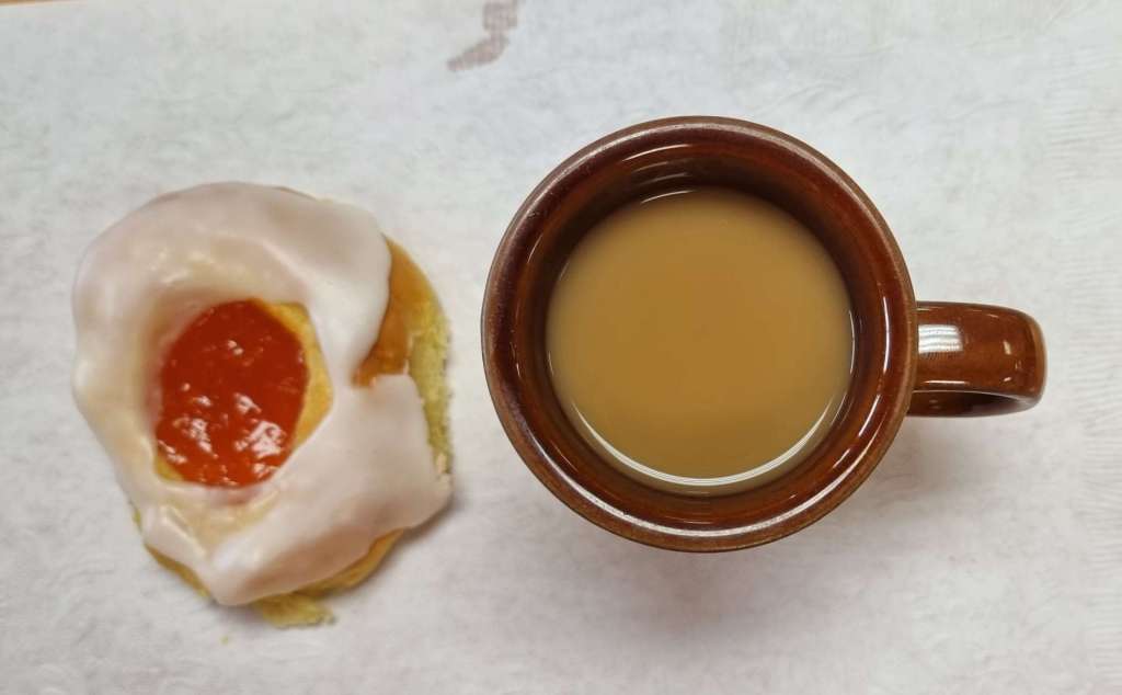
I found one more view of the lake leading up to our coffee stop, where I had a warming americano & a poppy seed pastry. The good news is the rain stopped just before we found our coffee stop!
It’s difficult to believe that by the time we started riding after coffee, the grey had been replaced by blue & there were just cotton wool clouds to break up the skies. We also left the residential districts behind for a while as we found regular spots to stop & admire the lake & its coastline. In one park we stood for a couple of minutes watching the ducks crossing the road in single file.
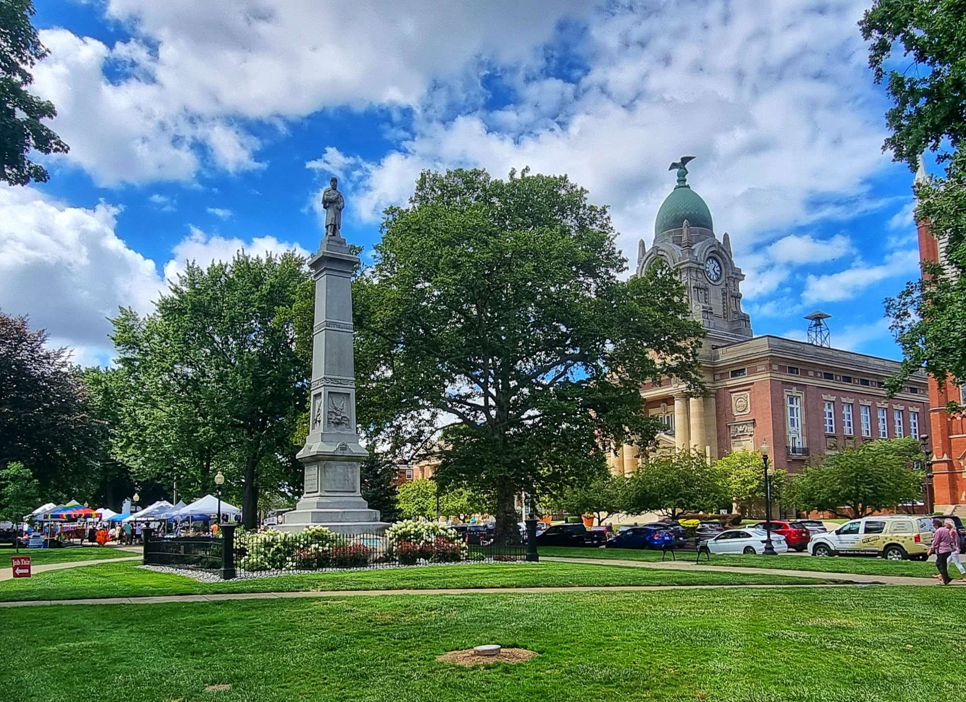
The town of Painesville has retained much of its original look & feel & the main thoroughfare is recognised as a National Historic District. There was a job fair taking place in the city park & like most of the towns we’ve passed through, there are far more jobs on offer than people to fill them.
This also reminded me that I will need to start looking for work when I get home. In the event anyone knows of anything that might suit me, please do get in touch, as I do genuinely need to work on my return.
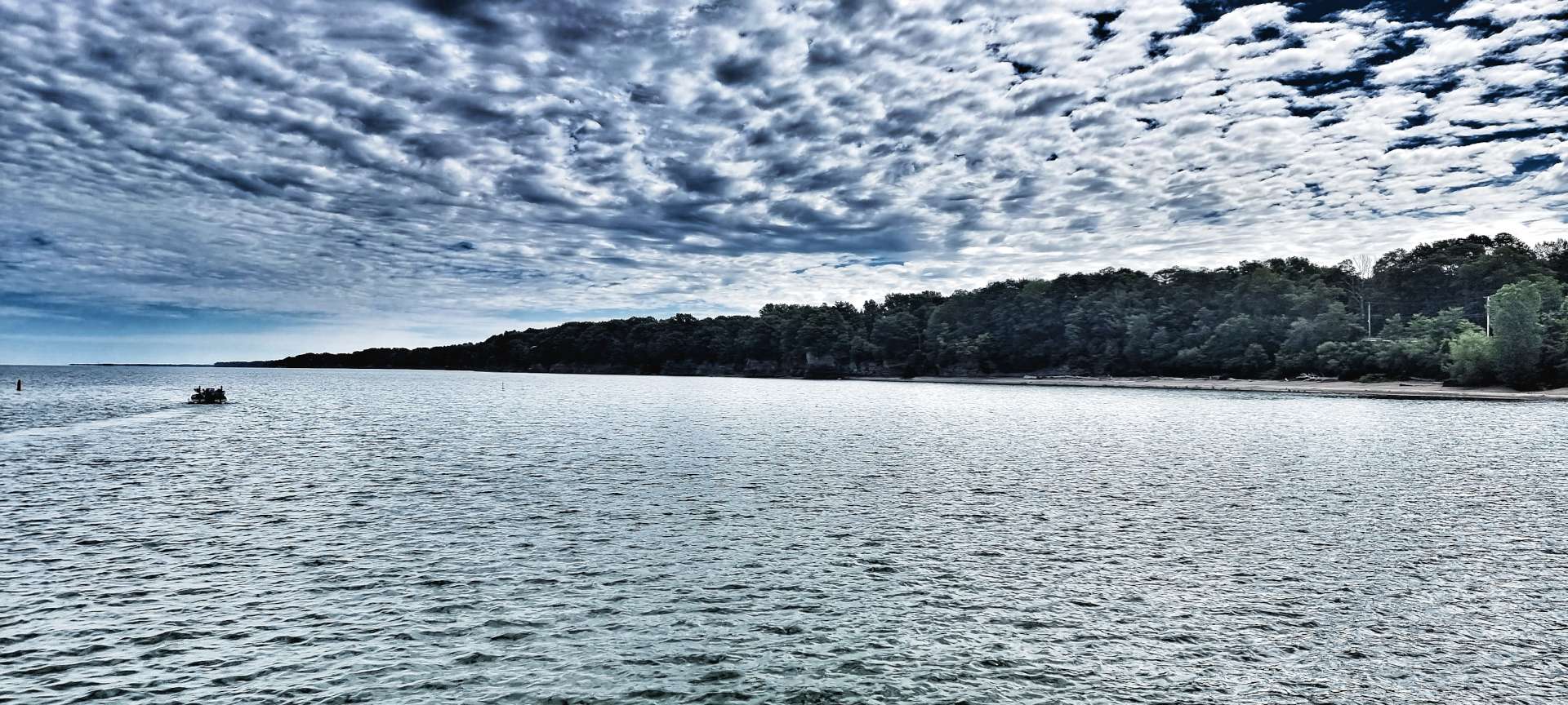
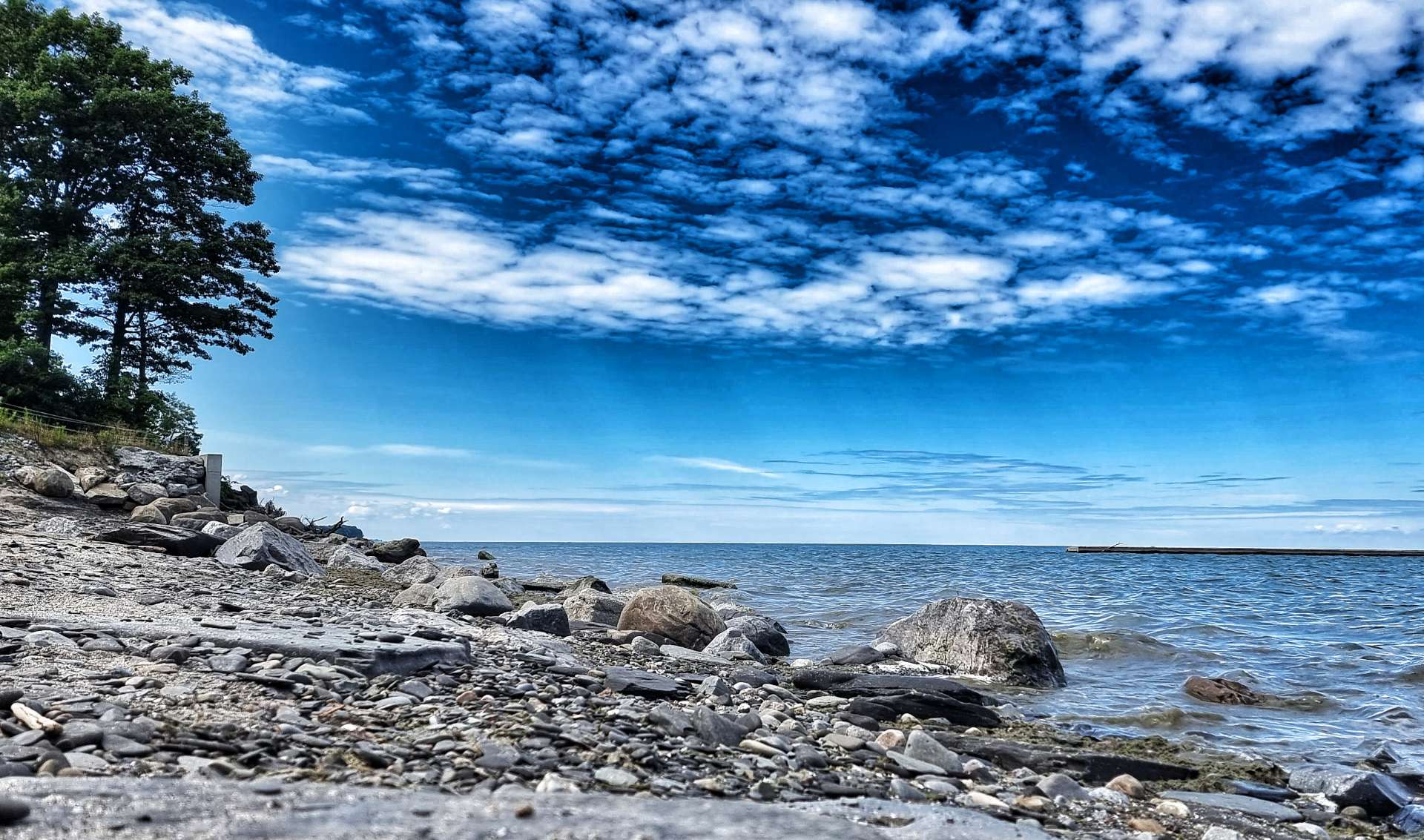
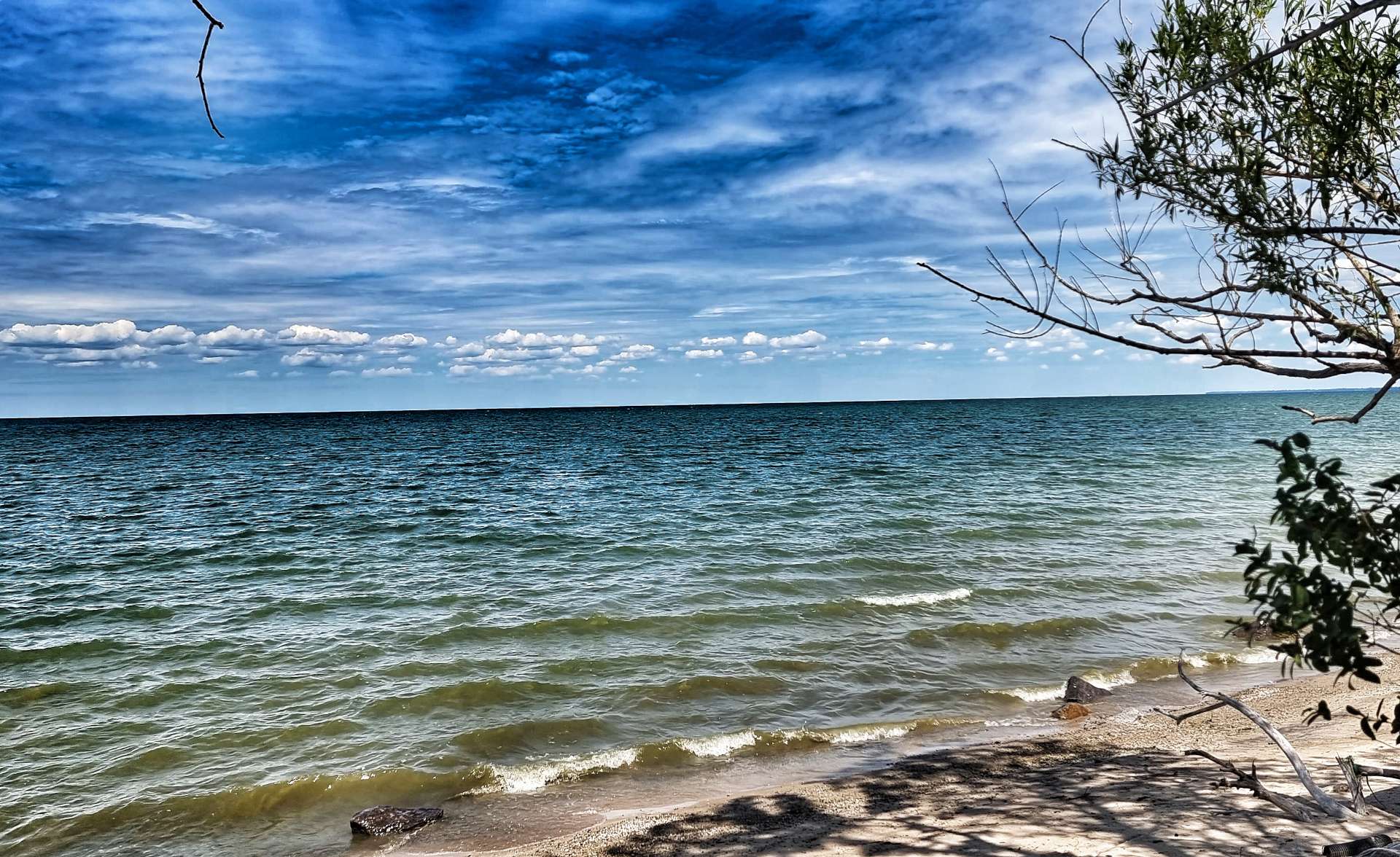
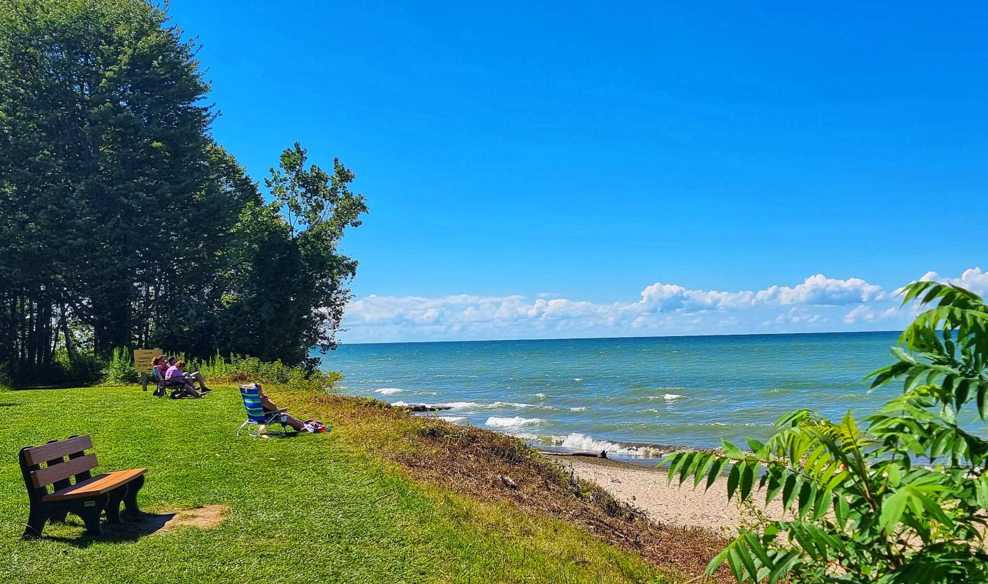
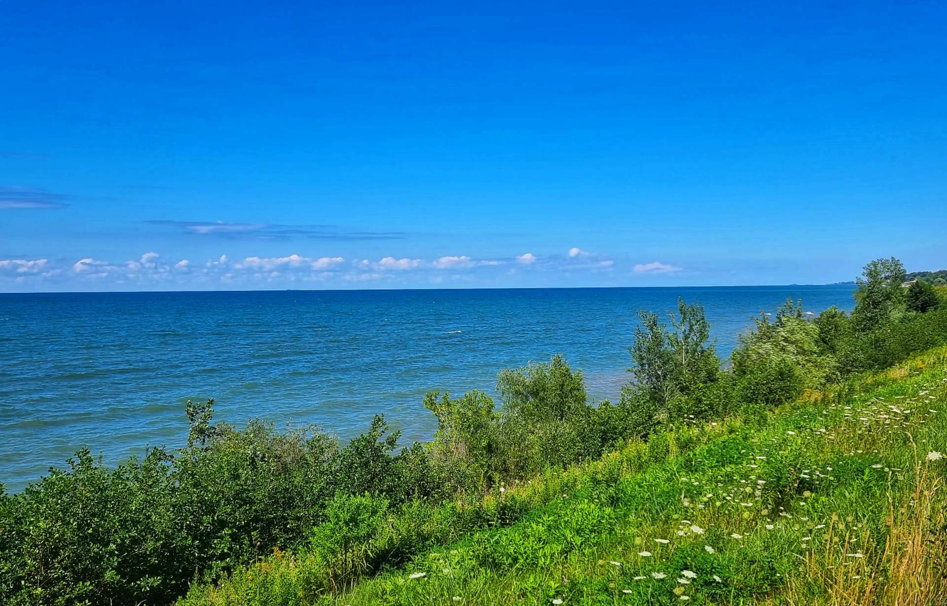
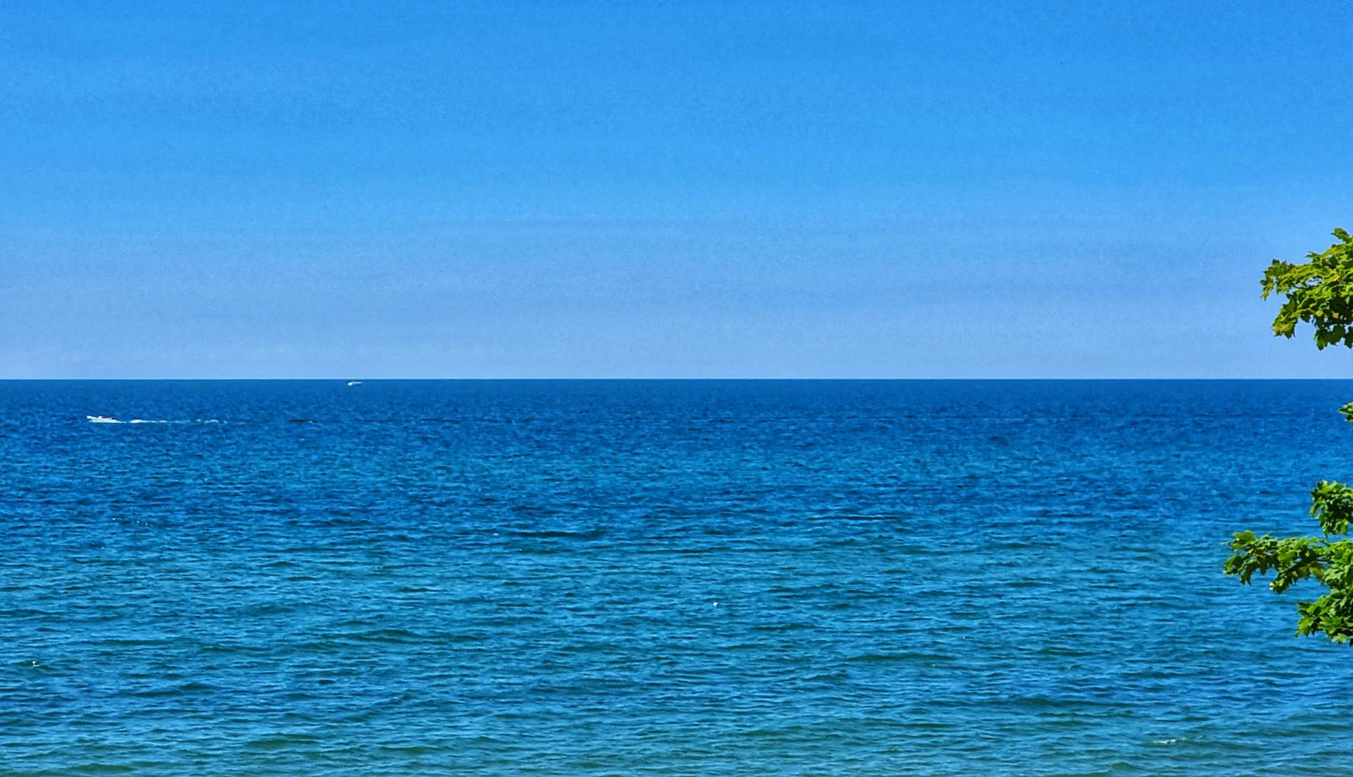
It wasn’t long before we were back on quiet roads, with opportunities to stop & enjoy the views from the sandy beaches. While the lake wasn’t millpond smooth, the gently lapping waves were barely recognisable from this morning’s monsters.
This stretch of the ride gave me ample opportunity to see the lake & I took advantage of pretty much every one that presented itself – Sean remained patient as I needed to stop regularly to take most of these photos – The Geneva State Park shot below is the exception. The beach at the State Park was beautiful & had a Mediterranean look & feel to it.
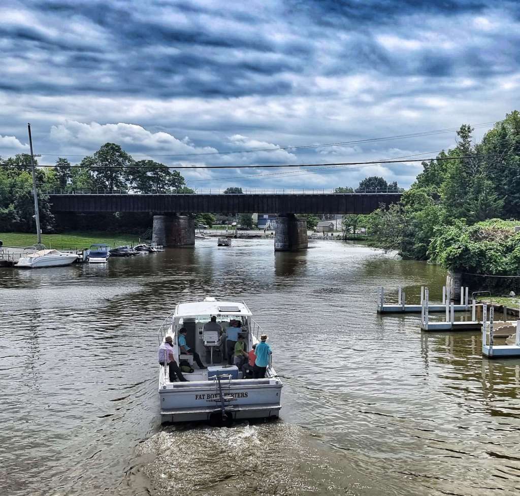
Leaving Geneva State Park behind, we arrived at Geneva-on-the-Lake. It’s a typical coastal holiday town, although it’s on an inland lake! If you wanted souvenirs, ice creams, food or drink, there was a shop to cater to your every need. This was also one of the only places I saw one of the freighters that ply their trade on Lake Erie.
Ohio’s coastline stretches for 300 miles along Lake Erie & its nine ports handle 40 million tons of inbound & outbound cargo each year. As recently as 2018, 33,000 people worked in the shipping industry on Lake Erie & it generated taxes of $838 million. It’s big business!
We were near the end of today’s adventure, we just had a few rolling hills to manage, then we turned inland towards our motel in Ashtabula. I have a good memory when it comes to recollected what we did & when, however, I had to check my journal to be reminded. All became clear when I read up on my evening – it involved hand washing today’s cycling kit in the shower so I could ride in it again tomorrow (same jersey both days!), as we arrived later than planned & we bought dinner from Subway. This probably won’t make my highlights reel!!!
Stage Stats – 77 miles, 1,142 feet of climbing. Sightseeing on the way across Cleveland, then riding quiet roads all afternoon as we had regular trips to the beach.
Ashtabula to North East – Friday 12th August (Stage 80).
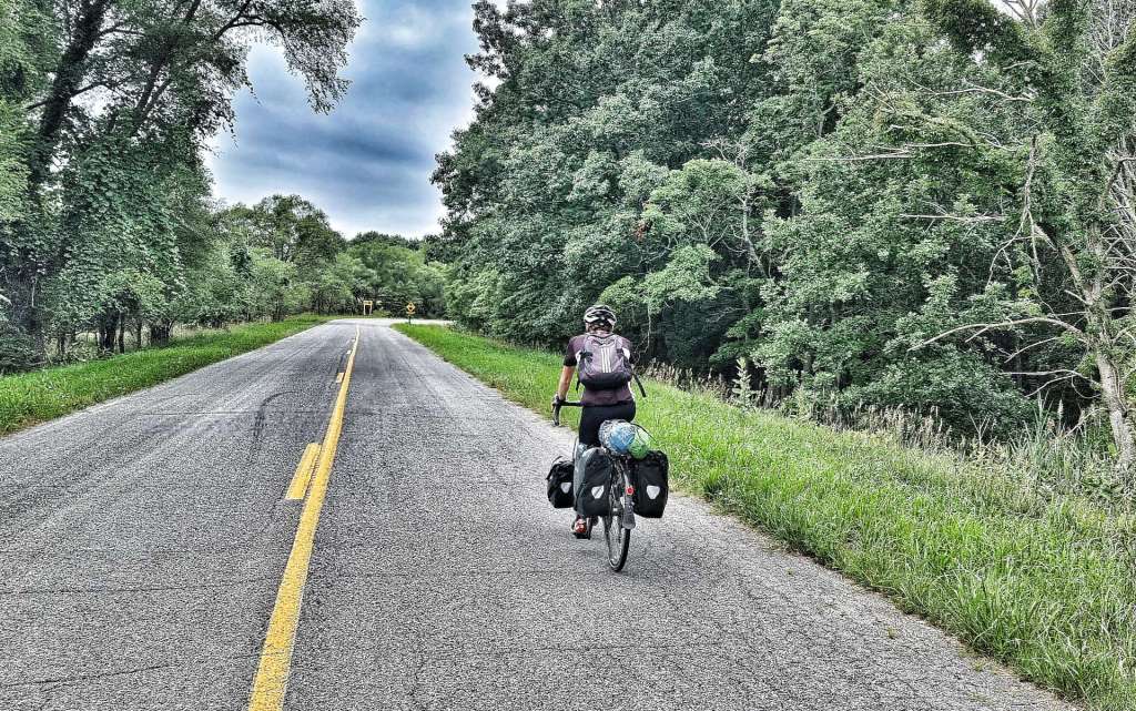
Today is our 4th day of riding on the bounce, so we’re heading into a rest day tomorrow. This is always a nice feeling, as it gives us a chance to stop, relax & process our most recent adventures.
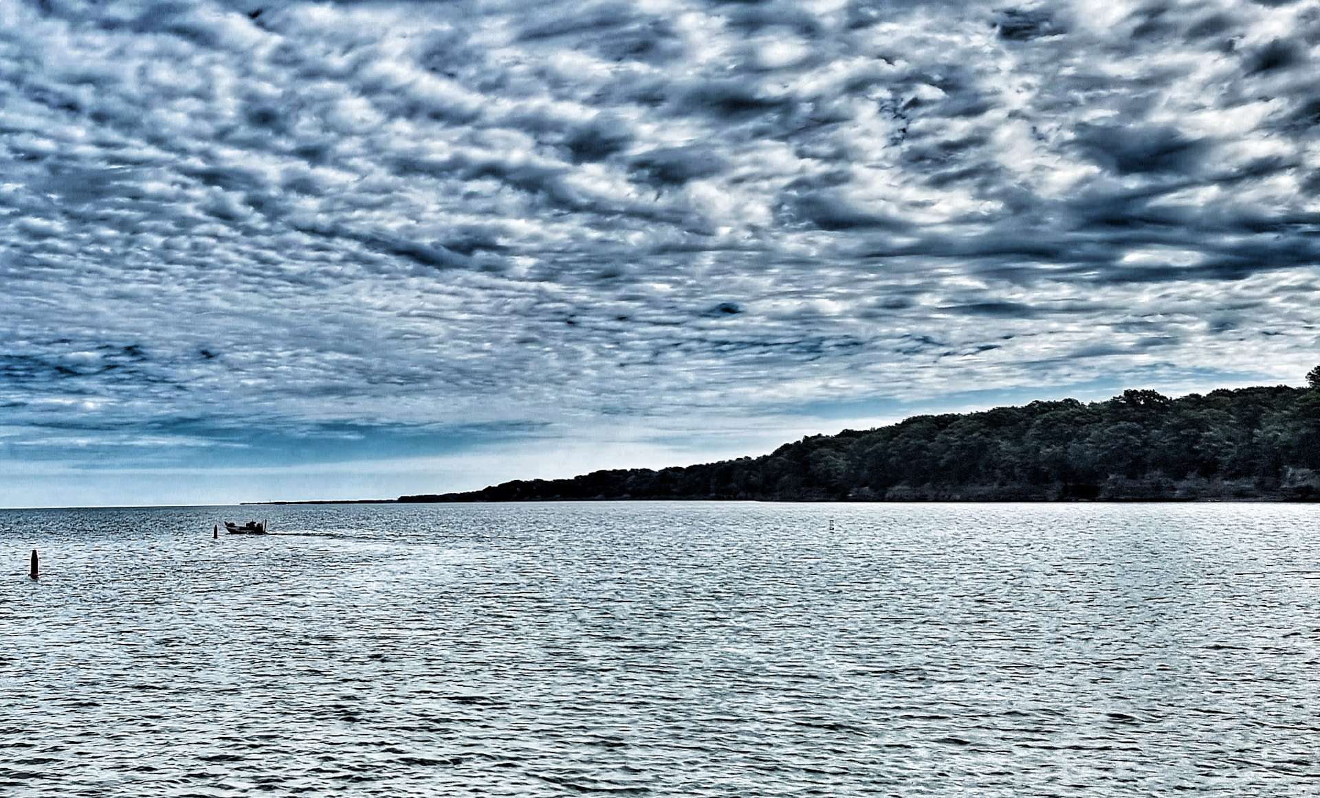
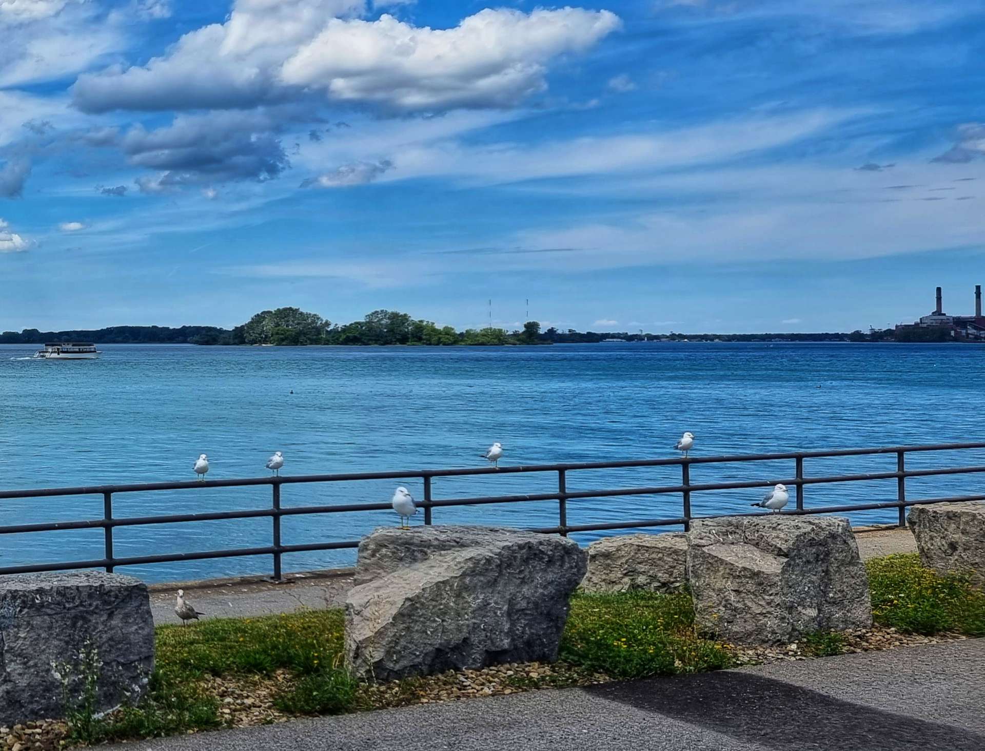
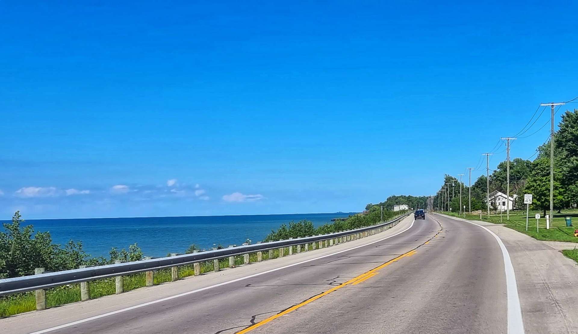
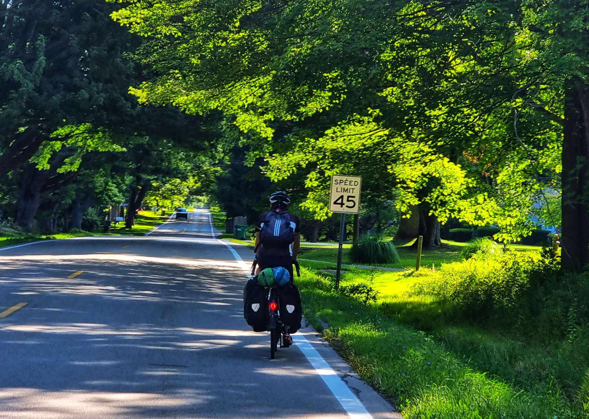
We picked up State Route 5 as we reached Lakeshore Park & got an early morning view of Lake Erie. Our rolling route resulted in quite a bit of climbing, but never for more than a few minutes, then immediately giving the feet back, before repeating again! The good news for me is that I could get quite a few nice shots from headlands, looking out across or along the lake.
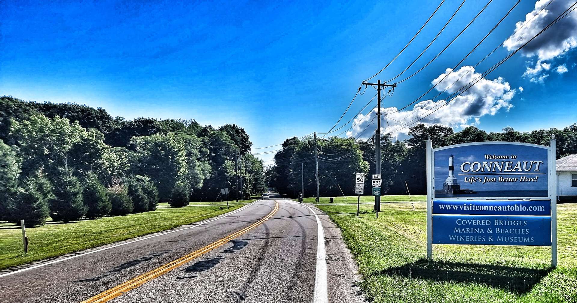
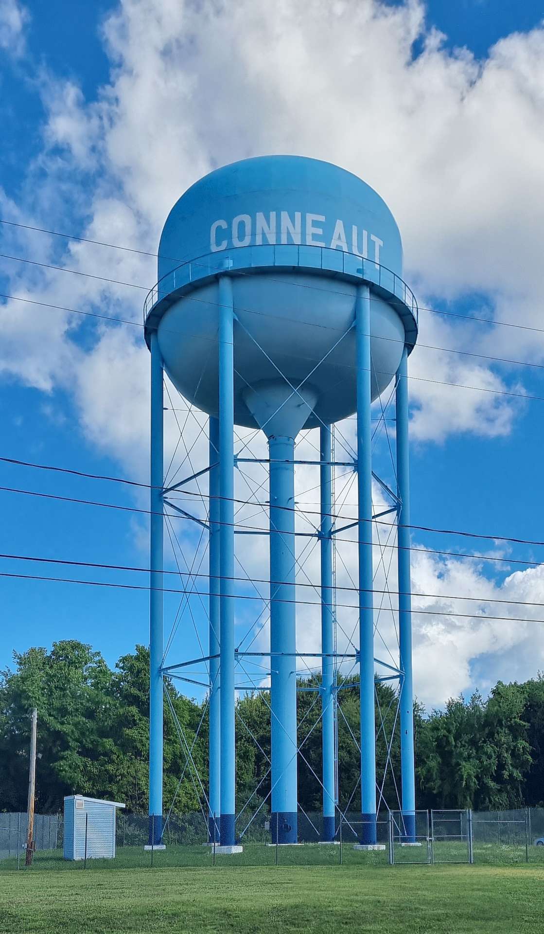
The first 15 miles followed the coastline, but then we turned inland & headed towards Conneaut, which boasted covered bridges, a marina, beaches, wineries & museums.
Life’s Just Better Here was their strapline & to be fair, it did look a mighty fine place to live.
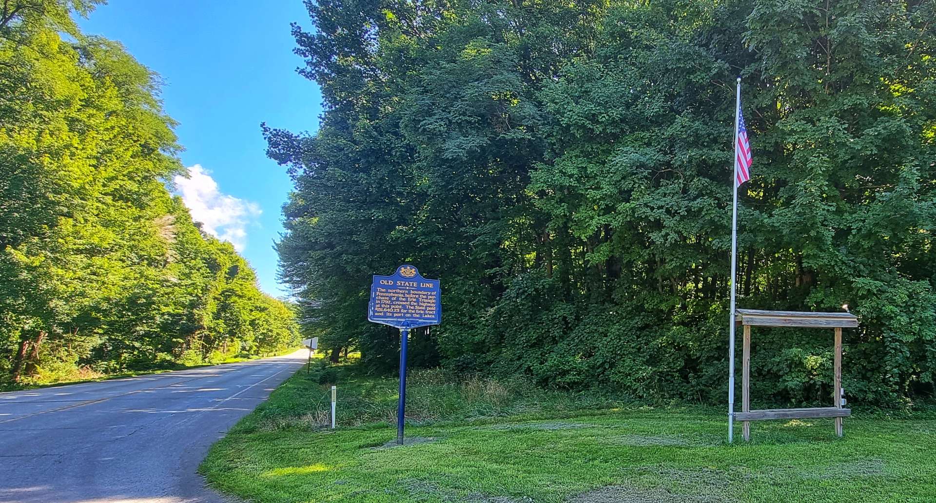
Conneaut was the last town we would see in Ohio, as we crossed the State Line into Pennsylvania. Founded in 1681 by William Penn, Pennsylvania is the birthplace of the Declaration of Independence & the Constitution of the United States. Pennsylvania purchased the Erie Triangle in 1792 for $151,640.25 & this extended the boundary further North, to where we took our picture.
This purchase was of huge value & significance for Pennsylvania, as it gave the State access to Lake Erie – the Erie Triangle comprised 202,187 acres of land & was paid for in interest-bearing continental certificates, money so severely devalued that the acquisition of the land was virtually free. If you think Junk Bonds are a new financial instrument, think again!
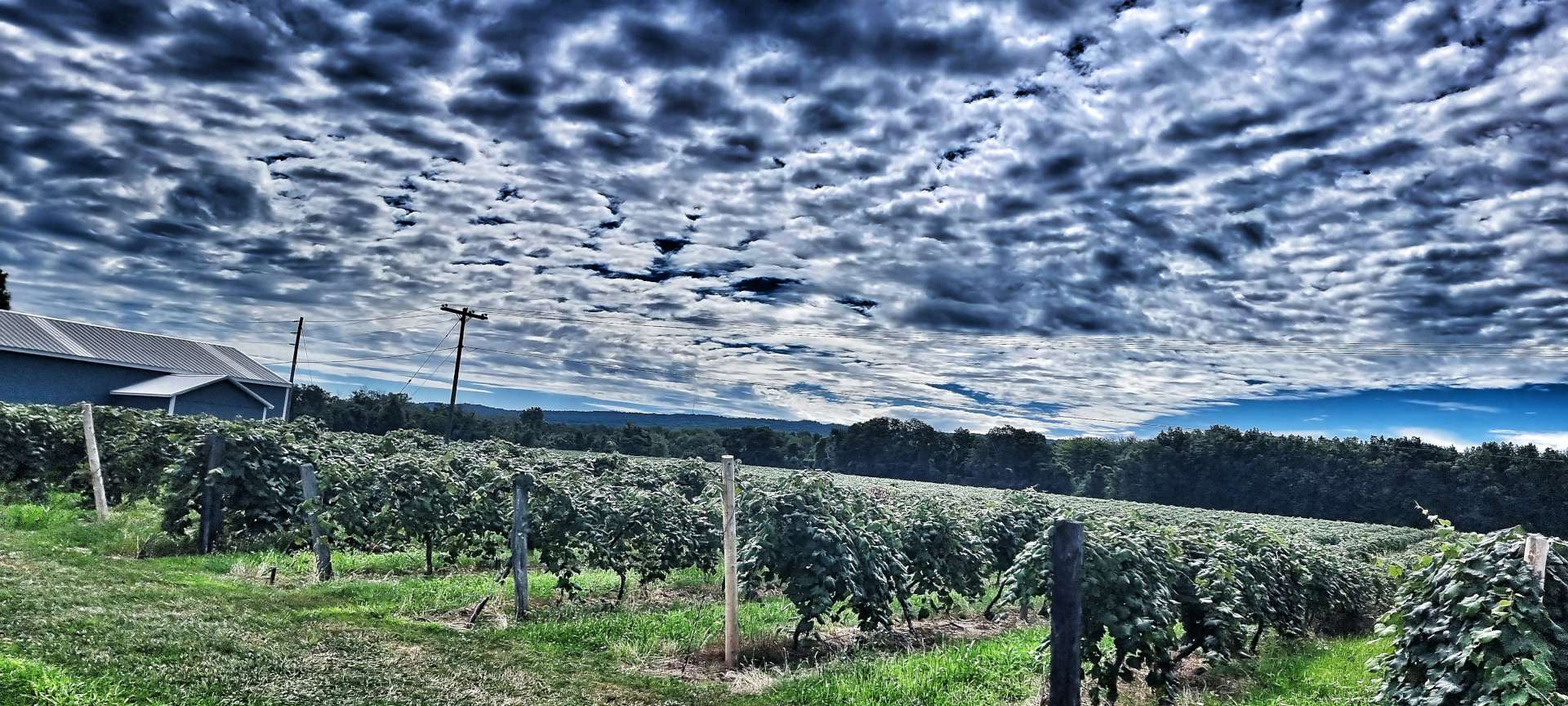
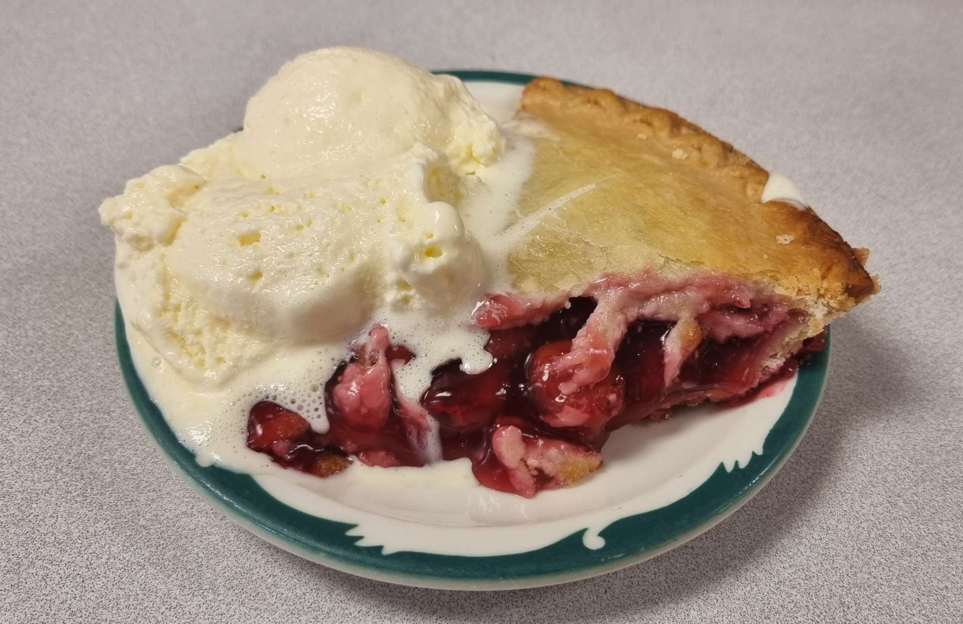
We had entered fertile wine growing territory & vineyards replaces corn & soya bean fields. Of more importance, after 38 miles we found a much needed pie & coffee stop. The morning had been hot & humid & we had been drinking the last of our warm (almost hot) water supplies when we stumbled upon Teresa’s Deli – it was a real oasis in the desert.
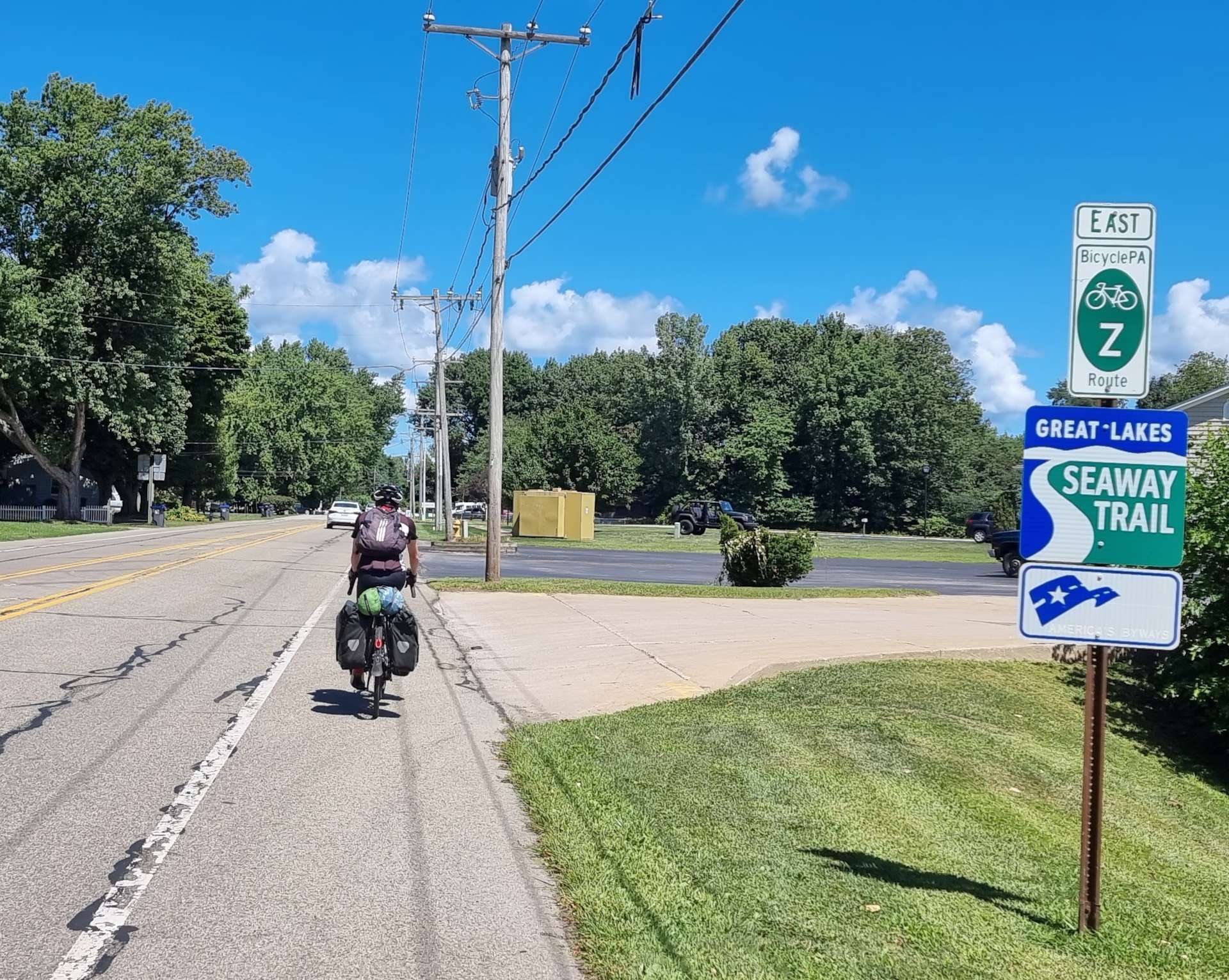
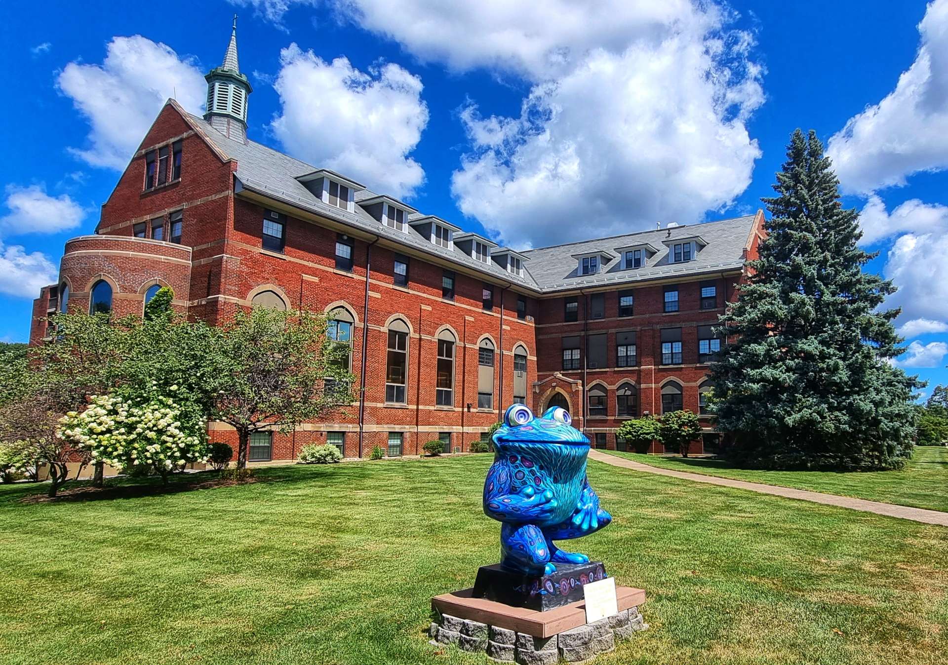
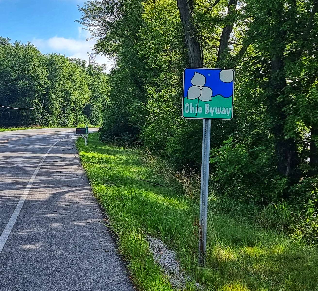
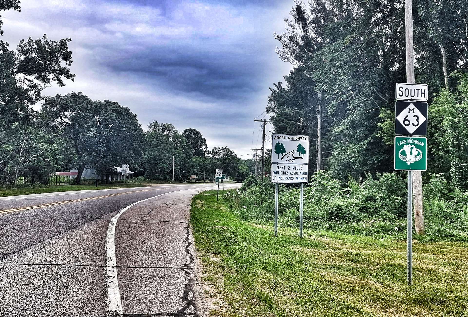
Setting off again, although we were still on the Great Lakes Seaway Trail, in Pennsylvania it also went by the State name of BicyclePA Z, one that just trips off the tongue! As we rode through Erie, there were a number of frogs that had been painted – Leap Frog! A Ribbitting Tale was launched on 1st January 2004 & a Hardcover book explaining more is available on Amazon for £30.89. It reminded us both of Bristol’s Wallace & Grommit & now I know why.
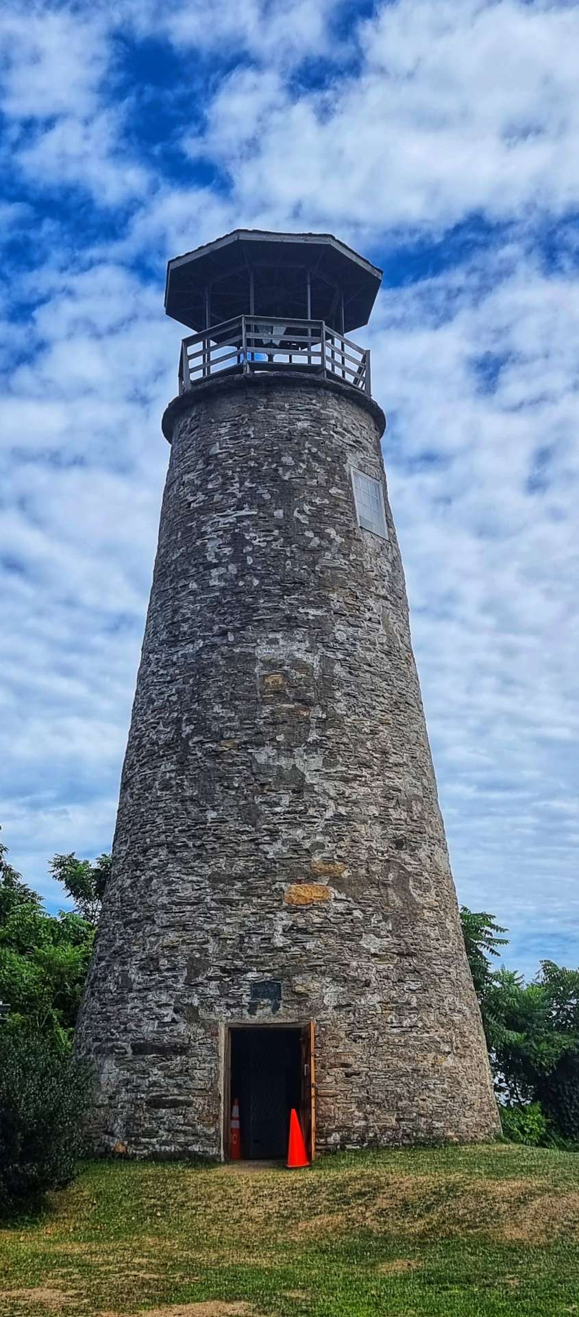
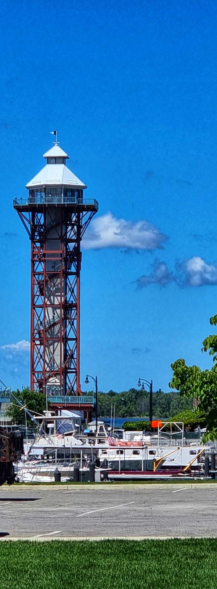
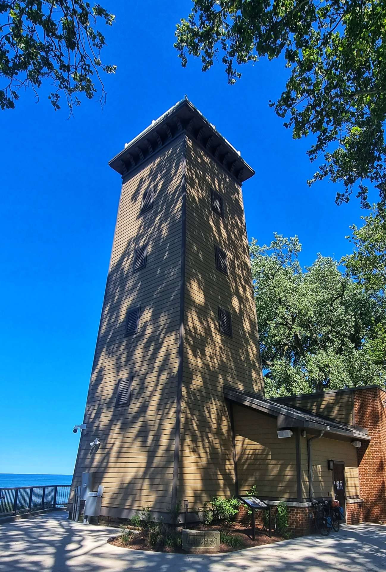
Erie marina was one of the largest we’ve seen so far along the lake & there must have been several hundred boats moored to the pontoons. There were also yachts & speed boats on the lake in the distance. The Erie Bicentennial Tower also caught my eye. It was completed in October 1996 to commemorate the 200 year anniversary of the founding of Erie. There are 210 steps to the top observation deck, which is 138 feet tall.
As we left Erie behind us, we headed back onto quiet 2 lane roads & at one point we passed 3 or 4 monasteries & nunneries in quick succession.
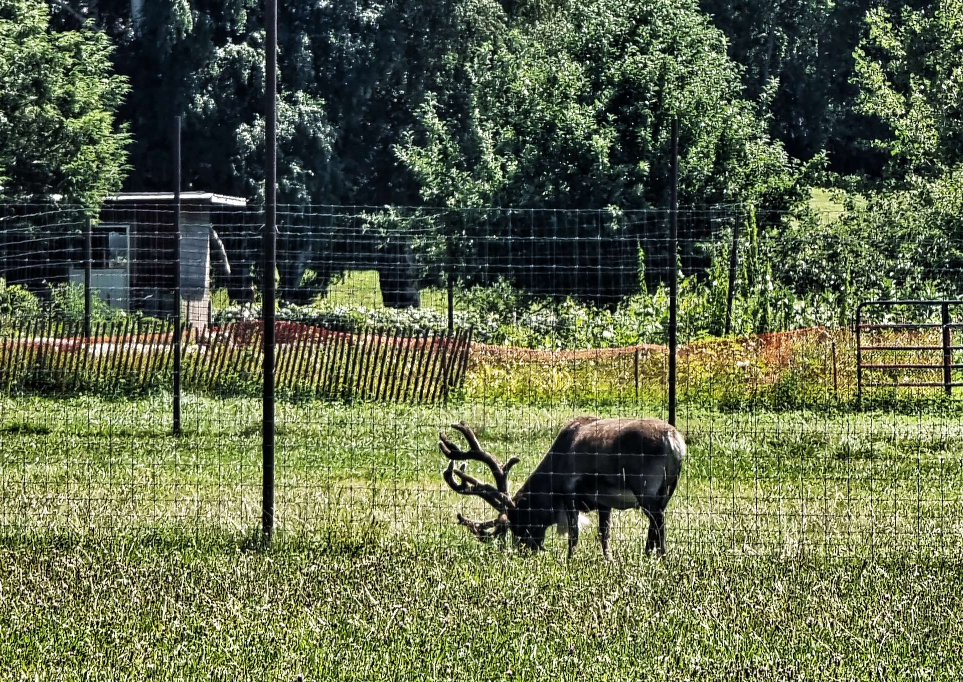
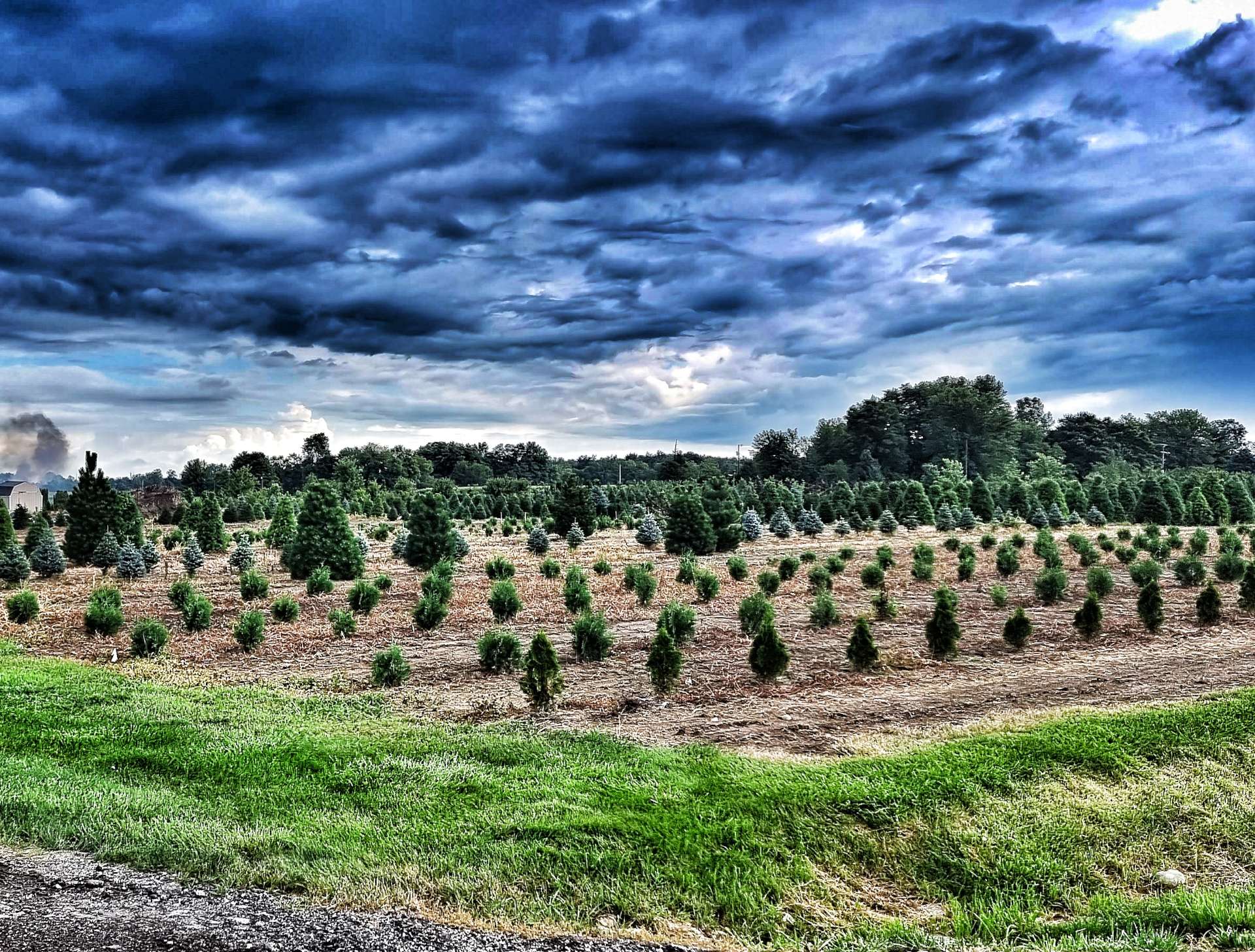
I was surprised to spot what looked like a reindeer in one field. When I think I’ve seen everything, along comes something else to prove me wrong – if only a moose would show itself! After one last look at Lake Erie for today, we headed inland slightly & immediately returned to vineyards again. We were now almost at our motel for the next two days just outside North East.
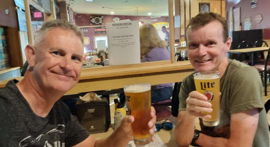
We checked in & the manager kindly agreed to wash our cycling kit for us (it was a 4 mile ride into town & he must have felt sorry for us!). It’s Friday night, so we headed to The Vine Bar & Grill, where we enrolled in Friday Beer Club with a couple of Darkfish IPA’s for me & a Sammy Adams’ for Sean – Cheers everyone!
Stage Stats – 66 miles, 1,542 feet of climbing. Crossing the State Line into Pennsylvania & toasting a well deserved rest day tomorrow!
Tuesday 9th to Wednesday 10th August – Stages 77 & 78.
Tuesday 9th August – Perrysburg to Norwalk (Stage 77).
We decided on a 2 day stopover (rather than the usual single rest day) in Perrysburg because in addition to being a relatively cheap place to have a break, we needed to plot the remainder of our route to the East Coast. We made the most of the couple of days rest & for once didn’t do any sightseeing – it was a rare opportunity to rest the legs! We found an ideal little restaurant just across the road from our motel, where we ate a couple of nights & enjoyed a relaxing beer.
The big news is we now have a specific location to aim for & a date to arrive there by – we’ve chosen to finish in Brunswick, Maine & we have to be there no later than 1st September. We have an Amtrak train booked on 2nd September to take us to The Big Apple for some rest, relaxation & shopping therapy!!! Our return flight to the UK is now booked for Tuesday 6th September & I’ll be back in Bristol on the 7th.
In some ways it’s sad that the end is in sight, but our adventure has to finish at some point & most importantly, we’ll have seen everything (& a whole lot more) that we set out to see & experience. Sean & I couldn’t see any value in us riding to places for the sake of extending the trip. All good things must come to an end & Brunswick by 1st September looks like the best time & place for that to happen.
We’ve built in a couple of contingency days in our route, so we may well be in Brunswick between 30th August & 1st September. Now lets carry on enjoying our adventures on the bike!!
The weather forecast said to expect light showers today, but I watched Michael Fish say just before The Great Storm of 1987 “Earlier on today, apparently, a woman rang the BBC and said she heard there was a hurricane on the way. Well, if you’re watching, don’t worry, there isn’t!”. Anyway, here’s a couple of videos of what I watched from my balcony yesterday & why I’m a little nervous about today….
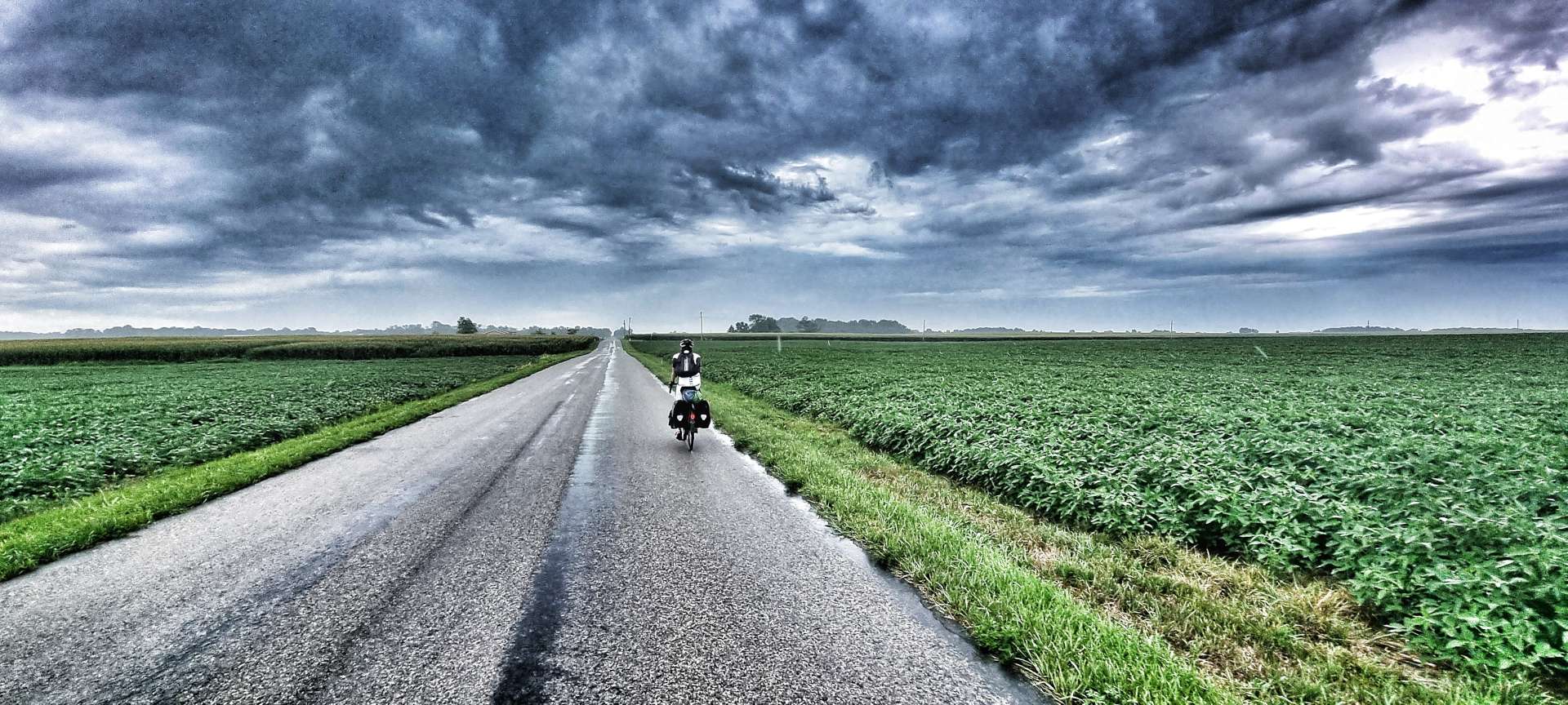
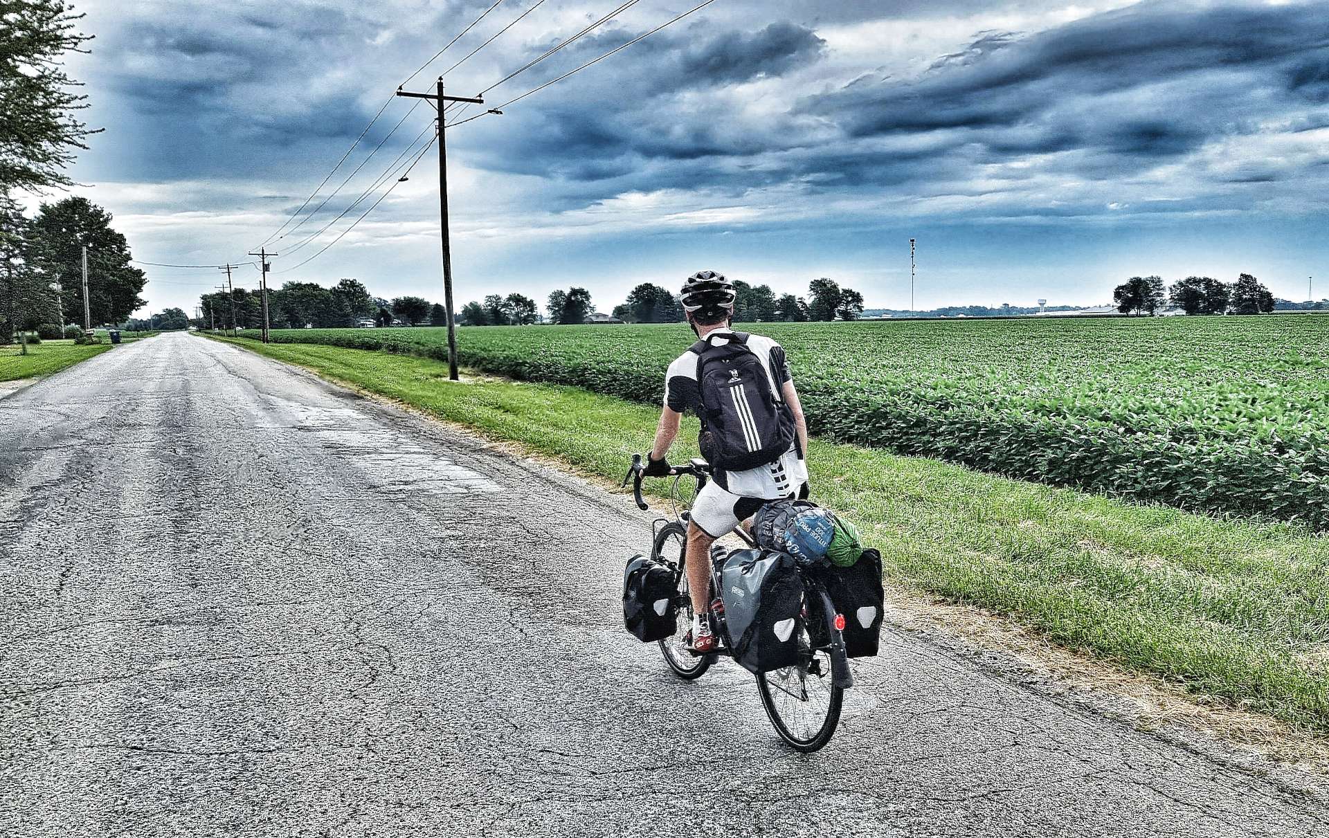
We left Perrysburg at 9am under overcast skies with everything crossed we wouldn’t experience anything worse than showers. Once we’d left town, we joined the familiar long straight roads with their intersections every mile. The first 38 miles of today’s ride only involved 90 degree turns – it’s out there now, I won’t mention it again in today’s post!
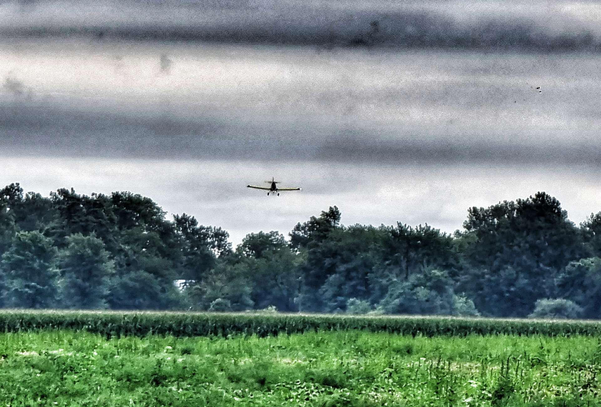
Our first treat of the day was watching what I now think is a crop duster doing his thing over a couple of fields directly in front of us. At the time I thought it was a pilot just enjoying himself, but we both think we saw the same plane later in the afternoon about 50 miles away & that one was definitely dusting crops.
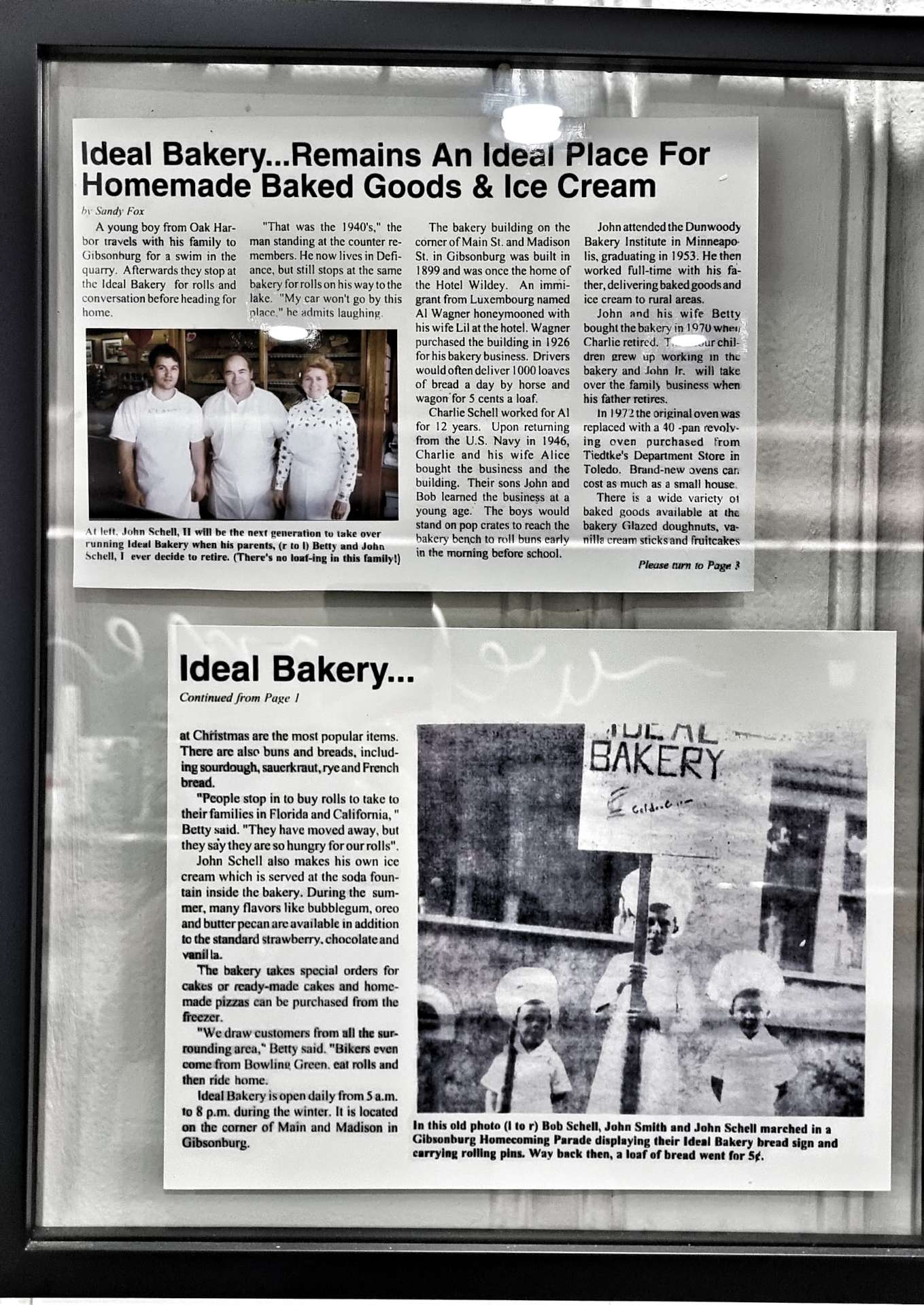
Our second treat of the morning came when we stopped at Ideal Bakery in Gibsonburg, after about 26 miles. Tracy was running the shop & she was really friendly & interested in our trip. She also shared some of her travels to date, which is always good to hear. Recipes have been handed down for 100 years & the shop is now owned by the 4th generation of the Schell family.
The bakery also stars in the film Gibsonburg, which is based on a true story where a high school baseball team has a regular season record of 6 wins vs 17 losses (including a 13 game losing streak), yet wins 8 games on the bounce in the post-season to win the state championship – the first team to do so with a losing record.
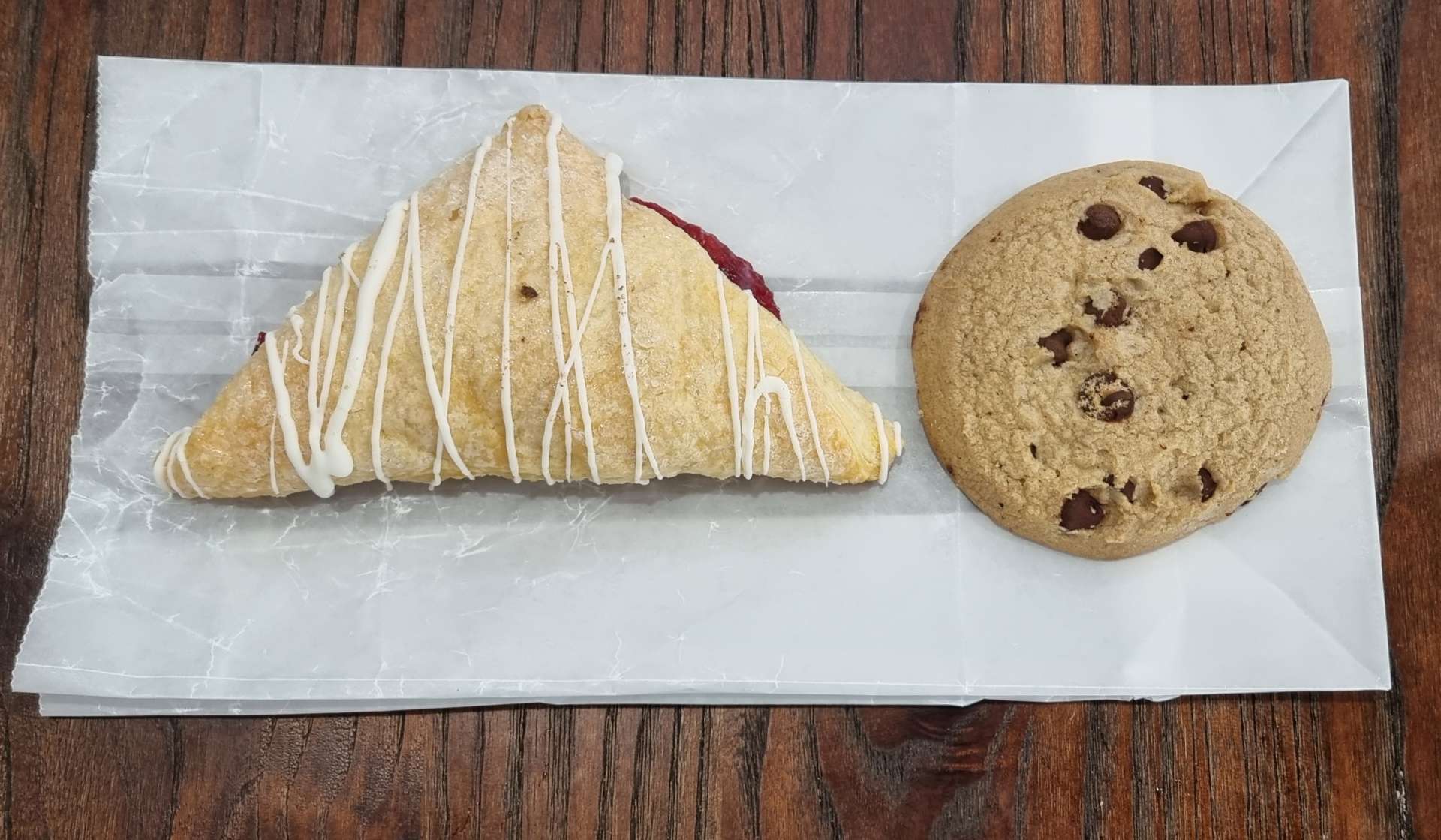
I’ve included a couple of the newspaper articles that are framed in the shop – I could have sat there for a couple of hours reading them all & eating more of their cakes & pastries!!! In the end I stopped after the cherry turnover & chocolate chip cookie, both of which were delicious.
Kathi & John – if you read this, please could you also let Tracy know how much we appreciated her time & interest when we stopped by.
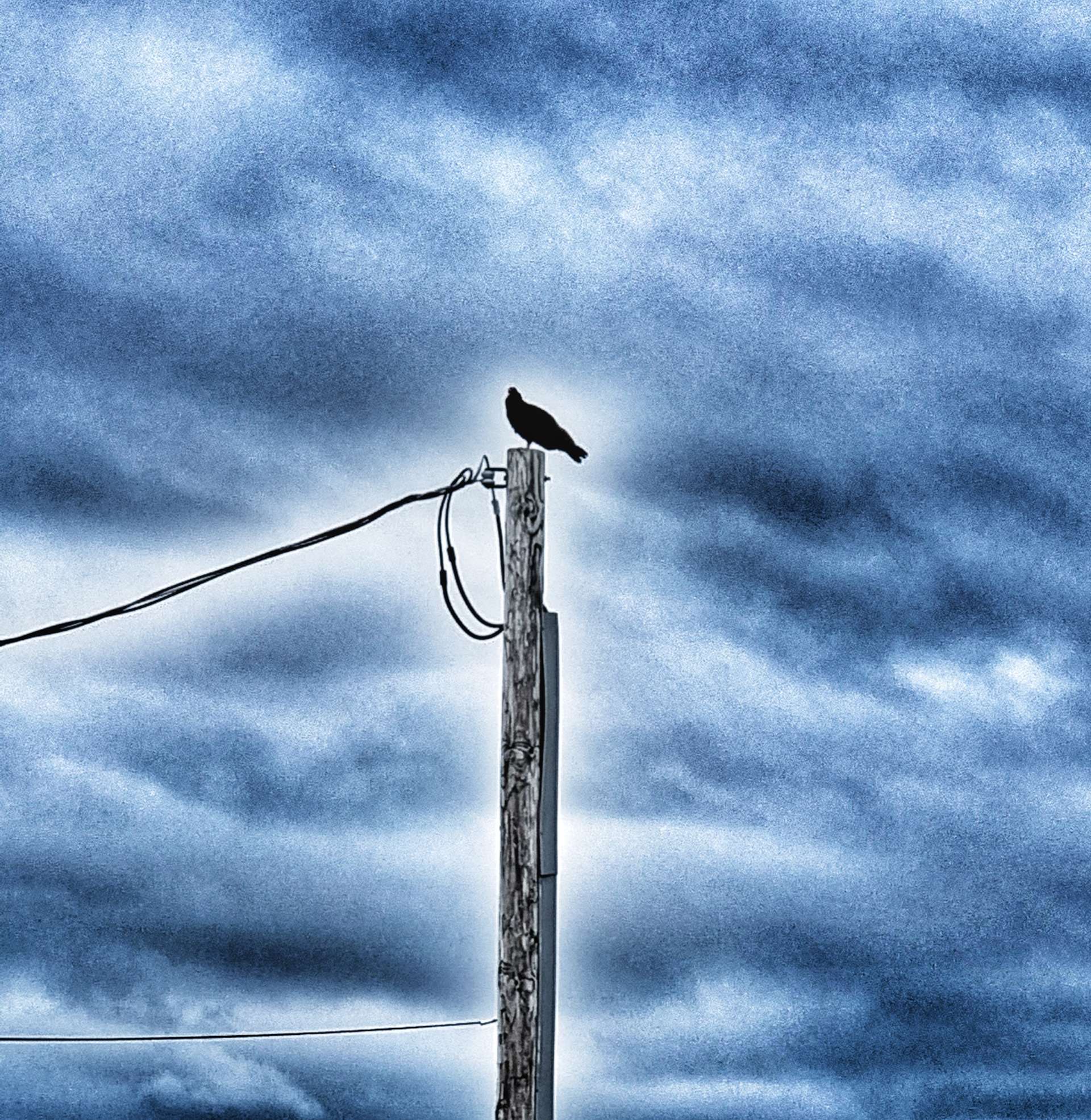
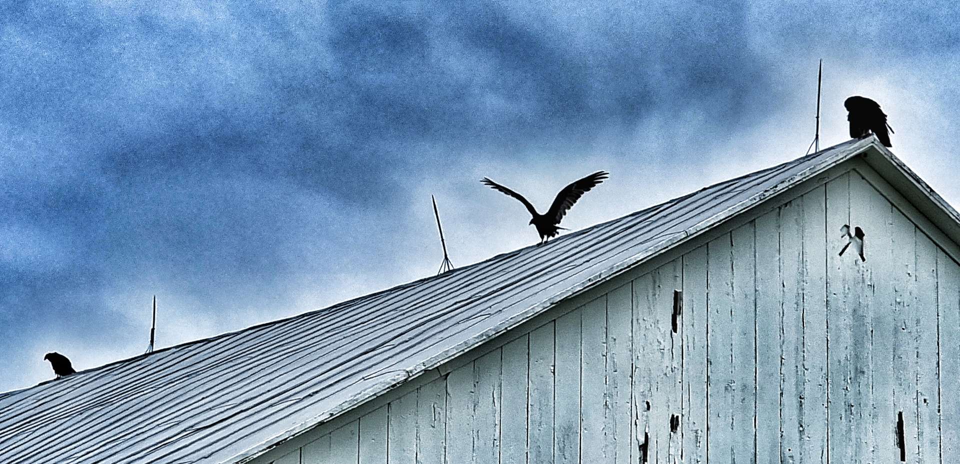
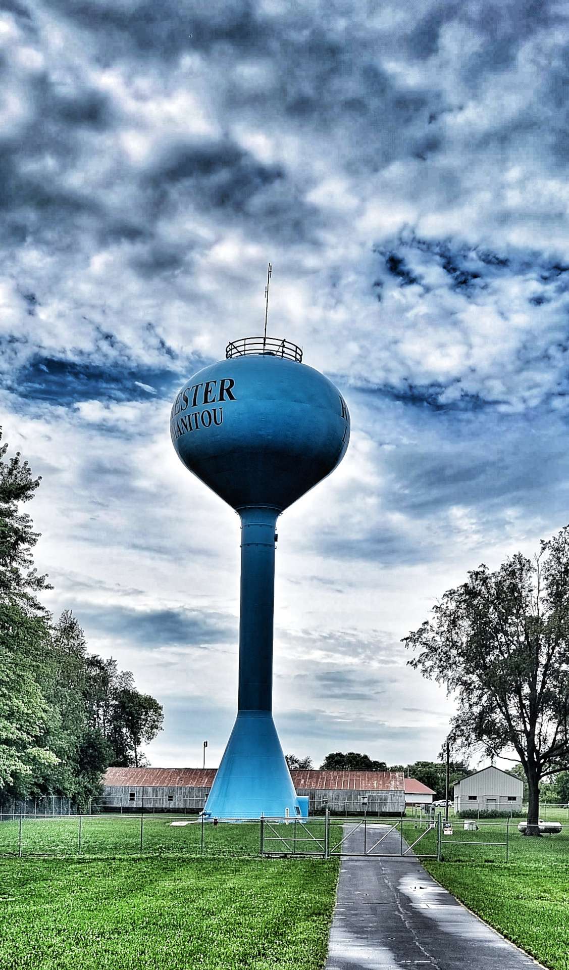
Gibsonburg also came up trumps with its water tower – a unique colour that appears to also attract the turkey vultures. In addition to the birds roosting on the water tower, we saw a solo bird on a telegraph pole & just across the road were 3 more (so a committee) perched on a barn roof.
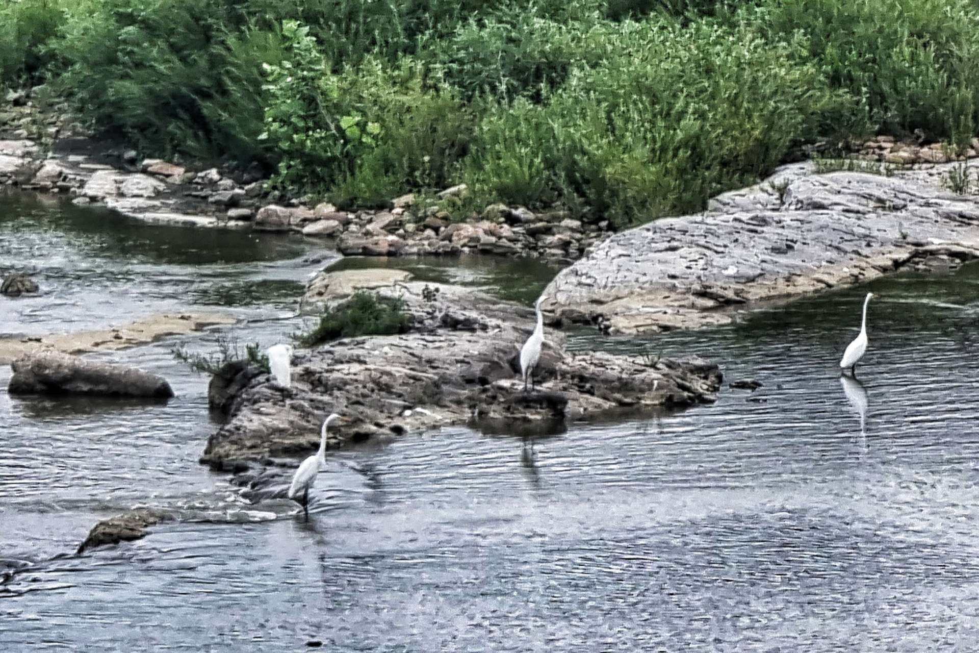
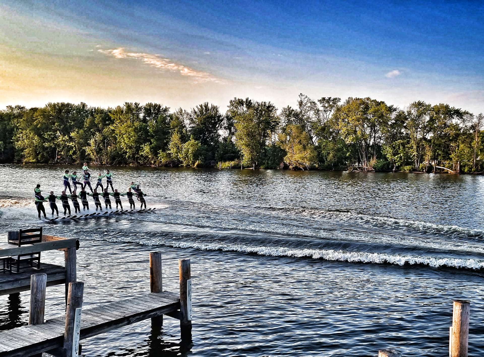
3 treats in very rapid succession & there was more to follow. When I saw purple flowers calling out for an action shot I gave it all I had & managed not to fall off as I demonstrated my “look, no hands” skills! We also spotted our first non-ninety degree corner of the day & then soon after saw ospreys & egrets fishing as we rode into Fremont. This was our 2nd Fremont, as it’s also where we saw the water-skiers when we were in Wisconsin.
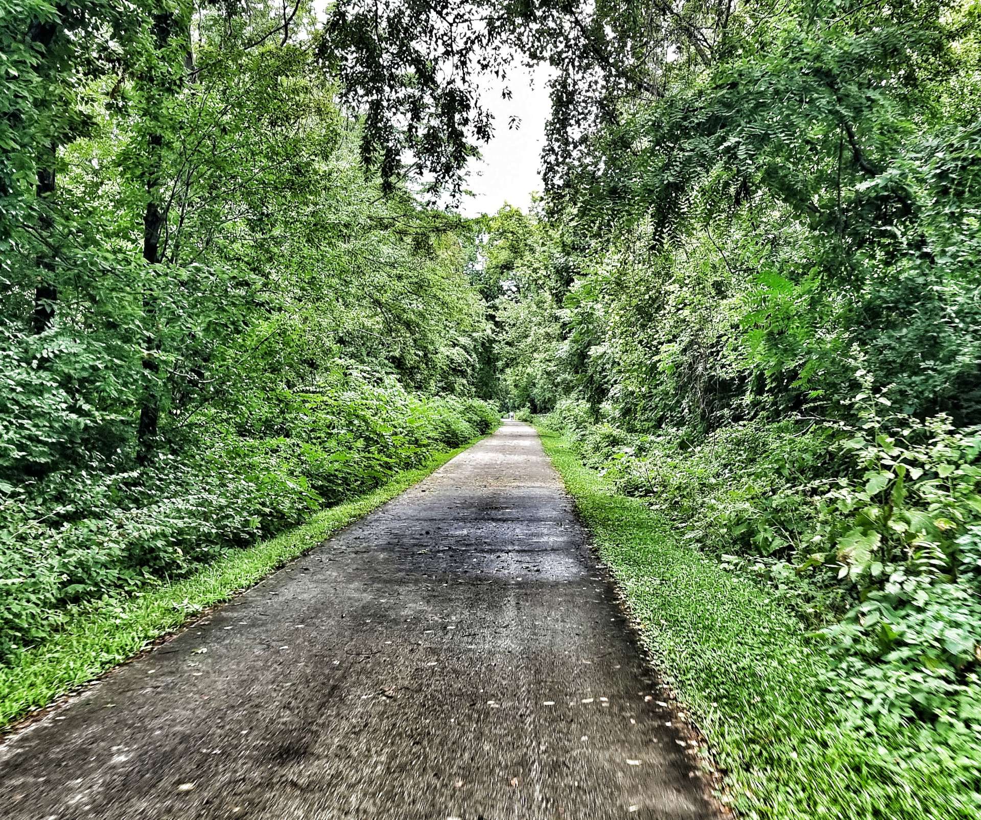
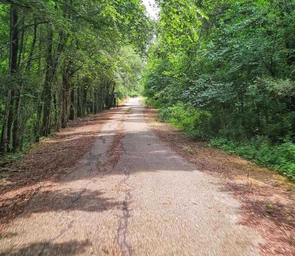
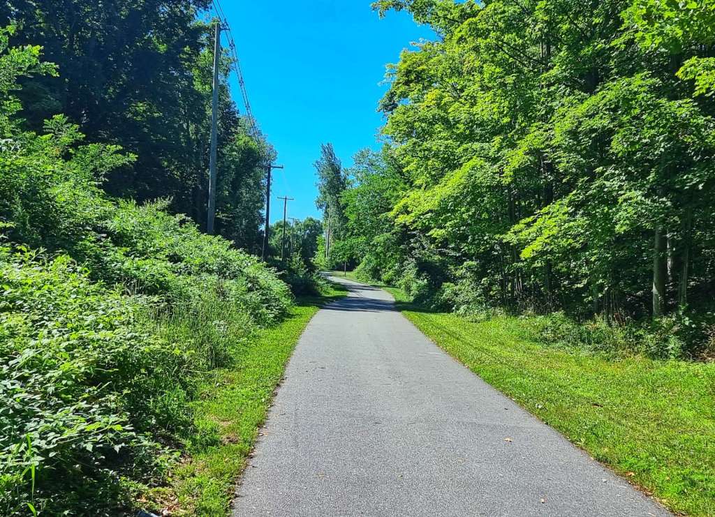
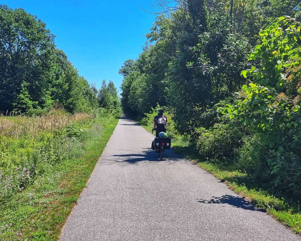
Fremont is also where we picked up the Northern Coastal Inland Trail (NCIT). It runs for 65 miles in total from Toledo to Elyria on the abandoned Toledo, Norwalk & Cleveland Railway. We rode the 13 mile paved section from Fremont to Bellevue & had the trail almost to ourselves as we passed through wooded areas & farmland.
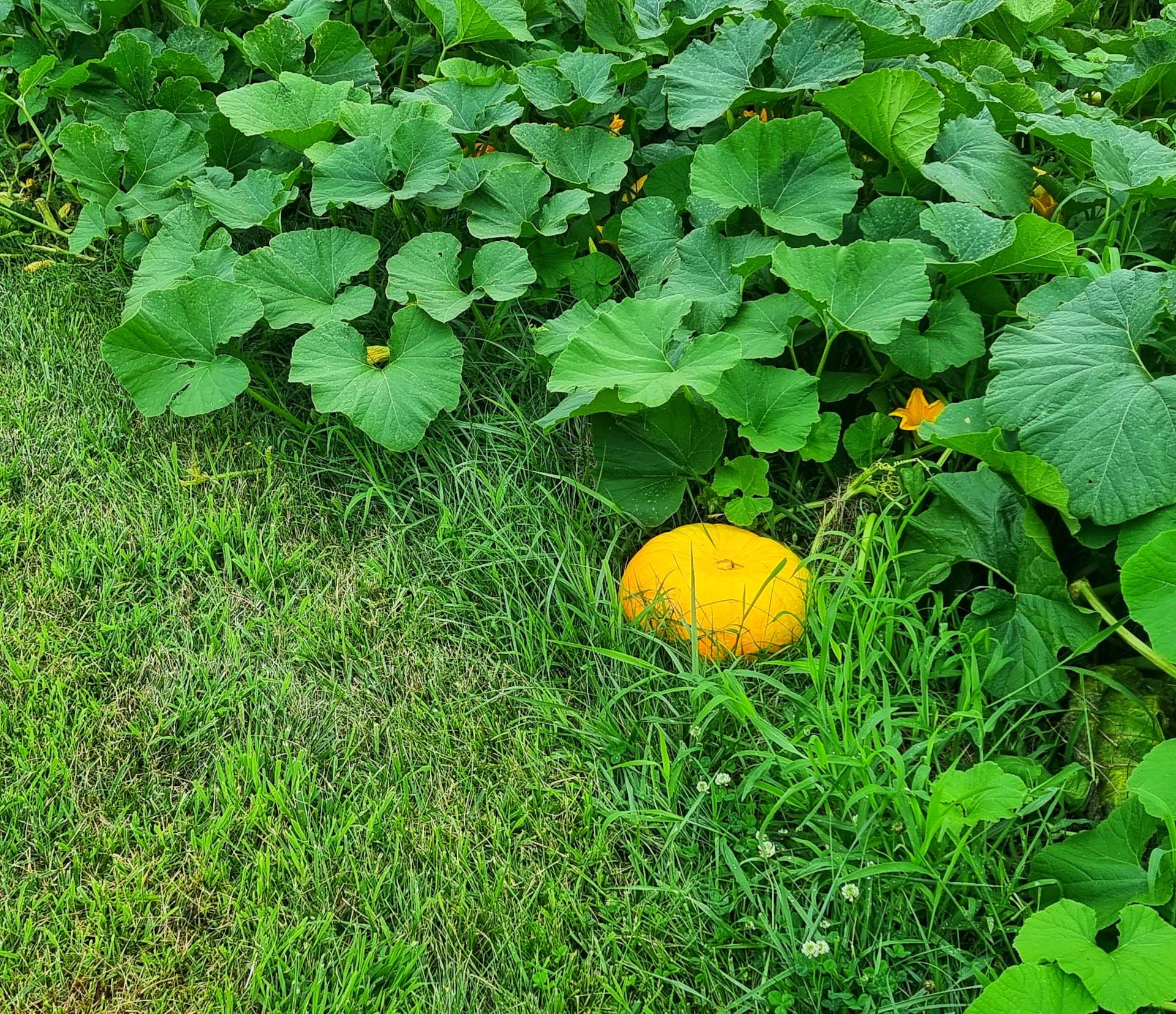
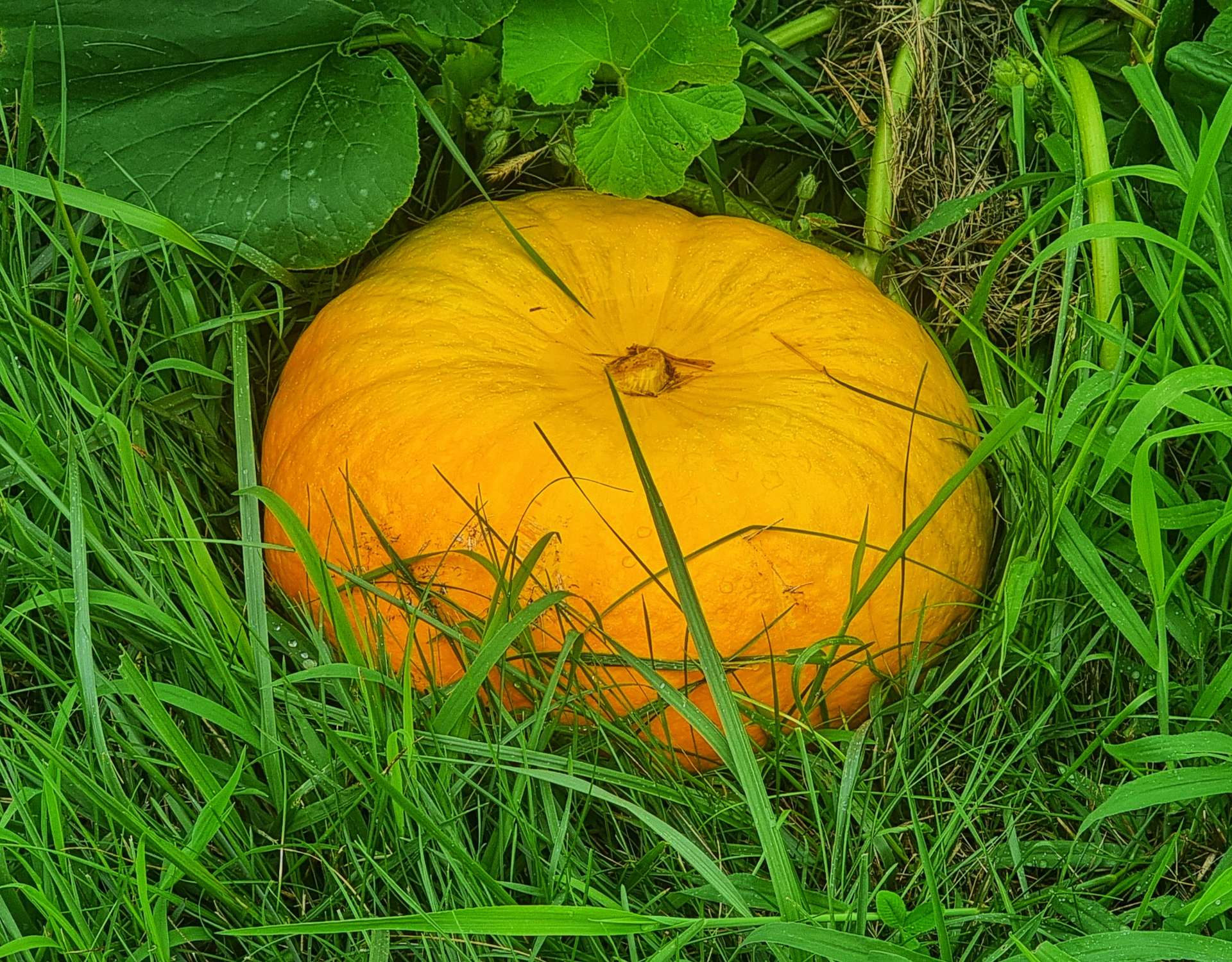
As we neared the end of the paved section we came across a pumpkin field – a reminder that although we’re still in August, Fall is only just around the corner! I missed a turning in Bellevue, so it took us a bit longer than it should have to get across town. Once again, good came from this error, as we arrived at the railroad crossing just in time to watch the freight train pass through.
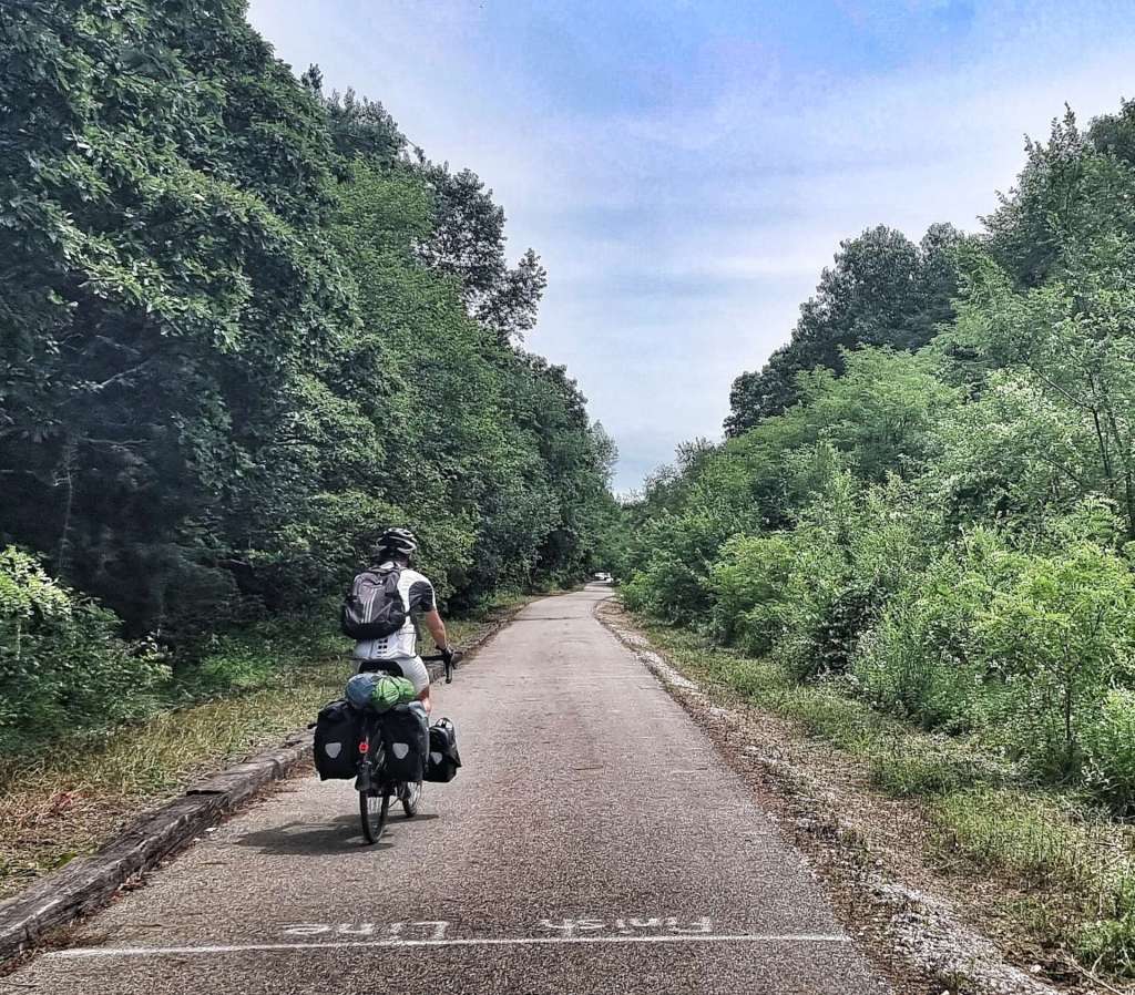
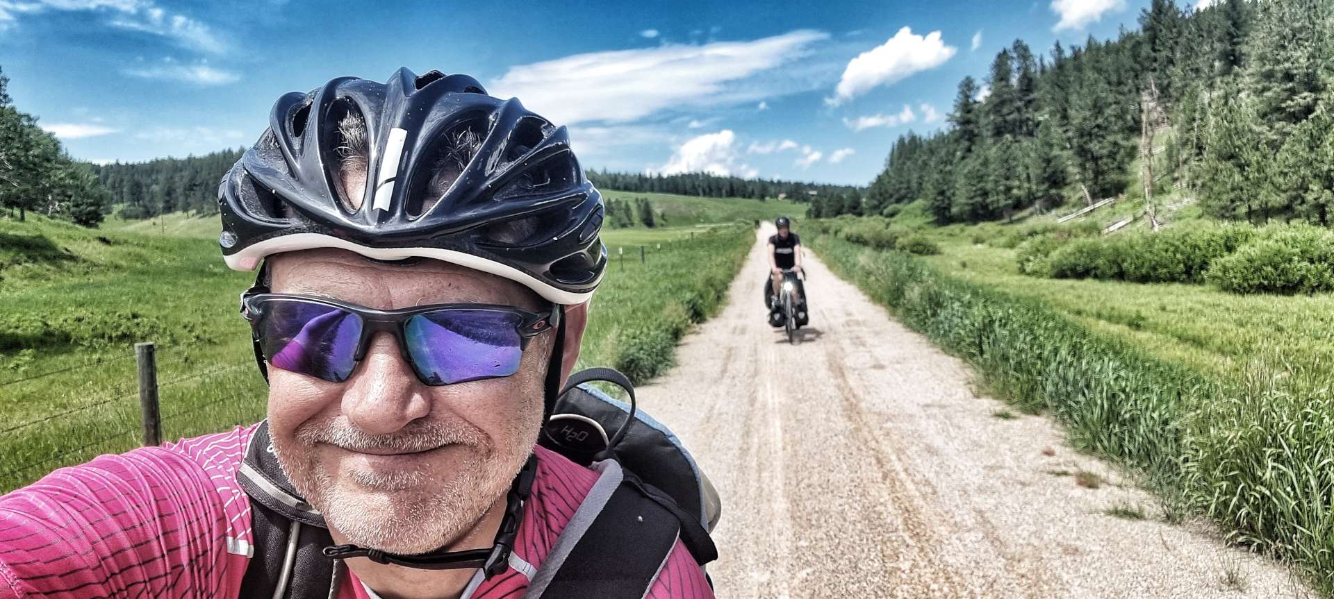
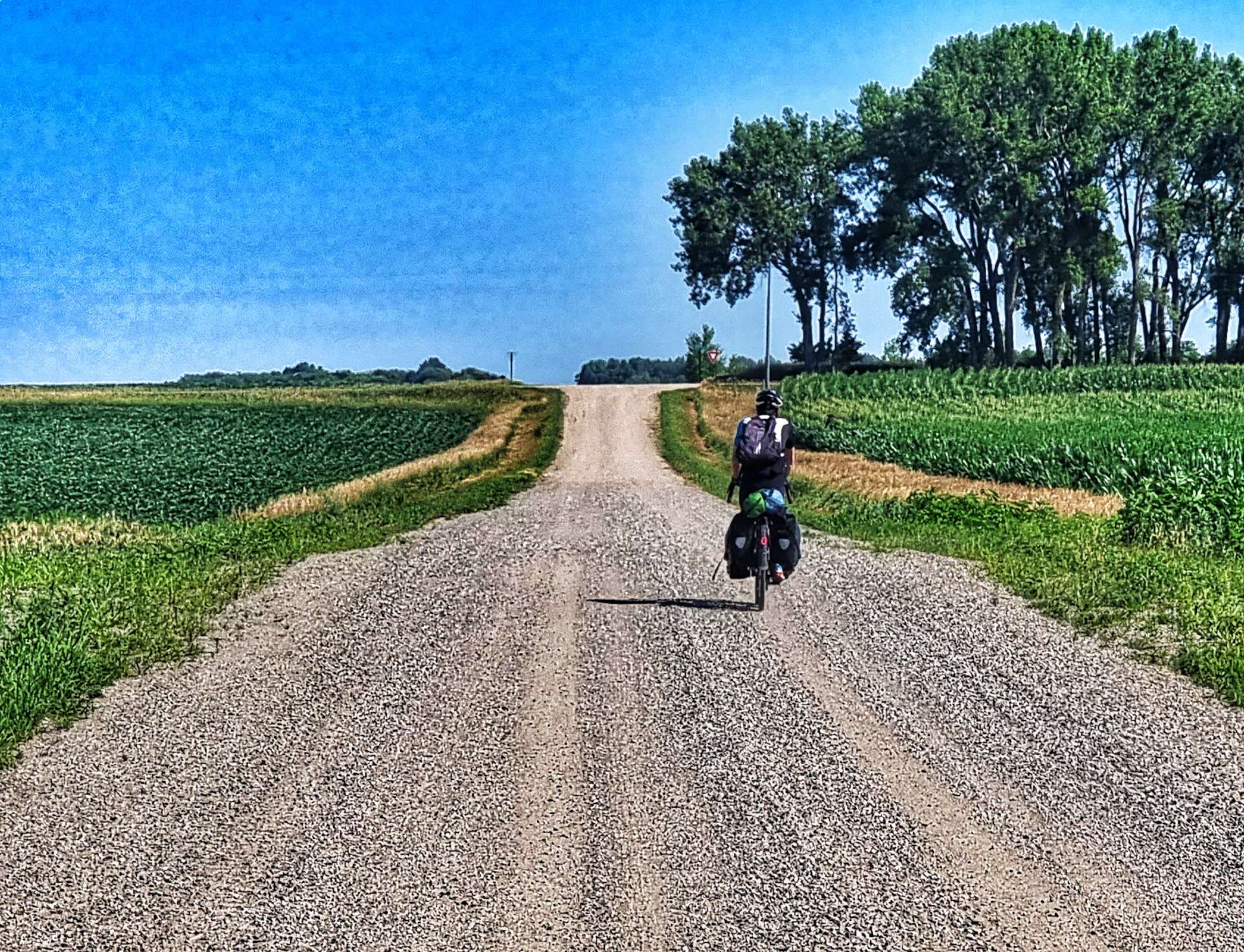
This was also where we picked up an unpaved section of the NCIT – the surface varied between crushed limestone, mud (which was a bit soft after yesterday’s storms) & gravel. I’ve come to really enjoy riding on the off-road trails, now that I’ve learned how to handle a fully loaded bike off-road. The 10 mile section took us all the way to Norwalk, where we were staying this evening.
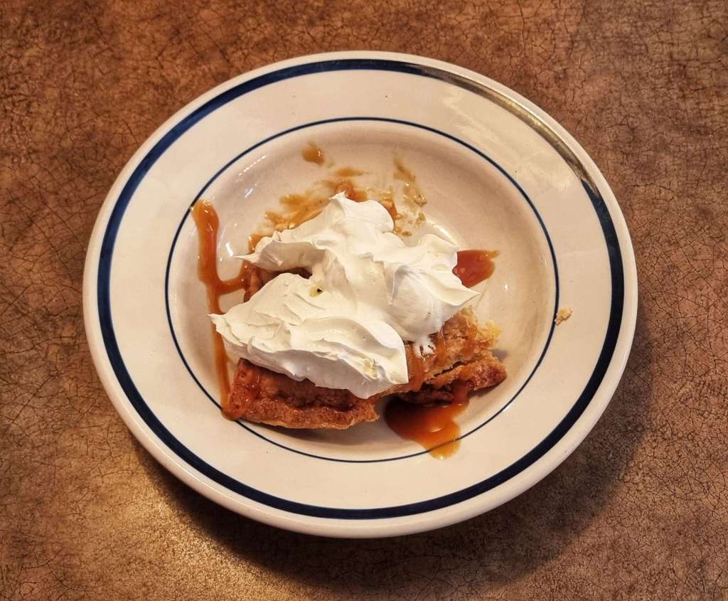
It was another epic day in the saddle, where we stayed dry – the forecast rain never arrived! We had dinner at Bob Evans Family Restaurant & I had a really good portion of fish & chips, followed by a delicious slice of apple pie, topped with caramel sauce & whipped cream. The perfect end to the day.
Stage Stats – 71 miles, 384 feet of climbing. Highlights included a crop sprayer exhibition, plenty of different birdlife & the Ideal Bakery stop in Gibsonburg!
Wednesday 10th August – Norwalk to Lakewood (Stage 78).
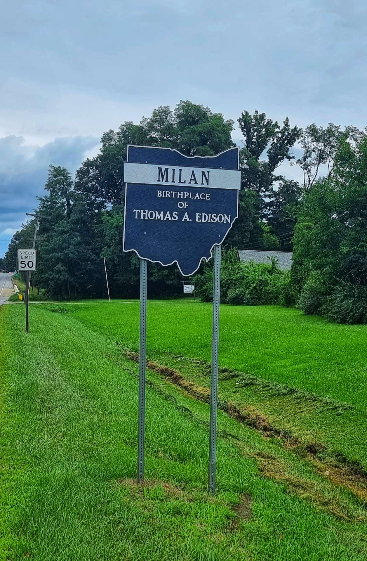
It was another overcast start to the day as we set off from Norwalk. I saw signs for Berlin Heights, Birmingham, Peru & Brighton, so I shouldn’t have been surprised when I saw we were going to Milan. It’s the birthplace of Thomas A Edison, inventor of the incandescent lightbulb, motion picture camera & the phonograph. He’s also credited with improving the telegraph & telephone.
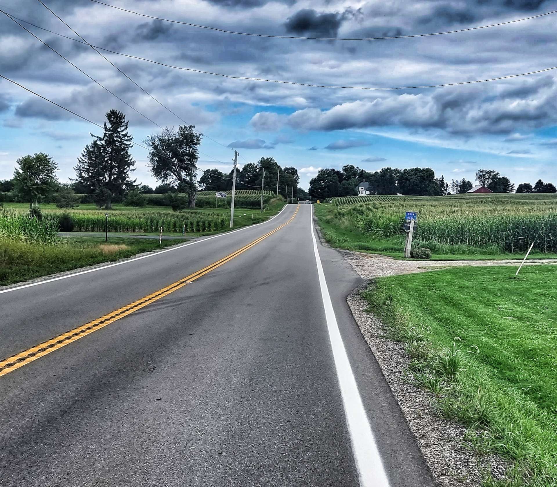
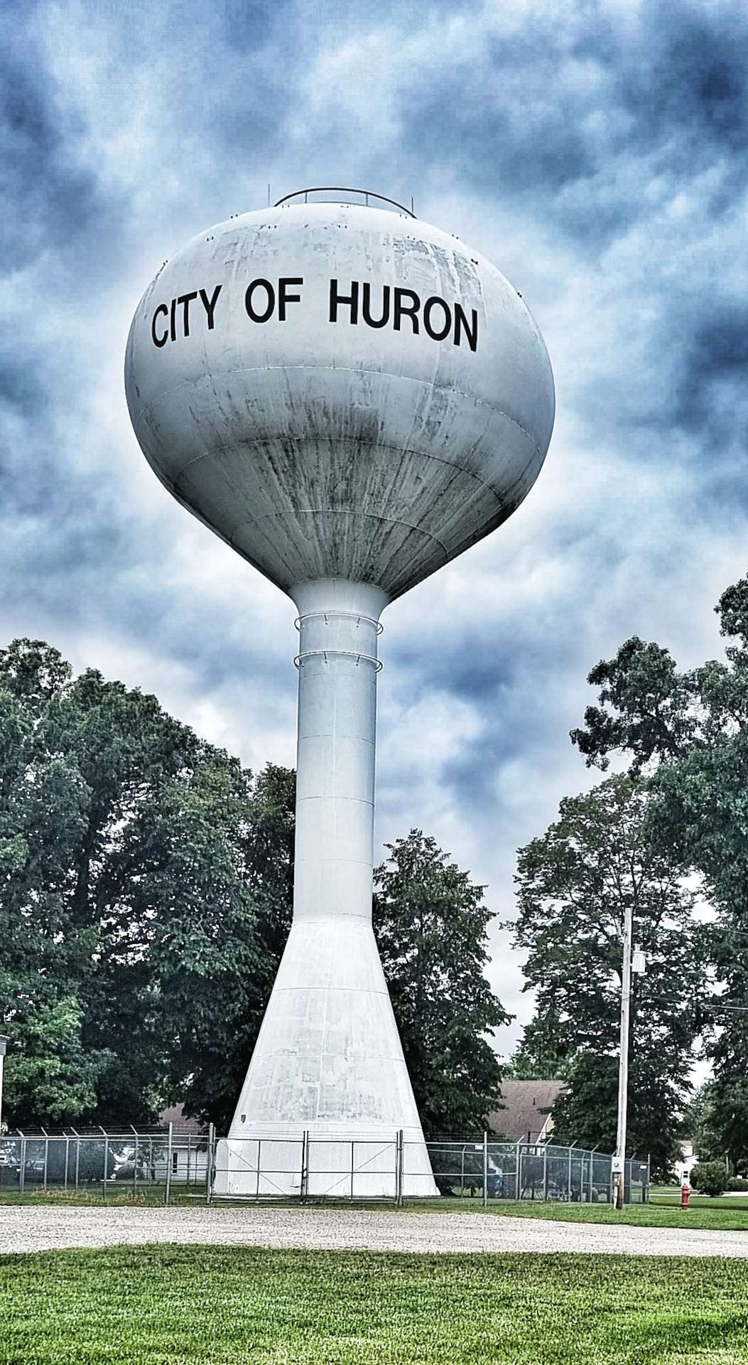
We continued North on relatively quiet roads as we headed towards Huron, which nestles on the South shore of Lake Erie. We’ll be tracking the lakeshore for the next 5 days as we make our way ever Eastwards – fingers crossed we find something interesting at the end of the lake!
We’re following the Lake Erie Circle Tour & Coastal Ohio Trail, both of which are road routes (with one or two sections of cycle paths). I’ll briefly mention that this section as far as our coffee stop included long sections of roadworks & relatively busy roads – never anything to be concerned by, but after 15 weeks of having the road to ourselves, we had to concentrate a bit more.
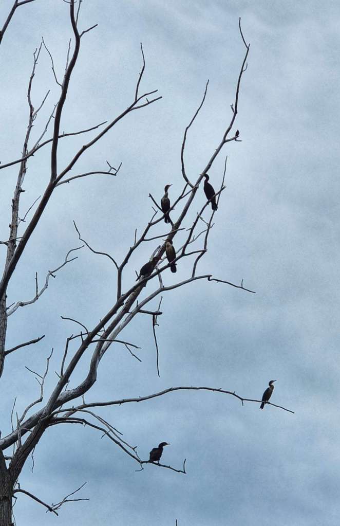
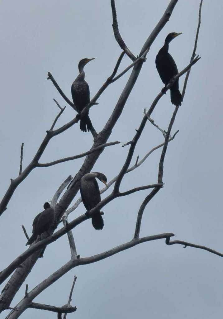
Having said that, we still found a few overlooks & turnouts where we could get good views of the lake. We also saw a group of birds perched in a tree – they had the shape of a heron or egret, but I have to confess I have no idea what they actually are. I just enjoyed stopping & watching them.
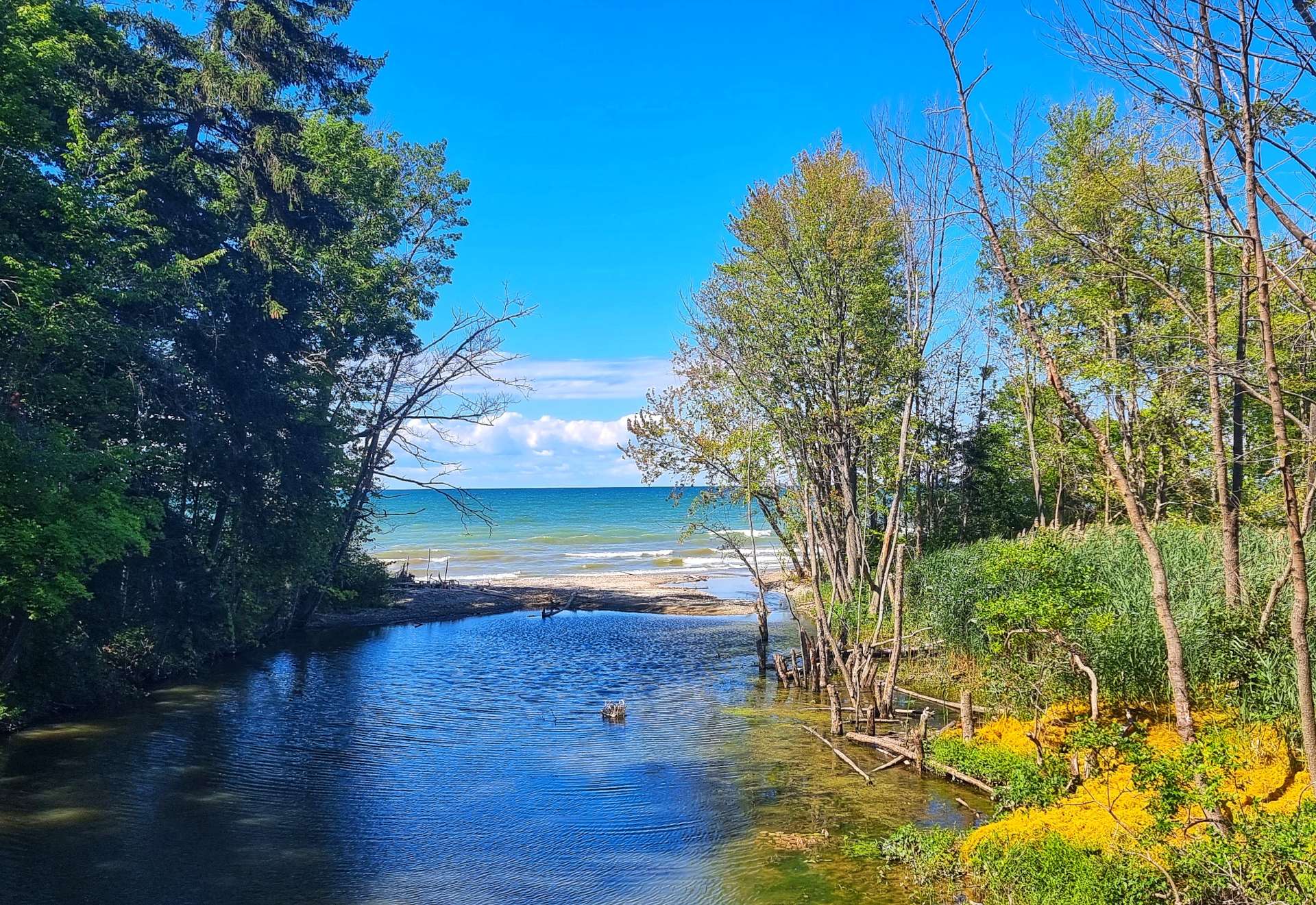
Our views varied every time we saw the lake. Sometimes it would be a sandy beach, then it would be a rocky outcrop, then next time it might be an outlet from a small river.
Lake Erie is the fourth largest of the five Great Lakes by surface area, but the smallest if measured by volume, with a maximum depth of 210 feet (62 feet average depth). However, it’s still the eleventh largest lake in the world by volume! It’s 241 miles long (East – West) & 57 miles wide, with a coastline of 872 miles.
While Lake Michigan takes 99 years for water to leave via the Mackinaw Straits, water only stays in Lake Erie for 6 years. Lake Erie has more consumable fish than the 4 other Great Lakes combined!!
Lake Erie also has its own monster – Bessie is her name. Legend has it that she’s a mutation of missing cows from the town of Lorain in 1894, or more likely she’s a large sturgeon, which can grow up to 20 feet & weigh 300 pounds. A bit like her Trans-Atlantic cousin Nessie, everyone loves a good Lake Monster story!
Where was I? Oh yes, heading along the shore past Beulah Beach, where I spotted an osprey flying over a park. By now, the grey skies were beginning to give way to sections of blue.
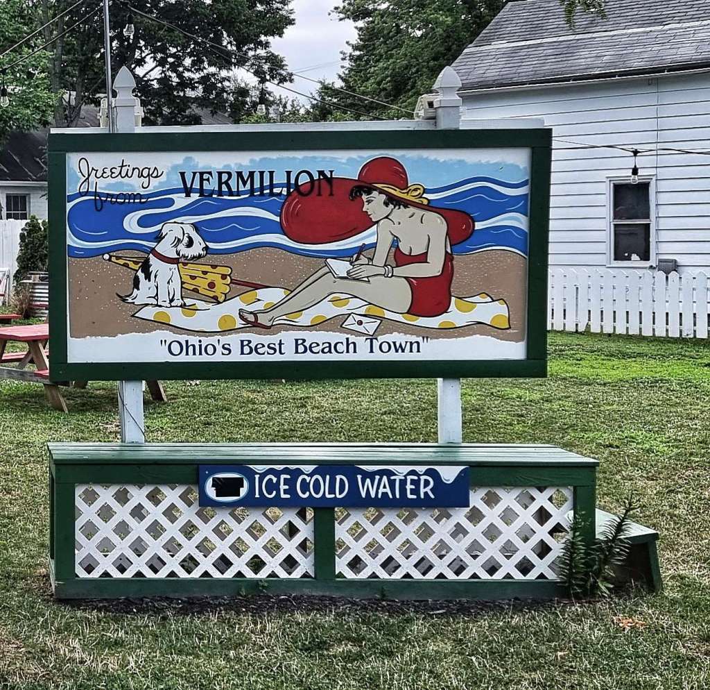
Arriving at Vermillion, which proudly declares itself to be Ohio’s Best Beach Town, we saw a few of the houses & boats which certainly suggest Vermillion has money, even if it’s lacking in humility! Roadworks were a theme along this stretch of road too, but at least there wasn’t much in the way of traffic.
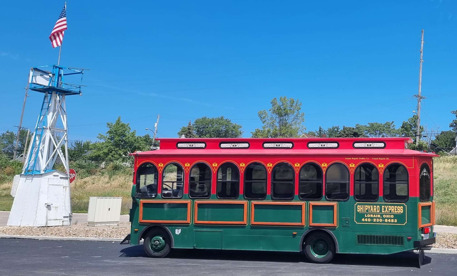
We were heading to Lorain for coffee & cake, passing the city beach & crossing the river on the way! The shipyards closed in 1981, after the William J DeLauncey was launched. It was & remains the largest freighter on the Great Lakes at 1,014 feet in length. The fourth photo below also includes one of the first boats to be built at the shipyard in 1898, the 450 foot Superior City which was the largest steel ship built on freshwater.
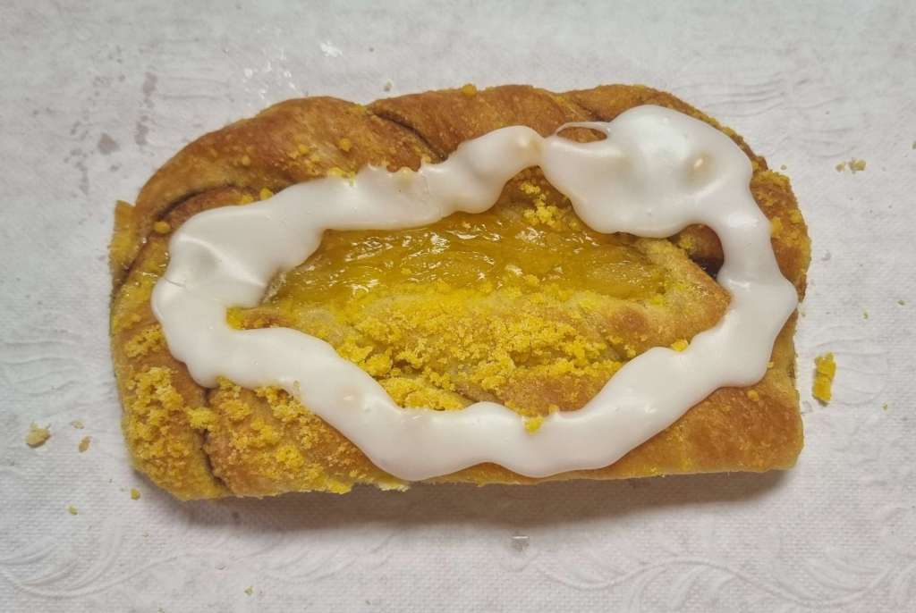
The building itself has been renovated & is now an event centre, with a coffee shop – another gem of a find, I could decide between a cherry Danish & an apple & caramel slice, so had them both!
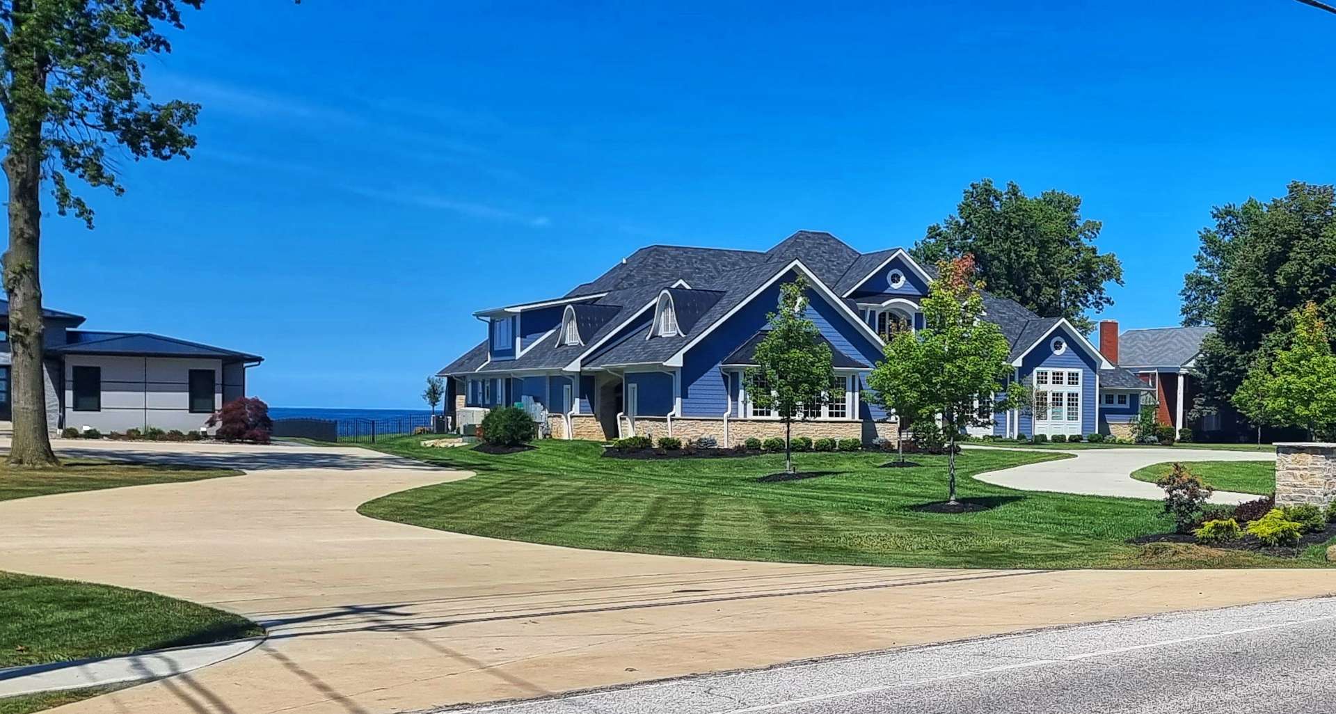
Throughout the day, views of the lake were quite rare, I’ve probably included a photo from most of the places I stopped. As with Lake Michigan, shorefront property is highly prized & sought after. I’ve included a couple of the smaller places that I could see, there were many others, hidden away behind gates & protective shrubbery.
I stopped at Bay Village as there was what appeared to be a lighthouse. It transpired that it was in fact a pump house from when the park was in private ownership. It enabled water to be taken from the lake for a swimming pool many years ago! It’s now a concession stand selling food & drink.
This was also the first beach to offer views of the city of Cleveland way off in the distance – hopefully I’ll get some decent photos tomorrow.
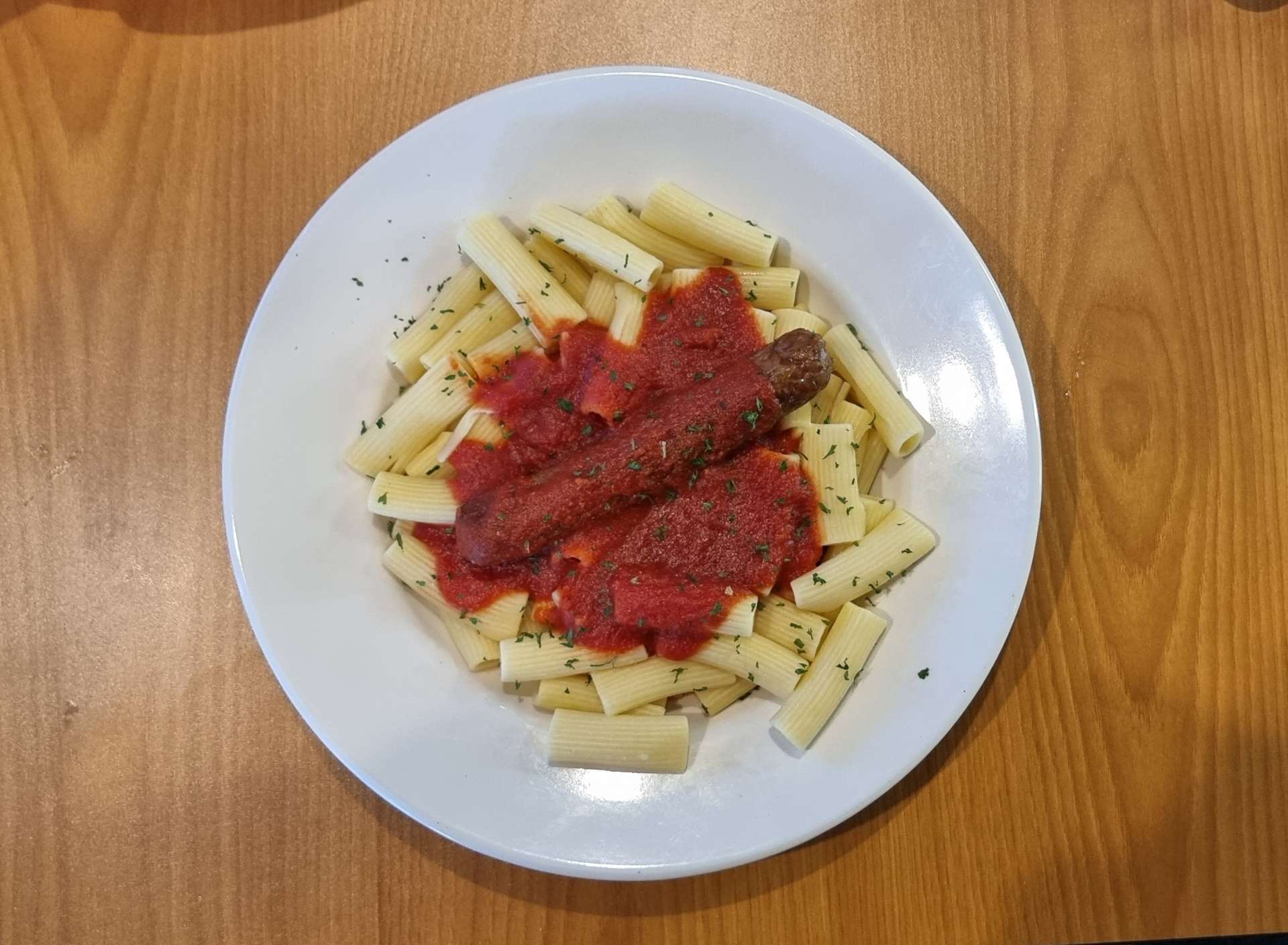
We cycled the final 5 miles to our motel, had a rest & got ready for dinner – a small little Italian pizza / pasta place that fitted the bill. When I ordered the rigatoni with sauce & Italian sausage, I was expecting it to be cut up! While some people (Andreas) would seriously mark down the food because of presentation, I’m guided solely by taste & it was a good 9 out of 10. We toasted another great day exploring a Great Lake!
Stage Stats – 56 miles, 823 feet of climbing. Our first view of our second Great Lake.
Well, How Did We Get Here? Miles, Feet Climbed, Maps & Profiles.
Previous updates described how we travelled from Seattle in Washington to Ludington, Michigan in the first 13 weeks of our adventure. Now find out where we went & what we did in Week 14! Hopefully picking a single photo to represent each day will refresh my mind when it comes to looking back on my adventure!
On Saturday we commenced our journey down Lake Michigan, via several Rails to Trail cycle paths. Turkeys offered a tribute to the album cover of Abbey Road by The Beatles on Sunday, as we continued our way south & on Monday we said goodbye to Lake Michigan for the last time, as we crossed into Indiana. We briefly dipped into Amish country on Tuesday, while Wednesday was a rest day, which gave me the opportunity to get my hair cut & get my Blog up to date. On Thursday it was all about the Turkey Eagles at Salamonie Lake & Dam, while Friday provided us with another all-American coffee stop at the Past Time Cafe as we entered Ohio.
The biggest mileage week yet of our Coast to Coast adventure.
Week Fourteen – Ludington (MI) to Defiance (OH) via Indiana
Thursday 4th to Saturday 6th August – Stages 74 to 76.
Thursday 4th August – Rochester to Huntington (Stage 74).
Yesterday was a rest day & I did 3 things of note – got some of my blog posts drafted for use over the weekend, planned the next few days of riding & had a haircut. I’m sure wearing a cycling helmet for over 3 months has expanded my bald patch!! Thanks Syd, I love it. You did a great job with very limited natural materials!
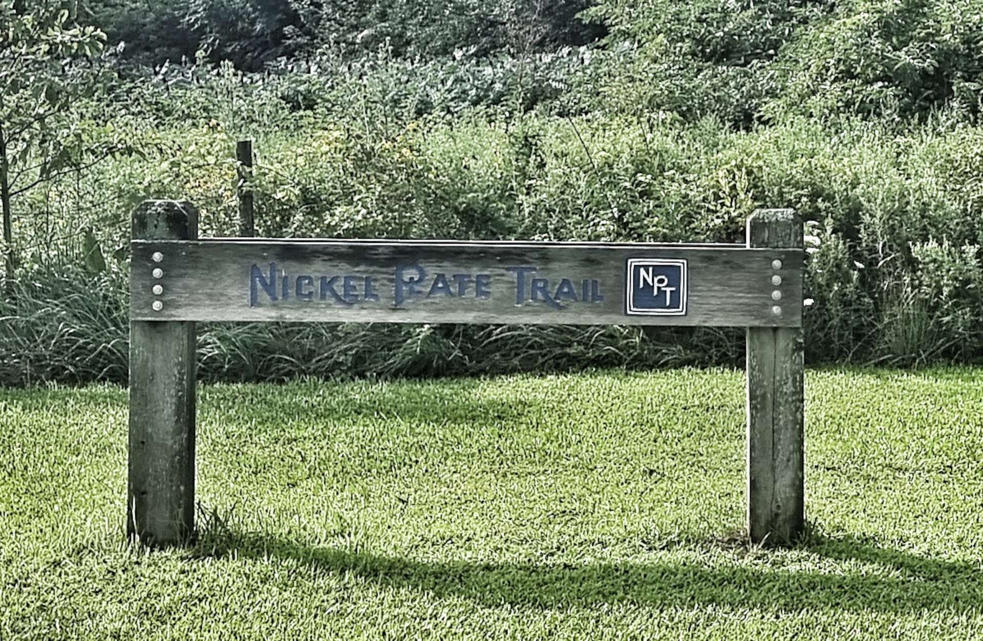
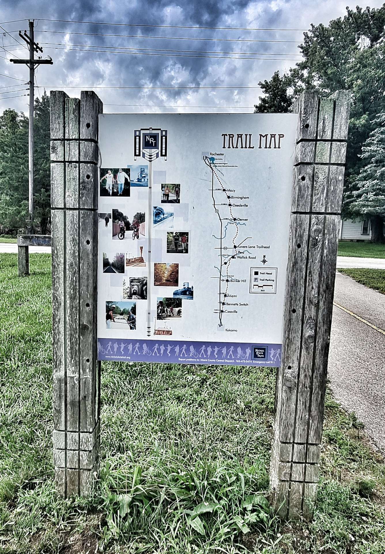
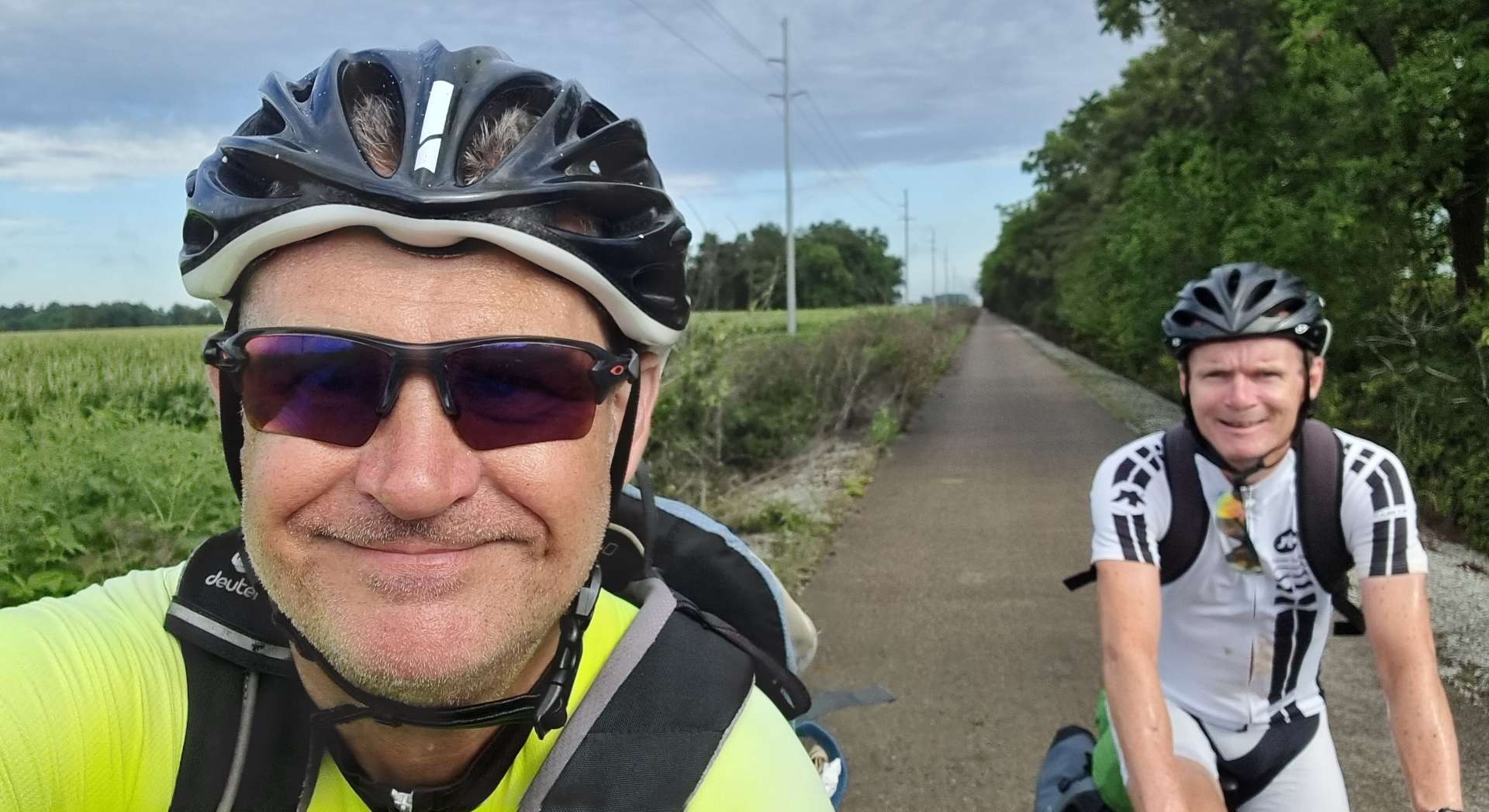
We had another 70+ mile day in the saddle planned, so were on our way by 9am, passing the city’s water tower on the way to picking up the Nickel Plate Trail. This is another Rails to Trail initiative & the 40 mile paved cycle path connects Rochester to Kokomo via the old Norfolk Southern Railroad route.
I was interested in how the name came about & after a bit of digging around on the internet, I can now share a little of its history – it’s nothing like I was expecting. The railroad passed through New York, Chicago & St Louis (NYCL) & generated vast sums of money for each of those cities. In the 1920’s, the editor of the Norwalk Ohio Chronicle described the NYCL railroad as being nickel plated (meaning it was guaranteed to make money, as well as being a pun on the American 5 cent piece) & the name stuck.
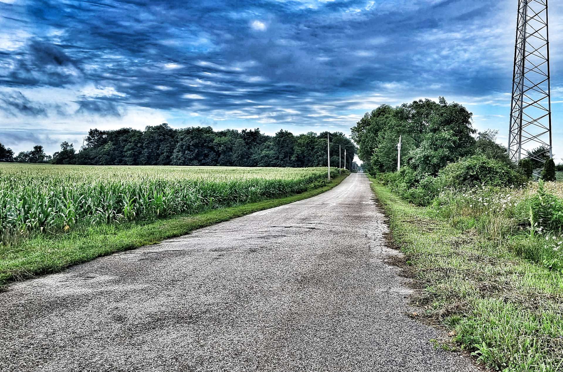
We only rode the first 15 miles of the trail as far as Denver, but that was enough to see how much care & attention had be spent on making it just right. There were trail maps at every trailhead, so you always knew where you were. The path took us along the edge of farming land, small residential outposts & through small pockets of woodland.
I was looking forward to reaching Denver, as it would put us back on the Adventure Cycling Association maps that I bought before we started our adventure. However, Denver Main Street was no more, as construction was underway to relay 3 miles of tarmac. Luckily, one of the workmen told us how to detour round town & get back onto the road further along.
The skies had been closing in since we set off from Rochester & about 20 miles into the ride we felt the first spots of drizzle begin to fall. The temperature had remained in the mid-70’s, so we were happy enough carrying on riding in just our shorts & short sleeved jerseys as we continued on our way between the soya bean plants.
There were a couple of unexpected surprises, firstly we passed a Christmas Tree farm that appeared to be in the middle of nowhere & about 30 minutes later we spotted a house with a statue that looked like it was Birdman from Flash Gordon – needless to say we then did awful impressions of Brian Blessed’s character Prince Vultan shouting “Gordon’s Alive”, as well as singing the Queen theme tune. 15 weeks on the road has turned our brains to putty!!!
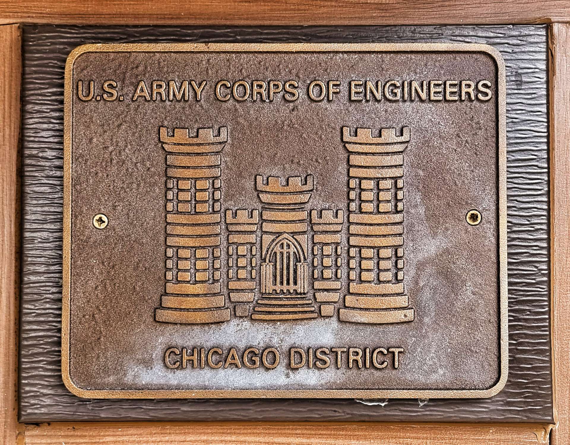
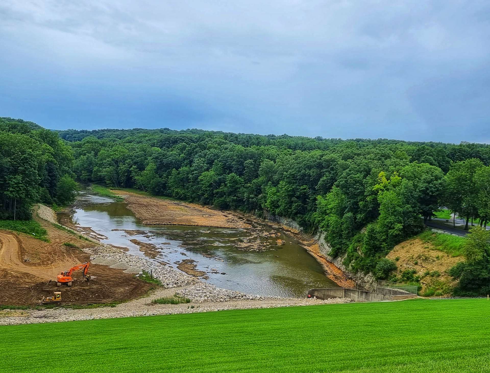
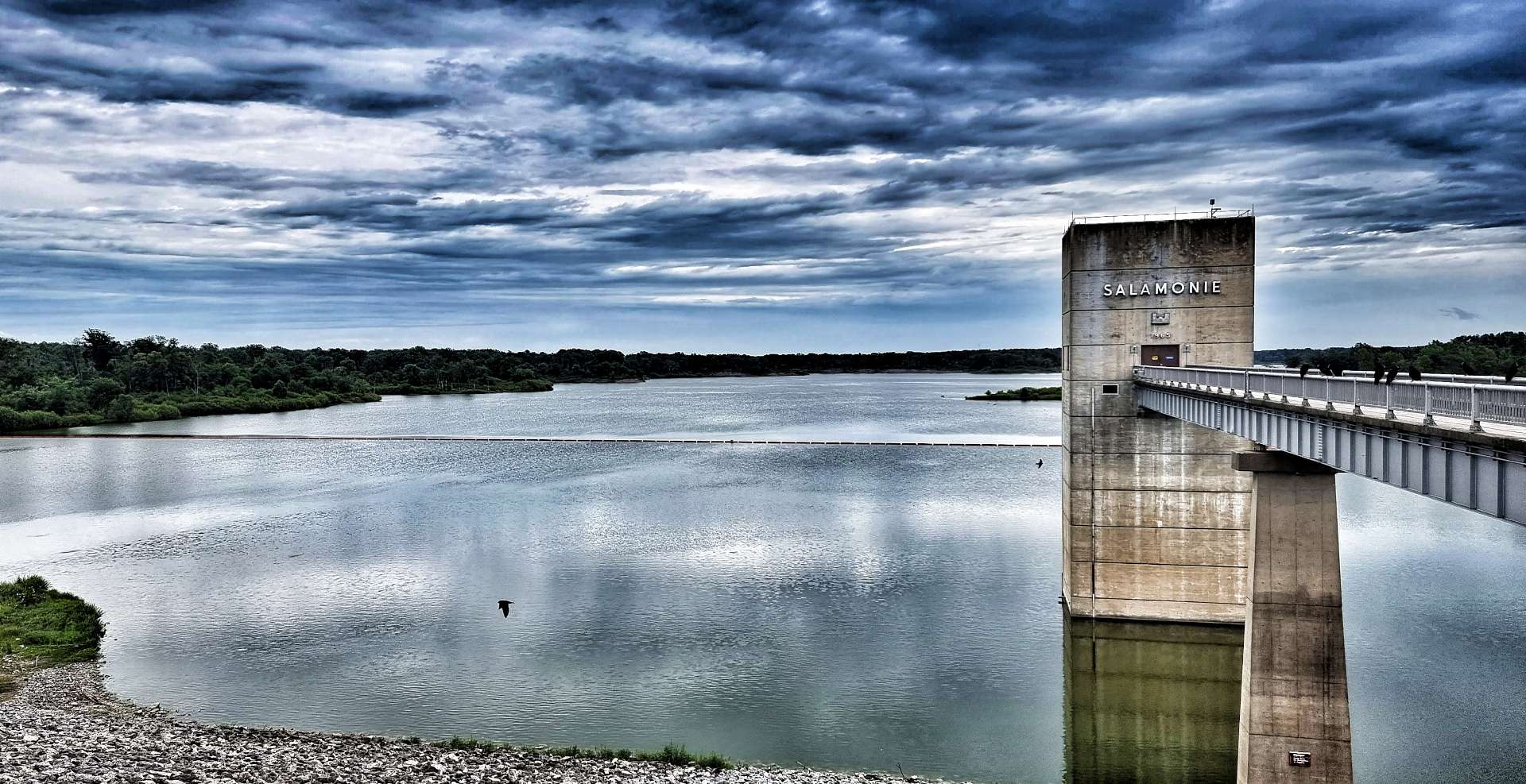
The ACA route recommended taking a side trip to visit the Dam on the way through Salamonie State Park. Fresh tarmac had been laid in the last couple of weeks & we fairly whizzed down the descents as we followed the river. The Salamonie Dam was constructed in 1966 by the US Army Corps of Engineers (you may remember that they also constructed the complex Locks & supports for St Anthony Falls in Minneapolis). The dam is 6,100 feet long & 133 feet high.
In 2012, Indiana was experiencing a severe drought & the Salamonie Lake receded, uncovering Monument City, one of 3 small towns sacrificed in 1965 to create the lake.
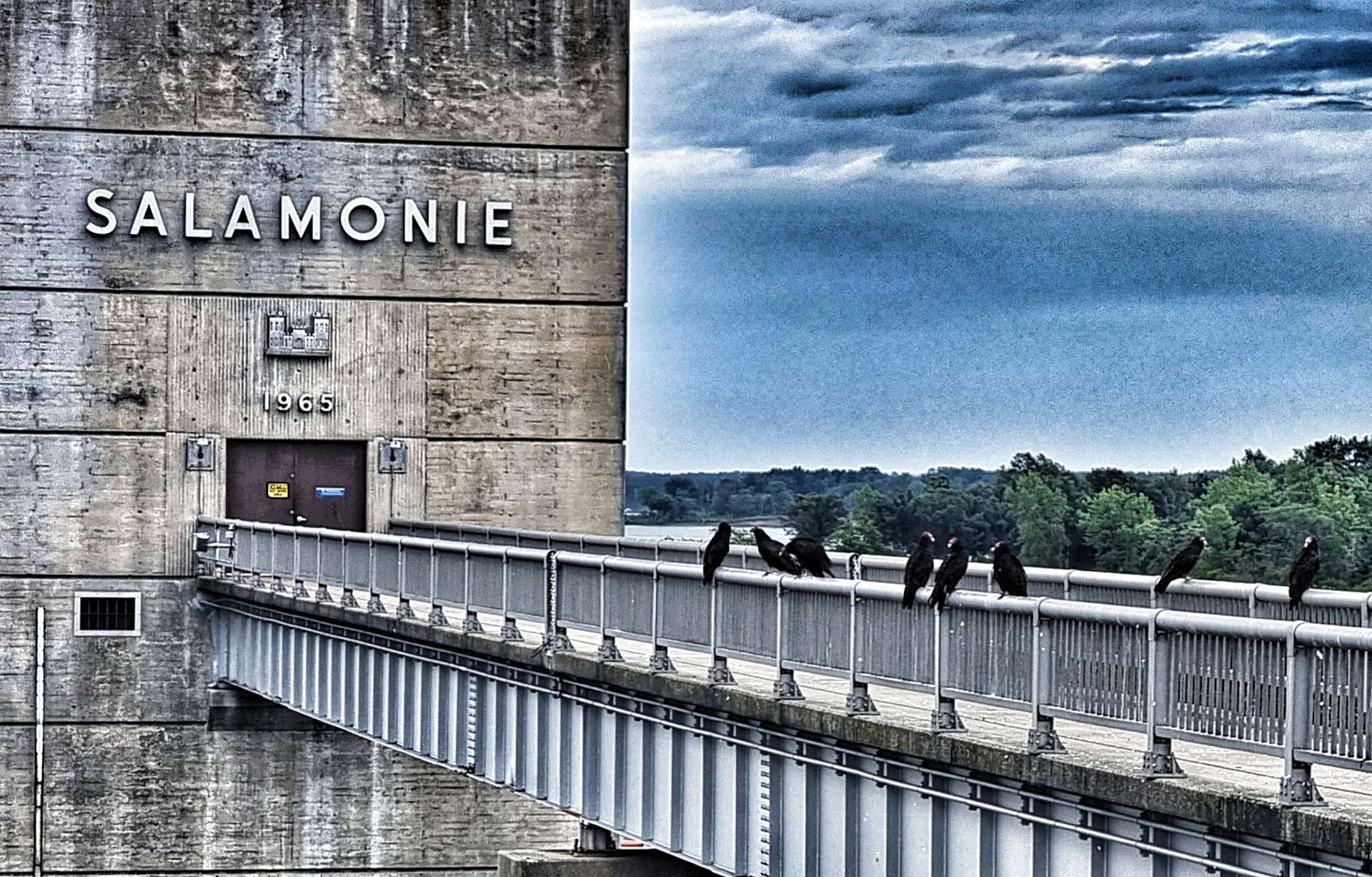
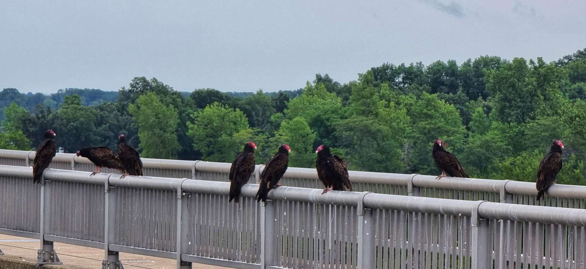
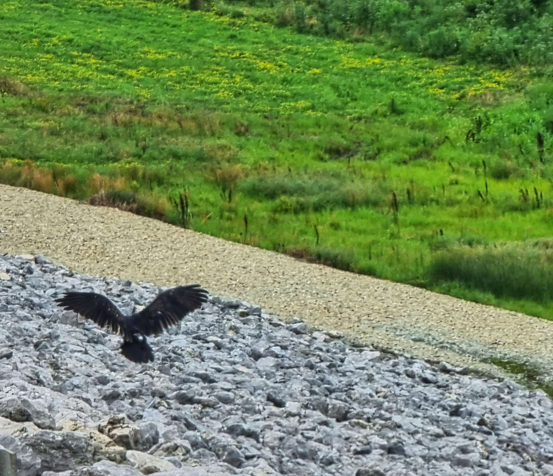
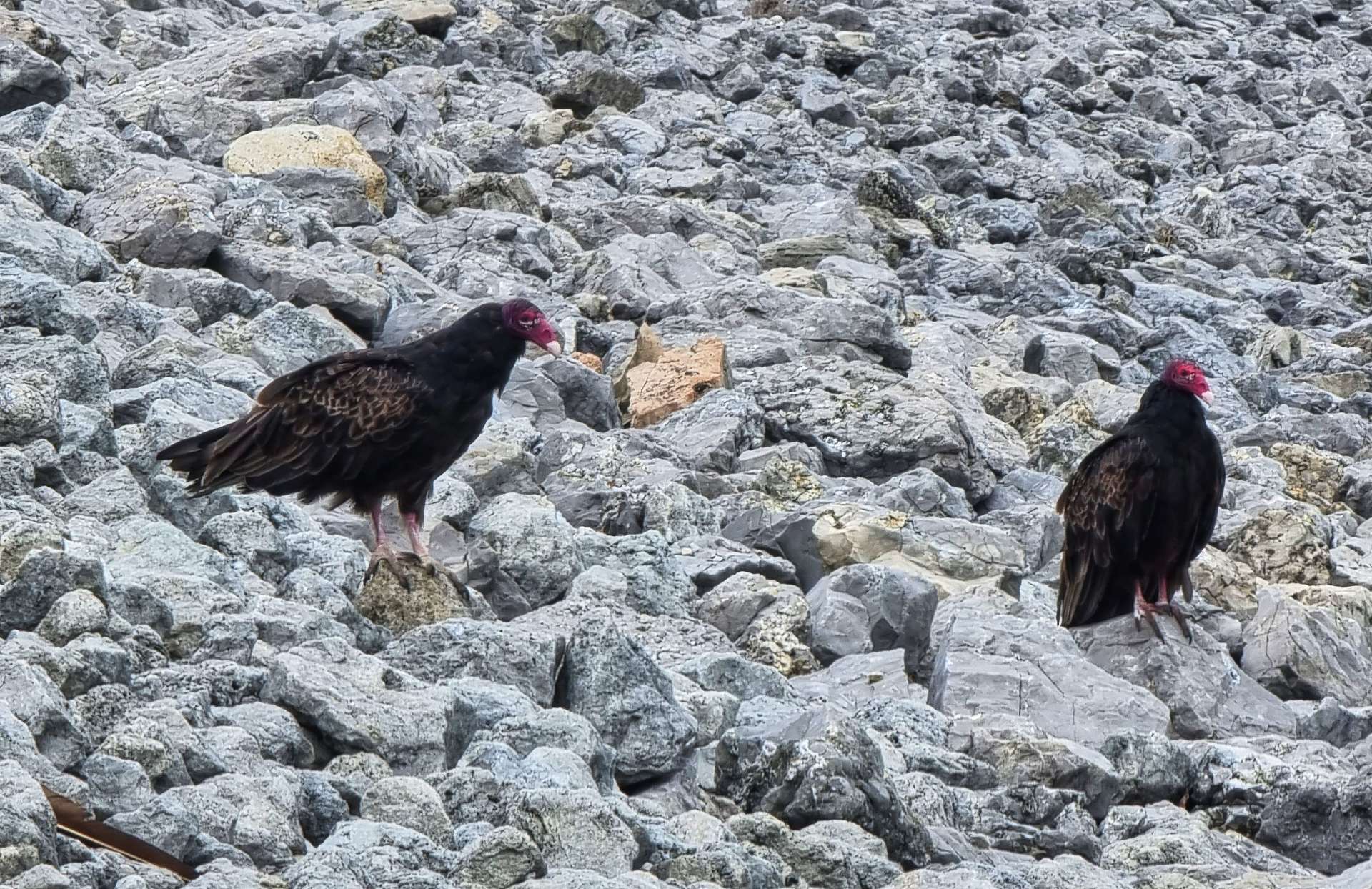
However, this wasn’t what held our attention today, interesting as it was – you may see some small black blobs in the railings in the photo above. There was a wake of 8 turkey vultures perched on the dam railing & they seemed totally unimpressed by 2 skinny Brits in cycling kit stopping to gawk at them.
Just a hundred yards or so along the dam, there were a few committees of turkey vultures with between 3 & 6 birds all congregating on the stones. We were just missing a kettle of them flying, but seeing so many birds in such a small area was a rare treat. A little known fact is that turkey vultures have feet that resemble chickens rather than other birds of prey. As a result they normally feed off carrion that has been dead for between 12 & 24 hours. In desperate times they will hunt small reptiles & rats, but this is quite uncommon.
We stopped briefly in the State Park Visitor Centre, where we learned that this is one of 3 interconnected dams & reservoirs that provide flood protection to the Upper Wabash River valley.
As we left the State Park behind, we returned to farmland, with the familiar corn fields laid out in front of us like a patchwork quilt. Although the rain of earlier in the day was long gone, the humidity remained in the air & whenever we stopped to take a photo our arms seemed to leak sweat, as if an internal tap had been opened!
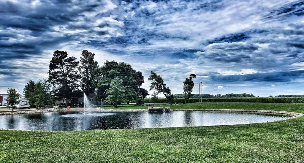
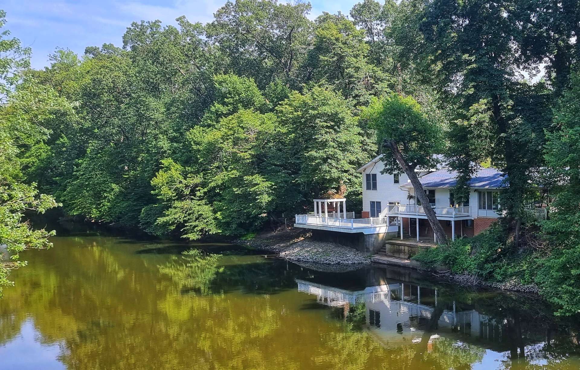
As we neared Huntington, we spotted a few more signs of civilisation & a number of the properties had lakes with fountains that appeared as if they may also double up as somewhere for the children to either swim or mess around in small boats. There also appeared to be a bit of competition between households, as each lake & fountain was slightly larger than the previous one!
We were still on the grid system of roads, so we could see there was a body of water getting ever closer. We were heading towards JE Roush Lake, another of the 3 flood protection lakes we read about at the Visitor Centre earlier.
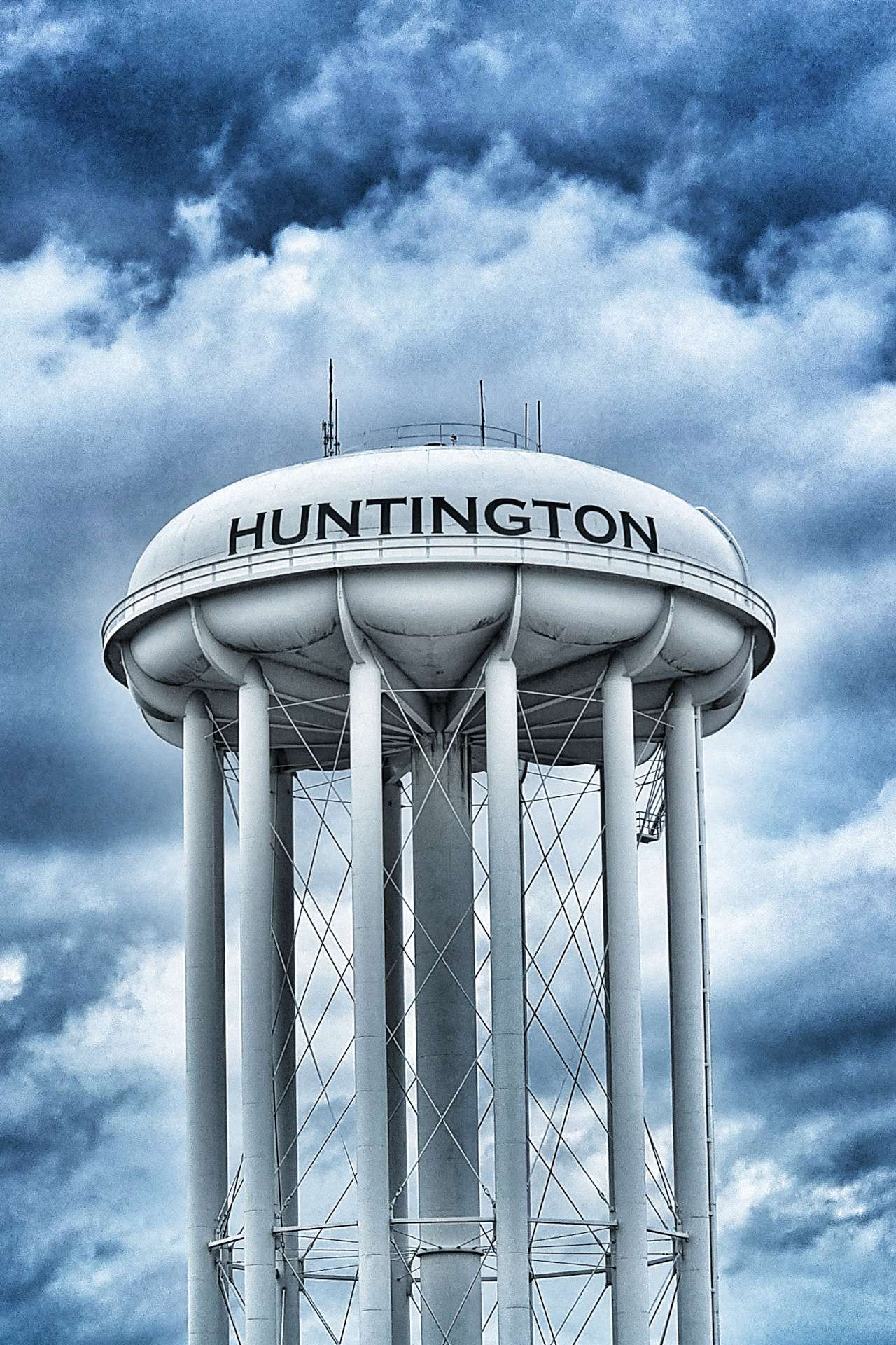
We continued on quiet lanes all the way to Huntington, where we made our way across town to our motel for the evening. I stopped to add a new type of water tower to my photo collection.
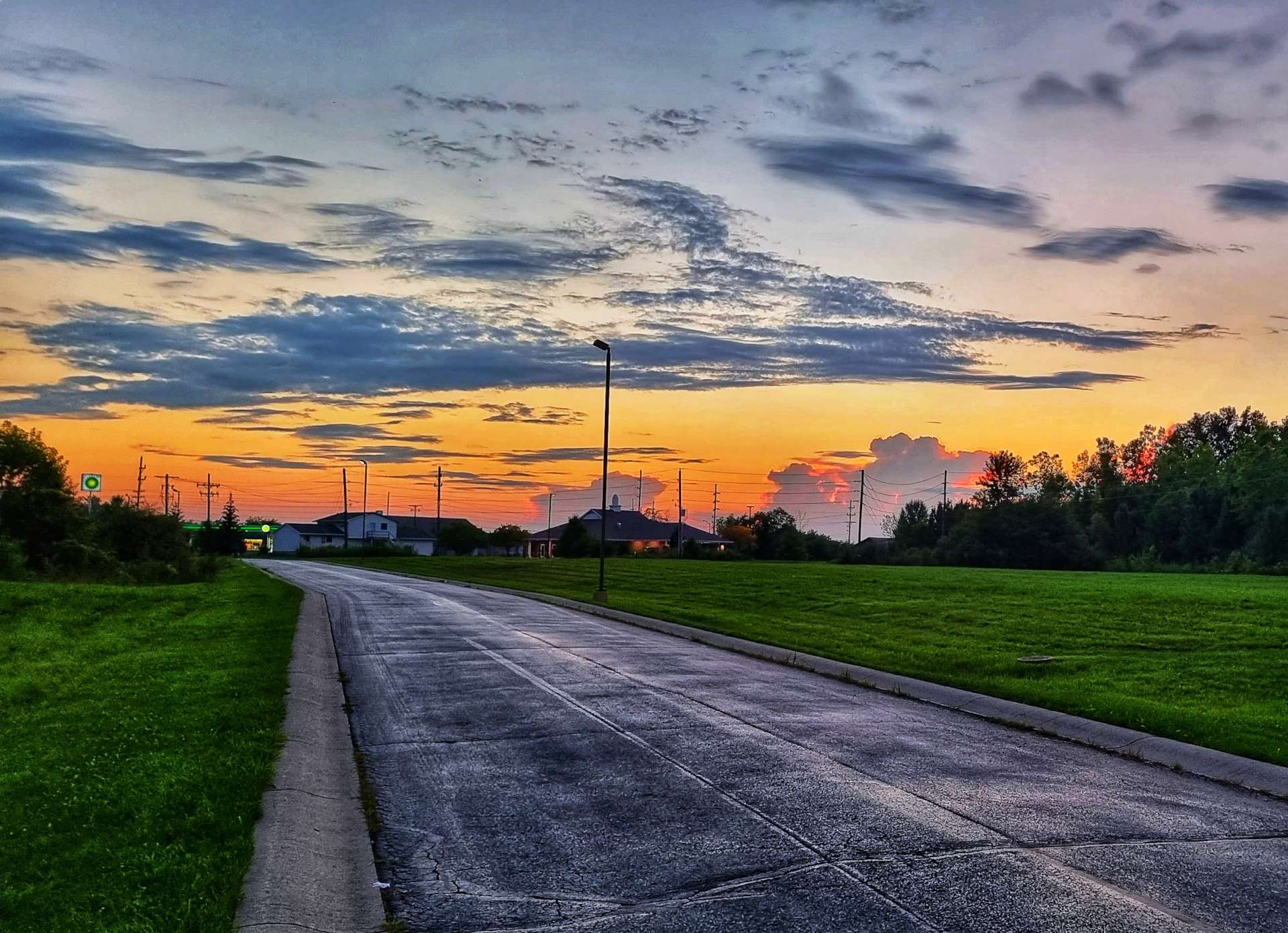
We’re in a Super 8 motel this evening & the photo below gives an idea of the set up of some of the nicer places we’ve stayed. This one had a swimming pool & of more interest to us, guest laundry! There was a glorious sunset this evening, so hopefully that’s a good sign for tomorrow.
Stage Stats – 72 miles, 1,365 feet of climbing. Long straight roads for the majority of the day, with flocks of turkey vultures in Salamonie State Park.
Friday 5th August – Huntington to Defiance (Stage 75).
Huntington is where J Danforth (Dan) Quayle, the 44th Vice President of the USA, went to school & the Quayle Vice Presidential Learning Center (US spelling) is located here. He was Vice President to George H W Bush from 1989 to 1993. As we left Huntington this morning, we both saw a sign for the Dan Quayle Museum (the old name for the Learning Center), so I wanted to find out what his connection was, as he was born in Indianapolis & spent most of his childhood in Arizona.
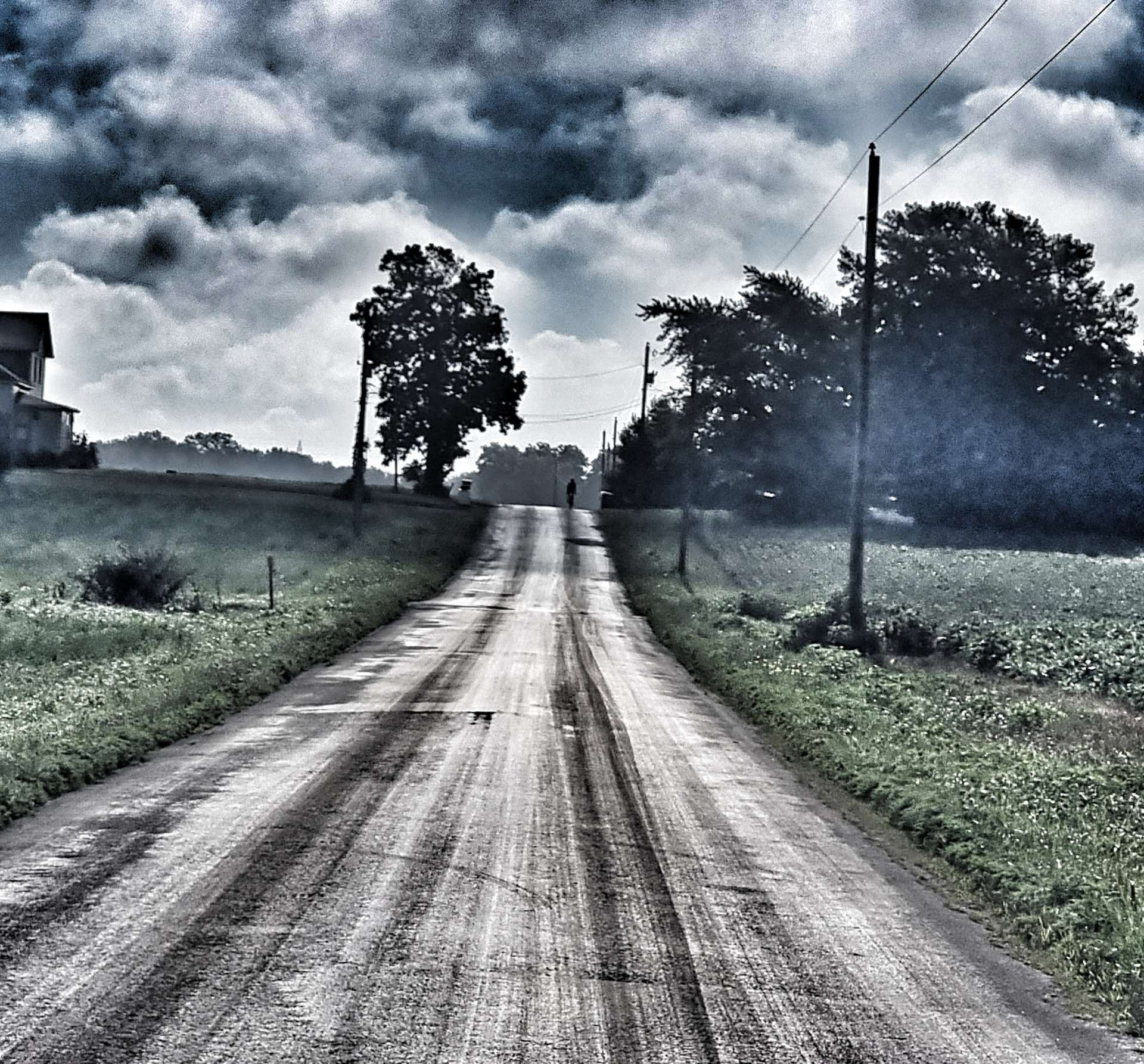
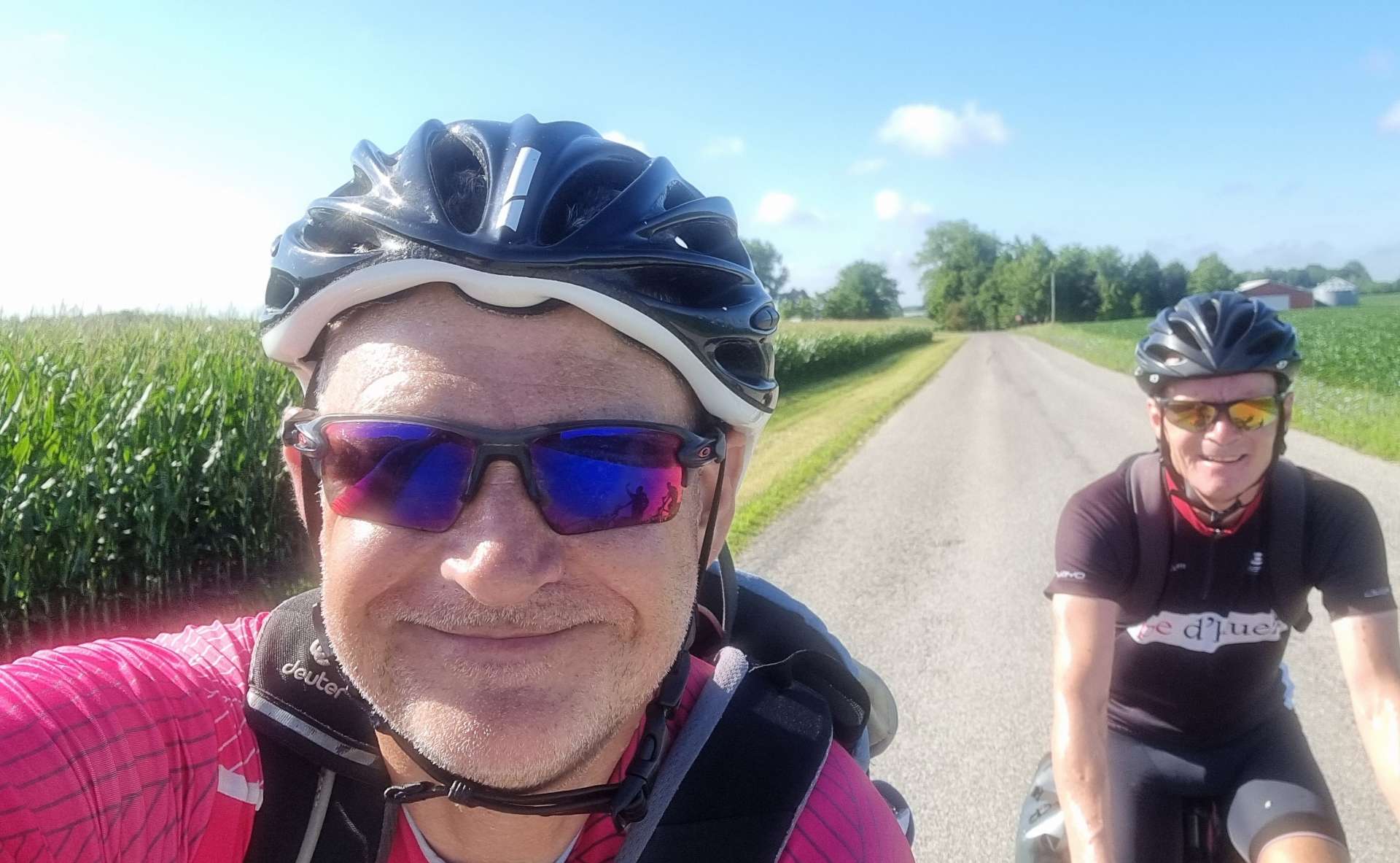
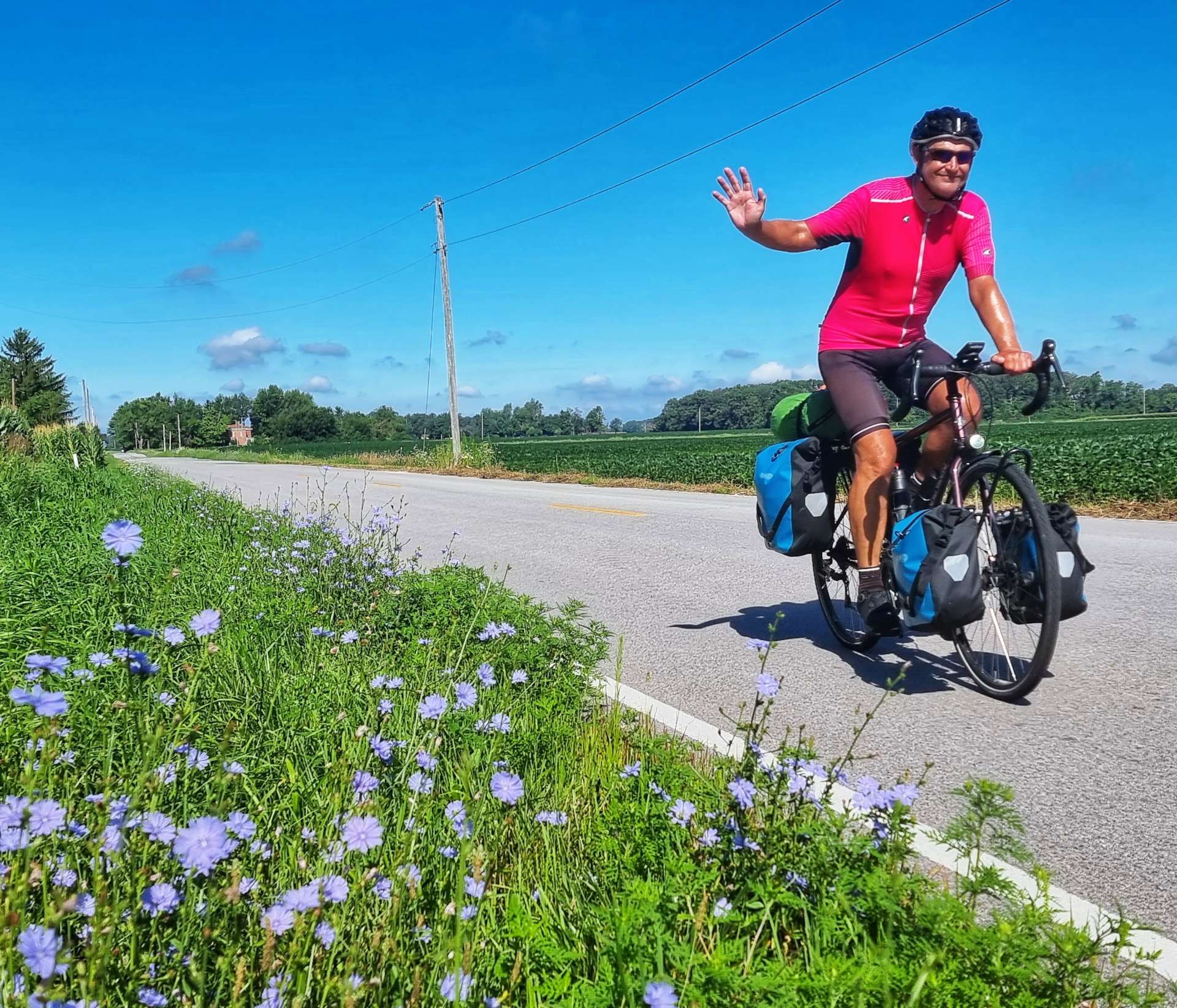
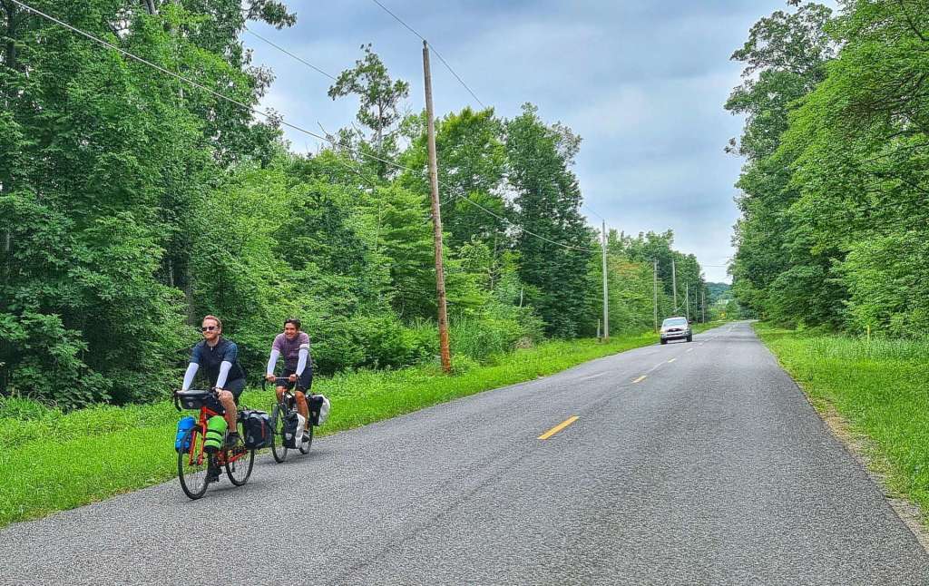
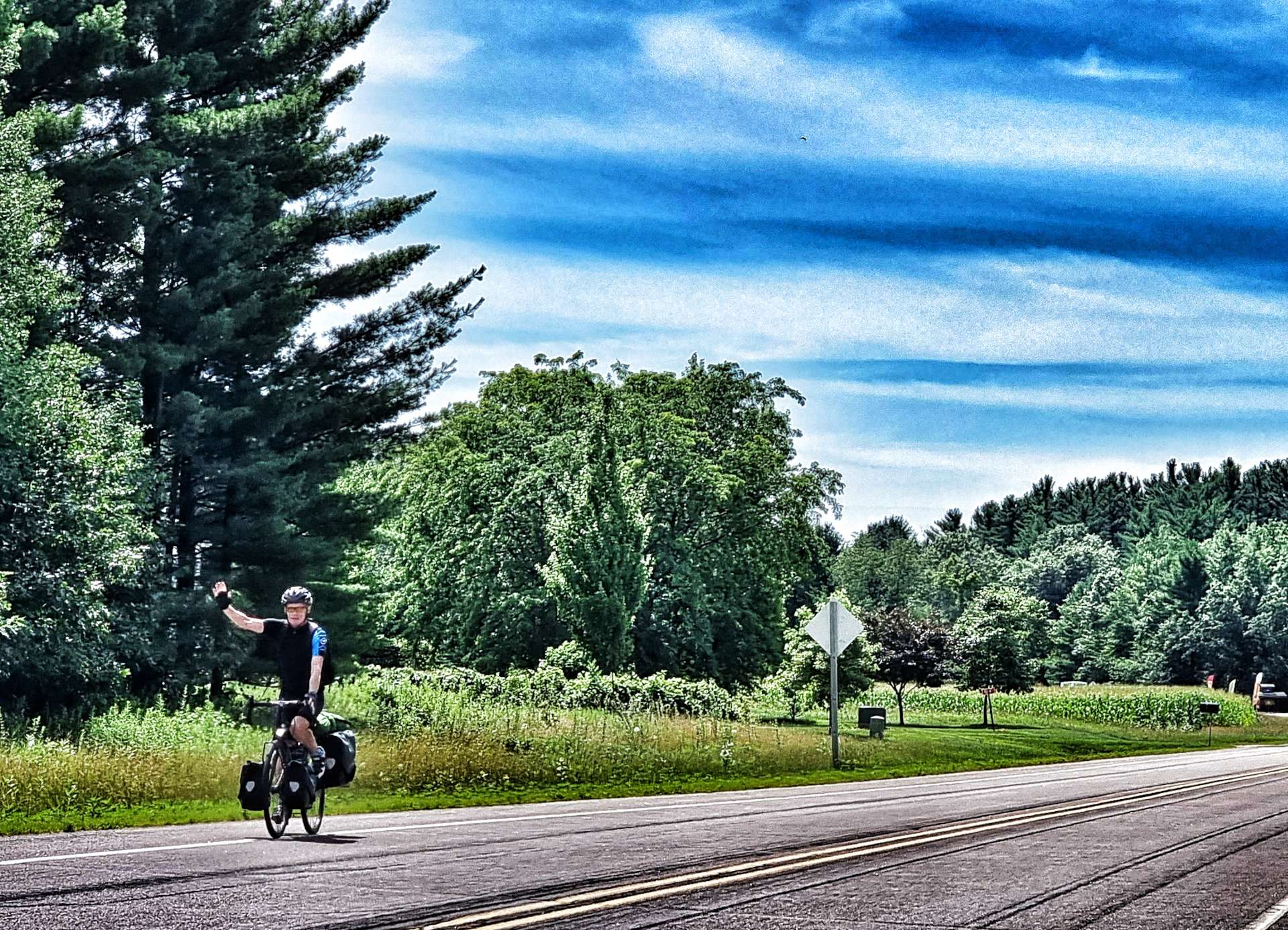
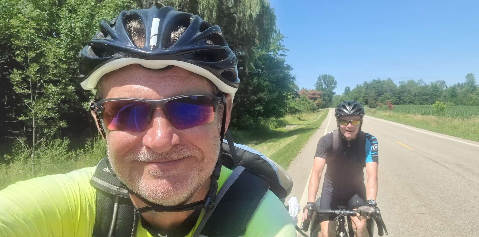
Setting off at 8.30am, we retraced out tyre tracks for 5 miles to Bowerstown, then picked up new tarmac. We were joined by Chris, a local, who was out for a 40 mile ride. He was interested in where we’d been & where we were going, as he’s previously done some touring. Chris rode with us for about 15 minutes or so & then continued on his way & in next to no time he was disappearing up the road! He’s on the crest of the hill in the first photo below.
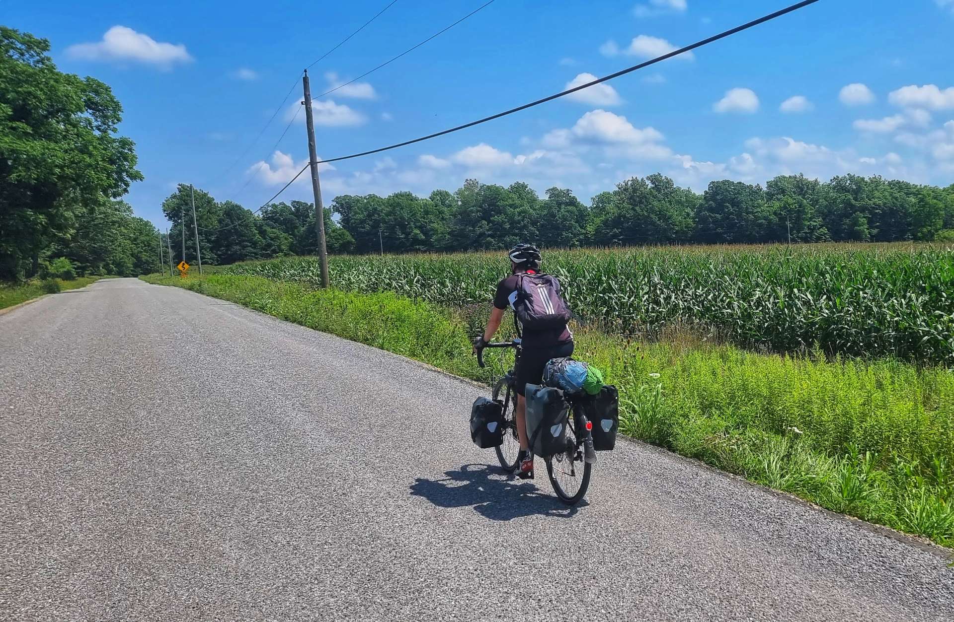
As you can see, we had the long, straight roads to ourselves again. Although the fields have had the same crops in them for the last week or so, the scenery is always slightly different & there’s always the possibility of seeing wildlife, so it hasn’t felt like a continuation of the same ride.
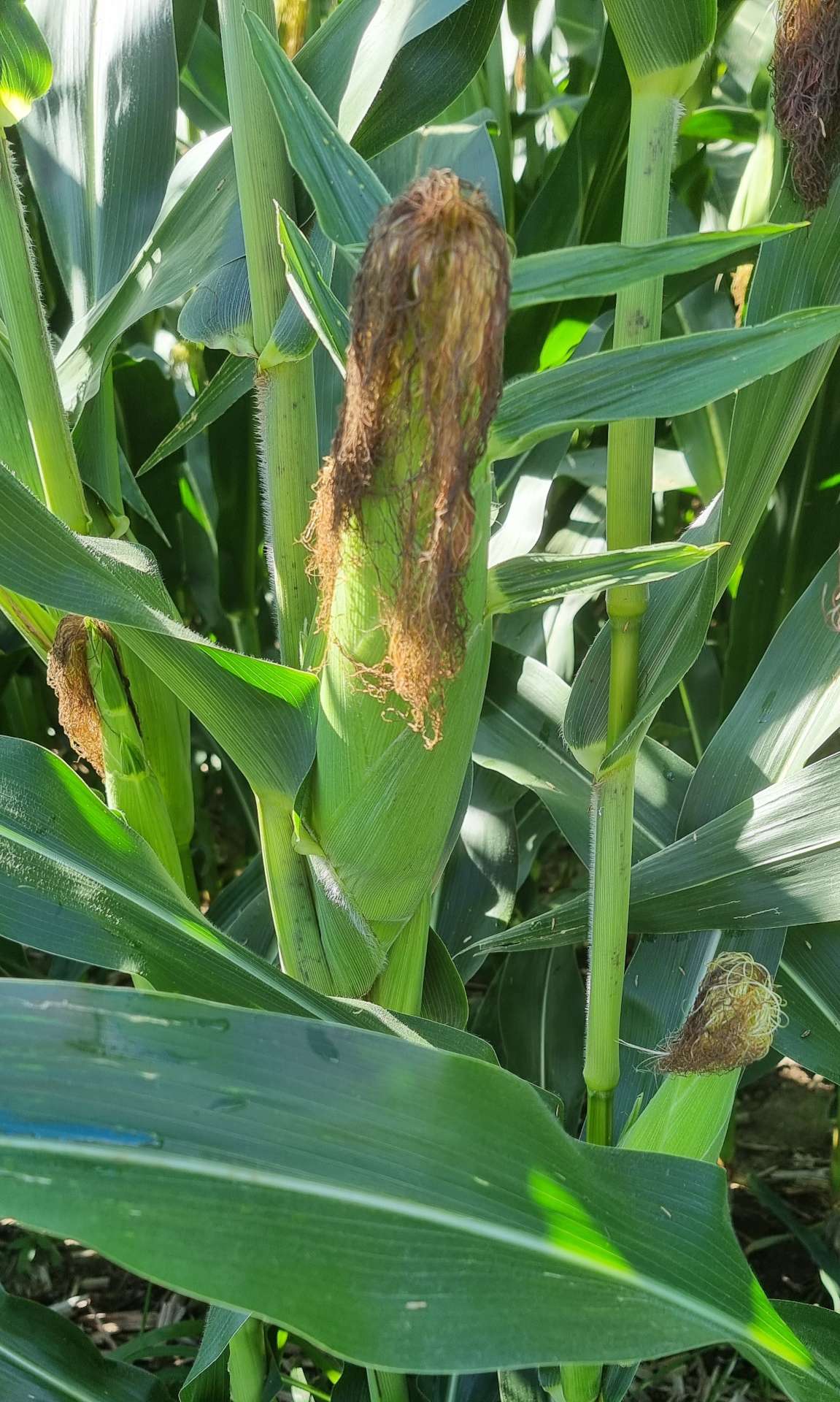
One of my favourite vegetables is corn on the cob & I’ve been watching as the crops have developed as we’ve crossed the USA from Montana to Ohio. We’re seeing some fields where the corn looks to be almost ready for harvesting. It’s common for plants to produce between 2 & 4 ears of corn in a season, depending on how well the crop is tended.
I’ve even cooked sweetcorn on a couple of occasions on my adventure – you can buy an ear in its husk for $1 in supermarkets & if you microwave it for 5 minutes, wrapped in a damp paper towel parcel, it’s ready to eat. You can have this cooking tip for free, although you may have to buy my upcoming book to find out how to brew coffee from a packet & make your own trail mix from peanuts, raisins and M&M’s!!!
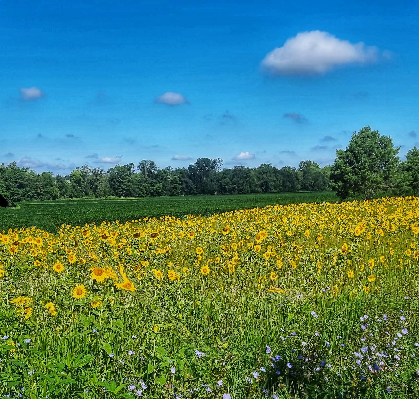
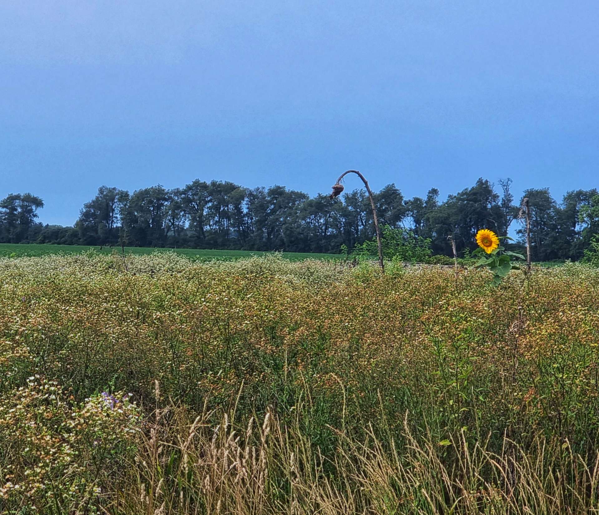
I’m a fan of the colours purple, yellow & orange – now I’ve admitted this, you’ll no doubt notice (if you haven’t already) that most of my action photos have at least one of these colours in. Nearing the small town of Poe, I’d dropped back to take a photo of Sean against a yellow background, although from this distance I couldn’t tell what the plant was.
As I got closer, I realised it was a small field of sunflowers – I don’t know why, but they always make me feel happy & bring a smile to my face. When I ride in the UK, there’s a field near Lacock that is turned over to sunflowers every summer & I always look forward to riding past it – I may also enjoy the coffee & cake stop just across the road!
We reached the small town of Hoagland, where I was hoping to find a coffee shop. However, the shop no longer exists so we had a very disappointing stewed coffee & processed lemon pie (it was so rank I didn’t even finish it) from a gas station. I didn’t take a photo, as I didn’t want to break the lens on my phone!!!! To be fair to the gas station, they did let us fill up our bottles with ice & fresh water from the soda dispensing machine.
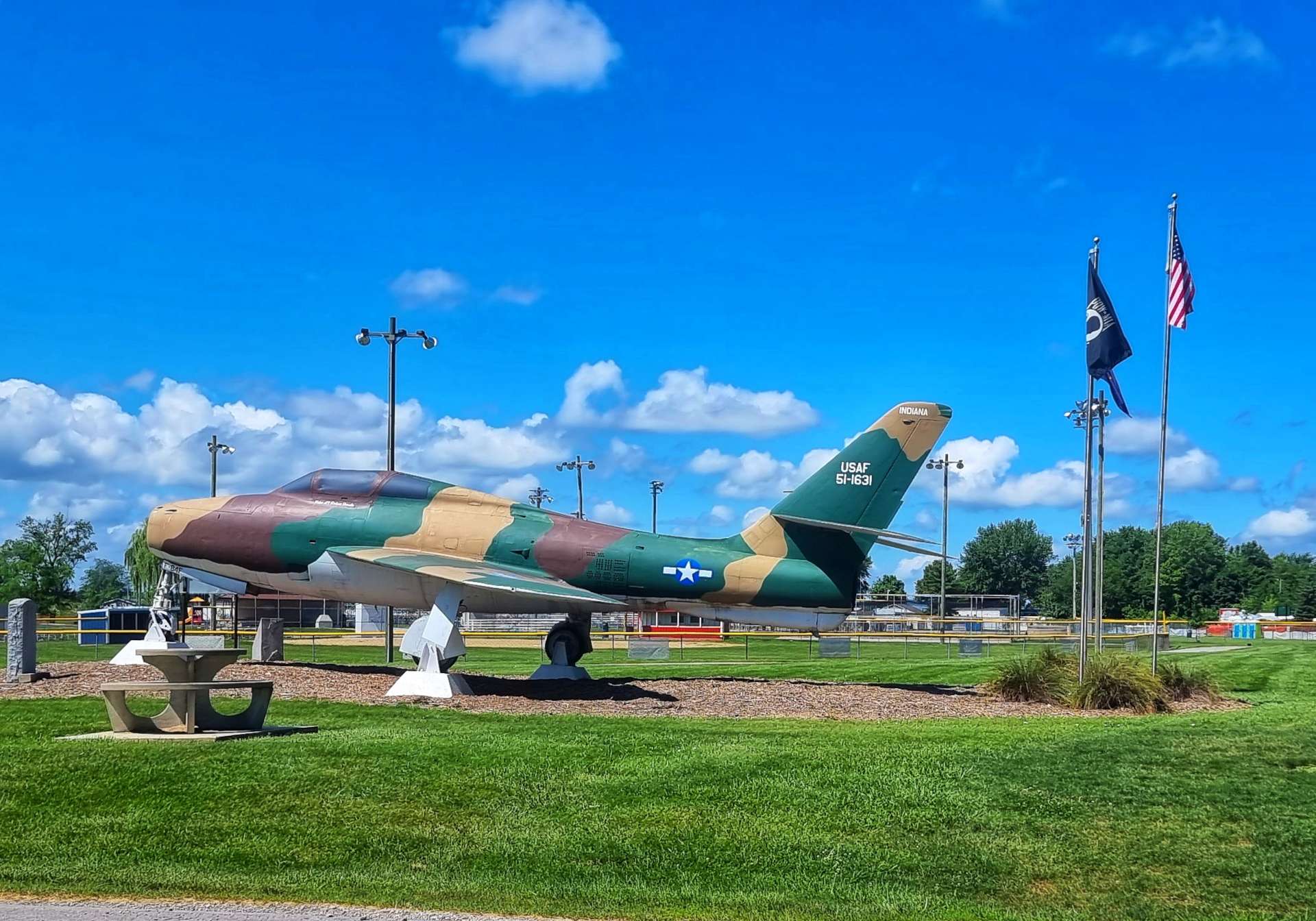
We continued on our way & as we reached Monroeville we saw our 2nd jet plane of the day (there was an identical one in Hoagland, but it had electricity cables in front of it, so I couldn’t get a decent photo). This F-84F was built in 1951 by General Motors & Republic Aviation & was eventually assigned to the 122nd Tactical Fighter Wing just outside Fort Wayne, Indiana. It’s now based outside the Monroeville Community Park & has pride of place.
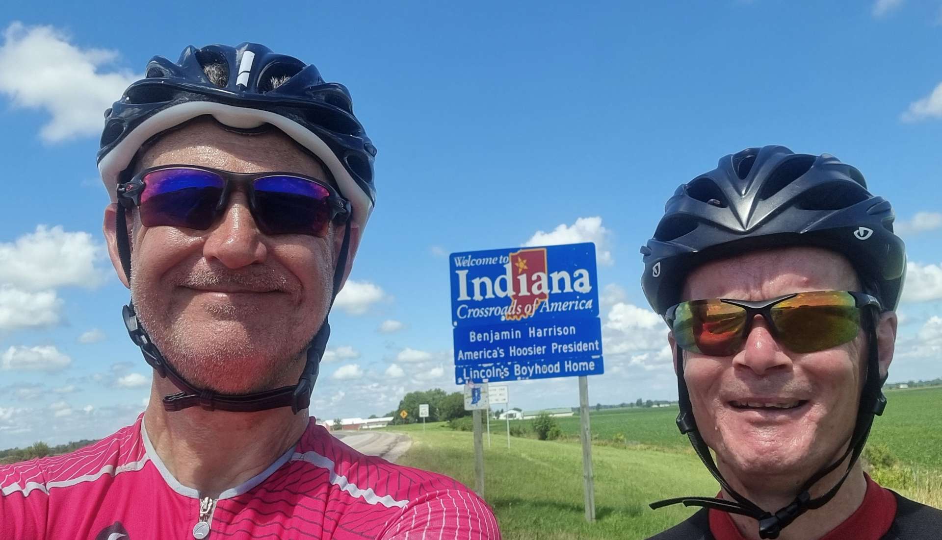
As we left Monroeville, we joined State Line Road, which took us to the Lincoln Highway at the border to Indiana & Ohio. The Indiana photo is the one I used the other day when we entered the State & today we’re saying goodbye as we head into Ohio on our way ever East.
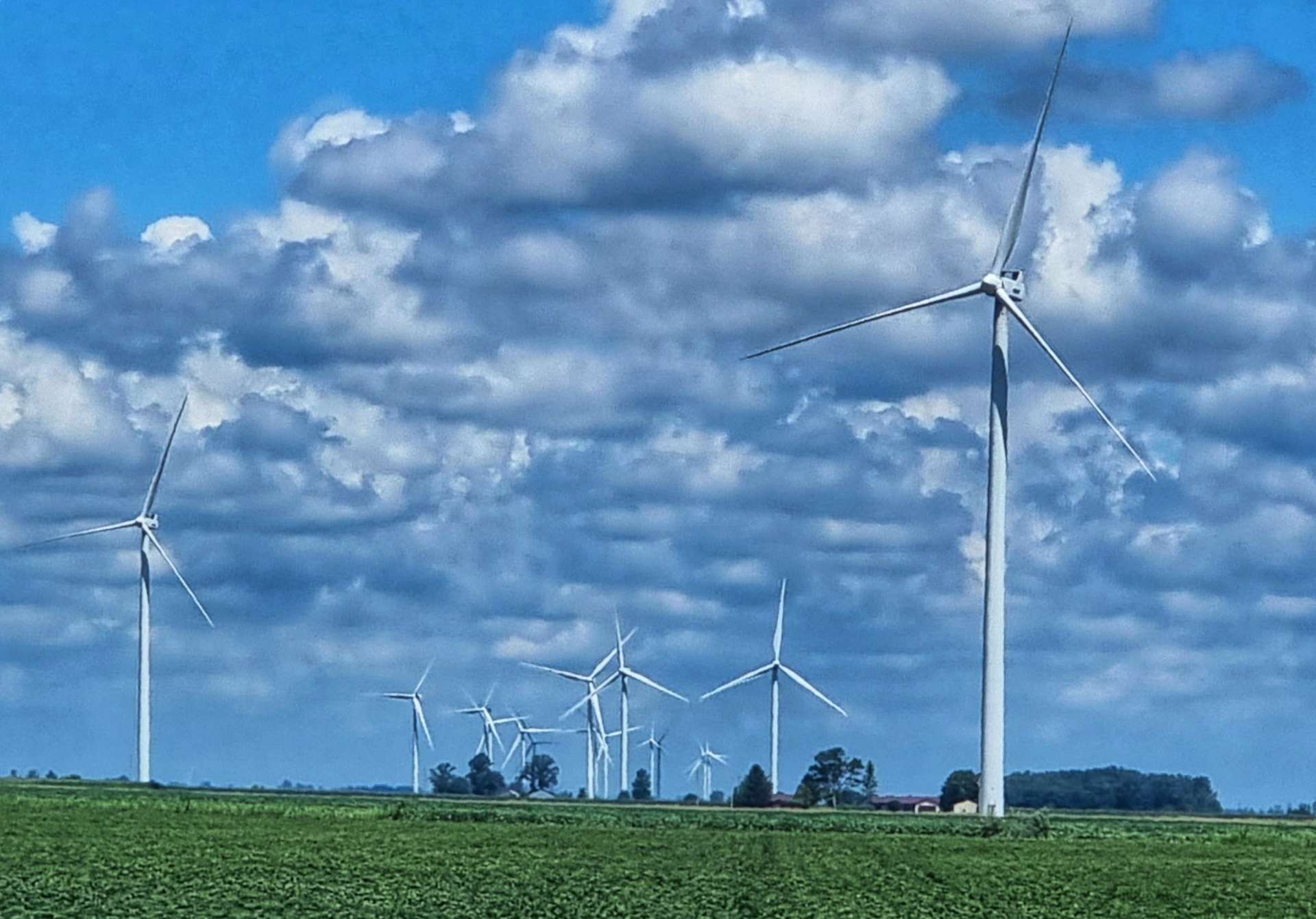
Crossing into Ohio, we immediately saw a windfarm – there are 152 turbines & when running at full power can provide enough electricity to service the equivalent of 76,000 homes. This is the largest windfarm in Ohio & farmers receive between $3,000 & $7,000 annually for hosting each turbine.
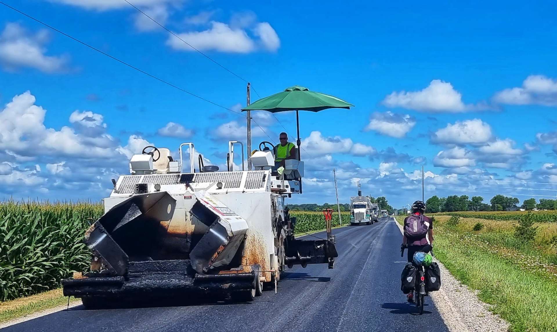
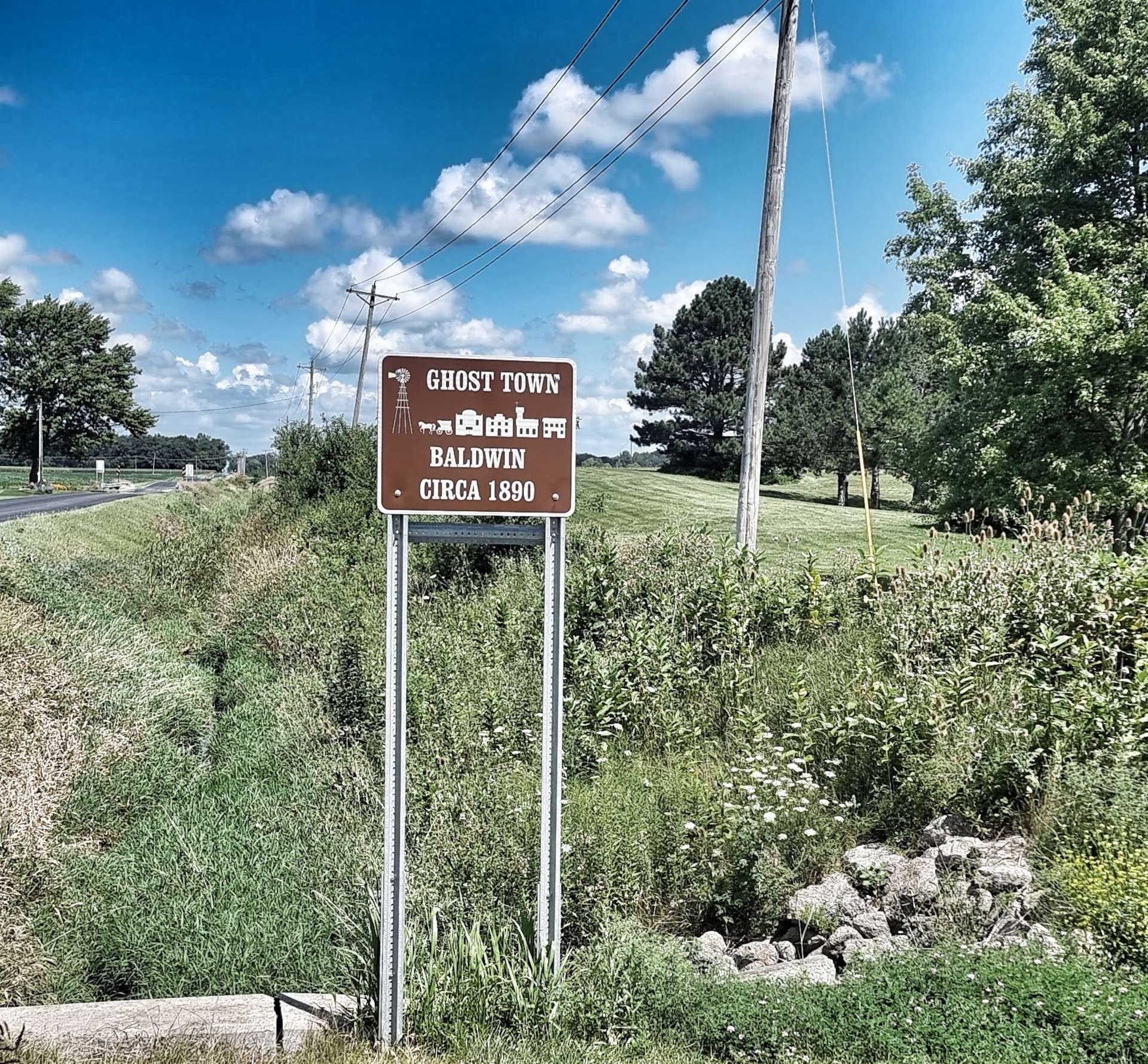
New tarmac had been laid recently & as we cycled along we could feel the road becoming more sticky, as the tar was still warm! As we neared the end of the new road, the road workers had finished for the day & were heading towards us. Baldwin is one of six ghost towns situated in Ohio, near to the Indiana border, but from later research there doesn’t appear to be much to see, so I’m glad we didn’t detour to try & find it!
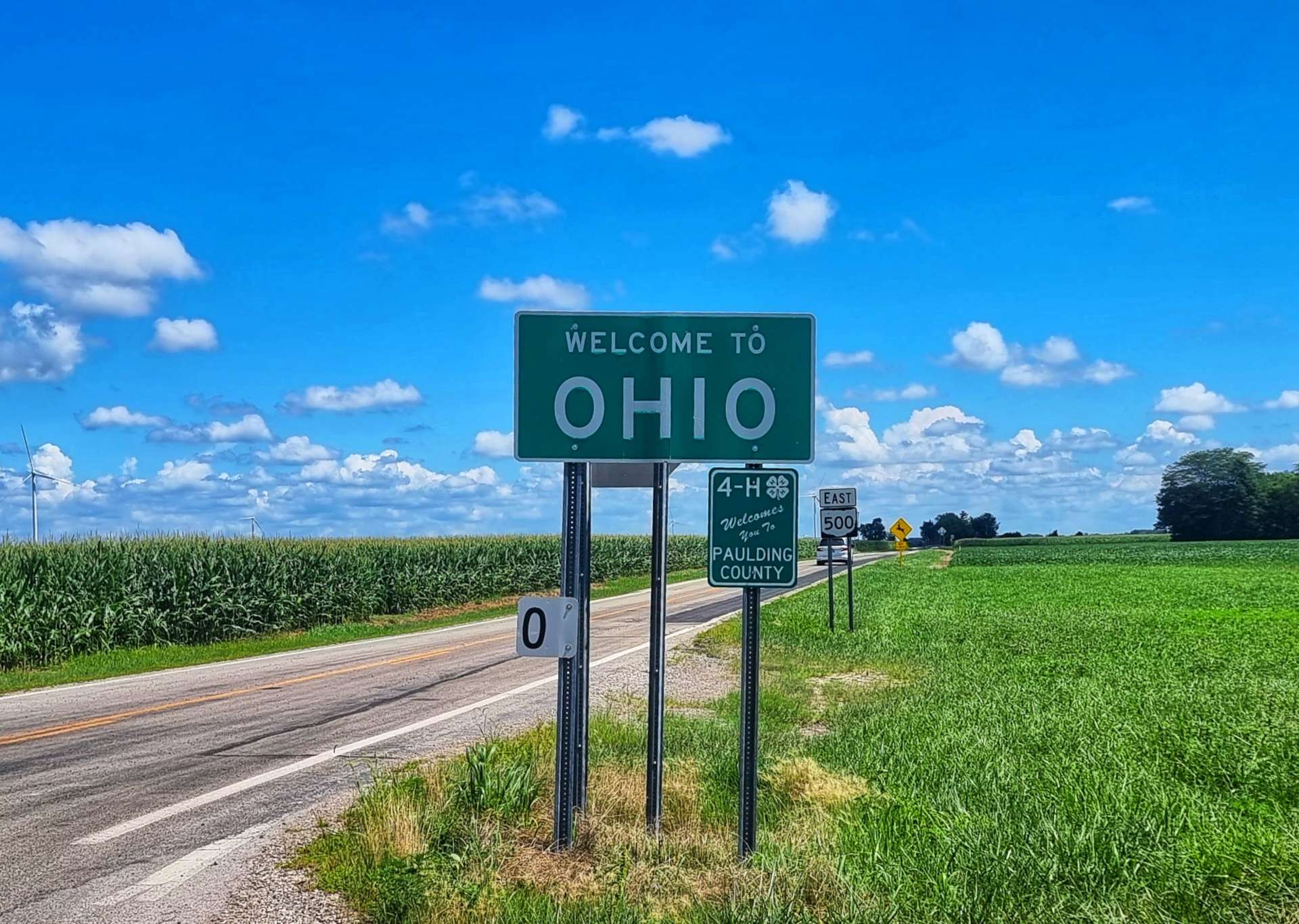
As we turned onto OH500 heading East, we crossed into Ohio for real. The only obvious difference between Indiana & Ohio was the wind farm, as the crops continued to be corn & soya beans.
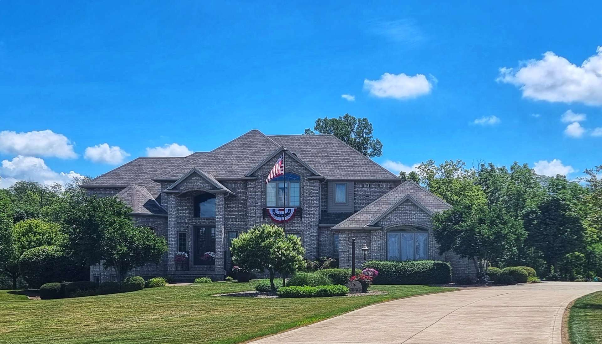
Heading towards Payne, farmland gave way to large residential properties, with equally large gardens – a recurring theme is how tidy the lawns are. We’ve seen many a person on their ride-on lawn mowers as we cycle in the mornings.
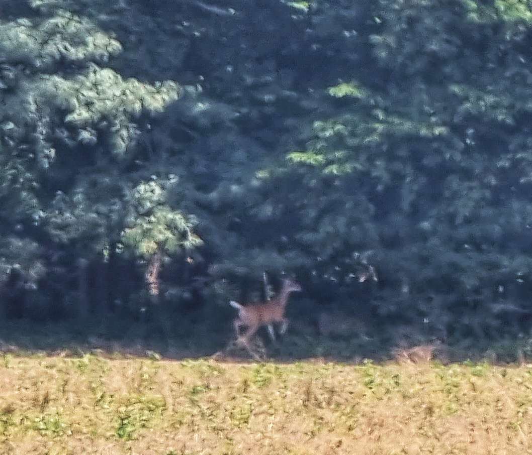
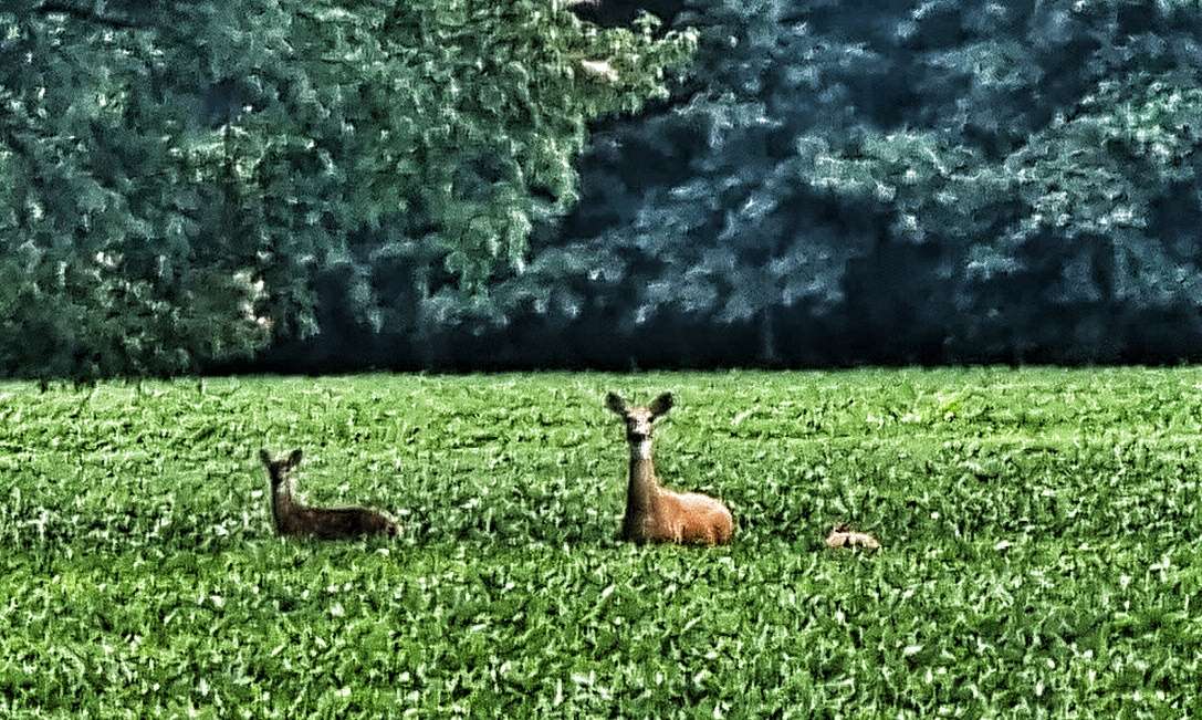
I also caught a fleeting glimpse of a white-tailed deer way off in a field. Just as I was getting ready to take a photo the deer was spooked by something & I ended up with an unexpected but very welcome action shot of the deer, mid-bound!
Some 10 miles on from the Indiana / Ohio border the wind turbines were still visible & some farmers must be doing quite well with their “good neighbour” payments.
As we reached Paulding we were both hoping there would be somewhere to stop for coffee & maybe cake. We spent 5 minutes looking round the Business District & eventually spotted Past Time Cafe.
The owner, Mike Iler, came over & asked us whether we were riding up / down the country or across it – he sees quite a few long distance cyclists & he welcomed us with open arms! In spite of him busy & needing to get to the bank, he stopped & chatted with us for about 20 minutes or so & was genuinely interested in our adventure – Mike, I know you’ll be reading this, as is Susan, so please pass our thanks on to your Team at the Cafe who looked after us.
We had a piece of cherry pie each & mine came with ice cream too – I need to keep up my calorie intake as I know people back home have been saying I look thin!!! The pie was delicious & I devoured the lot 🙂
Without exception, our interactions with people we’ve met as we’ve crossed the country have been positive & enjoyable occasions & they have really added to the experiences & memories that I’ll take home with me.
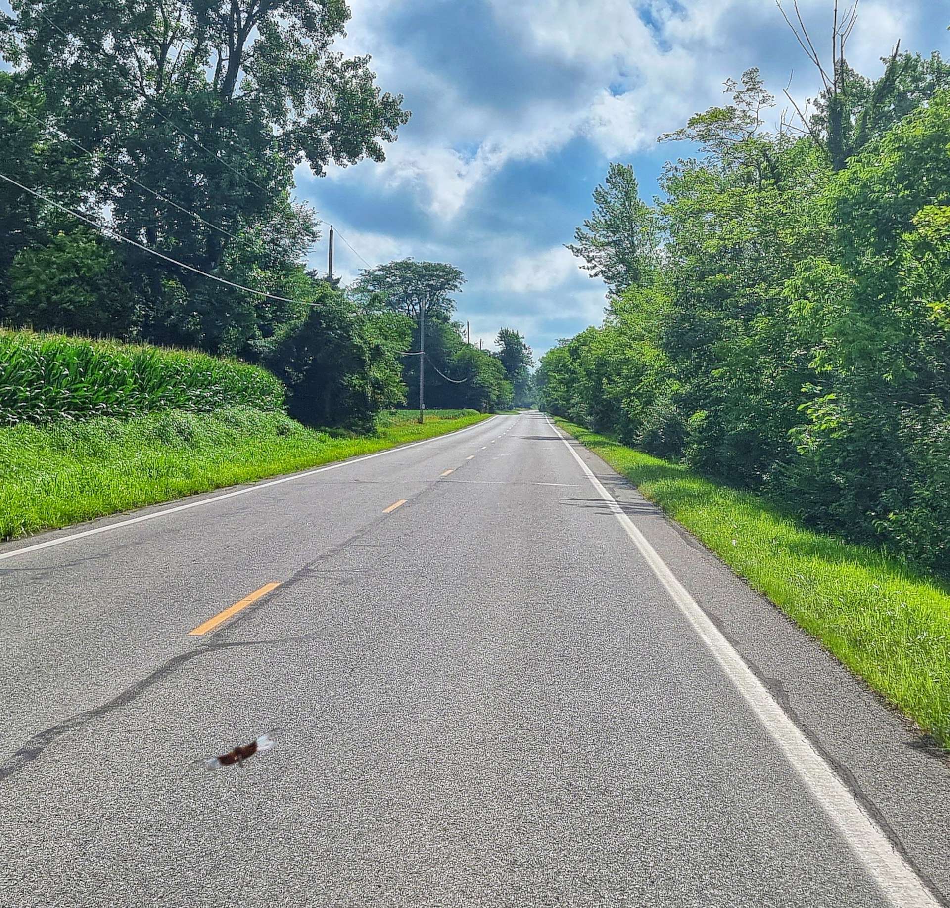
Leaving Paulding behind, we joined more deserted backroads that took us across more farmland. We were once more on the grid system of roads, where every corner was a right angle & the roads were at 1 mile intervals. It made navigation very simple & straightforward.
As we reached Junction, the road followed the course of the Auglaize River into Defiance, our stop for the evening. Defiance sounds like the name of a town that Jack Reacher would turn up in – we passed through Beyond Hope way back in Idaho & I had the same thought then!
The river is a tributary of the Maumee River, which it joins in Defiance. Hopefully we’ll see some of the Maumee on tomorrow’s ride. As far as today is concerned, we made our way across town & found our motel for the evening.
As it’s a Friday night, we found a grill/bar just across the road where we could relax & toast fellow Friday Beer Club members around the world! Apologies for the awful photo, we had red lights shining on us.
Stage Stats – 85 miles, 587 feet of climbing. Making friends over cherry pie!
Saturday 6th August – Defiance to Perrysburg (Stage 76).
We woke to blue skies & high humidity, with a slight cross-wind. As we had a slightly shorter ride, we were on the road for about 9.45am. Leaving town, we joined State Route 424 where it becomes the Maumee Valley Scenic Byway. Throughout our ride today we would be shadowing the Maumee River as we head North-East towards the next Great Lake on our adventure.
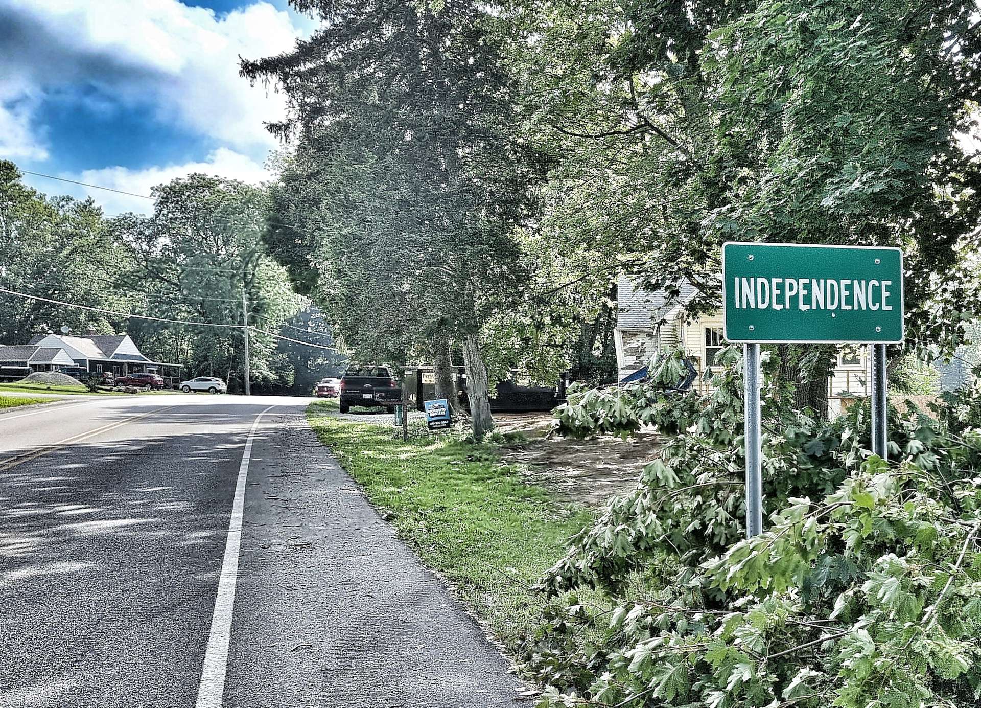
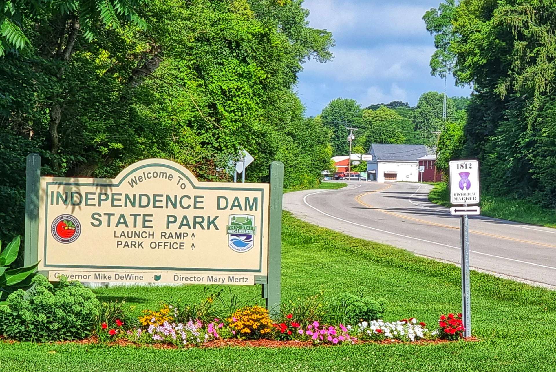
The Jack Reacher theme continued this morning, as Defiance led to Independence – I can almost picture Jack riding into town on the Greyhound bus with just his wallet & toothbrush for company! Independence Dam State Park is on the Maumee Water Trail which runs from Lake Erie in the North East to the Ohio / Indiana border in the South West – at the State Park we stopped briefly & chatted to a Dad who was relaxing with his young lads as they all watched the local fishermen doing their thing.
We’ve noticed that our Genesis Tour de Fer bikes are real talking points, not because of the bikes themselves, but because they identify us as a rare breed of person – people who measure our journey by the experiences we have & people we meet along the way, not how quickly we reach our destination! We’ve been on the road so long that we now have stories to tell about places we’ve been, whereas 3 months ago all we had were dreams & aspirations of what we hoped to experience & places we hoped to visit.
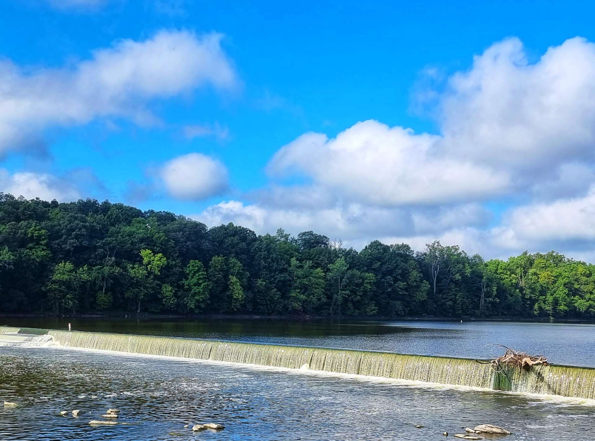
The original wooden dam was built in the 19th century to provide water for the canal system. This was replaced in 1924 with the concrete dam you see below which creates a weir. The canals that connected the Ohio river with Lake Erie were created in the 1800’s, but were eventually usurped by the railroad & they fell into ruin. In 1913 a flood destroyed most of what remained, however, 7 miles of the canal are preserved between the State Park & County Road 424.
Although it was a Saturday morning, there was hardly any traffic on the road. As we continued along the side of the Maumee, the scenery around us continually switched between woodland & farmland. I’d asked Sean if he’s take an action shot for me & we managed to time it so we also captured 3 local cyclists out for their Saturday ride – they disappeared into the distance! We’ve learned to be humble & accept that with our steel bikes & touring kit we’re easy pickings for everyone else on a bike & trying to catch up or keep up only ends in tired legs & bruised egos!!!
Jimbo, don’t get ideas – I’ll be trying to chase you down at every opportunity when I get home!!! 🙂
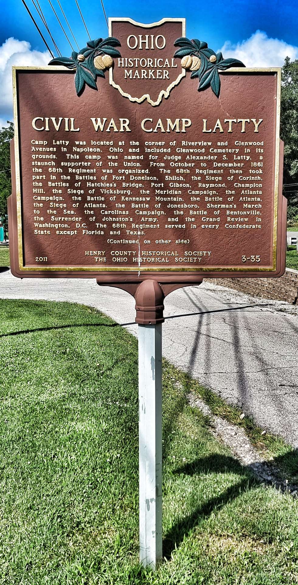
Ohio has also re-introduced us to Historical Markers – in this instance we learned about Judge Alexander Latty & the Camp that was named after him. These are a great source of information & also help to understand some of the history associated with the local area.
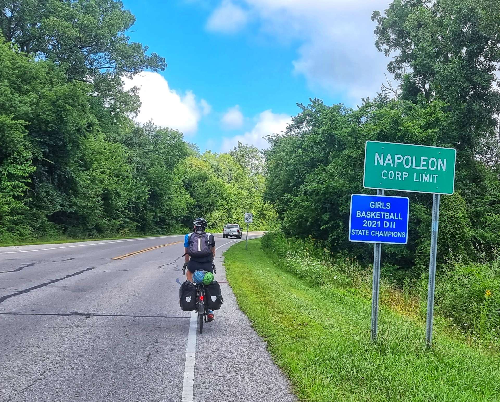
Entering Napoleon (yes, it was named for the French Emperor of the same name in 1832), we were on the lookout for coffee & hopefully cake. After a brief hunt around the Business District we found Country Gourmet & they came up trumps – I asked the barista what she would recommend & went with her suggestion of a pumpkin & chocolate chip cookie, as well as a blueberry muffin & a black forest latte. It was absolutely delicious!!
As we left town we passed the Town Hall, so I grabbed a photo to remind me of our visit.
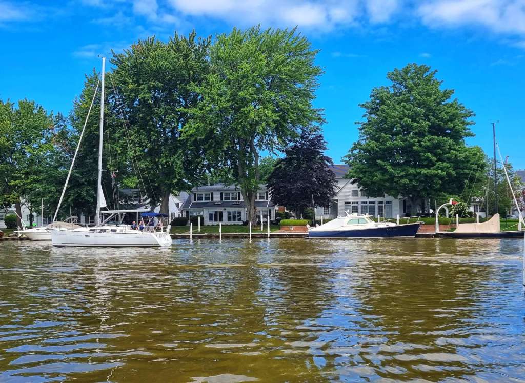
The river had been hidden from view since Independence, but it was worth waiting for it to reveal itself again. There were tens of pleasure craft ploughing their way up & down the river. We were cycling along the left bank, so we were overlooking the river & had great views in both directions.
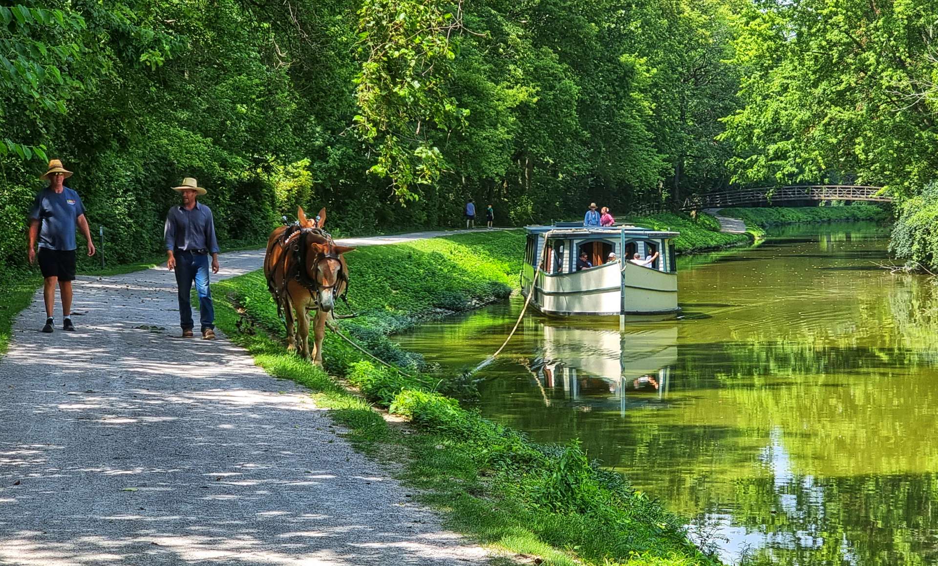
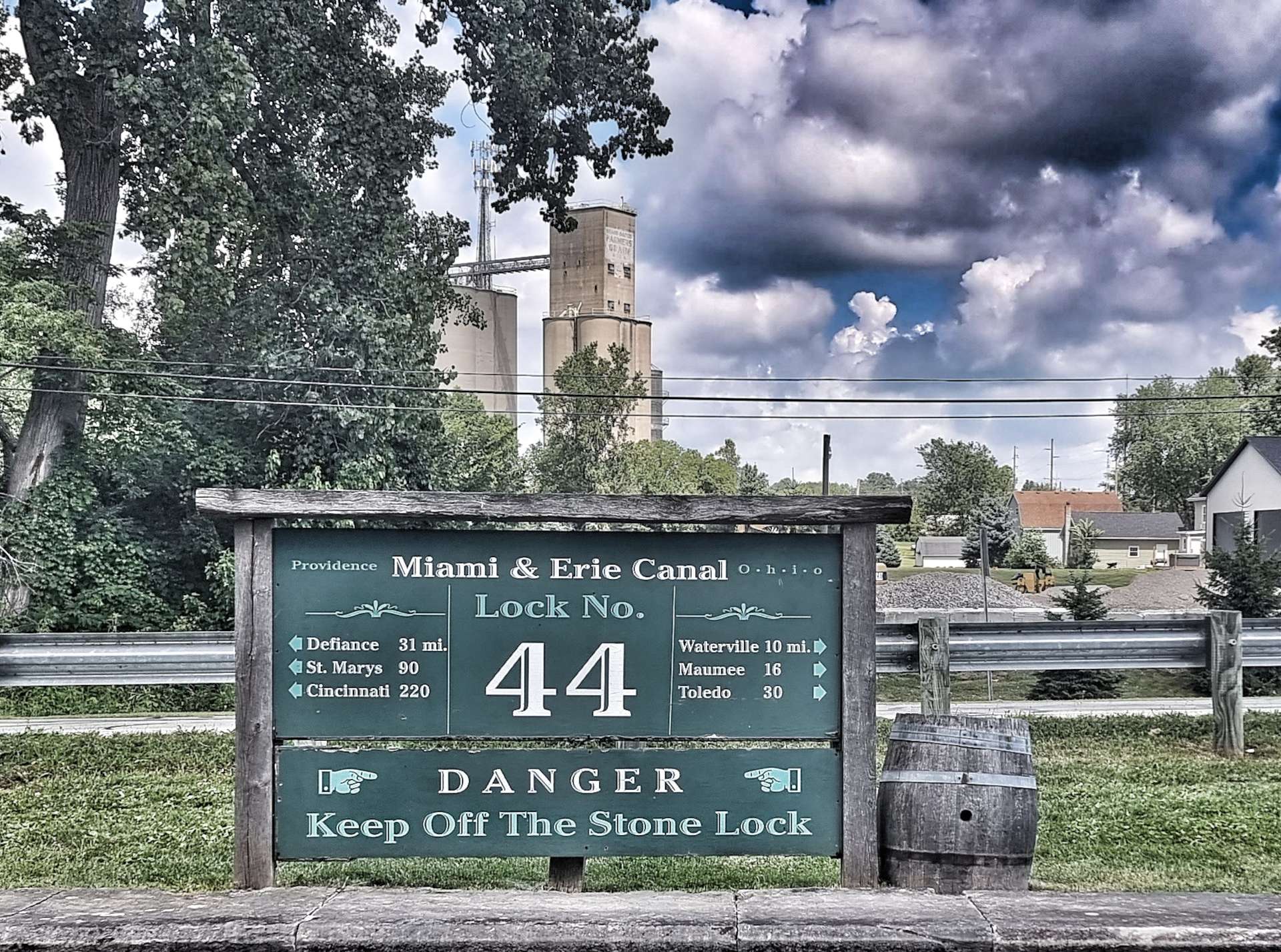
I was aware that at some point today we’d be picking up a gravel trail, but I was still surprised (in a very good way), when we arrived in Providence & stumbled on the Miami & Erie Canal. Canal boats once carried goods & people the 249 miles between Toledo & Cincinnati. We got a sense of what canal travel might have been like along a renovated section of canal, complete with lock.
The horse in the first picture is pulling a replica of an authentic canal boat, while the historic Isaac Ludwig Mill preserve features of a mid-1800’s Ohio.
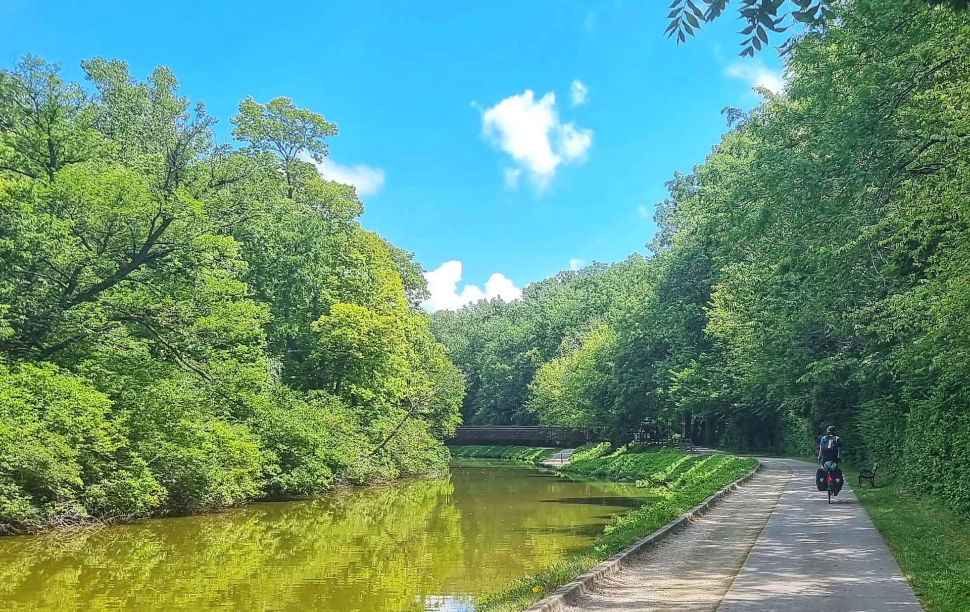
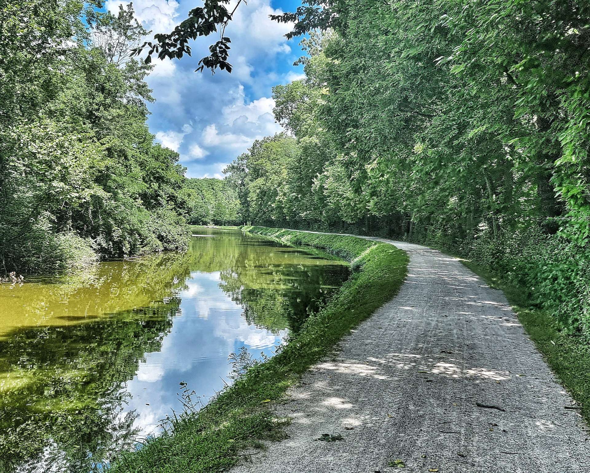
This was also our gateway to the Towpath Trail, which follows the remains of the Miami & Erie Canal towpath for 8 miles to Farnsworth Metropark in Waterville. Initially we were on a paved surface, but it soon became crushed limestone & gravel. We were both happy riding on the gravel today, me because I genuinely enjoy it & Sean because it gave protection from the fierce sun overhead!
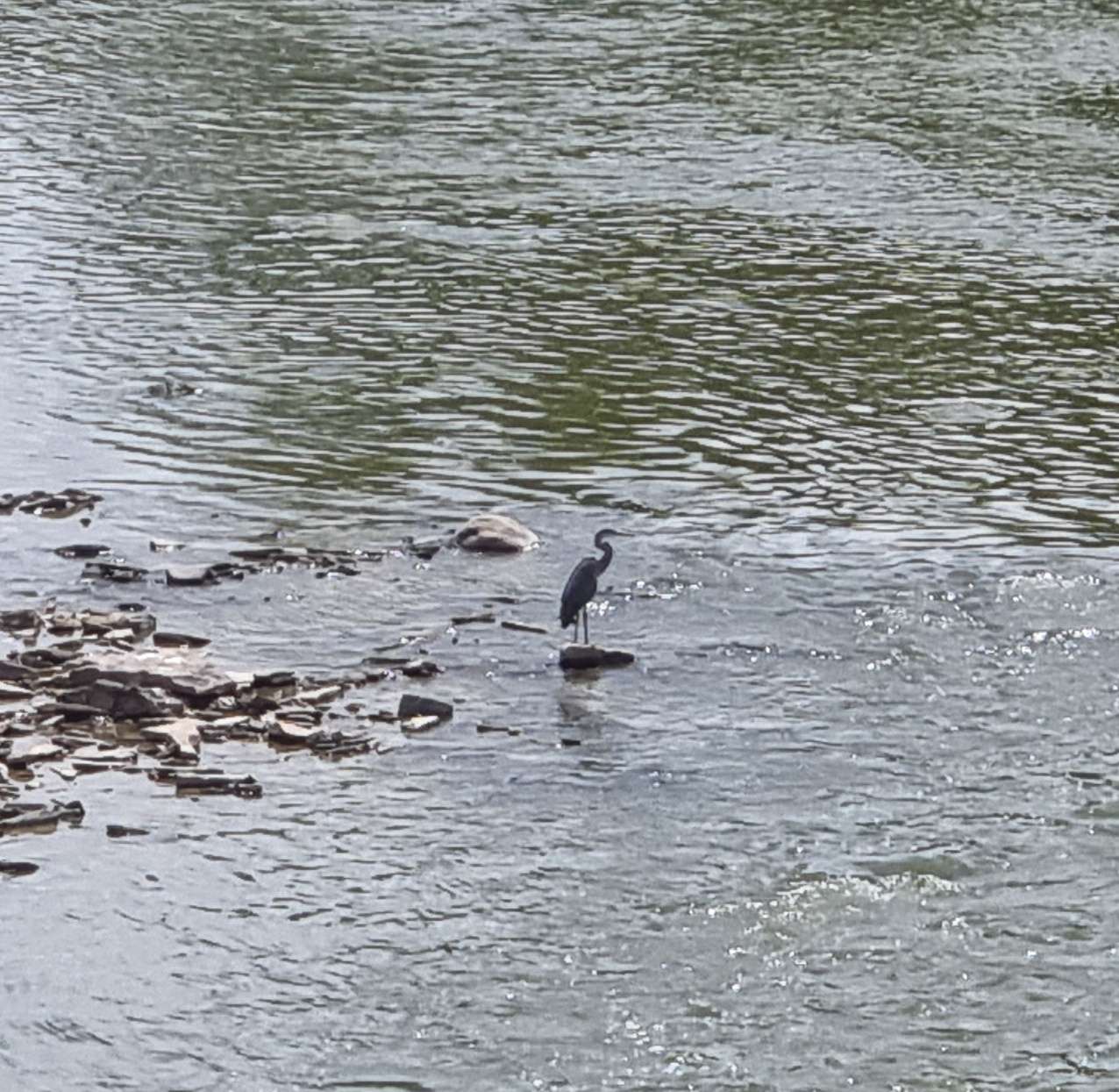
Along the trail we passed through Bend View State Park with vast vistas of the river in both directions. As we reached Waterville & crossed the river, we could see egrets & blue heron fishing in the shallows below.
All that remained was for us to make our way across to Perrysburg, where we would be staying for the next 3 nights. To celebrate another 3 adventure filled days we tucked into chicken alfredo, washed down with a Nordic IPA from Schell’s Brewery. As Saturday Beer Club was in session, we stayed for a 2nd pint too!
Stage Stats – 57 miles, 384 feet of climbing. Following the Maumee River, then the Miami & Erie Canal.
Monday 1st August – South Haven to La Porte (Stage 72).
It was another 70+ mile day today, so we stuck with our tried & tested routine of getting on the road for 9am. However, one hurdle to overcome was a rather meagre breakfast offering, which when we’re riding for 5 or more hours a day, on multiple days, isn’t ideal preparation for the day ahead! 2 bits of toast & a bagel was all that was on offer, so we agreed to stop at the first opportunity.
It was a challenge getting onto the Van Buren Trail State Park this morning as the trail was being resurfaced & the workers didn’t offer any advice of how long it went on for or where we could re-join it! We were only on this Rail to Trail for about 5 miles, but it was still a beautiful place to ride, once we found our way onto the trail!
As we picked up the Blue Star Highway we briefly passed through the Van Buren State Park & we were hemmed in by woodland.
As you can see from the photos it was an overcast day, but that just meant that when we saw Lake Michigan for the first time today the green-blue water stood our even more than the last couple of days. I had a 2 minute walk from the deserted road to get to this beach, while Sean waited patiently for me to do my thing with my camera.
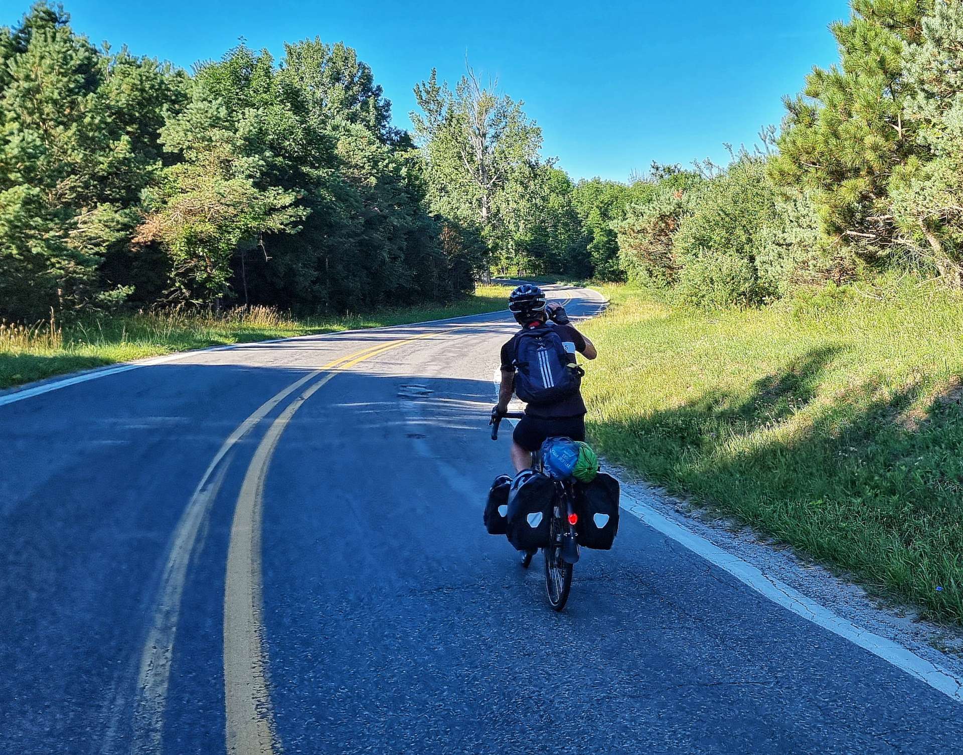
I try to take as many photos as possible while we’re on the move, but there are times when I need to stop to get the shot I want & Sean’s been patience personified whenever I’ve stopped. Hopefully seeing the photos on these posts make some of the waiting worthwhile!
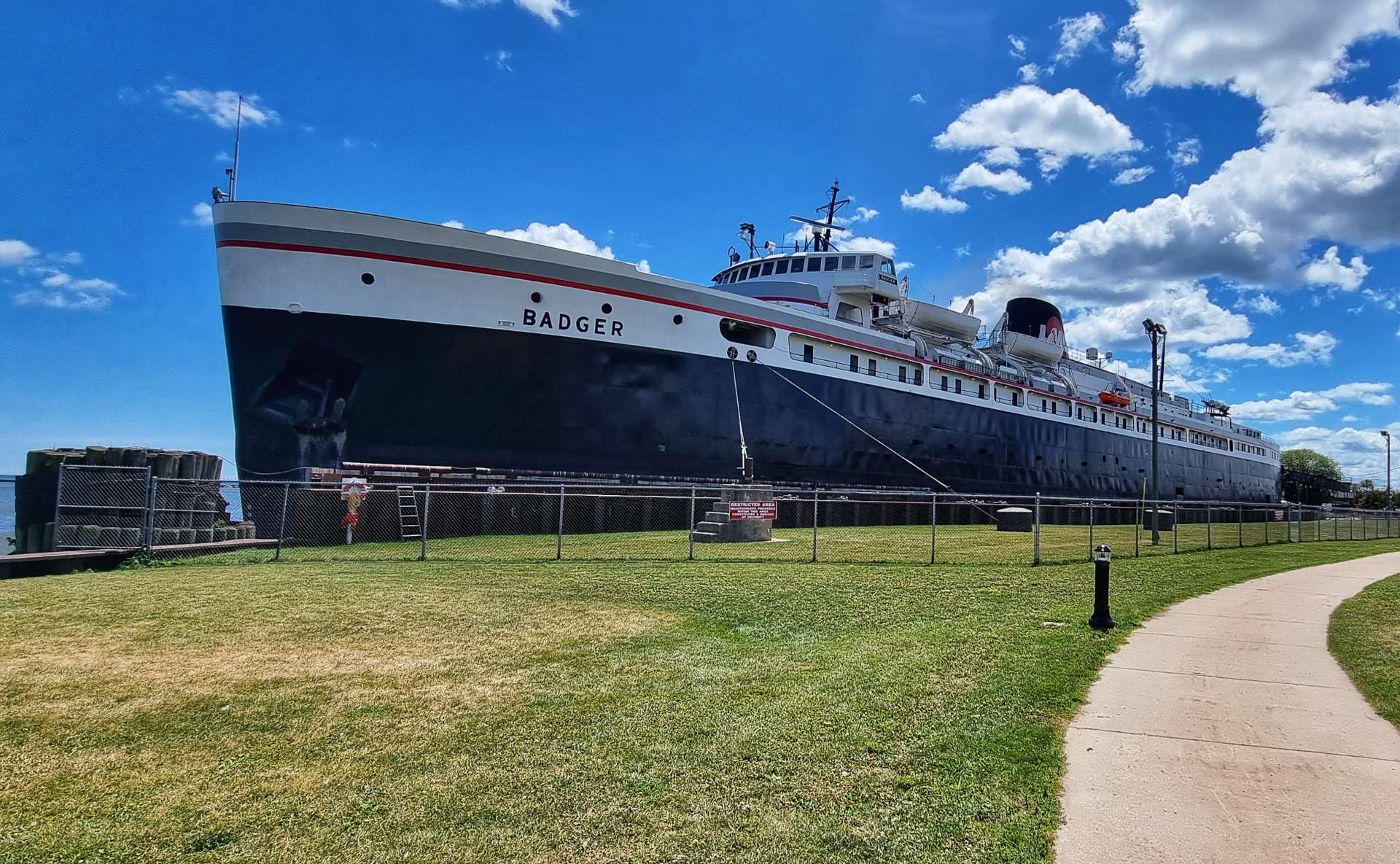
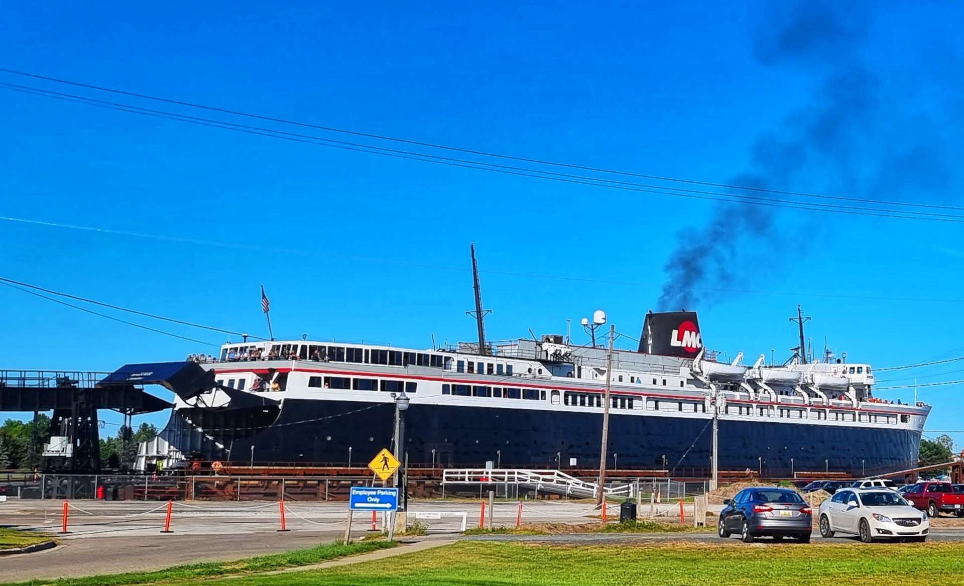
The Blue Star Highway (Highway M63) is part of the Lake Michigan Circle Tour – a route that takes in the complete coastline of the lake, as well as the designated Highway 10 crossing of Lake Michigan by the SS Badger. We hardly saw any traffic in the first 25 miles of our ride today, so had plenty of time to look out for unusual follies in gardens.
You may be thinking that I said in the first paragraph we would be on the lookout for a stop & here we are 25 miles in, with no mention of coffee & cake. That’s because we were still looking & were feeling very hungry, but up ahead was the town of St Joseph & over the river there was a chance of at least a gas station.
St Joseph had more than a gas station – it had Chocolate Cafe, which specialised in…..delicious chocolate cakes & acceptable coffee. In spite of being starving, this was the only occasion on the adventure where I was unable to eat everything! It was just to rich for me finish, but it was a fine piece of cake.
As we left town via Lakeshore Drive, we saw a huge fountain down by the lake with loads of children playing under what was now a blue sky. We also passed a poignant monument remembering all the people of St Joseph who served in the armed forces & never returned from active duty.
At Lookout Point we had a last view of Lake Michigan for a while as we headed slightly inland.
Heading towards Stevensville we crossed under the Interstate & passed through Shoreham (a reminder of my summer holidays as a schoolboy, as I used to visit a place by the same name in West Sussex when I stayed with my Aunt in Littlehampton). We then skirted the edge of Grand Mere State Park, where we saw 2 other long distance cyclists heading West as we headed East.
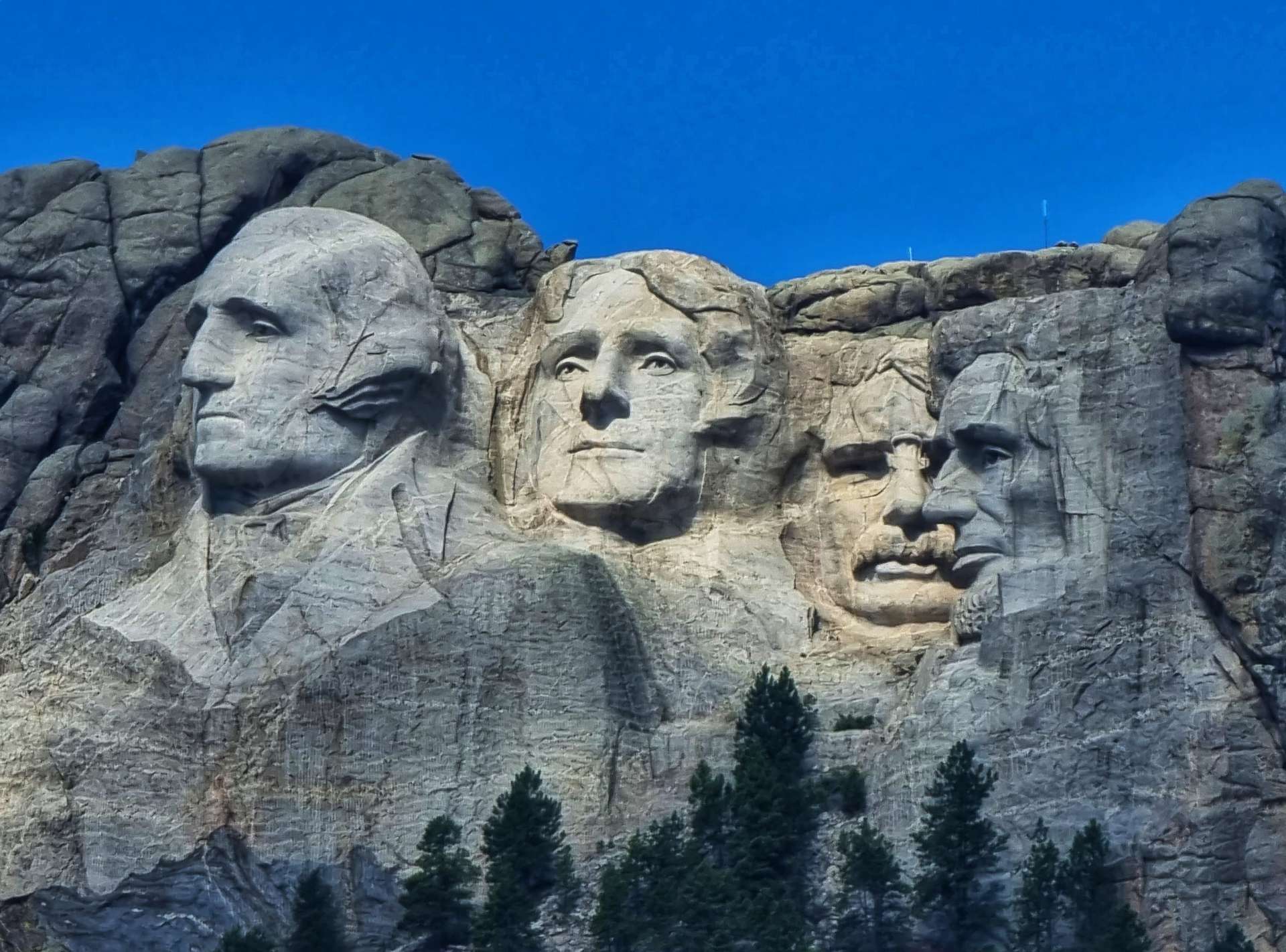
At various random points I’ve had “eureka moments” of what a huge adventure we’re on & seeing a sign for Chicago was one of those moments. Others include the first time we crossed a State Line (Washington to Idaho) for the first time after 21 days of cycling, when I had a 5 minute crisis of confidence on our 4 hour climb of Powder River Pass & when we visited Mount Rushmore & I realised we were now more than halfway through out adventure.
We continued to shadow the Interstate, with corn fields on our right, while trees separated us from the cars & lorries to our left. We headed towards Lake Michigan as we approach New Buffalo, heading through woodland that protected us from the sun overhead.
Our final view of Lake Michigan reminded me of the French Riviera with its stunning turquoise water, sandy beaches & distant coastline – it’s hard to believe this is an inland lake! I’ve really enjoyed my two & a half days tracking the USA’s largest body of water that lies entirely within its borders, but I’m also looking forward to seeing more large lakes before the adventure ends!
The eagle-eyed of you will notice that I’m wearing a different jersey in the selfie above & the one below. Well done if you noticed! There’s a simple explanation, the photo below was taken when we left Indiana a few days later! We crossed from Michigan to Indiana on a deserted lane between me taking the first & third photo below, so there wasn’t a “Welcome to Indiana” sign. We did visit Indiana though, honest!!!
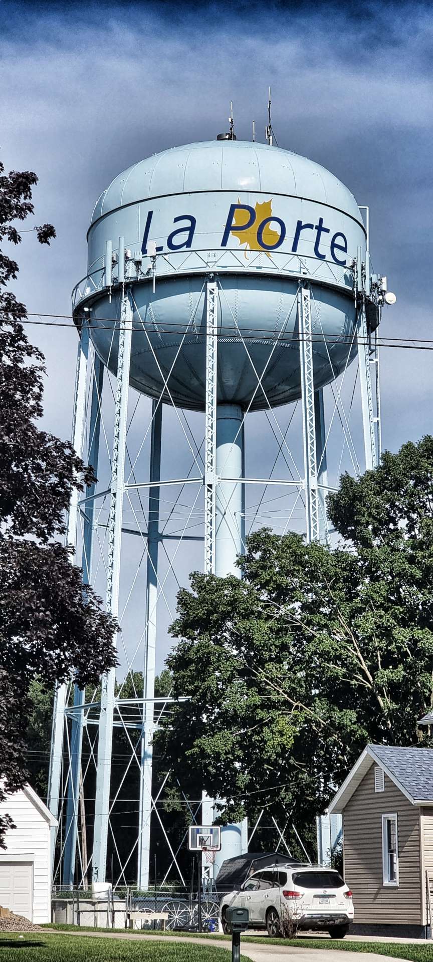
Our long, straight road intersected with a long straight railroad track & it wasn’t obvious from the bridge whether the rail or the road would deviate first! La Porte has about 10 to 15 lakes in the near vicinity & we passed a couple of them as we headed to our motel. The day had started under grey cloud, but ended in glorious sunshine – another brilliant day exploring in the saddle!
Stage Stats – 75 miles, 2,057 feet of climbing. Saying goodbye to the Lake & State of Michigan, as we say hello to Indiana.
Tuesday 2nd August – La Porte to Rochester (Stage 73).
A recurring theme as we’ve headed East is the ubiquitous presence of water towers that indicate the name of each town before you reach it. The La Porte example here is one of the better ones that we’ve seen. We made our way across town & within 10 minutes we had found the first of the day’s long, straight, farm roads – we would be on this one for about 11 miles without ever deviating off due South!
For most of the first couple of hours we were between fields of corn & soya beans, so when I saw a single, lonely sunflower I had to stop & capture the moment.
The straight roads, with right angle corners continued for more than 2 hours – this is something you never experience in the the UK & it took until mile 34 for our first non-ninety degree corner! That was just shy of half distance on today’s ride & only 2 miles short of our coffee stop…..
North Judson is home to the Fingerhut Bakery – I looked up a coffee stop in advance to make sure there was one, as we’re on remote roads all day. The bakery has been open for 75 years & on my limited taste test of their apricot & pineapple cakes, they’ll be here for another 75 years! The selection of cakes was out of this world & the people working in the shop had a real passion for what they did.
After I’d eaten 2 cakes Sean literally pushed me out the door before I settled in for the day!
As we joined the North Judson Erie Trail & it was clear that bikes would be welcome! The trail follows the old JK Line Railroad for 9 miles between North Judson & Bass Lake. The good news for us was that we would be cycling the entire 9 miles! Whereas once upon a time the railroad would have demanded right of way, the cycle trail gives way to traffic, so there are gates to slow cyclists down as they approach each of the roads.
As we were cycling along chatting to each other, we startled a huge contingent of birds of prey that were sat quietly on the ground. To this day I don’t know for sure what they were, as they were up in the air before we had a chance to have a good look at them. I shot some video footage of them, but I still can’t work out what they are, although I don know there are a lot of them!
We struck a rich vein of wildlife as no sooner had we left the trail than we spotted 3 deer, as they spotted us. They kindly stayed in place long enough for me to get a photo, then they turned around & pranced off into the distance. This is a sight I’m going to miss as we continue east.
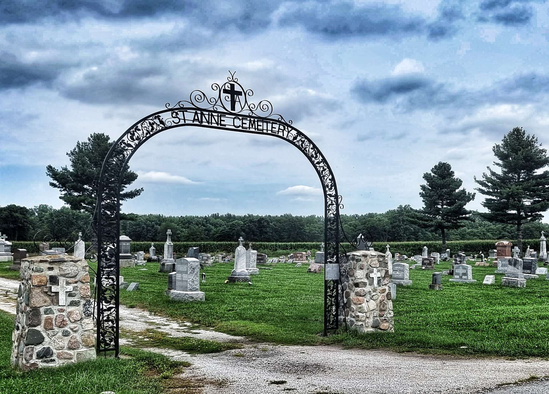
We were still on deserted, straight roads & we couldn’t remember when we last saw a car. All through Wisconsin, Michigan & now Indiana we’ve passed cemeteries on the outskirts of small towns. Some had as few of 5 or 10 headstones, while others like St Anne’s Cemetery outside Monterey had hundreds of memorials & headstones.
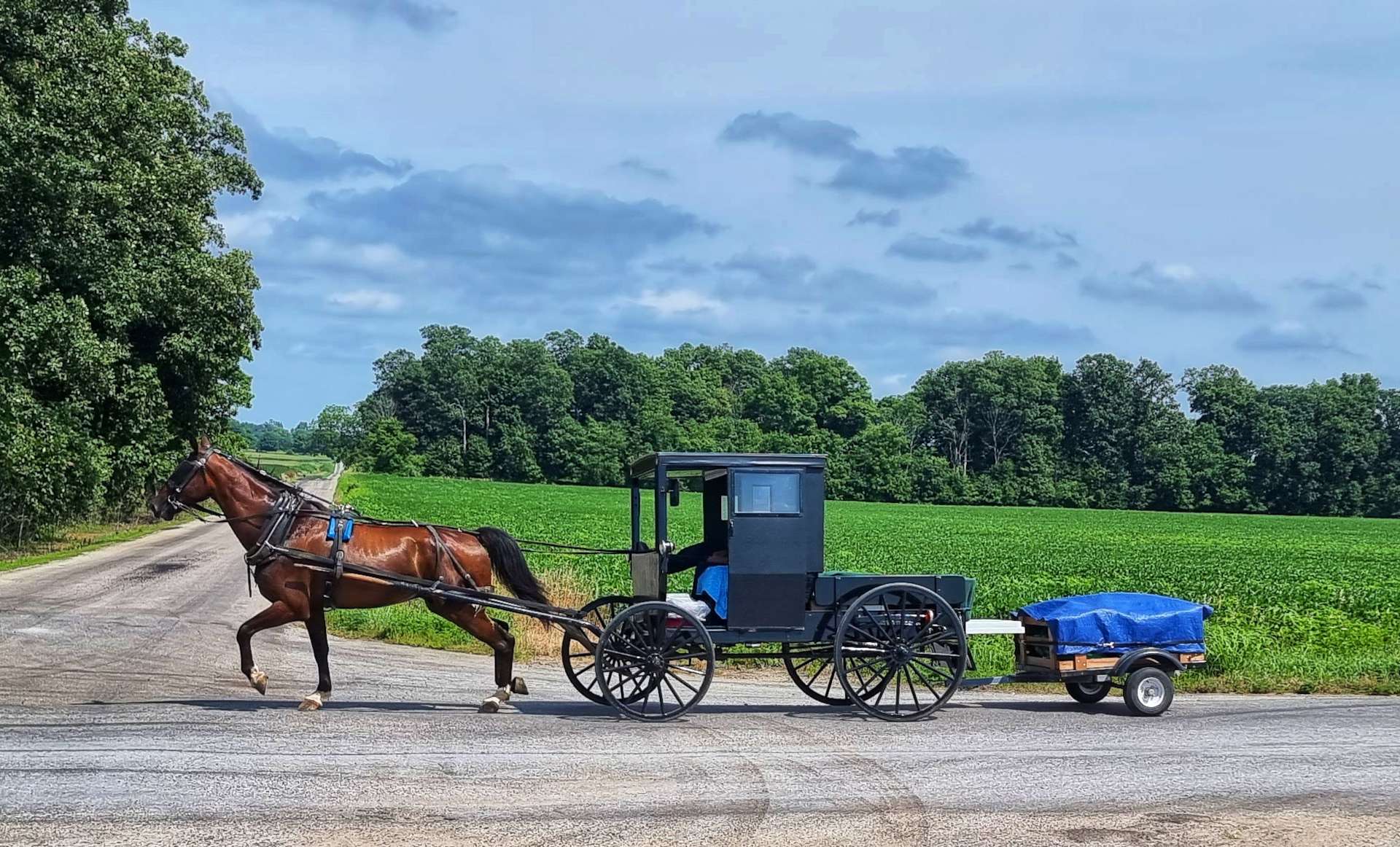
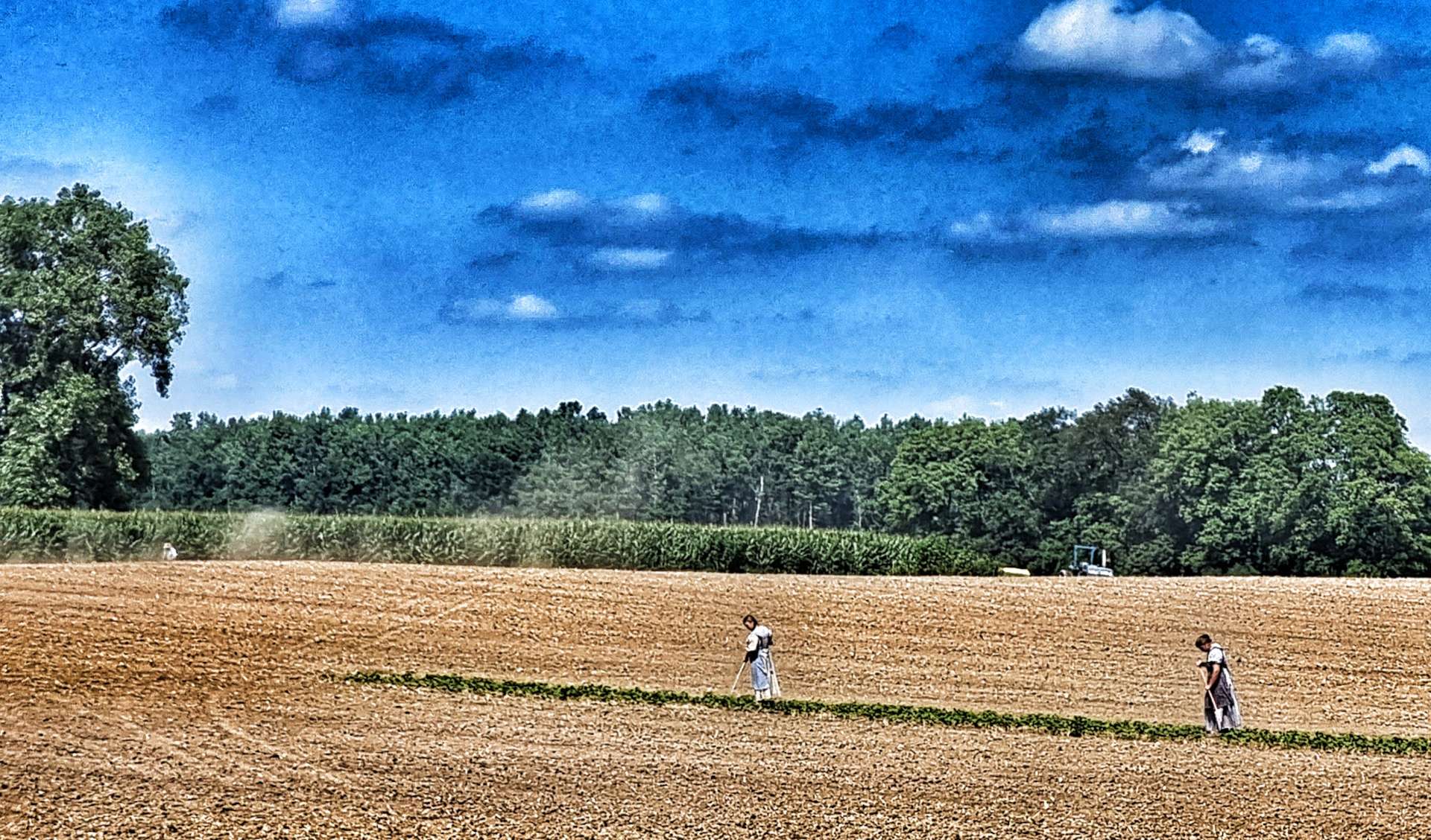
We stopped in Monterey to top up our water bottles & enjoy a cooling coke in the air conditioned bar. As we returned to farmland we gave way to an Amish horse-drawn carriage. We were hot on our bikes, but that was nothing compared to how hot it must have been for the people we saw working the fields dressed in traditional clothing.
As we continued towards Rochester on the final long, straight road of the day we passed a couple of examples of the type of houses we’ve been seeing for the last couple of days. The gardens are always pristine & the buildings are also kept in perfect condition.
Stage Stats – 78 miles, 689 feet of climbing. Our fourth day on the trot of cycling over 70 miles. An indication of how our fitness has built over the last 14 weeks.
You may remember that the original plan when we set off on 30th April was to ride an average of 5 days in every 7 & to average 50 miles a ride. In short, we’re quite close on the number of days we ride each month, but are cycling 20% further per ride than planned (60 miles instead of 50).
There were 31 possible riding days in July, so we were expecting to have ridden just over 22 days in the month.
July totals were;
13.1 – average speed in mph.
23 – number of days ridden.
45.0 – highest speed achieved in mph.
62.6– average mileage per ride.
78.32 – longest single ride.
109 – number of hours ridden.
1,440 – total miles ridden.
40,525 – feet climbed.
The totals since 30th April are;
12.7 – average speed in mph (up from 12.5 at the end of June).
71 – number of days ridden (up from 48 at the end of June).
53.3 – highest speed achieved in mph.
60.0 – average mileage per ride (up from 58.8 at the end of June).
104.08 – longest single ride.
334 – number of hours ridden (up from 225 at the end of June).
4,262 – total miles ridden (up from 2,834 at the end of June).
160,396 – feet climbed (up from 119,871 at the end of June).
While I had a detailed plan of the route we would try to follow, I hadn’t spent too much time planning where we might be 3 months in. However there have been some significant changes to the original route
April & May’s unseasonably cold weather, which has resulted in road closures due to snow in the mountains.
Late snow in Washington required us to navigate The Cascades via Stevens Pass, rather than Rainy & Washington Passes.
More snow in The Rockies meant we couldn’t explore as much of Glacier National Park as planned & the Going To The Sun Road was closed. As a result of increased Covid outbreaks, paperwork requirements & late snows, we didn’t visit the Canadian Rockies at all.
Our extended tour of Montana delayed our arrival in West Yellowstone – by then there had been flooding which caused Yellowstone National Park to be closed. We detoured via Jackson & Grand Teton National Park, so we could enter via the South Entrance on the day the National Park re-opened.
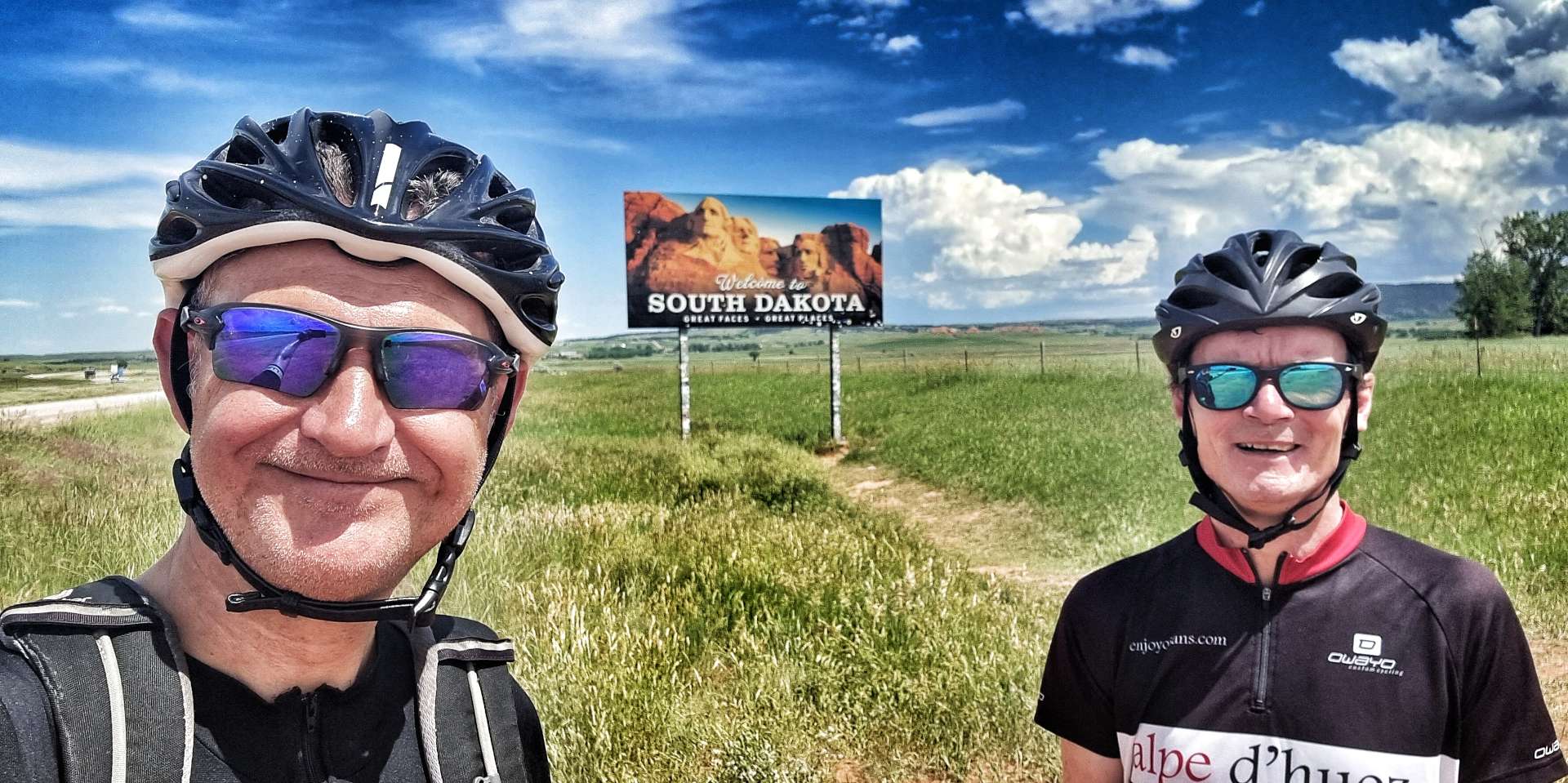
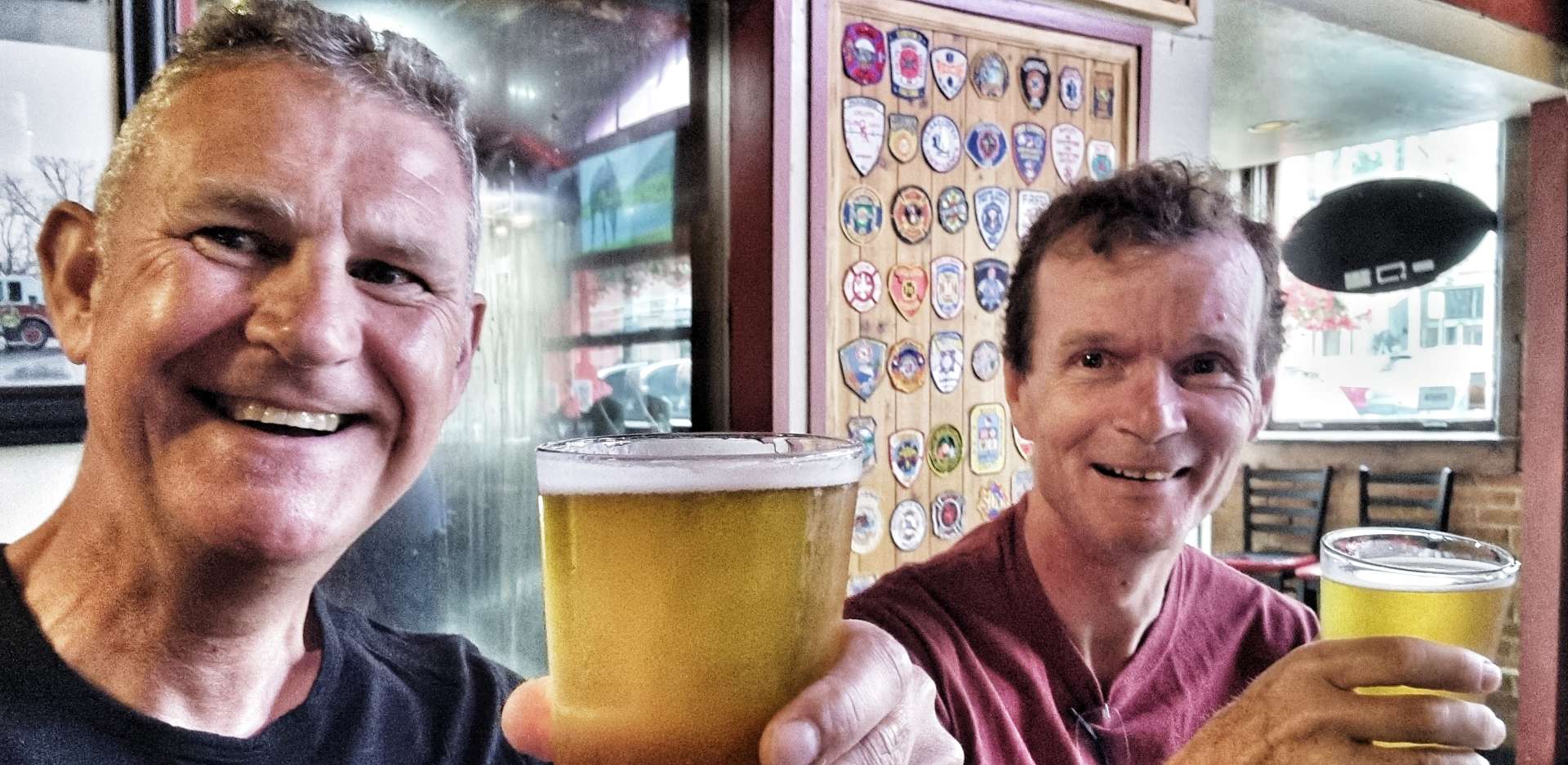
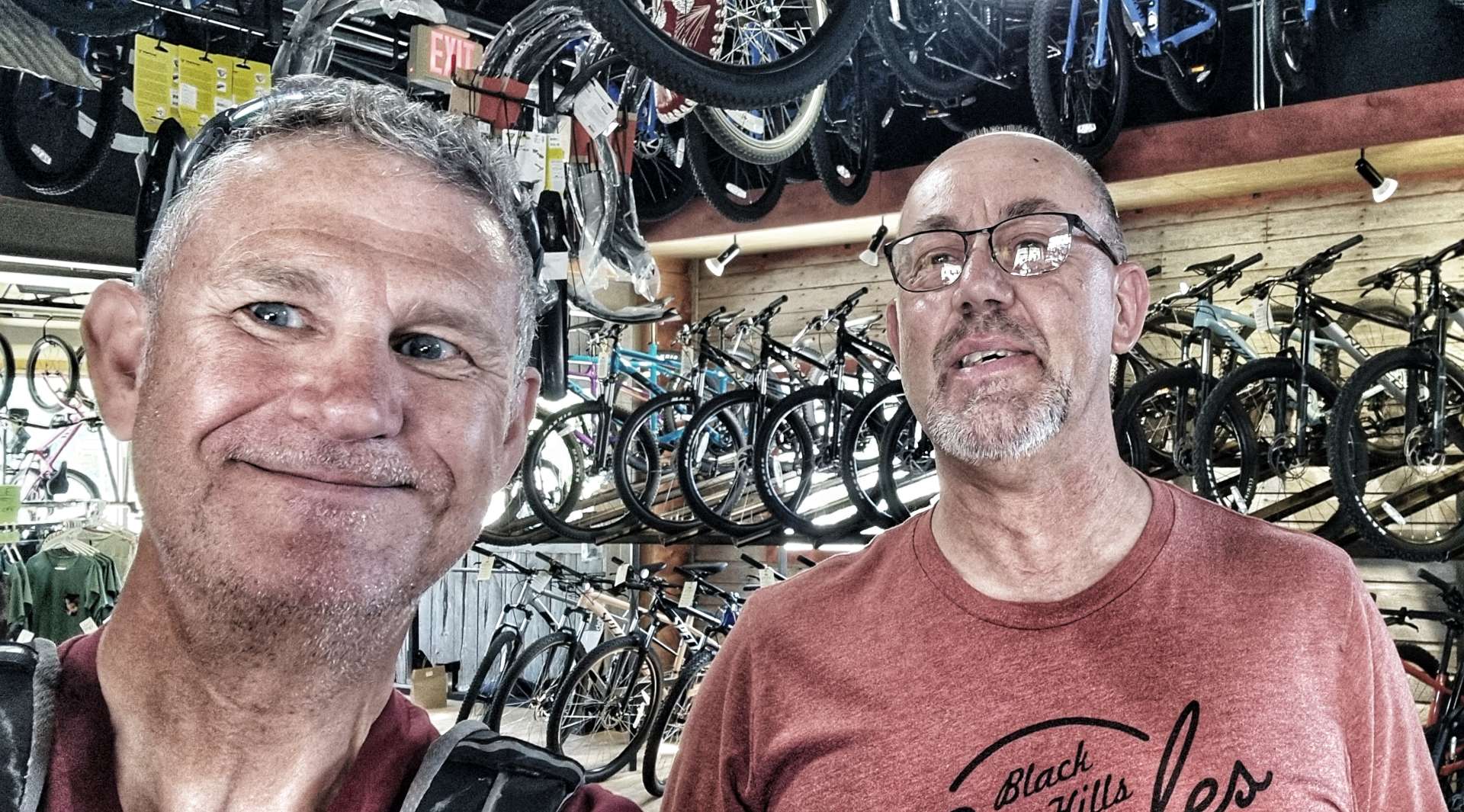
I’ve been amazed by the kindness & generosity of people in the mid-West. Without fail someone has stepped up & helped us when we needed help or assistance, none more so than Doug, Tom & Dan at Black Hills Bicycles when I was stuck with bike troubles in Philip, South Dakota.
We made a late decision to explore Wisconsin when we left Minneapolis, rather than Ohio & Illinois as previously planned. Thank you to everyone we met on the way who encouraged us to cycle in Wisconsin, we’ve had a great experience riding deserted roads, meeting some wonderful people & watching a world class Water Ski exhibition. We also got to take a ferry across Lake Michigan!
The changes to itinerary have all added to our experience & have taken us to some amazing places – Grand Teton is one of my favourite places on the adventure to date.
We will be back to our original route by 6th August, but I fully expect the plan to remain fluid & will embrace changes as they occur.
Saturday 30th July – Ludington to Muskegon (Stage 70).
We were packed & on our way by 8.45am, so after a final goodbye to the SS Badger, we set off on the first of three days exploring the West Coast shoreline of Lake Michigan. Almost as soon as we crossed the small inlet for Pere Marquette Lake, we had a short, sharp climb on to the sandy cliffs above Ludington. We saw what looked like grouse in the nearby Phillips Cemetery as we were making our way to the scenic overview for our first view of Lake Michigan, near the Ludington Pumped Storage Power Plant.
The hydroelectric power plant & reservoir were built in the late 1960’s & early 1970’s & the licence to operate the plant has just been extended to 2069. The reservoir above the plant is 2.5 miles long, by 1 mile wide, by 110 feet deep & it can hold 27 billion gallons of water – if you read yesterday’s post, you’ll know this reduces the height of Lake Michigan by less than 1/2 inch!
At peak performance, the facility can produce sufficient electricity to support a community of 1.65 million people.
After cresting Summit Park, we enjoyed the short, twisting descent to Bass Lake (it’s connected to Lake Michigan via a small outlet), where we saw water skiers for the 2nd time in 4 days – these ones were slightly less skilled than those we saw on Wednesday night. While some parts of the shoreline are covered in sandy beaches, other sections were set up as picnic or barbecue areas, with spaces for boats to dock.
Just on the outskirts of Pentwater, we passed the Veterans Memorial where an Abrams M60 tank was on display. Pentwater is a cosmopolitan town that caters to the many tourists who flock to Lake Michigan in the summer months. We were on a tight schedule, so after stopping to take some photos we continued to make our way around Lake Pentwater (which also has an outlet onto Lake Michigan).
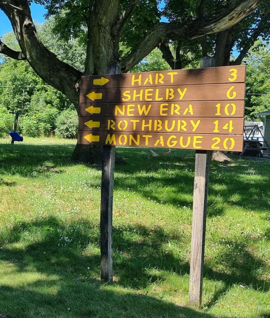
Leaving Pentwater behind, we took a quiet side road through the woods. We were on Cycle Route 35, 500 miles of which run through Michigan from Sault Ste Marie in Canada to New Buffalo in Indiana. We reached the small town of Hart at the 26 mile point & found The Bakery On The Corner, where we stopped for coffee & a cranberry muffin – tasty!
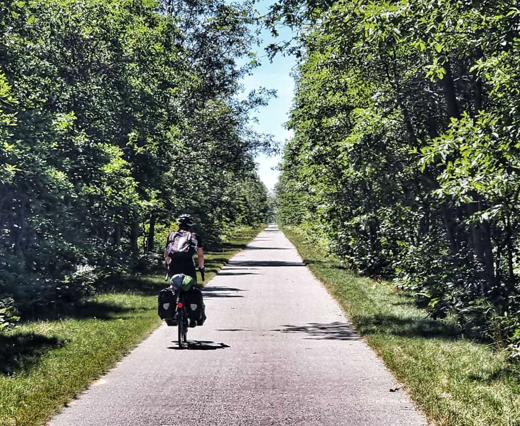
I was really looking forward to the next section as we would be following the routes of old railroad lines on purpose built bike paths. First up was the Hart-Montague Bike Trail State Park, Michigan’s first linear State Park. As the name suggests, the 22 mile trail starts in Hart & ends in Montague & it was one of the first Rails to Trails projects in Michigan.
Even though we were riding it on a Saturday morning, we hardly saw anyone on it until we reached Montague. The White Lake Pub Pedal is an annual event to raise awareness of the many bars & restaurants in the White Lake area & also raise funds for local causes. This year they were raising money for the White Lake Youth Theatre – as you can see from the photo below, the event was very well supported. We saw hundreds of people in Pub Pedal jerseys!
After crossing the White Lake & passing the Caboose Museum (the last car of a freight train, for the use of the train crew) we joined the White Lake Pathway for 3.2 miles as we crossed the town of Whitehall.
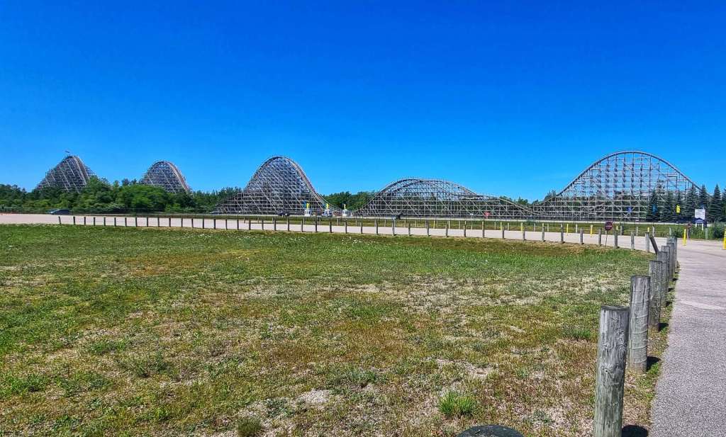
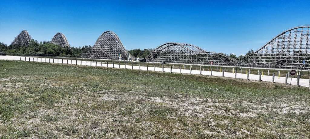
As the White Lake Pathway ended, so the Fred Meijer Berry Junction Trail began. The 11.5 mile trail follows an old Chesapeake & Ohio railroad route from Whitehall to North Muskegon & along the way we passed Michigan’s Adventure Park which has a wooden roller, the Shivering Timbers. Enjoy the footage below!
There was one small section of gravel which delivered us back to the road network about 5 miles from our motel in Muskegon. This final 5 miles was possibly the roughest tarmac we’ve experienced on our adventure to date. There were more potholes than road surface! It had been another epic day in the saddle & we’re hoping to see more of Lake Michigan tomorrow.
Stage Stats – 72 miles, 1,539 feet of climbing. The majority of the day was spent on cycling specific trails & paths.
Sunday 31st July – Muskegon to South Haven (Stage 71).
We had another long day in the saddle planned, so we were up & on our way just aver 9am again. Within 10 minutes we had our first views of water – Mona Lake is another of the many inlets around Lake Michigan & exclusive local communities have sprung up on them all. Lake Michigan is known as the USA’s Third Coastline & on what is only our 2nd morning of exploring, it’s easy to see why.
If you look carefully at the 4th photo, you may be able to think of your own witty caption, along the lines of “Man with….”
In between Lake Harbor Park & PJ Hofmeister State Park we were clearly in an area of town inhabited by “The Haves”. The properties were immaculate with perfectly manicured lawns & with highly prized & much sought after access to the Lake Michigan shoreline.
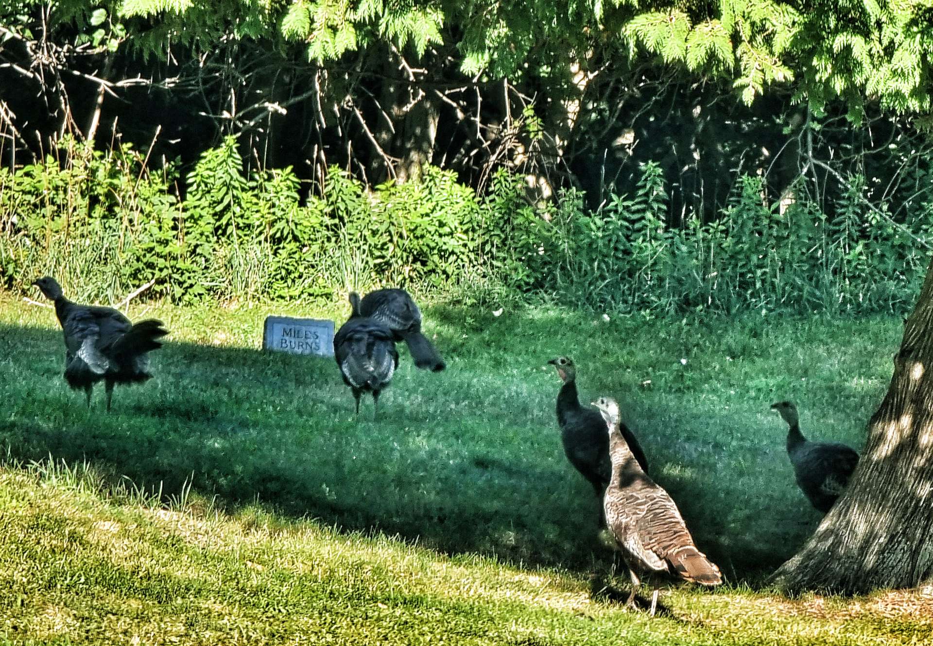
We took a right turn that took us through the Ferrysburg Nature Reserve & just after we left it we encountered some roadworks, so had to slow down. At that same moment, 5 wild turkeys walked out of a nearby garden & proceeded to cross the road in front of us – I’m so glad I got some photos, as it was a surreal moment!
Continuing on our way, we reached Grand Haven, which is renowned for its soft-sand beaches, picturesque lighthouse & musical fountain with a synchronised light show. Every year Grand Haven hosts “Coast Guard City, USA”, which honours the men & women of the US Coast Guard who serve & protect the citizens of West Michigan. Most of the residents appear to get involved, based on the number of houses that were displaying posters, banners & flags.
As we headed out of town, we caught up with & overtook a lone cyclist. As we passed him, he picked up his pace & slotted in on the back of us – our first chain-gang of our adventure! He asked us about our trip & said he was out for a short ride that would finish when he got to Holland – this was on our route too, so he stayed on our back wheel for about 15 minutes or so as we chatted.
It felt as if we had headed inland, as we hadn’t seen the shoreline of the lake for the best part of 10 miles, but as we reached Beechwood & Holland, Lake Macatawa (another small inlet of Lake Michigan) came into view.
I had been looking forward to Holland, as I’d seen a possible coffee stop that I wanted to check out. Bowerman’s on 8th specialises in blueberries (the Bowerman family own a blueberry farm & they produce a wide range of blueberry based drinks
I engaged fully in the blueberry experience – blueberry & lemon meringue pie (best sweet cake / pie / pastry of the trip), a triple blueberry cheesecake (2nd best cake / pie / pastry of the trip) & an iced raspberry mocha (which was also delicious!). Sean had a blueberry latte & he was equally delighted with his choice too.
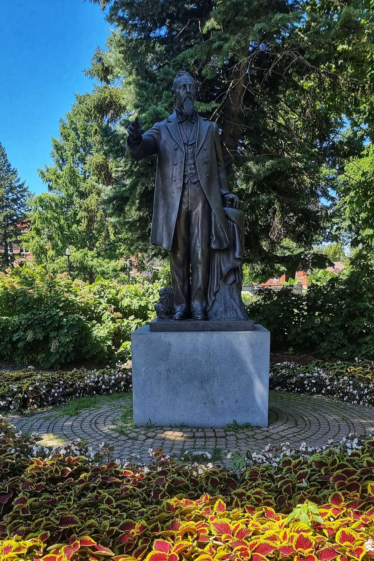
Reverend Dr Alberius C Van Raalie founded the city of Holland when he brought a group of fellow immigrants from the Netherlands in 1847. The plaque which gave me this information was unveiled on the 150th anniversary of the city being incorporated, by Her Royal Highness, Princess Margriet of the Netherlands.
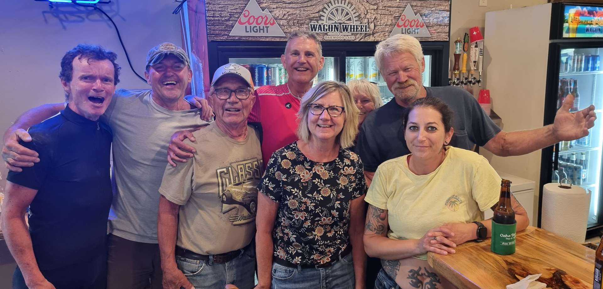
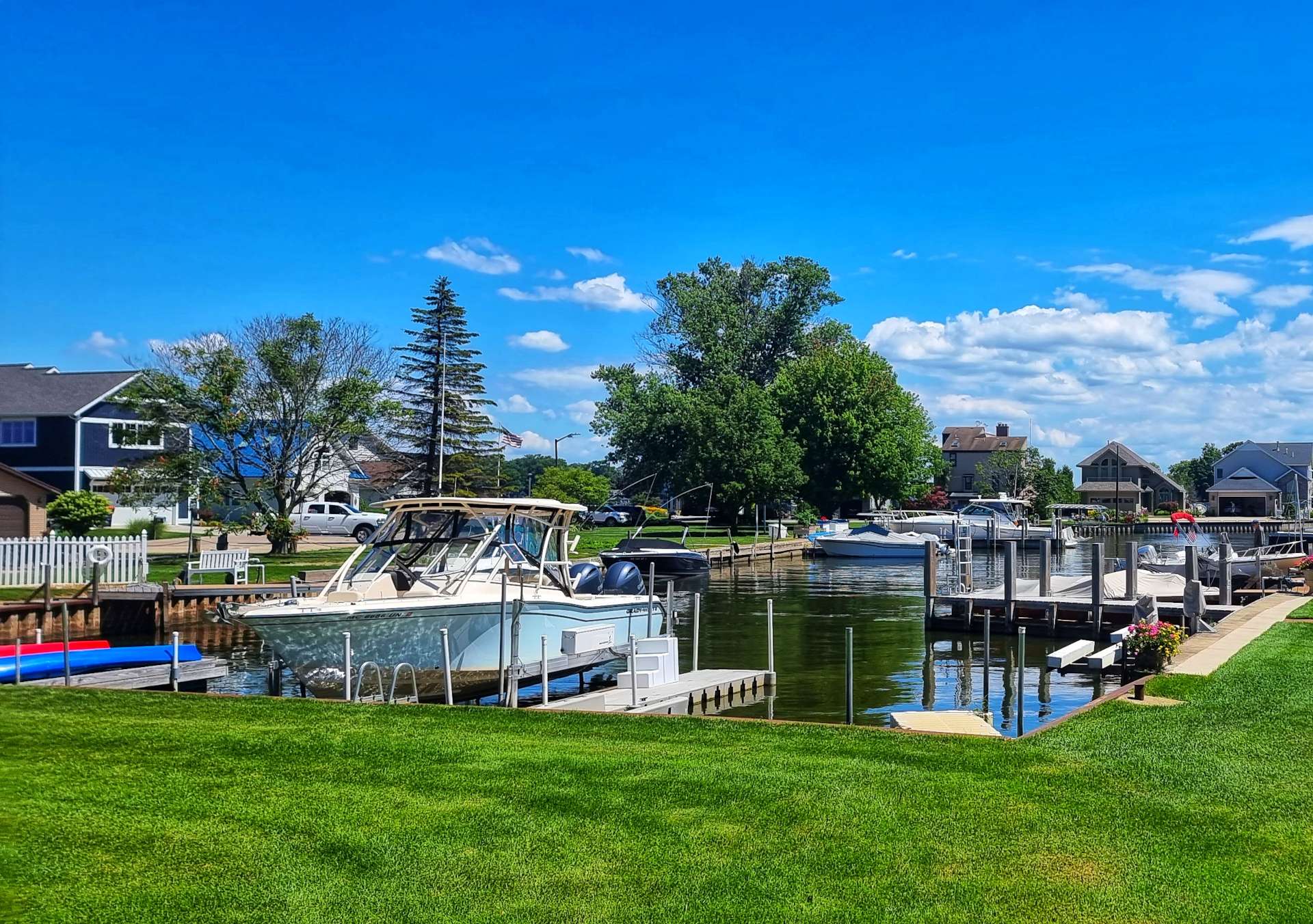
It was clear that Lake Macatawa was an exclusive area to live in. We caught a few glimpses of the properties & one of the estates was accessible, so I poked my nose in for a look around. Each house had a dock allocated in the private marina – I was tempted to ask for a trip on a boat, but didn’t think they would be as approachable of my friends at The Wagon Wheel who took me out on Oakwood Lake!!!
Sand Castle View estate had one of the best follies I’ve seen, so I’ve included that here too – there isn’t a story, I just liked the photo.
If we were in any doubt about the money that lives here, in the space of 5 minutes only 3 cars passed us – 1 Ferrari & 2 Porsches. Next up was the small beachfront resort of Saugatuck, with its bars & restaurants that overlooked Kalamazoo Lake. Boats of all shapes & sizes were in evidence, from the eye-wateringly expensive boats staffed by a crew, to the one & two seaters. All budgets & tastes were there.
In order to reach our next piece of paradise, we needed to ride on a slightly busier road, but as you can see, it’s not exactly rush-hour! It’s a sign of how fortunate we’ve been to ride on deserted roads that I even mention this. We had one final view of Lake Michigan & families enjoying their Sunday afternoons, before heading inland slightly for the remainder of the ride.
As we approached the town of Glenn we took the decision to ignore the Detour signs & the price of that particular decision was to ride on a surface that was similar to when the ironworks have been exposed in the UK. My fault, I chose to take the direct route at the end of a tiring day!
As you can see though, it didn’t dampen our spirits, as we were only a few miles from our Motel. Once we’d checked-in & completed our laundry, we headed out to toast our time in Michigan, as tomorrow we head to our next State. We also tucked in to a Rib Dinner special each to replenish our energy, although I’m confident that once again we had a day where we expended more than we ate!
Stage Stats – 74 miles, 1,450 feet of climbing. A day of exceptional pies & cakes at Bowerman’s on 8th!
Well, How Did We Get Here? Miles, Feet Climbed, Maps & Profiles.
Previous updates described how we travelled from Seattle in Washington to Red Wing in Minnesota in the first 12 weeks of our adventure. Now find out where we went & what we did in Week 13! Hopefully picking a single photo to represent each day will refresh my mind when it comes to looking back on my adventure! I cheated this week & allocated Lazy Monday’s photo to Friday.
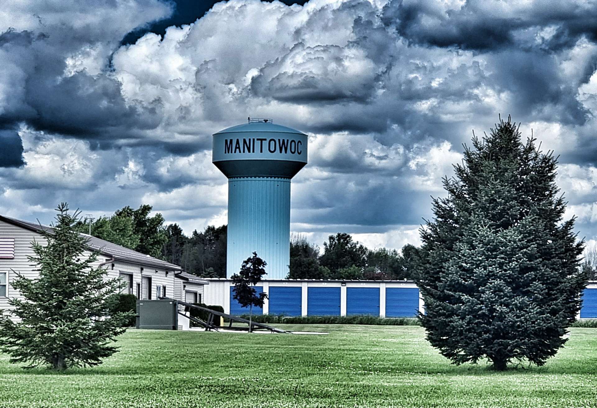
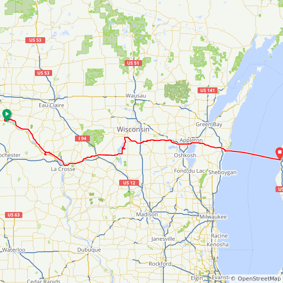
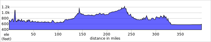
Saturday was all about crossing the Mississippi river twice & getting caught it an electrical storm. On Sunday we finally moved into Wisconsin for a few days, having done day trips there on Friday & Saturday! Monday was a lazy rest day, so I’ve allocated the photo to Friday. Tuesday we cycled quiet backroads & saw a tank, as well as having our first navigational challenge of the trip. Wednesday delivered us to Fremont, where we met Lin, Pat & Mike, as well as seeing a brilliant water skiing exhibition. Thursday we picked up a glorious tailwind into Manitowoc & on Friday we took the ferry across Lake Michigan & met Anders, John, Glady & Ed.
Another great week with some sightseeing, getting off the beaten track & making more friends on our Coast to Coast adventure.
Week Thirteen – Red Wing (MN) to Ludington (MI) via Wisconsin