
Ain’t No Mountain High Enough
Sunday 8th May – Stage 8
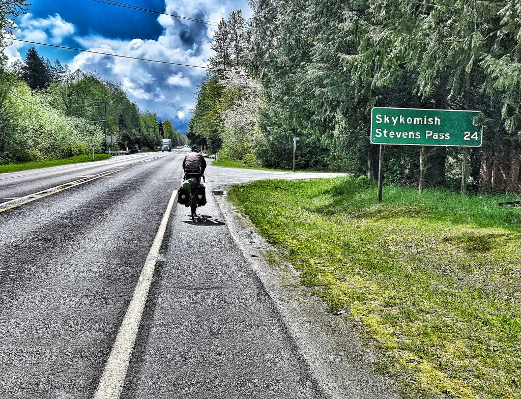
Gold Bar to Leavenworth via the Stevens Pass. Since we floated the idea of re-routing south to cross the Cascade Mountains, this day had been playing on my mind. It would be the first serious examination of our ability to cross the USA coast to coast. The Stevens Pass is a 15 mile climb that rises to 4,061 feet above sea level & we would be attempting it with fully loaded panniers on heavy touring bikes – while we’d done many training rides, none of them could compare to today’s route.
Enough of the hype – We would be on State Route 2 all day, heading in an easterly direction. As we expected a long day in the saddle, we’d finished breakfast & were on our way by 9am. We started under lead grey skies, with clouds hiding most of the snow covered higher peaks.
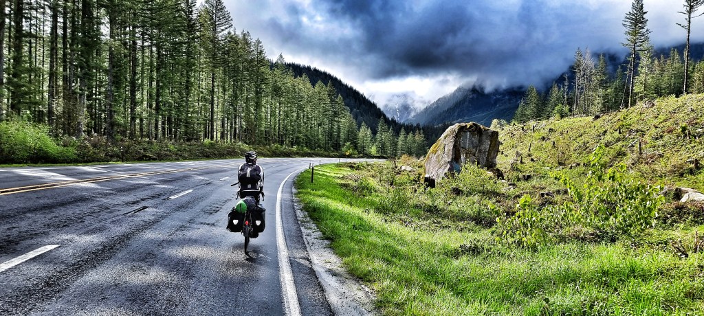
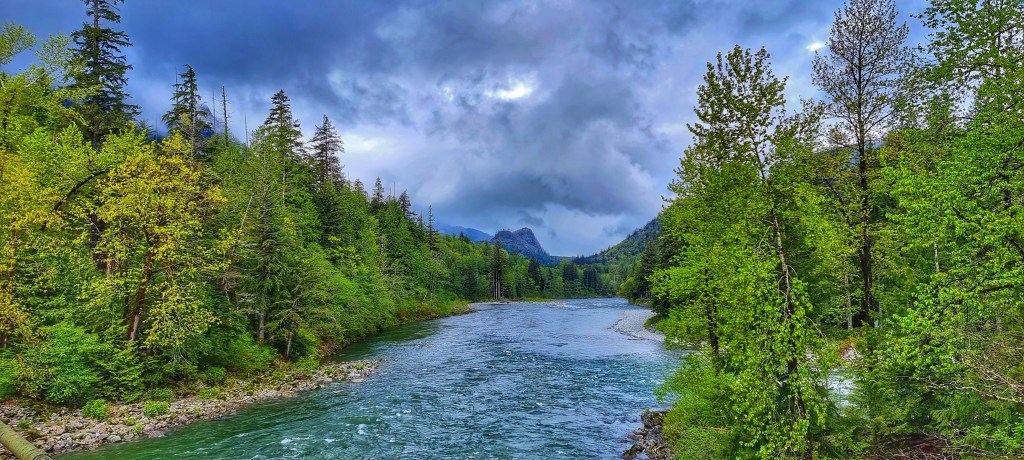
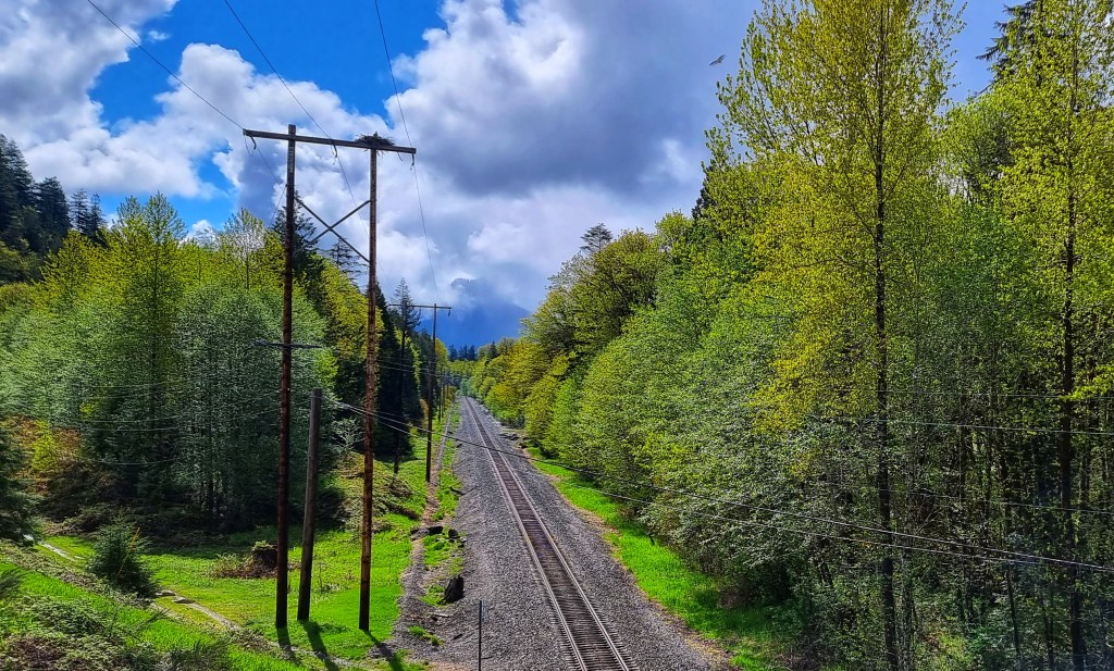
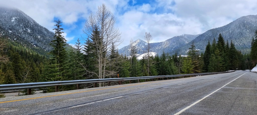
We could make out light dustings of overnight snow on the pine trees which dominated the lower slopes. Our hotel rooms were booked in Leavenworth & were non-refundable, so one way or another we had to crack on! We followed the Skykomish river & railroad as they criss-crossed their way across the valley, always creeping ever higher. In the blink of an eye, the grey skies were replaced with sunshine for the first time in a week & we saw the immensity of the landscape around us. What struck us was how close we were already to the snowline, yet we were at barely 750 feet above sea level!

Our first animal surprise was spotting an active eagle nesting site on the top of a telegraph pole by the side of the railroad & one of the eagles was guarding the nest – you may be able to make out the other eagle flying just above the trees on the right of the photo. This was quickly followed by a completely unexpected sighting of a Bigfoot just outside of Index – this is where Harry & The Hendersons was filmed back in the late 1980’s & early 90’s. Needless to say we stopped for a selfie with the big man himself!

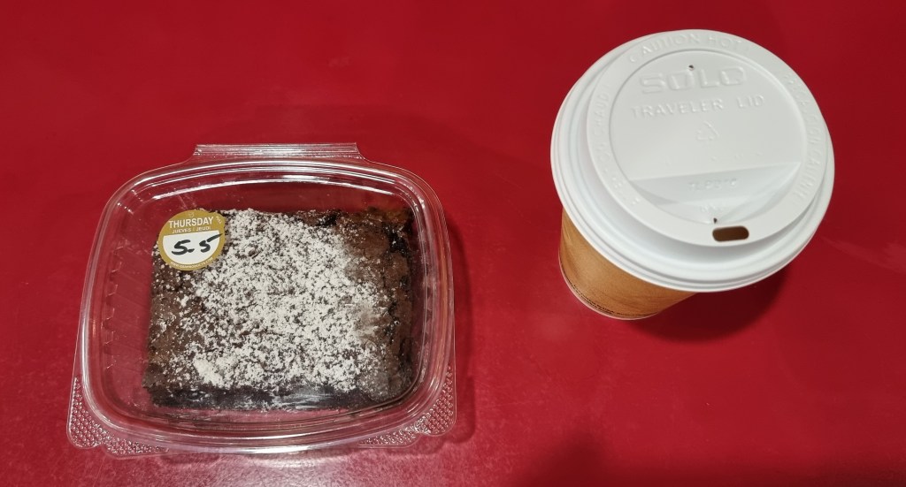
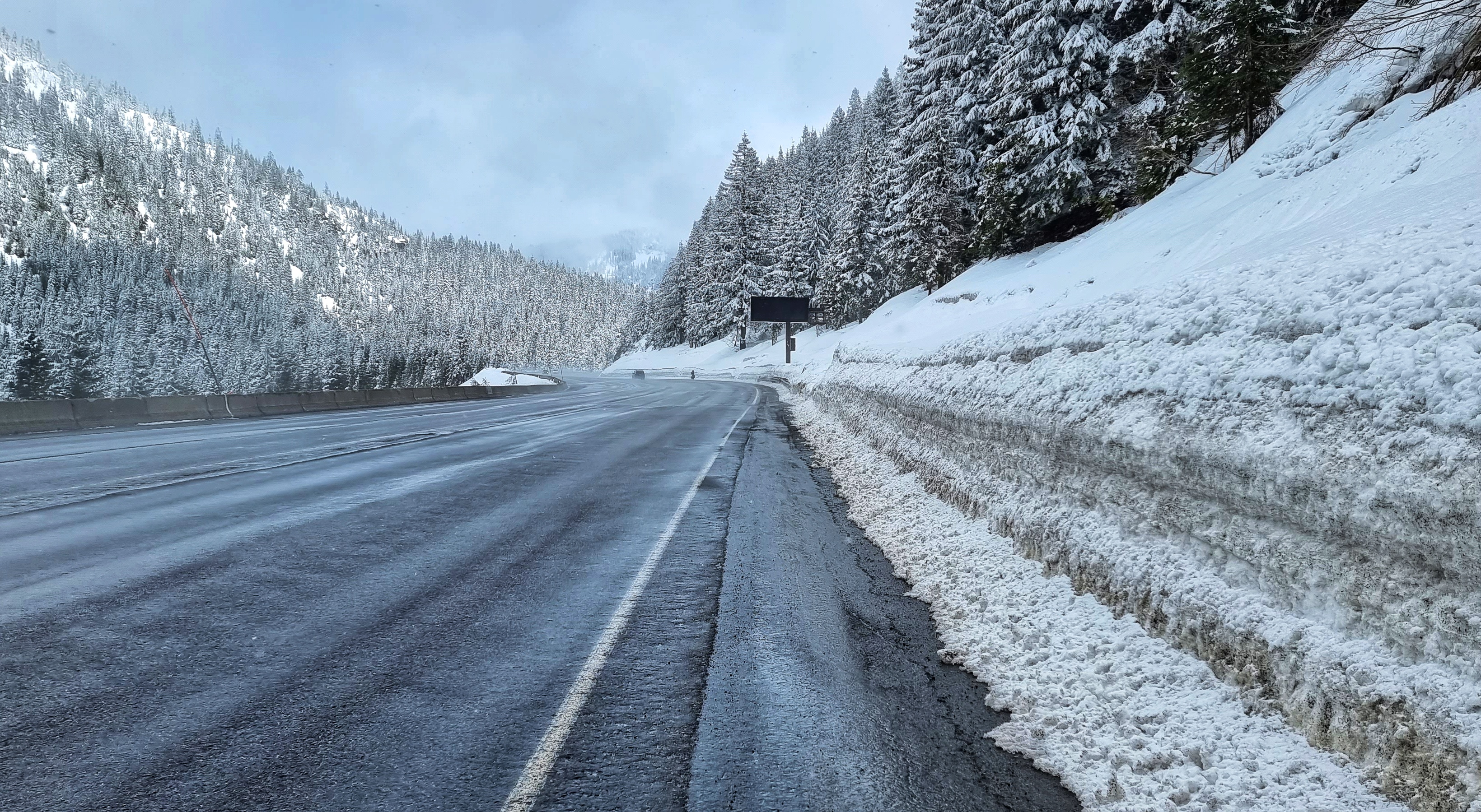
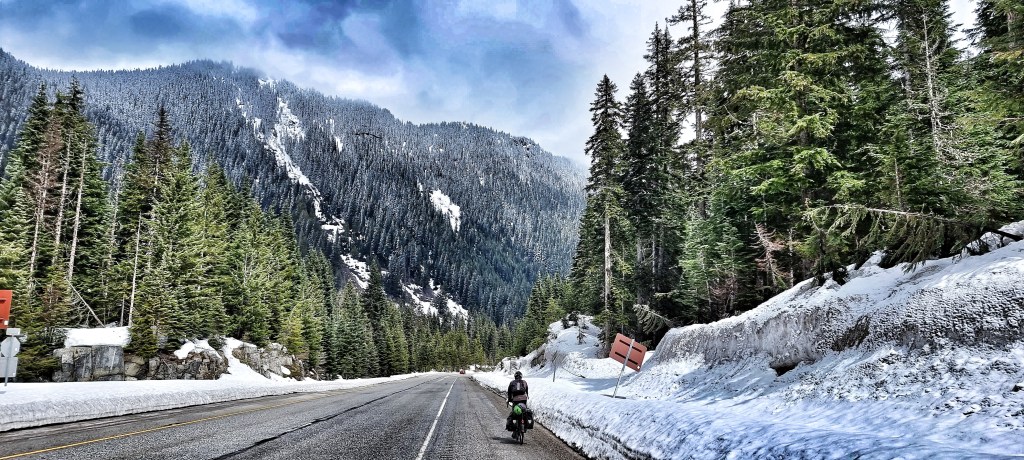
We pulled in at LouSkis in Skykomish after 19 miles, so we could enjoy a huge chocolate brownie & americano before setting off for the main course. The climb began in earnest at mile 22 as we passed Deception Falls – up to this point we’d gained about 1,000 feet of elevation. Over the next 15 miles we’d be gaining another 3,000 feet at a fairly steady 4% – 6% gradient.

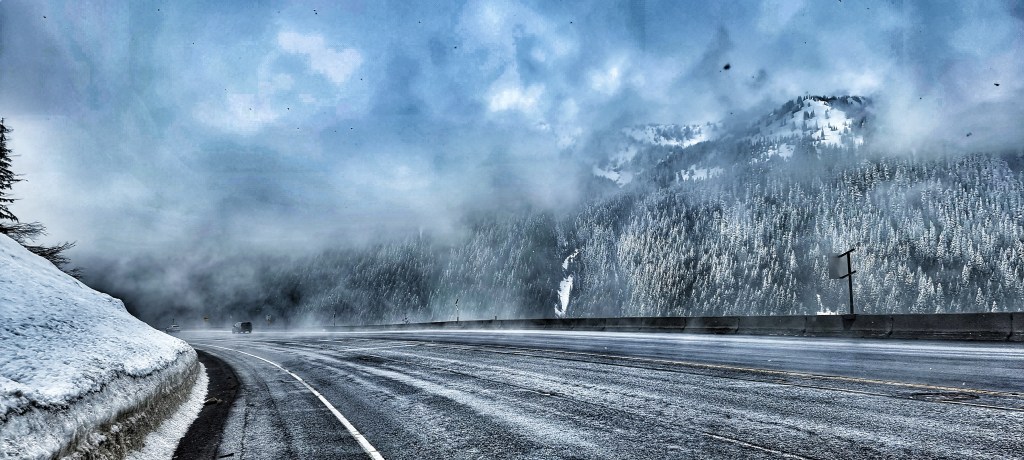
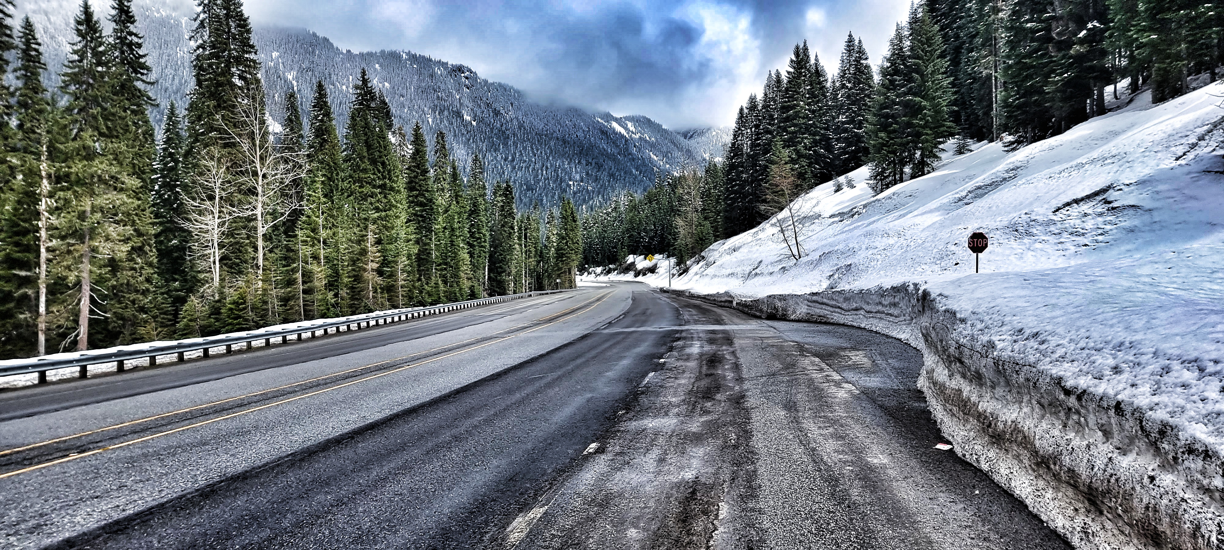
As we hit 1,500 feet above sea level we reached the snow line – small little hummocks & mounds to begin with. Soon the ground was covered in snow everywhere except on the road, which remained mainly dry & completely ice-free. Sean gradually began to pull away from me at the 3 to 4 mile point in the climb, so I took the time to record my thoughts on the lower slopes of Stevens Pass.
At the 6 mile point the road turned back on itself as a hairpin (or lacet) & I realised that we’d had a tailwind up the climb so far & would now be into a headwind!! Crikey, that would add another level of difficulty to proceedings. As would the snow that was now starting to fall as the temperature plummeted to below zero degrees centigrade. I was generating enough heat that I was still comfortable in a short sleeved jersey, arm warmers, gilet & cycling shorts.

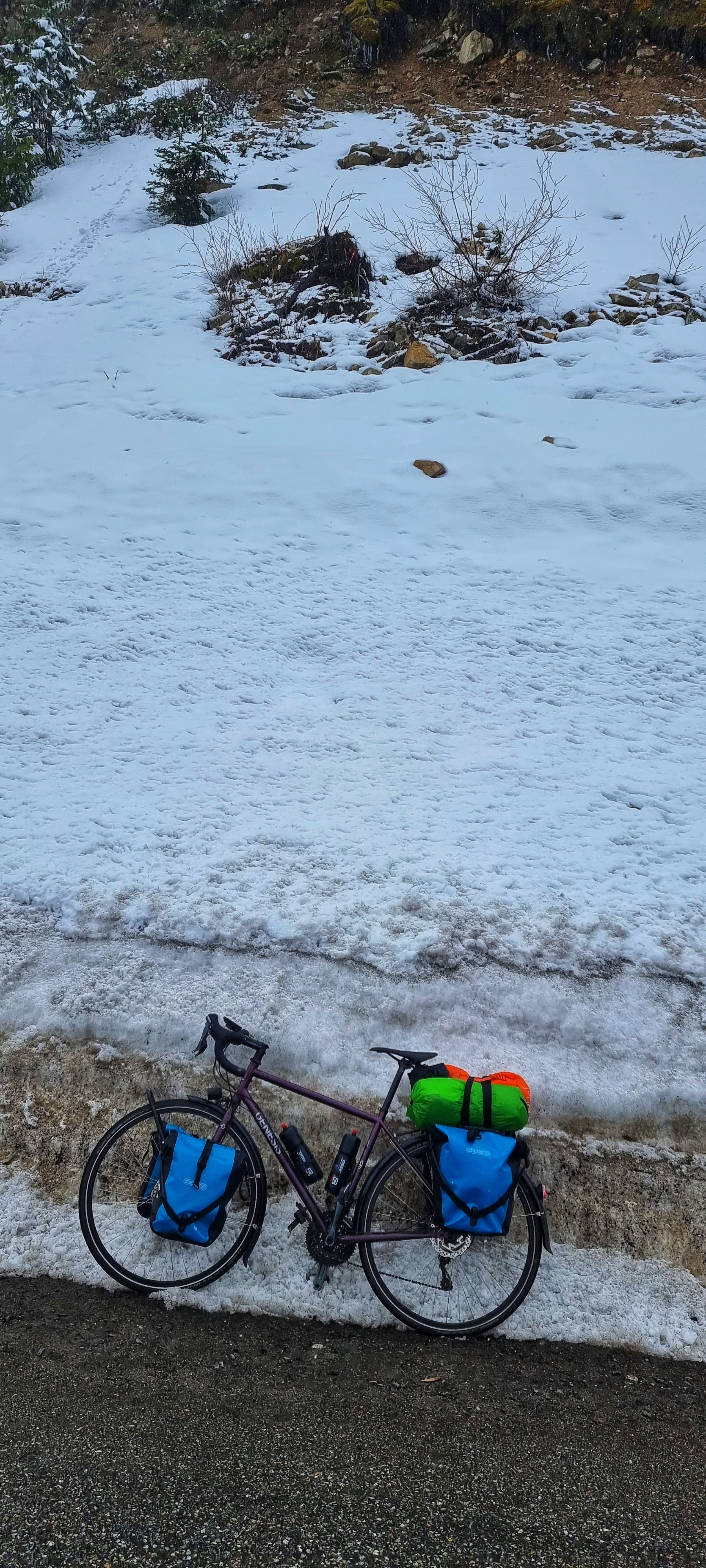
I stopped for a moment to take a photo of my bike next to the large snowbanks by the side of the road & then recorded another snippet of video to remind myself how the climb felt. A few cars hooted their horns & waved at the 2 mad Brits cycling up Stevens Pass in the snow!
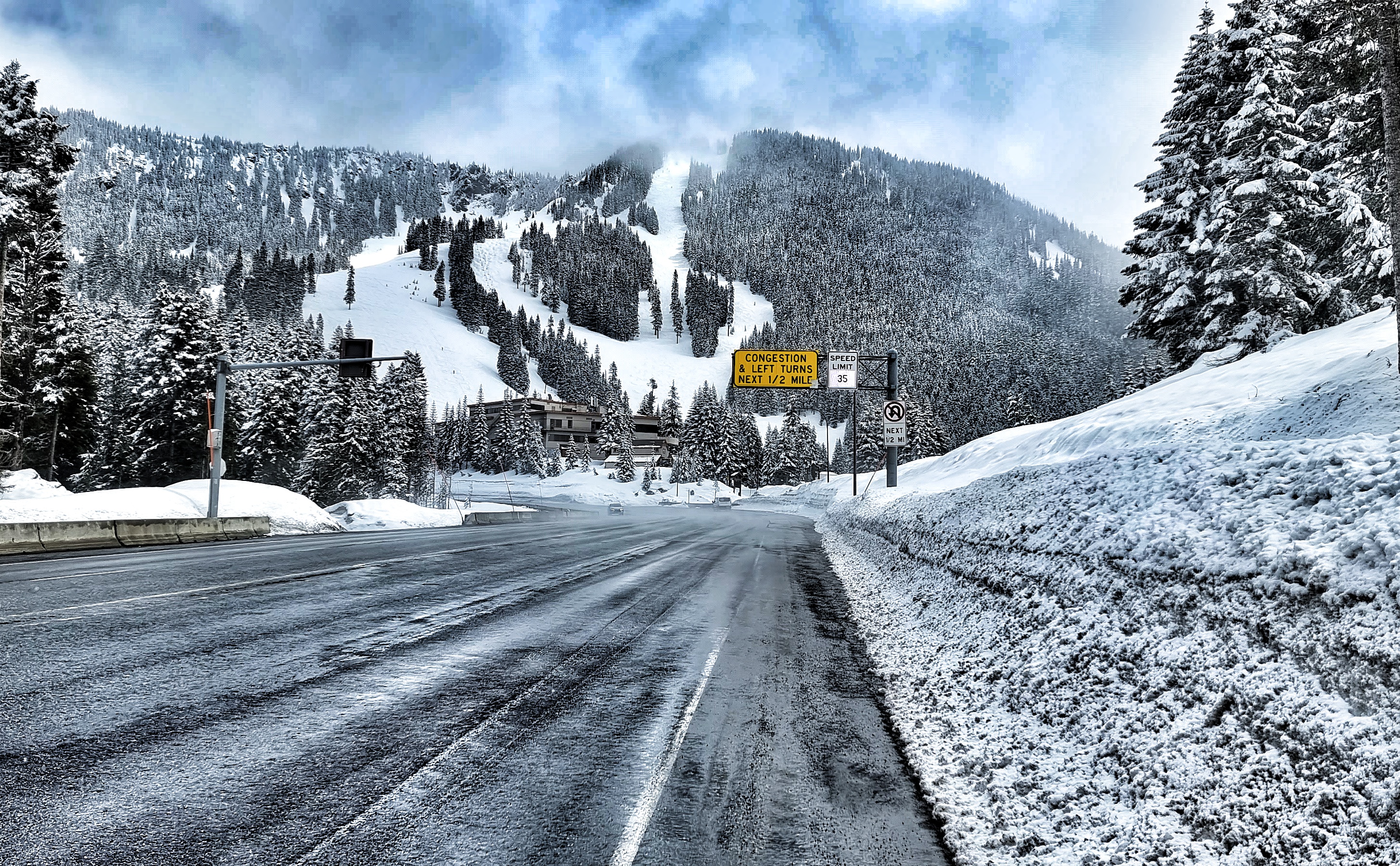
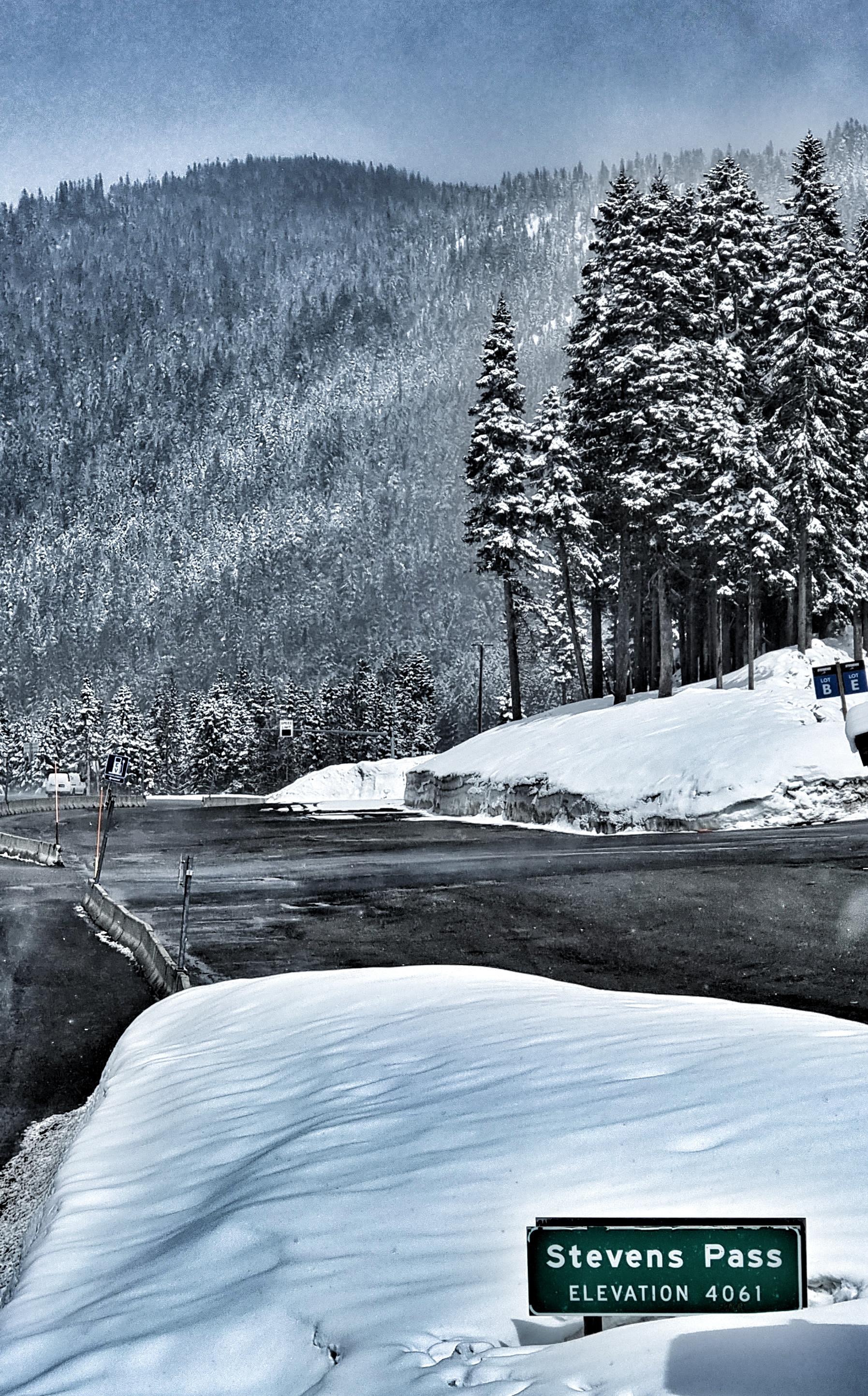
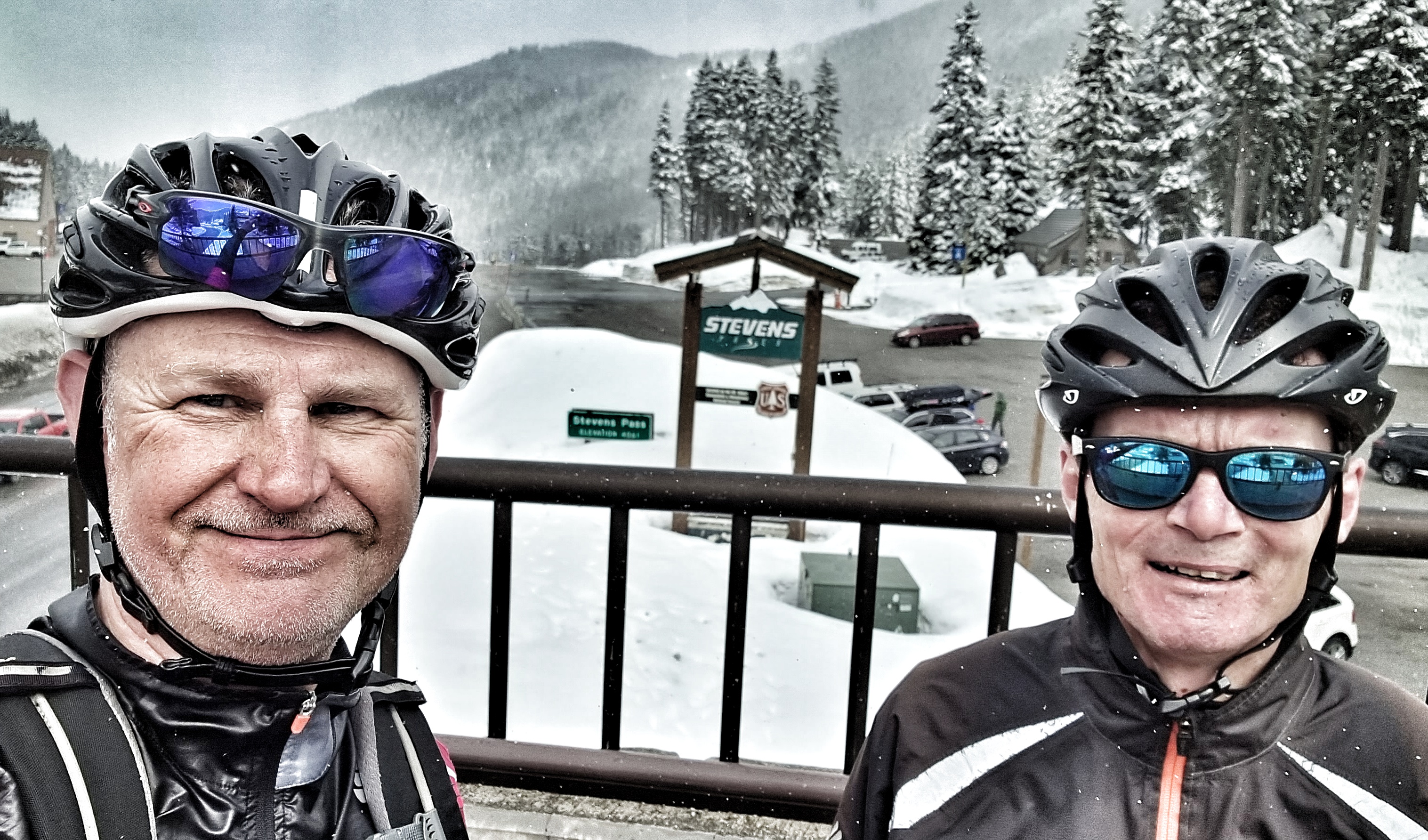
A mere 1 hour 50 minutes after we started the climb, we were congratulating each other on the summit, taking a couple of photos for posterity, then I was putting on long fingered gloves & my Castelli Gabba for a lightning descent towards Leavenworth, some 34 miles down the mountain.
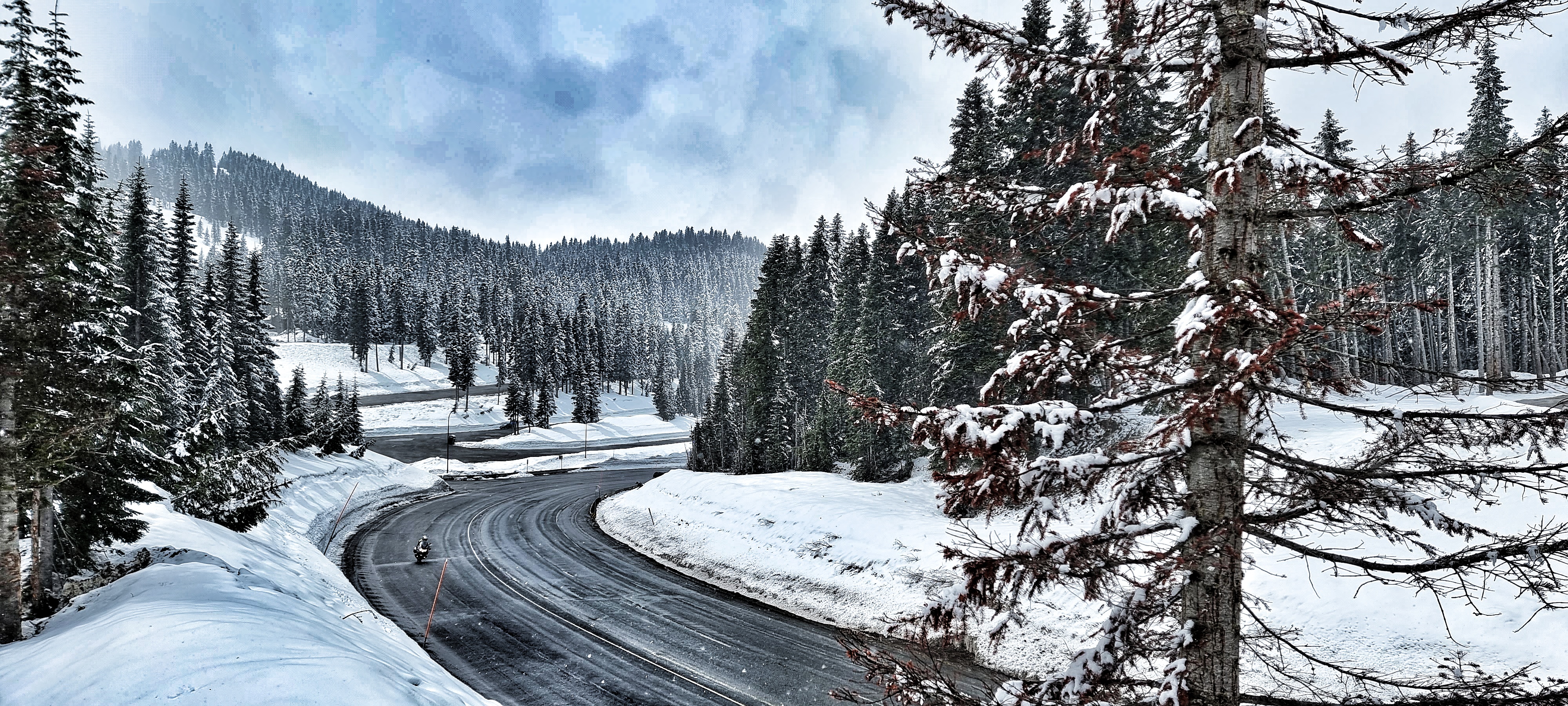
We were still in the cloud cover as we commenced the downhill, but it only took about 10 minutes for us to return to the sun again. I hit 42 mph as we plummeted to the valley below.
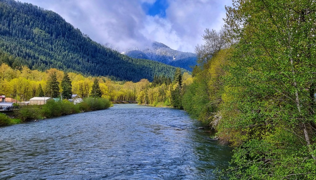
All the while, we had huge views across to the mountains on either side of us. There were a couple of short, leg stinging uphill sections, but we were generally enjoying a 34 mile descent towards Leavenworth. SR2 was tracing the course of the Nason Creek until Coles Corner. Then a few miles later we joined the Wenatchee river for the final 10 miles into Leavenworth. It’s a fast flowing river with many sections of white water – we were lucky enough to see a deer by the edge of the river & an eagle soaring on the thermals on this stretch.


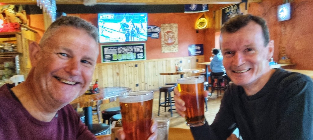
Just before 4pm we entered Leavenworth at the end of a truly epic day in the saddle. As if the day couldn’t get any better, we spotted 3 deer on the pitch & putt golf course as we walked into town for food & a few celebratory beers! Tomorrow is a rest day after all!!


Stage Stats – 71 miles, 5,702 feet of climbing. Rolling to begin with, Hors Category climb, then exhilarating descent. Worthy of its billing as the Queen Stage so far.
