Alpine Adventures – Tour de Barcelonnette – September 2019

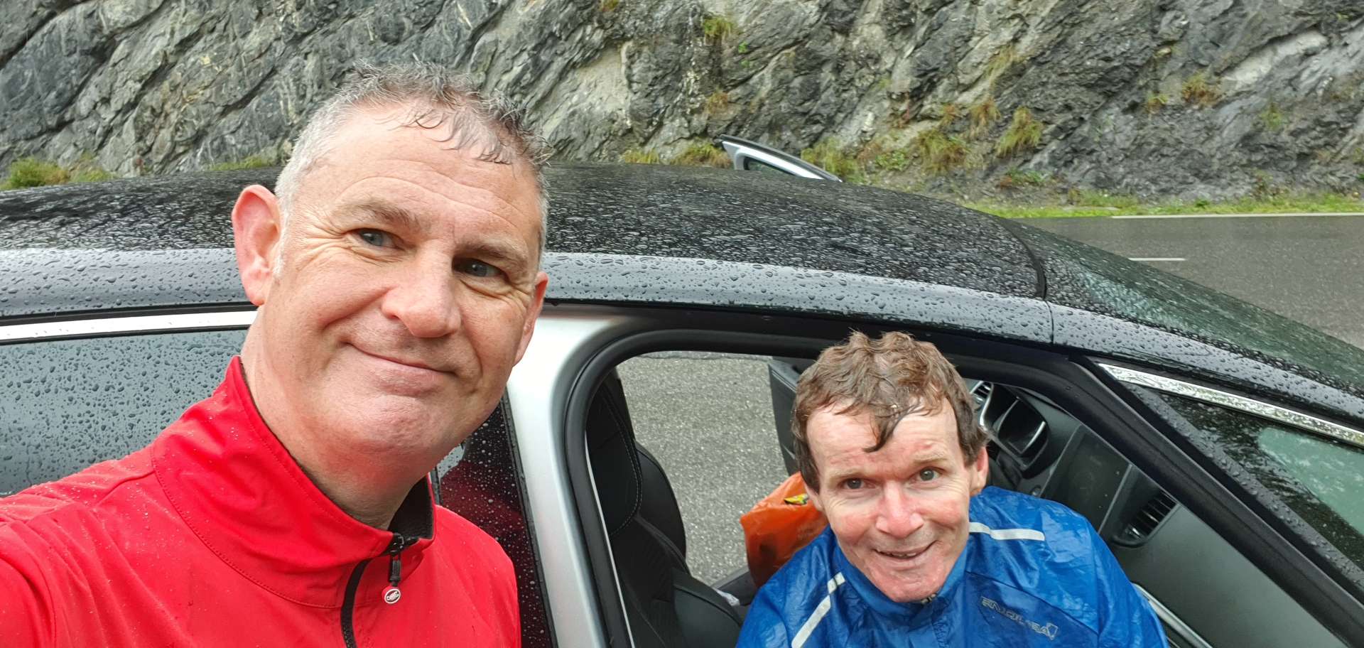
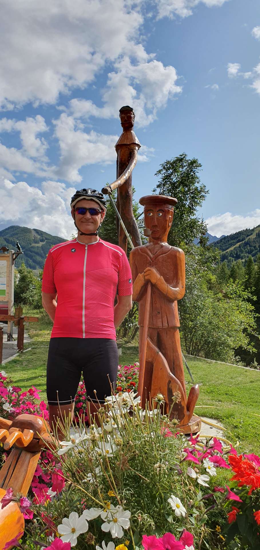
Bal Blanche Loop – Day Four

After yesterday’s almost constant rain, we woke to clear blue skies overhead, so today’s plan was to tackle the mighty Col de la Bonette. However, after heavy snow yesterday, the roadside col information signs said that the col was closed. We found this out about 2 miles into the planned route. We’re in Barcelonnette for another couple of days, so hopefully we’ll still have a chance to explore both sides of the Bonette.

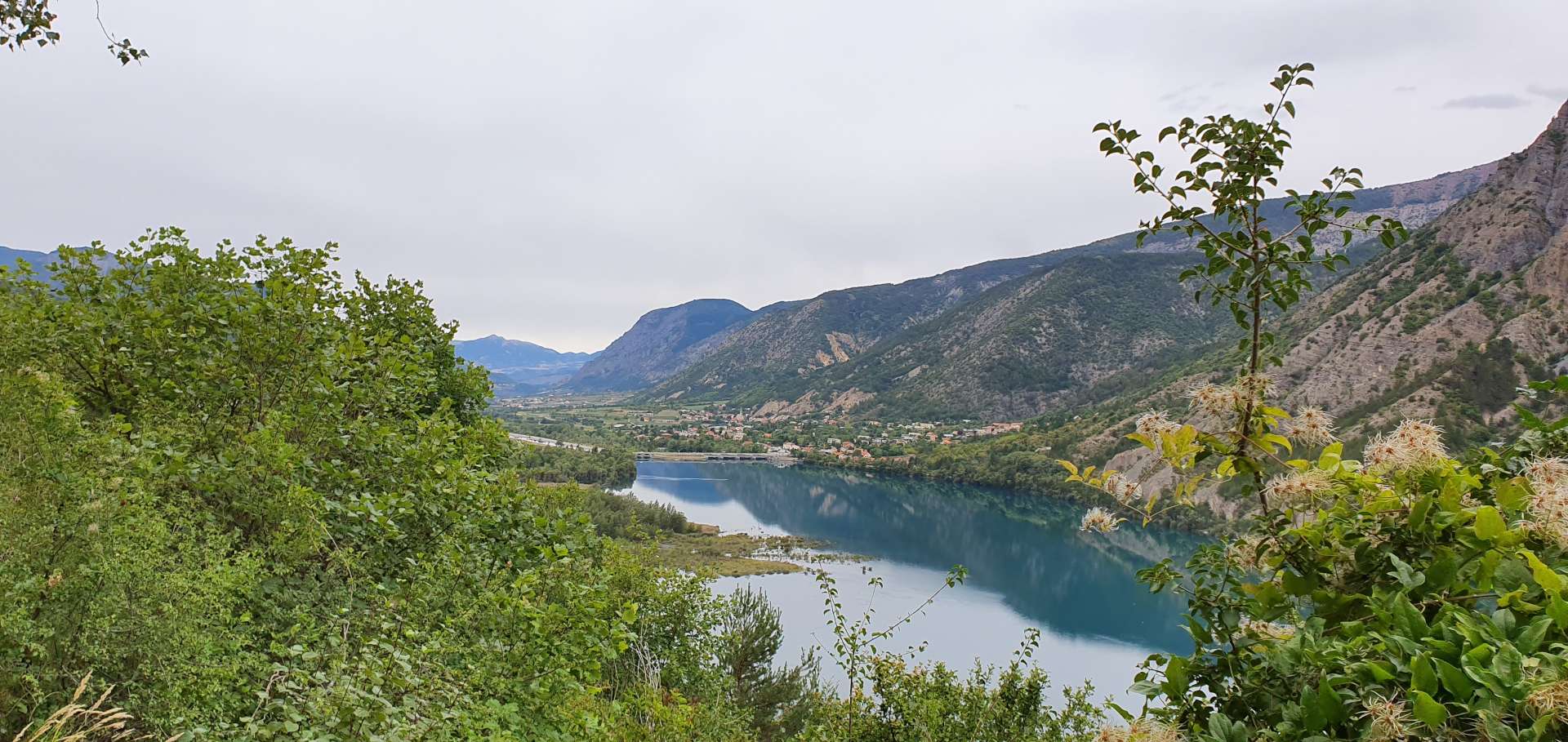
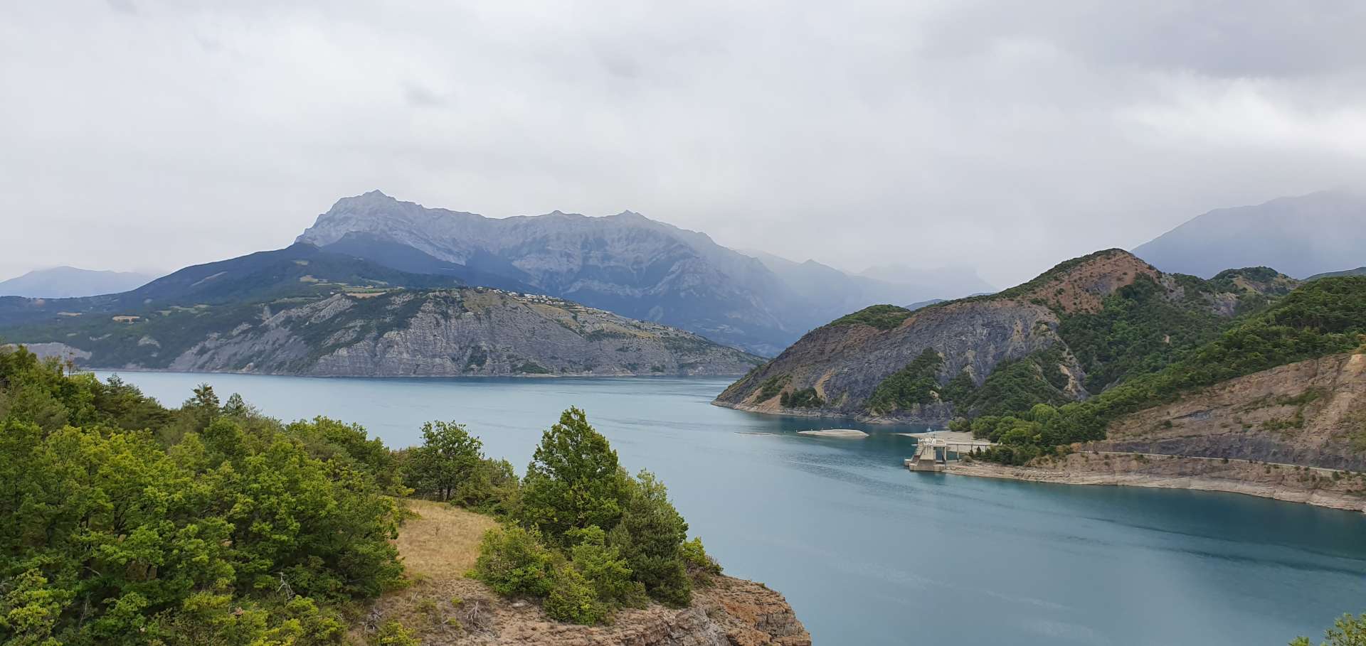
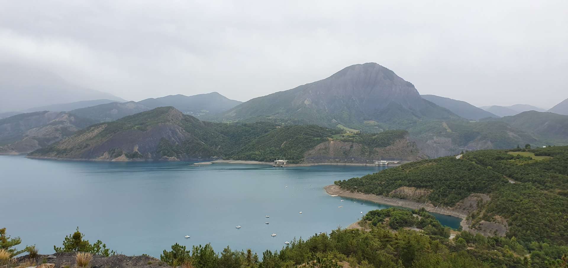
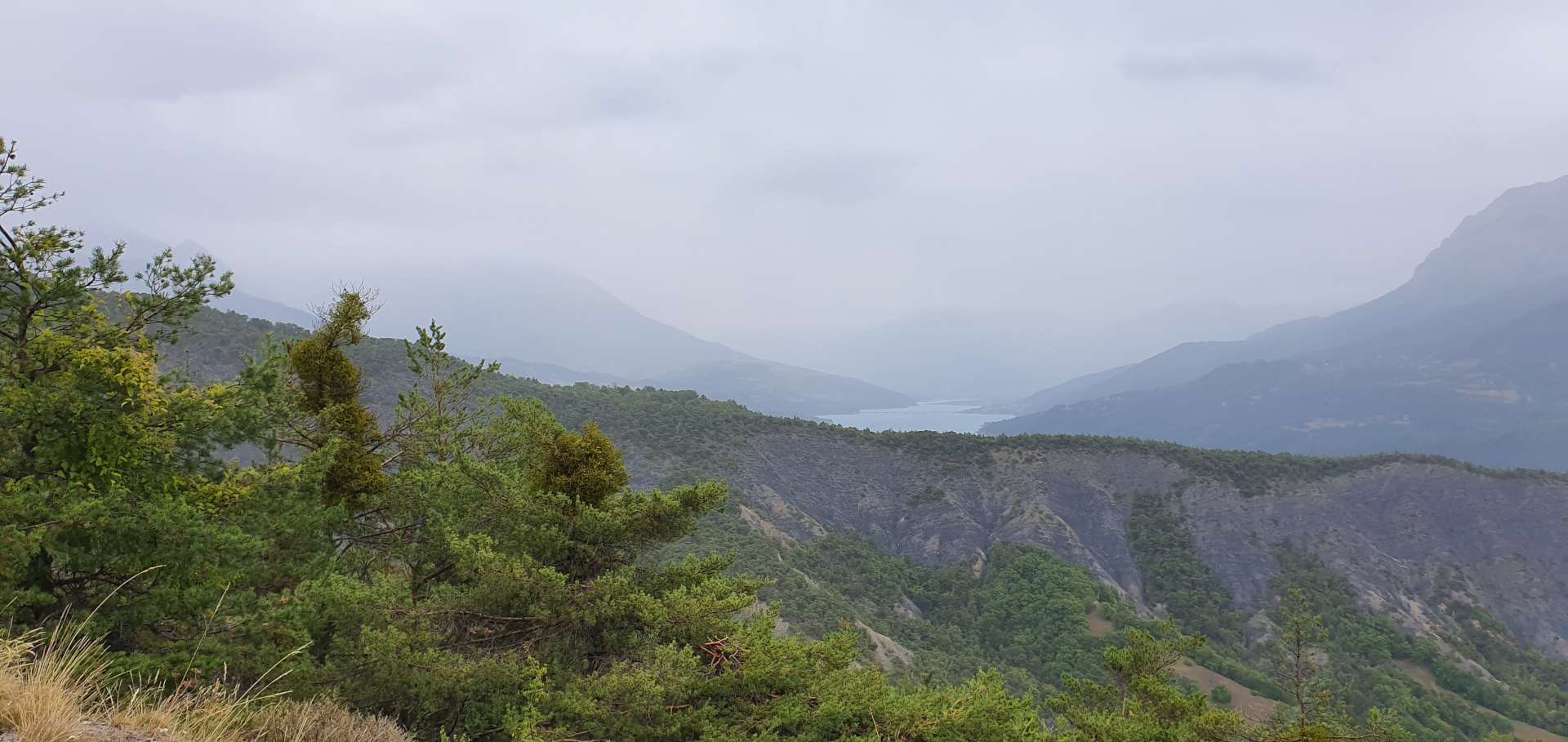
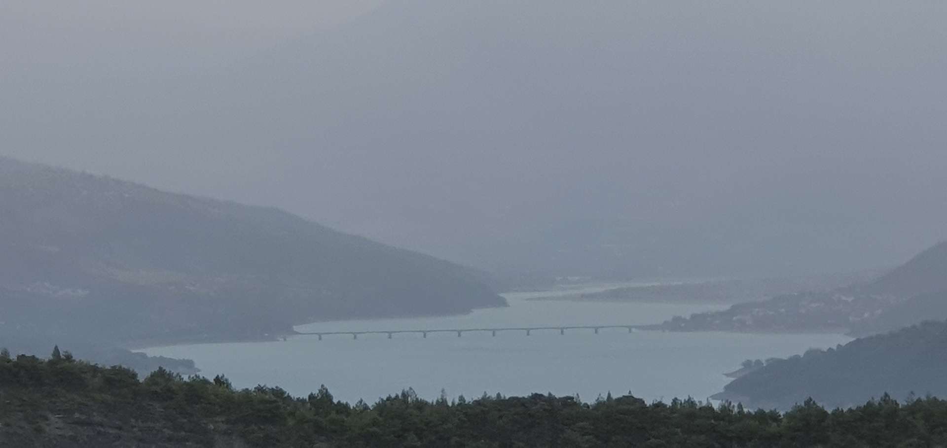
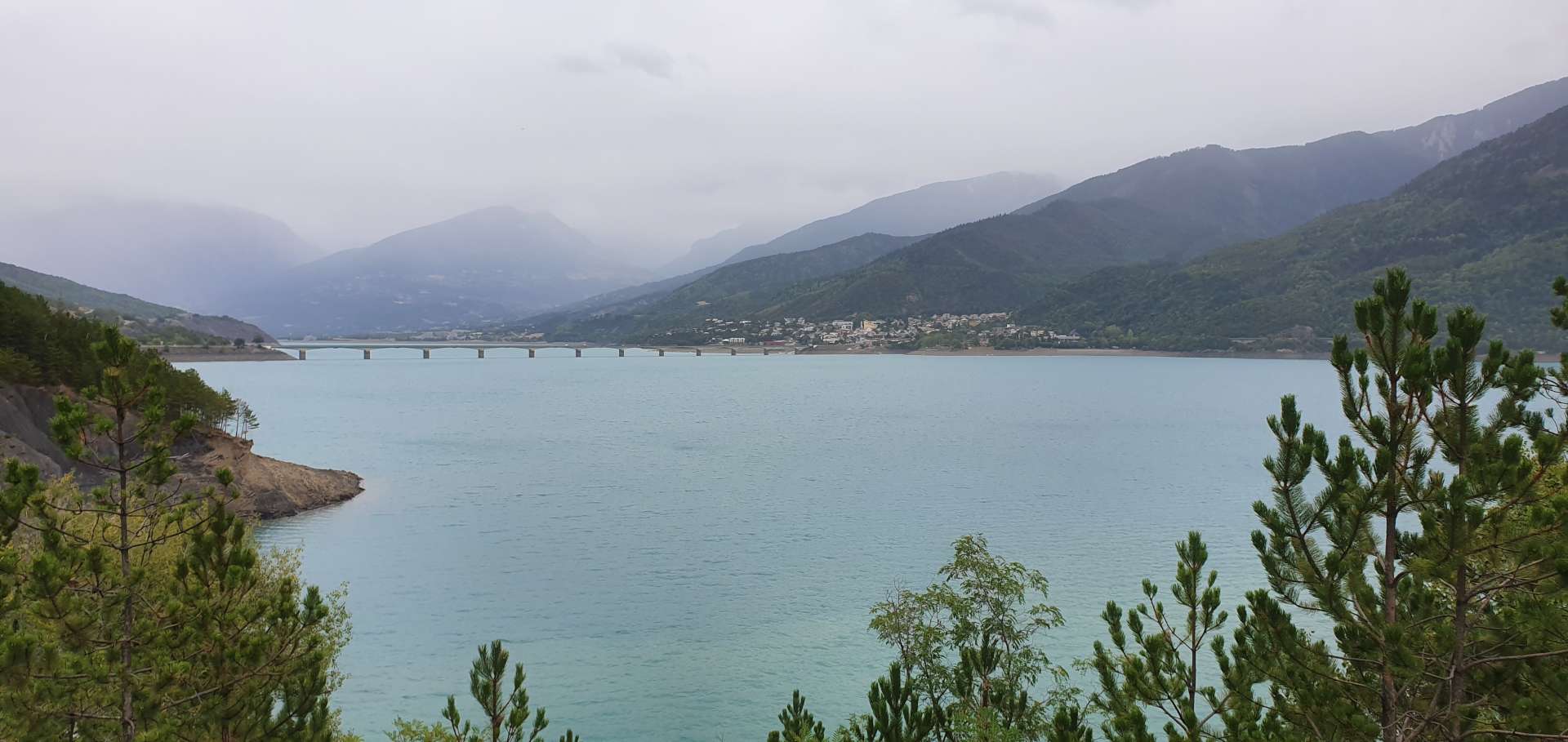
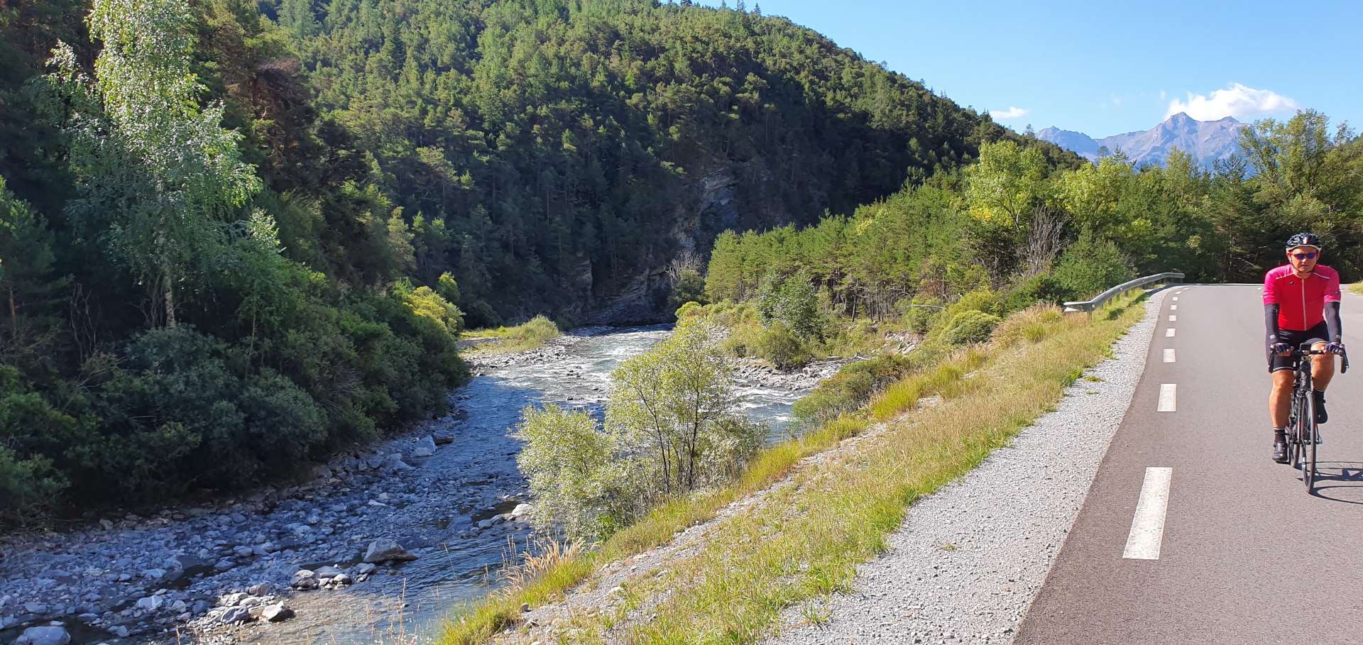
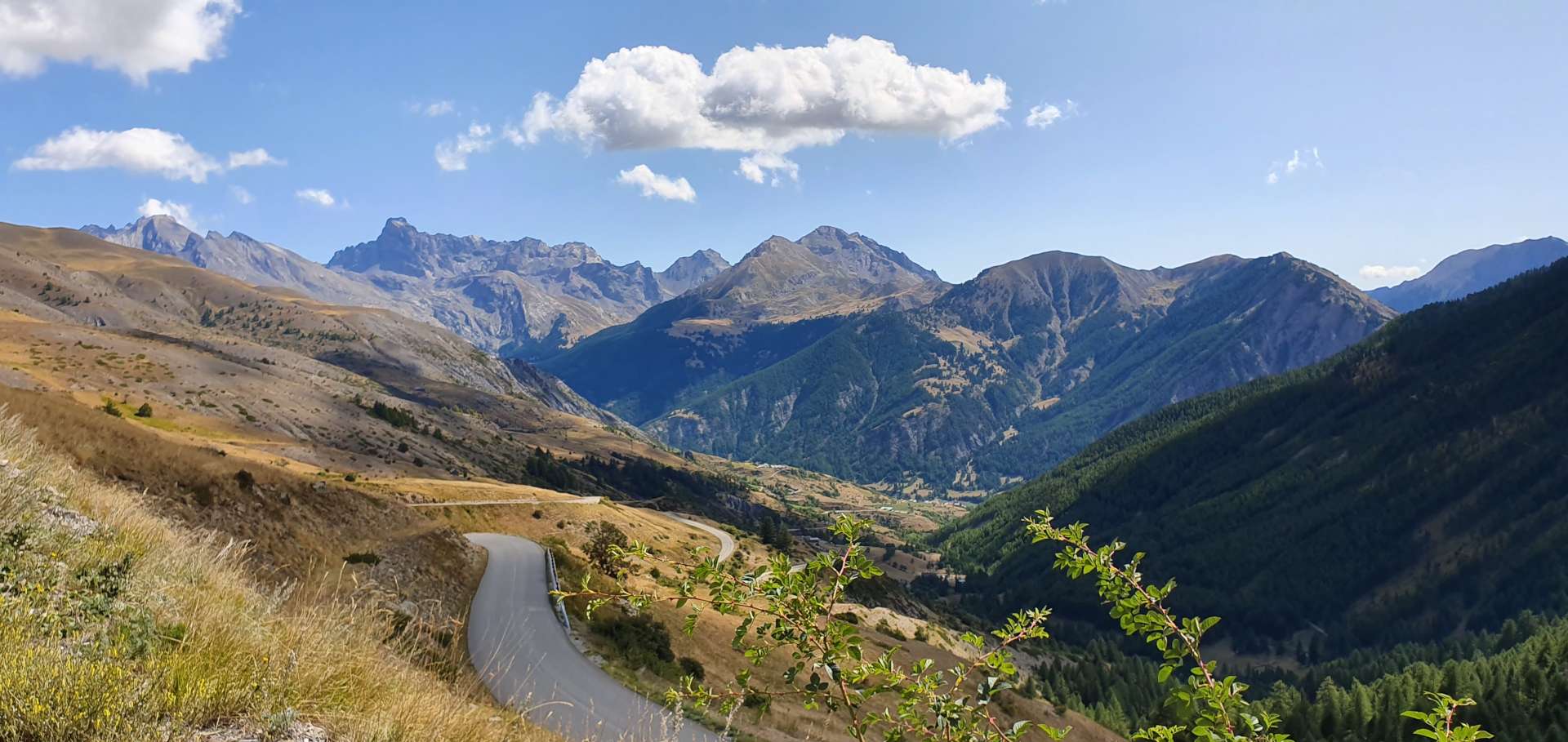
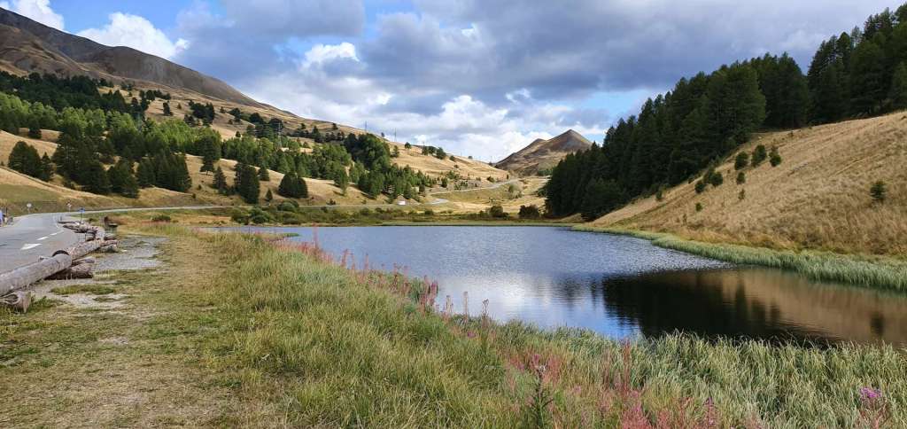
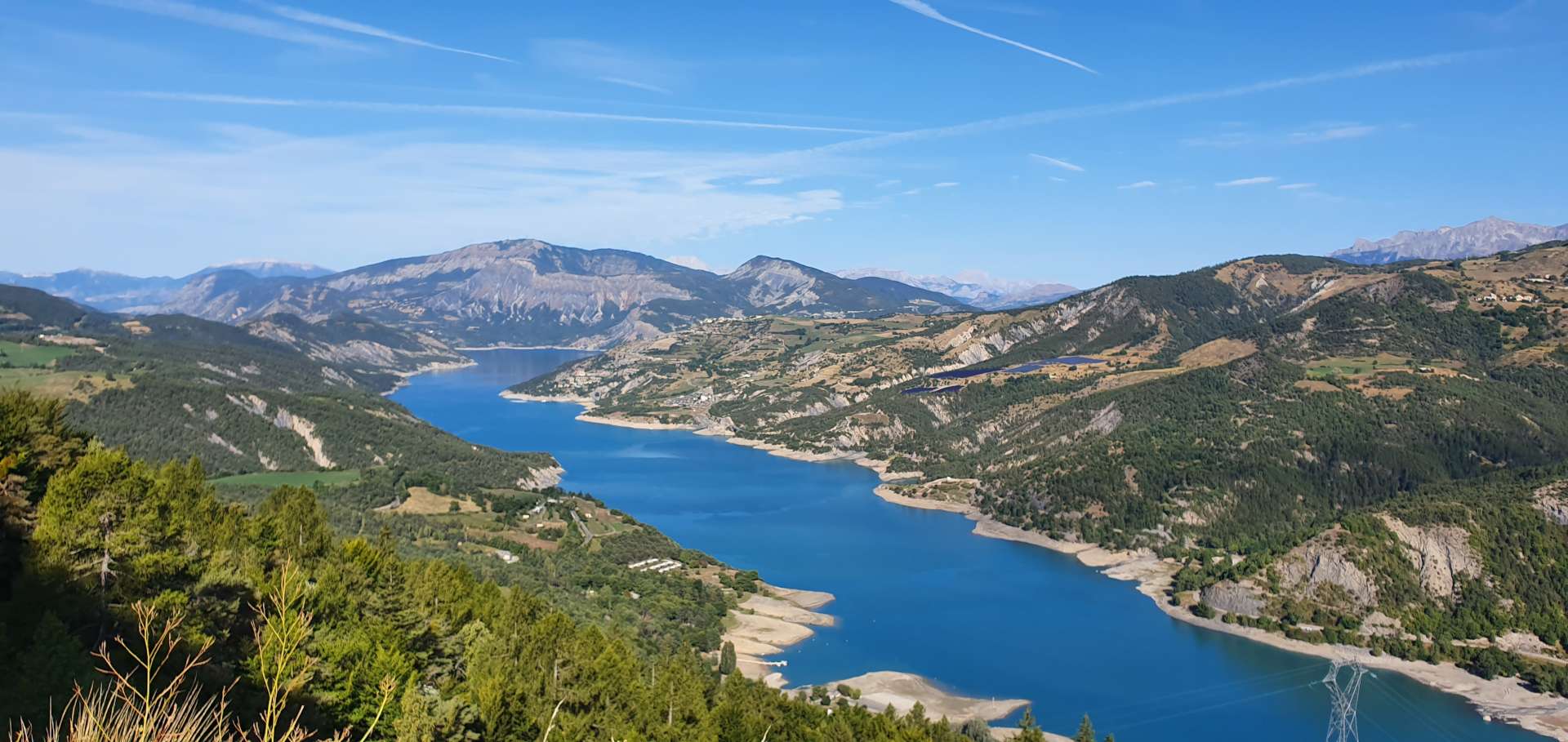
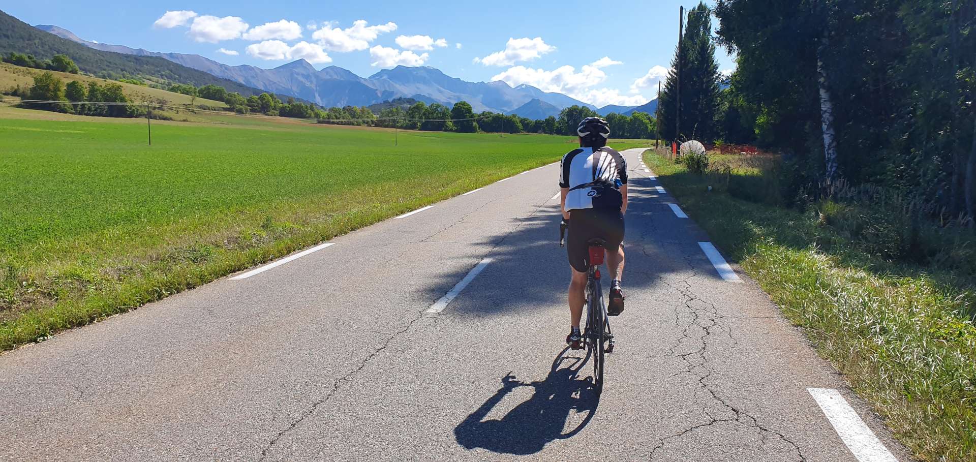
I suggested that we cycle down to towards the Lac de Serre-Poncon again (we rode around it yesterday) & explore some of the lesser known climbs of the Val Blanche (a popular skiing area). We retraced our tyre tracks across town, before gently descending the Ubaye valley towards the lake for the next 15 miles. We passed our parking spot from yesterday’s ride & for the next 7 miles took the same route. The views were totally different under blue skies, as we could see the huge mountains beyond the lake.

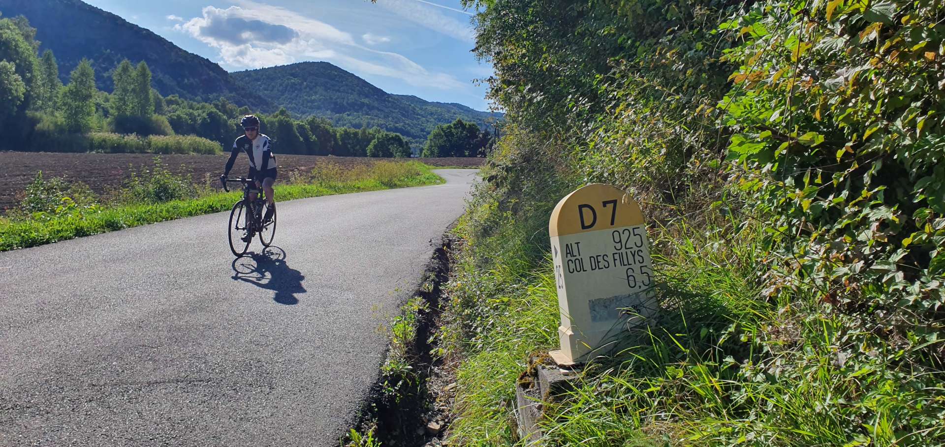
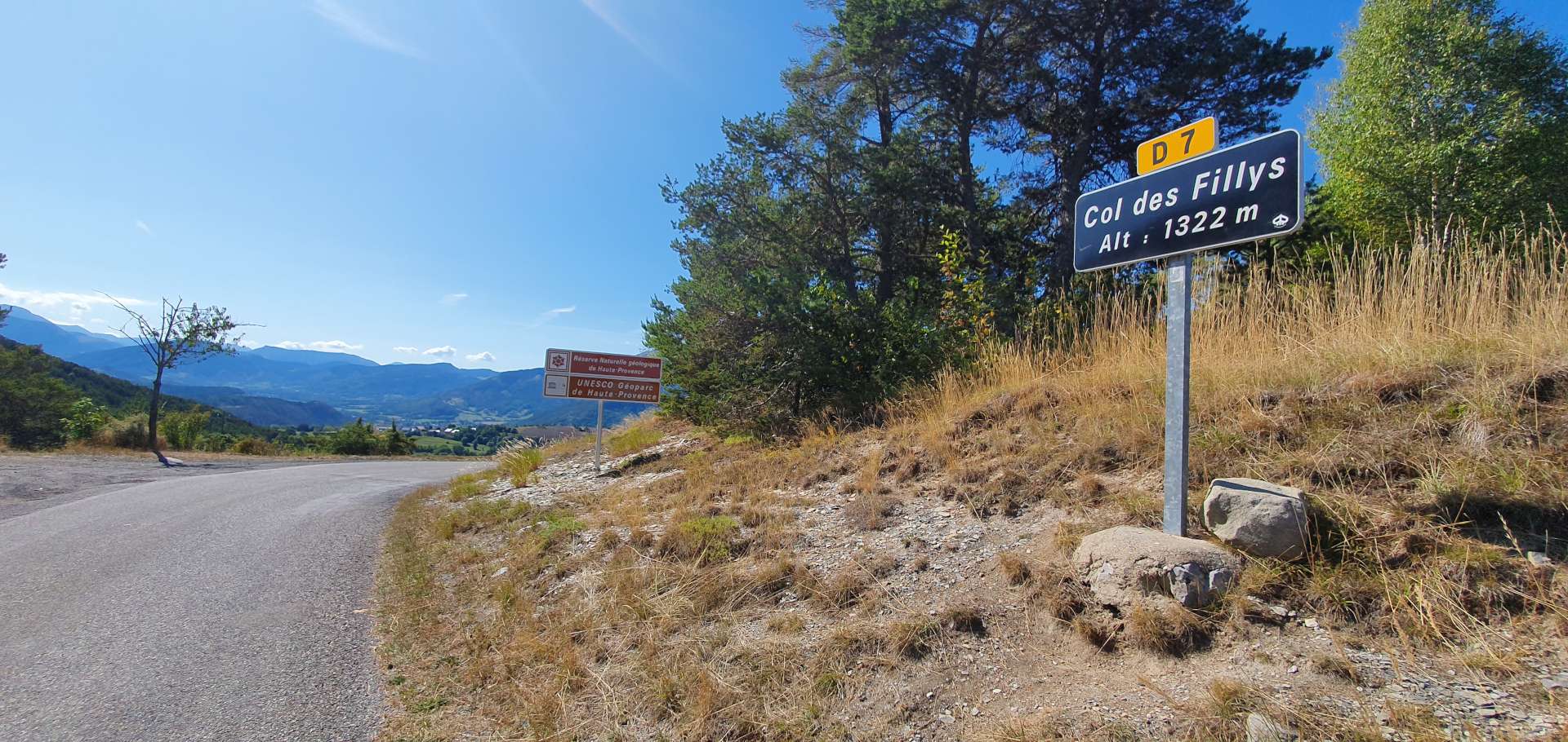
We then took a left turn onto a small side road, the D7. It was little more than a single track lane, just the sort of road we were hoping to find ourselves on! We were immediately onto the first climb of the day, a 5 mile ascent up to Col des Fillys, which at times had small ramps with gradients of 12 to 15%. The road twisted its way through a forest, which limited the views slightly, but every now & again we caught a brief glimpse of the lake way below.

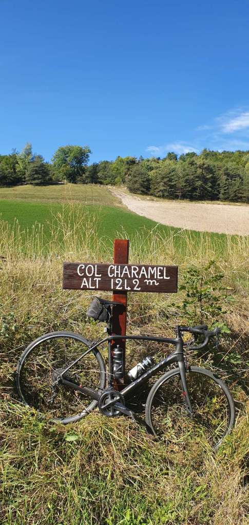
On the way up, we also bagged an unexpected bonus col, the Col de Charamel, which didn’t show up on the route plan – there was a Col sign, so it counts in the Col climbing stakes!

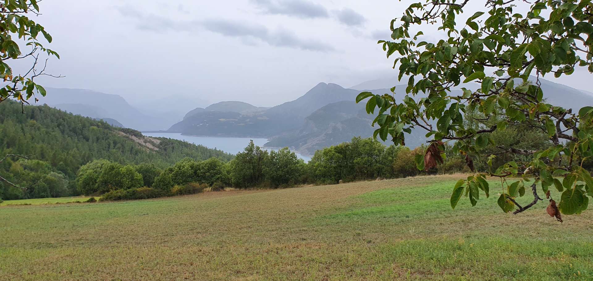
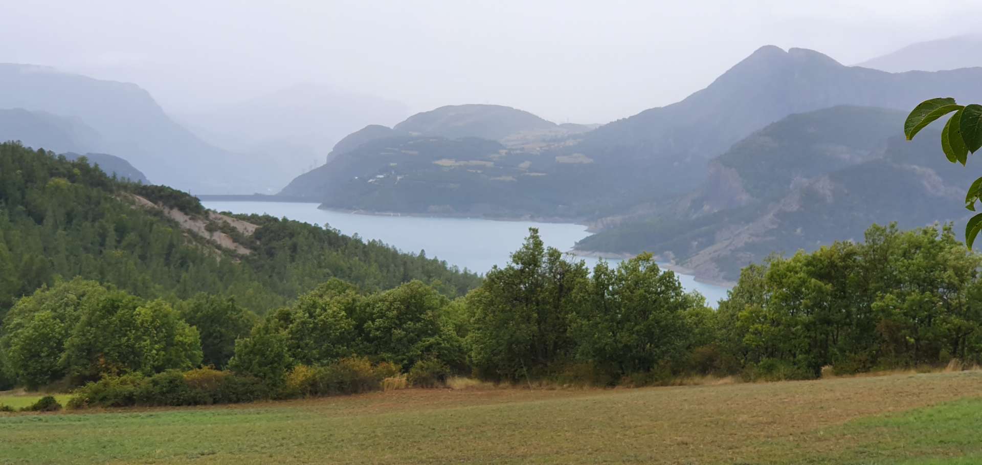
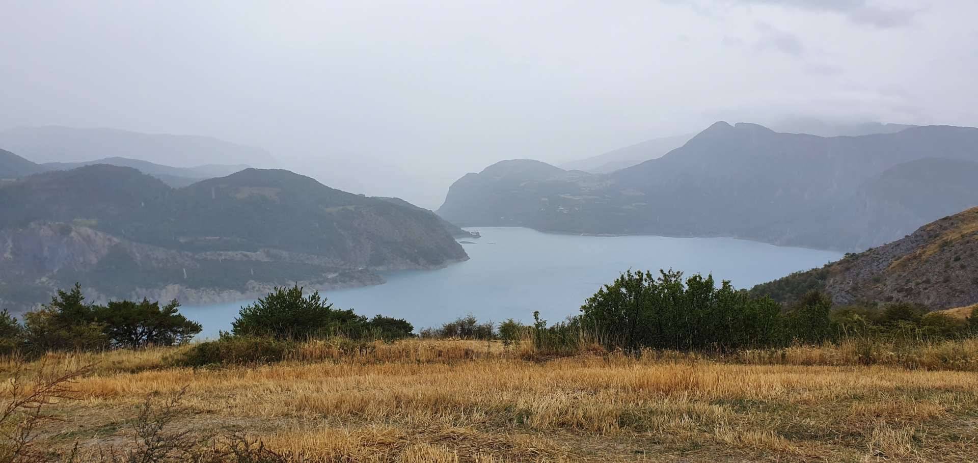
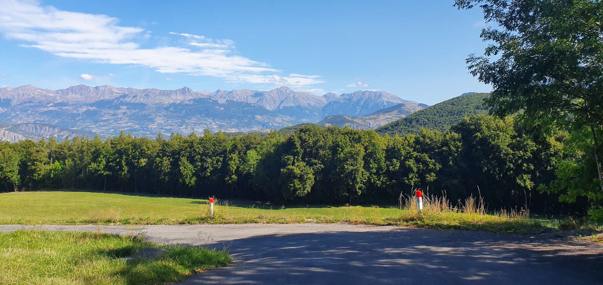
At the summit of Col des Fillys, the views opened out in front of us, as we caught our first look at the UNESCO Geoparc de Haute-Provence. As we crossed into the Val Blanche, we passed through a couple of tiny hamlets as we plummeted towards the valley floor below.

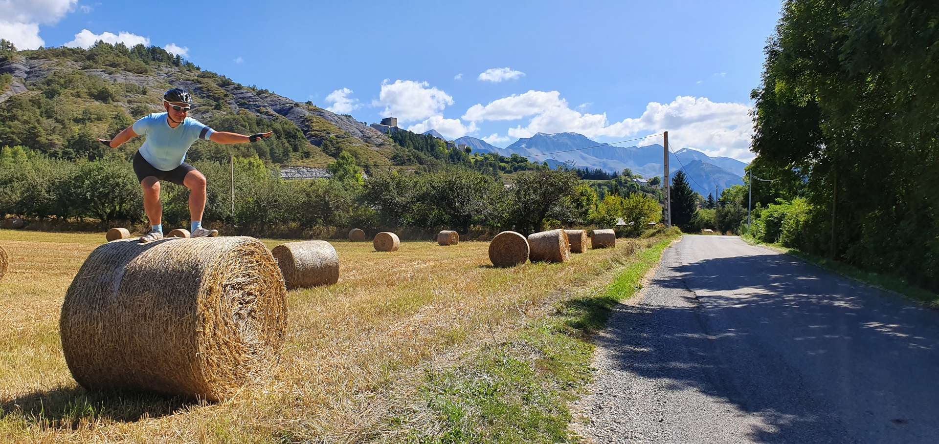
As we passed the medium sized village of Selonnet, we spotted a café/restaurant, where we stopped briefly for our first ice cream of the trip & a coffee. Almost as soon as we set off, the road took us past a field full of hay bales, so I had to pull in & attempt some hay bale surfing – after 3 full days of riding, I’ve lost some flexibility & my technique clearly needs some work!

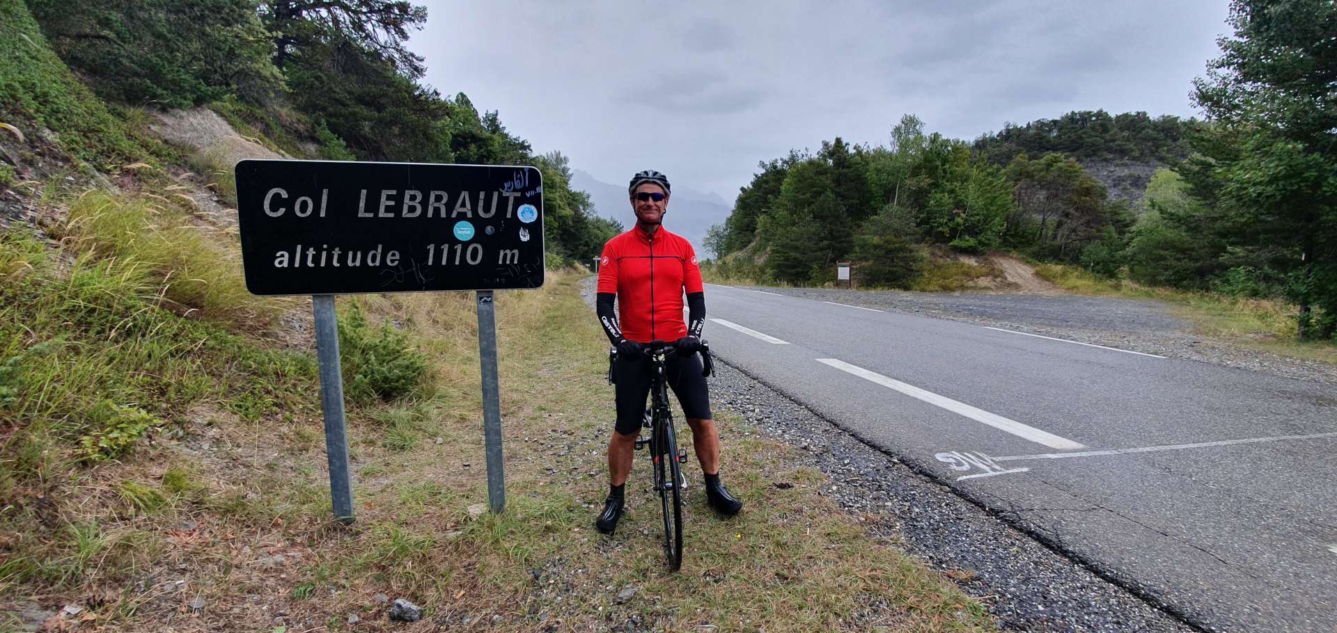
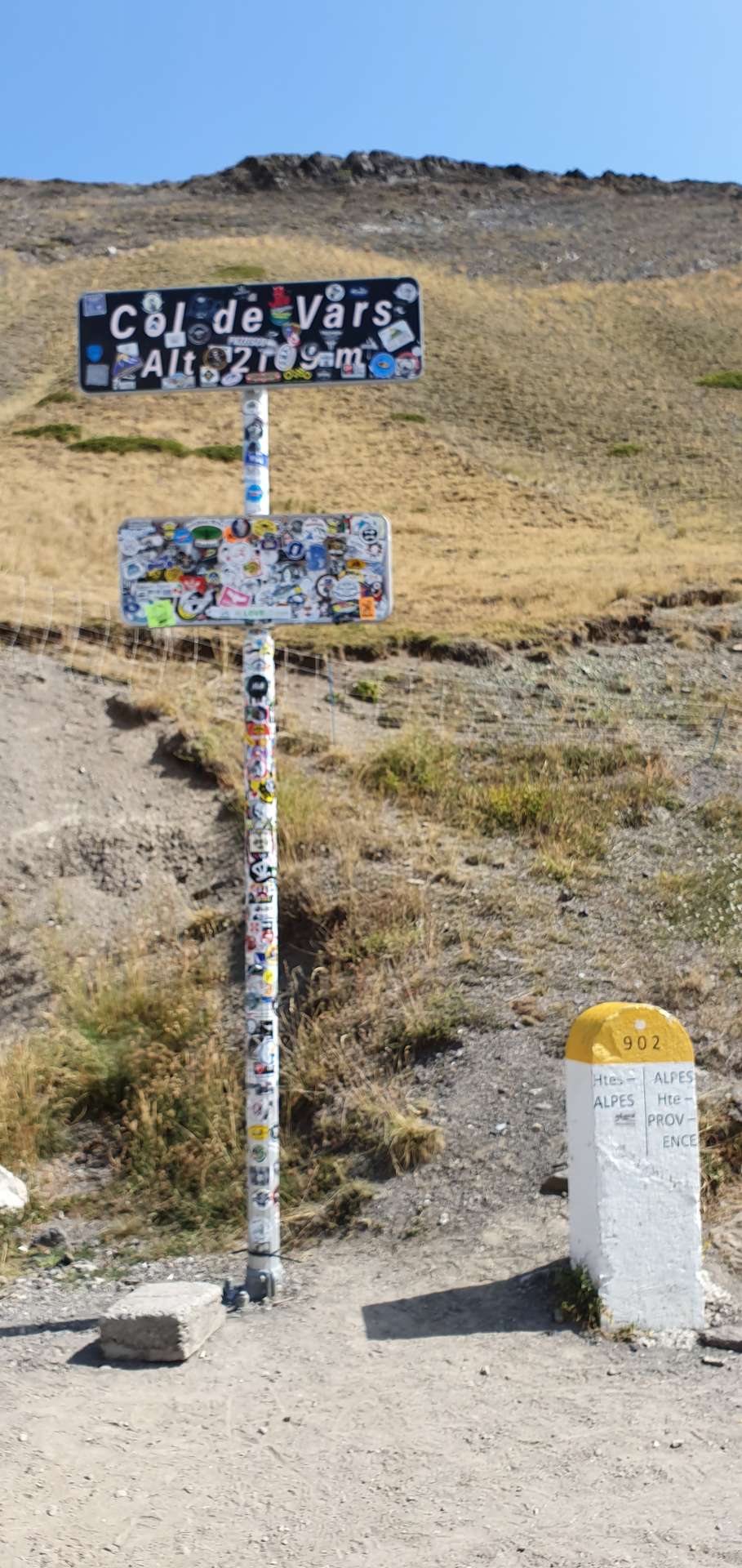
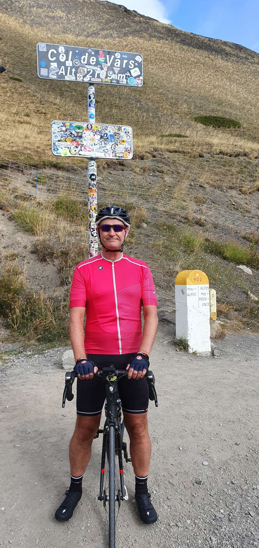
We continued along quiet back lanes for another couple of miles, before joining the wider (but equally quiet) D900 towards Dignes. This marked the start of our next climb, which was probably our easiest of the day, as the gradient was only 3 or 4% for the 3 miles up to to Col de Maure – we both felt that it didn’t really qualify as a Col, but we were happy to bag it. We were still surrounded by huge mountains, quite a few of which had coatings of snow showing on their summits.

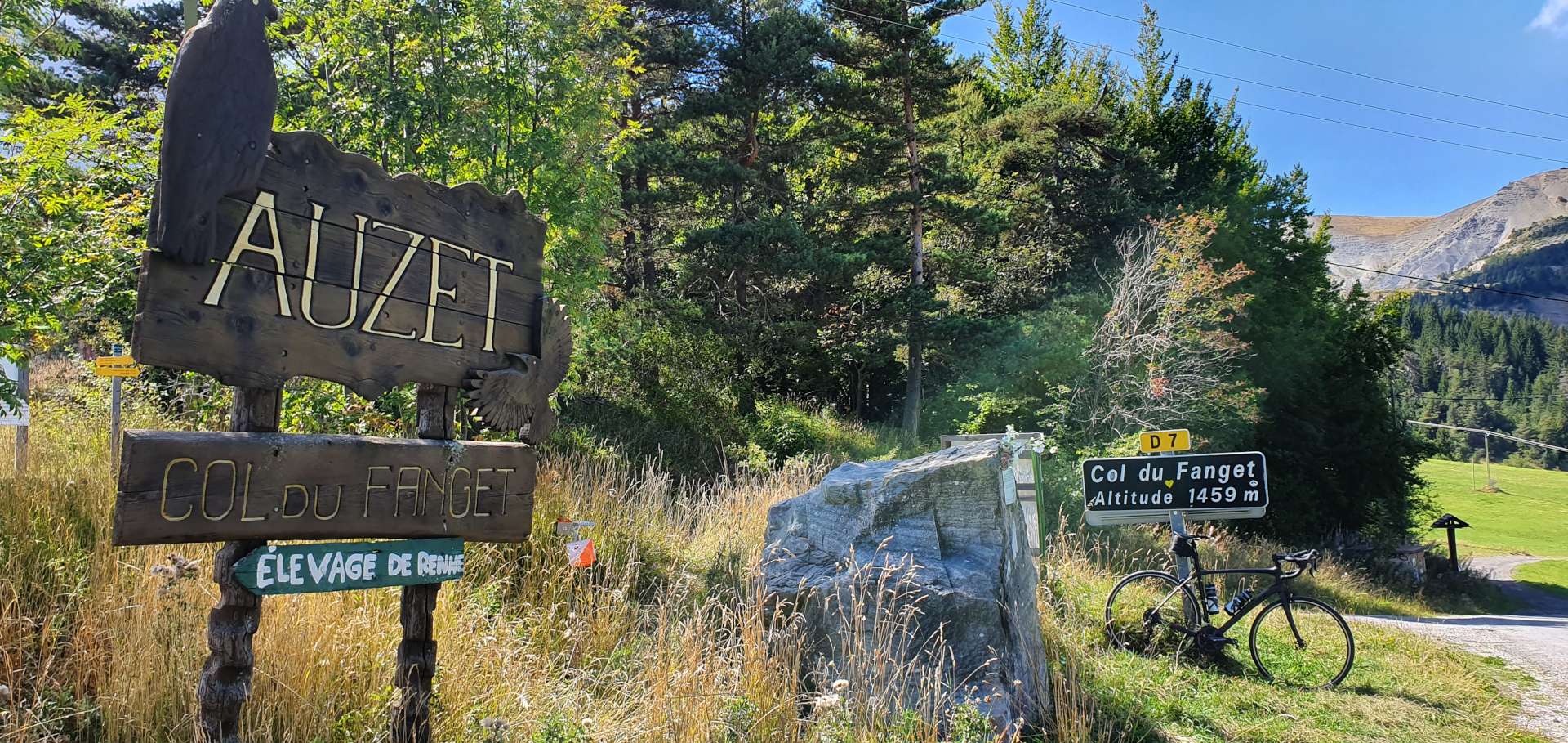
We stayed on the D900 for another 6 miles as it descended down the opposite side of Col de Maure. We then took a single track road (which had the best tarmac of the trip so far) as it continued the drop to the valley floor. At the 47 mile point we turned onto an even smaller track, which marked the start of our 4th climb of the day – the 5 mile climb of the Col du Fanget through a beautiful forest.

The first mile averaged 9%, which included a short stretch where the road crossed a river below. I was a bit concerned about what this unknown climb may throw at us, but after the initial slap to the face, the gradient dropped to a much friendlier 4 & 5%. As we made our way round a blind bend, we could hear an almighty screeching noise in front of us – we’d stumbled across a crew of workmen using an enormous caterpillar digger to dig a trench & lay cable. We had to get off our bikes & walk through the long grass to get past them. This was also where the gradient increased to an average of 9% for the final mile & a half, with stretches hitting 15%.

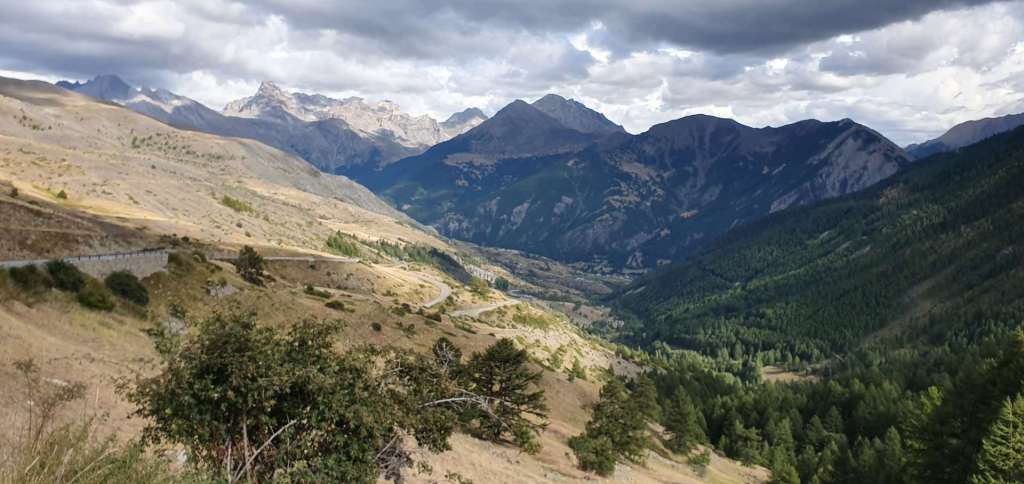
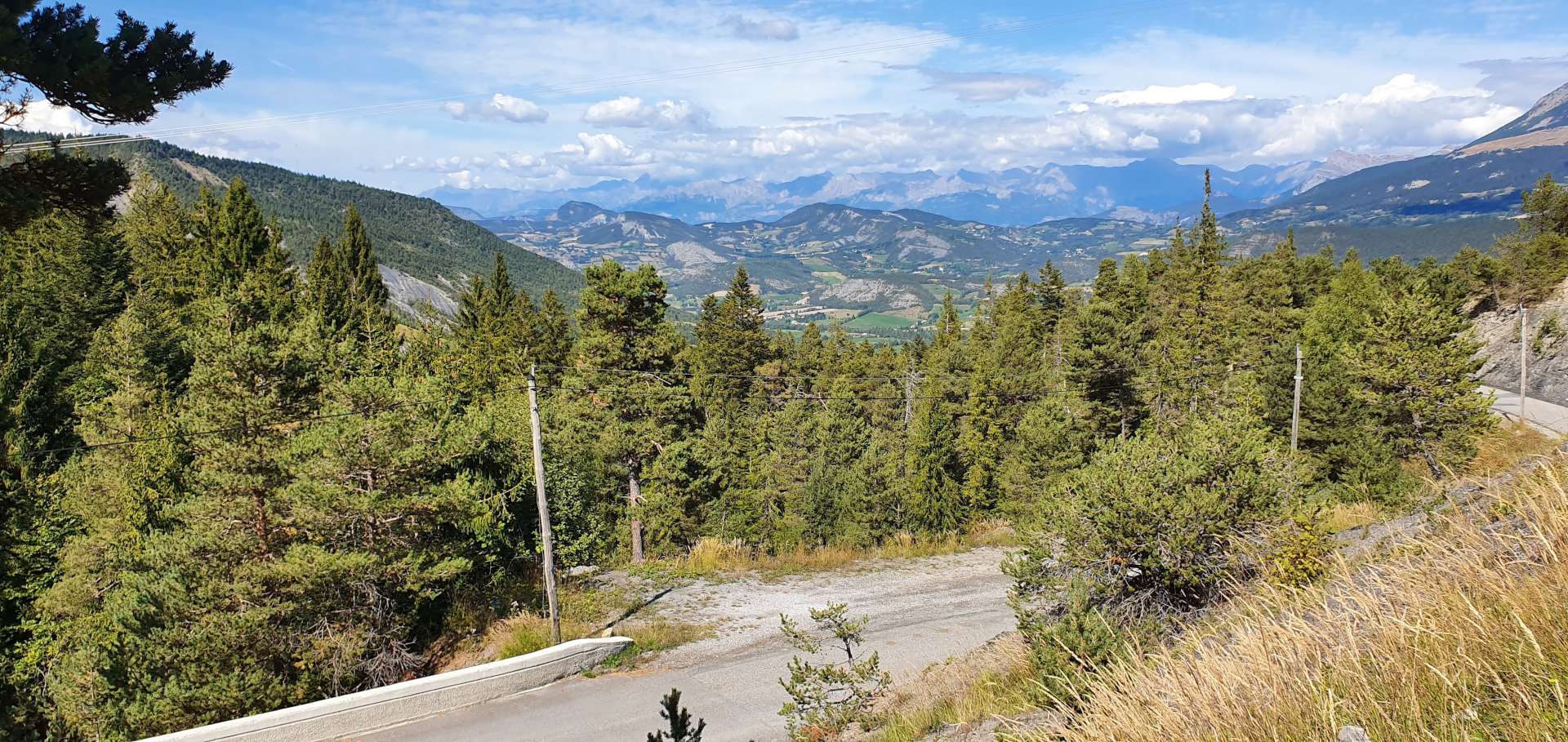
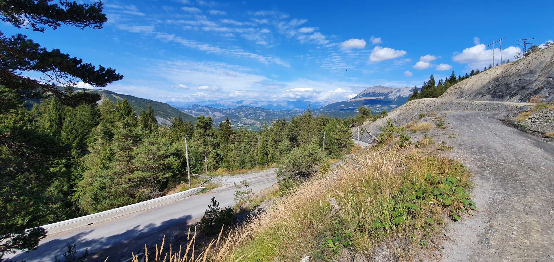
The huge views from the summit of Col du Fanget made the effort all worthwhile – big panoramic views to the mountain ranges in the far distance. The 4 mile descent was on a badly rutted & potholed surface, but we didn’t see a single vehicle on the way down, so could use the full width of the road to try & find some decent tarmac.

We were now back in the large village of Seyne, where we’d hoped to grab some lunch, however, everywhere was shut as it had just past 2pm. We only had one more climb to go, so after eating a banana & downing a gel, we were on our way again. The Col de St Jean showed on the map as being just before the ski resort of St Jean-Monclar, however, there wasn’t a sign, so we simply rode on & continued on our way.

As we passed through St Jean, we took a sharp right onto a much wider road which would drop us down to the main lake road. From here we just had to follow our path back to Barcelonnette, via a late lunch stop at Le Lauzet-Ubaye – although the chef had closed the kitchen, the owner very kindly made us a ham & cheese bagette each.

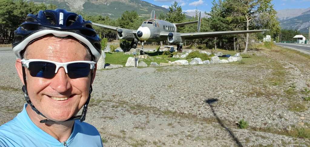
The road back up the Ubaye valley to Barcelonnette wasn’t something we were looking forward to, as it seemed like we flew down the hill in the morning. However, fate was on our side & we had a tailwind the entire way home! Just as we were riding into Barcelonnette at the end of the ride we passed a local airfield & I stopped for a quick photo op outside.

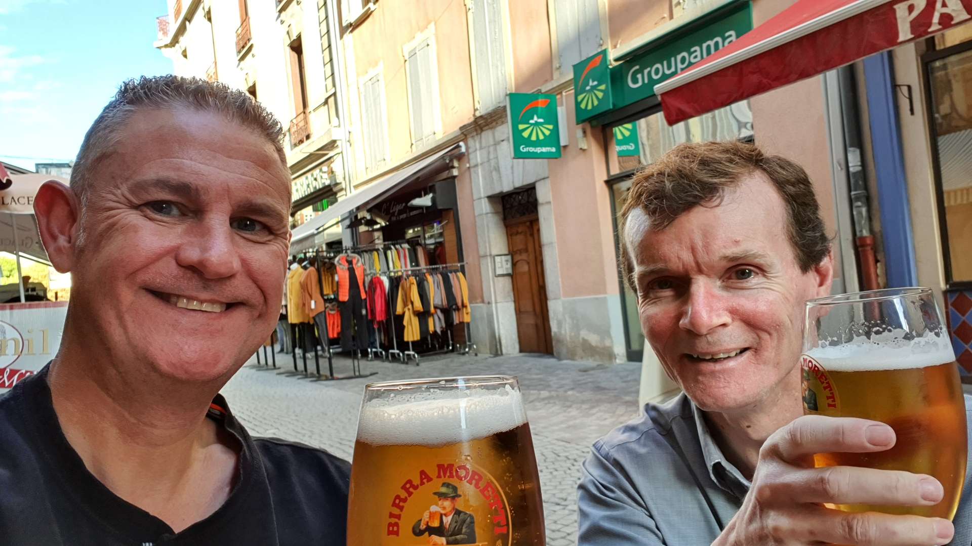
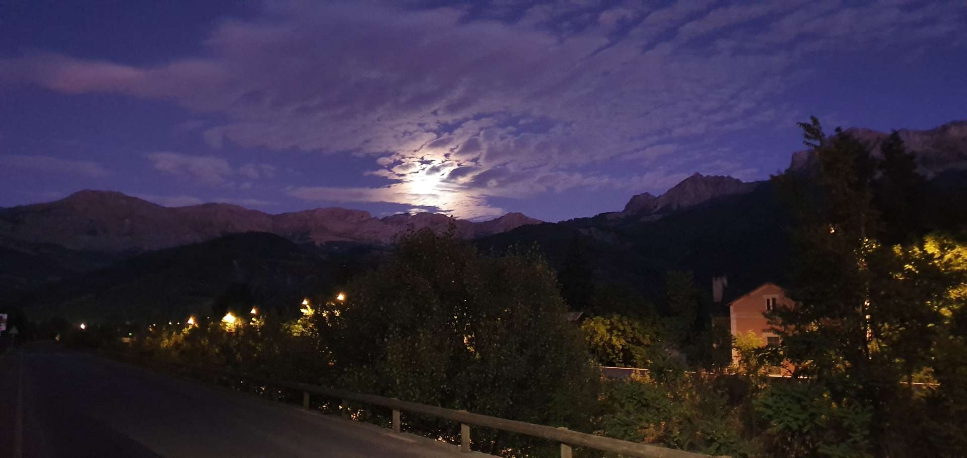
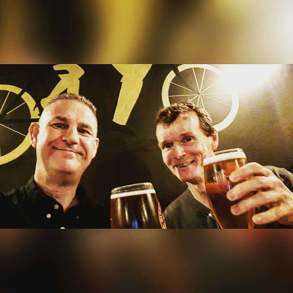
We had the sun on our backs, had ridden the most amazing day on quiet country lanes & now it felt like someone was pushing us up the hill – this was one of those days where everything fell our way. All that remained was to enjoy a celebratory beer in Bar Tandem & then top up the energy reserves, before a stroll home under the moon! What a great day out!

Alpine Adventures – Tour de Barcelonnette – September 2019

Lac de Serre-Poncon Loop – Day Three

My original plan for today involved a 1 hour drive to Vinadio in Italy to climb the Italian & French sides of Colle della Lombarda/Col de la Lombarde . However, when I shared my plans with the owner of the hotel we’re staying in, he advised that it wouldn’t be safe, as rain was forecast & at that altitude it would likely turn to snow. In my experience our hosts & hostesses have always been willing to share their local knowledge of weather / likely road conditions & I’ve learned to trust their recommendations.

One of our other planned rides was a 75 loop around Lac de Serre-Poncon, which is lower down the Ubaye valley than Barcelonnette, so I played around with that to come up with an alternative 58 mile route, with the option of further reducing it to 45 miles if the rain arrived as expected at 11am. We drove 15 miles to the start of the route, which was just outside Le Lauzet-Ubaye.

Once we’d either dressed in, or stowed, all our wet weather gear, we commenced a clockwise loop of the lake, under bruised & broody dark grey clouds, which looked ready to dump their rainfall at any time! The early miles gave brief glimpses of the lake far below, the water was a shade of turquoise that you only ever see in Alpine lakes, as a result of the moraine that gets washed down from the mountains above.

The lake was created when a dam was built across the River Durance to create a hydro-electric power station that is now operated by EDF. There’s also has a small overflow lake below it, which we would also have to circumnavigate.

The first 14 miles were on the main D900 which links Cuneo in Italy with Gap & Sisteron in France. Although it was a bit busy, all the traffic was very courteous & gave us plenty of room. The road itself rose steadily for the first 7 or 8 miles, then descended 5 miles on a wide road, with sweeping bends which meant I only had to brake twice – once because of temporary traffic lights that were on red & the other time to stop & turn on my lights as we had to go through a tunnel. The final mile took us round & over the small overflow lake, before we took a right turn onto a much smaller & quieter road, which followed the opposite side of the small lake.

The huge dam holding back the water from Lac de Serre-Poncon was in front of us, so the only way the road could go was to zig-zag up the side of the valley, until eventually we were level with the dam itself – I was hoping to get a few photos, but unfortunately it’s closed to the public. The road continued its hairpin ascent of the valley wall at a gently 5 or 6 % for the main part, until we reached an EDF PR site, where there was a panoramic view of the lake below & also information on the construction of the dam & the positive impact it has on the surrounding area.

We were 1 hour 15 minutes into our ride & we felt the first spots of rain, which fairly quickly turned to drizzle, so it was time to put on the remainder of our wet weather gear. We continued climbing with occasional views of the lake in the foreground with what should have been towering mountains in the background (today it was clouds!!).

At the 17 mile point we passed through a long tunnel which took us away from the lake, but we continued climbing towards Col Lebraut (the only signed summit of today’s ride) at the 19 mile marker. I stopped to get a quick photo, then we followed the road downhill, as it twisted & turned towards one of the lake’s numerous inlets, where there would have been bathers & kayakers if the weather had been dryer & warmer.

After the descent down to the lake, our feet & hands were soaked through (so much for the waterproof qualities of neoprene!), so we were feeling the cold. The next 6 miles followed the shoreline & was relatively flat, so we took the chance to build up some body heat with some high tempo pedaling. We now had a choice to make, continue around the lake & stop for lunch at Embrun (still another 12 miles away), or cross the lake via the Pont de Savines & shorten the ride. It’s an indication of how cold & wet we were that we chose to shorten the ride by taking the bridge & then stopping for lunch in Savines Le Lac. No photos of food today – we were so cold & hungry that we wolfed it down before I had time to take a picture!!

The road started climbing as soon as we left our lunch stop, but the gradient was always comfortable as we rode through the forest which surrounded us. To our left was a huge monolithic rock that towered over the surrounding hills –this is the Col de Pontis, which while being accessible by road, is a bit too steep for my comfort (about 4 miles at 10%) & as it was raining, I had the perfect excuse to give it a miss today!

La Sauze de Lac marked the top of the climb & under normal circumstances we would have had huge views across to the opposite side of the lake, with big mountains providing a stunning backdrop. However, today it wasn’t possible to see the mountains or the sky, all that was on offer was rain & dark grey clouds. The final descent back down to the shoreline of the lake was a twisting one, with several hairpins, made a little trickier than normal by the water streaming across the road.

All that remained was to head through one final tunnel, before a gentle 400 foot climb back to the car. In spite of the rain, it was a thoroughly enjoyable day out, in part because we cut the ride short before it felt like a chore – we have 3 more great days riding planned. Having driven back to the hotel & had a warming shower, I looked out the window & there was fresh snow visible on the lower mountain peaks, so goodness only knows what it must be like on the Col de la Lombarde, which is some 3,000 feet higher up.

The kit I wore today was so wet that I could wring out my gloves, jacket, socks & shoe covers – I even got the hair dryer out to try & get the rain jacket ready for tomorrow’s ride, where I plan to use it for its windproof qualities! All in all, another great day of cycling in the Maritime Alps.

Alpine Adventures – Tour de Barcelonnette – September 2019

Barcelonnette to Guillestre & back via Col de Vars – Day One

My second (& final) Alpine Adventure of 2019 was based around the small town of Barcelonnette, in the Maritime Alps of Southern France, about 90 miles north of Nice. Yesterday’s travel day was longer than planned, due to my inability to queue in the right car rental queue – I spent 45 minutes in the Europcar queue, before realising I’d booked the hire car through Hertz!

In the rush to put our bikes together before heading out for something to eat, Sean’s collar on his seatpost failed, which meant his saddle wouldn’t stay in the right place. All the bike shops were already shut, so it meant we had to adjust plans for this morning’s ride – in the end I found a bike shop in Jausiers (about 5 miles down the road) that opened at 10.30am, so today’s ride was a 64 mile ‘out & back’ to Guillestre, over both sides of the Col de Vars.

We started out following the River Ubaye upstream to Jausiers & within 15 minutes, the friendly mechanic at Technicien du Sport had found a replacement part & fitted it for the bargain price of €7 & we were on our way. After 10 miles of gently climbing alongside the babbling Ubaye, we turned left off the D900 & joined the smaller & quieter D902 – this is a legendary road in Tour de France history. In the space of less than 100 miles, this road goes over the epic Tour de France climbs of Col d’Izoard, Col du Galibier & Col du Telegraphe in addition to the Col du Vars, our climb(s) of the day.

For the next 5 miles, the road climbed steeply as it twisted & turned up the side of the valley, passing through quiet villages along the way. Whilst the climb wasn’t long, the gradient was consistently over 9% & I found it a challenge to keep up with Sean, although he was riding well within himself – I’m a few pounds heavier than my usual touring weight & I felt it today. The views across to the surrounding mountain peaks were amazing, with white clouds providing great contrast to the blue skies & they took my mind off the difficulty of the climb.

At the summit there’s a couple of signs, a café & a large car park. We stopped long enough to take a few photos, put on a wind proof jacket & then we were descending the longer, but shallower side of the col, heading towards Guillestre. Along the way, we rode through the ski resort of Vars – this is where the world record was set for skiing, some 254 kilometres per hour….on skis!!!!

Descending into Guillestre was fun, the road was wide (so coaches can get the ski resorts in winter), the corners were easy to navigate & the surface was good quality. After about 8 miles of the 12 mile descent, huge views down to Guillestre & across to the Izoard came into view. In less than 25 minutes we’d reached our lunch stop in town – we hoped to grab a panini somewhere, but all the restaurants in the main square were proper sit down affairs, so we settled in for an extended lunch & set about demolishing some pasta.

We were on our way again by about 2.50pm (at least a couple of hours later than we would have expected), now all we had to do was conquer the 12 mile climb back to the summit of the Col de Vars. We estimated that this would probably take us in the region of 2½ hours, on the basis we would climb at about 5 mph. The first 3 miles were a consistent 7 to 8% & this meant we could settle into a good rhythm. As the road hair-pinned its way ever upwards, we could see the climb spread out before us.

As we rode through Saint-Marcellin there were loads of wood carvings of winter sports characters, including a huge man on skis. After a brief stop to admire the artwork & take a couple of snaps, we were on our way again on what was my favourite part of the climb – it had a 1 mile descent at this point! The entire climb was less steep than this morning & as a result I was better able to enjoy the views & chat as we rode – this morning all I could do was huff & puff!

The final couple of miles of the climb took us past a moody looking lake, with big rain clouds beginning to gather in the distance. This was the direction we were heading, so the appearance of potential rain clouds was of interest to us.

After just over 2 hours of climbing we were back at the summit, once again it was time to wrap up warm for the descent (10% for the first mile) & then enjoy the ride!

It took just over 13 minutes to descend the 6 miles back to the main road – it was incredible how quickly I gathered speed when I released the brakes. Luckily there were plenty of twists & turns to ensure that we both took the descent sensibly. The road back to Barcelonnette via Jausiers was slightly downhill all the way, but any thoughts of free miles were scuppered when we picked up a full-on headwind! Oddly, the downhill section into the headwind took longer than when we rode it in the opposite direction as an uphill this morning.

After a slow start, the day turned into a truly great expedition into the high mountains of the Maritime Alps. I’m looking forward to finding out what tomorrow will bring, but in the meantime it’s time to toast today’s great adventure in Bar Tandem!