Here Comes The Sun – 9th, 10th & 11th May
Monday 9th May – Rest & Recovery Day
After 6 days of back to back cycling, it was time to enjoy a well earned day off & what better place to do that than in Leavenworth. It grew on the back of settlers who were hungry for gold, furs & timber. However by the 1960’s it was shuffling along towards extinction – until the town leaders had the bright idea of changing Leavenworth’s appearance to take advantage of the amazing alpine hills & turn it into a German themed town.

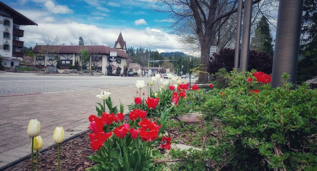
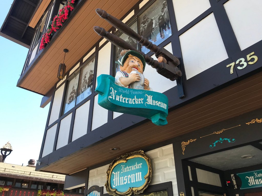
More than one million people now visit Leavenworth each year – they’ve done more than just give the town a facelift, they’ve adopted many of the German festivals, including Octoberfest!! The town is also home to The Nutcracker Museum, where over 7,000 nutcrackers are on display – I didn’t go in, but it brought back many happy memories of my childhood, as we had a homemade nutcracker that used to come out every Christmas.
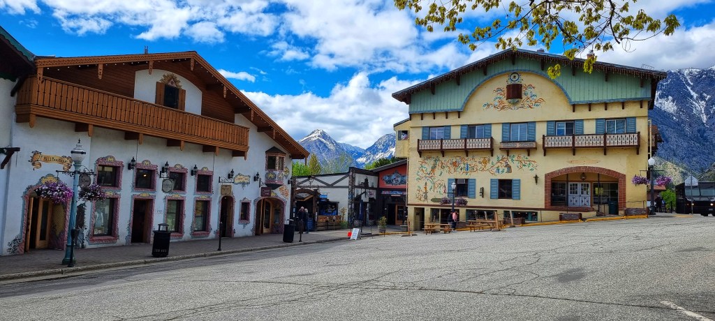
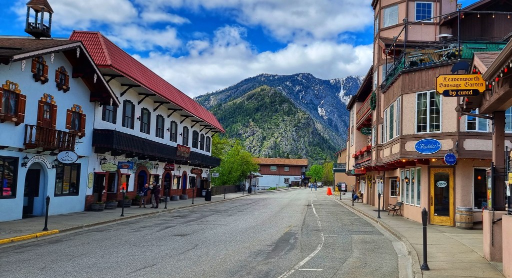
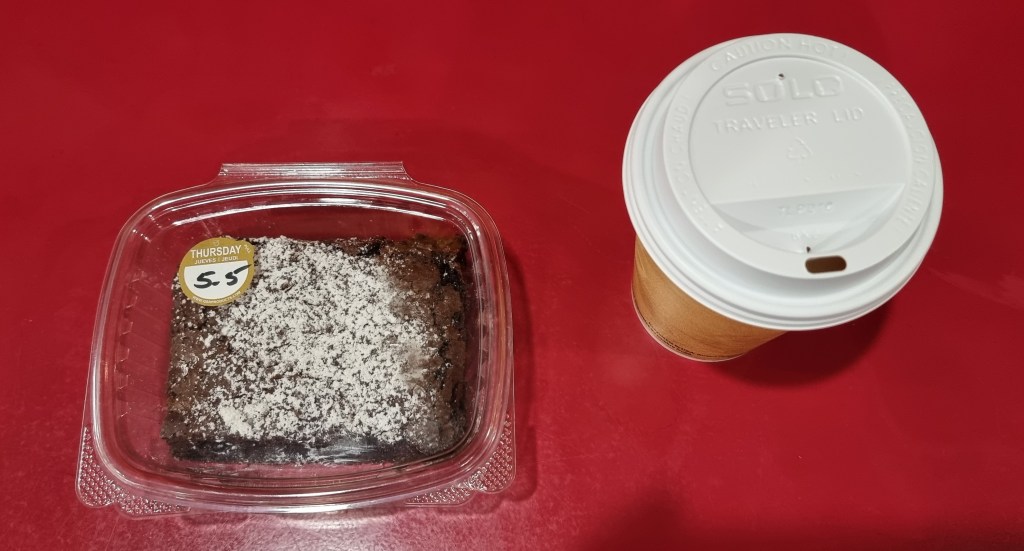
Every building & business in a 3 block by 3 block square is now Bavarian themed – I thoroughly enjoyed the day mooching around, relaxing in the town square with a cherry strudel & coffee, just watching the world go past. We got chatting to a couple from New Jersey who were halfway through a 6 week trip in the Recreational Vehicle (RV) which had taken them through Virginia, Kentucky, Missouri, Oklahoma, Kansas, Colorado, Utah, Idaho & Oregon. They were planning to head home along a similar route to us, but it will take them 3 weeks rather than 6 months!


We also had to catch up on essential admin like working out our routes for the next 3 days & booking accommodation in suitable motels – we’ve accepted we’re still a couple of weeks away from camping. A day off the bike was just what was needed, as by the end of the day we were both looking forward to our next block of exploring on our big adventure!
Tuesday 10th May – Leavenworth to Chelan (Stage 9)
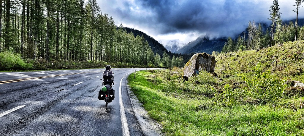
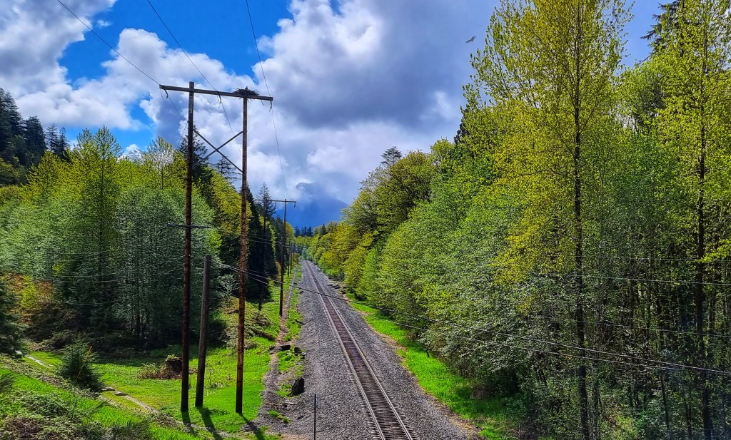
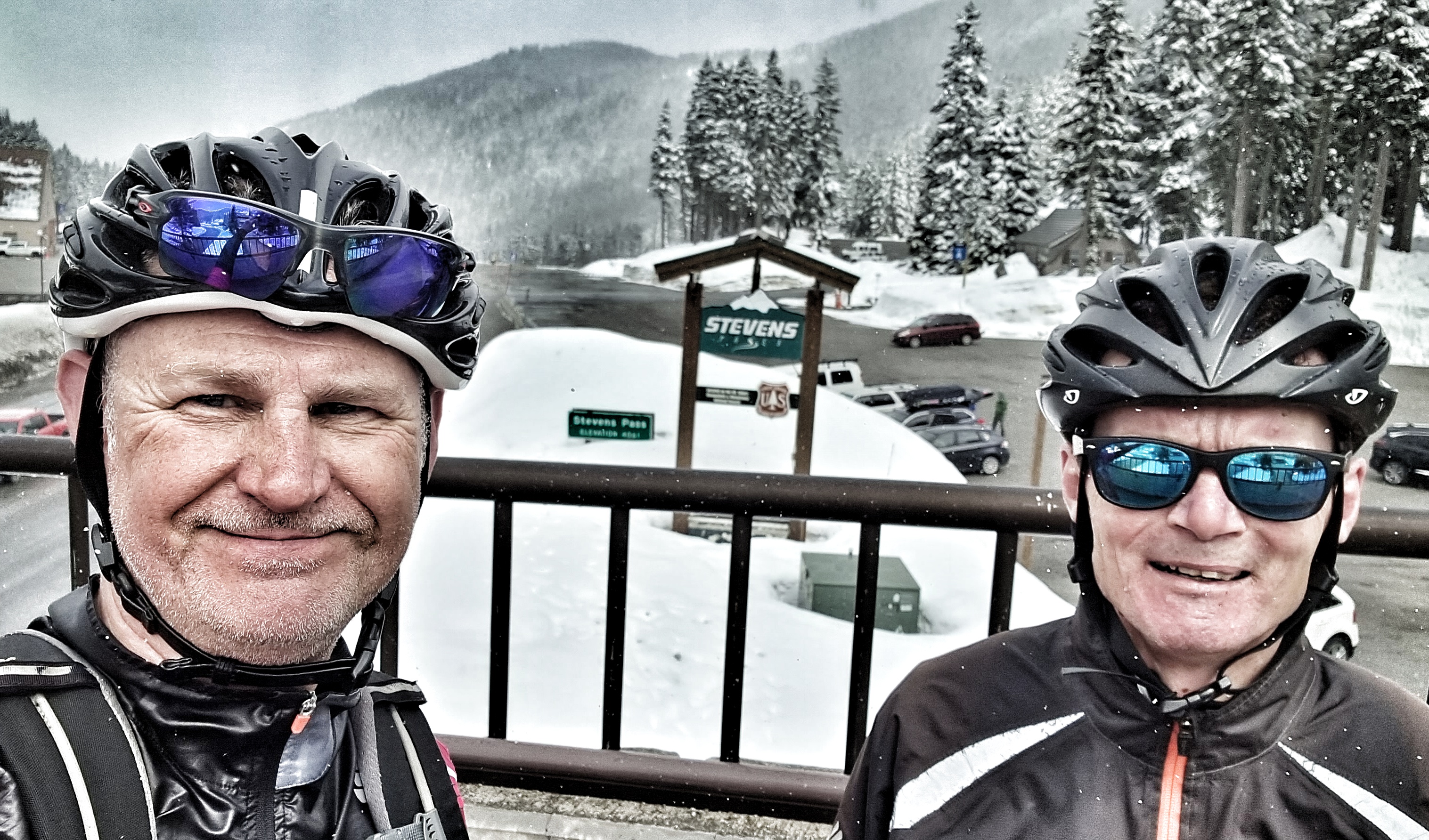
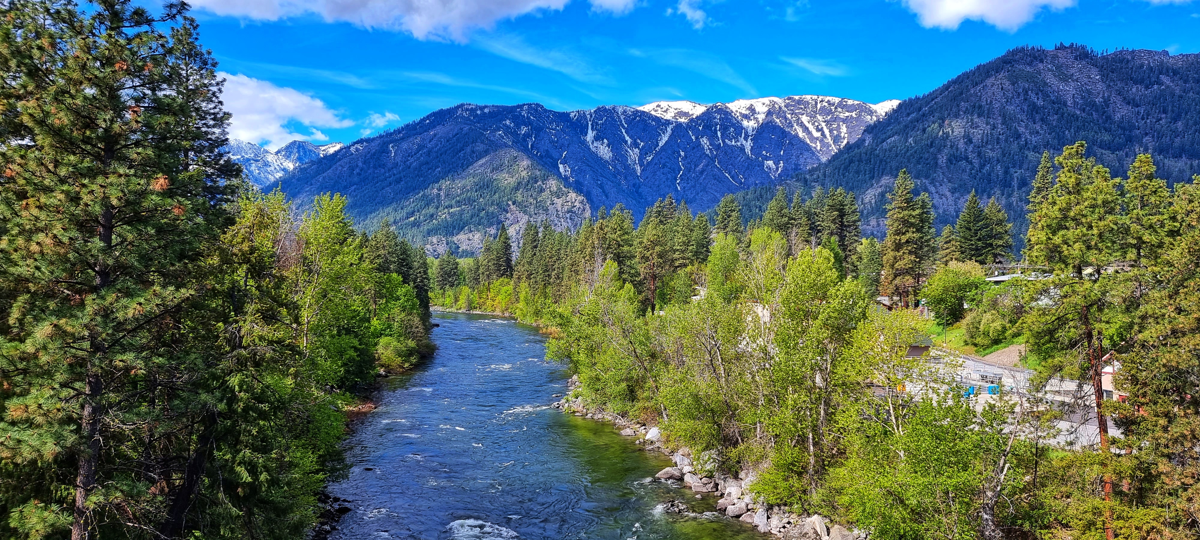
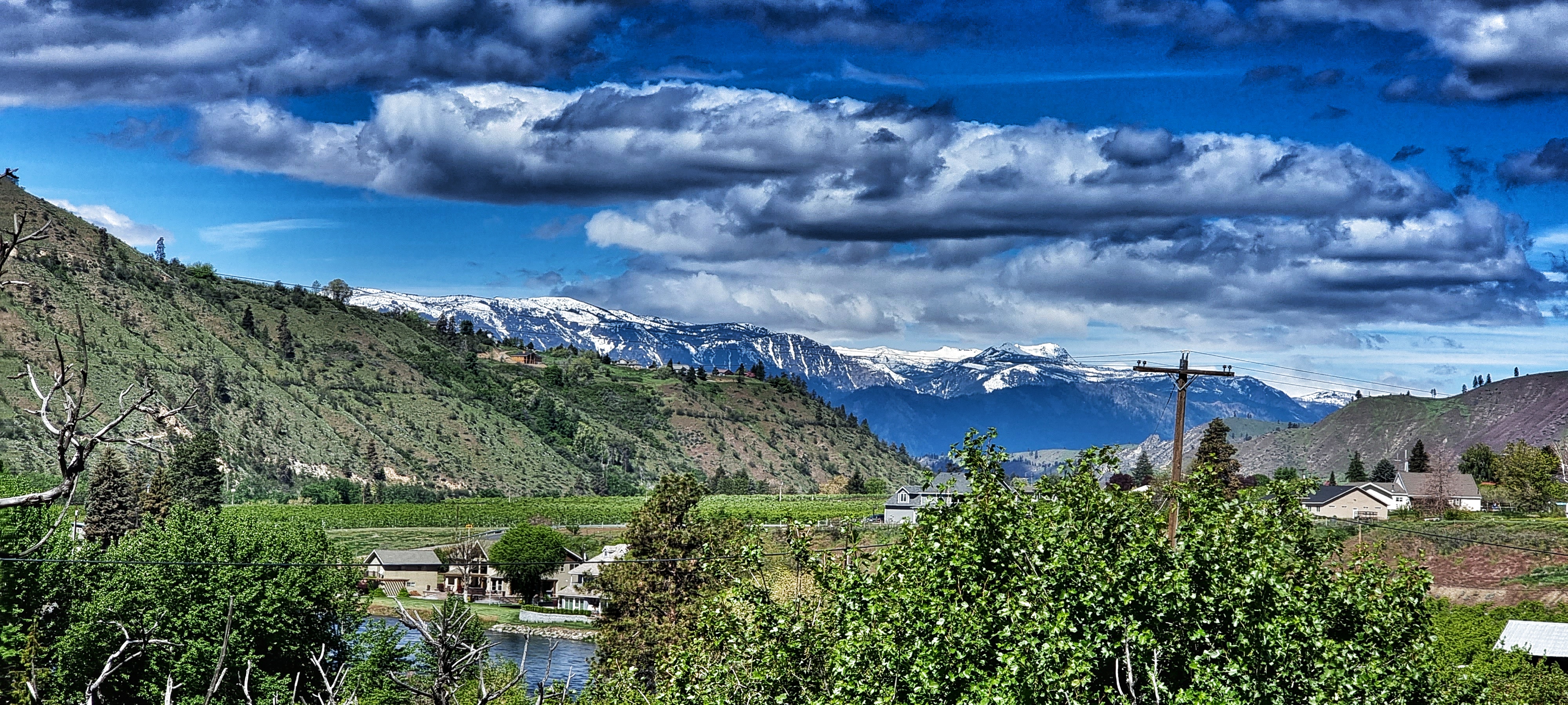
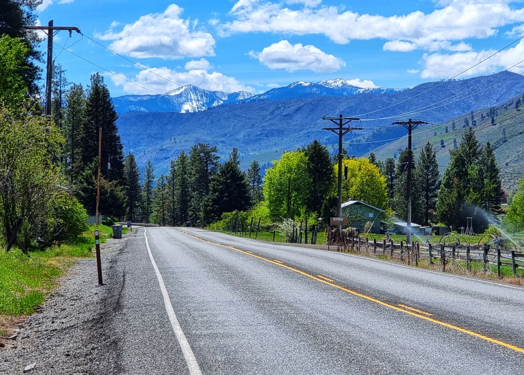
We awoke to azure blue skies for the ride to Chelan, so for the first time on the trip we needed suntan lotion – happy days! The route would take us downhill most of the day, with just one climb towards the end of the day, so we were already expecting to make decent time & have a fairly relaxing day. A tailwind was the icing on the cake.
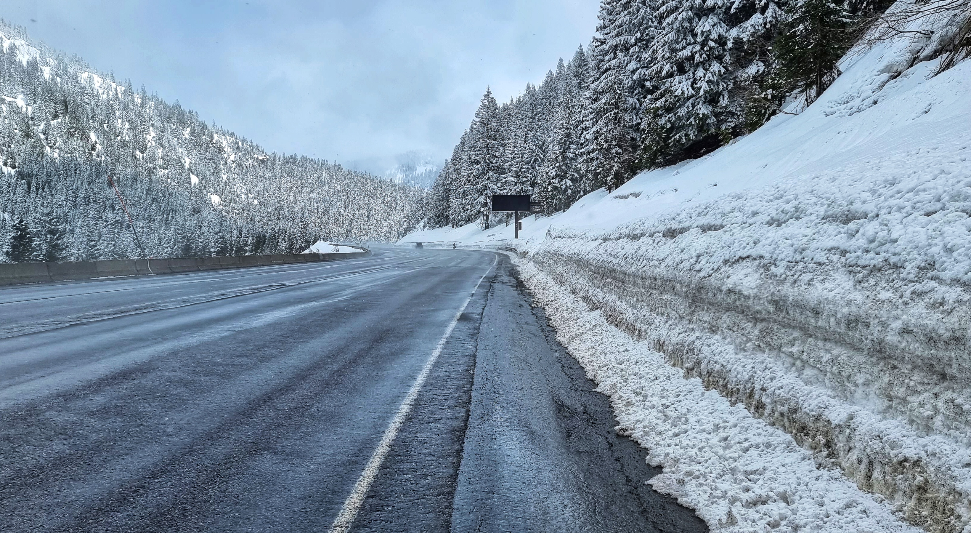
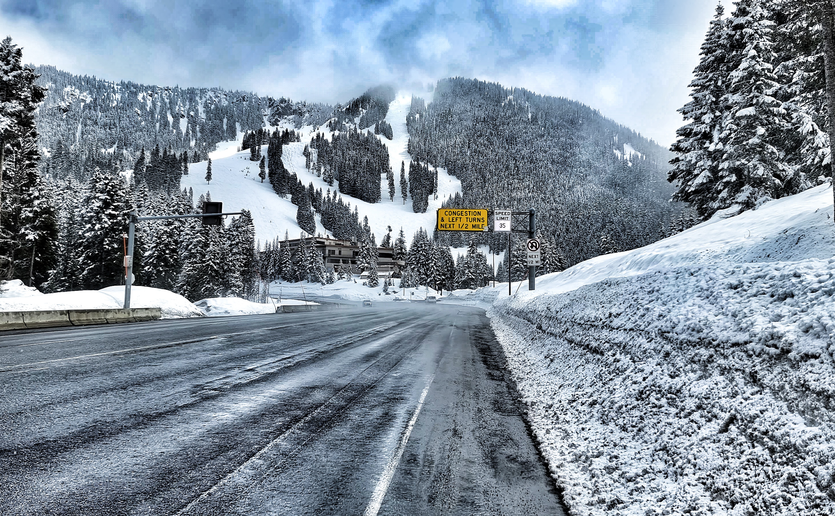
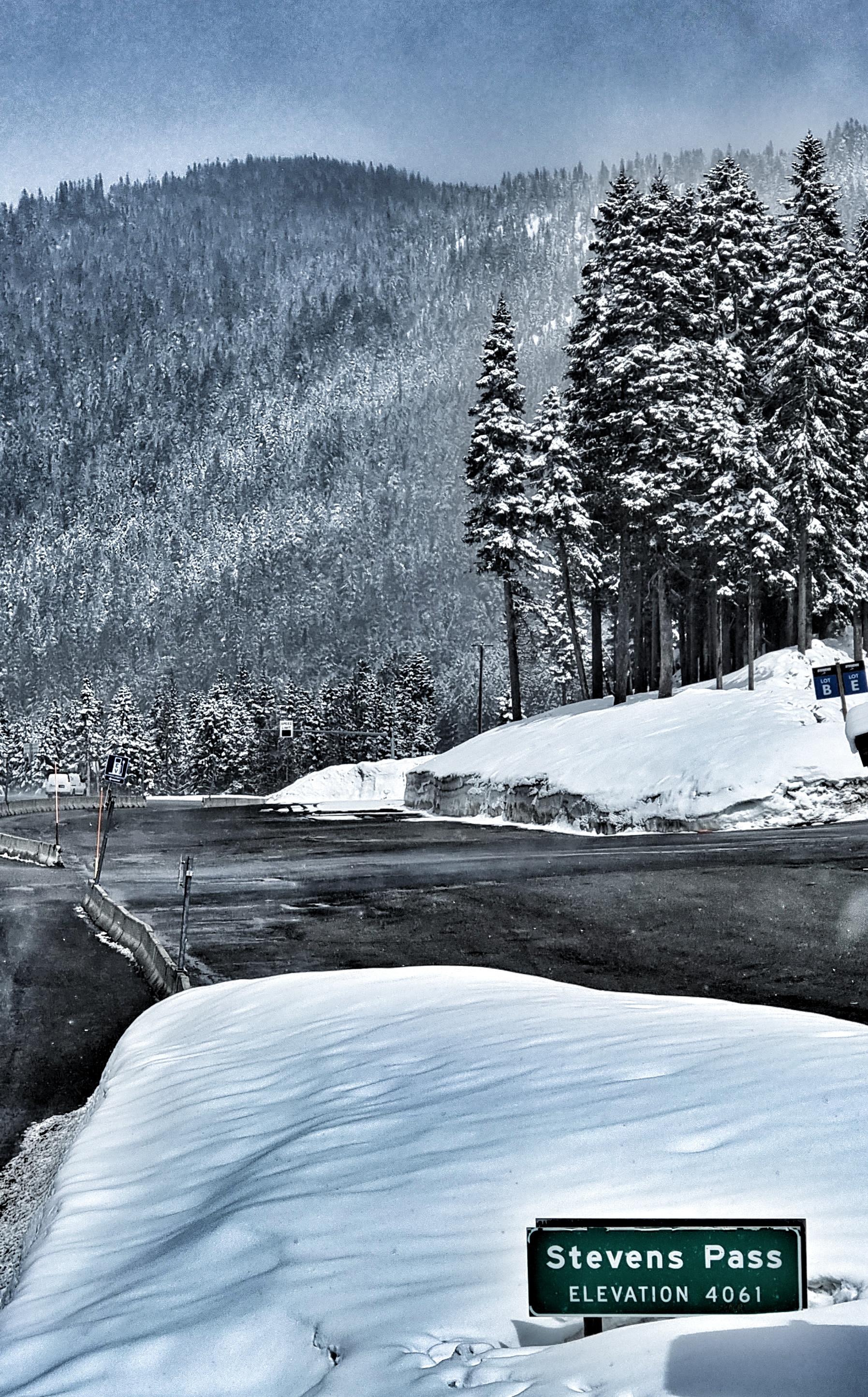
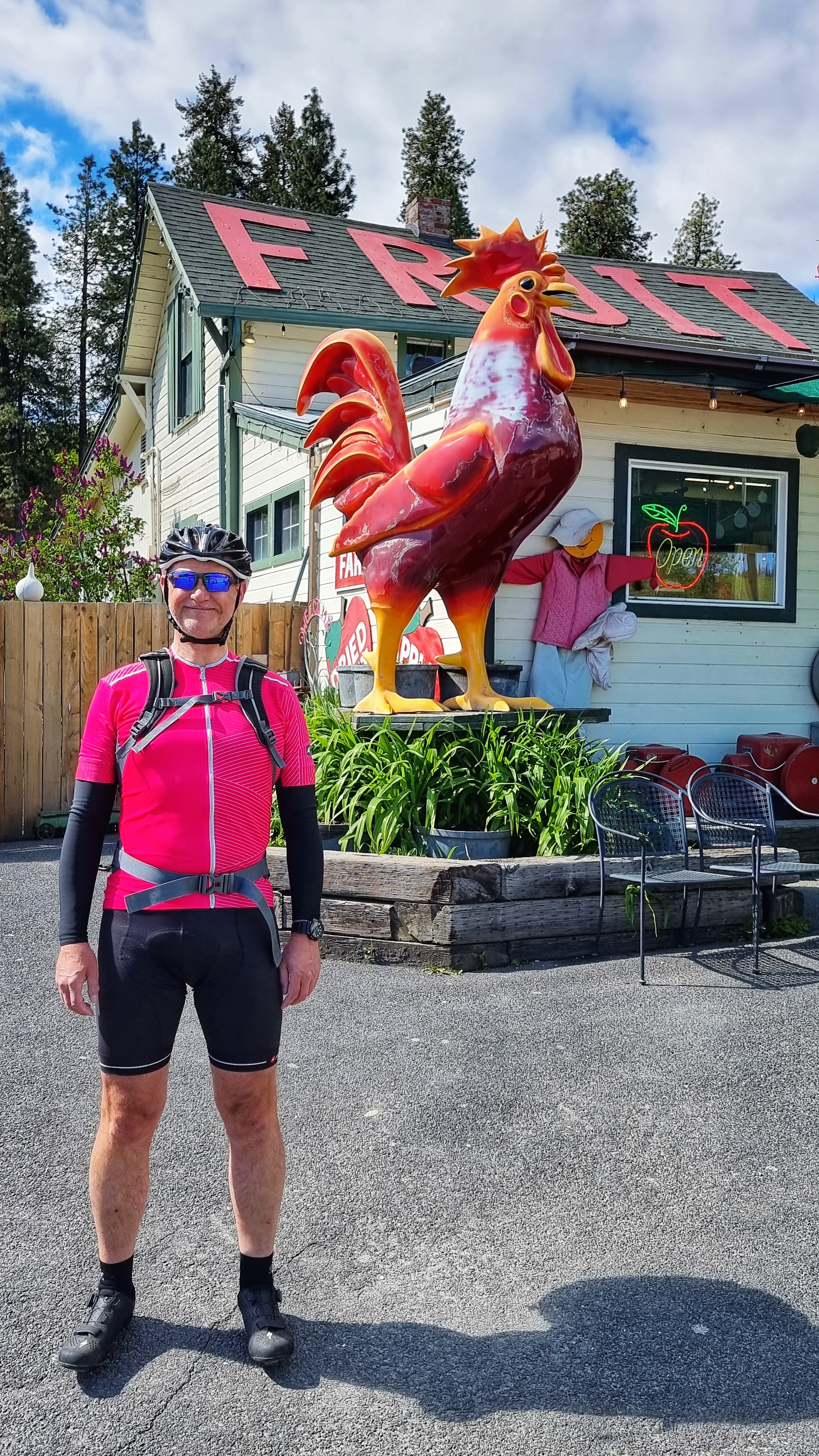
Leaving town we took one last look at the snowy-peaked mountains of the Stevens Pass, before leaving town on SR2 & heading into prime farming land. There were orchards of apples, pears, cherries & olives in every direction. We stopped briefly at Smallwood’s Harvest just so I could insert a puerile photo where you, the reader, can choose your own title! The SR2 became a 4 lane highway after about 8 miles, but although we were effectively on a dual carriageway, we had wide hard shoulders all to ourselves as we rode next to the Wenatchee river.
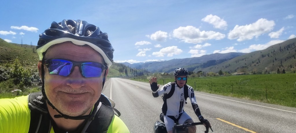
We took a small back road from Monitor to Sunnyslope , where after covering 24 miles in the first 90 minutes, we stopped briefly for coffee & a cookie. We were reminded that the UK & the USA are nations divided by a common language! When asked where we were headed I explained that we were on our way to Chell-an – the server’s face was a picture, so I tried again Cheeeelan…..I now know the correct pronunciation is Shey-laaaan! There were big views of mountains & rivers in all directions, all on deserted roads. This felt like cycling paradise.
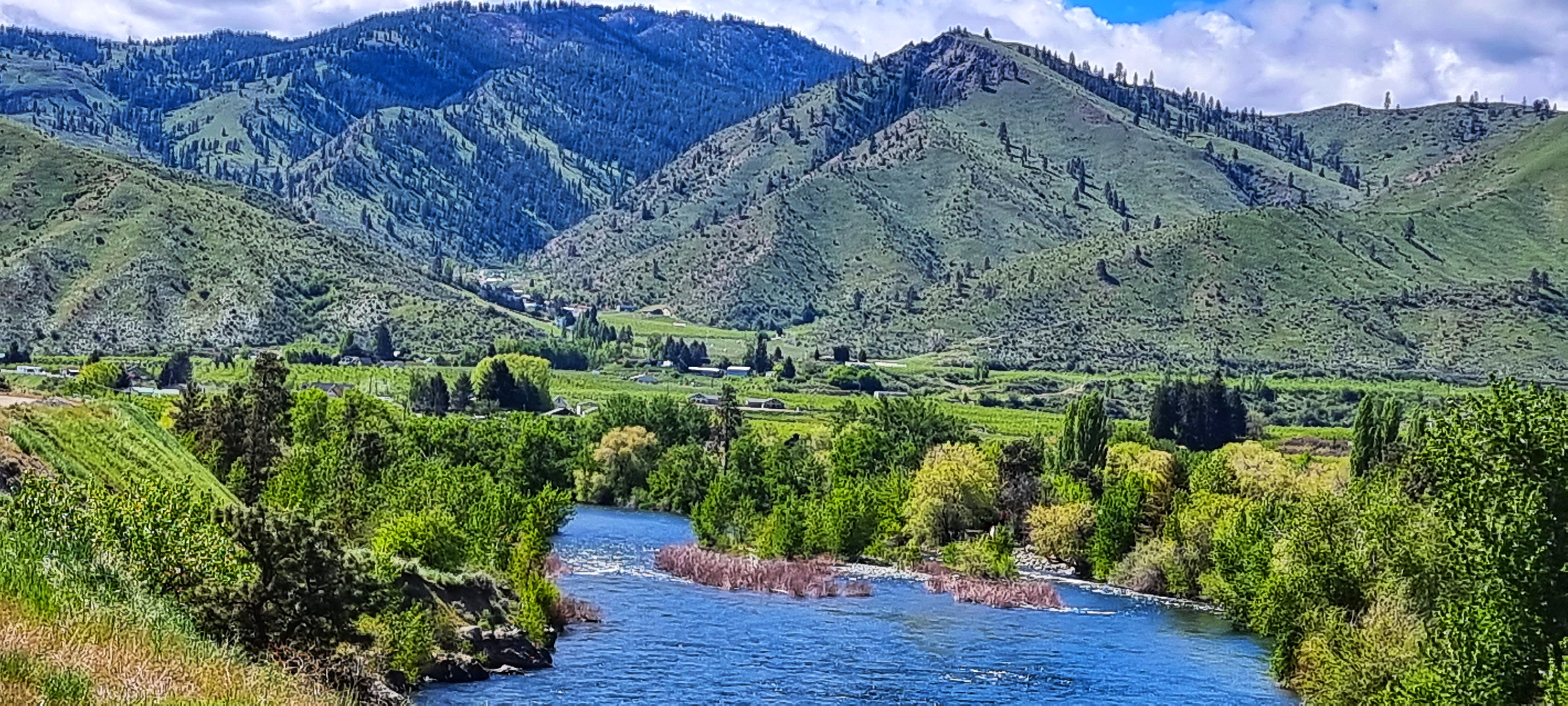

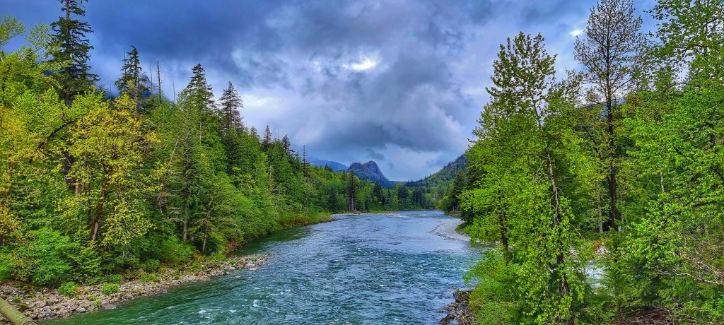
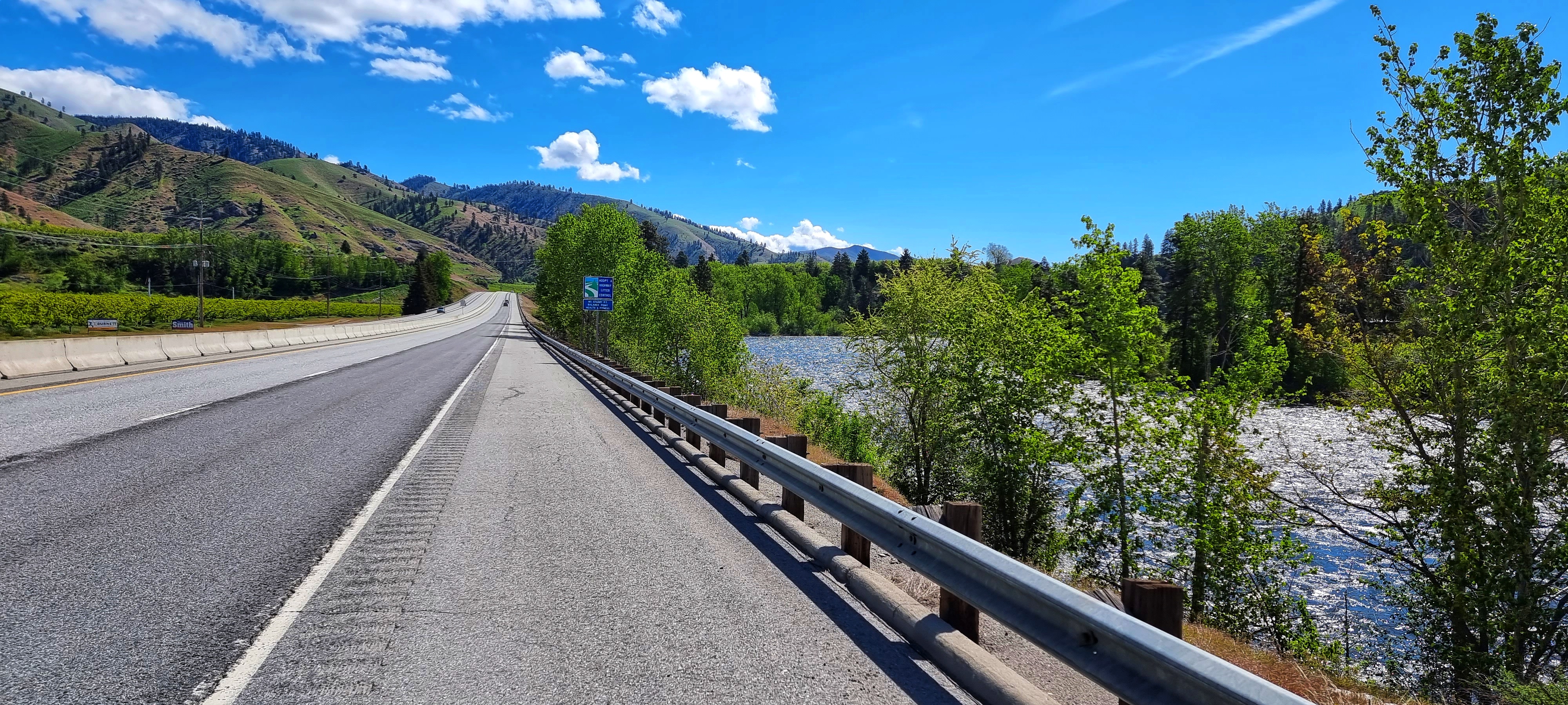
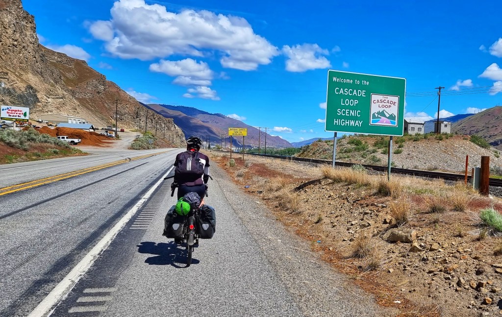
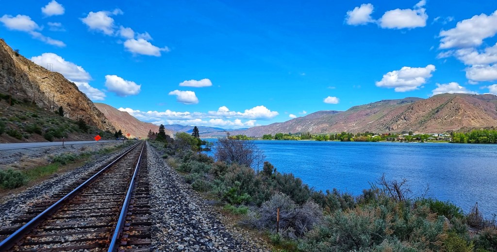
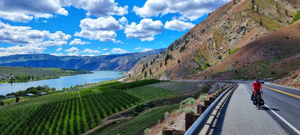
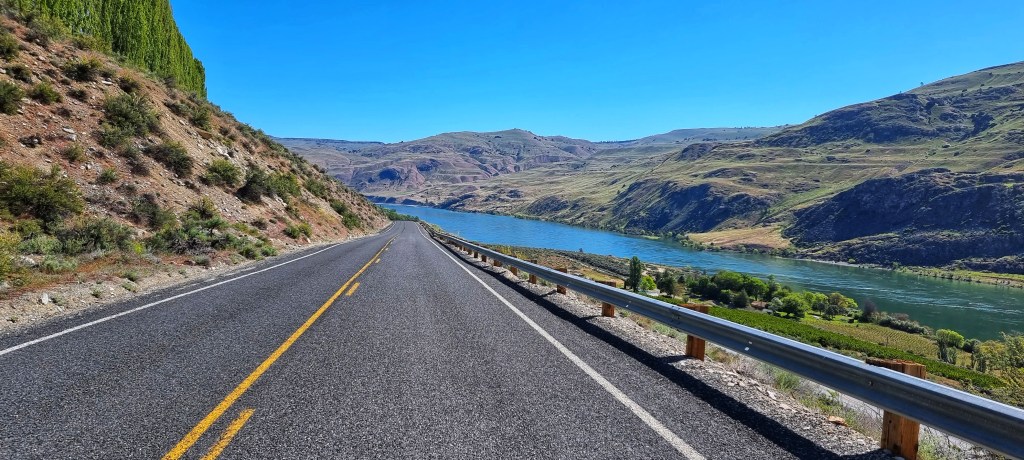
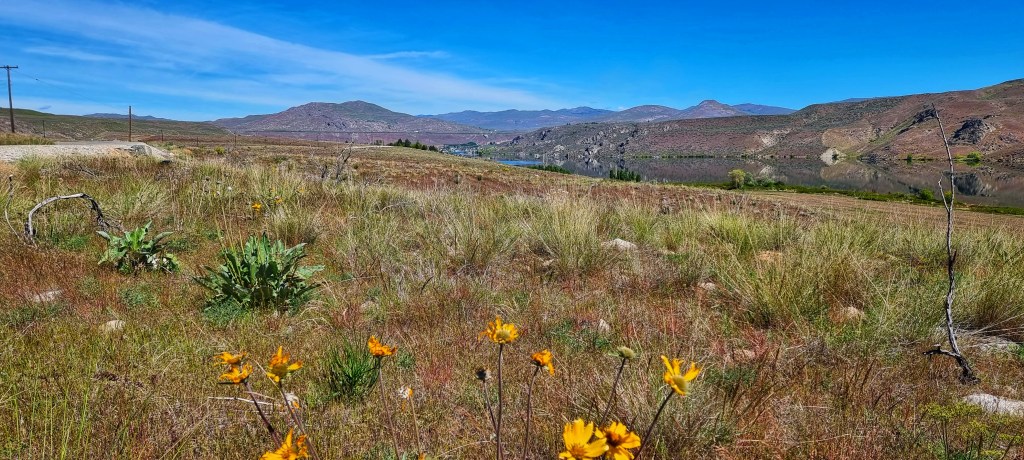
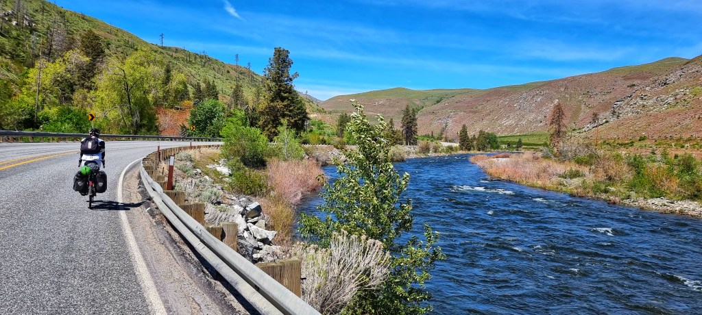
We joined the Cascades Scenic Loop on the Alt 97. For the next 25 miles we followed the course of the Columbia river – originally I was expecting us to be gently climbing, as we were heading upstream, however, the river has been dammed at various points & so the road is able to follow the railroad track a few feet above what are effectively a series of lakes.

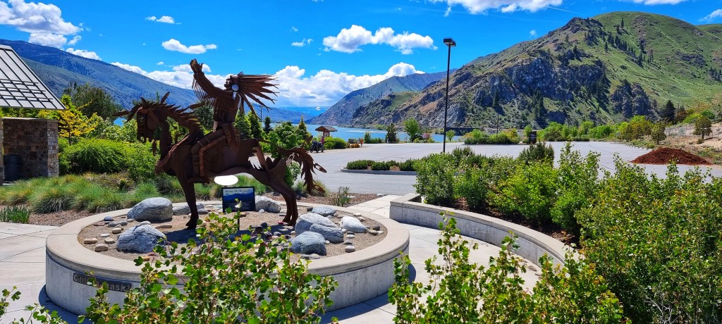
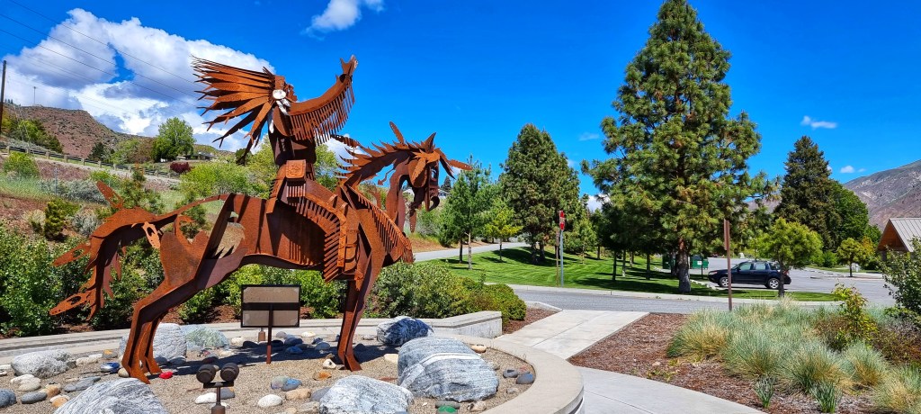
Passing through Entiat we stopped at Silicosaska Park – there was a stunning metal sculpture of Chilcosahaskt a member of the Entiat tribe in 1872. His Great-grandson, Wendell George has worked with the city to create this haven of peace & tranquillity on the waterfront. I was so glad I’d stopped to learn a bit more about the original custodians of the land who now live on the Colville Indian Reservation.

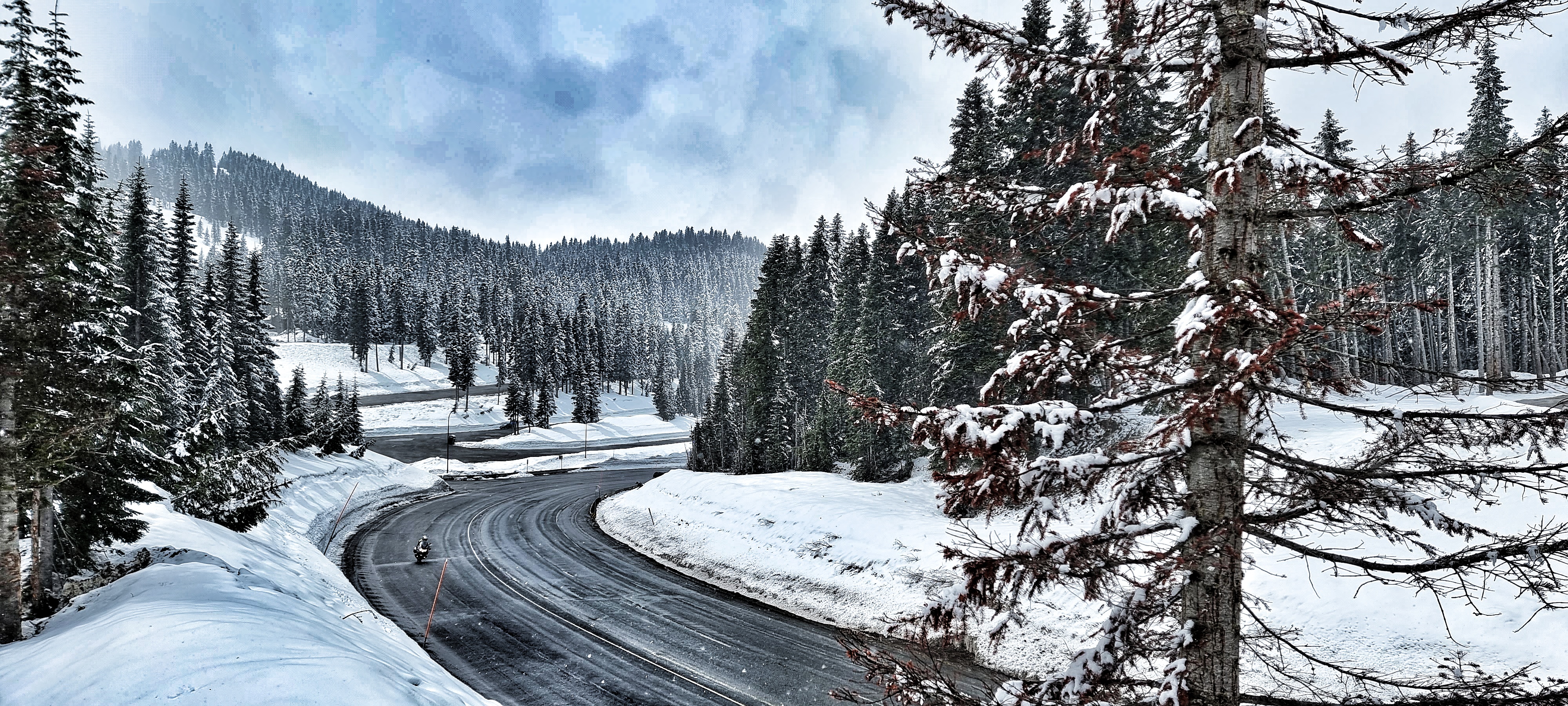
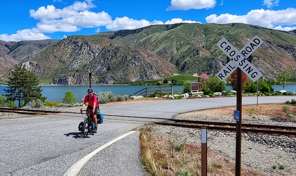
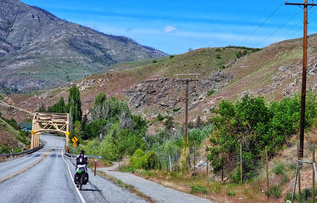
At one of the small turnoffs from the Alt 97 I stopped to get a photo of me next to an iconic railroad crossing sign (sadly we didn’t see a train all day). We continued to follow the course of the river, with the river cliffs getting ever nearer. At the 45 mile point we encountered our only climb of the day, a 750 ascent which took us out of the Columbia river valley via a short tunnel (we pressed a button & it set off flashing lights to let motorists know there were 2 stupid cyclists in the tunnel!).


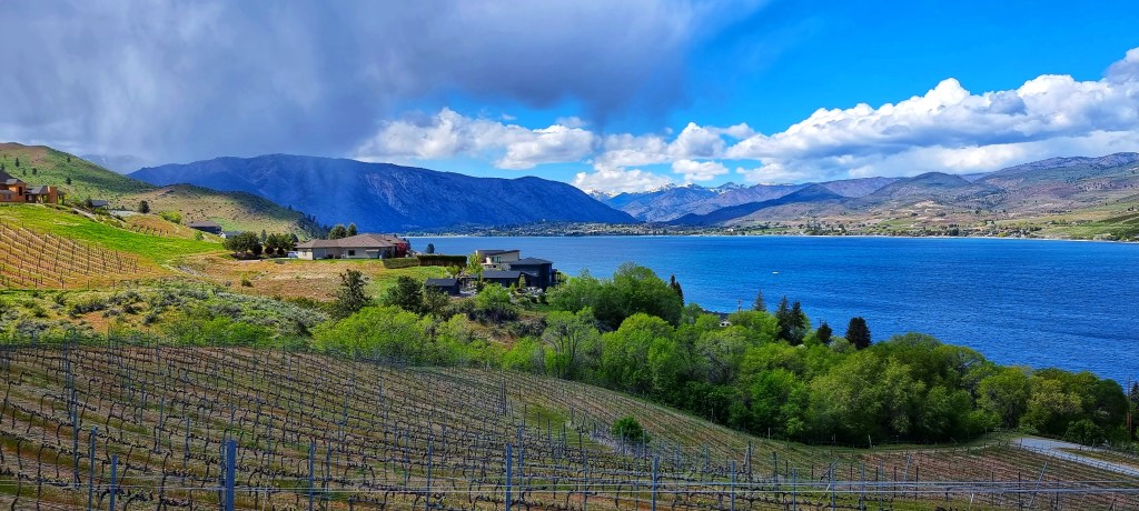
Exiting the tunnel, we were on a plateau that continued to rise for another couple of miles, but our friendly tailwind continued to blow us up the small incline! As we crested the climb, we could see rain falling at one end of Chelan lake, while glorious sunshine was very much evident over the town of Chelan – someone was looking after us today!
We fairly flew down the descent into town & quickly found the Deepwater Inn, our motel for the evening. Once we’d checked in, we popped over the road to the laudromat to clean our kit – we now know how everything works & are considering applying for jobs on EastEnders when we return to the UK! We’ve been in the USA for a couple of weeks & this evening we’ve started trying to live as locals, rather than eating out every night – we visited the local Safeway & bought food for this evening’s meal & tomorrow morning’s breakfast.
Stage Stats – 56 miles, 2,828 feet of climbing. Slightly downhill most of the day, with one small climb. Weather was warm & sunny all day.
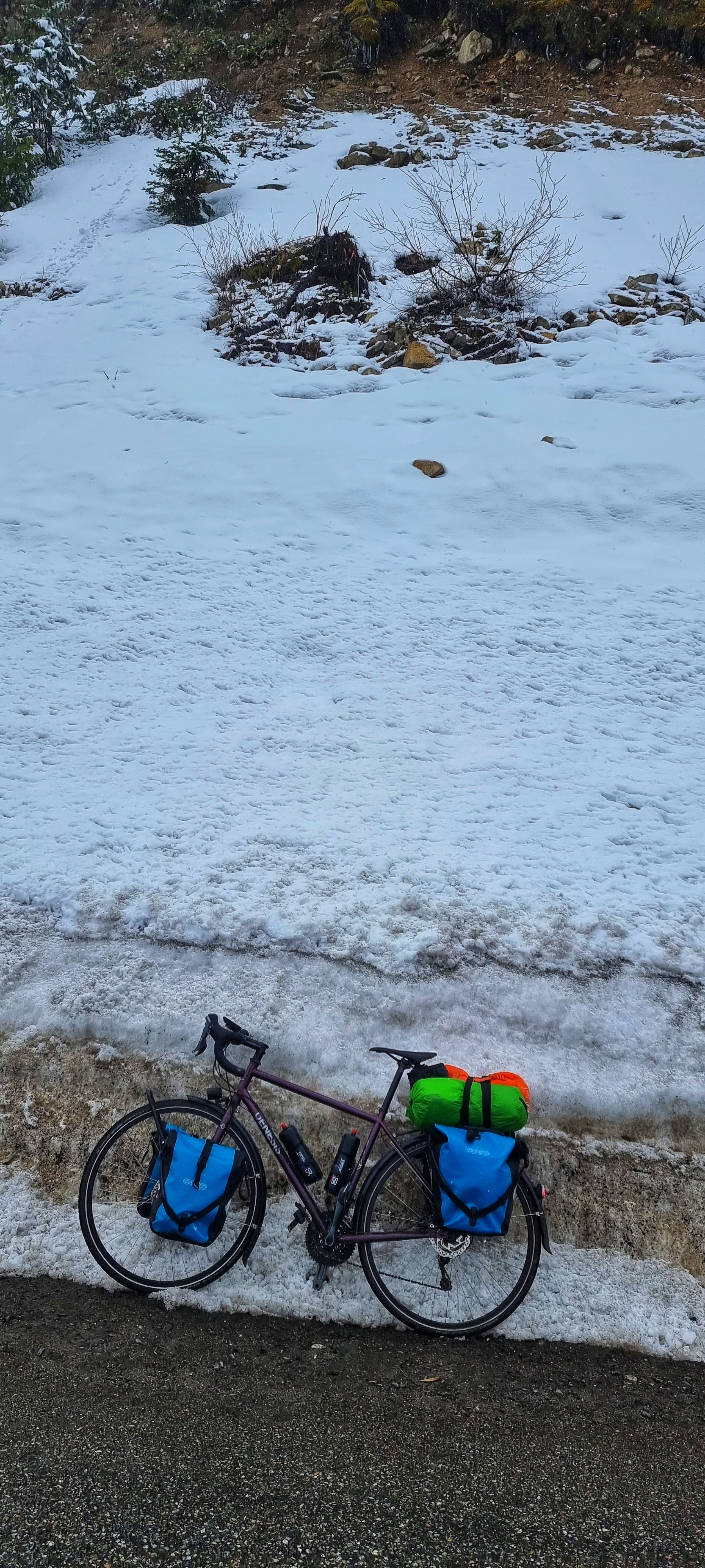
Wednesday 11th May – Chelan to Mazama (Stage 10)
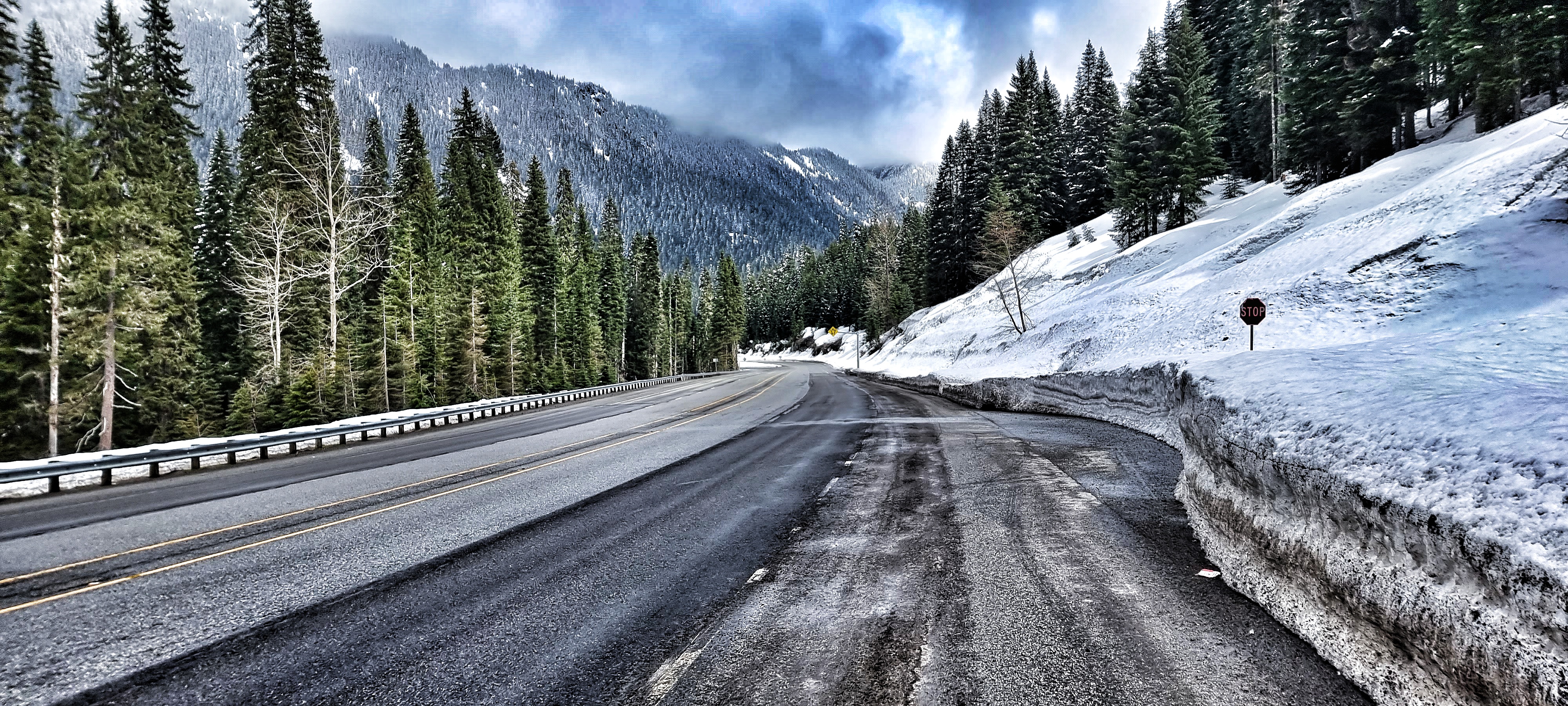
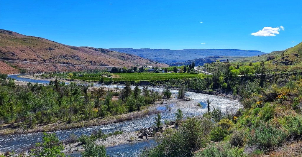
For the 3rd day running we awoke to blue skies overhead. After enjoying a breakfast of cereal, yoghurt, fruit & croissants we headed out of town by 9am on the Alt 97 for what would be our longest day to date. After a very small drag out of town, we’d be climbing all day, although there wouldn’t be a hill to speak of. For the first 10 miles we had the road pretty much to ourselves as we cut through a small canyon, then dropped back down into the Columbia river valley, where we’d spent much of yesterday.

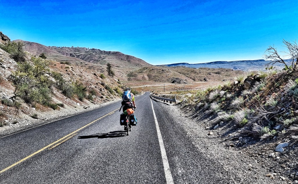
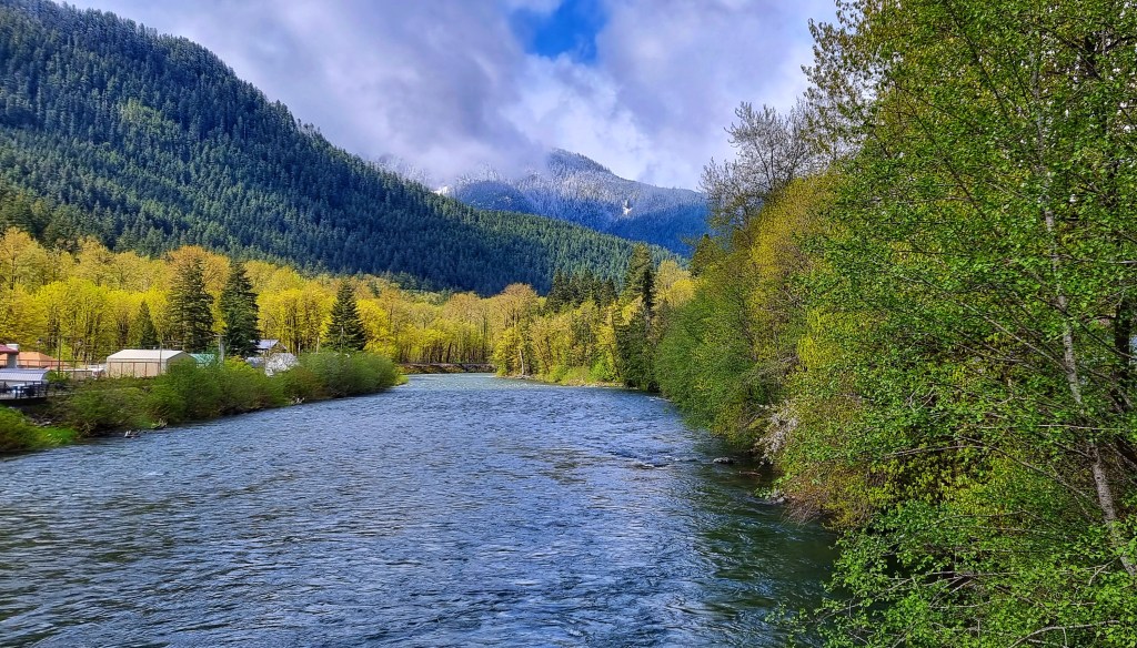
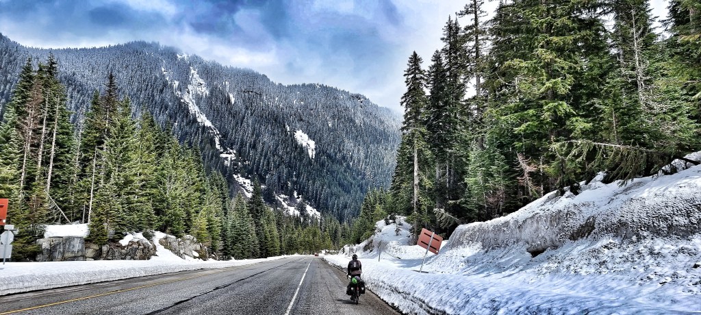
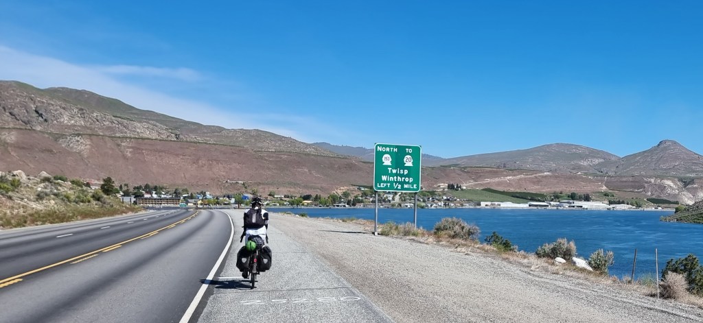
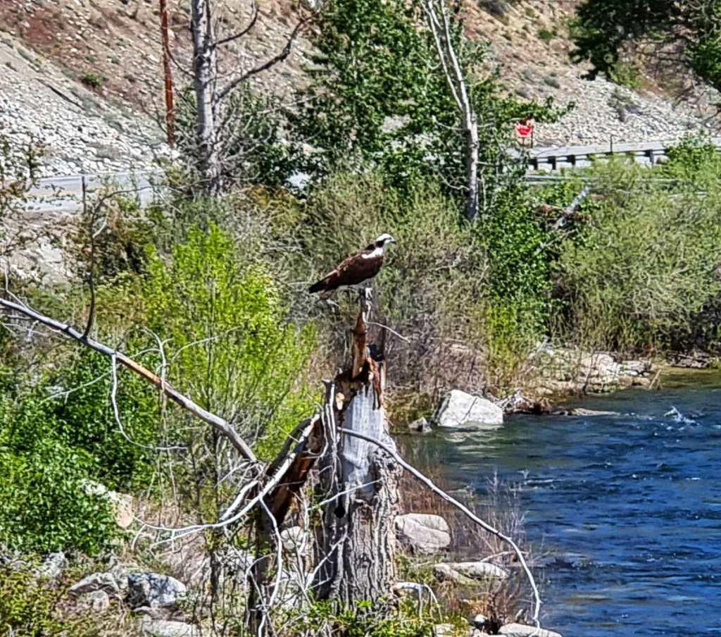
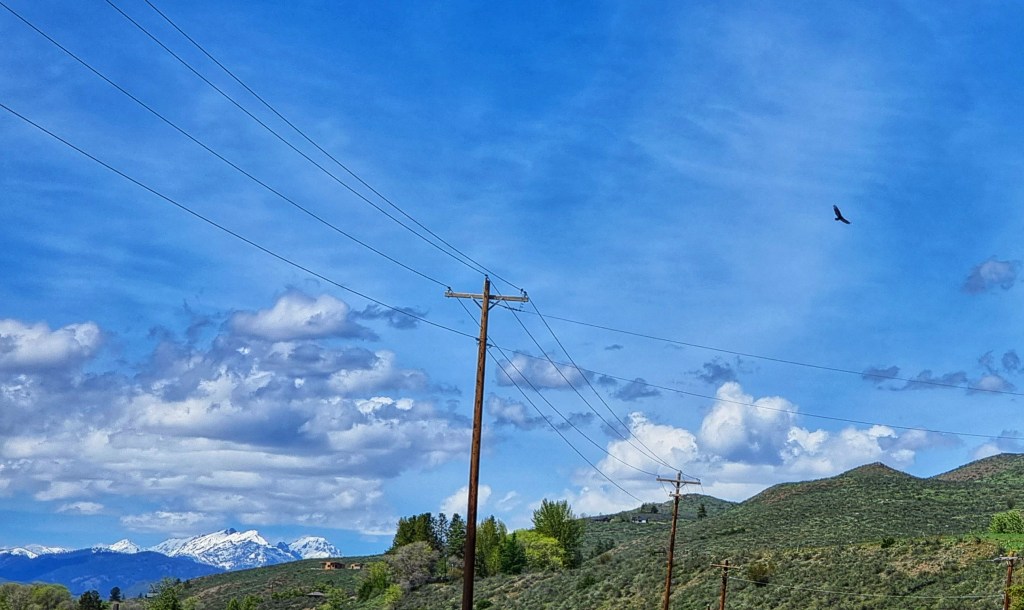
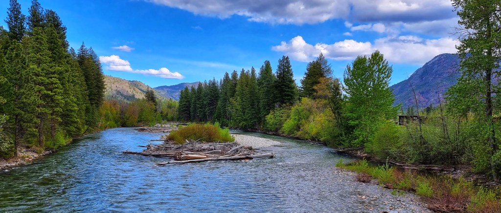
We briefly cut inland, giving a slightly different view of the surrounding scenery, including some dandelion like flowers. We were on the lookout for fish eagles (or ospreys), as we’d been told this was a common breeding area – the key was to look out for pallets on top of telegraph poles. We passed one pole with a pallet on it, but no ospreys were home. As we reached Pateros we joined SR153 towards Twisp – for the next 33 miles we’d be following the course of the Methow river, untamed by man.
This was where the uphill would start & continue for the rest of the day, as we were now cycling against the flow of the river. The road regularly criss-crossed the river as we continued on deserted tarmac & then out of the blue an osprey flew into view & landed on an old tree stump not 300 yards ahead of us. I had my phone out in a flash & zoomed in, all the while hoping he/she would wait for me to line up the shot – I’m quite pleased with the end result.
We occasionally passed through small hamlets, as we continued along the river & although we were making decent time, this stretch felt like it passed in slow motion. As we passed through Carlton we saw a gas station & decided to top up our caffeine levels -it was a bargain at 99 cents for 12 fluid ounces! Along with a couple of scoops of trail mix (mixed nuts, raisins plus M&Ms) we were re-invigorated.


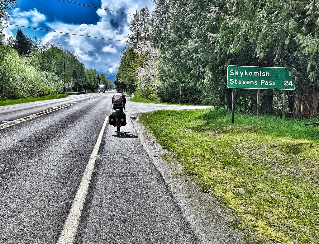
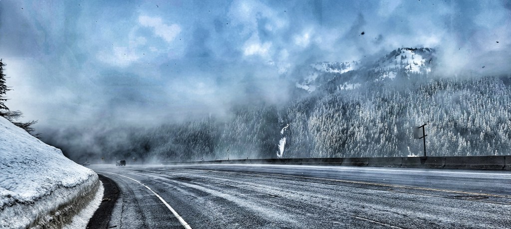
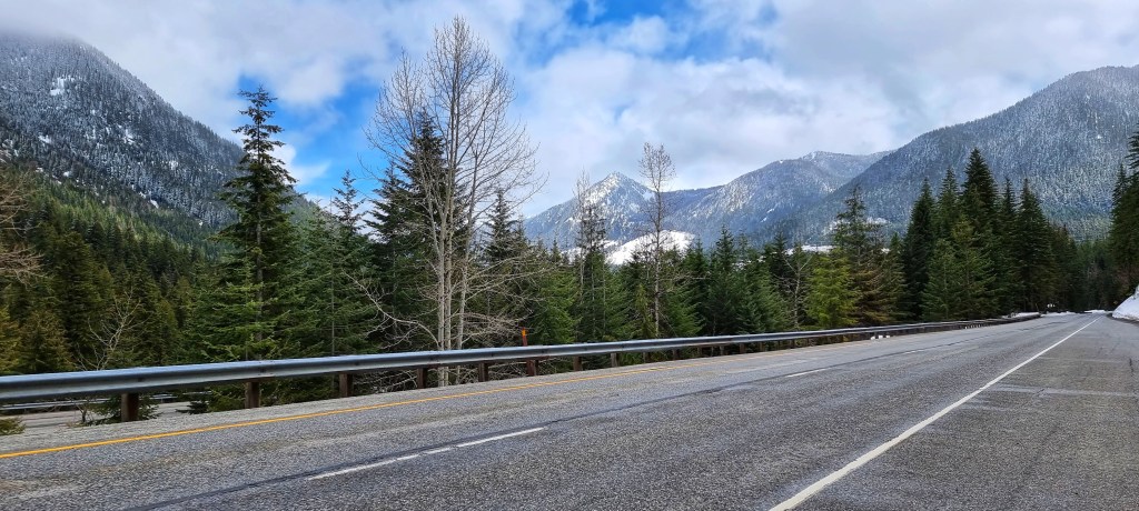
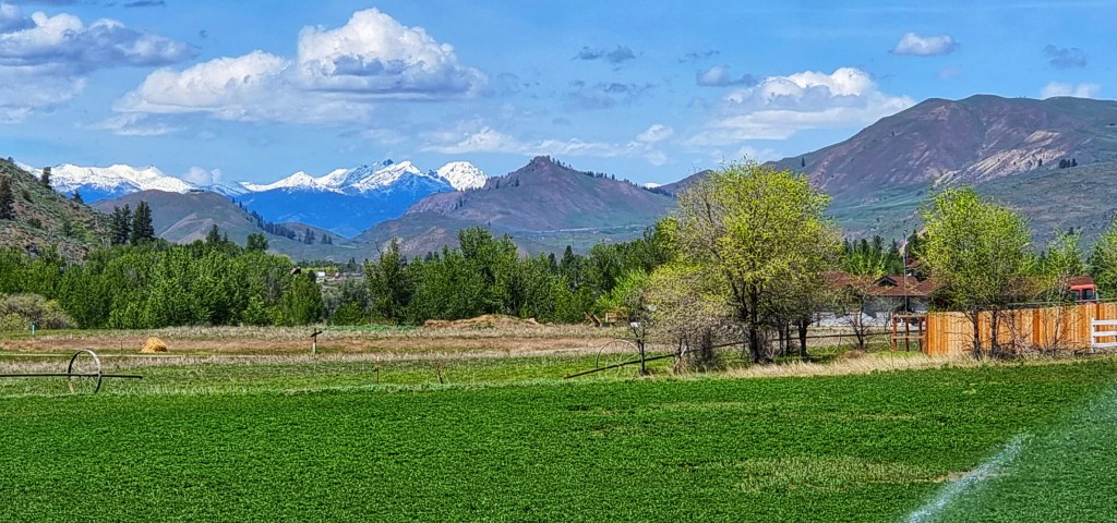
We also got our first brief glimpses of snowy mountain peaks in the far-off distance. This gave us fresh impetus, as we’d detoured all the way round SR2, over Stevens Pass & on to Chelan so we could cycle one of the these peaks – find out which one tomorrow!
Arriving at Twisp we briefly re-joined the SR20 (we’d spent Stages 2, 4 & 6 riding sections of it in week one of our adventure), before taking a quieter back road to Winthrop – by now the snowy peaks were looking much closer! We also spotted another Osprey flying overhead – seeing one in a day felt special, so to see two was very exciting!

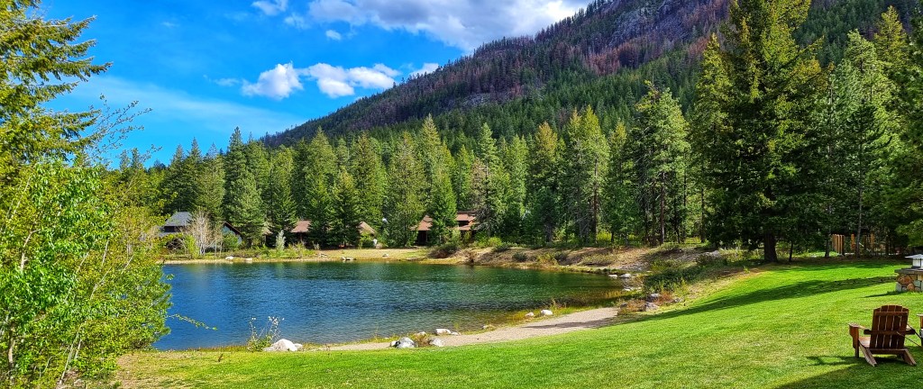
From Winthrop we had a long drag of 15 miles into a nagging headwind – at the end of a 76 mile ride it felt hard work, plus we both experienced numb feet. After such a stunning day it was a small price to pay & it all melted away when we finally reached our accommodation for the evening – the Freestone Inn is an oasis, with a beautiful lake that backs onto our room.
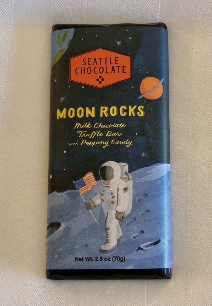
As if that wasn’t enough, we’d been left a chocolate bar treat!! We’re both a bit nervous about tomorrow, as rain is currently forecast & we’ve done the best part of a one week detour to get here. We’ll be cycling up a big mountain pass tomorrow regardless of the actual weather, but it would be preferable to do it in the dry.
Stage Stats – 76 miles, 4,558 feet of climbing. Dragging uphill all day. Weather was warm & sunny all day again.